Acapulco, MX 1996
Over the Thanksgiving vacation in USA, Becky (my wife) and I flew to Acapulco, Mexico for a vacation. However, we were actually following doctor’s orders, because I had picked up a case of “Valley Fever” while slot-canyoneering in Southern Utah. {Valley fever, also called coccidioidomycosis, was an infection caused by the fungus Coccidioides}. The symptoms were similar to Pneumonia, and my doctor ordered me to go to very dry-climate and weather through my coughing fits. We chose Acapulco, Mexico.
Ah, Acapulco! The very name conjures up images of steamy sensuality, beautiful people, and beautiful beaches. All of these were realities.
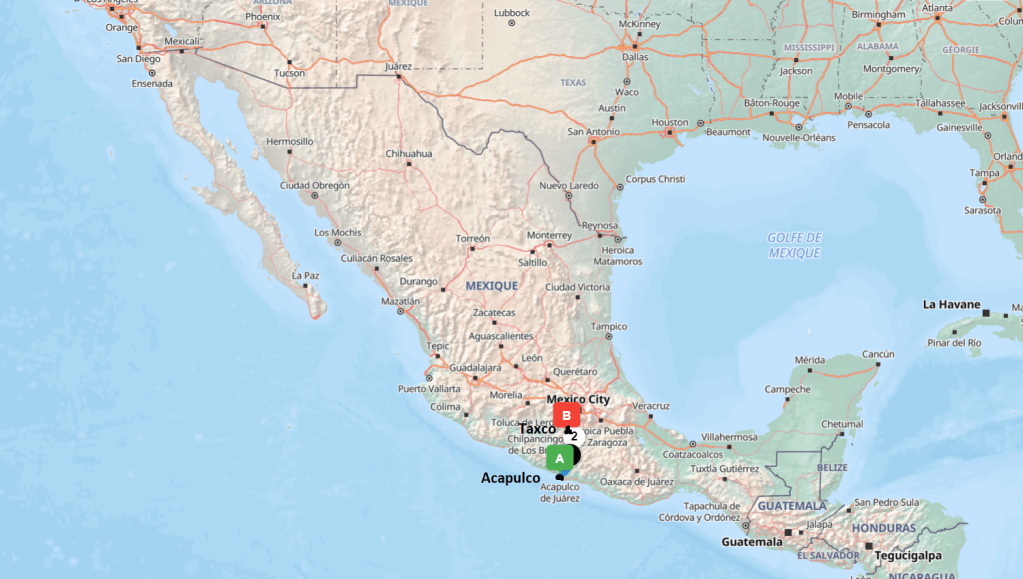
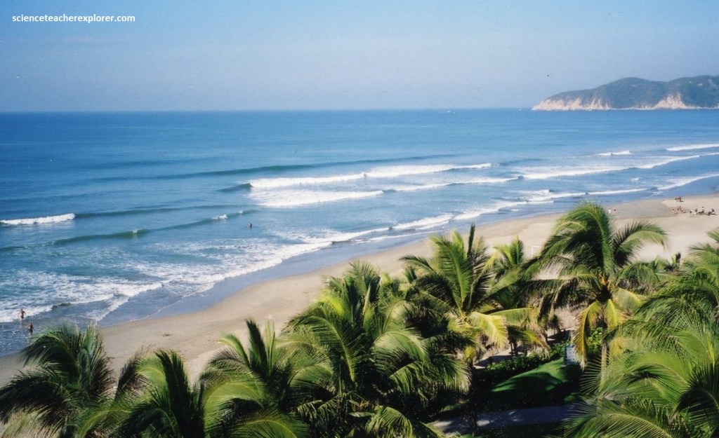
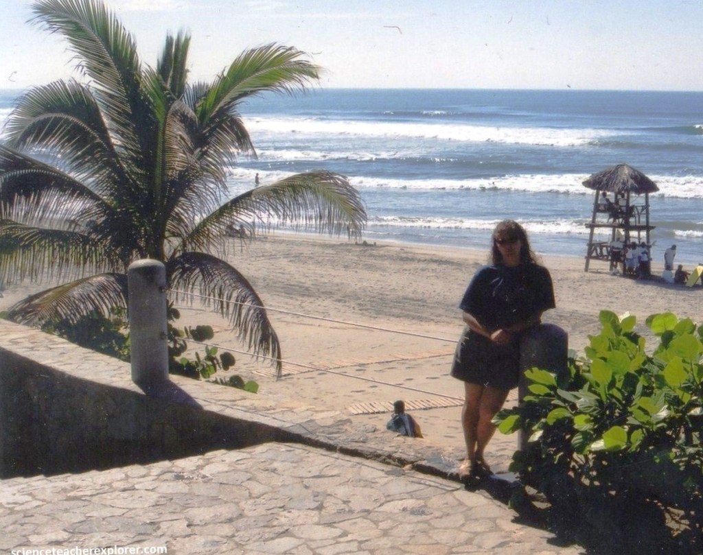
Acapulco is a city and major seaport in the state of Guerrero on the Pacific Coast of Mexico, 380 km south of Mexico City. Imaged above, Acapulco is located on a deep, semicircular bay and has been a port since the early colonial period of Mexico’s history.
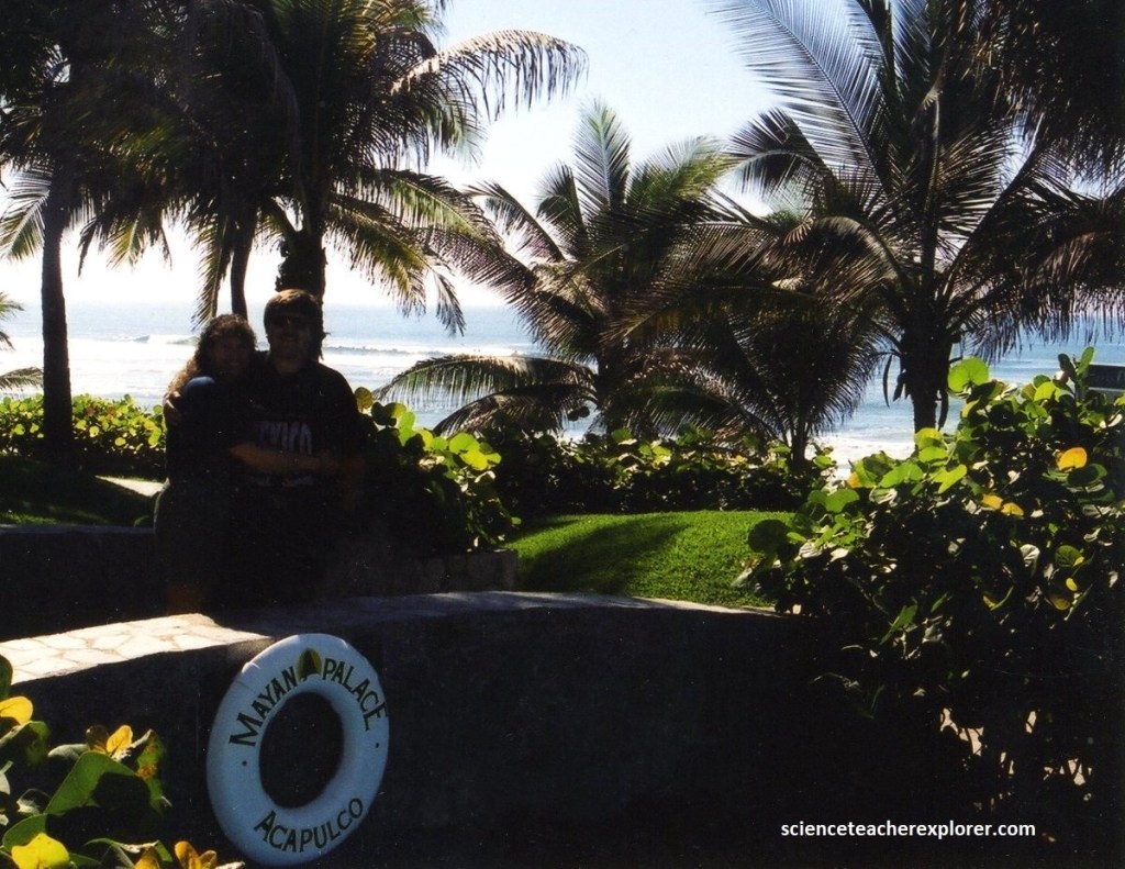
Pictured above, Acapulco was truly tropical with palm tree, coconut grove, and mangoes, and flowers of every imaginable color screaming for our attention. The place was a veritable cornucopia of pleasures of the senses. The beaches, some long and sweeping, some tiny and private.
The winter, (November), weather was heavenly. That meant temperatures were in the seventies and low eighties during the day and sixties at night. It was also very cosmopolitan, with world-class shopping, Wal-Marts, and the occasional tienda sandwiched in between.
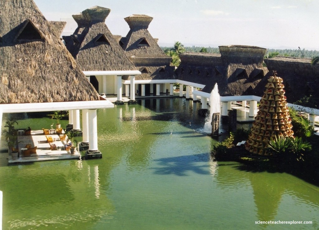
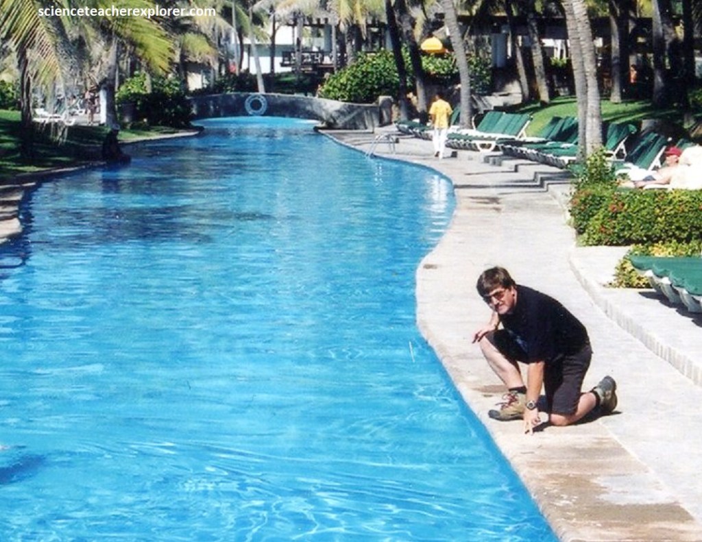
The pool area at the Mayan Resort was interesting. It appeared to be designed as a “Lazy River” the encircling a garden. The other pools sat right on the edge of the beach, providing amazing views and instant access.

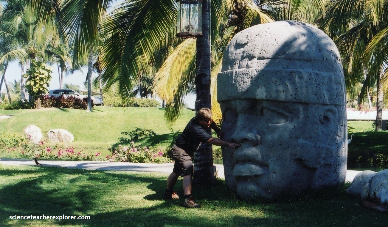
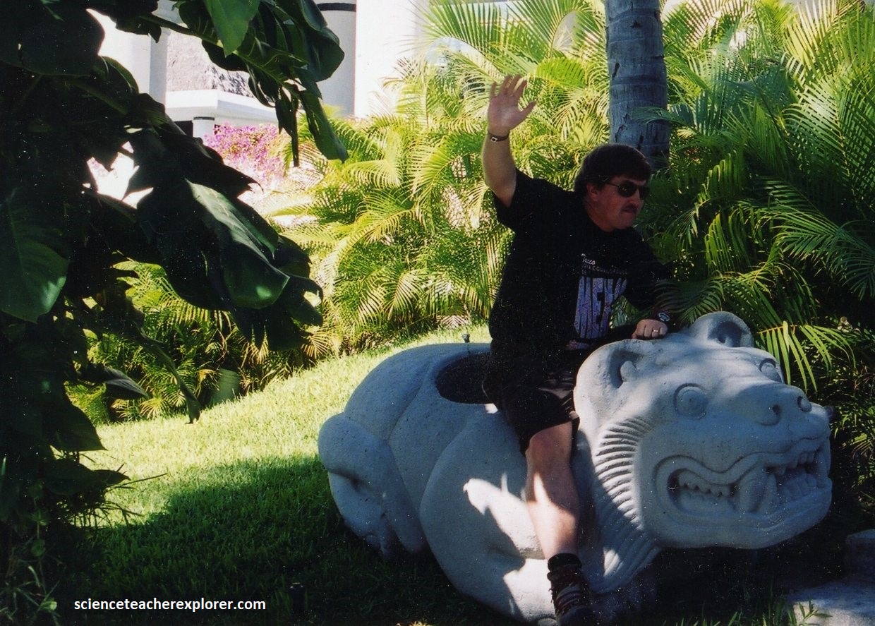
Pictured below, in the Mayan Palace garden, we found these Mayan statue replicas. I found it interesting the one of the statues seem to have an African look to it. Actually, it is a replica of one the San Lorenzo Teonchtitlan Calossal Heads found in the southern portion of the state of Veracruz. They are 3-meters-high of Olmec sculpture origins, with lips and nose that seem to resemble African facial features. Some researchers suggest that the Olmecs were related to peoples of Africa, (based primarily on their interpretation of these facial features of the Olmec statues). The other statue that I’m riding is a Jaguar. This replica is of a Cuauhxicalli or container, (in this case in the shape of a jaguar), where the blood and hearts of those sacrificed were deposited to feed the Sun and the Earth. It is found in the Museum of Anthropology in Mexico City.
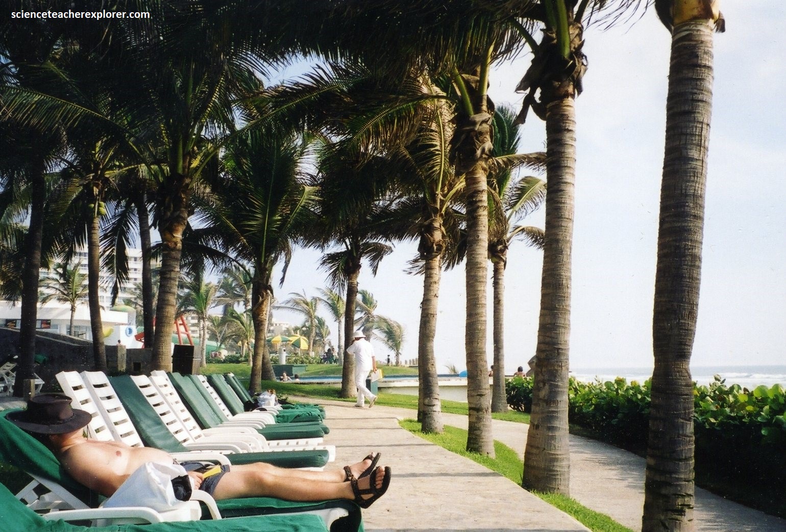
As I mentioned before, I was very sick in Acapulco. So I was unable to do any trekking around Acapulco to look at the geology. We spent most of our vacation time lounging around the pool & beach areas, (pictured below). I was trying really hard to get better.

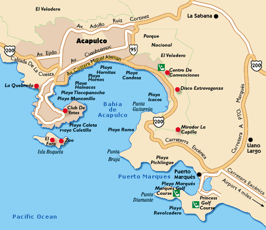
However, we did take a few excursions near Acapulco that made me happy as a trekker/explorer. One of those excursions was the famous Acapulco Cliff-Divers. “La Quebrada” in Acapulco is a cliff that measures approximately 35m high, where brave divers risk their lives to follow the tradition. I took a video at calculated their jump height, using projectile-physics. Watch below:
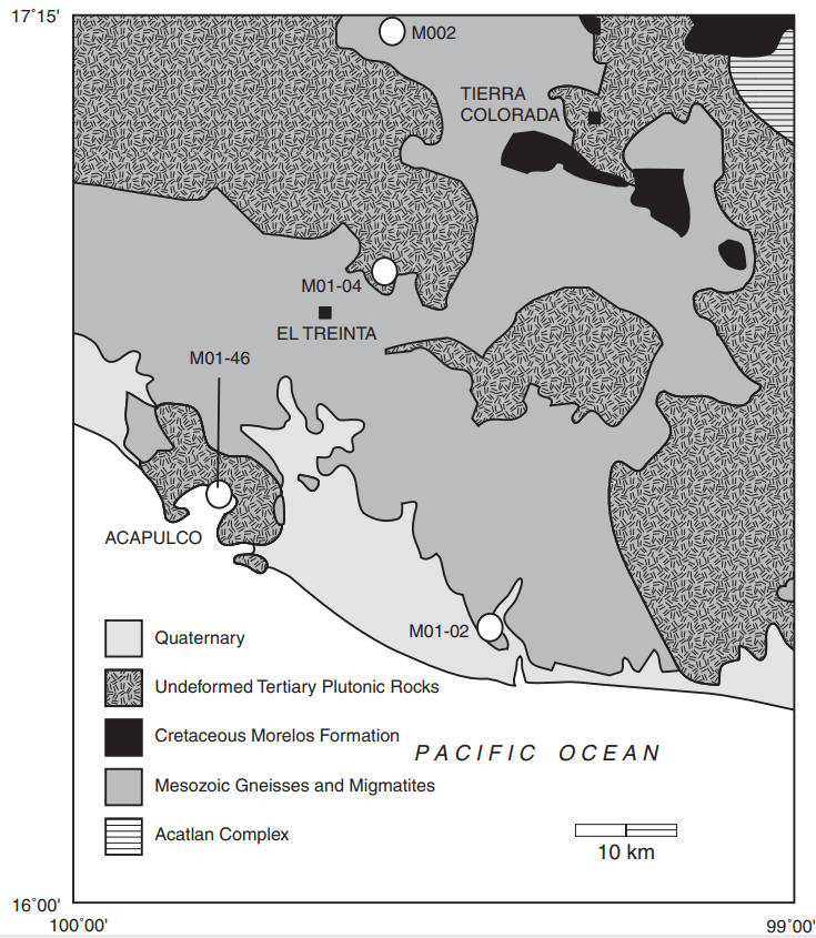
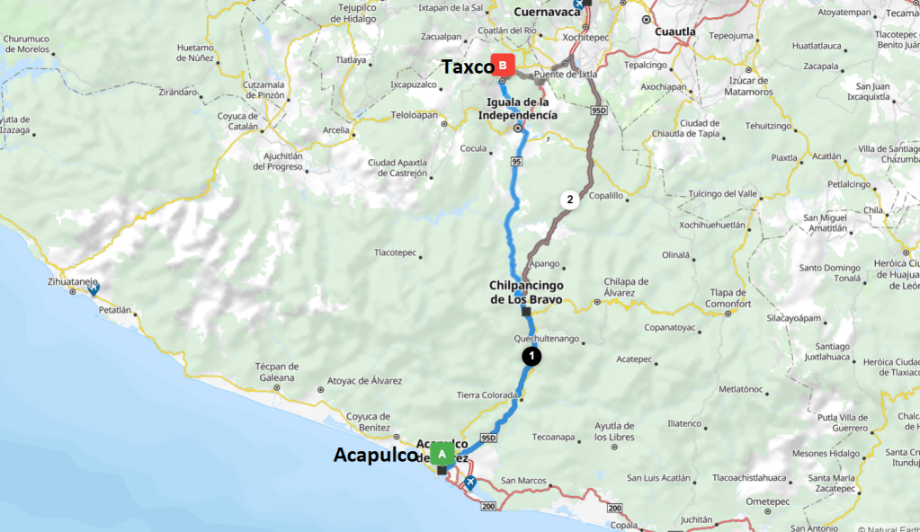
The rocks around Acapulco and “La Quebrada” are non-metamorphized Tertiary granite (plutonic) called the Xolapa Complex. The geology of the Xolapa Complex consists of high-grade ortho-gneisses and para-gneisses as well as migmatites, intruded by generally un-deformed tonalitic to granodioritic plutons around Acapulco.
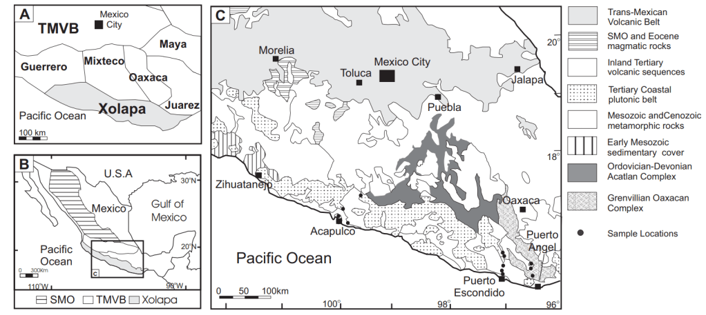
It was thought by many researching scientists that the Acapulco coastal rocks represent an out-of-place terrane that may have docked to mainland Mexico by the Late Cretaceous. This is a reasonable assumption, because of the massive subduction zone found off of the southern Mexican Coast Line. However, some studies have shown that the geology of the Xolapa rocks, while somewhat distinctive from the neighboring scraped-off terranes, represents a magmatic arc that formed in place during the Mesozoic and continued into the Cenozoic.
Since the middle Cretaceous, the relationship between the Farallon and North American plates changed several times. The plate boundary was predominantly convergent, with both periods of oblique subduction and periods when the margin was a continental transform boundary.
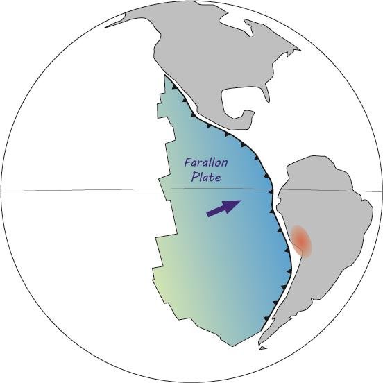
By 20 million years ago, the Farallon plate had fractured into the Cocos and Nazca plates. The Cocos plate continued on a north-northeast trajectory with respect to the North American plate along the current southern Mexican border causing metamorphism of the igneous rocks placed there during the Cretaceous.
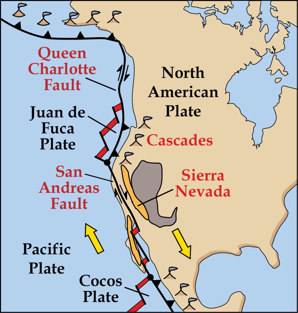
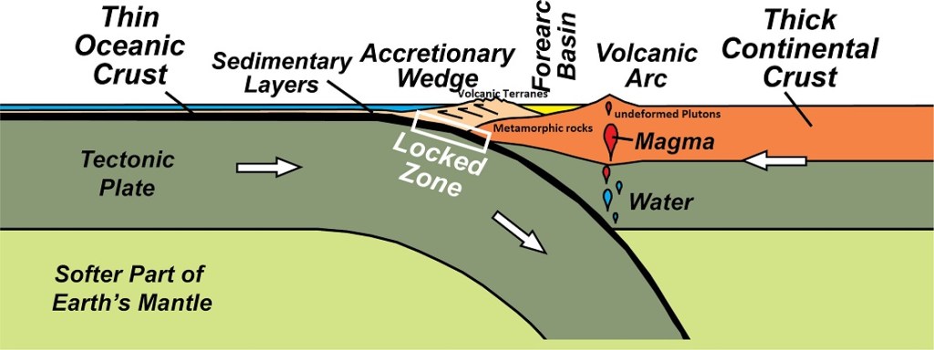
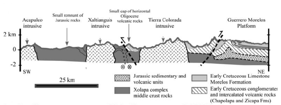
The current southern margin of the North American plate has experienced truncation along the southern margin of the Xolapa Complex. Though subduction has been occurring at most times since the early Mesozoic, the current margin displays none of the mature margin characteristics of other 100 million year old margins, (imaged below).
The Middle America Trench today lies only ~75 km offshore, and thus, the distance between the modern trench and the Eocene-Oligocene magmatic arc is much less than in other arc systems.
The lack of high-pressure/low-temperature rocks along the continental margin, as well as the lack of an accretionary prism landward from the Middle America Trench, add additional support for the hypothesis that truncation has occurred at some time.
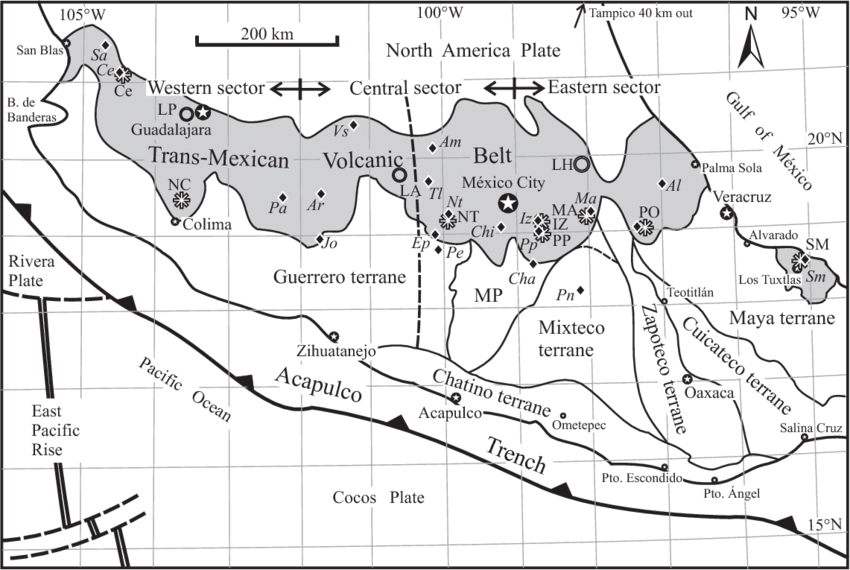
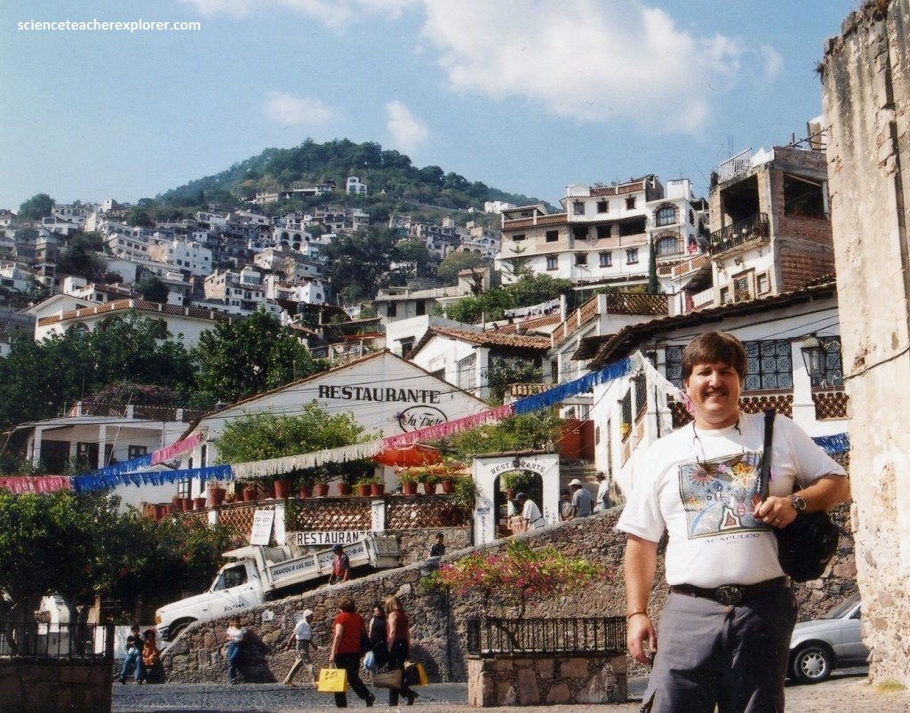
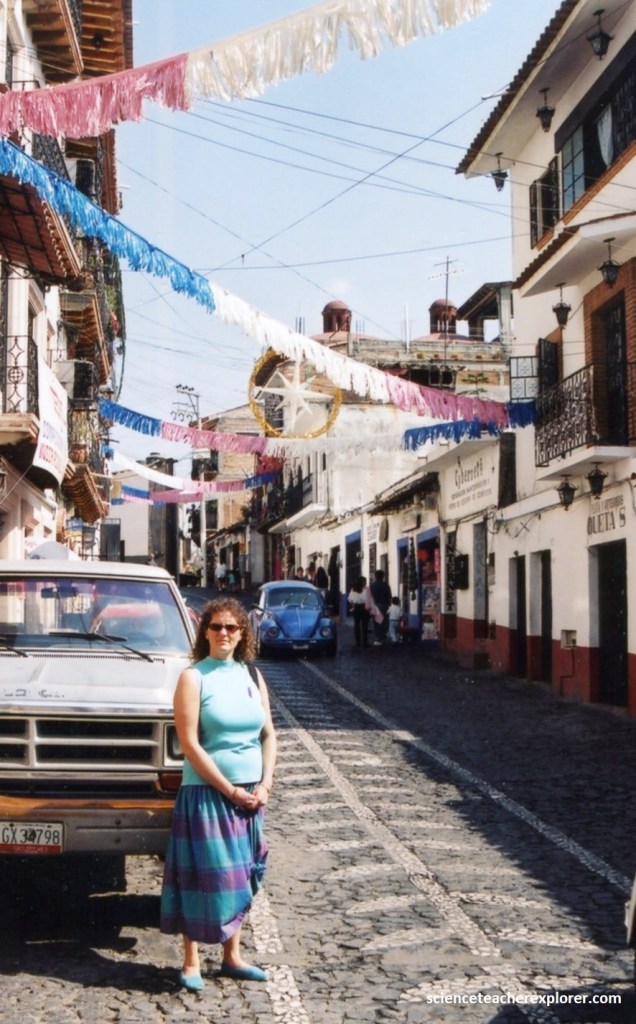
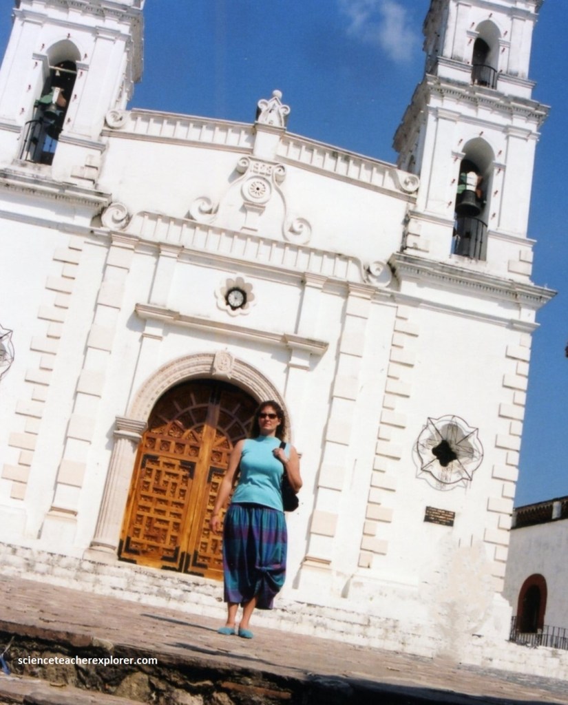
One of the other excursions that Becky and I did was to catch a tour to Taxco, Mexico. This took us north 245km onto Hwy 95A & 95 into the older Cretaceous metamorphic-regions of Xolapa Complex, (image below).
The Taxco region has been one of the most important precious metal producers in Mexico since pre-hispanic times. During the colonial (1521-1810) epoch, Taxco mines produced large quantities of silver and gold and were considered among the richest mines in the Americas.
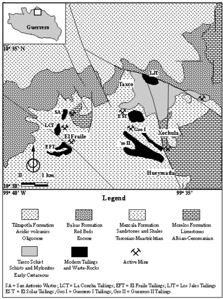
In Taxco, mineralization mainly appeared in hydrothermal veins, replacement ores and stockworks hosted in limestones of the Morelos and Mexcala formations, and more rarely in the Taxco Metamorphic Schists and Balsas formations of the Early Cretaceous. Main ores include galena, chalcopyrite, sphalerite, native silver, argentite and gold-bearing calcite, barite, quartz, rhodochrosite, hematite, tremolite and epidote.
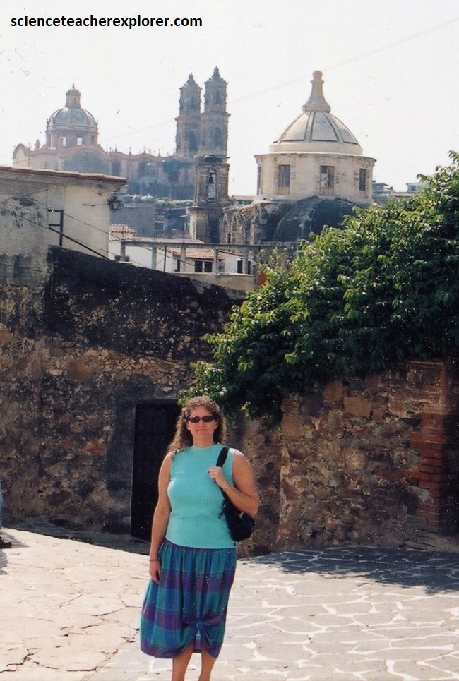
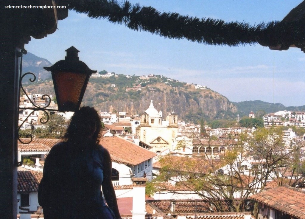
As one of the most beautiful towns in Mexico, this was a great place to aimlessly wander. The narrow streets twisted up and down along the hilly mountainsides. And the cobblestone paving, forces the traffic to move almost as slowly as the pedestrians.
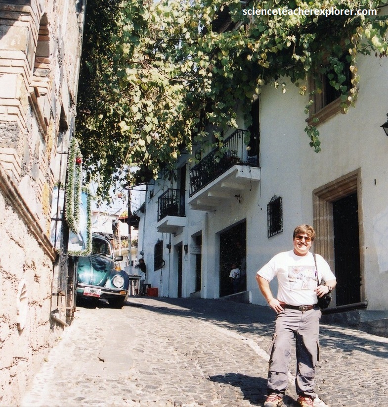
Taxco is also known as a stunning pueblo magico with twisting streets lined with colonial buildings and Volkswagen Beatles used as the official taxis, (pictured above & below).
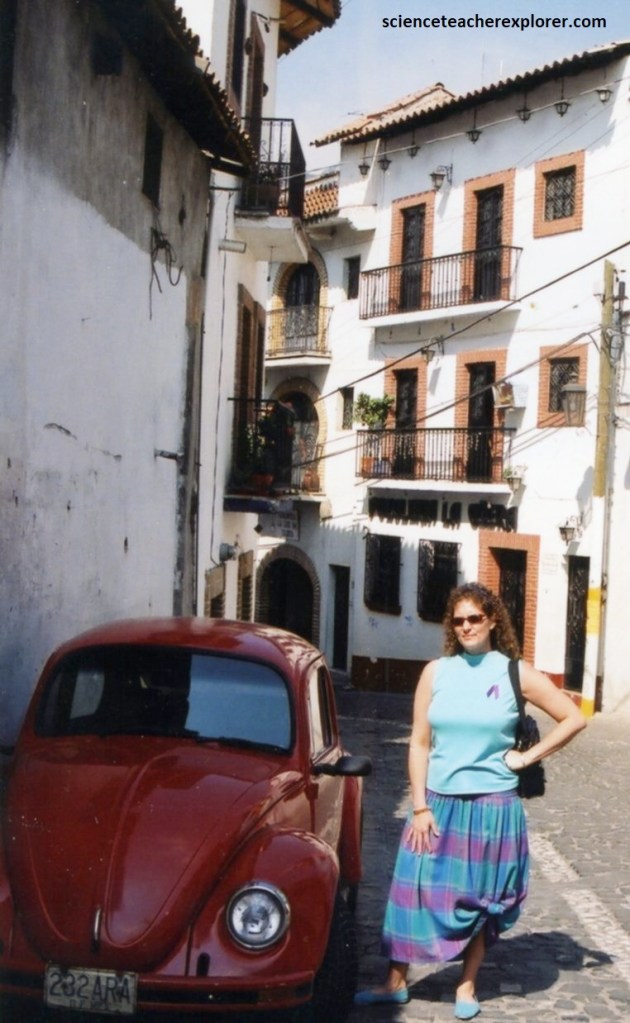
Taxco Mexico is known for its fine silver jewelry. It is considered the center for silverwork in the Western Hemisphere.
Taxco Mexico is known for its fine silver jewelry. It is considered the center for silverwork in the Western Hemisphere. However, we didn’t buy anything silver. Even though every store we came across was selling silver jewelry.
The climate in Taxco was relatively mild. During this dry season in November of 1996 the temperatures dipped to the low 40s (6°C) while daytime highs hovered around 77°F (25°C).
At nearly 2,000m above sea level, Taxco Mexico was located on the slopes of Atache Hill along the north-central edge of the state of Guerrero. It took our driver 4 hours to drive us up here and 4 hours to drive us down to Acapulco, Mexico. Meanwhile, our driver talked non-stop about his adventures with the Hurricane “Boris” that ravaged Acapulco 4 months prior in 1996. Apparently, the Hurricane killed 6 men on the streets of Acapulco, and our driver was there helping save the other survivors.
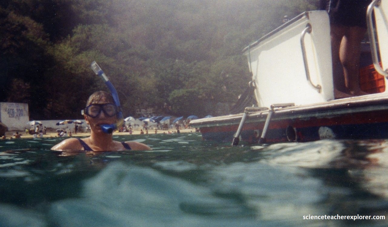
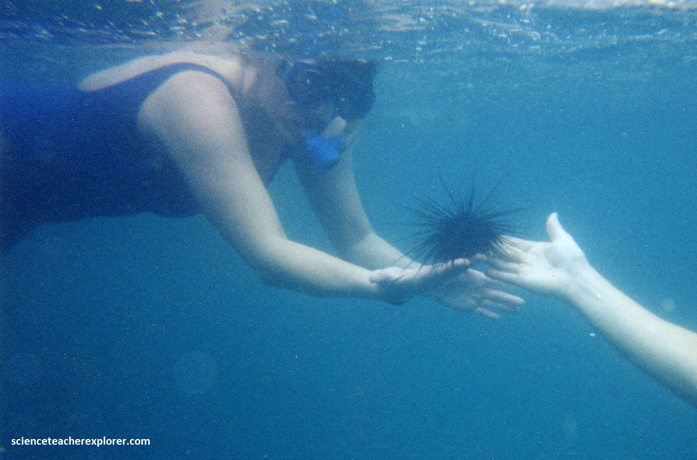
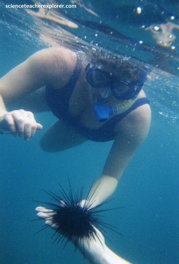
I started feeling better from my sickness at the end of our vacation. So Becky and I booked a snorkeling cruise. Pictured below, I hand Becky a long-spined sea urchin, (Diadema antillarum). What distinguished the Diadema is the length of its spines. Most sea urchin spines are 1–3 cm, but the spines in this species are usually 10–12 cm in length, and can grow as long as 30 cm in very large individuals. The Diadema antillarum is still one of the most abundant, widespread, and ecologically important shallow-water sea urchins.


Acapulco is the granddaddy of Mexican coastal resort cities. The divers at La Quebrada, gracefully swan-diving into a narrow chasm with the surf rising and falling below, were amazing. Becky and I had a blast trekking and exploring the Acapulco Region, even though I was sick through most of my stay.