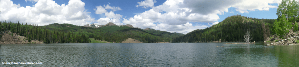
Tushar Range, Utah
This is home….I was raised on the Tushar Mountains. The Tushar Mountain-Range is bounded roughly by I-15 to the west, I-70 to the north, US-89 to the east and U-20 to the south. U-153 crosses the southern part of the range between Beaver and Junction, Utah.
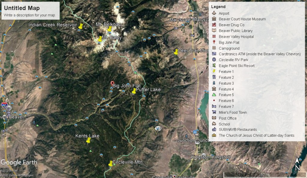
Even though this was my back yard, I hardly could include every beautiful place on this Mountain Range. However, I’ve included some of my most favorite places.
The Tushar Mountains are the third highest mountain range in Utah after the Uinta Range and the La Sol Range. Located in the Fishlake National Forest, (I worked for the Forest Service for about 6 years as a young man).
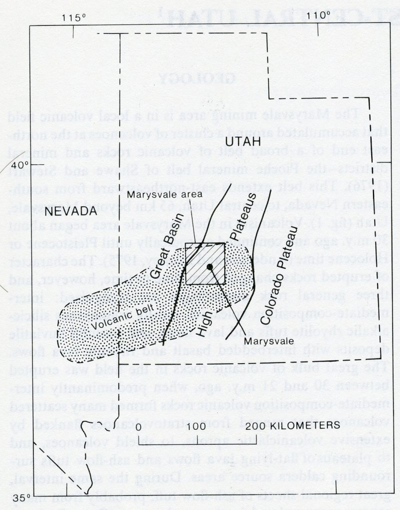
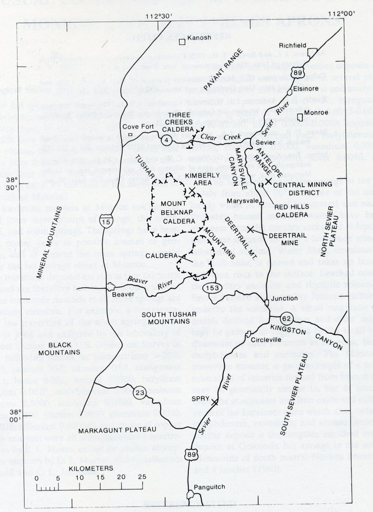
The Tushar Mountains consist of the Bullion Canyon Volcanics from 22-35 million years ago and the Mount Belknap Volcanics from roughly 21 million years ago. The Tushar Mountain area is in a local volcanic field the accumulated around a cluster of volcanoes at the northeast end of a broad belt of volcanic rocks and mineral districts, (the Pioche mineral belt). Imaged below, this belt extends east-northeastward from south-eastern Nevada, to central Utah, 65 km beyond Marysvale, Utah.
The character of erupted rocks changed from time to time, however, and three general rock assemblages are recognized: intermediate-composition volcanics, locally voluminous silicic-alkalic rhyolite tuffs and lava flows, and basin-fill fluviatile deposits with interbedded basalt and rhyolite lava flows.
About 21 m.y. ago, the composition of erupted volcanic rock changed abruptly to dominantly silicic-alkalic rhyolite. Between then and 17 m.y. ago, locally voluminous ash-flow tuffs and lava flows were eropted from two source areas near Marysvale, (one in the southern Antelope Range and eastern Tushar Mountains 7-10 km north and northeast of Marysvale), and the other in the Mount Belknap caldera in the central Tushar Mountains.
Catastrophic eruptions with large volumes of ash deposited as far north as Richfield forming the Joe Lott Tuff Member and led to the collapse of the Mount Belknap caldera 19 million years ago.
Pictured above, the Joe Lott Tuff erupted as a large avalanche of volcanic ash, rock, and gas. The Joe Lott Tuff is a light tan to pink-brown rock primarily composed of welded ash with quartz and feldspar crystals, glass fragments, and larger fragments of gray pumice and darker volcanic rocks. So much material was effected during the eruption that the roof of the magma chamber collapsed due to the loss of interior support, creating the Mount Belknap caldera, located about 16 km to the southwest.
Not long after this eruption (geologically speaking, 1 or 2 million years), the Earth’s crust here and to the west began to be stretched westward. During this initial phase of basin-range extension, sediments were eroded off higher areas and deposited in river channels, flood plains, and lakes, eventually filling in valley and canyons with layers of siltstone, mudstone, sandstone, and conglomerate.
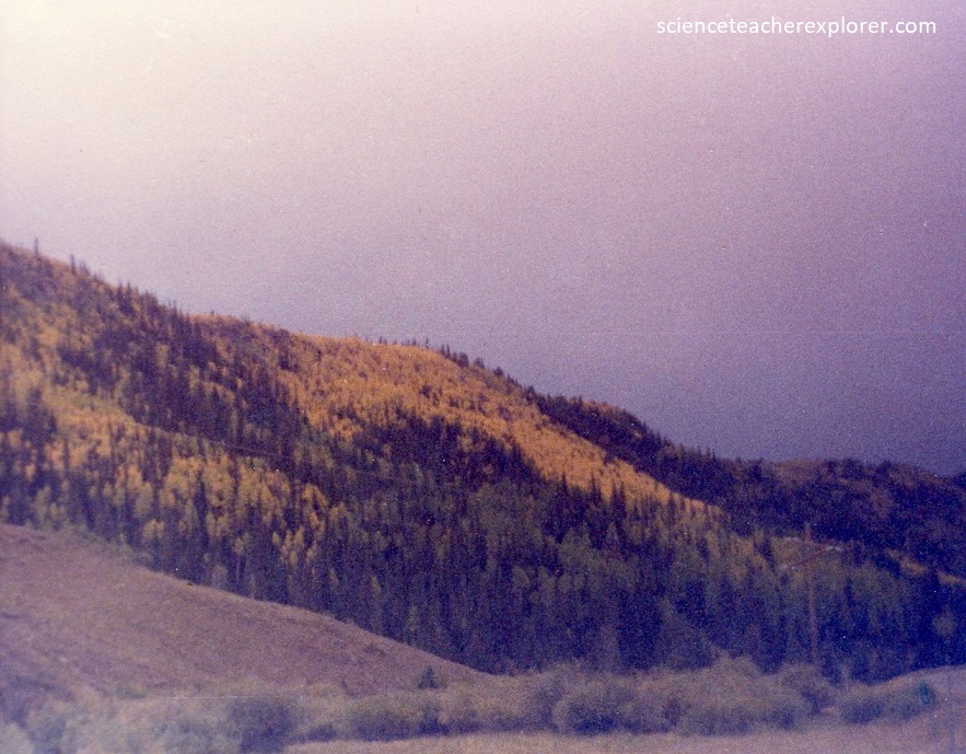
Fluvial, eolian, and glacial activity has largely eroded these volcanics. Sulphur-laden deposits with their distinctive yellow color are also visible in this region and attest to the later stages of the volcanic activity.
Overall, the Tushars are the remnants of a long succession of volcanoes that erupted from 5 -35 million years ago.
Extensional basin-range tectonism in the western United States, which apparently began in the Tushar Range area with the initial structural separation of the High Plateaus and the Great Basin sometime between 28 and 22 m.y. ago, progressed to widespread block faulting after eruption of the Mount Belknap Volcanics. This block faulting was especially active during late Miocene and Pliocene time, but some Holocene scarps indicate that deformation is still going on, although perhaps at a reduced rate. But much of the faulting imaged below was formed during this time.
The Tushar Mountains are composed of a whole slew of igneous rock types including obsidian, basalt and andesite flow, breccias, tuffs, ash flows, silicates, rhyolite and granitic intrusions. The total thickness of these deposits exceeds 3,500 m.

Pictured below, many of these volcanic rocks are rich in mineral deposits, including ores of gold, silver, mercury, copper, lead, zinc, uranium, manganese, iron, aluminum, and potassium. Mineralization took place at many times during middle and late Cenozoic volcanism. The earliest that has been documented took place in the cores of some of the old intermediate-composition volcanics. In the eastern and northern parts of the Tushar Mountains, the quartz monzonite intrusive core of a volcano was emplaced about 23 m.y. ago; the intrusive and surrounding volcanic rocks were widely propylitized, and gold- and silver-bearing quartz-calcite-pyrite veins were deposited in northwest-trending fractures.
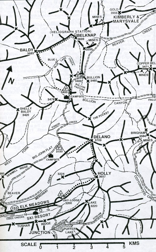
Pictured above, Bullion Canyon is the site of epithermal north-trending gold veins mined at the Bully Boy, Cascade, and Shamrock mines. Discovered in 1868, the ores produced almost $4 million, mostly in gold.
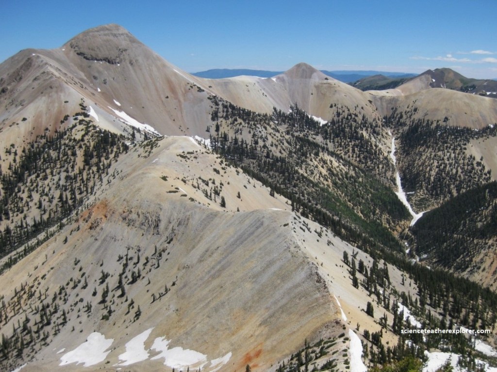
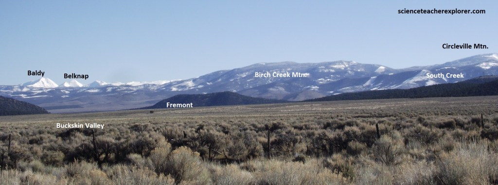
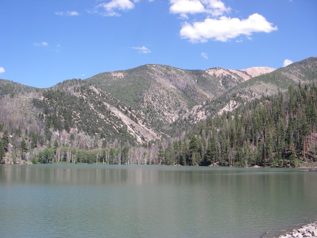
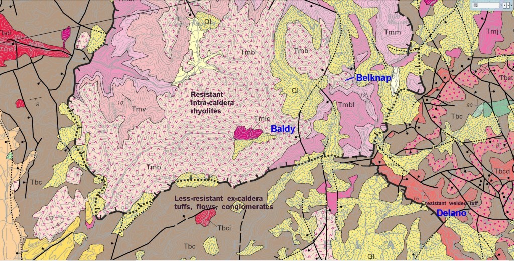
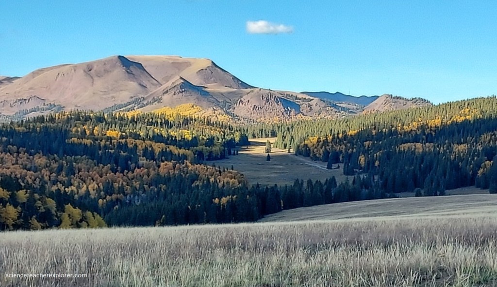
Pictured above is Mount Baldy at 12,090 feet (3,690 m) and Mount Belknap at 12,137 feet (3,699 m). Both formed on the cusp of the Mount Belknap Caldera (once a volcano).
Mount Belknap and Baldy of the Tushars were formed between 22 and 32 million years ago by volcanic activity that included a calamitous explosion that blew off the top of a massive peak leaving these two peaks behind.
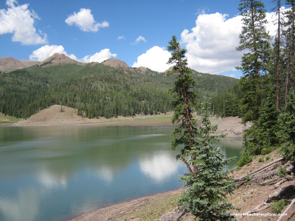
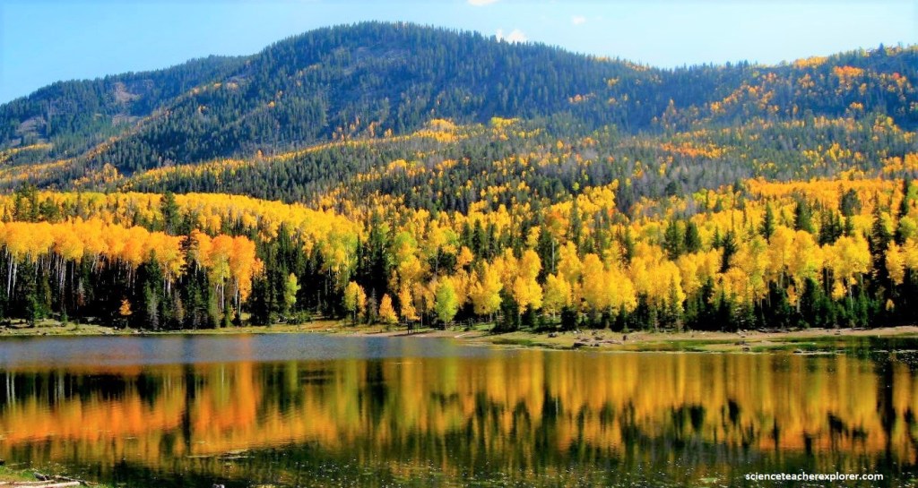
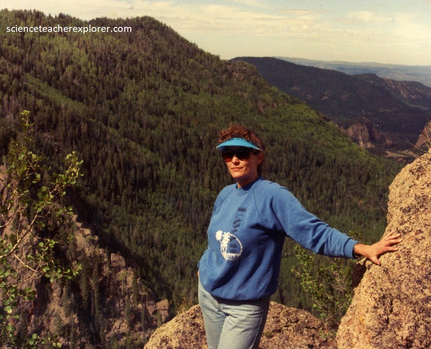
The Tushars have at least seven high alpine glaciated canyons, Cottonwood Canyon, North Fork of Cottonwood Canyon, South Fork Basin, The Pocket Basin, Bullion Basin, Beaver Basin and City Creek Basin. All were heavily glaciated during the last ice age.
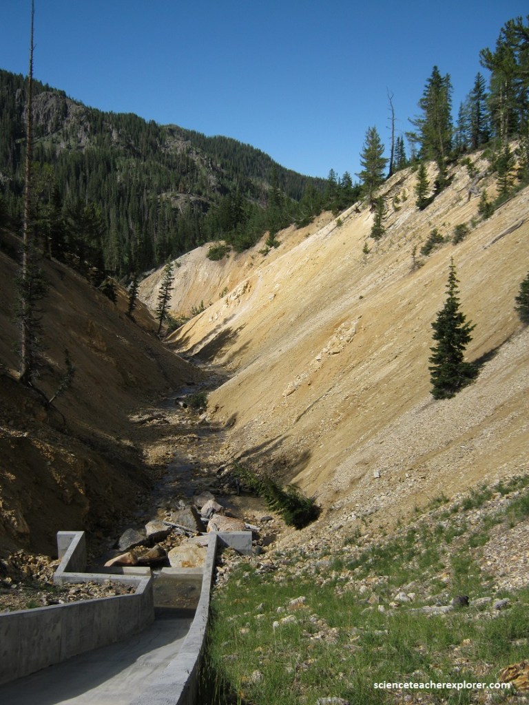
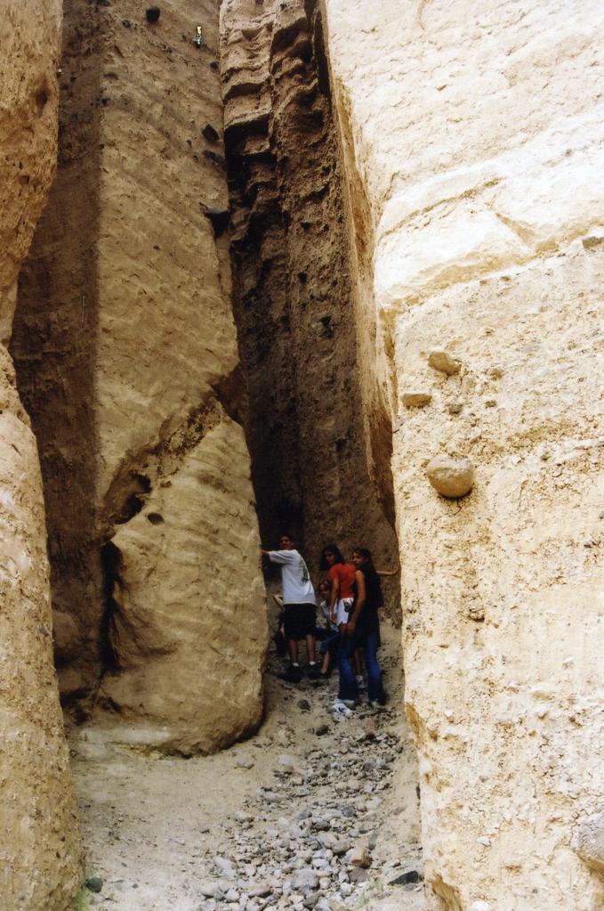
Pictured above, the Altered Zone excels in the Colorado Plateau for showing the effects of hot water or hydrothermal activity of igneous rocks and the development of clays in the weathering process associated with the late phases of igneous activity. The highly altered, brightly colored rocks associated with a variety of igneous intrusions and extrusions make this area distinct and virtually unique in the Colorado Plateau.
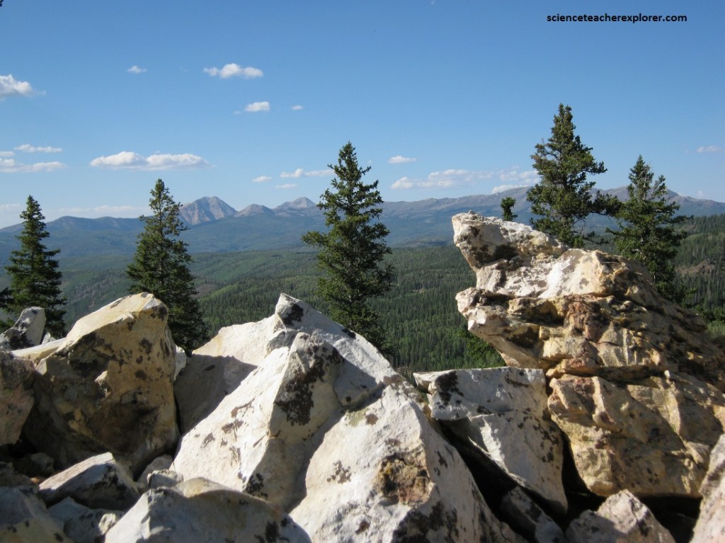
Pictured above, is an outcrop of a white silicate rock that my Father wanted me to make a headstone out-of. It was a highly resistant, tightly compacted Quartz that contained red, green and black veins. He died in May of 2012.
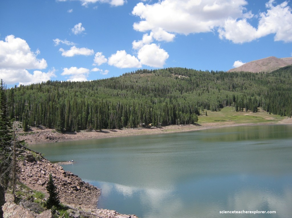
Pictured above and below, is the Big Flat of Tushar Range. Under this flat is a zoned center of mineralization of an altered core caldera with high-grade veins of alunite, surrounded by propylitically altered volcanic rocks containing gold- and silver-bearing quartz-calcite veins along the northern flank, and sedimentary rocks with manto deposits of gold, silver, copper, lead, and zinc on the east. Sericite from a manto deposit and alunite from the core area gave ages of 13-14 m.y..
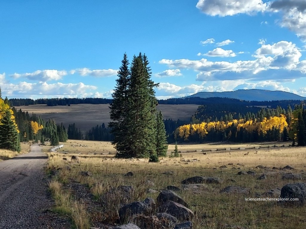
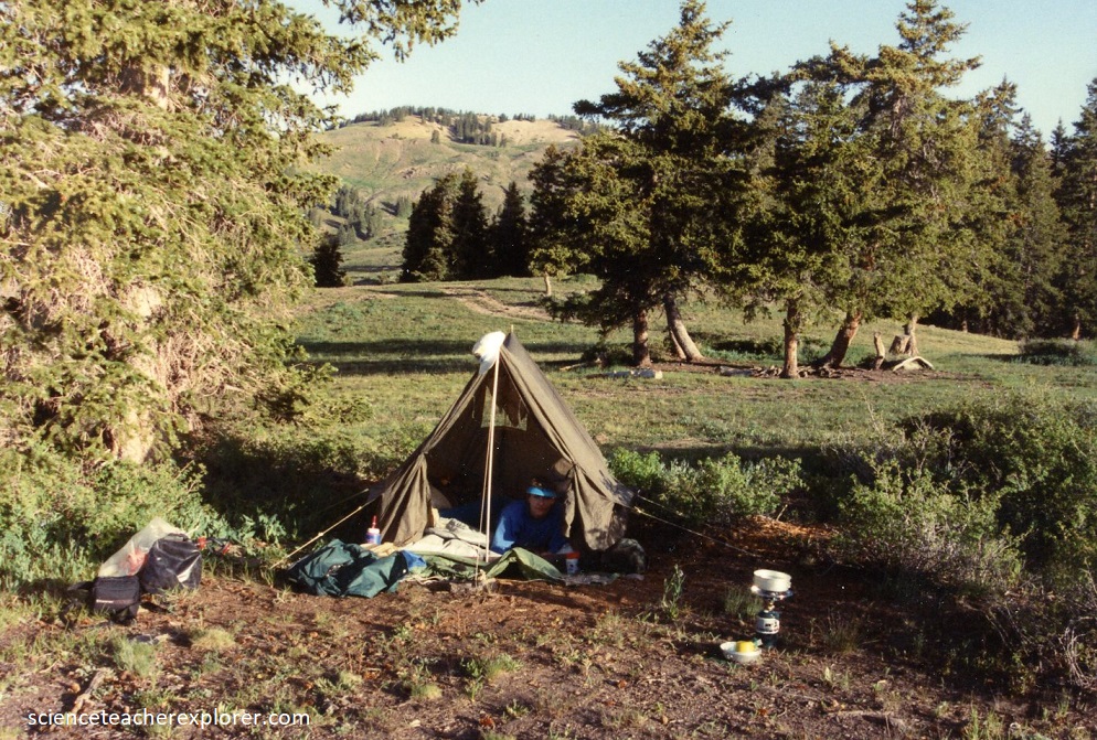
Pictured above, the Tushars support alpine and sub-alpine vegetation, mountain meadows, dense aspen, sub-alpine fir, Engelmann Spruce, five needle pine and some Douglas Fir, mountain brush, sagebrush steppe, pinion-juniper woodlands, oak, mountain mahogany, and upland mountain grasslands.
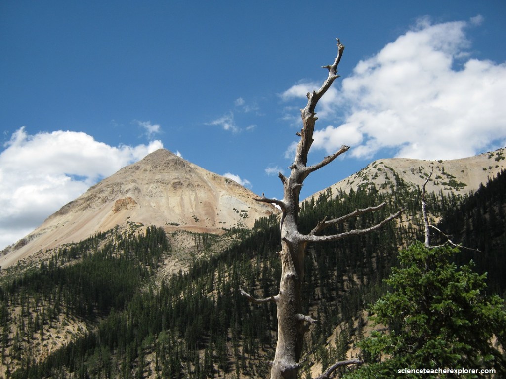
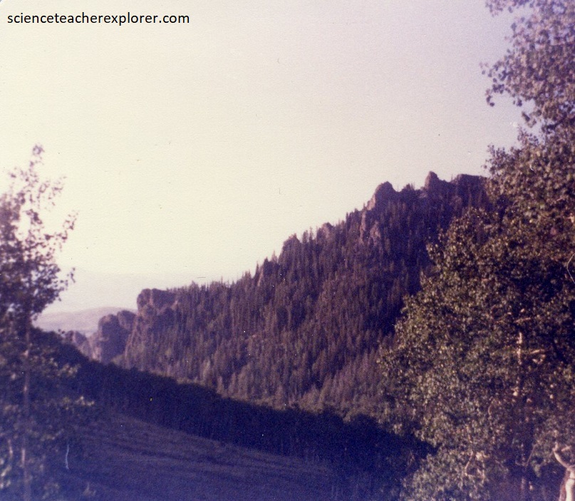
Pictured above, Circleville Mountain contains a sequence of resistant, dark-gray to black, vesicular to dense lava flows and autoclastic flow of porphyritic basaltic andesite.
Pictured above, looking southeast towards Spry, Utah from Cherry Creek are the tan rocks of the Spry laccolith. The 30 m.y.-old (Oligocene) pluton is exposed throughout and area of about 130 square kilometers. Ranges from monzonite to dacite porphyry. Formed a topographic high against which ignimbrites that were deposited before the Bear Valley Formation lapped and on which no deposition of Bear Valley took place.
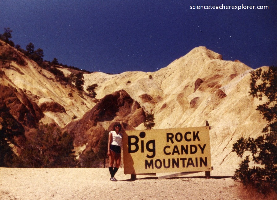
On the northeastern part of the Tusher Range and located a few miles north of Marysvale, Big Rock Candy Mountain consists of altered volcanic rock in various shades of yellow, orange, red, and white, (pictured below). Approximately 22 – 35 million y.a., a cluster of stratovolcanoes erupted, depositing large volumes of lava and ash. Known as the Bullion Canyon Volcanics, these volcanic rocks are more than 1,000 m thick. Approximately 21 million years ago, at least six magma bodies intruded the overlying Bullion Canyon Volcanics. Through a complex chemical process involving hydrogen sulfide, steam, ground water, and oxygen, the original volcanic rock was partially altered or totally replaced. The vivid colors that one sees at Big Rock Candy Mountain are the direct result of this mineralization. The yellow, orange, and red colors are from the presence of iron minerals, such as hematite, and pyrite. The white color is due to the presence of alunite and kaolinite, minerals rich in potassium and Aluminum. Over the past 15 million years, erosion has removed the distinct shapes of the former volcanoes, and within the past several million years has exposed the altered volcanic rocks in Marysvale Canyon along the Sevier River.
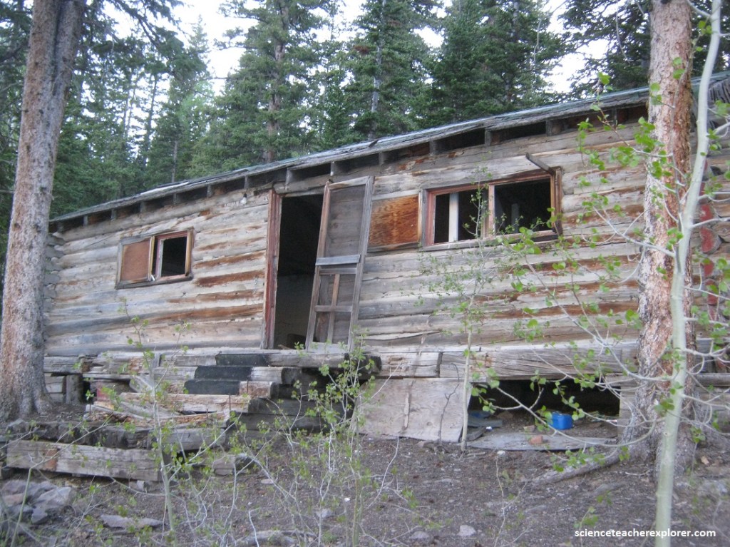
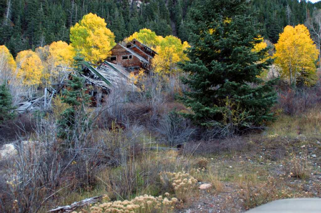
The Deer Trail Mine is near Marysvale, Utah on the eastern side of the Tushar Mountains. Pictured below, the mine operations consist of underground workings. There is one inclined shaft. Subsurface depth reaches a maximum of 232 meters and extends 39,624 meters in length. The ore mined is composed of gold, galena and silver with waste material consisting primarily of fluorite. The ore body is tabular shaped 1,219 meters long, 121 meters wide, and 12 meters thick. The host rock in this area is limestone from 259.80 to 252.17 million years ago (Permian Toroweap Formation).
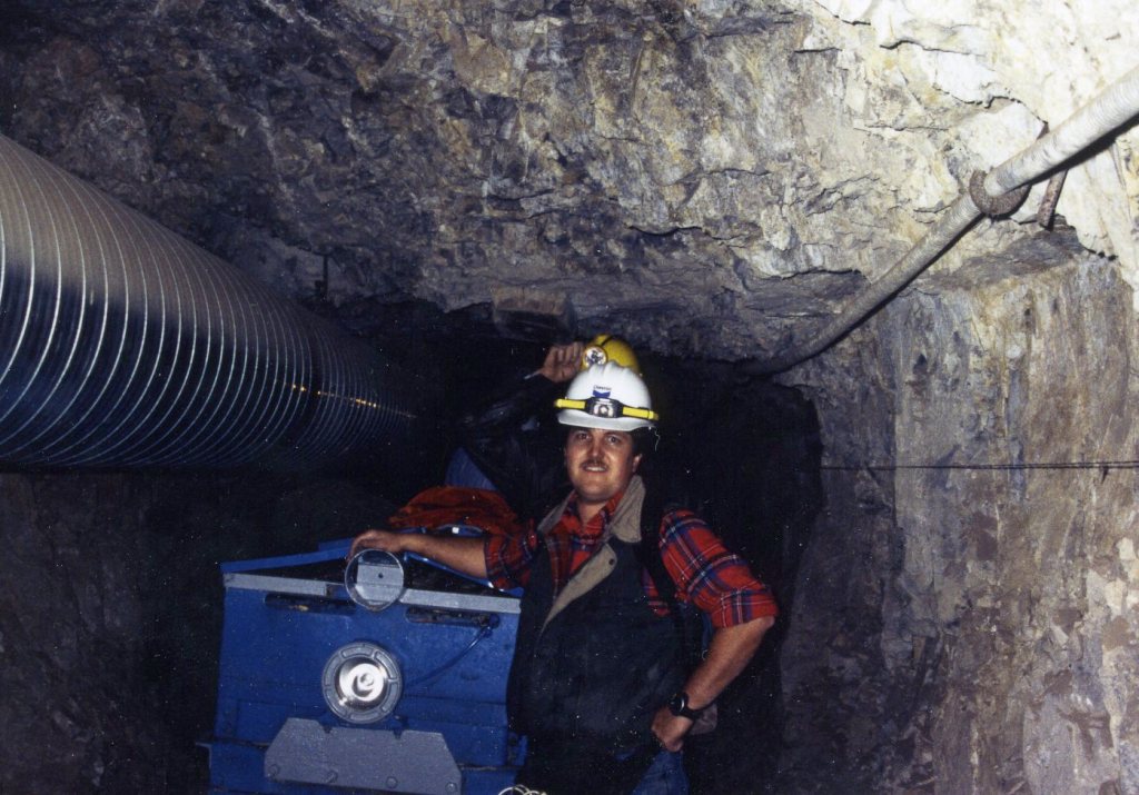
The Deer Trail, which was discovered in 1878, has produced more than $6 million in lead, zinc, silver, and gold; ores contain some mercury, selenium, and thallium.
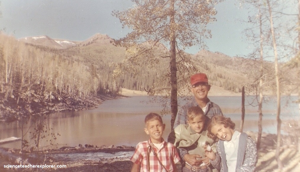
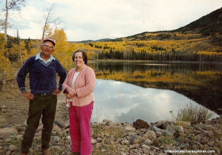
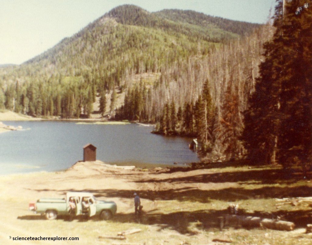
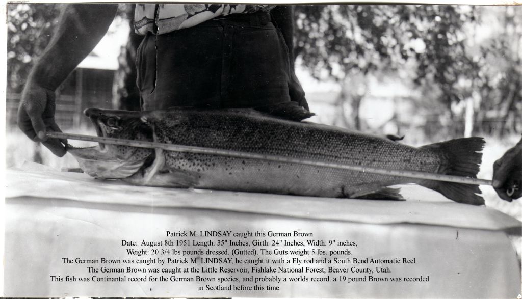
My father’s passion and zest for life was centered on providing for his family by hunting deer, pheasants, and geese. Additionally, he fly-fished and tied his own flies. In July, 1951, he caught what may have been the largest German Brown trout ever caught in the State of Utah or World at that time.
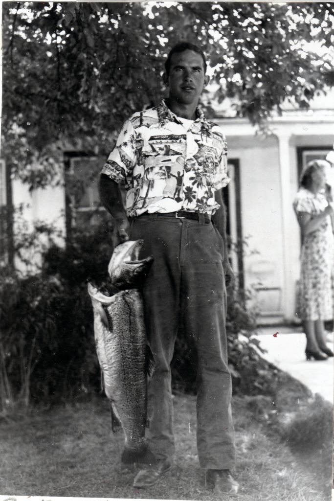
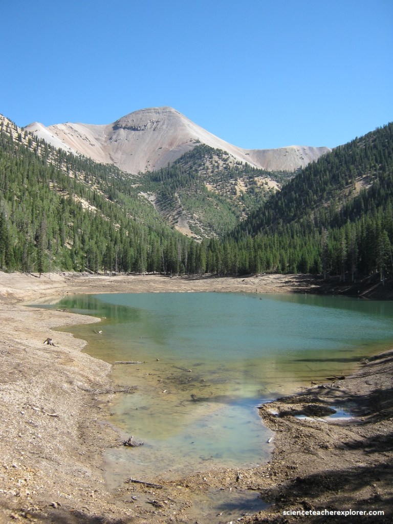
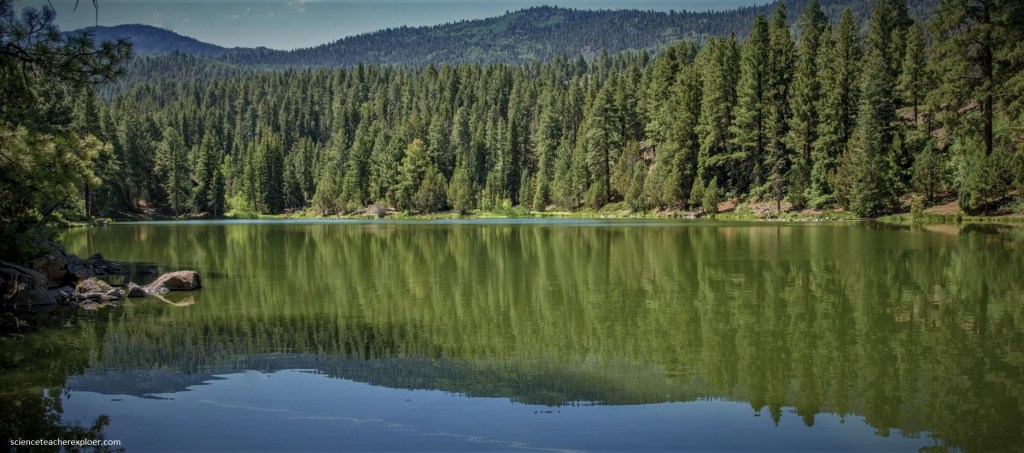
Pictured above, the German Brown Trout was landed by Patrick M> Lindsay at 5:30 P.M., Tuesday at the “Little Reservoir in the Tusher Mountains. The huge trout was 35 inches in length and 9 inches wide. Before realizing that it could have been a record, he had removed the entrails. Even so, it weighed 21 and 3/4 pounds. It probably would have weighed 26 pounds or more.
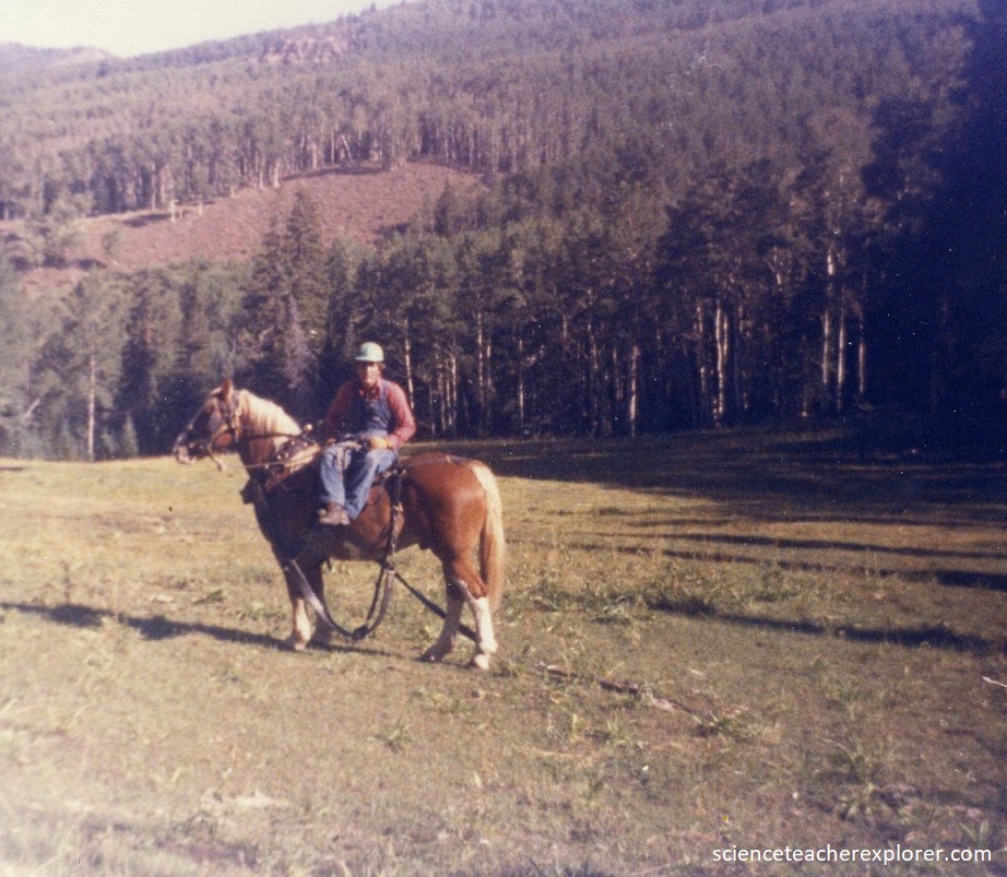
Pictured above, my father was accompanied on the fishing trip by his father, Charles Lindsay, Lewin Limb, and Don Patterson, and the latter actually netted the catch. Pat was using an eight ounce fly rod and a #6 hook which he had tied himself. He was using a 9 pound test leader. The men saw the mammoth trout strike the fly almost the instant it hit the water.
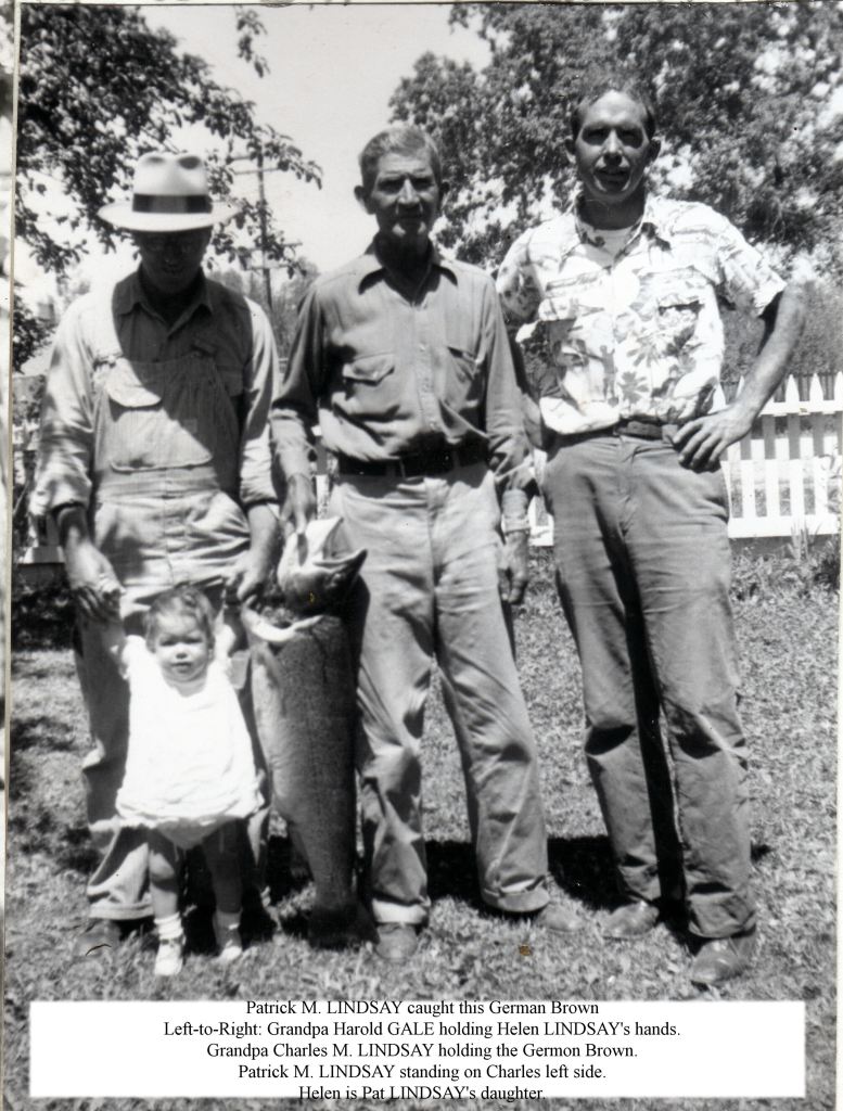
Pictured above, the fish was landed even before his father, Charles Lindsay had assembled his pole to begin the evening fishing. His father caught a 9 pounder in the “Little Reservoir” on opening day of fishing season, that year. When the big one was cleaned, it was discovered that no small fish had been recently devoured and was apparently hungry. Many witnesses got a thrill watching him bringing his large trout to the bank. They all got a thrill at seeing so large a German Brown trout landed in the “Little Reservoir” which at that time was the world record. It is beautifully mounted in the “Fishlake National Forest Service Office in Beaver, Utah” as proof and was the main attraction for years to come for fly fisherman purchasing homemade flies tied by my mother Louise Lindsay.