Zion N.P., Utah
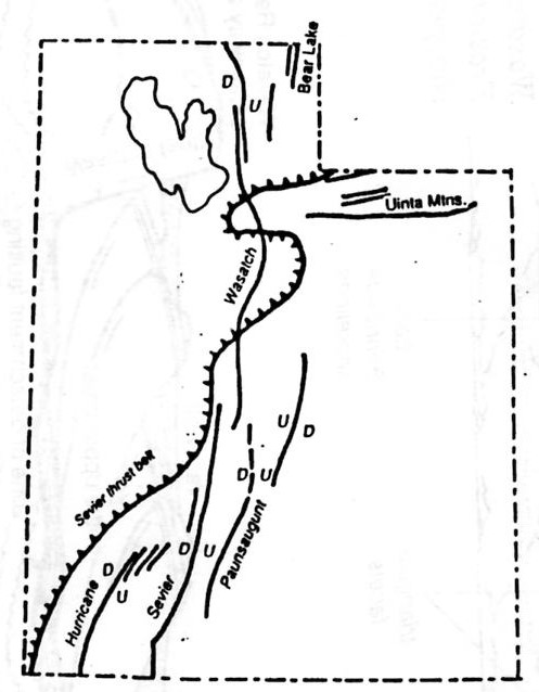
I was raised in southwestern Utah. Therefore, I’ve been to Zion National Park many times. But, I officially took a group of students into the Zion Narrows in the Spring of 1997 and trekked the main Park in 2010. Zion National Park is located on the western margin of the Colorado Plateau, in the High Plateaus section. Zion National Park occurs on the Markagunt Plateau which is bounded to the west by the Hurricane and east by the Sevier Faults. Uplift and tilting along these faults resulted in a gentle northeast dip of the rocks.
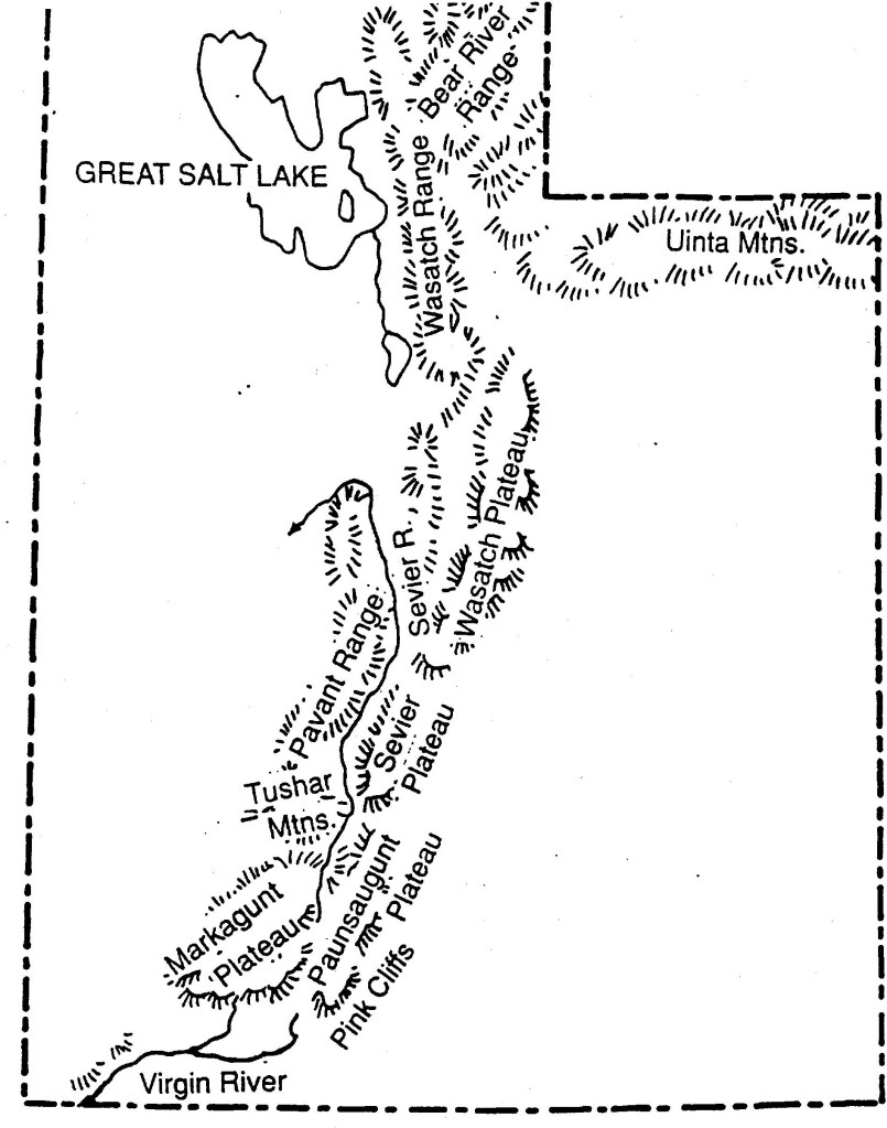
Zion National Park is located in southwestern Utah close to the Arizona and Nevada borders. This is the edge of the Colorado Plateau, where the lush high country meets the lower dry desert. Zion is roughly a 1-hour northeast drive from St. George, Utah. The closest town in Springdale, Utah.
The spectacular cliffs in Zion National Park are make of Navajo Sandstone, which reaches thicknesses of 600 m in southwestern Utah. You can see the large, well-defined cross-beds which are a hallmark of this unit. Cross-beds are a typical structure of sandstones created by the migration of bed forms which vary in scale from less than a centimeter to more than 10 m high.
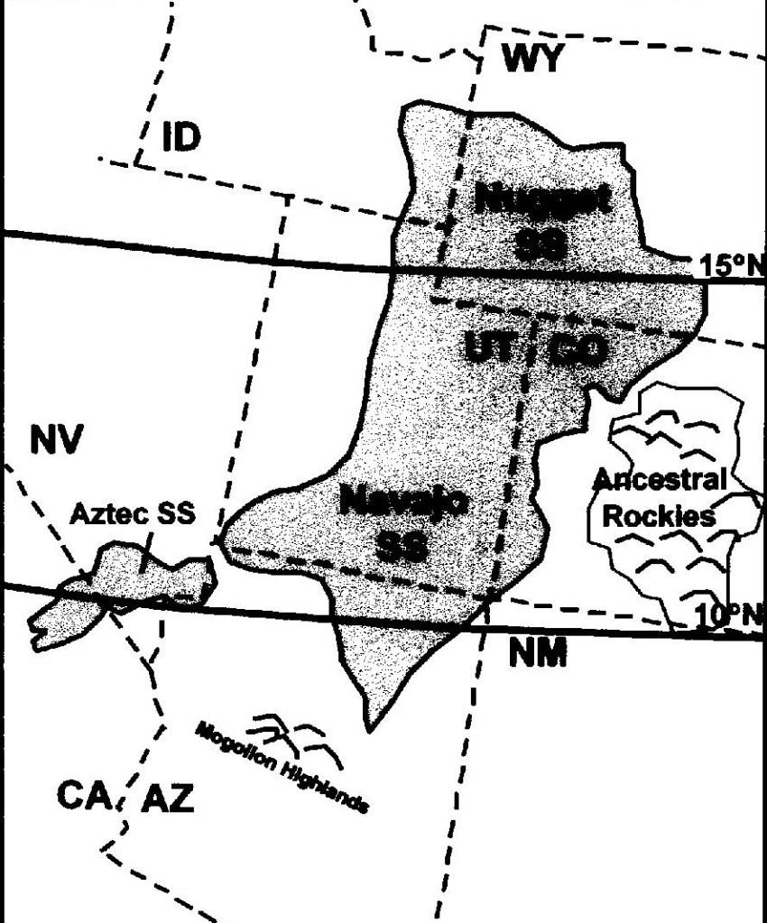
Zion was a relatively flat basin near sea level 240 million years ago. As sands, gravels and muds eroded from surrounding mountains, streams carried these material into the basin and deposited them in layers. As the land rose and fell and as the climate changed, the depositional environment fluctuated from shallow seas to coastal plains to a desert plains to a desert of massive windblown sand. This process of sedimentation continued until over 670 m of material accumulated. This how the Navajo Sandstone was created. These sandstones represent an erg that occupied an area over 1,000 km from north to south and 400 km from east to west during the Jurassic.
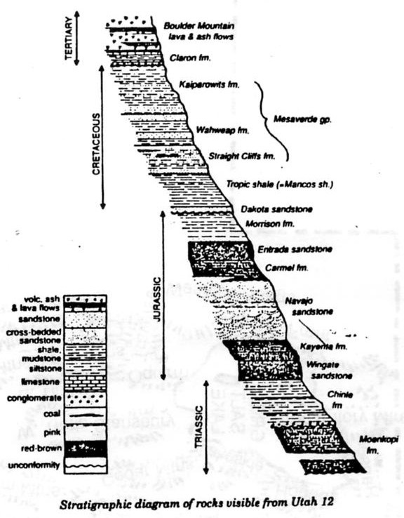
In an area from Zion to the Rocky Mountains, forces deep within the earth started to push the surface up, (Sevier Orogeny). Zion’s elevation rose from near sea level to as high as 3,300 m above sea level. The rock layers have been uplifted, tilted, and eroded, forming a feature called the Grand Staircase, (a series of colorful cliffs stretching between Bryce Canyon and the Grand Canyon). Pictured below, the bottom Tertiary layer of rock at Bryce Canyon is the top layer of rock at Zion, and the bottom layer at Zion is the top Triassic layer at the Grand Canyon.
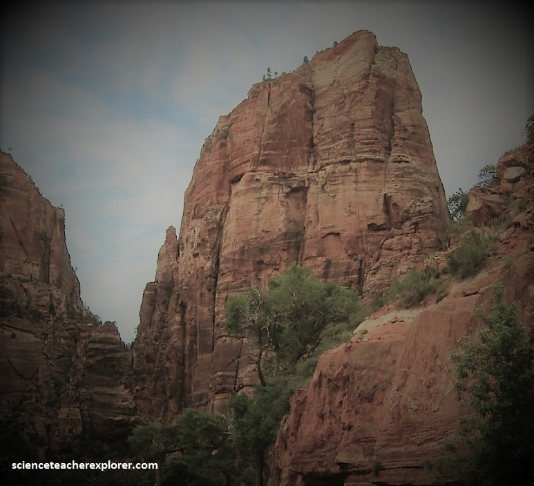
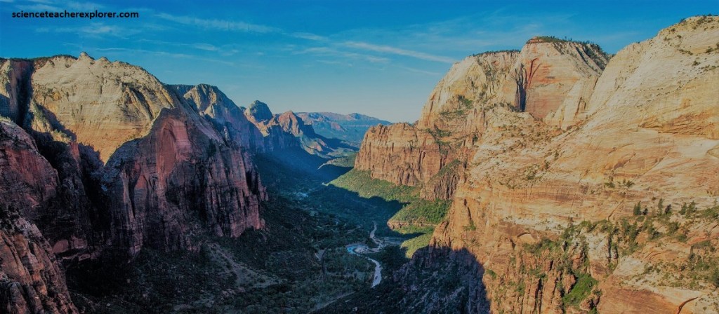
The Sevier Orogeny uplift gave the streams greater cutting force in their descent to the sea. Zion’s location on the western edge of this uplift caused the streams to tumble off the plateau, flowing rapidly down a steep gradient. A fast-moving stream carries more sediment and larger boulders than a slow-moving river. These streams began eroding and cutting into the rock layers, forming deep and narrow canyons. Since the uplift began, the North Fork of the Virgin River has carried away several thousand meters of rock that once lay above the highest layers visible today, (pictured below).
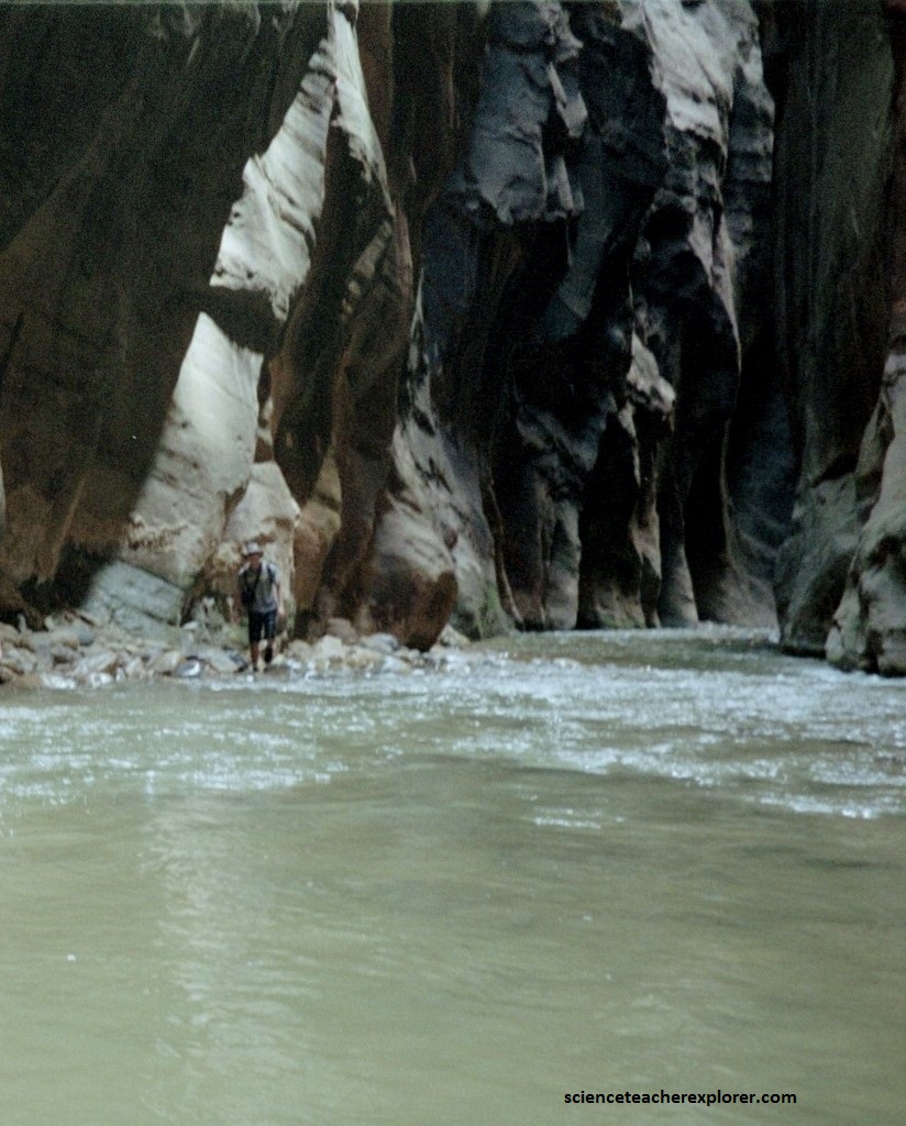
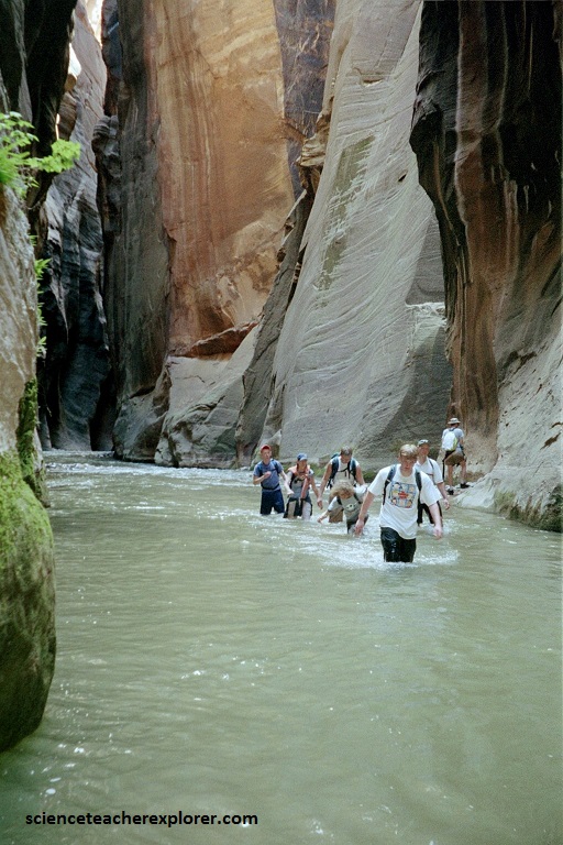
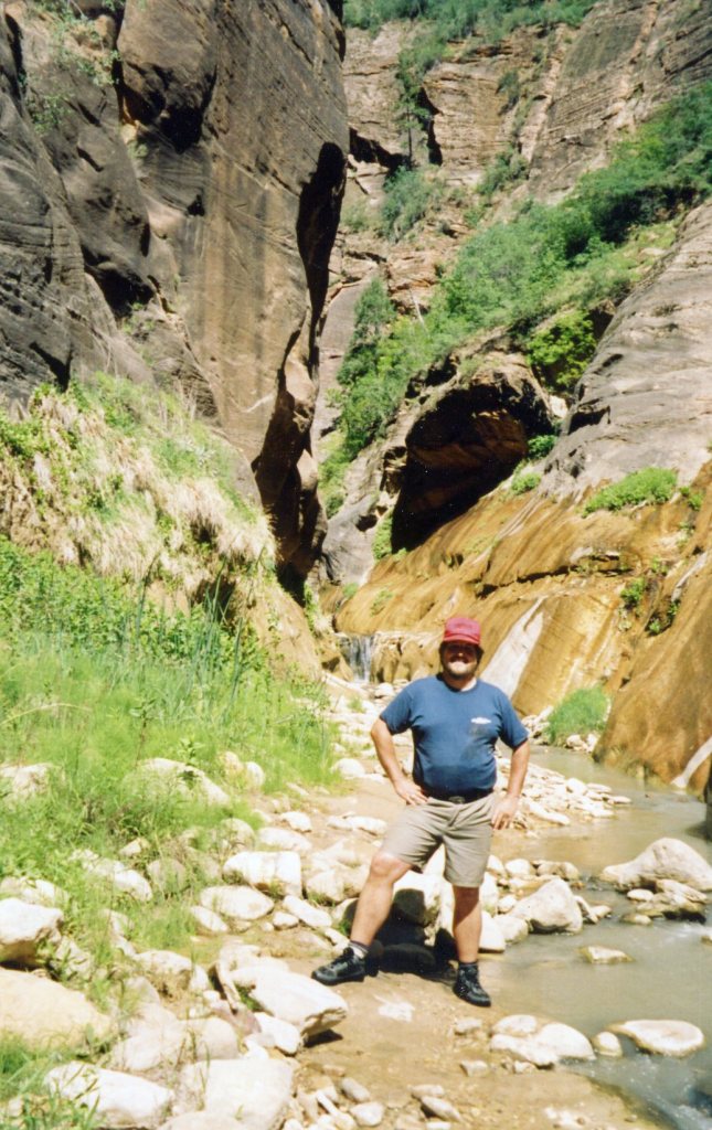
The Virgin River is still excavating. Upstream from the Temple of Sinawava the river cuts through the “Navajo Sandstone”, creating a slot canyon called the “Zion Narrows”.
At the Sinawava Temple, the Virgin River has reached the softer Kayenta formation below. Water erodes the shale, undermining the overlaying sandstone and causing it to collapse, widening the canyon.
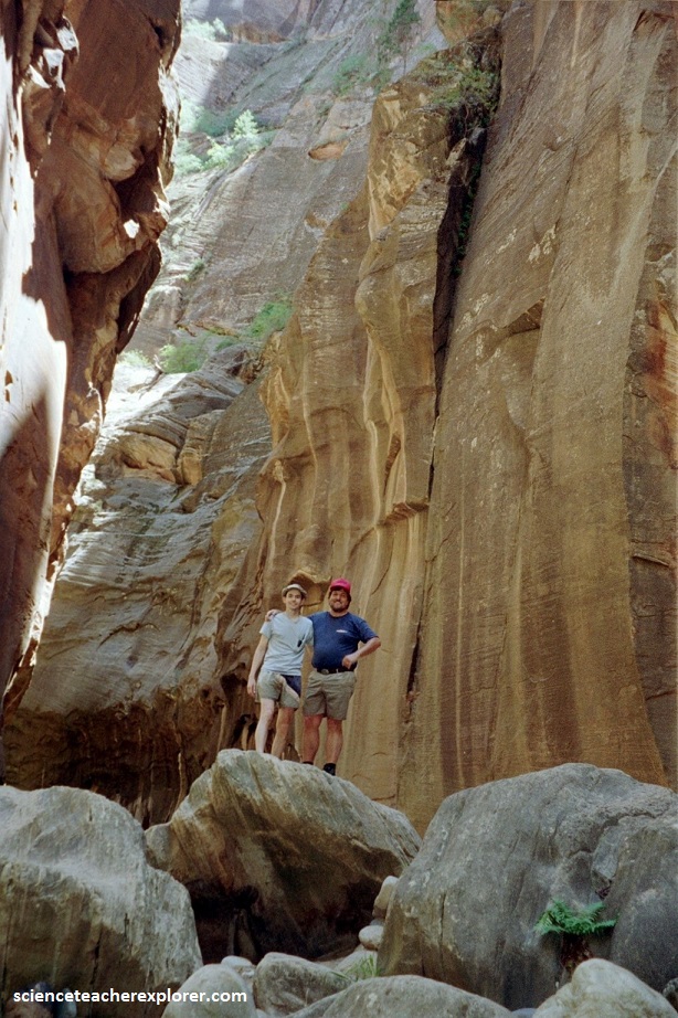
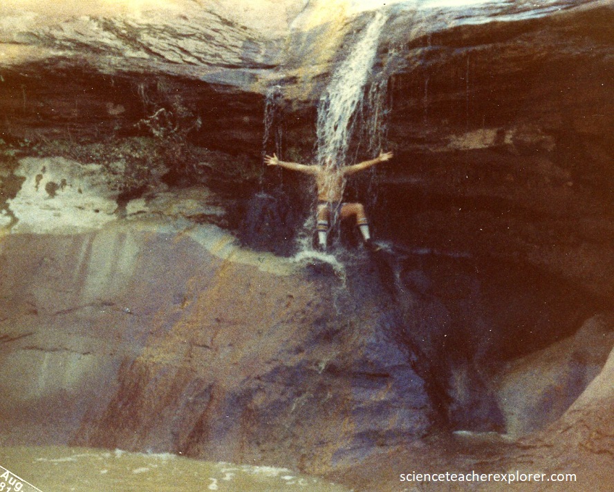
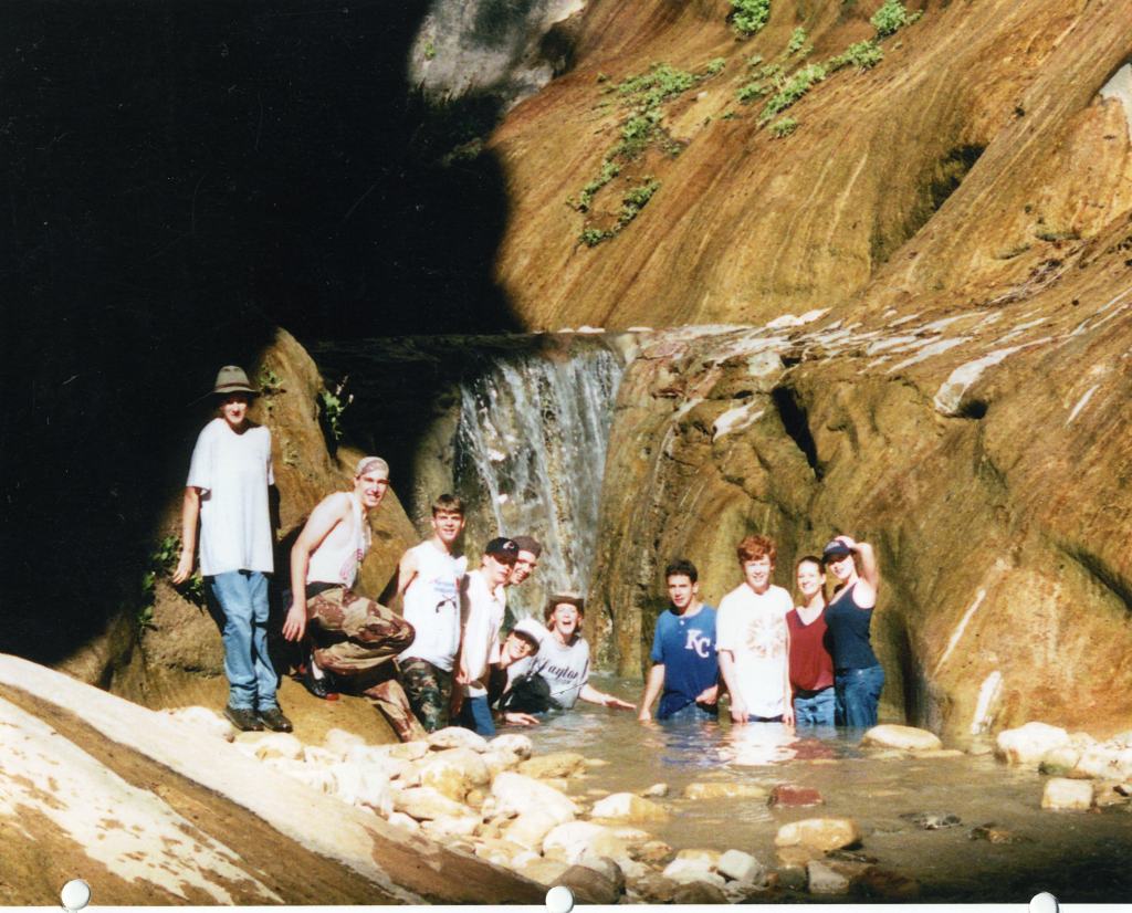
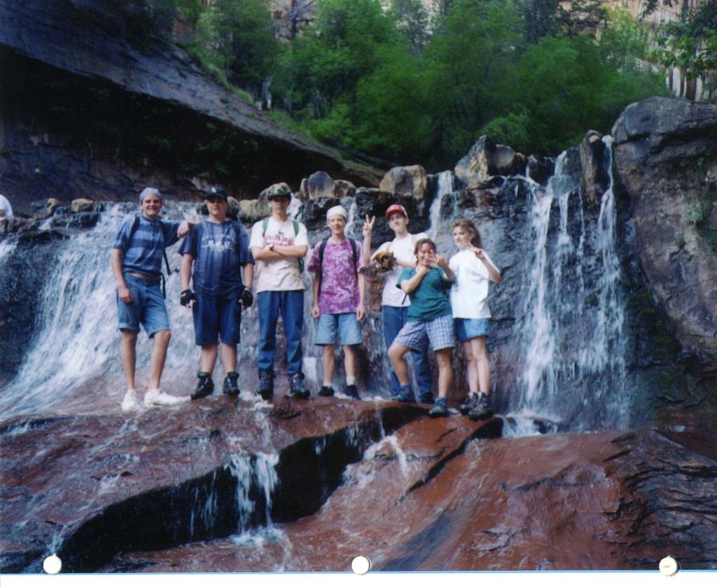
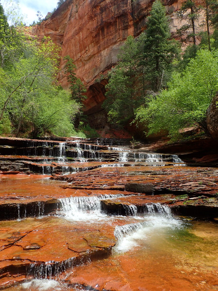
Pictured below, Orderville Canyon is an adventure through a slot canyon, so spectacular that it rivals the Zion Narrows. At the start of the route, juniper and pine trees abruptly give way, as my group dropped into a brushy waterway and saw their first glance of a waterfall. Rock walls and waterfalls slowly started to populate the stream as towering vertical barricades enclosed the canyon.
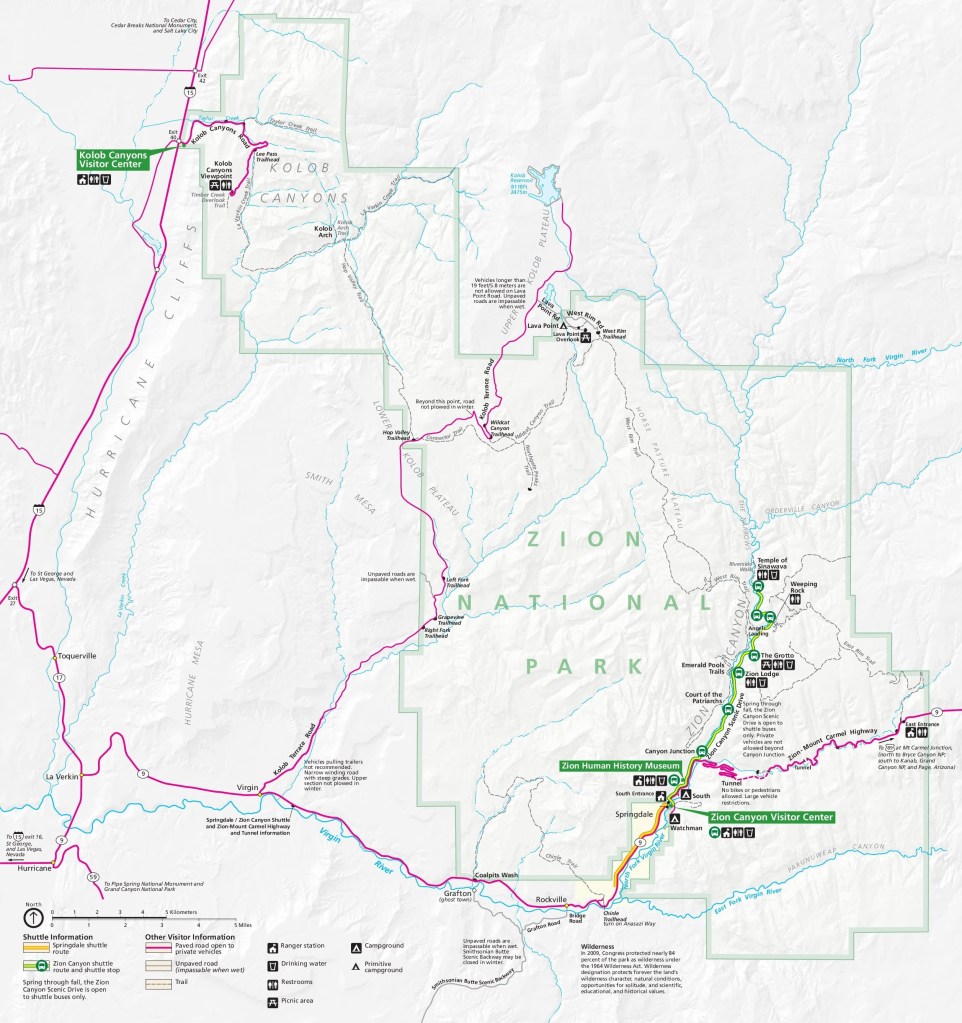
This one-way ‘hike’ began outside the eastern boundary of the park and ended at the Temple of Sinawava in the Zion Narrows.
Flash floods occur when sudden thunderstorms dump water on exposed rock. With little soil to absorb the rain, water runs downhill, gathering volume as it goes. These floods often occur without warning and can increase water flow by over 100x.
The Jurassic Kayenta Formation and Navajo Sandstone are responsible for most of the spectacular scenery seen at Zion National Park (i.e: The Left Fork Canyon or The Subway). The Kayenta consist of reddish-brown, interbedded sandstone, siltstone and shale deposited in a delta or flood plain environment.
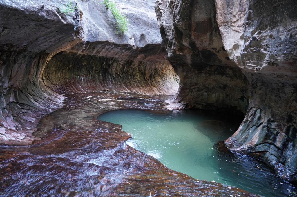
In 1994, I guided a group of students and adults into the “Left-Fork Canyon” or the “Subway”. This was a very strenuous 15 km through-hike that required rappelling skills, 20 meter of of rope, and extensive route finding experience. The route also required swimming through several deep pools of very cold debris-filled water. The route began at the Wildcat Canyon Trailhead and ended at the Left Fork Trailhead next to the Kolob Terrace Road.
The Kayenta Formation (200 meters thick) starts immediately above the Springdale Sandstone with more of the crumbly red siltstone that forms steep, loose slopes. Near the top, just below the Navajo, the Kayenta is a solid, red sandstone that forms long ledges and benches. The floor of the Subway and the red waterfalls below the Subway are Kayenta, (pictured below). It should be noted that walking on the cascading waterfalls are very slippery. I had several minor slip-injuries occur amongst the group while exploring.
Pictured below, the Navajo Sandstone, up to 670 m thick, is a cross-bedded sandstone that is composed of 98% quartz that was deposited in an eolian environment.
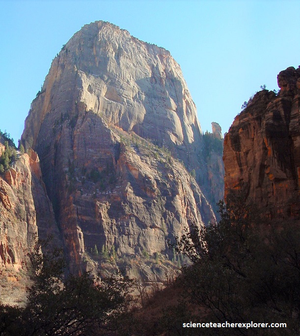
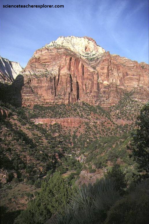
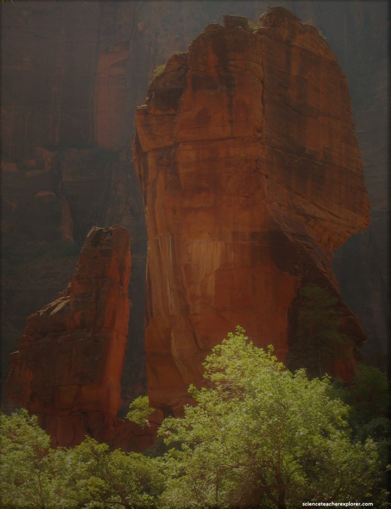
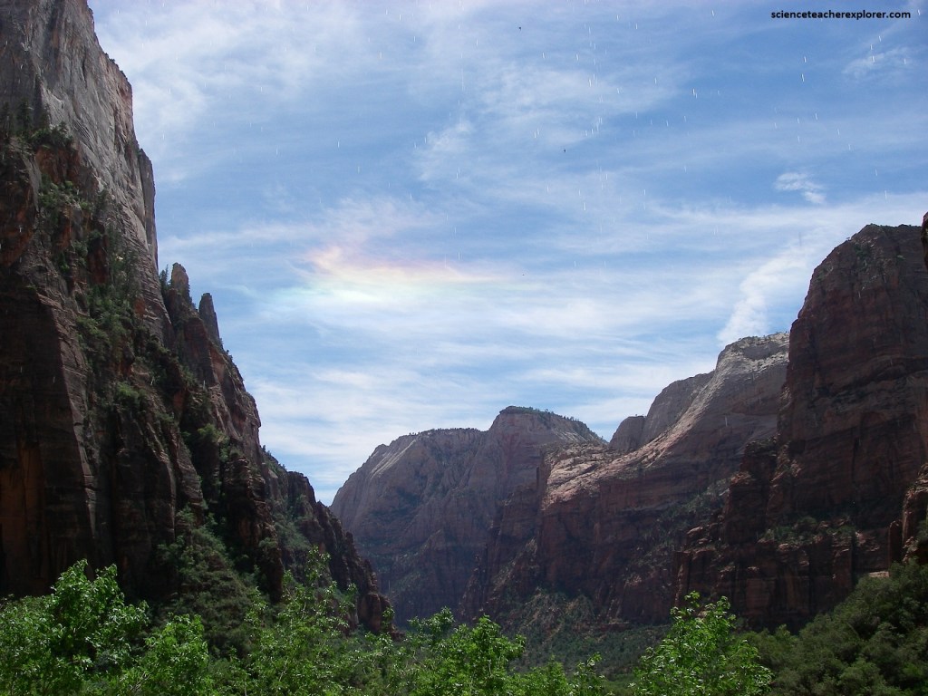
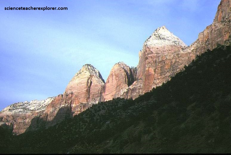
The upper “Navajo Sandstone” appears white in color and weathers into rounded hills and the lower “Navajo Sandstone” is red to pink and forms more vertical cliffs. Pictured above, the “Great White Throne” consists of both the lower and upper “Navajo Sandstone”. The north face of the “Great White Throne” rises 800 m in 500 m from the floor of Zion Canyon near Angels Landing. It is often used as a symbol of Zion National Park.
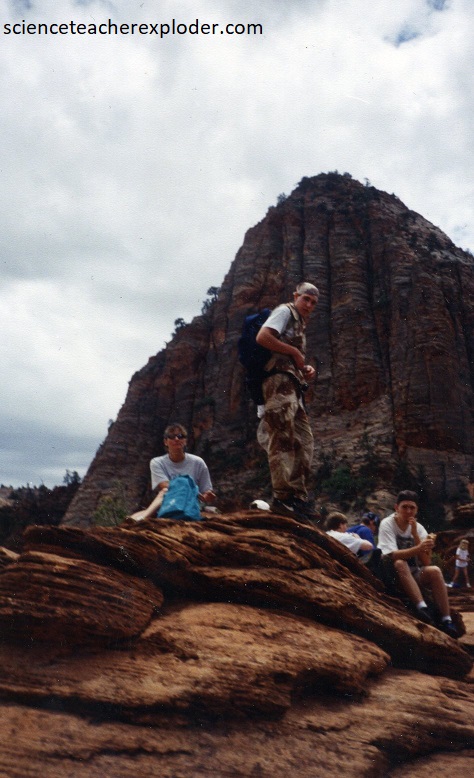
I took a small group to the top of “Angel’s Landing” in 2010. Our trek took most of the morning and day. Pictured above, “Angels Landing” is a 500 m tall rock formation, (lower Navajo Formation). A trail cut into solid rock in 1926 leads to the top of Angels Landing and provides views of Zion Canyon.
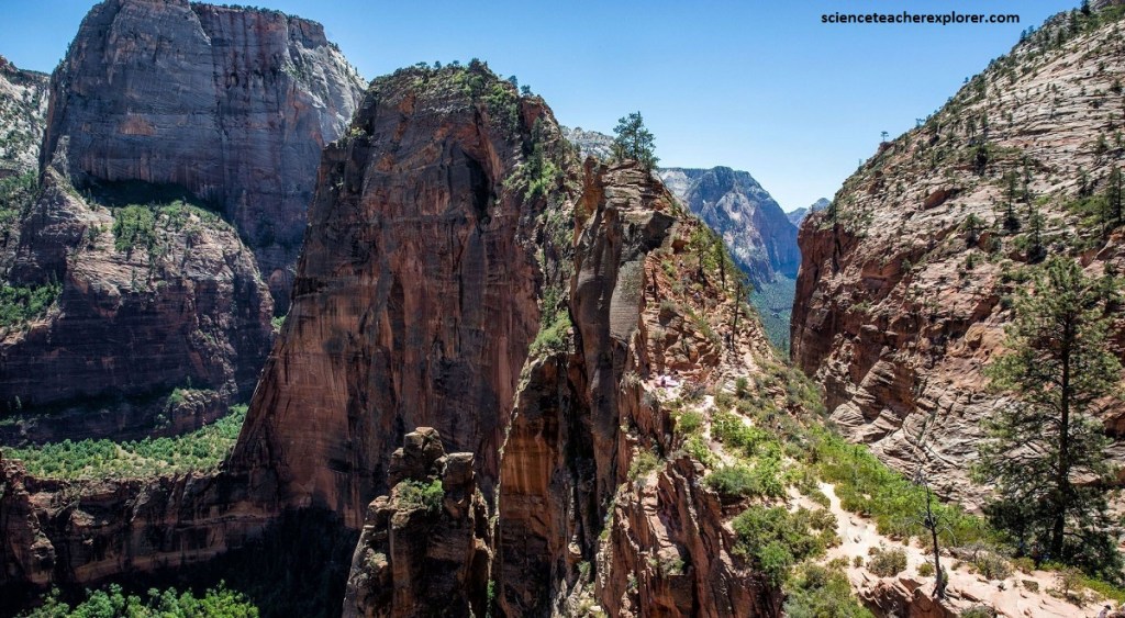
To reach the top of “Angel’s Landing” by noon, we had to leave at 3 A.M. This also allows the gruesome hike to occur in the cool hours of the morning.
Within the canyon, a half-mile, one-way paved trail to the Lower Pools takes a little maneuvering but is easily manageable by all. Pictured above, a striking water formation, the 35 m Emerald Pools waterfall forms a thin misty sparkle of water over the rock edge. The cascading water sparkles while catching the light in a rainbow of color and provide a stunning background while looking down the canyon toward the “Sentinel” peak.
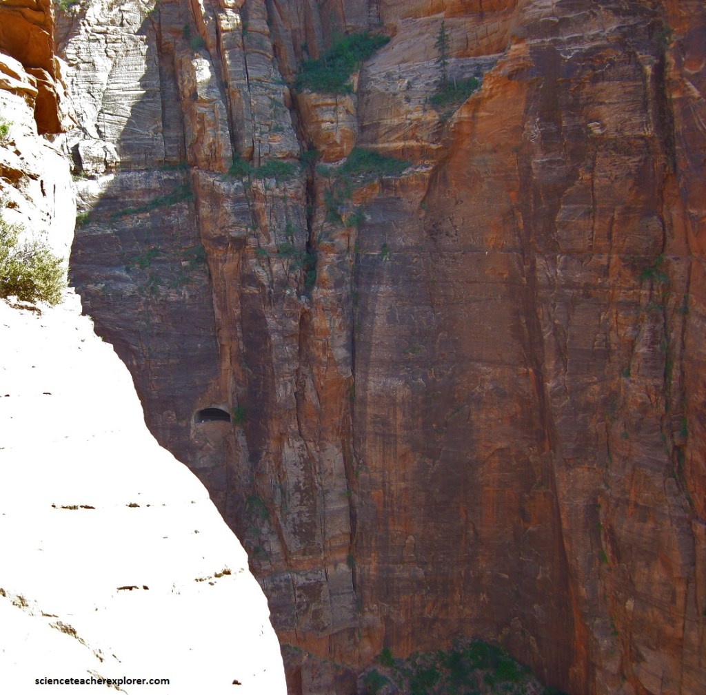
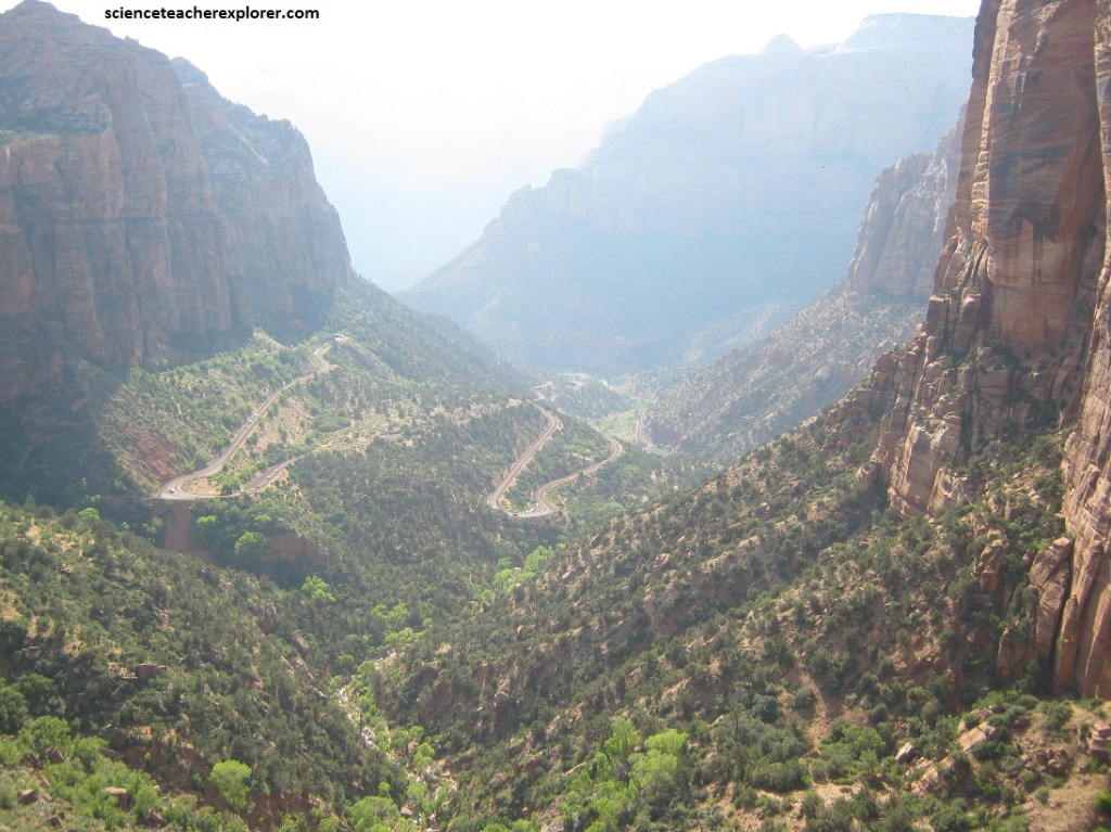
Construction of the 1.8 km Zion-Mount Carmel Tunnel began in the late 1920’s and was completed in 1930. At the time that the tunnel was dedicated, on July 4, 1930, it was the longest tunnel of its type in the United States.
The purpose of the building the Zion-Mount Carmel Tunnel (and the Zion-Mount Carmel Highway) was to create direct access to Bryce Canyon and Grand Canyon from Zion National Park.
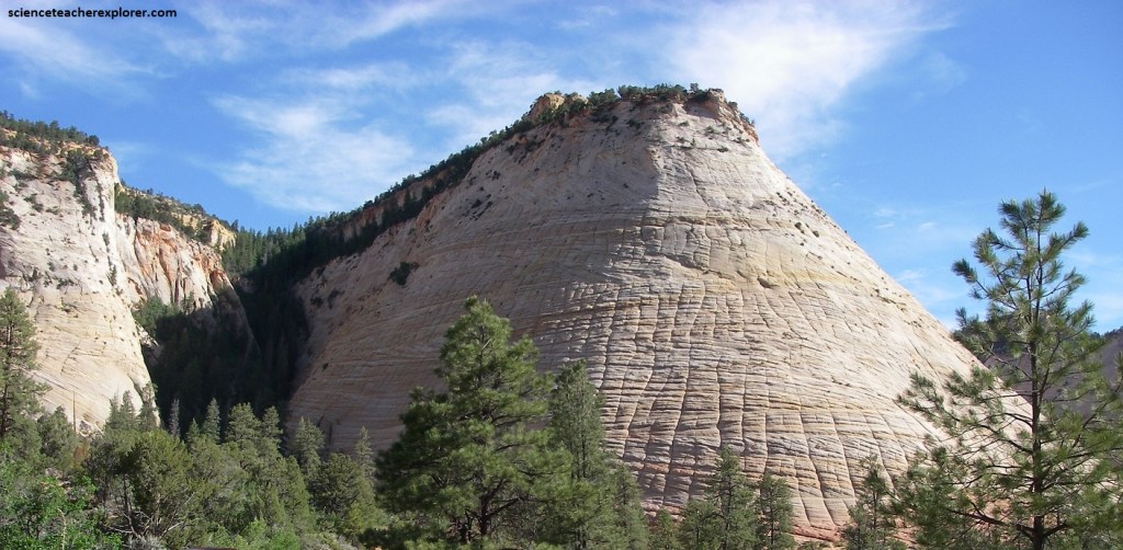
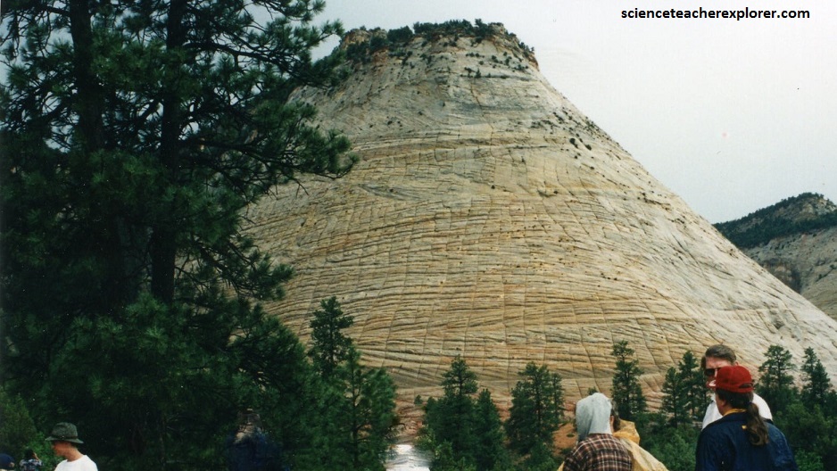
Pictured above, Checkerboard Mesa on the east side of Zion National Park is a good look at the “Upper part of the Navajo Sandstone”. The Checkerboard Mesa has two sets of lines forming the checkerboard pattern. The horizontal lines, commonly called cross bedding, represent layers of wind-blown sand that built up into sand dunes. These dunes were then buried, and the sand grains glued together by calcite and iron oxide to form sandstone. The vertical lines are less common. They are actually shallow cracks that result from stress and erosion on the rock surface. These cracks are probably caused by expansion and contraction, temperature changes, wetting/drying, or a combination of these processes.
Located at the junction of the Colorado Plateau, Great Basin, and Mojave Desert regions, Zion National Park has a unique geography and a variety of life zones that allow for unusual plant and animal diversity. Numerous plant species as well as 290 species of birds, 75 mammals (including 19 species of bat), and 32 reptiles inhabit the park’s four life zones: desert, riparian, woodland, and coniferous forest.
Zion National Park includes mountains, canyons, buttes, mesas, monoliths, rivers, slot canyons, and natural arches. I’ve considered Zion National Park as one of my most favorite places to hang out in the world.
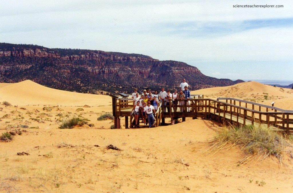
While exploring Zion National Park with a group of students, I prefer to camp them at the nearby, Utah State Park or Coral Pink Sand Dunes, (45 km southeast of the east entrance of Zion). The Coral Pink Sand Dunes is one of the largest “freely migrating” dune fields in the Colorado Plateau. The dunes here owe its unique color to iron-oxide stains on the surface of the sand. The sand is mainly derived from the nearby Navajo Sandstone cliffs which are exposed near and around the Zion National Park.
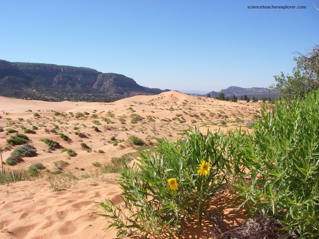
The dunes themselves are composed of transverse ridges, barchanoid ridges, and a single star dune. The dunes at the southern end of the State Park have north-south trending characteristics that would represent the prevailing winds blowing in from the south. Further north the dunes characteristics change to a south-west-north-east trending field.
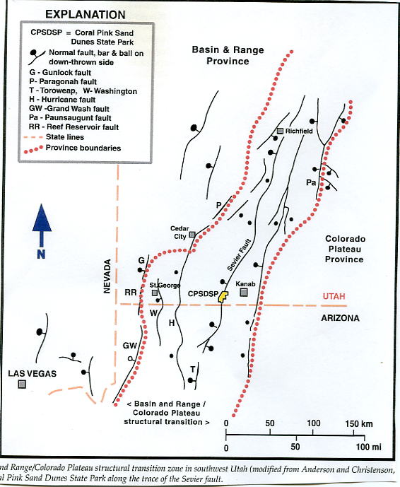
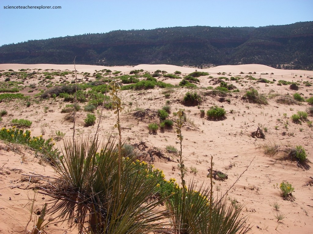
Imaged above, the formation of a dune field here is thought be largely due to the Sevier Faults activity which caused a large break or gap in the Vermillion Cliffs to the south of the State Park. As the strong southerly winds reached this gap they would increase velocity in a narrowed portion of the gap and pick more sediment. As the Sevier gap widens and the winds reach the bedrock scarp, created by the Sevier Fault, the velocity of the wind would then decrease allowing for deposition of sediment.
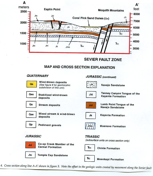
Imaged above, the Coral Pink Sand Dunes lies on the boundary between the Colorado Plateau and Great Basin of the basin and range province and so lies in an area of once active tectonic activity. The bedrock escarpment that forms the eastern boundary of the dune field were created by the north-south trending Sevier Fault, which cuts the park into two (almost equal) halves. This large normal fault extends from the Grand Canyon to central Utah as a series of braided faults and began movement approximately 12-15 million years ago. The eastern side of the fault has been thrust upward revealing members of the Moenave Formation, much higher than the younger Navajo Sandstone, which appears on the down-drop side.
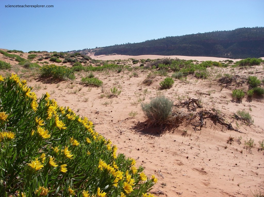
The Coral Pink Sand Dunes State park features pink-hued sand dunes located beside red sandstone cliffs. The dunes are estimated to be between 10,000 and 15,000 years old. The total grounds include 3,370 acres (13.6 km2).
Contrasted by blue skies, juniper and pinion pines, and steep red cliffs, the park was a wonderful place for camping my students there while we explored Zion National Park.
Pictured below is another alternative location, (a Ghost Town) we regularly visited while exploring Zion National Park.
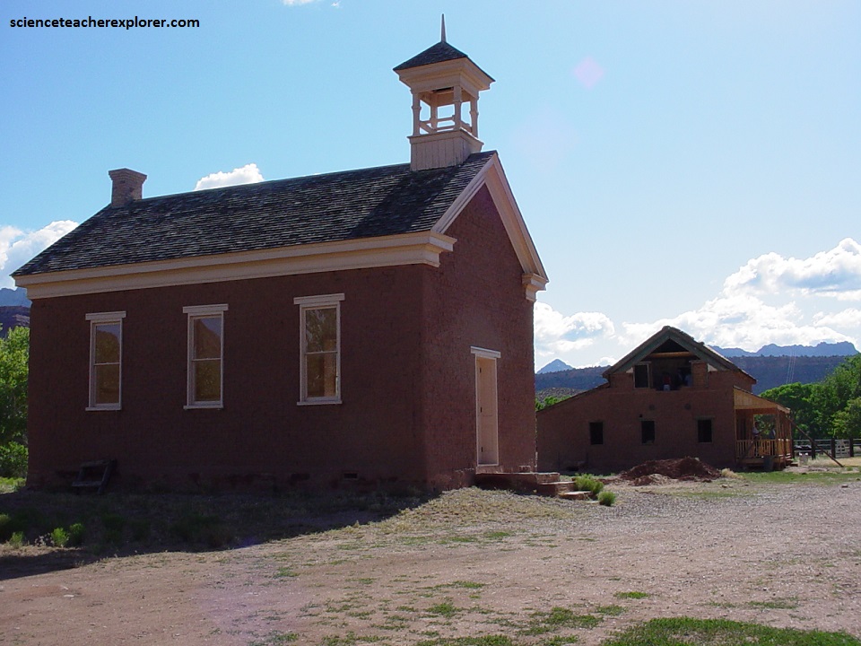
Pictured above, the town of Grafton was settled a few miles southwest of Zion National Park on the Virgin River in 1859 by five Mormon families, but they soon had to scale back cotton production in favor of food crops. Today, Grafton is a ghost town, and one that has enjoyed a few moments in the spotlight. Several movies were shot in this abandoned frontier settlement, including several scenes from Butch Cassidy and the Sundance Kid and the 1929 film In Old Arizona, the first talkie filmed outdoors. Descendants of the people who live here still gather for an annual reunion to keep the spirit of this frontier village alive, (though only four buildings and the cemetery remain).