White Canyon, UT 2001
In 2001, I led a group of students and adults into White Canyon within the “Cedar Mesa” area. Presently, it is part of the “Bears Ears National Park”, but at the time it was part of the Bureau of Land Management.
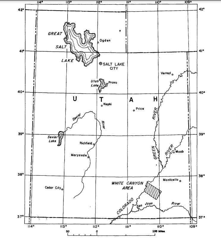
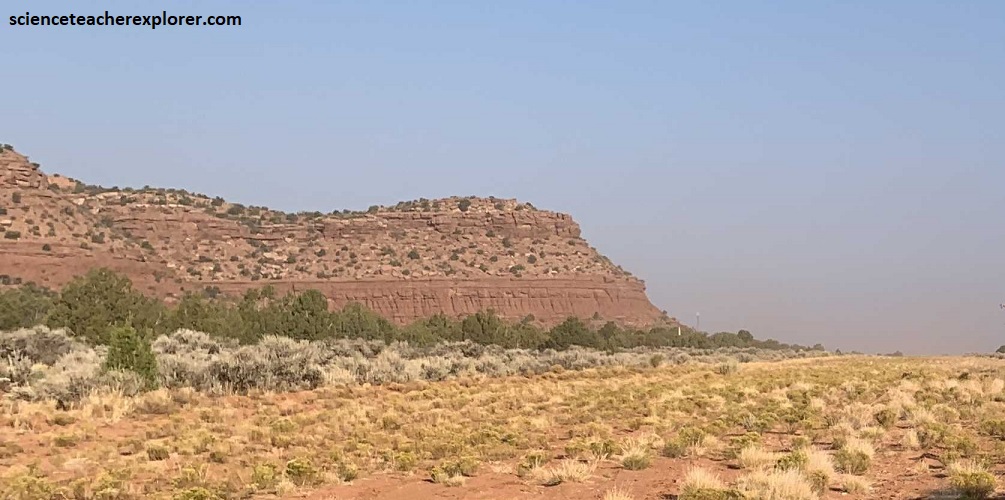
The White Canyon Area is between Hite Marina on Lake Powell, and Blanding, Utah.
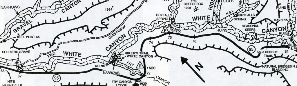
To get there, we drove south from Hanksville, Utah and then continued east from Hite & Lake Powell on Highway 95. We started exploring White Canyon by visiting Natural Bridges National Monument. Between mile-posts 91 & 92 we turned northwest and drove 8 km to the visitor center. From there we drove the 13 km loop-road, which took us to the 3 main bridges the park is famous for.
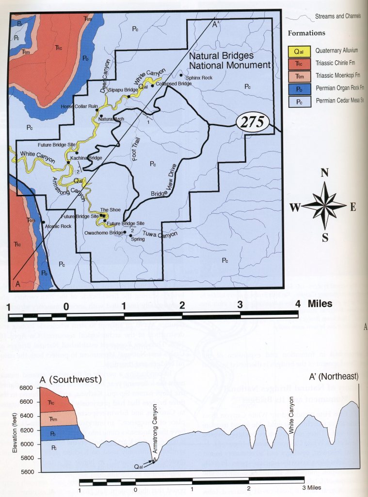
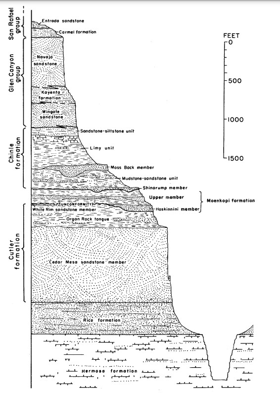
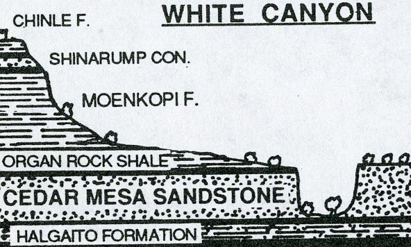
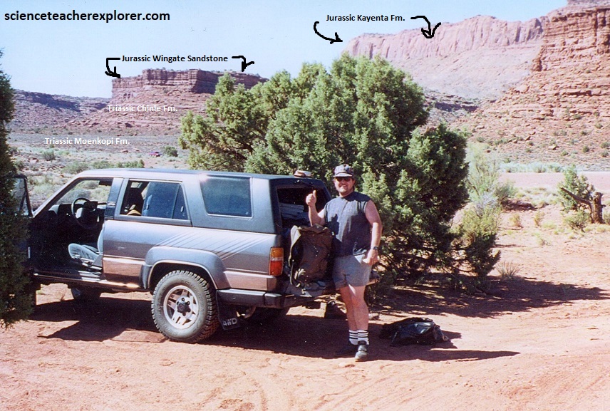
Image above, in the Natural Bridges region, the Organ Rock Formation is the top of the Permian System. Triassic and Jurassic rocks that overlie the Organ Rock Formation are exposed along the skyline that is visible from Natural Bridges National Monument. These rocks include the Lower Triassic Moenkopi, the Upper Triassic Chinle Formation, and the Lower Jurassic Wingate Sandstone. The organ rock, along with the underlying Cedar Mesa Sandstone and in the informally named lower Cutler beds, are part of the Cutler Group. The lower Cutler beds are the oldest Permian rocks exposed on Cedar Mesa.
The Natural Bridges, like those on Cedar Mesa, form from stream erosion within deep canyons, and as their name implies, they occur as high spans from one canyon wall to the other. All of these bridges in the National Park are continually reshaped by stream erosion and gravity. Although similar, the processes that created Sipapu, Kachina, and Owachomo Bridges were not identical.
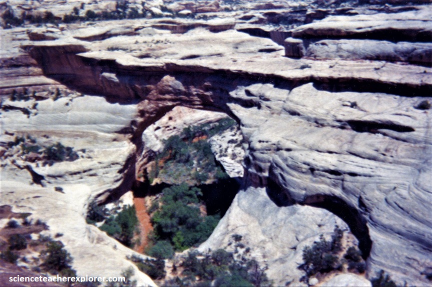
Pictured above, as we worked our way down to the Sipapu Natural Bridge, we were in White Canyon. The bridge was 73 meters high and spanned 89 meters from the canyon wall to canyon wall. The width of Sipapu was 10 meters at it’s narrowest point, about the same as a two-lane bridge. From the top of the bridge to the bottom of its unsupported span, known as its base, Sipapu was 18 meters thick at its narrowest point. Sipapu Natural Bridge is formed by meander cutoff. Meander cutoff is a process that takes places on floodplains unless geotectonically uplifted. Then the broad loops that once sat on an almost flat surface become incised meanders, sometimes thousands of meters below a canyon’s rim.
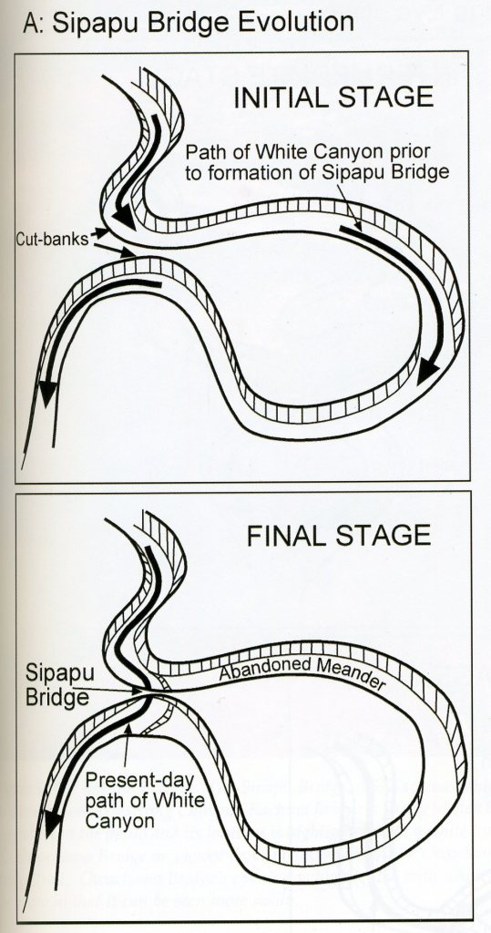
Pictured above, when a stream flows around a meander, centrifugal force throws the thalweg to the outside. In streams, high velocity equals high erosion and low velocity equals deposition. Wherever a stream flows around a meander, it erodes material on the outside of the loop (which is called a cutbank), and deposits material on the inside of the loop (called the point bar). Through this process, the channel moves outward. Sometimes two meanders move toward on another, and if they’re close enough, the process of erosion gradually diminishes the space between them until water is able to breach it, forming the Sipapu Natural Bridge.
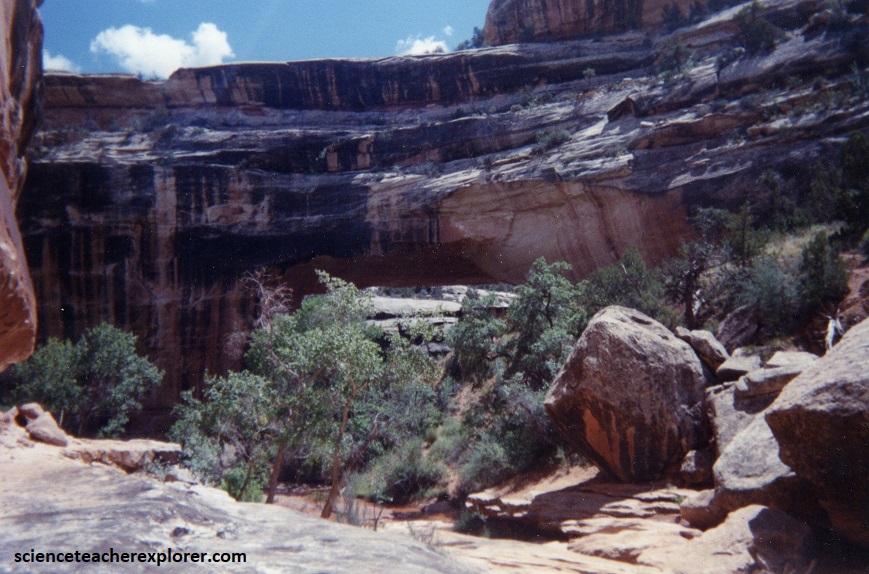
Pictured above, standing beneath the Kachina Natural Bridge, we could certainly see its broad shape at 70 meters high with a 68 meter span. Kachina was 15 meters wide on top, and at 31 meters thick, it was almost twice as thick from top to base as Sipapu.
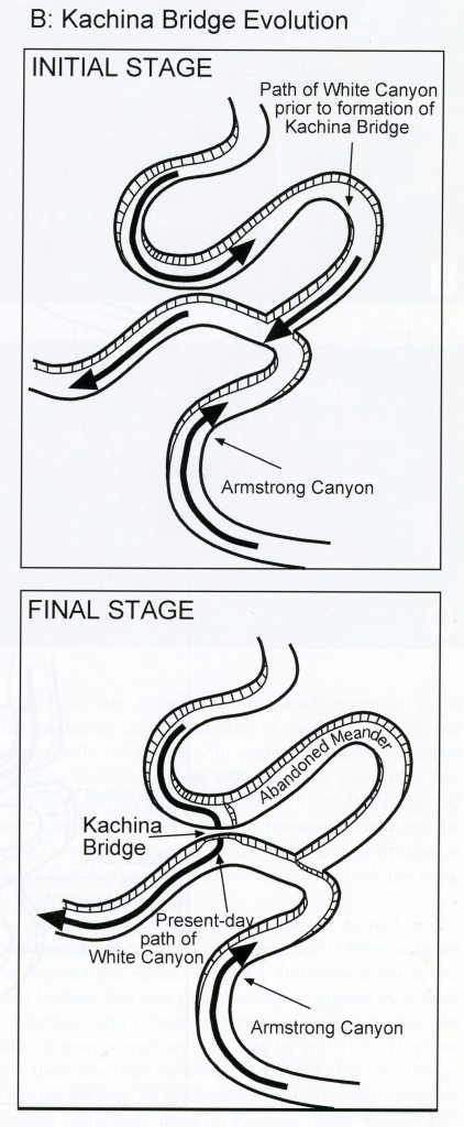
Imaged above, Kachina formed from the interaction of two converging drainages, White Canyon from the north and Armstrong Canyon from the east. White Canyon originally followed a southerly meander, then a northerly meander prior to joining Armstrong Canyon. The southerly meander, however, eroded outward, eventually breaking through the base of the rock wall to create hulking Kachina Bridge above. The northerly meander became a dry and abandoned channel.
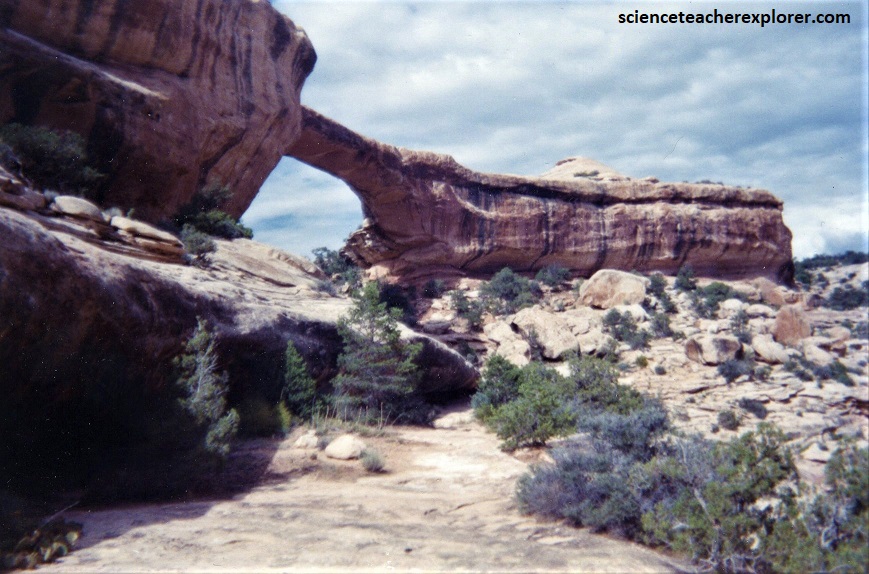
Pictured above, the oldest and frailest of the three bridges, Owachomo Natural Bridge was 9 meters wide on top, but only 1 meter thick at its narrowest point from top to base. It stood 35 meters high and stretched 60 meters across the canyon.
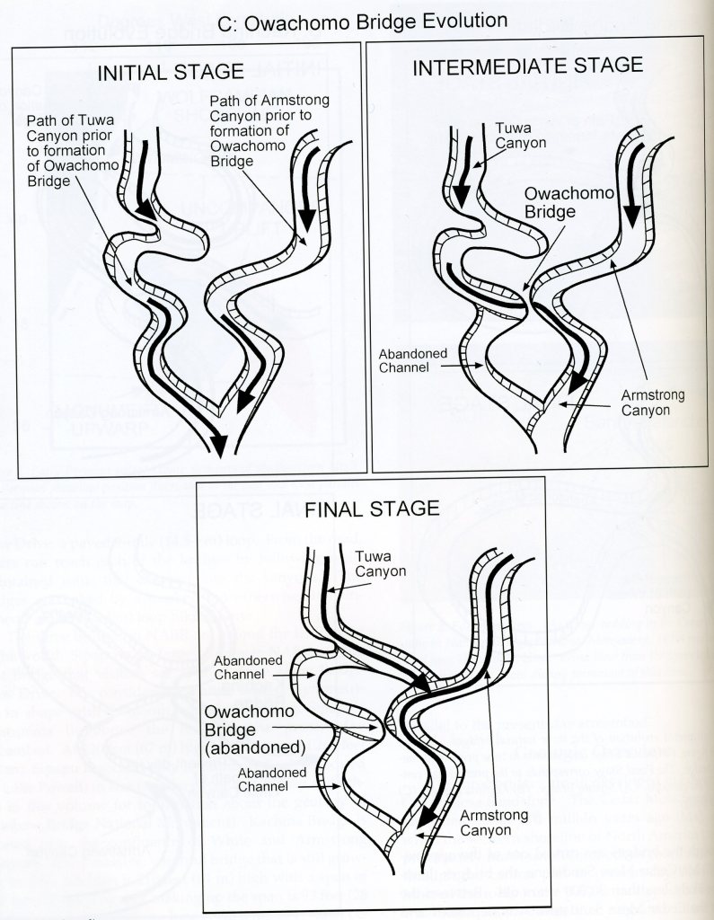
Imaged above, Tuwa Canyon and Armstrong Canyon both head west, with Tuwa Canyon lying north of Armstrong Canyon. The original junction of the canyons, west of Owachomo Bridge, had been abandoned due to a southerly meander breaking through the south Armstrong Canyon. It was this cutoff that created Owachomo Bridge long ago, (100,000-30,000 yrs). But this channel was abandoned also, as another southerly meander to the east of this one also broke through into Armstrong Canyon, perhaps creating a new bridge in the process. If there once was a bridge over the active channel, it doesn’t exist anymore, (perhaps it has fallen to earth and been swept away.
The White Canyon of Utah encompasses and area underlain entirely by the Lower Permian Cedar Mesa Sandstone and Organ Rock Formation, (deposited 255-290 million years ago). Like the Wingate, Navajo, and the Entrada sandstones, the Cedar Mesa is “eolian” in origin, meaning it was deposited by wind. In southeastern Utah, eolian sandstones dominate the scenery. They make up the cliffs towering above Moab and rimming most mesas and buttes in the area. Eolian sandstones are also sculpted into rock domes and spires, as well as natural bridges and arches. The red and white banded appearance is a result of periodic floods which carried iron rich sediments down from the Uncompahgre Mountains during its formation.
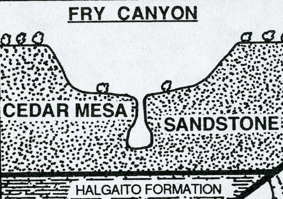
While the Cedar Mesa Sandstone shares many features with other eolian units, it has its own distinctive character and geologic story. The Cedar Mesa Sandstone was deposited in and along the margins of a massive sand dune system, approximately 280 million years ago. The heart of the Cedar Mesa dune-field was in the Cedar Mesa area, in the general vicinity of Natural Bridges, where the sandstone attains a thickness of more than 400 meters. The Cedar Mesa is about 217 meters thick in the Needles District, which was closer to the northern margin of the field. It “pinches out” (or thins to a feather edge and then to no thickness whatsoever) just north of the Needles north-east of the Natural Bridges National Park.
When the Cedar Mesa dune system was active, the Ancestral Rocky Mountains were present in western Colorado. Rivers flowing from them dumped red sediments in the Moab area and further south towards the dunefield. Ocean waters lapped to the west, and an arid mudflat was present near where the Four Corners now meet.
Like other eolian sandstones, the Cedar Mesa is characterized by “cross-bedding” , (which are inclined layers formed by moving dunes or ripples). As a general rule, eolian cross-bedding is at a much steeper angle and at a larger scale than crossbedding formed by rivers or ocean currents. The prevalence of large, steep crossbedding in the Cedar Mesa Sandstone provides some of the most direct evidence that these sands were deposited by blowing winds from the southeast, and that the source of the sand was the shoreline to the west.
Pictured below, the Fry Canyon Lodge is the only building for the entire length of Scenic Byway 95. It is 114 km southeast of Hanksville, 82 west of Blanding, and 24 miles (including the 1½ miles down Hite Road) from tiny Hite, Utah, which sits on the bank of the Colorado River and Lake Powell (at normal lake levels) inside Glen Canyon National Recreation Area.
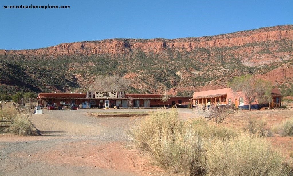
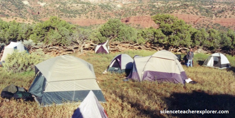
Fry Canyon Lodge opened in 1955 and was a bustling, rowdy business in the Uranium boom days, but closed after the mines shut down, and the lodge fell into decay. However, it was reopened and restored by new owners in 2001, (with reservations only). The Lodge generated its own utilities, with a satellite phone for emergencies and a dirt airstrip. It sounded like the perfect place to house my group of 30 people for the exploration of White Canyon. But when I asked the owner for a reservation, he turned my down. He told me that my group was not the cliental he wanted at his facility. Therefore, I continued down the Fry-Canyon County Road to ask a local cattle rancher named Sandy Johnson to use his “Wild-Horse Coral”, just east of the Lodge, for primitive camping, (pictured below).
Additionally, Mr. Johnson gave me permission to use the outdoor showers and water for the Lodge, because he-claimed that the water rights to the entire area was his. Eventually, the “Fry-Canyon Lodge” closed down due to it’s water issues. {I’m not sure of the exact date}. Eventually, this zone is now became part of the “Bear’s Ears National Monument”. Even Sandy Johnson, (the friendly cattle-rancher), is presently in flux.
In 2001, we used the above air-strip to transport some of my adult supervisors. A bit of wind erosion near the base of the grass had made the runway more rough than normal. The runway was sloped uphill 1.7% headed to the north. Our landings and takeoffs were be accomplished in both directions. It was also nice to have an emergency vehicle access in this remote and primitive location.
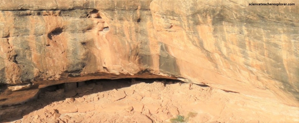
Pictured above, a small group of Ancient Pueblo Ruins can be seen from a viewpoint near the Fry Canyon Airstrip. It has a commanding view of the ruins, skillfully tucked in the alcove on the opposite side of Fry Canyon. The ruins contain many rooms plus what looks to be a ceremonial “kiva” used for religious rituals.
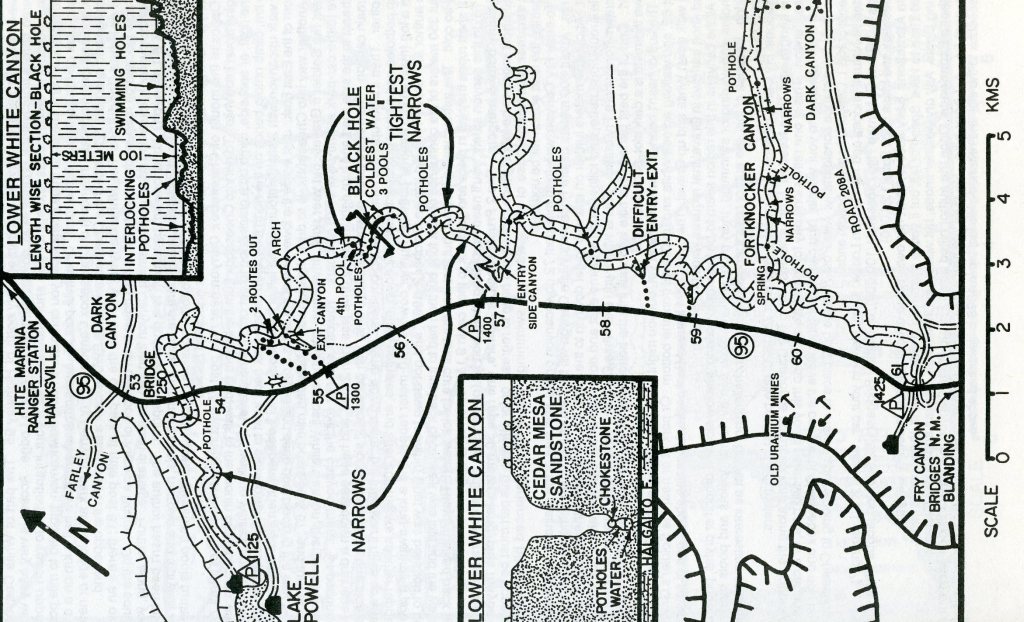
Our main destination for this trip was the exploration of “The Black Hole Slot-Canyon”. The Black Hole made a great semi-technical adventure hike for my group.
Pictured above, the reddish brown layers directly above the Cedar Mesa Sandstone are know as the Organ Rock Shale and the Moenkopi formations. These two formations are difficult to distinguish from one another because they are both comprised of fine grained mudstone, siltstone, and marine shales. The Organ Rock Shale tends to form gentle slopes while the Moenkopi usually forms walls and towers. Above the Moenkopi formation is a whitish strata known as the Shinarump member of the Chinle formation. It is comprised mostly of stream deposited shale, sand, and gravel. It also contains uranium, petrified wood, and both plant and animal fossils of a wetter climate, (which is mined in the area). The red section above the Shinarump is known as the Moss Back member, yet another member of the Chinle formation. Made up of siltstone, sandstone, and conglomerate, it was laid down by streams. Above the Moss Back formation is Wingate Sandstone. A very impressive stratum of reddish color, it is composed mainly of small, rounded quartz grains. It is cross-bedded, and cliff-forming. The top of the nearby Bear’s Ears are capped with Wingate Sandstone.
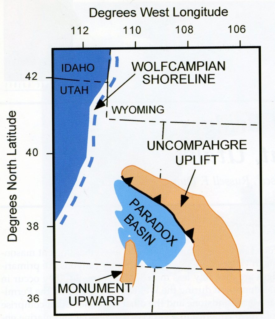
Three major paleotectonic elements (Uncompahgre uplift, Paradox basin, and the Monument up-warp) influenced deposition in southeastern Utah during the Early Permian. The Uncompahgre uplift, (Pennsylvania Period), was part of the Ancestral Rocky Mountains and responsible for the development of fault-bounded uplifts and basins across south-central United States. The Uncompahgre uplift is bounded by a high-angle reverse fault along its southwestern side. The movement along this fault resulted in the development of a foreland basin, the Paradox basin, adjacent to the uplift. During the Permian, the Monument uplift was a broad, elongate, low-lying topographic high that extended from Monument Valley to approximately the confluence of the Green and Colorado Rivers. This influenced the deposition of the Cutler and Chinle Formations of the Cedar Mesa area, (image below).
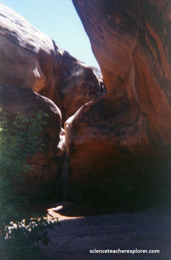
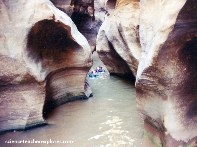
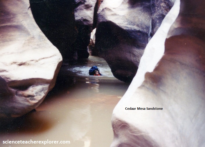
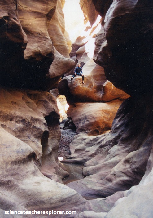
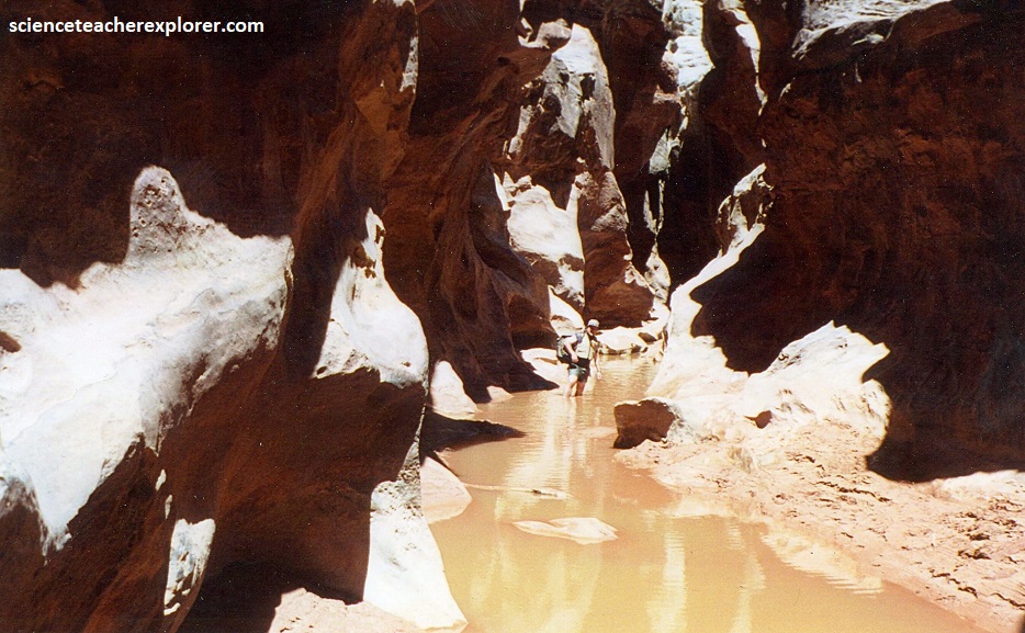
To get through the “Black Hole” of the lower White Canyon we had to swim through several long cold-pools, and scrambled up/down dry-falls and choke-stones. In the middle of the longest swim, we had to squirm around a 90-degree turn.
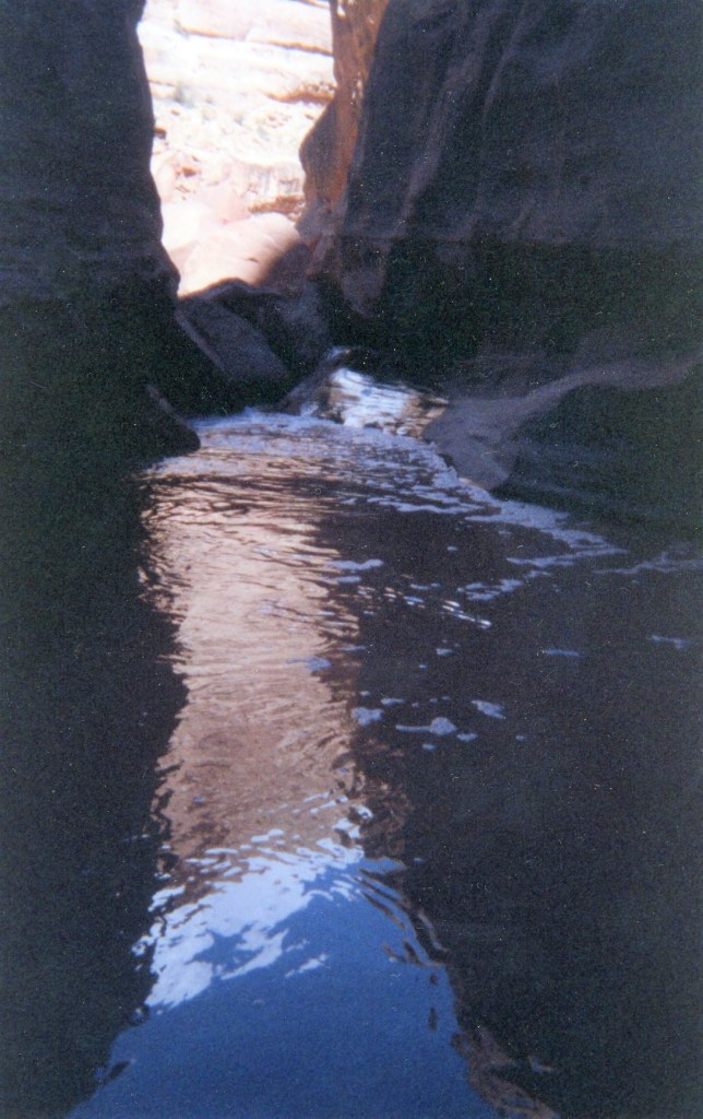
The water is cold year-round and hypothermia was a very important danger. Rented wet suites were required from my group. The Black Hole water is 11 degrees Celsius. [We had to swim a 125 meter section in this frigid water].
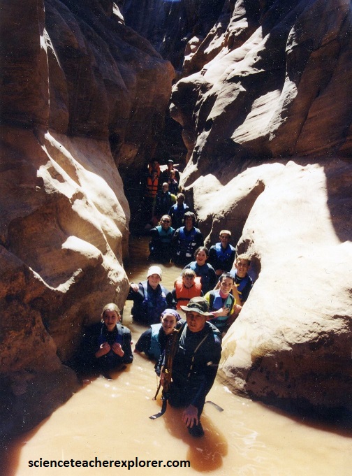
The Lower White Canyon was a dry canyon, with the exception of the “Black Hole”. I required my group to have some kind of float device. A boater’s life jacket worked well, but a pack with plastic bags worked also.
Flash flooding posed another significant danger. The drainage is large and the canyon could flash if it rained anywhere above the Black Hole, (the Bears Ears or Natural Bridges National Monument).
In September, 1996, one girl was drowned in this slot. It had rained hard the night before up-canyon near Bridges and the flood reached the hikers at the worst possible time, right in the “Black Hole”. I first explored the “Black Hole” in 1998, just after a rain storm and flash-flood. I actually didn’t make entirely through. I had to swim under-water to by-pass a large choke-stone boulder. But when I reached the large room, while swimming, it was full of suds from the flood. The suds were about 1 meter thick and it disoriented me enough to turn around and go back. I also wasn’t wearing a wetsuit, and my time was very limited before reaching a hyperthermia state. I returned more prepared in 2000 with a trekking partner and successfully made it through.
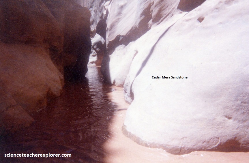
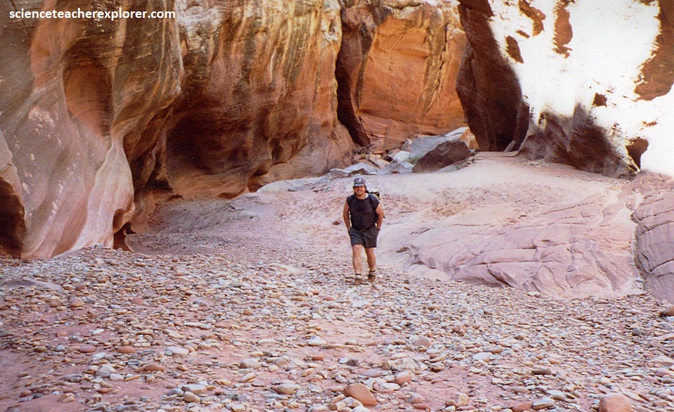
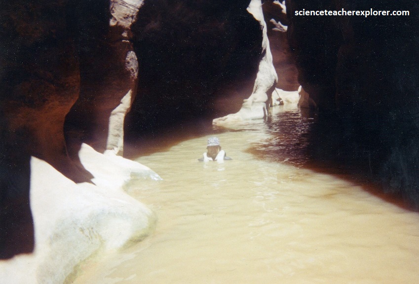
Almost all of the bedrock exposed with the “Black Hole” is Cedar Mesa Sandstone, (pictured above). White Canyon is named for the light colored sandstone. The contact between the Cedar Mesa and underlying lower Cutler beds cannot be seen within the “Black Hole”.
Pictured above, the Cedar Mesa consists of three litho-facies, (rock assemblages). The dominant facies is a white sandstone. The second facies occurs as thin interbeds of red sandstone that are underlain and overlain by the white sandstone facies. The third facies is a gypsum and limestone facies. Only the first two facies are common within this area.
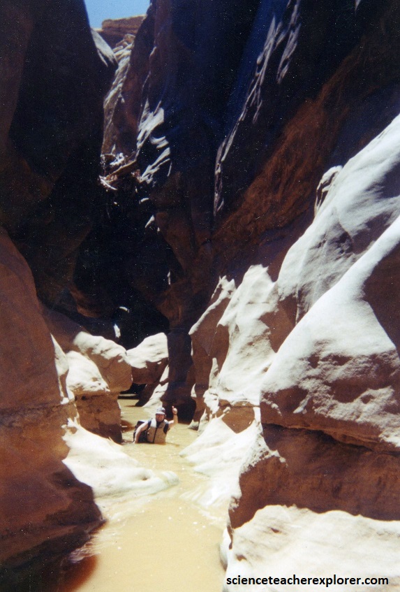
The White Canyon area is the result of Quaternary erosion of Permian bedrock. Explorers find their access routes into the canyons controlled by geology. Like the ancestral-Puebloan people who occupied this area over 1,000 years ago, we made use of the ledges formed at the contact between the white sandstone facies (below the ledges) of the Cedar Mesa Sandstone to travel through the region.
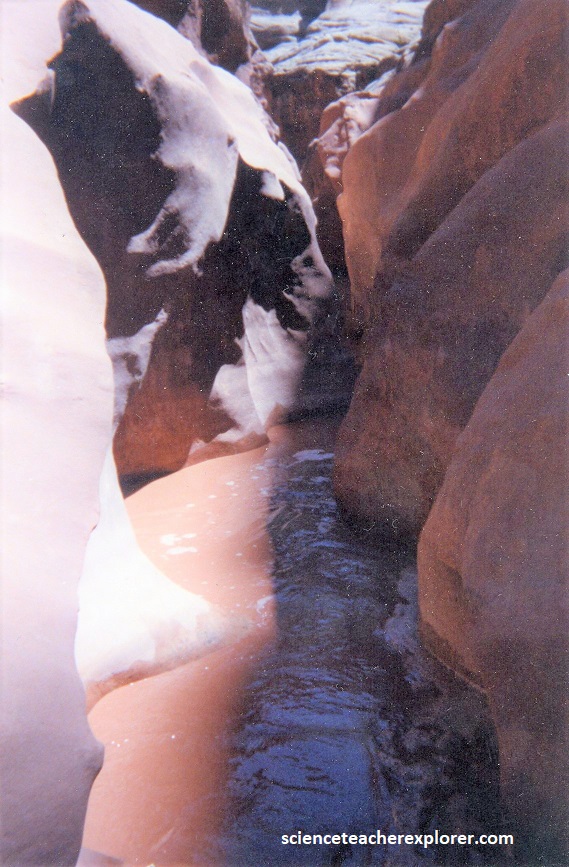
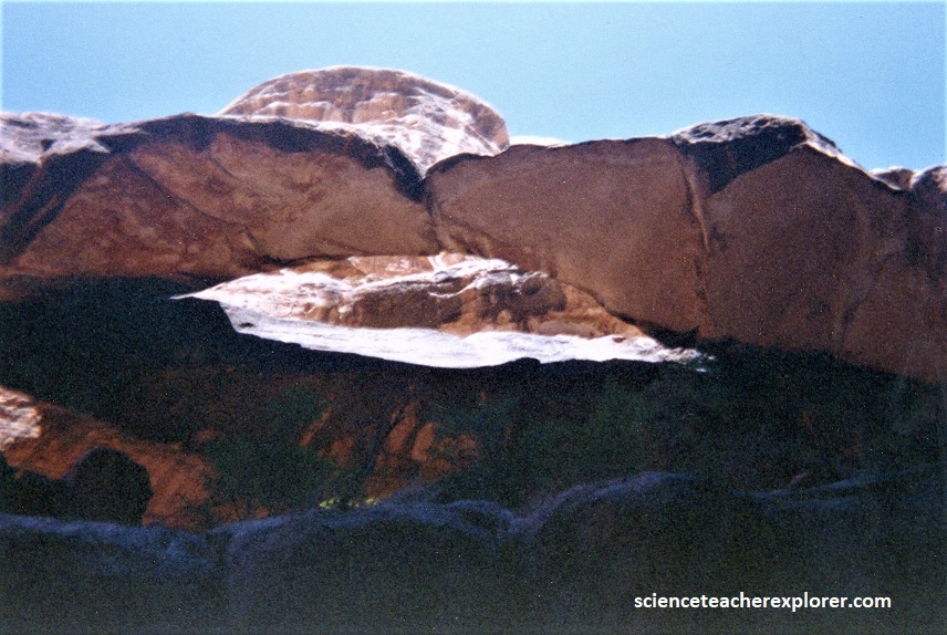
There was an arch on the right within the “Black Hole Slot”. The arch was an important landmark. Just past it the canyon wall eased, (pictured below).
The “Black Hole Slot is beautiful and the hike is enjoyable, if you are prepared. Ropes aren’t usually necessary but it is a good idea to carry one just in case. We did…..
About 2.4 km below the Back Hole, we exited the canyon to the south (left). At that point we saw an obvious, narrow side canyon come in from the south. We hiked down White Canyon for a couple hundred meters below that side canyon and then looked for a way to climb ledges to get out of White and up to Highway 95 on milepost 55. There was no official exit trail. We had vehicles waiting on top for us.
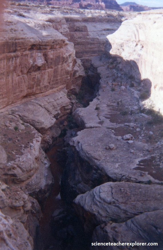
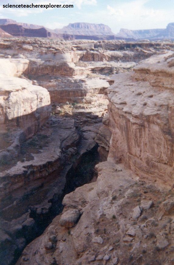
From the “Black Hole Slot”, White Canyon continues towards the north to hook up with Lake Powell and the Colorado River. Pictured above, Highway 95 crosses White Canyon between mileposts 53 & 54. It was a great place to get a picture of White Canyon from above.
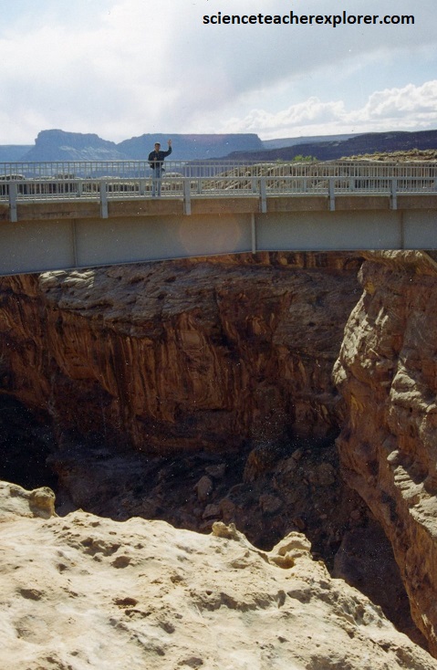
This bridge received an award in the short span category from the American Institute of Steel Construction. It was recognized through an award for qualities related to design and aesthetics.
