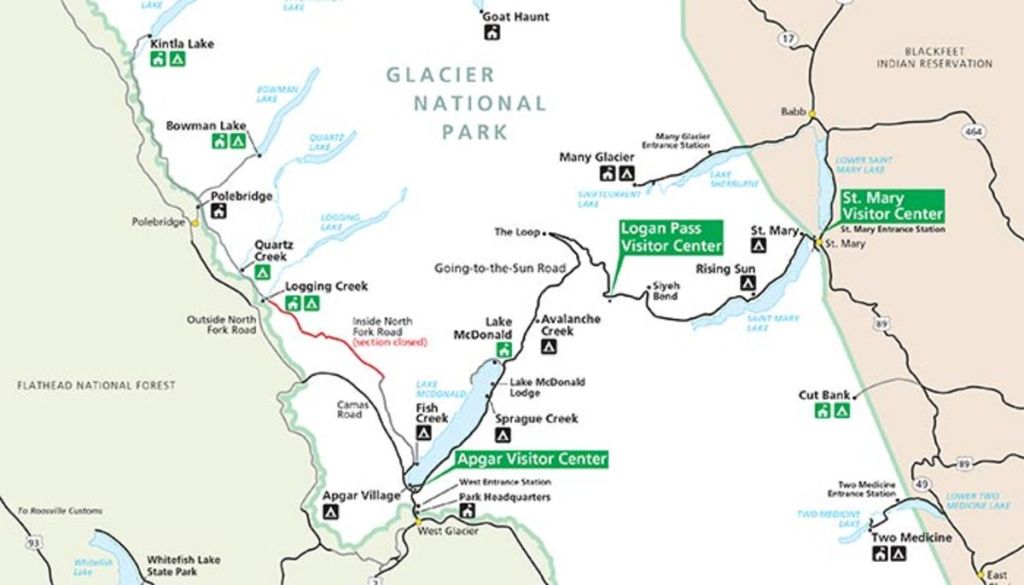
Glacier N.P.; Montana
The first week of July in 2016, Becky (my wife) and I took a week long road-trip to Montana to visit Glacier National Park.
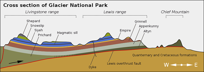
Majestic peaks, glacial trough, lakes, and the Continental Divide make up Glacier National Park. The mountains in the Glacier National Park region are described as “mountains without roots” because they consist of ancient Precambrian rocks resting on top of much younger sedimentary beds. The reason for this is that a huge, low-angled thrust fault, known as the Lewis Overthrust fault, transported the sequence of Precambrian rocks eastward for many miles over the younger rocks.
https://www.rocdoctravel.com/2016/12/glacier-national-park.html
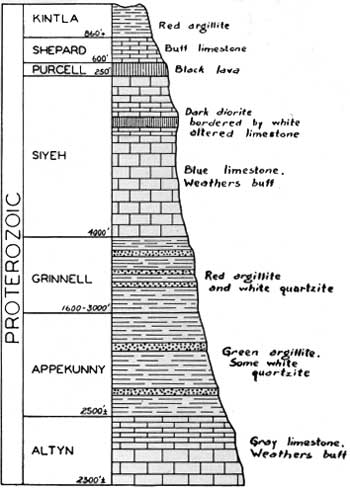
The layered rocks in Glacier National Park are part of a thick series of sedimentary rocks called “the Belt rocks” or more formally, the Belt Super-group. What makes these rocks so unusual is that they are relatively undeformed and only lightly metamorphosed despite the fact that they were deposited fairly late in Precambrian time, (1600 – 800 million years ago).
Pictured below, we visited Lake McDonald, the largest lake in the Park.
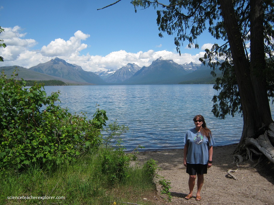
Surrounded on three sides by towering Rocky Mountains that rise 2,000 meters into the sky, the view is sensational, with white alpine glaciers hugging the jagged upper slopes of the mountains and lush green forests covering the lower slopes.
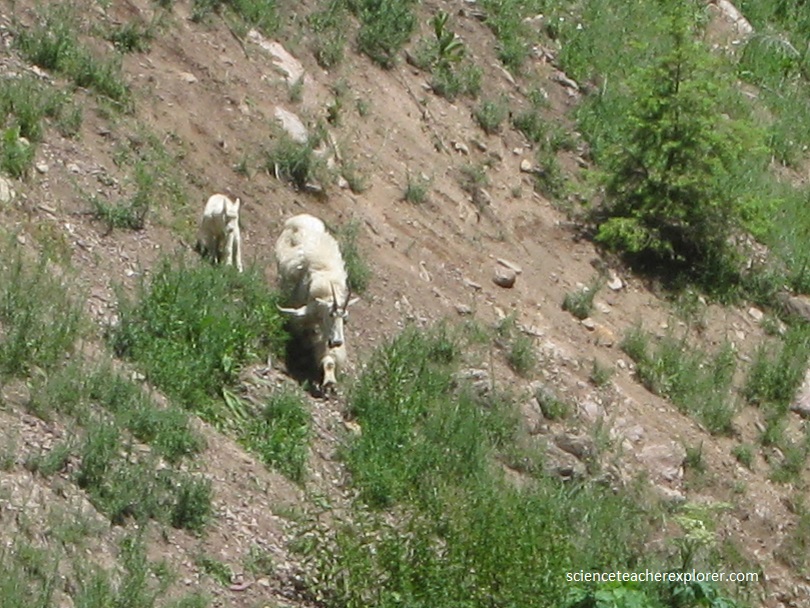
While Becky and I were in the Rocky Mountain Park we saw Rocky Mountain Sheep, Mountain Goats, Bald Eagles, and a Grizzly Bear.
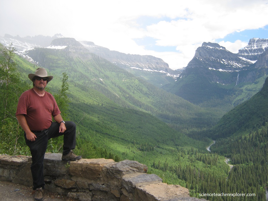
Below, I’m standing in front of the Lewis Mountain Range to the east, which acts as a rain block to the clouds whose moisture supports a rich, dense forest of western red cedar and hemlock trees.
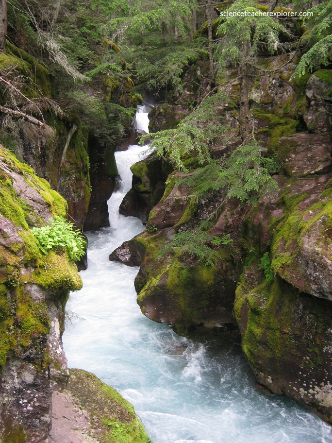
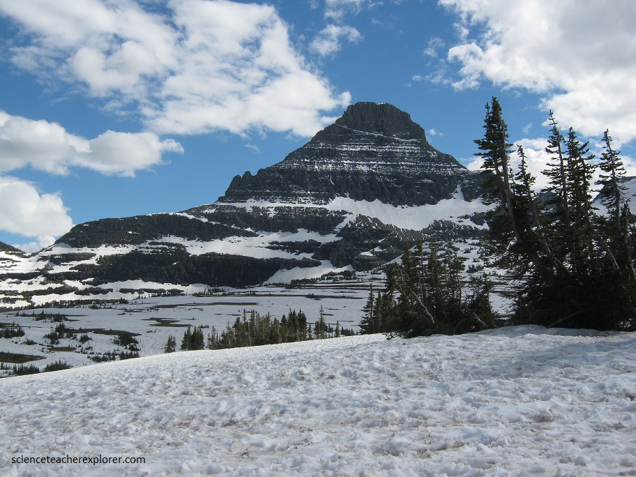
The glaciation that produced the spectacular, ice-sculptured landforms in Glacier N.P. was at its maximum extent during the Pleistocene Epoch. However, the small cirque and cliff glaciers now existing in the park developed only a few thousand years ago during the “Little Ice Age”. The park’s active glaciers are found between elevations of 2000 and 3000 m. The perennial snowfields lie in protected areas, usually on slopes that face north or east.
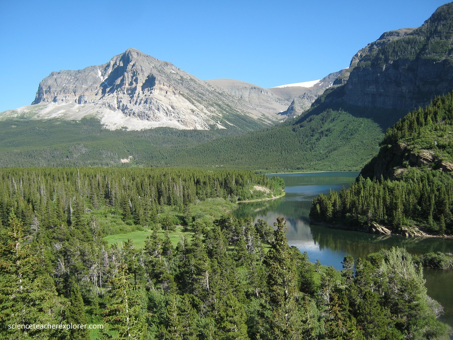
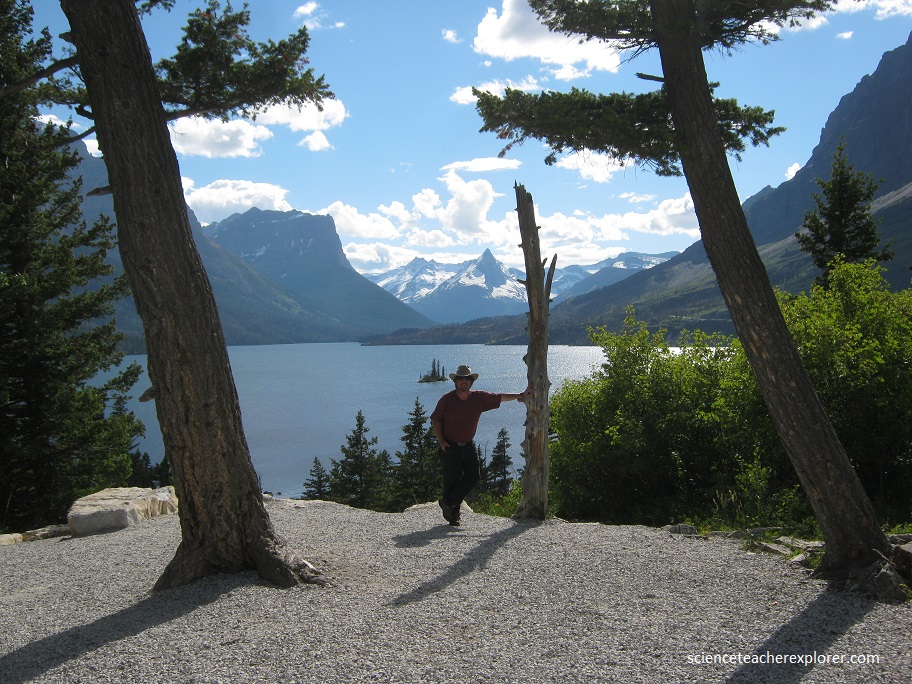
Later, we visited St. Mary Lake, pictured on the upper right. St. Mary Lake is a beautiful, glacial blue lake in one of the most perfect settings imaginable.
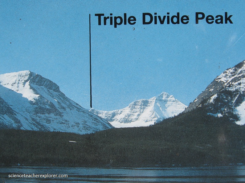
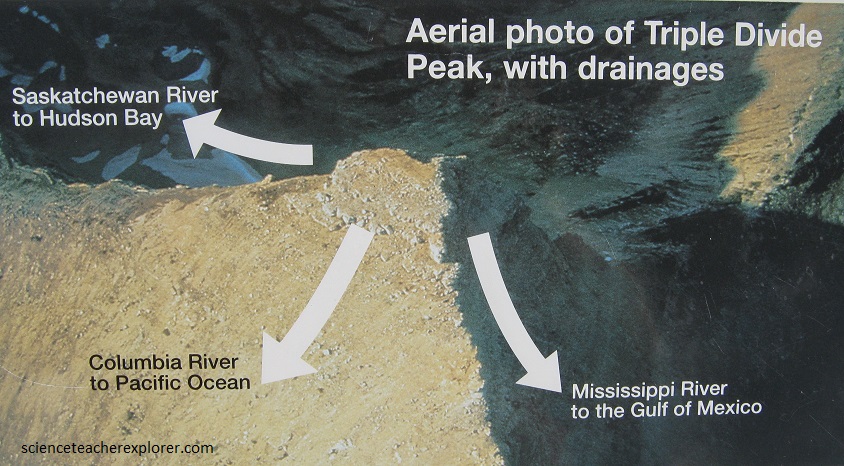
Triple divide Peak, south of St. Mary Lake, is unique because water drains in three directions instead of two: namely, west toward the Pacific, northeast toward Hudson Bay, and southeast toward the Gulf of Mexico.
On three sides it is surrounded by the steep Rocky Mountains, and on its eastern shore, it gives way to a rolling prairie and forested hills.