Santorini, GR 2023
While cruising the Mediterranean in June of 2023, Becky (my wife) and I, stopped to explore the Greek Islands of Santorini. The group of islands known as Santorini belongs to the Cycladean Archipelago, which lies in the southern Aegean and extends through numerous islands and islets.
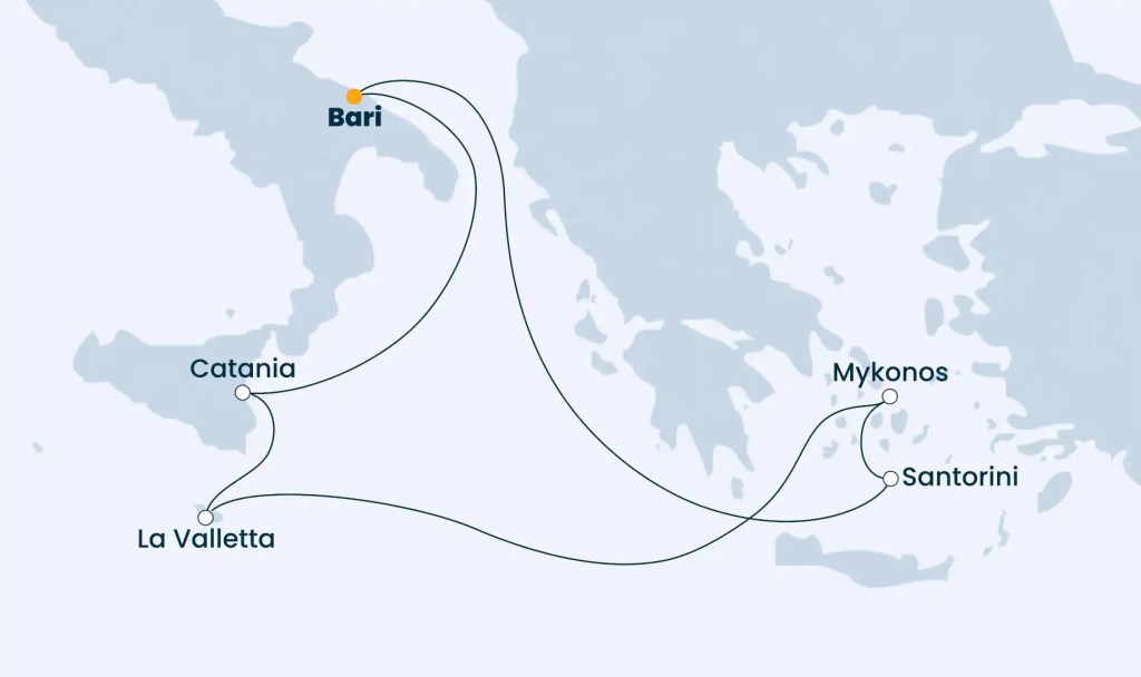
The Santorini Islands are about 120 km north of Crete, and in keeping with the meaning of their former name in ancient Greek, Calliste, are the most beautiful of all the Greek islands.
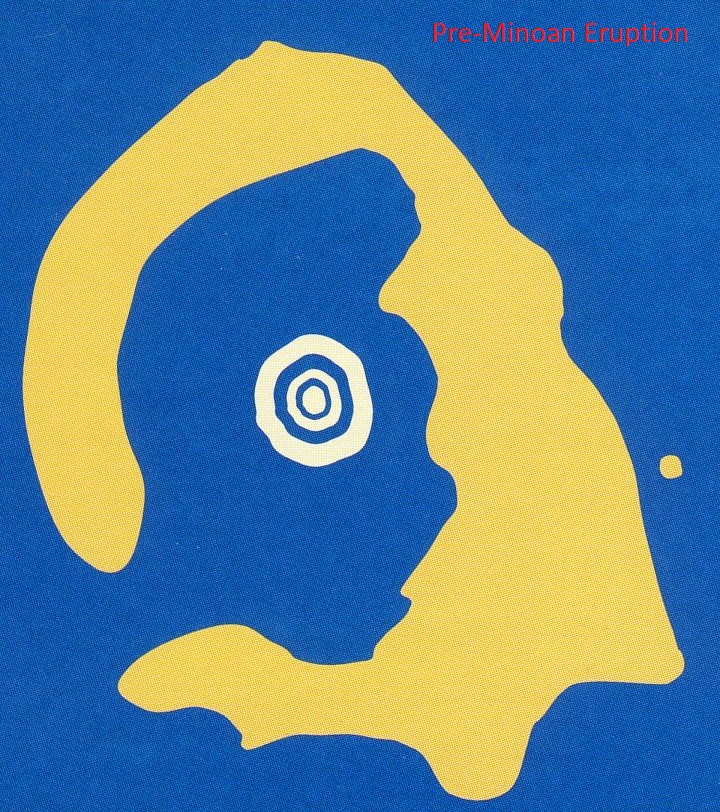
Santorini was originally a single, rounded volcanic island with several volcanoes, which was shaped from their ash, slag, and lava flows over an older core of non-volcanic rocks. Before the catastrophic Minoan eruption of the Bronze Age gave the volcanic edifice its present form, it was still a connected island ring.
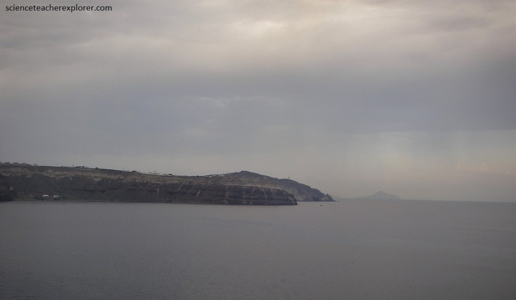
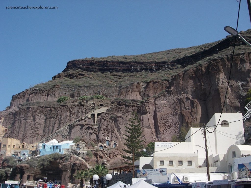
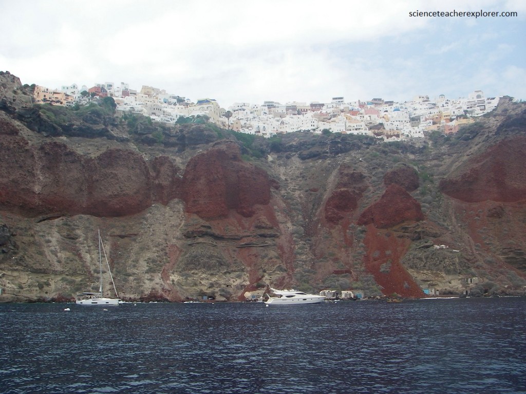
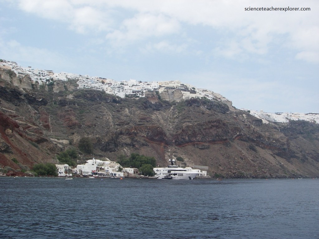
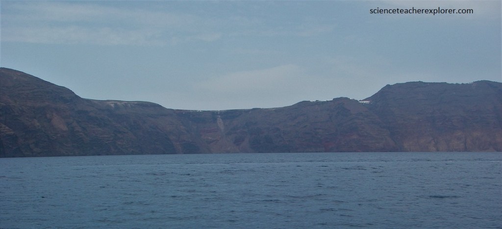
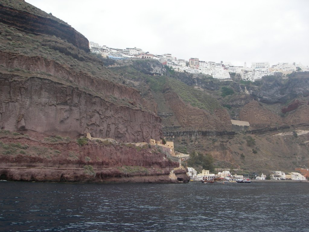
Becky and I entered the bay of Santorini from the deck of our cruise ship. We were looking up the 300m-high cliffs that formed the western flanks of the main island.
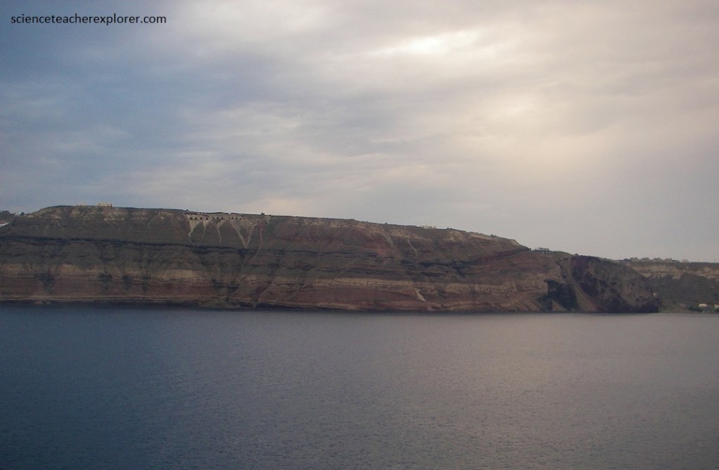
The Santorini bay, some 10km long and as deep as 400m in places, is actually the flooded caldera of a volcano, whose eruptions caused the center of a once-large island to collapse.
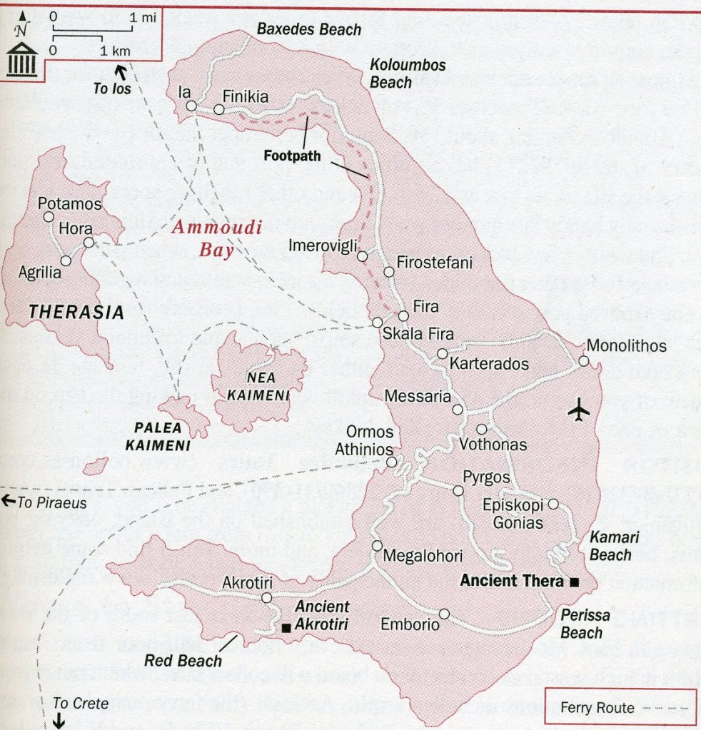
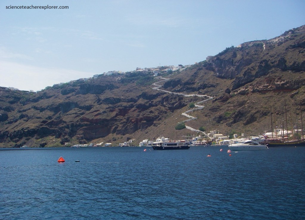
Our cruise ship docked, outside at the port of Skala Fira. Apparantly, the exposed port at Skala, (directly below Fira), was unsafe for the larger cruise ships, but it seemed to be used by smaller ferries. Since I was interested in the geology of Santorini, we booked a ferry from Skala to the “Kaimeni islands” in the center of the bay.
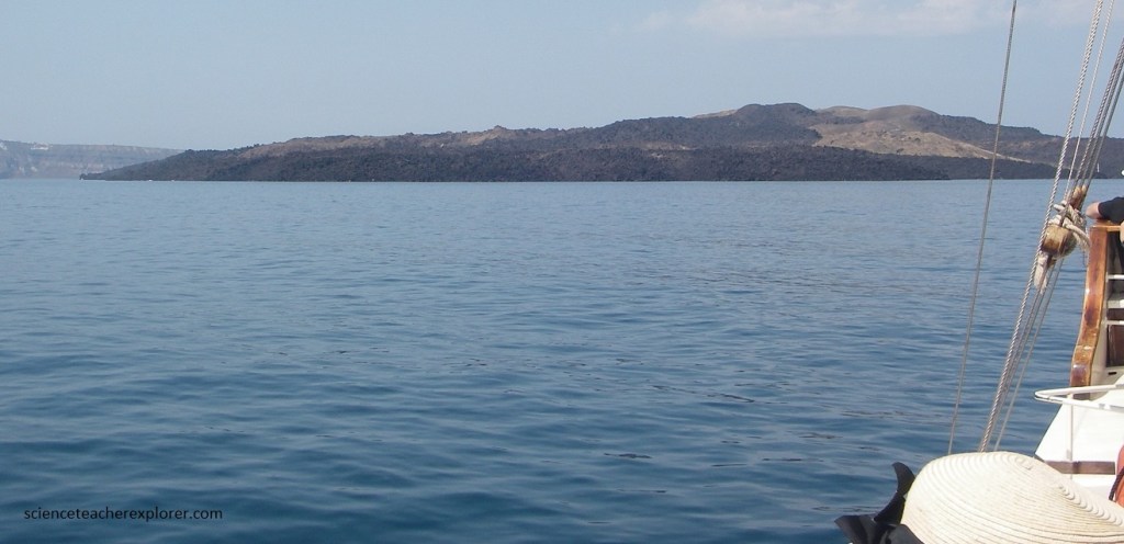
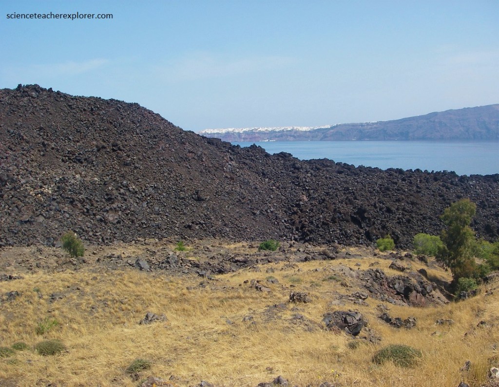
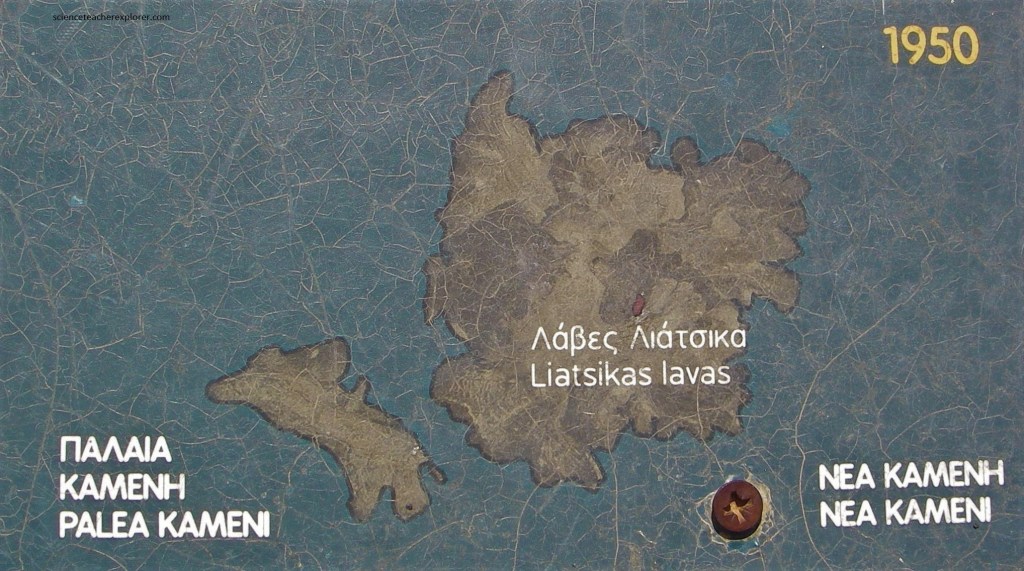
Pictured above and below, the ‘New Burned’ Island (Nea Kaimeni) is the youngest volcanic island in the Santorini Caldera. The islet of ‘Nea’ Kameni is an unparalleled testament to beauty, a site of major scientific interest and a protected natural monument. The Hellenic Ministry of Culture has declared it and the rest of the Santorini island group a “historical site of exceptional natural beauty”. The Palea and Nea Kameni islets and the caldera area have also been nominated for a place on the World Heritage list of geological monuments.
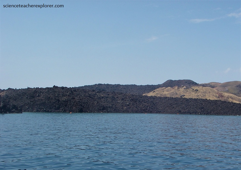
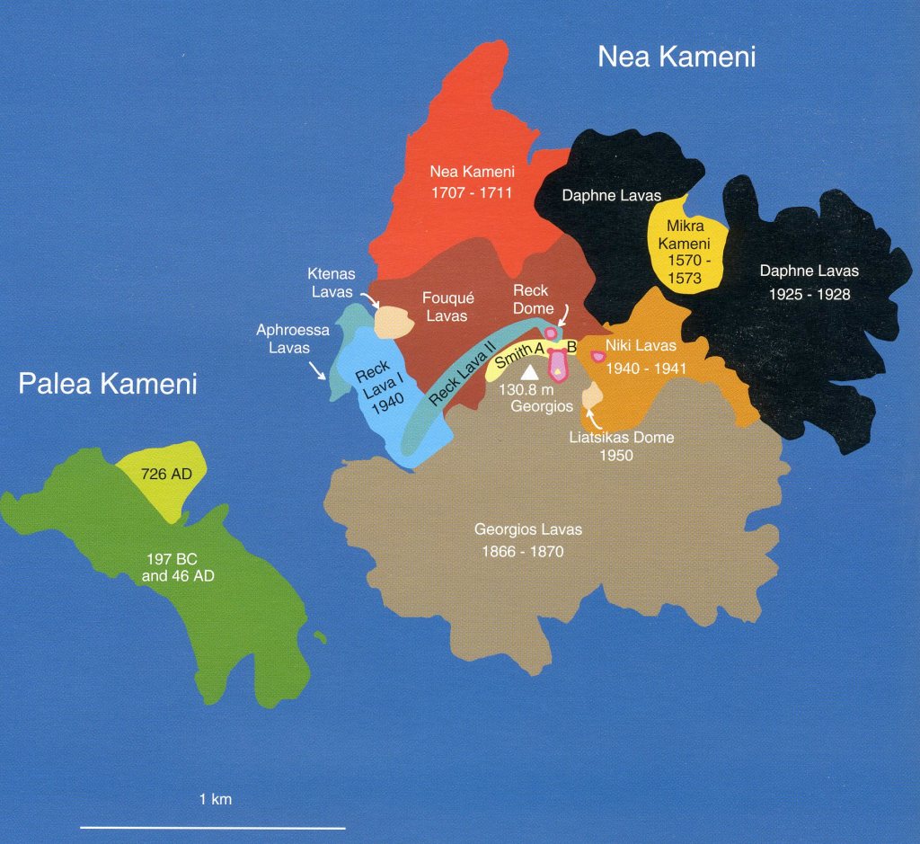
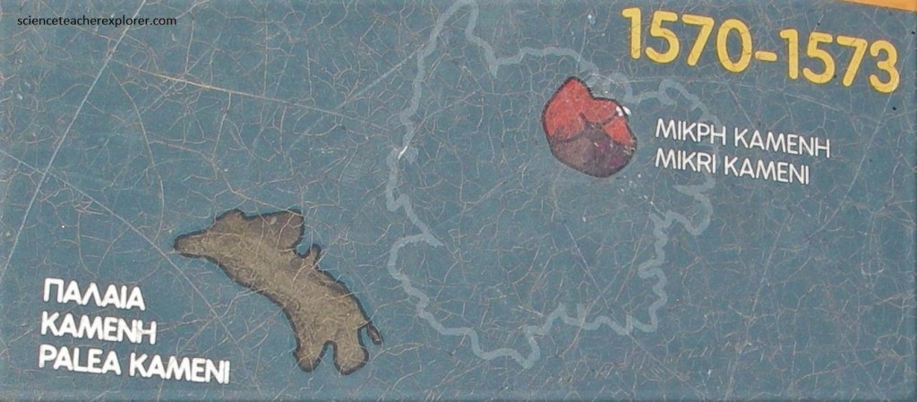
Pictured above, ‘Nea’ Kaimeni was formed in 1707 by the coalescence of newly erupted lava with the earlier rocks of ‘Mikra’ Kaimeni.
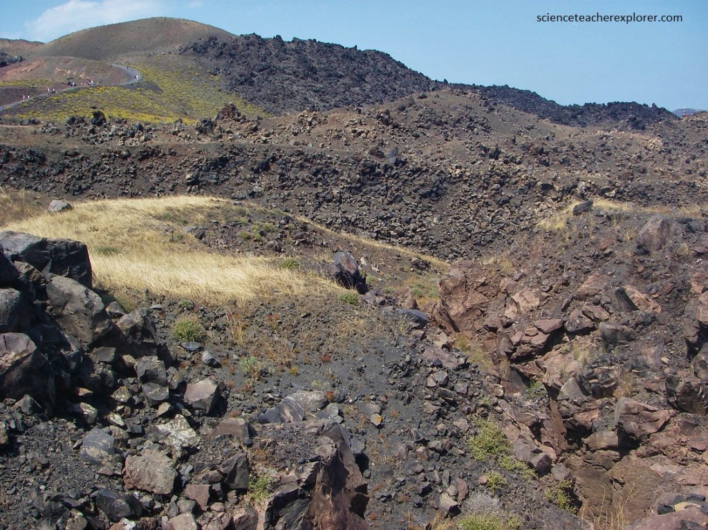
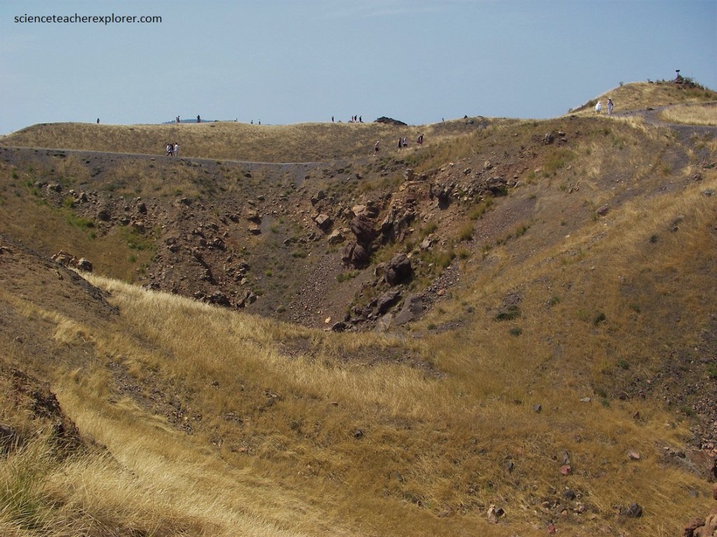
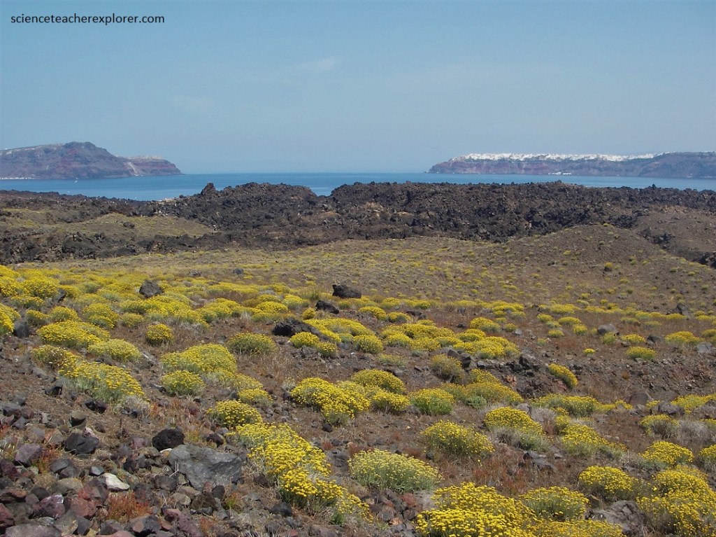
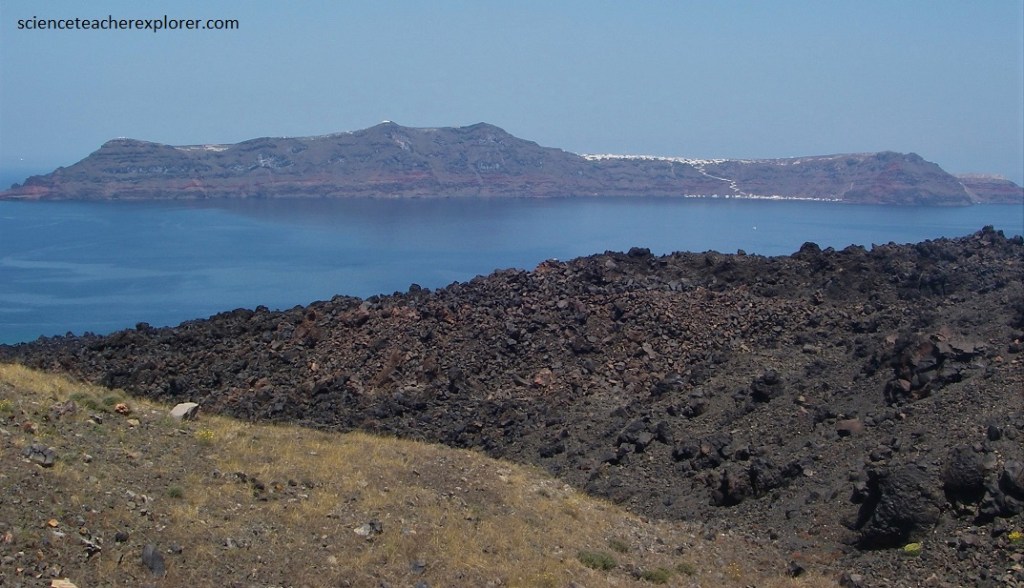
Pictured above & below, ‘Nea’ Kaimeni Island is almost circular and it is a uniform shield volcano that is made up of lava, slag, and ash.
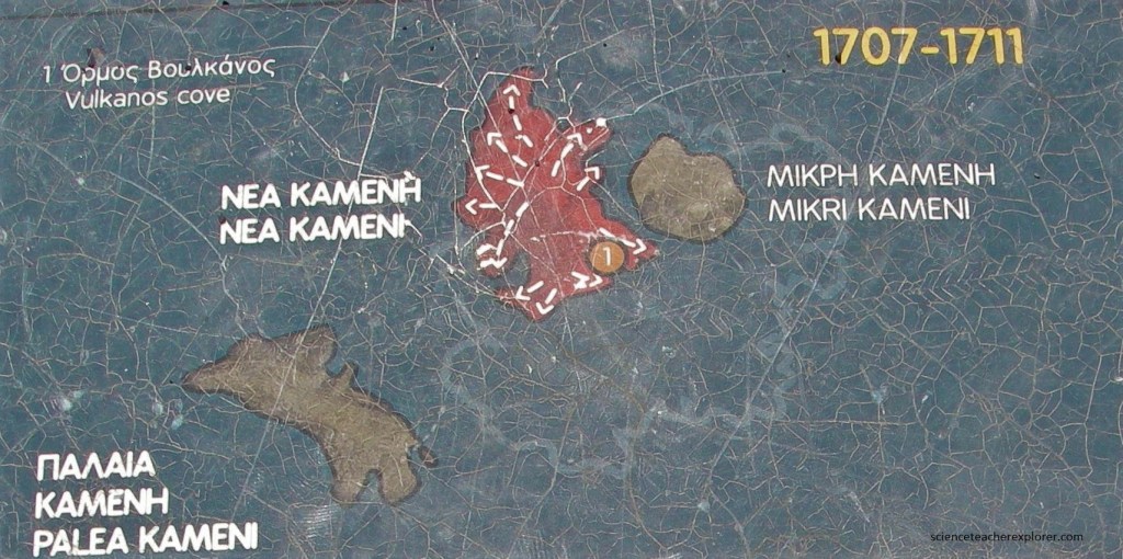
Pictured below, the summit crater, Georgios, is the highest point on the ‘Nea’ Kaimeni Island (124m). The eruptions of 1707-1711 at the ‘Nea’ Kaimeni Island location inside the caldera were of great geological interest, because this was one of the rare cases in which a volcano was observed to emerge from the sea.
There are only few descriptions of volcanic eruptions that are more detailed then those of ‘Nea’ Kaimeni in the twentieth century, possibly because it was easy for volcanologist to observe all chances on the island from the security of the high caldera rim on Thera Island. The unique nature and significance of this area lies in the fact that it is the youngest volcanic platform in the eastern Mediterranean. It is an active volcanic center, its oldest rock formations dating back 430 years and its most recent a mere 50 years. The landscape’s unearthly natural beauty is not the only remarkable thing – the site is also unique from a scientific perspective: The fact that the islet was born and gradually formed through volcanic eruptions spanning 430 years, in six different volcanic events, makes it possible to study a number of extraordinary geological, volcanic and biological phenomena and process in a balanced geo – ecosystem undisturbed by human activity.
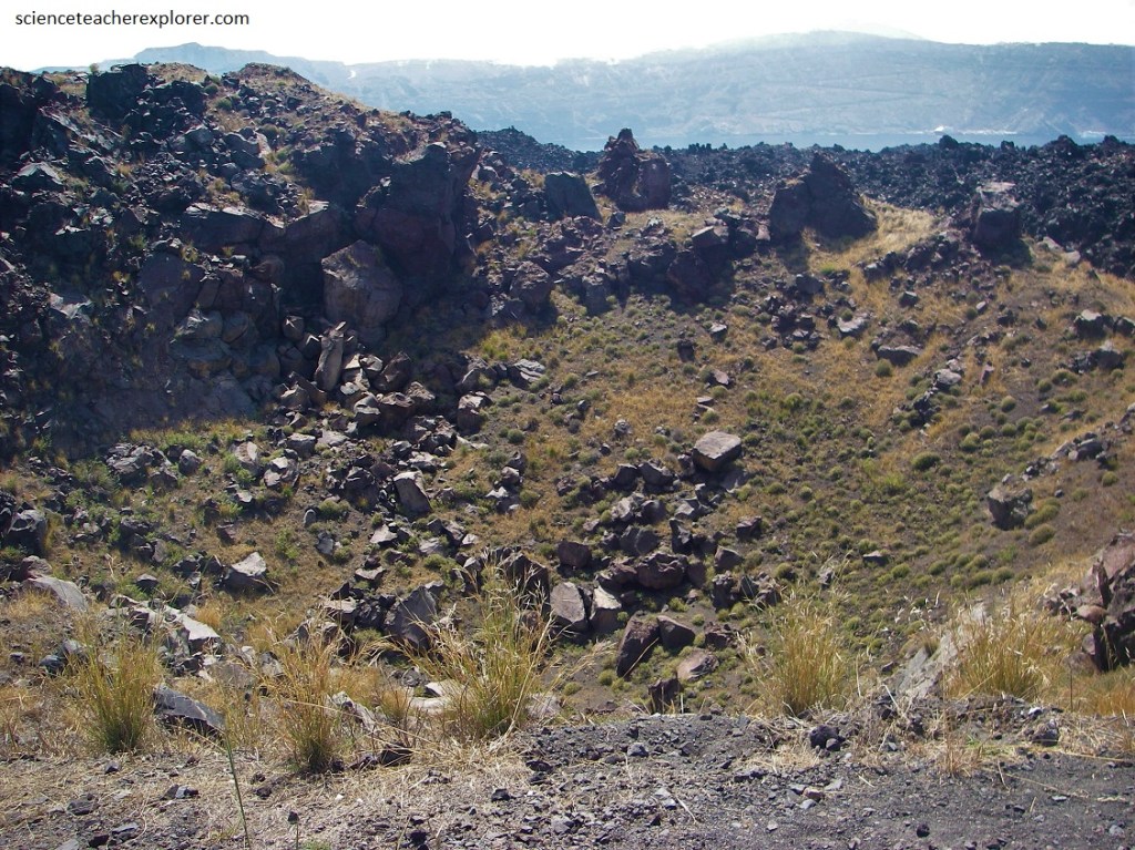
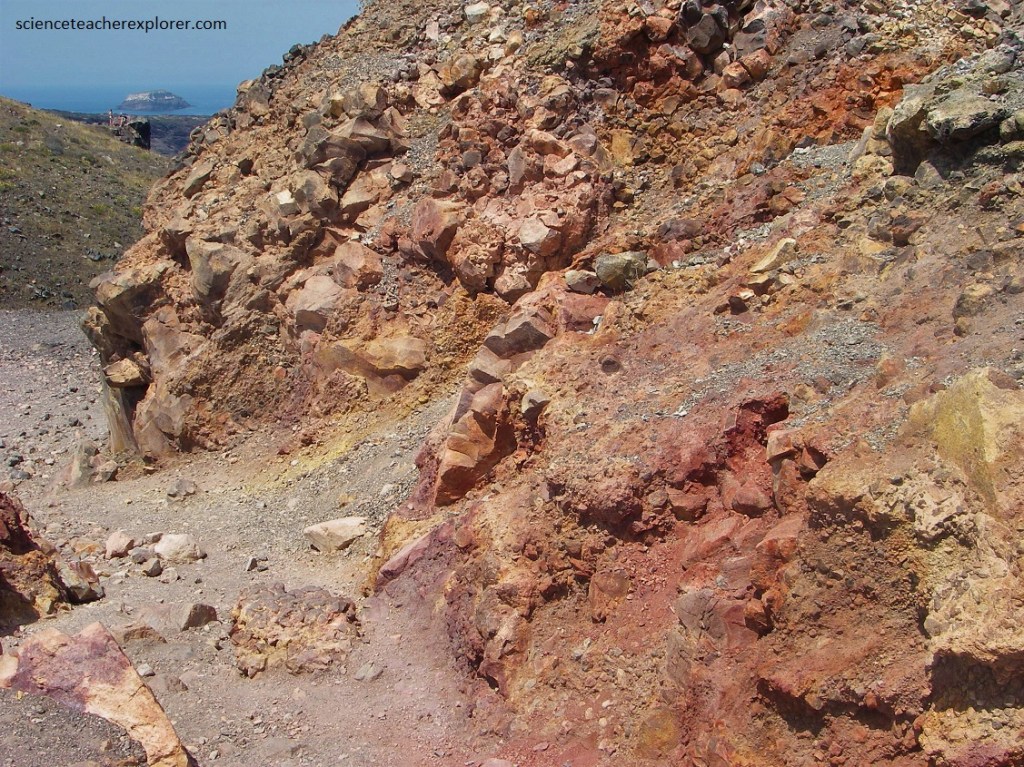
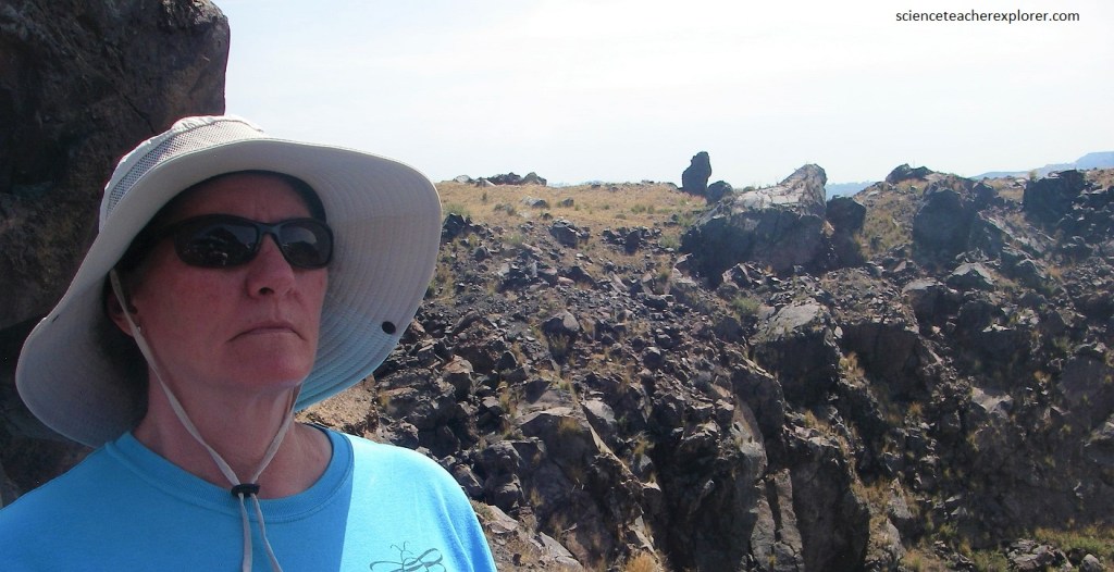
Pictured above, Georgios summit-crater’s walls contain certain spots that (solfatara and fumaroles) still give off warm sulphurous gases.
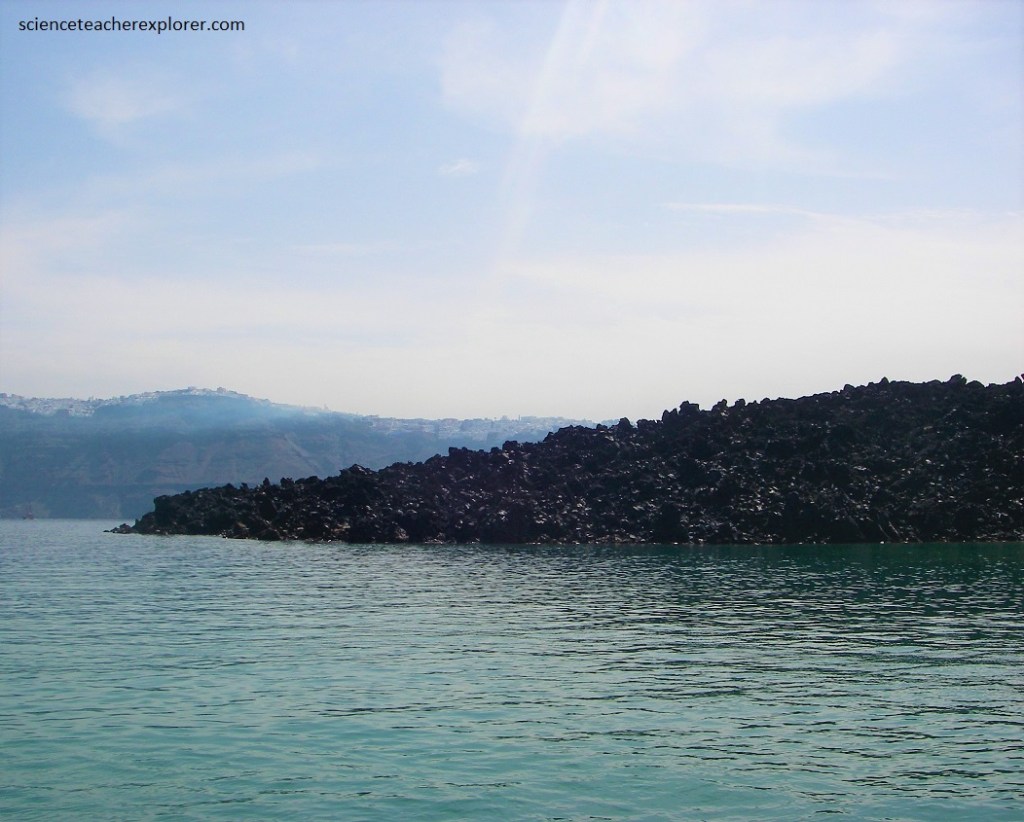
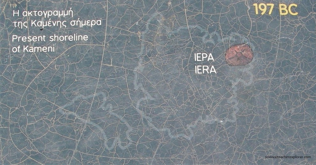
The island known as Palea Kaimeni, meaning ‘Old Burned’ in Greek, is well named. It was the first to be formed after the Minoan eruption. From various written sources we know that volcanic activity started here around 197 BC.
Pictured below, Palea Kameni is now uninhabited. Its truncate shape indicates that , in the past, it was substantially larger. This is shown most clearly by the steep cliff on the northeastern side of the island. Note that the cliffs are part of the oldest part of the island.
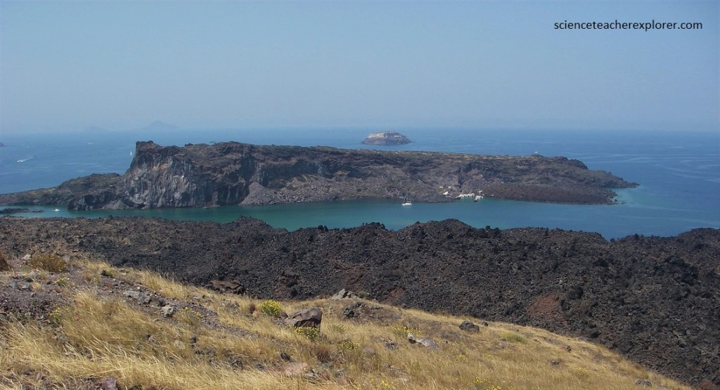
Pictured above, if we compare the ‘Palea’ Kaimeni Island with ‘Nea’ Kaimeni, one gains the impression that the present ‘Palea’ Kaimeni is only a small part of what was once a much larger island.
An interpretive sign along the ‘Nea’ Kaimeni trail gives a history of the Kaimeni Islands, (pictured below).
Pictured above, from time to time, the viscous magma that remained in the bowels of the earth after the destructive eruption of 1630 BC of the Minoan-Eruption welled up at the center of the huge caldera formed during the eruption. It poured out sluggishly at regular intervals, adding layer upon layer to form the ‘Palea’ and ‘Nea’ Kaimeni.
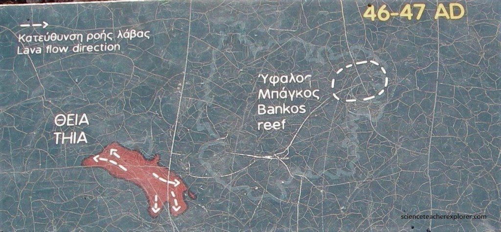
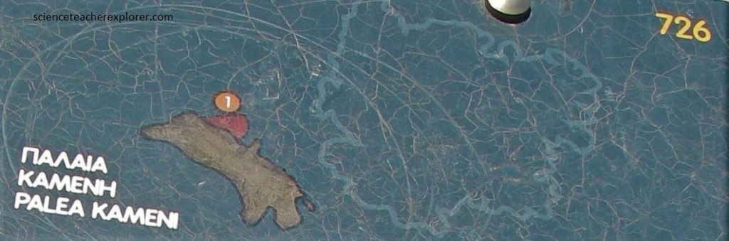
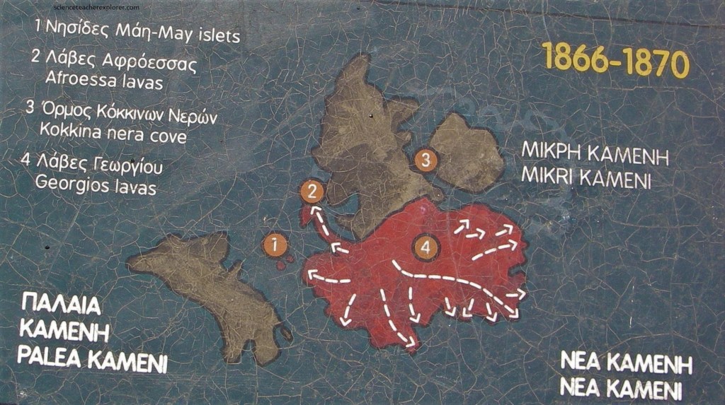
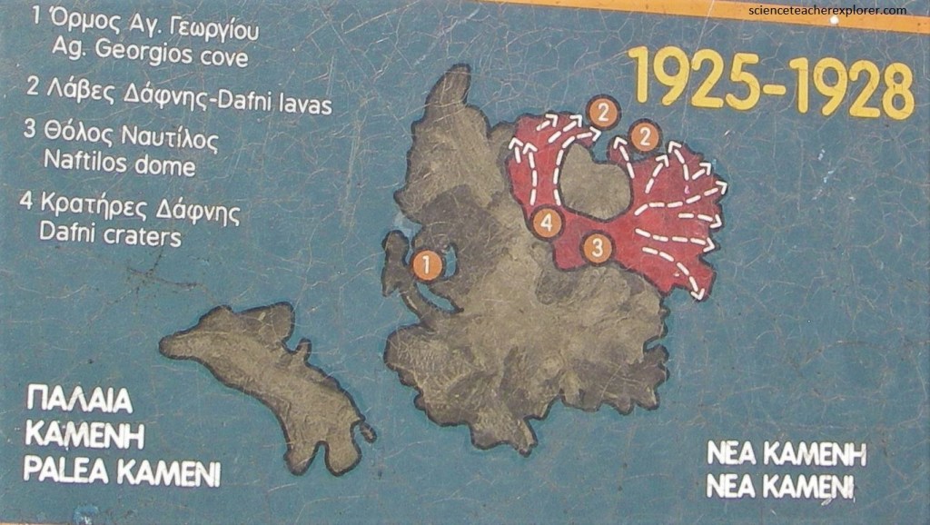
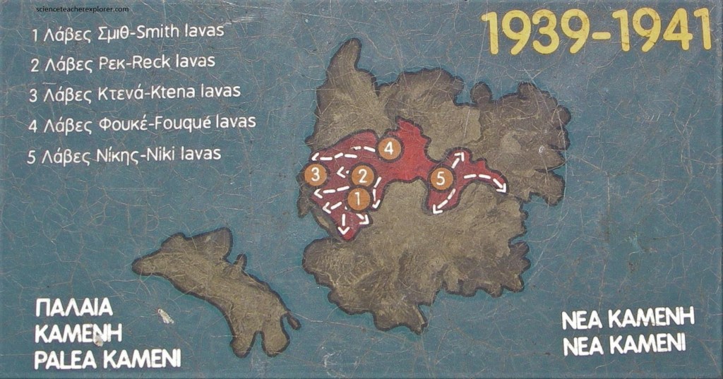
Pictured above, between 1600 BC and 197 BC a series of periodic submarine effusions led to the creation of a large underwater volcano whose peaks are the ‘Palea’ and ‘Nea’ Kaimeni islets. The first emergence of an island from the sea was documented in 197 BC. Eight more eruptions have been documented from then till today (46 – 47 AD. 726 AD, 1570 – 1573, 1707 – 1711, 1866 – 1870, 1925 – 1928, 1939 – 1941, 1950), which formed the ‘Palea’ and ‘Nea’ Kaimeni islets, the youngest landform in the eastern Mediterranean. All these eruptions were mild and did not cause serious problems for the island’s inhabitants.
After the last eruption of ‘Nea’ Kaimeni in 1950, the Santorini volcano remains dormant till today. The only witnesses to the existence of the magma at the depth of a few kilometers under the island are the hot springs that gush out at various parts of the shores of ‘Palea’ Kaimeni and the hot gases (water vapor, carbon doxide and traces of other gases) that are emitted from the fumaroles of the central craters on the peak of ‘Nea’ Kaimeni.
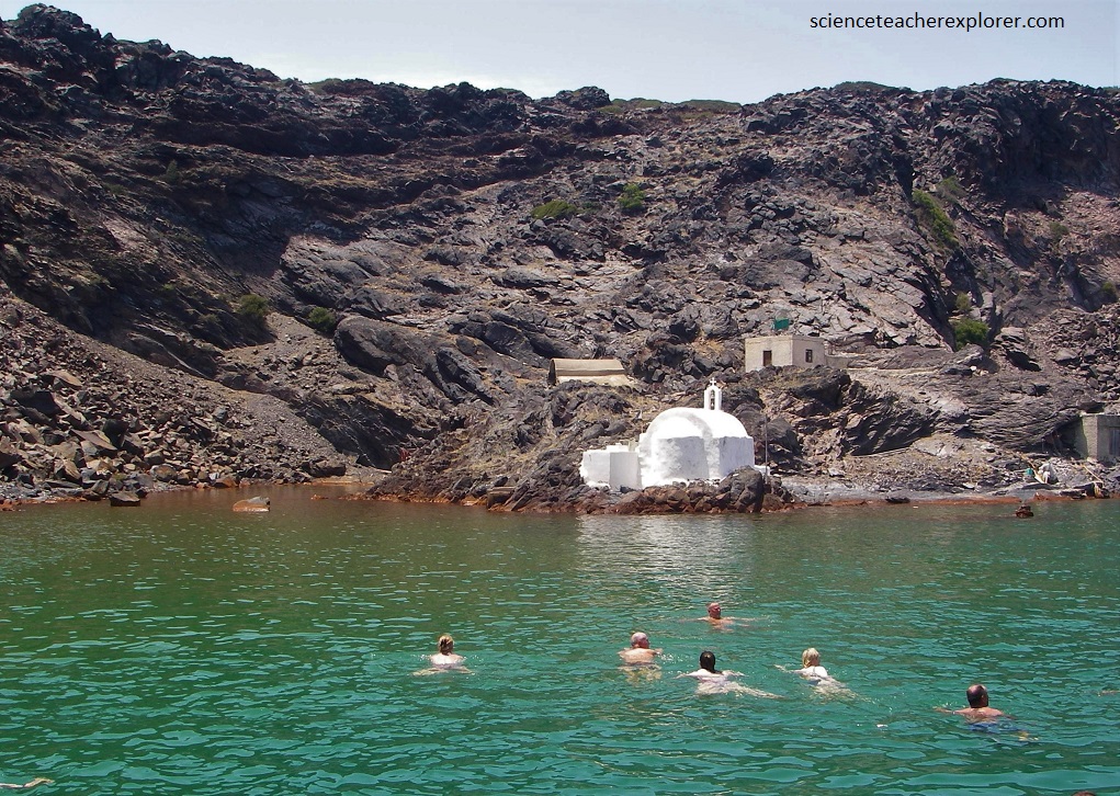
Pictured above, a bay on the north side of ‘Palea’ Kaimeni is conspicuous because its water has a deep reddish-brown color. In this hallow area, the sea bottom is covered with a layer of mud up to 60cm thick, the upper-most part of which is reddish brown. The bay is called the ‘Red Water Bay’. The water is about 380C and nearly everywhere in the bay bubbles can be seen rising through the water.
Pictured above, the Red Water Bay at ‘Palea’ Kaimeni Island is a favorite spot for tourists who like to sit in the warm mud, but it provides and excellent opportunity to study the formation of metallic ores in a marine environment from hydrothermal solutions.
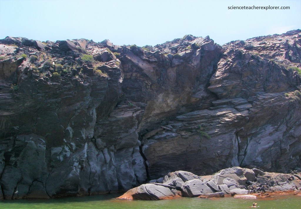
After visiting ‘Palea’ Kaimeni Island at the Red Water Bay, Becky and I took a ferry to the island of Therasia. Pictured above, the island of Therasia (the Little Thera), forms the north-western part of the ring of islands. It consists entirely of volcanic rocks, which at Viglos Vouno reach the height of 295m (pictured below).
The largest town on Therasia Island is Manolas, which stands on the caldera rim above the harbor of Korfos. Pictured above, Manolas is reached by a steep, winding stairway from the harbor and by a new road from Korfos, the landing place in the northwestern part of the island.
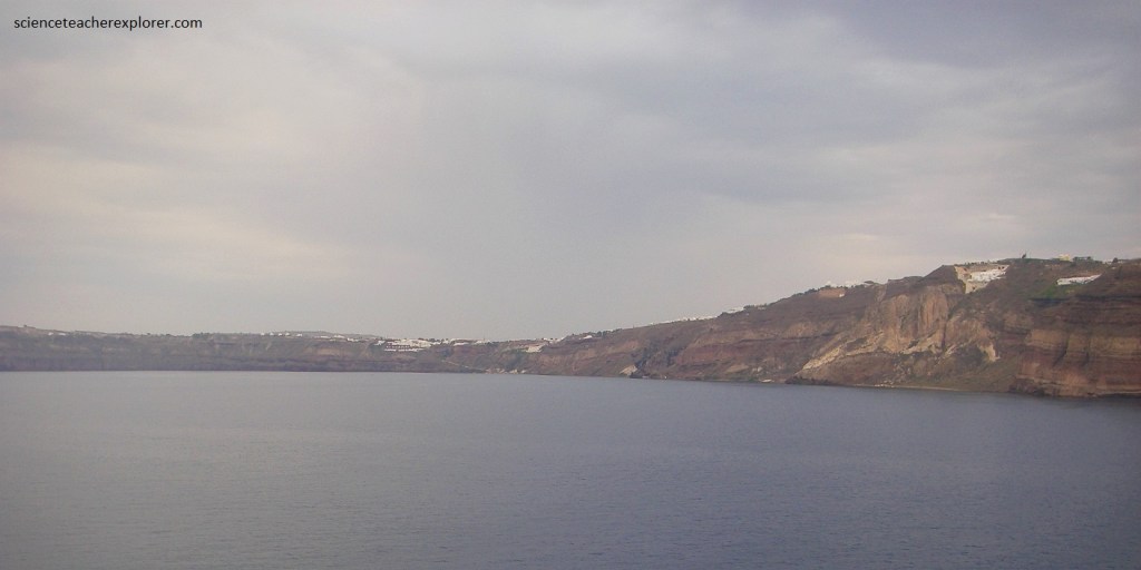
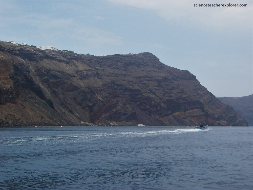
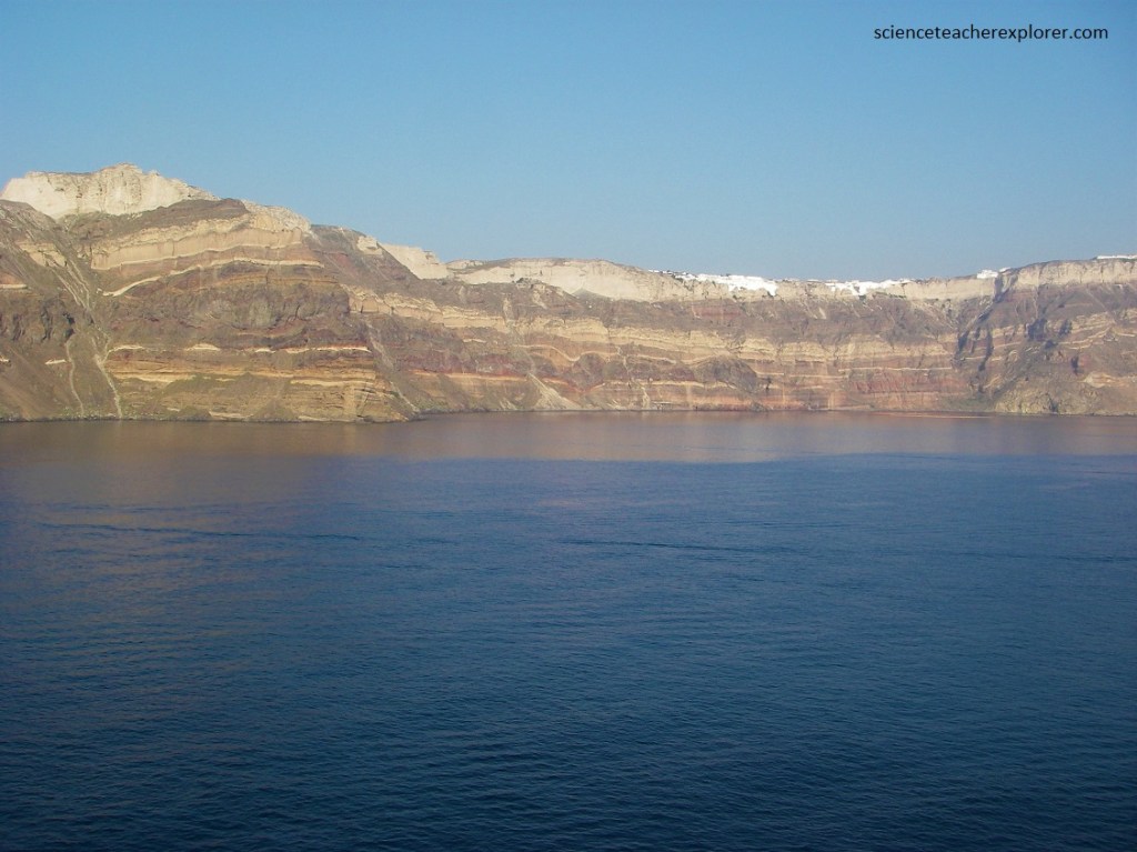
Until the earthquake of 1956, there was still the village of Agrila, but today it is gone and replaced by Manolas. From the sea, the towns and villages that line the Santorini Caldera look almost like apparitions. At first the clusters appear to be natural formations of white stone or snow, until blue domes come into focus and you notice white cubical houses practically teetering on the side of the cliffs. Becky and I continued our circuit of the caldera by ferry and observed the caldera walls of Therasia and Thera, (pictured below).
Pictured above, one can see the marvelous, multicolored display of horizontally layered rocks with occasional transecting vertical units. At first, the imposing picture seems confusing, but if one can interpret the rocks, it is possible to decipher the long volcanic history of Santorini.
Pictured above and below, it is evident from the variety of colors and forms that the volcanic complex was not formed by a single event but by many phases over a long period of time. One should note the the volcanic material was laid down as a mantle over the core of ancient metamorphic rocks that, during the Pliocene, stood as an island in the Mediterranean.
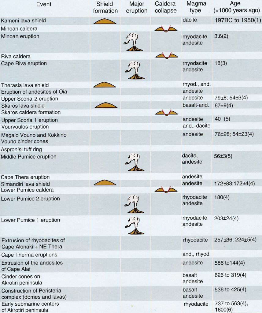
For about 1 million years, at least twelve eruptive centers contributed their various products to the volcanic edifice. As it developed, the nature of the rocks changed along with topographic form of the volcano. As volcanic material was laid down on the land, large parts disappeared into the depths of the sea. At least 4 times, a caldera was formed only to be filled again with volcanic material. Imaged below, one can trace the various pulses of magma by comparing chemical analyses of the rocks.
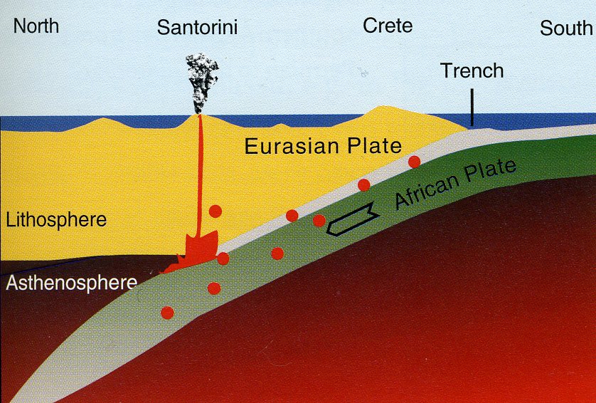
Imaged below, the southern Aegean volcanic arc extends from the Greek mainland through the islands of Aegina, Methana, Poros, Milos, Santorini, and continues through Kos and Nisyros to the Bodrum peninsula of Turkey. It marks the geological boundary between Eurasia and Africa.
At this plate boundary the African plate is descending, (or being subducted), into the mantle as it moves northward and converges on the Eurasian plate at a rate of up to 5 cm/yr. The main driving force of plate motions causes relative deformation in the form of extension, compression, adjustment, and shearing in that part of the lithosphere making up the upper 100km of the earth. Magma can ascend only if extension opens channels through the crust as it did along the Aegean Volcanic Arc.
Today, the Aegean region is fragmented into many segments. In a geological sense, it is relatively young. As recently as the Miocene, this region, known as the Aegean landmass, was still structurally coherent.
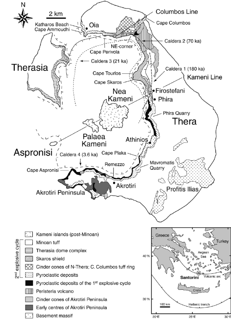
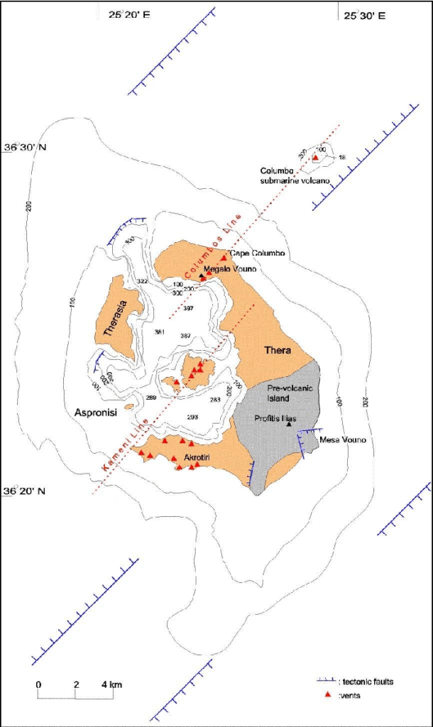
Situated 7 km off the northeastern coast of Thera the Columbo cone measures 4-8 km with its long axis oriented parallel to a northeast-trending tectonic fault-structures known as the ‘Columbo line’ and the ‘Kaimeni line’. It’s highest point at the crater rim lies only 18m below sea level.
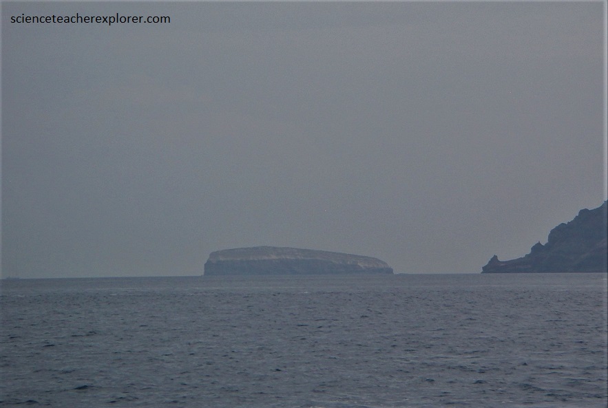
Pictured below, as the Greek name Aspronisi appropriately expresses it, this small island is covered with a thick layer of white pumice laid down by the Minoan eruption. Aspronisi is uninhabited and , even though it is only 60m at its highest point, its interior is almost inaccessible.
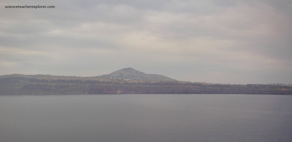
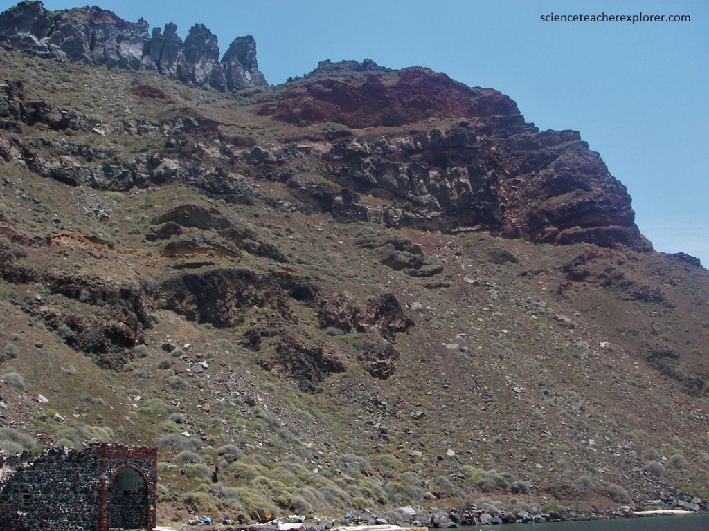
Pictured below, Thera is the largest remnant of the original ring-island. The core of the crescent-shaped island has the oldest rocks of the island group. [Originally laid down as sediments about 200 million years ago and now metamorphized].
Pictured above and below, Thera Island consists entirely of volcanic rocks. In the northern part of Thera they make up the volcanic cones of Megalo Vouno (330m), Kokkino Vouno (283m), and Mikro Profitis Elias (314m), all of which are built of lava, ash, and slag.
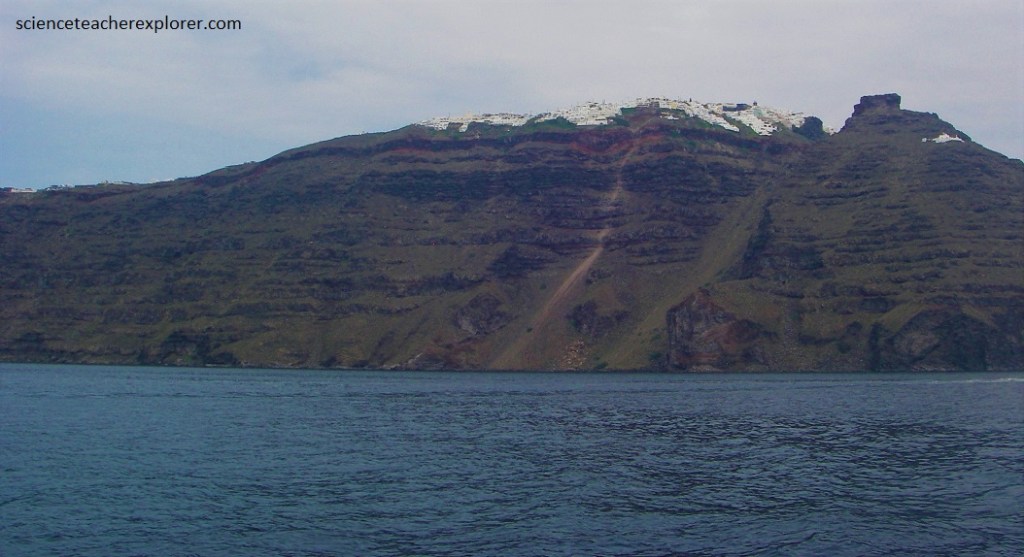
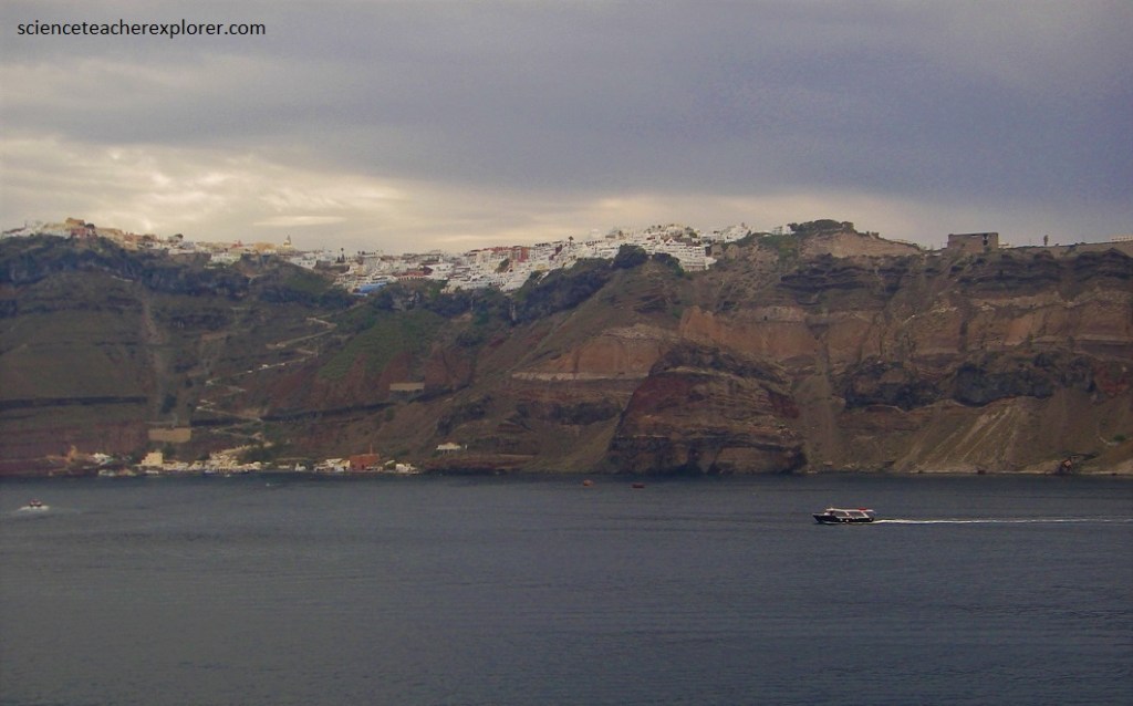
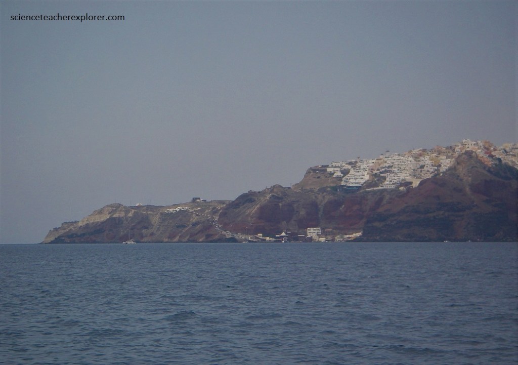
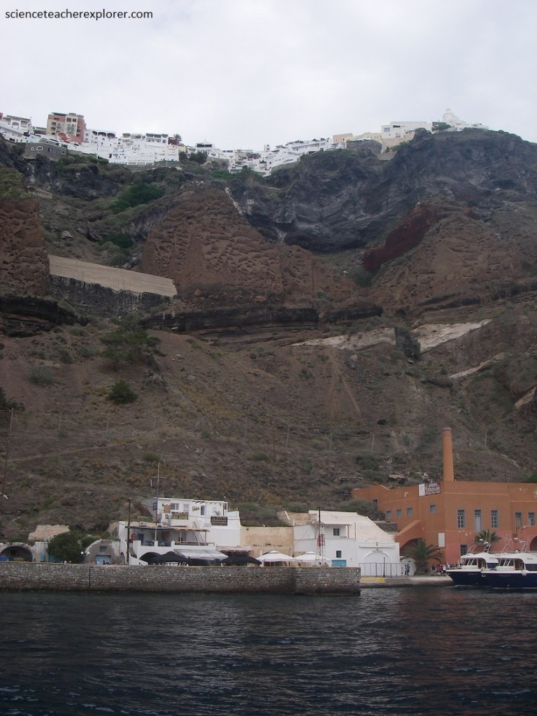
Pictured below, Fira or Phira, the main town of the island, stands on the crest of the caldera rim, where its picturesque, white houses and churches look out over the bay.
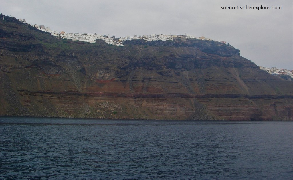
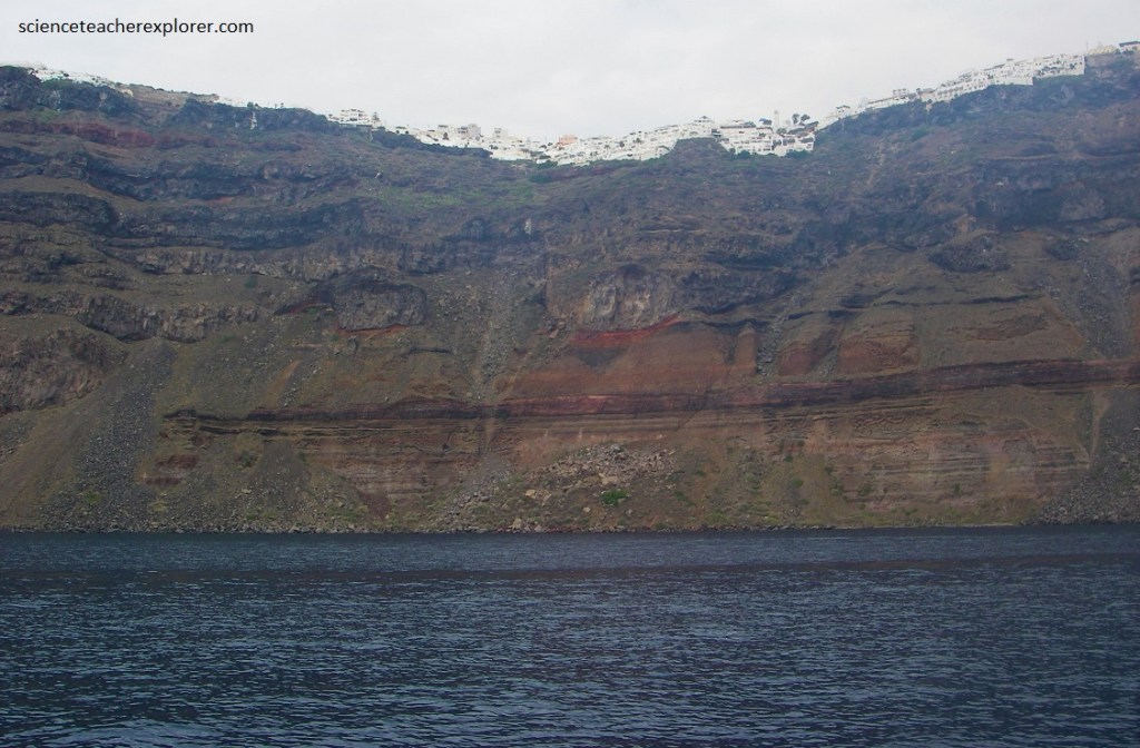
Pictured below, from the small harbor at Katofira, Fira is reached by a long, winding stairway, and a cable car. Mules are usually offered to ride at Skala. However, Becky and I chose not to take this route.
It should be noted that the layers of volcanic ash erupted from Santorini have a wide regional importance, because they were produced by a relatively brief but well-defined event and were laid down contemporaneously in a wide region. Knowing their ages, (from K/Ar isotope-dating methods, one can use them as time markers wherever they can be identified.
Pictured above, erosion has left its marks on the steep caldera walls, where caves and grottoes have been cut into the soft volcanic rocks. Erosion by wind and water can produce bizarre formations in the soft pumice of the Minoan eruption. Wind erosion produces these strange patterns by preferentially removing soft materials and leaving others that are more resistant. Honeycomb-like patterns are often seen in the rocks of the coastal areas.

The steadily moving lithospheric plates of the earth create tectonic stresses and regions of active volcanoes, such as those of the Santorini region. Threat means that earthquakes, eruptions, and tsunamis will continue to characterize this area in the future. Nothing can stop this dynamic force.
After studying and exploring this location, I find that the possibility of the biblical plagues, visited upon Egypt during the time of Moses, and the subsequent parting of the Red Sea is valid. It has been claimed, the “exodus” events were caused by a volcano that erupted on the Greek island of Santorini in the 16th century B.C. and transferred its effects to Eygpt. The age description of the massive Minoan Eruption matches the time period.
