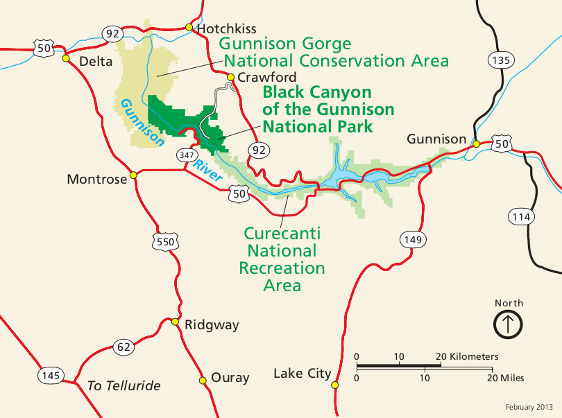
Black Canyon, CO 2011
During Fall Break of 2011, Becky (my wife) and I went on vacation to Durango, Colorado. On our way back to Utah, we stopped at Black Canyon of the Gunnison.
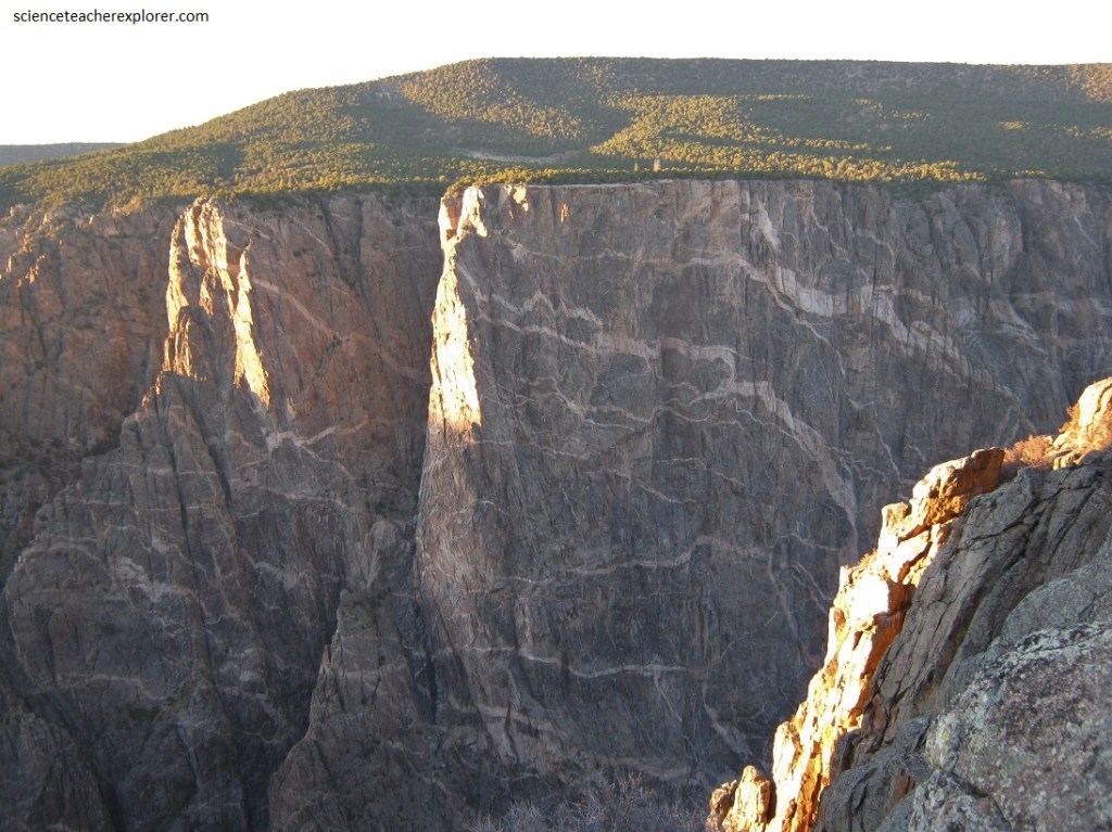
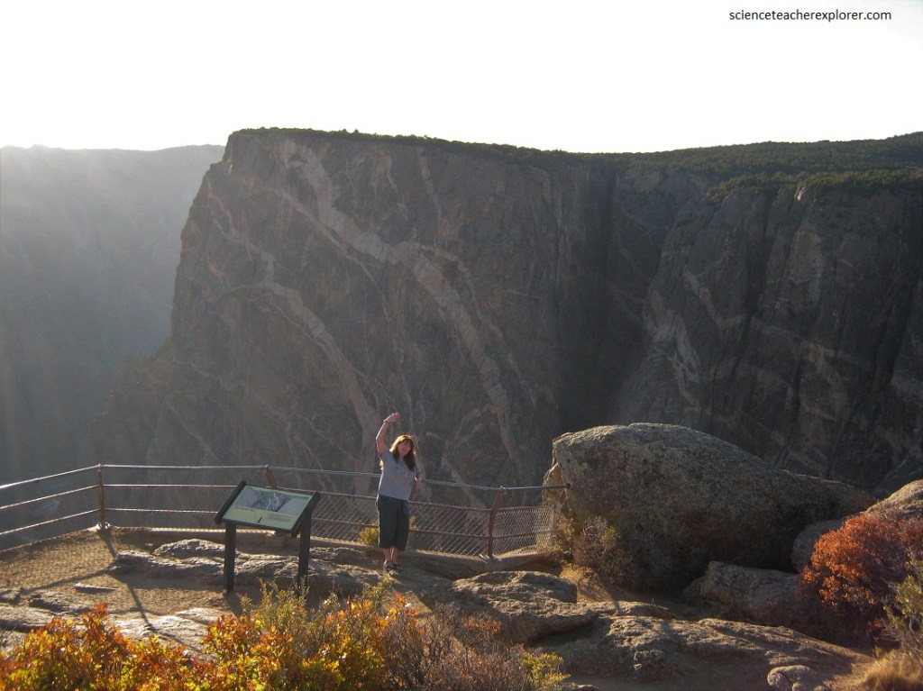
The Black Canyon of the Gunnison’s rugged landscape formed slowly when water and tumbling rock scoured down through hard crystalline rock. No other canyon in north America is as narrow or can equal its sheer vertical walls. It is named Black Canyon because very little direct sunlight penetrates its depths.
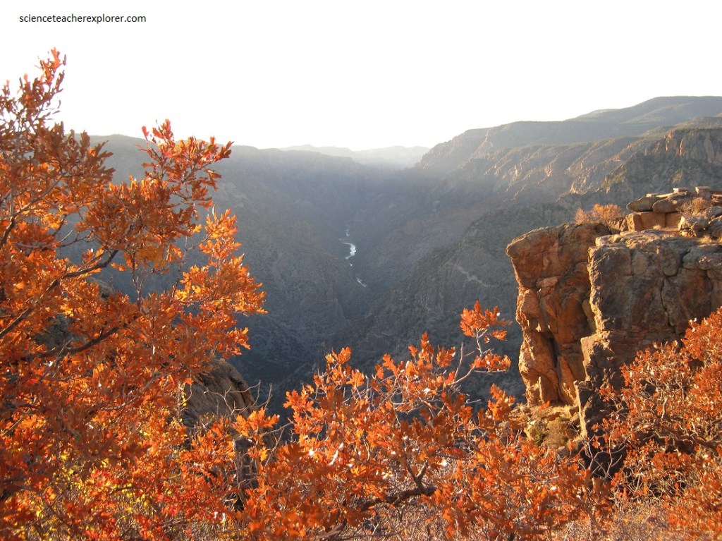
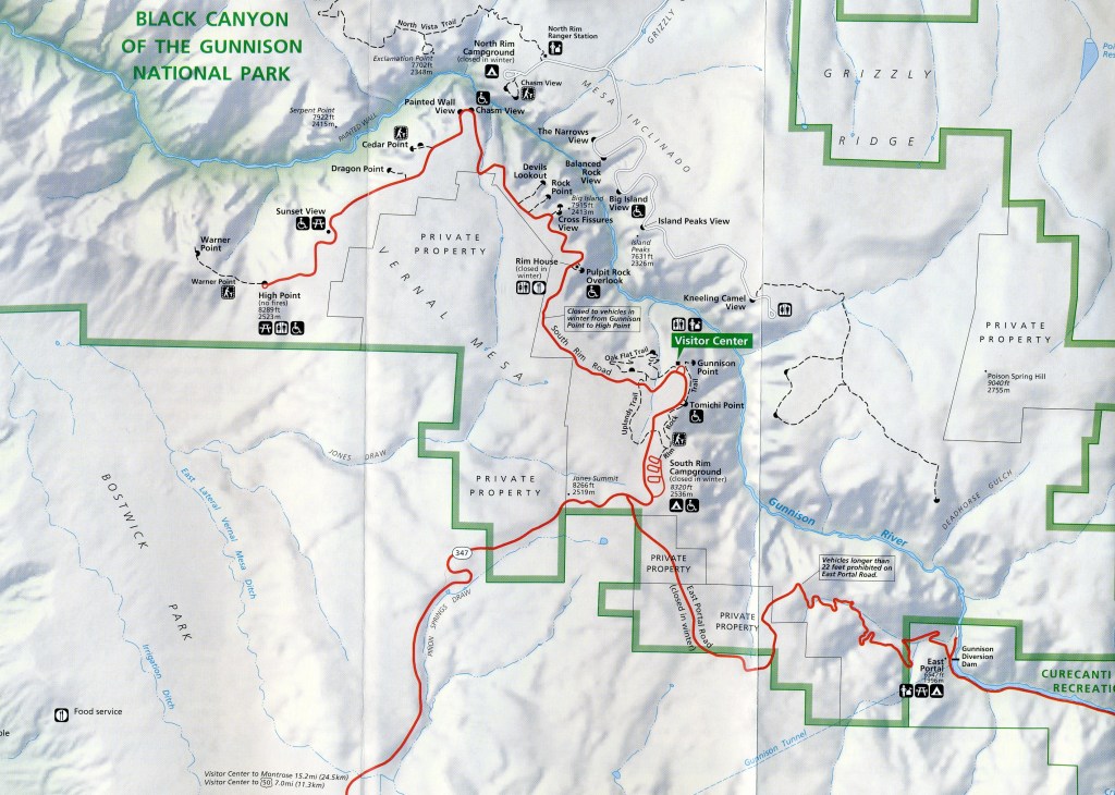
The canyon was once an impressive 80 km long but three dams have been built upstream, which has left just 20 km unspoiled. The roads around the canyon rim feature several overlooks down to the strangely frightening dark, jagged and menacing rocks below.
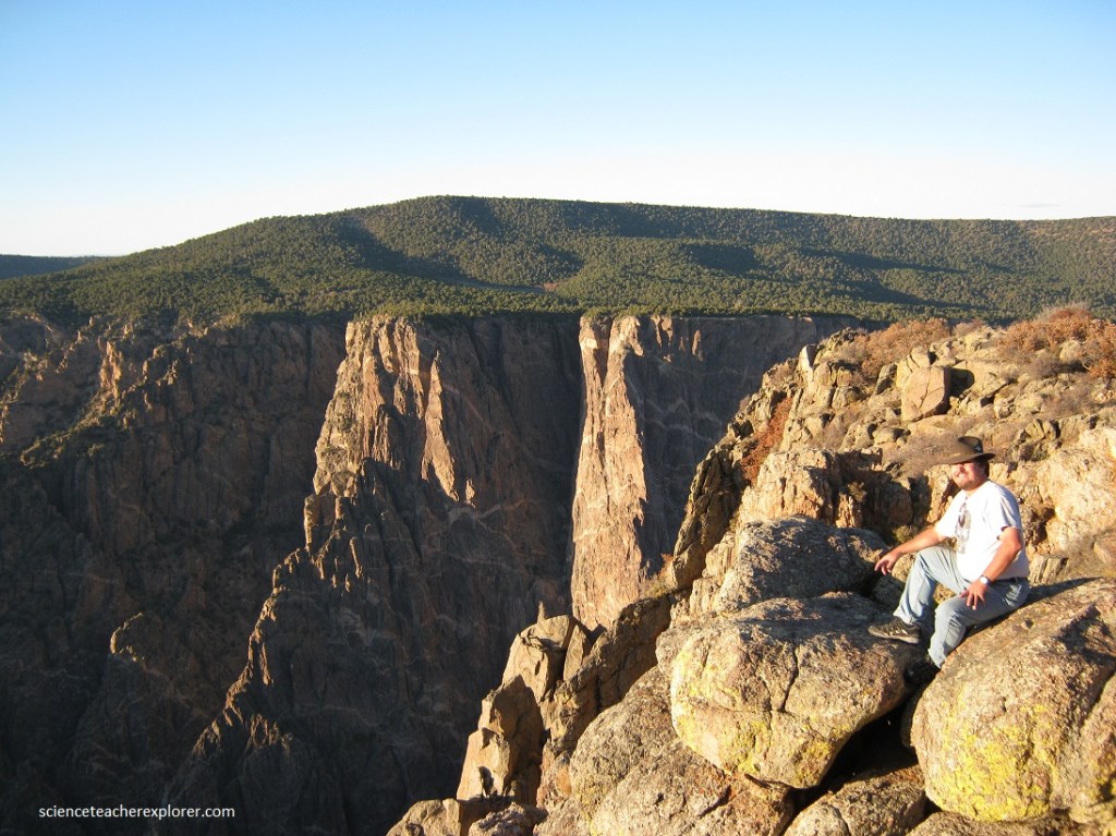
The average depth of the canyon is 610 m, with a maximum width of 823m, just north of Warner Point to a minimum of 533 m at The Narrows. The Gunnison River has an usually steep gradient over the length of the gorge. It falls about 655 m from the canyon head at Sapinero to the mouth at the junction with North Fork, a distance of just 80 km. This is an average drop of 13 m per km, greater than the Grand Canyon.
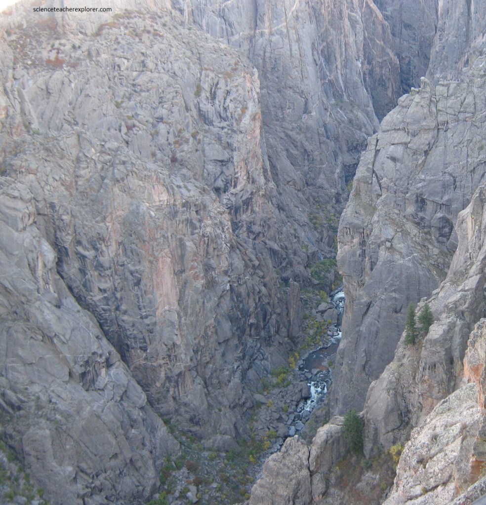
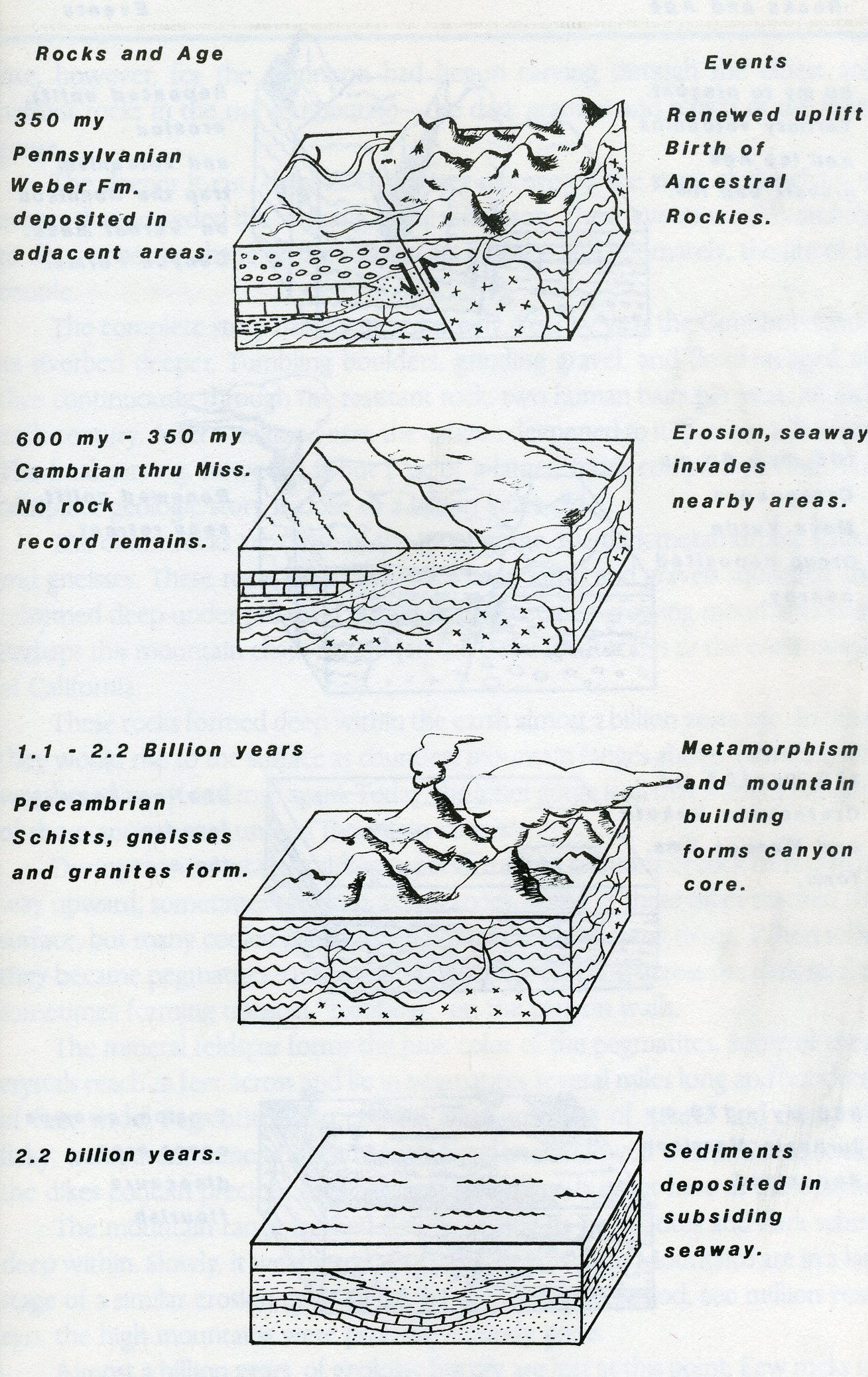
Through incredible erosion, the Gunnison River has exposed a wide range of rock types, from 1.7 billion year old gneiss and schist to Mesozoic – Cenozoic fossiliferous sedimentary rocks and modern unconsolidated sediments.
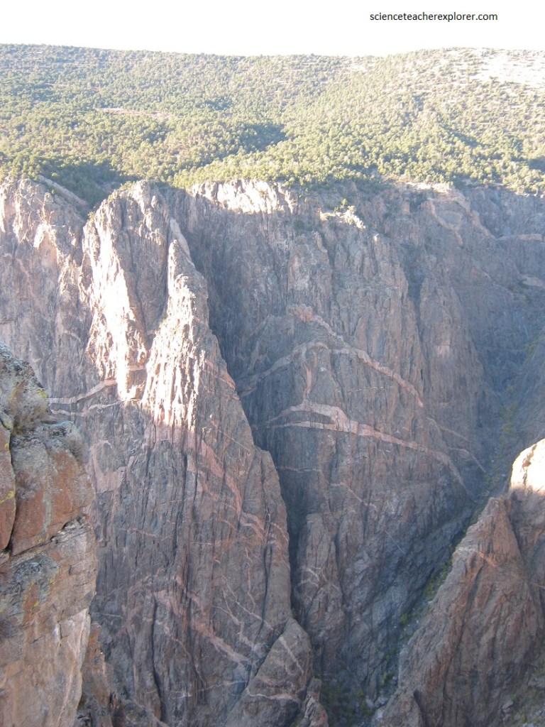
The steep, “black” walls of Black Canyon are composed of Precambrian granites, gneisses, gabbros, diorites, pegmatites, and schists.
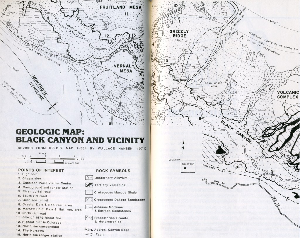
The canyon itself is considered one of the best exposures of these ancient rocks in the world. Pictured above are pink colored pegmatite dikes with crystals up to 6 feet in length, criss-cross the canyon walls.
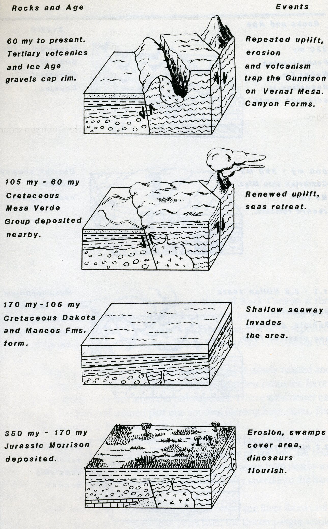
Directly atop the Precambrian rocks, in the trees, lie Mesozoic and Cenozoic sedimentary strata. No Paleozoic sedimentary rocks exist in the Black Canyon. The absence of Paleozoic strata creates an unconformity, indicating that approximately 370 million years of earth history are missing from this landscape, and was eroded away above the ocean.
The entire region was uplifted during the Laramide Orogeny. Initial carving by the early Gunnison River began in the Oligocene Epoch as mountain runoff was funneled into a single drainage by volcanoes erupting in the West Elk Mountains to the north and the growing San Juan volcanic field to the south. The river became entrenched as it carved through easily eroded volcanic debris and underlying Mesozoic sedimentary rock layers. As the Sawatch Range continued to rise to the east in the river’s headwaters, the Gunnison continued to cut downward. Much of this narrow canyon has been carved in the last 1.5 million years during the enormous flows of meltwater of the Pleistocene ice age.