Olympic National Park, Hurricane Ridge, WA
In October 2018, My wife, Becky and I went on a road trip with our friends Mike and Lisa Stevens to the Olympic Peninsula in Washington State. Our main goal was to visit Olympic National Park. Olympic National Park is possibly the national park system’s most diverse national parks, including snowcapped peaks, temperate rain forests, and windswept ocean coastal areas. The park is located on the Olympic Peninsula in the extreme northwest corner of Washington state, surrounded by the Strait of Juan De Fuca on the north, the Pacific Ocean on the west, and the Puget Sound to the east.
The Olympic Mountains are striking and are among the most beautiful mountain ranges in any American national park. The range is visible throughout the Puget Sound area. But some of
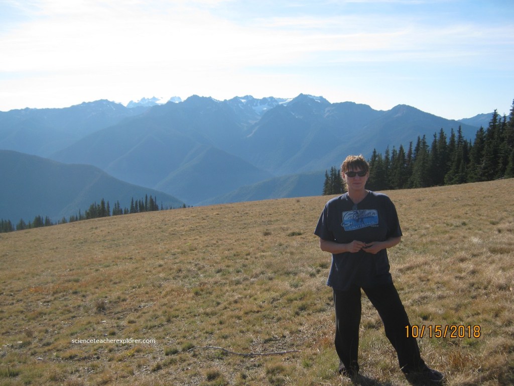
the most beautiful views of the Olympic Mountains are found from the vantage point of Hurricane Ridge, (pictured below with Becky). The line of mountains running in a north south direction and visible from Hurricane Ridge is the Bailey Range. This range actually sits east of, and from the perspective of Hurricane Ridge, in front of, Mt. Olympus. The Bailey Range form the backbone of the Olympics. The Bailey Range resemble the teeth of a saw blade. The characteristic “folds” of the range, visible below, are formed by the erosive action of melting snow and dripping glaciers. The mountains of the Olympic ranges, specifically the Bailey Range, pull moisture from the air which flows in from the Pacific. This creates a rain-shadow which results in an extraordinarily wet-climate on the west side and a dry one on the east side. The climate west of the crest of these mountains is the driest on the northern Pacific Coast.
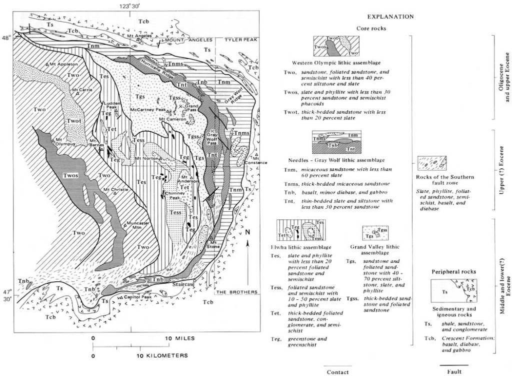
It seems evident from the above USGS map and the drive up the Hurricane Ridge road, that most of the sedimentary rocks of the Olympics were deposited on basaltic oceanic crest, although some were laid down on partly submerged continental rock that may have been on the leading edge of the North American plate.
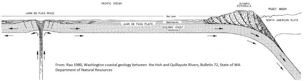
When an eastward-moving segment of oceanic crust, called the Juan de Fuca plate, encountered the westward-moving North American plate, the heavier basaltic oceanic crust was subducted or overridden by the lighter continental crust. From the image above, during a period of several million years, accumulations of marine sedimentary rock were scraped off the plate, folded, compressed, thrust upward, fractured, partially metamorphosed, sliced and uplifted. The creation of the Olympic Mountains was one result of the powerful activity.
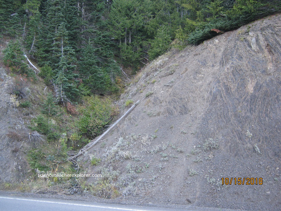
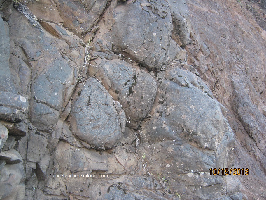
While the sediments were still accumulating on the ocean floor, great quantities of basaltic submarine lava began welling up and spreading over or interfingering with the sedimentary layers. In some places lava flows piled up so high that offshore islands may have been formed, geologically called microcontinents or terranes. Most of the flows cooled quickly under water as pillow lavas or brecciated rocks shown below on the road towards the Hurricane Ridge.