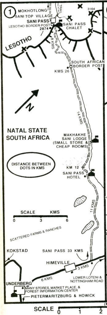
Drakensburg, S. Africa
In the Spring of 2023, a trekking buddy (Mike Stevens) and I explored the KwalZulu-Natal region of South Africa. There we trekked below the Drakensburg Range. The Drakensberg range, (a vital watershed in the dry subcontinent), stretches from the Eastern Cape, near Durban, to the point where Lesotho meets the South African provinces of the Free State and KwaZulu-Natal, (at Mont-aux-Sources at a height of nearly 3,300 meters & Harrismith).
The geology of the Natal Drakensberg is relatively simple because the various rock layers consist almost entirely of igneous and sedimentary types which usually lie horizontally.
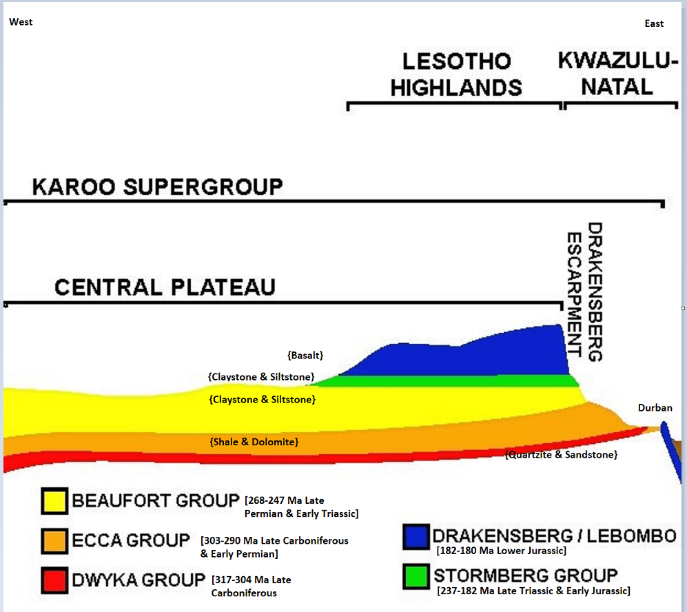
About 180 million years ago and 20 million years after the start of the Jurassic period (208 to 144 million years ago), the tectonic plates of the super-continent of Gondwana, consisting of Africa, Antarctica, South America, Australia and India, started drifting apart.
This resulted in the extension (or stretching) of the tectonic plates, causing magma (molten rock) to flow up onto the surface through rifts in the Earth’s crust in a process called fissure eruption.
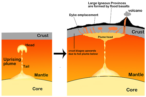
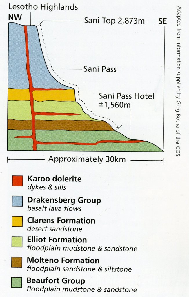
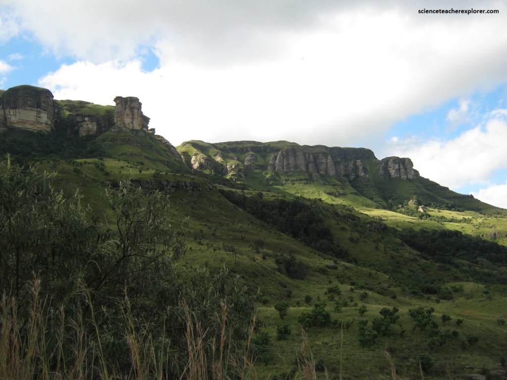
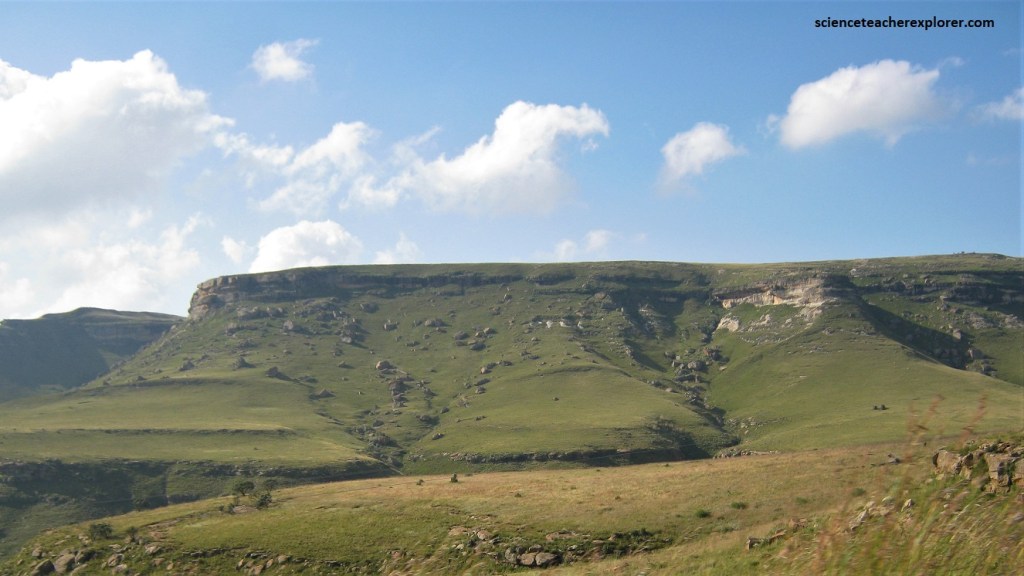
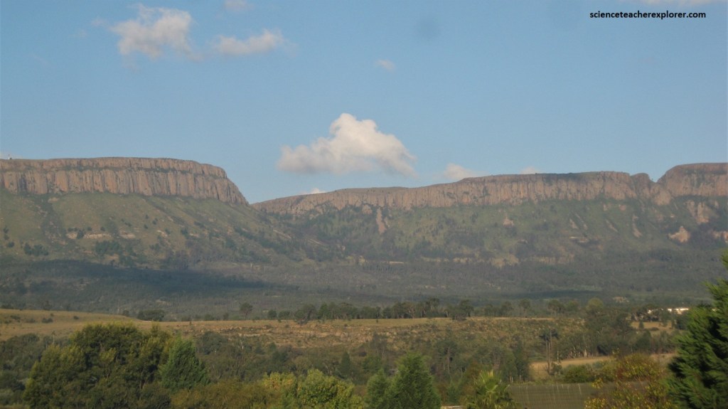
The Drakensberg rifting resulted in a flood of igneous lavas called the Lesotho Formation solidifying to a depth of a kilometer or more over the region now known as Lesotho Highlands. Over millions of years, erosion eventually formed the peaks, passes and valleys which we see today as the Lesotho highlands & the formation of the “Great Escarpment”, (imaged below).
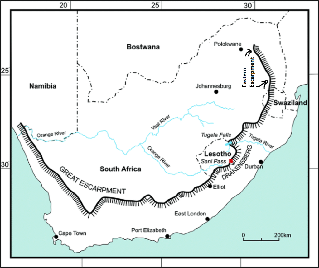
The geologic history of the Great Escarpment, which includes within it the Drakensberg escarpment, provides one of the most scenically impressive continuous rock-walls in the world, extending almost 300 km and reaching vertical heights of over 600 m.
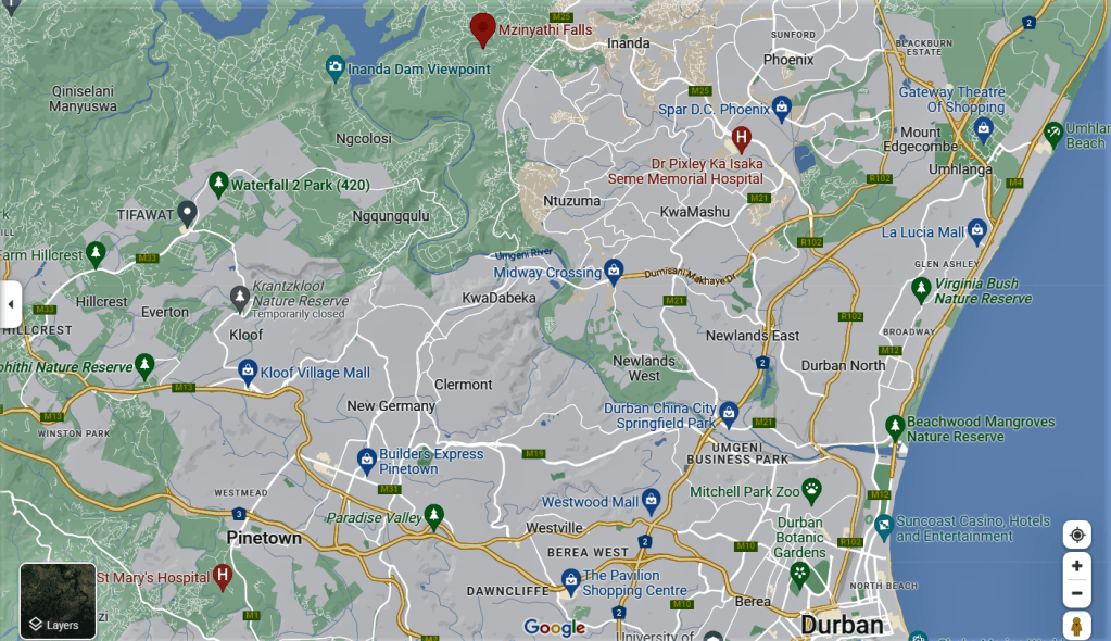
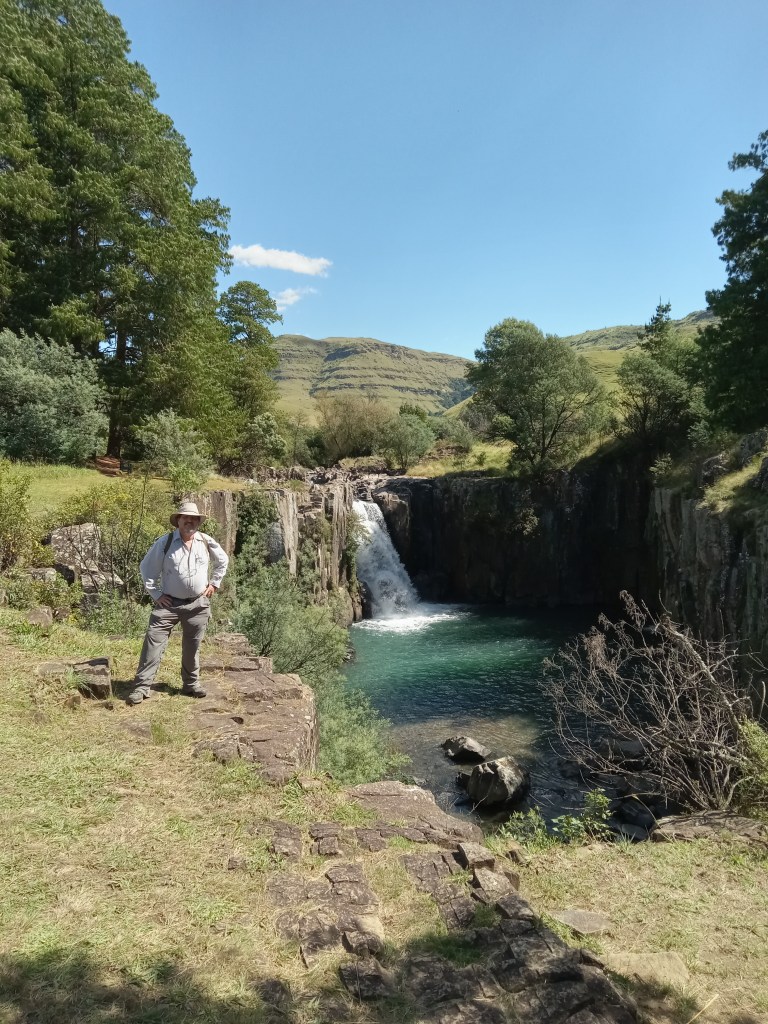
Imaged above, our first trekking adventure was to start in Durban and explore the Mzinyathi Falls. The rocks in the area of Durban form several discontinuous, fault-bounded inliers along the KwaZulu-Natal’s South Coast. The various granites and gneisses were formed 1.2-1.0 billion years ago during the major Namaqua mountain-building event, which created a wide and structurally complex belt along the southern margin of the Kaapvaal Craton.
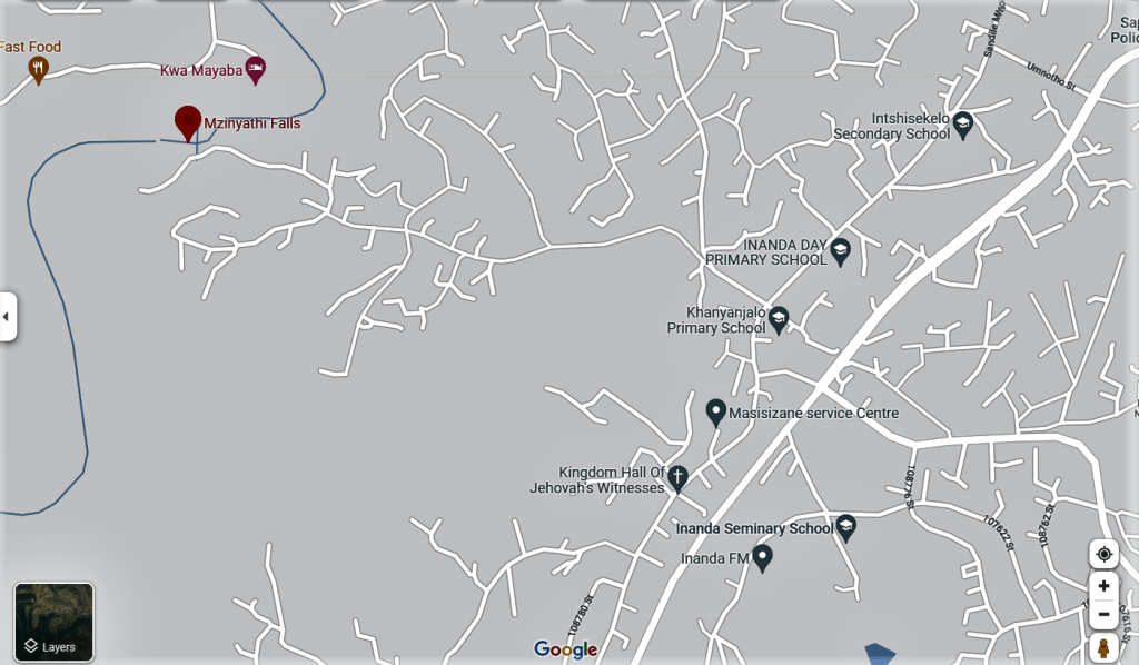
Mzinyathi Falls is little-known site that is a stone’s throw from Durban, (just about 20 minutes from the resort town of Umhlanga north of the city). Yet it gets very few visitors. Access to the falls (also spelled uMzinyathi) is not easy, as the last stretch of the way is a dirt road full of potholes and cracks.
Pictured above, the Mzinyathi Falls is a sacred waterfall used for religious rituals such as the baptism of Ibandla Lama-Nazaretha. The falls and the surrounding area are used by a Rastafarian community that has a very steep and rugged dirt road that offered a beautiful view of the cascade, as the Mzinyathi River plunges 320 feet down into the lush valley below.
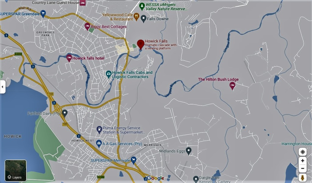
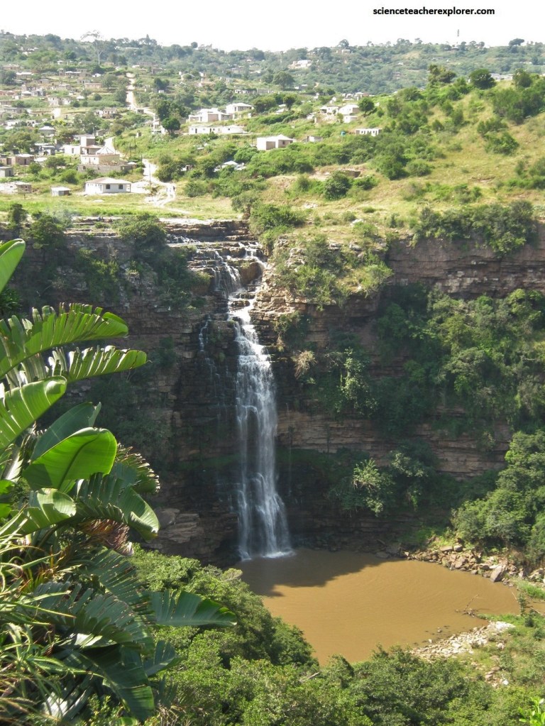
Our next destination was along Highway N3 in South Africa to Howick Falls. Howick Falls’ other name is KwaNogqaza, the ‘place of the tall one’, (for obvious reasons). The waterfall is a 95 meter cascade into a broiling, restless pool and is regarded by the local Zulus with grave superstition, and said to be the place of the spirits of ancestors. Local legend believes that in the pool lives a giant snake-like creature and, probably because of this, only sangomas are safe, close to the falls.
The old wagon road from Durban into the interior forded the Umgeni River just above the falls at Umgeni Waterfall Drift. A village was founded here in 1850; an inn was estabilished and a ferry operated and the village grew into the town of Howick. The geology around Howick is dominated by intrusions of Karoo dolerite that form the higher ground. They were intruded into flat-lying sedimentary rocks about 183 million years ago, at the same time as the Drakensberg lavas were being erupted. The sedimentary rock formations belong to the Ecca Group, the lower part of the Karoo Supergroup.
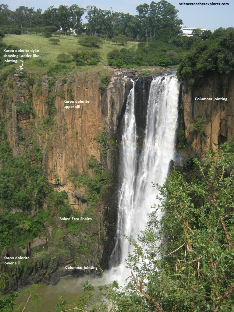
Pictured above, the spectacular scenery around Howick is the result of a dissected landscape, caused by the interplay between harder dolerite sills and dykes and softer Karoo sediments, (the latter baked hard in places by the heat from the dolerite), which was intruded as molten magma into the sedimentary rocks at a temperature of around 1,000 degrees Celsius. The process of weathering and erosion has been accelerated by the high rainfall in the region.
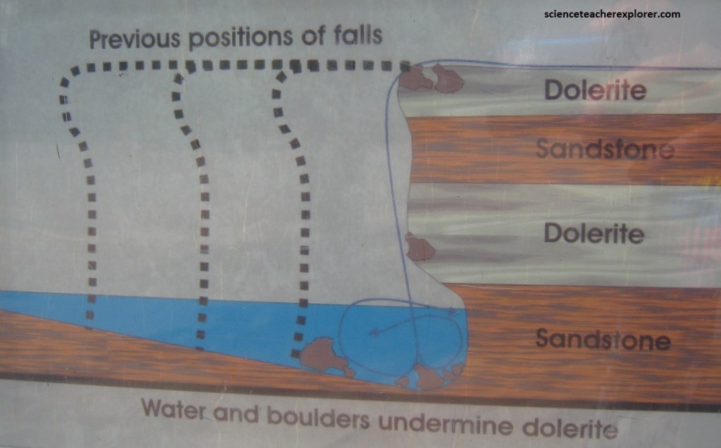
Imaged above, at Howick Falls the Umgeni river plunges 95 meters over a dolerite cliff into a gorge, creating the spectacular waterfall, (formed where strong head-ward erosion by the river was arrested by the more resistant thick dolerite sill), the position where the river has had its erosion profile re-adjusted. In the photo above, note the Karoo dyke that is visible on the far side that is a narrow vertical dolerite dyke that was possibly a feeder channel for the Drakensberg lavas, but postdated the sill. The dolerite sill was formed by molten magma that forced its way into pre-existing horizontal beds of Ecca Shale and some sandstone layers. About halfway down the cliff there is a 25 meter thick, horizontal layer of dark shale that has been strongly baked and hardened by heat from the dolerite intrusion above.
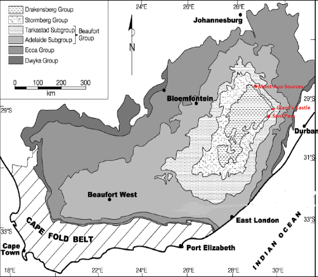
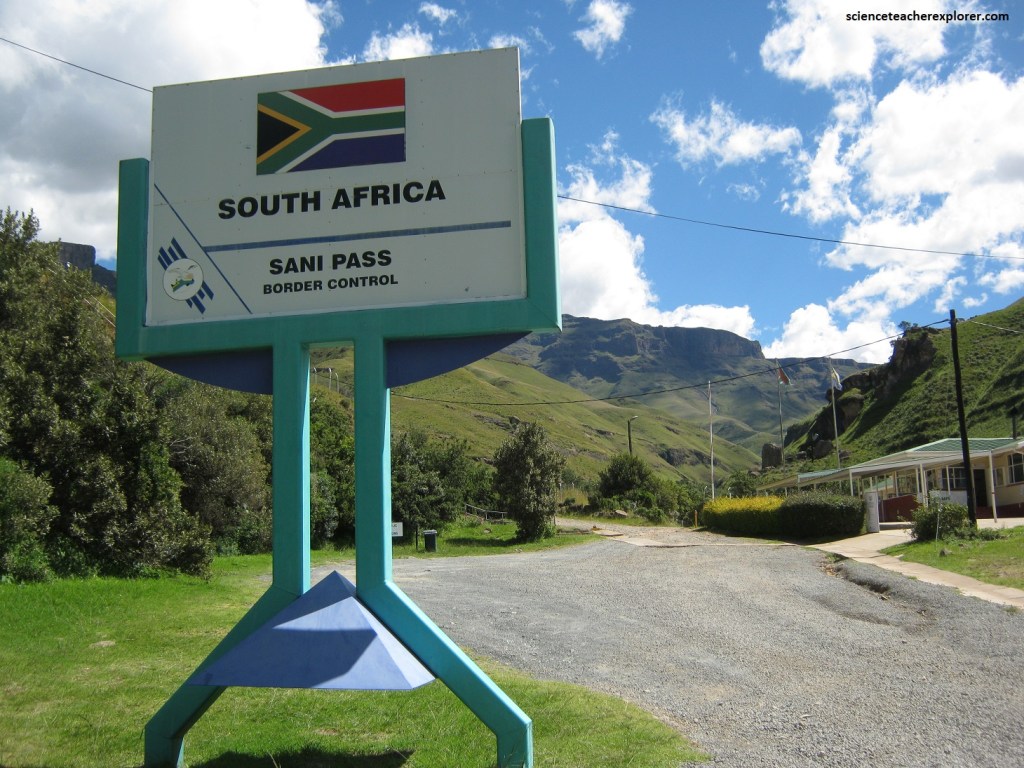
Europeans have known South Africa’s mightiest mountain range for two centuries as the Drakensberg, (the Dragon’s Mountain). To the Zulus the range is known as uKhalilamba, “the barrier of Spears”, a name said to imitate the sound of spears beaten against the great war shields. Both names derive from the impression made by the rocky basalt ridges and pinnacles that tower above the plains of KwaZulu-Natal. In 2000 the region was declared South Africa’s fourth World Heritage Site with the name uKhahlamba-Drakensberg Park. Our next trekking destination was to spend a few days exploring the Sani Pass, the Giant’s Castle & the Mont-Aux-Source regions.
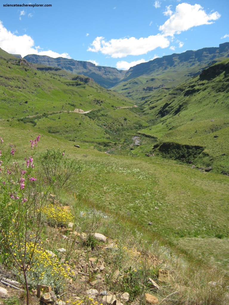
Pictured above, from Himeville, the Sani Pass road climbs through the full sequence of upper Karoo sedimentary formations and Drakensberg lavas to the top of the rugged Lesotho Highland plateau. The pass road starts some 25 km northwest of Himeville at the ruins of the “Good Hope Trading Post”, then passes through the border control post, where a passport is required.
Pictured above, also known as amaNzi’mnyama Pass, this legendary route is South Africa’s most hair-raising mountain road, (the highest, steepest and the most dangerous, rising almost miraculously more than 1,500m over a distance of about 8 km to reach the Lesotho highlands). The Mkhomazana River runs along the side of the Sani Pass road, (note the two groups of Pompas Grass Cortaderia selloana). This vigorous, tussock grass is up to 3,5m in diameter, with flowering stalks up to 4m high. Greyish- or bluish-green leaves with rough margins. Silvery-white feathery inflorescences appears while we were there in March. This grass invades river banks and seasonally wet habitats.
Pictured above with the video; the major feat of road building of the Sani Pass road, ascends the steep wall of the Drakensberg in little more than 8 km, from the valley at 1.350m (at the Mkhomazana Falls) to the Roof of Africa at 2.873m. The pass would originally have been used by indigenous ‘San’ people, an it became a donkey track leading down the escarpment. In the 1930s it was upgraded to a 2.5m wide bridle trail and became a lifeline to the people of northeastern Lesotho. The first motor vehicle to negotiate the pass was a Willy’s Jeep, driven by ex-RAF pilot Godfrey Edmonds in 1948. The hairpin bends were so sharp, and the track so steep and rugged that it took nearly 6 hours of hair-raising effort to complete the journey.
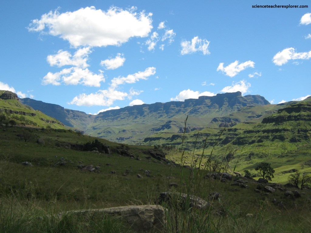
Imaged above, the pass is dominated by basalt lavas of the Drakensberg Group, the topmost volcanic layer of the Karoo Supergroup. These rocks are part of the far more extensive Karoo Igneous Province that covered much of southern Africa. Underneath the lava flows is the sedimentary Stormberg Group, at the top of which is the Clarens Formation.
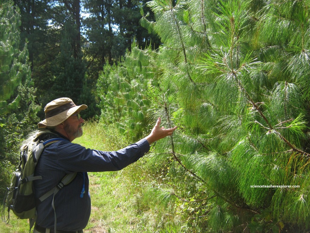
Picture above, Mike Stevens is checking out a Weeping Pine near Mkhomazana Waterfall. The Patula pine Pinus patula is a coniferous tree which grows to a height of 30 m or more and attains a diameter at breast height of up to 1.2 m. It can rapidly invade grassland and shrub land where they can compete with native plants, affect fire and hydrological regimes. They seem common in South Africa, and is an invasive species.
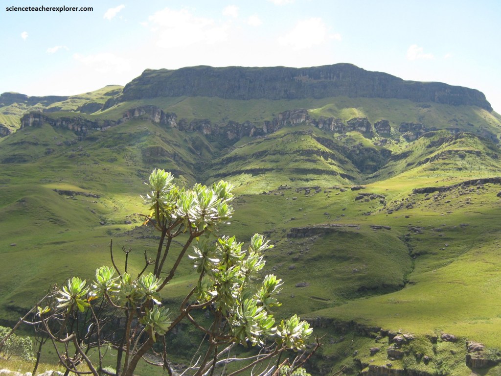
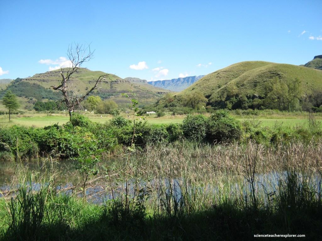
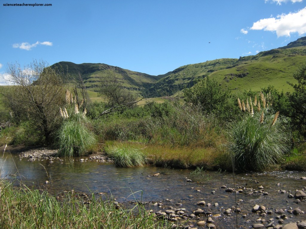
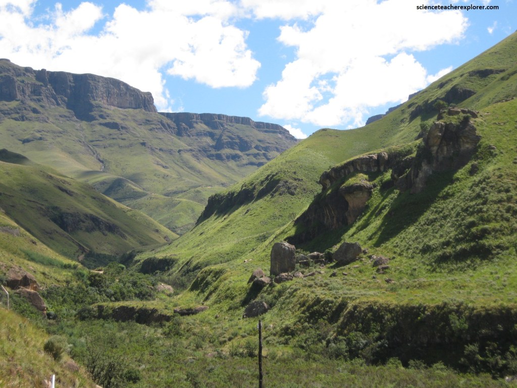
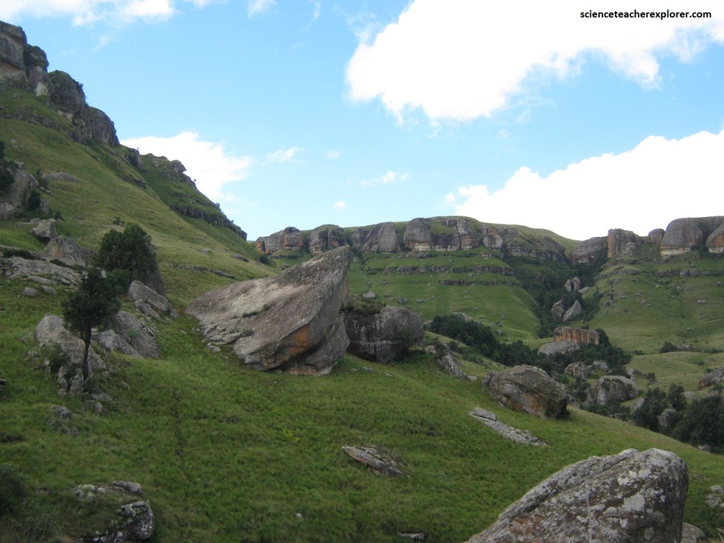
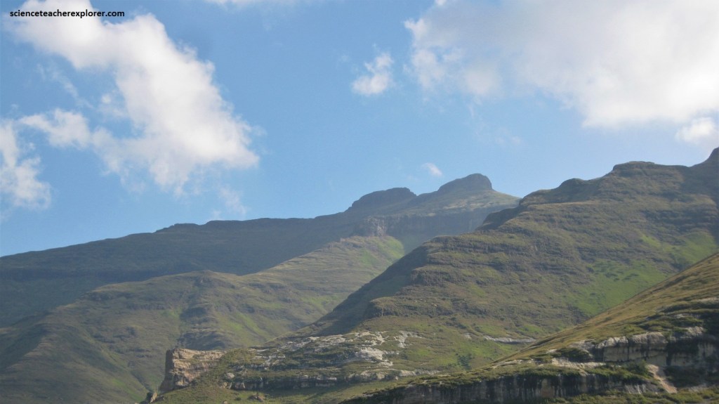
Pictured above, the Sani Pass lies at the head of the strongly incised Mkhomazona River Valley, which has cut back deeply into the Drakensberg Escarpment.
Pictured above, the Mkhomazona River Valley is a demonstration of aggressive erosion along the escarpment, progressively cutting back ever since the break-up of Gondwana.
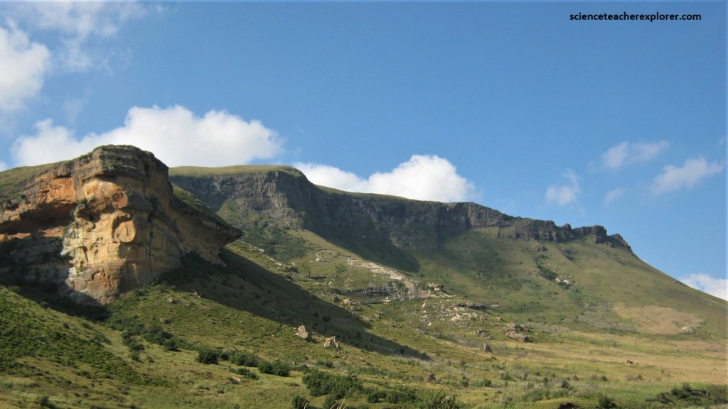
Pictured above, erosion is enhanced here by a dolerite dike that runs northwestwards up the Mkhomazona River Valley and forms the neck at the top of the pass.
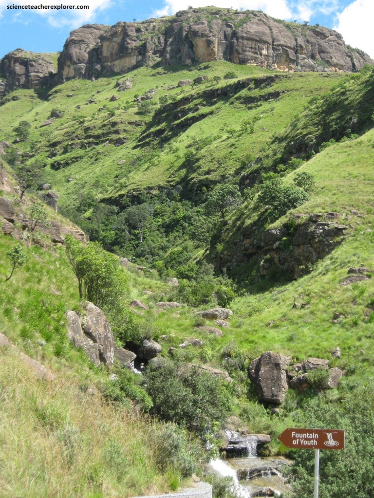
Well-bedded sedimentary rocks, mainly alternating sandstones, siltstones and mudstones of the informal Stormberg Group and upper Beaufort Group, underlie the Clarens sandstone in the incised Mkhomazana River.
Pictured above, Sani Top, at 2.873m, is on the edge of the Lesotho Highlands, a relict of an ancient land surface that predates the major break-up of Gondwana from around 150 million years ago.
Pictured above, the Drakensberg lava is approximately 800m-thick basalt sequence consists of countless stacked lava flows, varying from 30 cm-20m in thickness. The lava flows in the upper part are remarkably similar, constituting he so-called Lesotho Formation, but there is a more variable lava zone at the base. All the basalt lava flows are typically amygdaloidal (contain small cavities filled with mineral deposits). The magma formed in southern Gondwana is known as the “Karoo Igneous Province”. This event coincided with the start of the break-up of the Gondwana Supercontinent. Today there is not much left of the once far-reaching lava that extended from the Drakensberg to the Zambezi in the north, and to Namibia in the west, and there is only the Lesotho remnant to recall the once piled-up accumulation of lava layers that reached up to 1,000m in thickness.
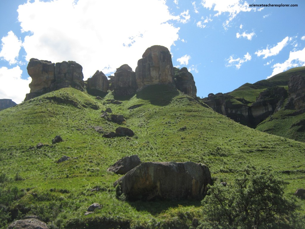
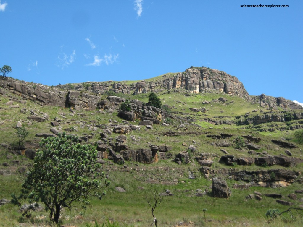
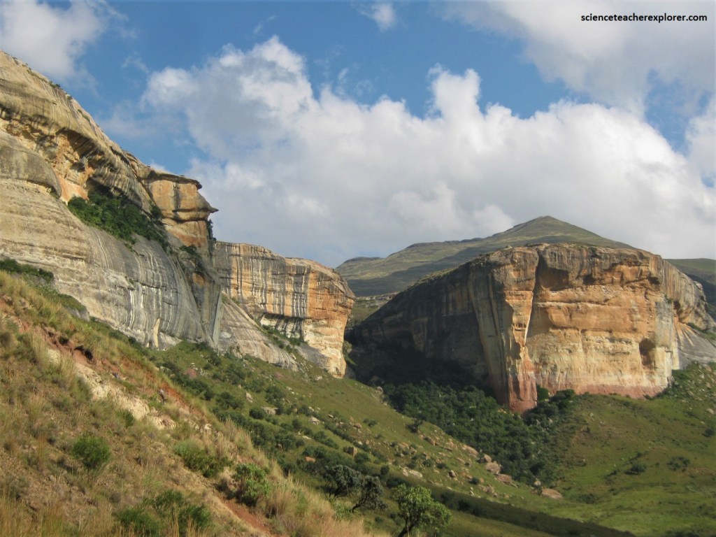
Pictured above, the Clarens sandstone Formation lies beneath the Drakensberg lava and forms a prominent scarp along the sides of the Mkhomazona Valley, similar in appearance to the Little Berg of the northern region of the uKhahlamba-Drakensberg Park. It is fine grained, creamish to pale greenish in color and has the same windblown origin.
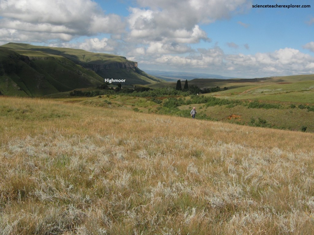
Pictured above, after exploring the Sani Pass, we continued down the Drakensberg Mountain Range to the Moloti-Drakensberg Park along the Highmoor road. Prior to either Europeans or Zulus, the ‘San’ people inhabited the area for thousands of years and have left an incomparable collection of rock art in more than 500 caves scattered throughout the mountains, (especially on the Moloti-Drakensberg Park).
Pictured above, in the proclamation of the World Heritage Site, the rock art was cited as “the largest and most concentrated group of rock paintings in Africa, south of the Sahara” and as “outstanding in both quality and diversity of subject”. The oldest painting is dated at 2,500 years old, while the most recent depict 19th-century scenes of hunters on horseback with guns. The proclamation also recognized the exceptional natural beauty of the region with its soaring buttresses, dramatic cutbacks, and golden sandstone ramparts of the Clarens Formation.
The Drakensberg Plateau owes its existence to extensive basaltic lavas laid down at the end of the Karoo period 190 million years ago. Erosion by rivers rising on this wet plateau has resulted in a massive line of cliffs capped by horizontal lava beds. This is best shown in the Giants Castle Reserve; the rolling foothills abruptly change to steep slopes; these become massive cliffs rising over 3,000m into the sky.
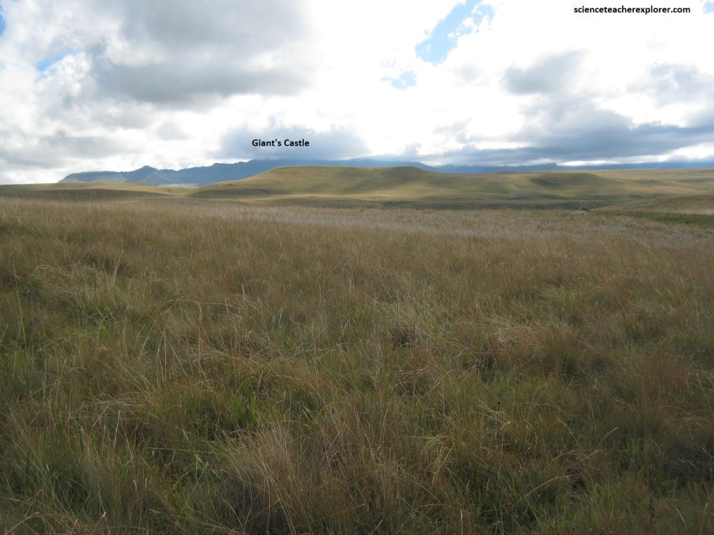
Pictured above, the ‘San’ people believe that dragons lurk there and this gave the Drakensberg its name, (explorers may also see the serrated peaks resembling the back of a dragon). The Zulu name for Giants Castle is “iNtabayikonjwa”, (the mountain at which one must not point). Pointing at the mountain is said to be disrespectful and will result in bad weather, (apparently we met some bad weather the day we were there and was unable to see it).
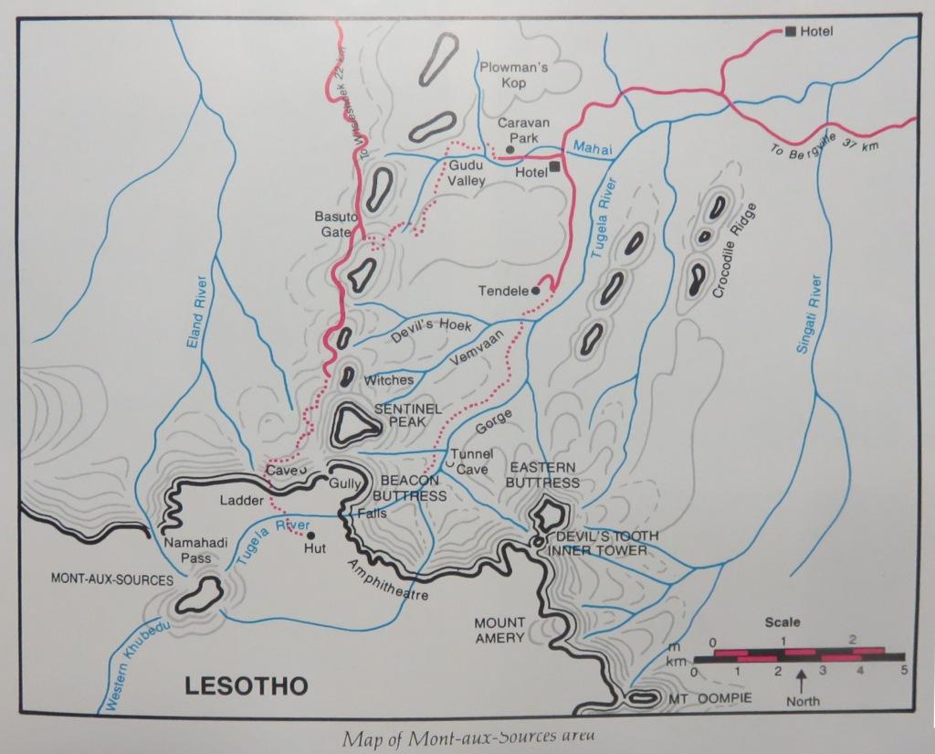
In 1836, two French missionaries looking for the source of te Orange River arrived at a magnificent escarpment near a peak know to the Basotho as “Pofung”, (the place of the Eland). Although the misunderstanding that the peak was the source of the Orange, Caledon, and Tugela rivers has now been modified, the name of Mount-aux-Sources has remained.
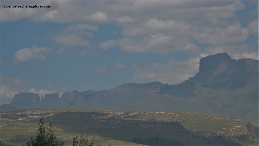
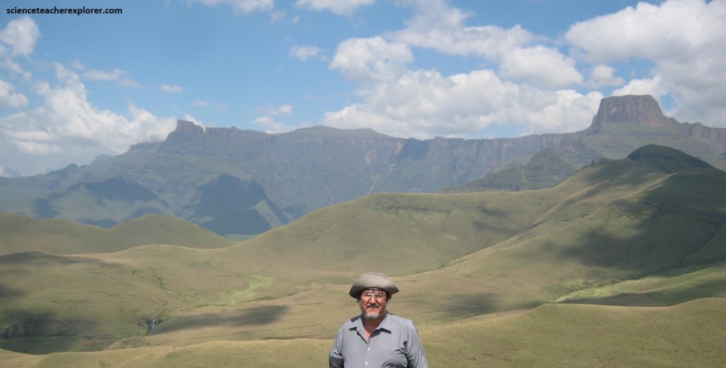
Pictured above, bounded by the Sentinel Peak to the northwest, the Western Buttress to the west, and to the east by the Eastern Buttress and the fearsome Devil’s Tooth (which was not conquered until 1950), the “amphitheatre” rears an awe-inspiring basalt face above the valley of the Tugela River. This giant rock face is 8 km long and 800m high. The amphitheatre is one of the great escarpments of the world, a rock wall flanked symmetrically by two imposing peaks. It is a marvellous exhibition of mountain retreat, (the rapid ‘backwards’ weathering and erosion of a mountain face), typical of the KwaZulu-Natal Escarpment.
Pictured above, the uppermost formations of the Karoo Supergroup are seen here at their best. On top is a pile of basalt lavas, up to 1,500m thick, called the Drakensberg Group, and below that the horizontal and varied sedimentary sequences of the informal Stormberg Group. As mentioned before, geological ages range from around 183 million years for the lavas to more than 200 million years for the sedimentary layers.
There are two landscape domains at the Mont-aux-Sources: the High Berg, which is made of more easily weathered lavas, and the Little Berg, which is topped mostly by massive ramparts of colorful sandstone, (pictured below).
Pictured above, the Clarens Formation makes up the prominent sandstone bluffs below the lavas and does much to enhance the attractiveness of the area. The characteristically cream to yellowish, lichen-covered, fine-grained sandstone layer is typically more than 100m thick and generally massive in appearance. It represents windblown desert sand that accumulated immediately before the eruption of the overlying lavas.
Pictured above, amygdaloidal Drakensberg lava formed as steam or gas cavities within the very liquid lava flows and are usually rounded to irregular but may be pipe-like and branching, indicating upward movement of vapor in very liquid lava.
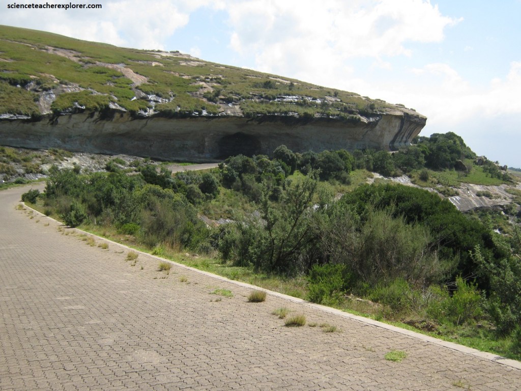
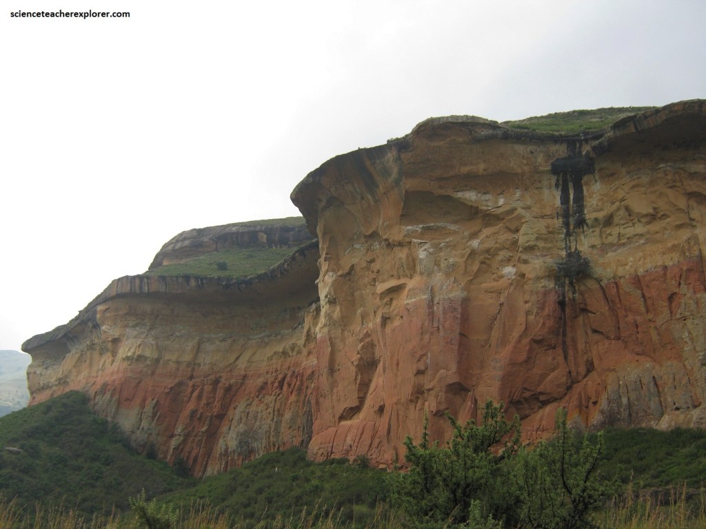
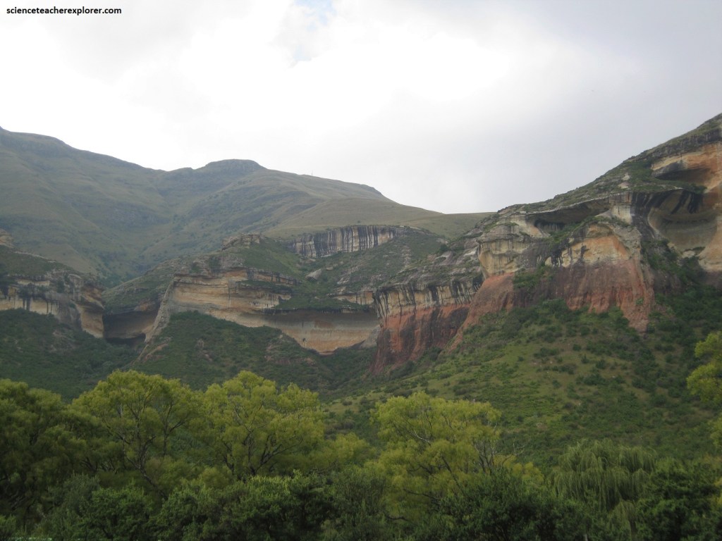
Our next destination, the golden Gate is a striking formation carved into the westward-facing ramparts of the Lesotho Mountains. It is formed from a fine wind-deposited Clarens Sandstone, also called the “cave sandstone” due to the incredible number of caves formed here.
Pictured above, the Clarens Sandstone is naturally colored, but in the setting sun the Golden Gate appears to be on fire, revealing a breathtaking tapestry of red, yellow, and purple hues.
Pictured above, the formations in the Golden Gate National Park represent the uppermost part of the Karoo Supergroup and comprise, from top down, the Drakensberg Group and the upper part of the sedimentary Stormberg Group, which predates the Drakensberg lavas. There are also numerous Karoo dolerite intrusives around 183 million years in age. The terrain is predominantly steep, open montane grassland.
Pictured above, Golden Gate is located at the watershed between the Wilge-Vaal and Caledon-Orange river systems. The extreme climate, (high rainfall, hot summers and freezing winters), has taken its toll on the landforms, resulting in eroded valleys and dissected highlands.
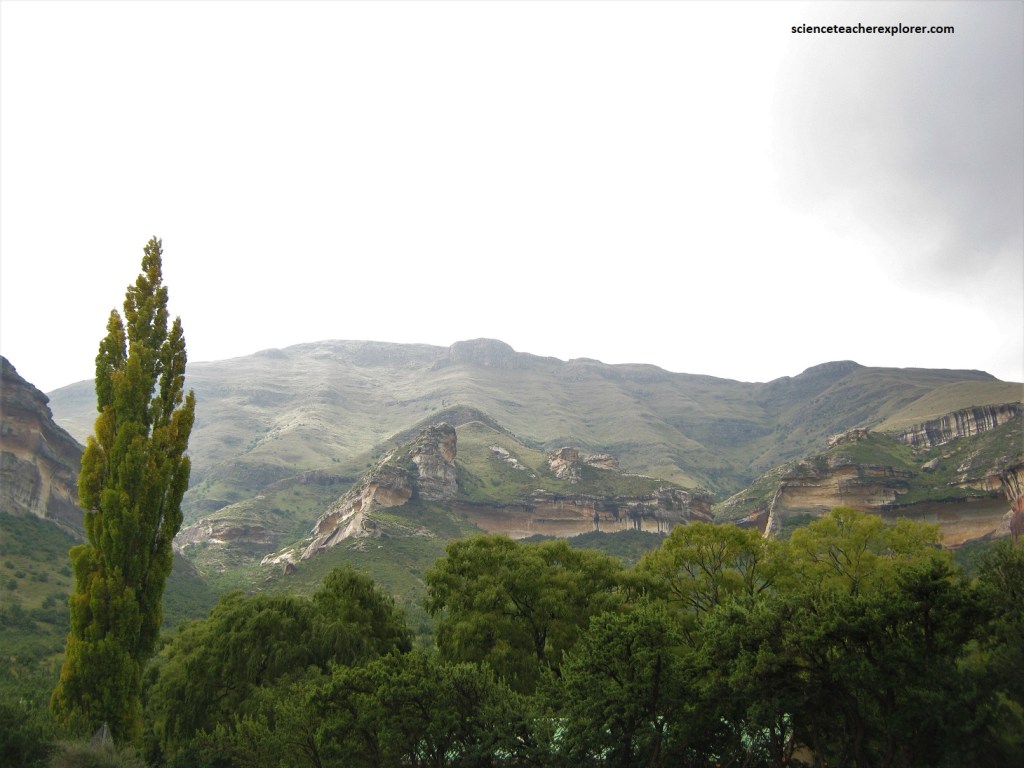
Pictured above, the highest peak is Ribbokkop (2,829m) close to the Lesotho border.
Pictured above, the top of Wonderkopp in the Golden Gate has the Drakensberg Group that is up to 600m of dark grey, amygdaloidal basalt lava flows that make up the high ground and peaks, and have produced blackish soil covered by tough mountain grass.
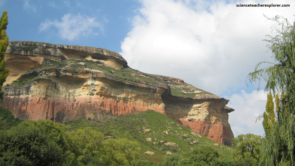
Pictured above, this is one of South Africa’s most iconic landscapes, well known for its impressively colored sandstone scenery, the best of which lies within the Golden Gate Highlands National Park. It is part of the Rooiberg range that forms the foothills of the Maloti Mountains, and is a western extension of the KwaZulu-Natal Drakensberg.
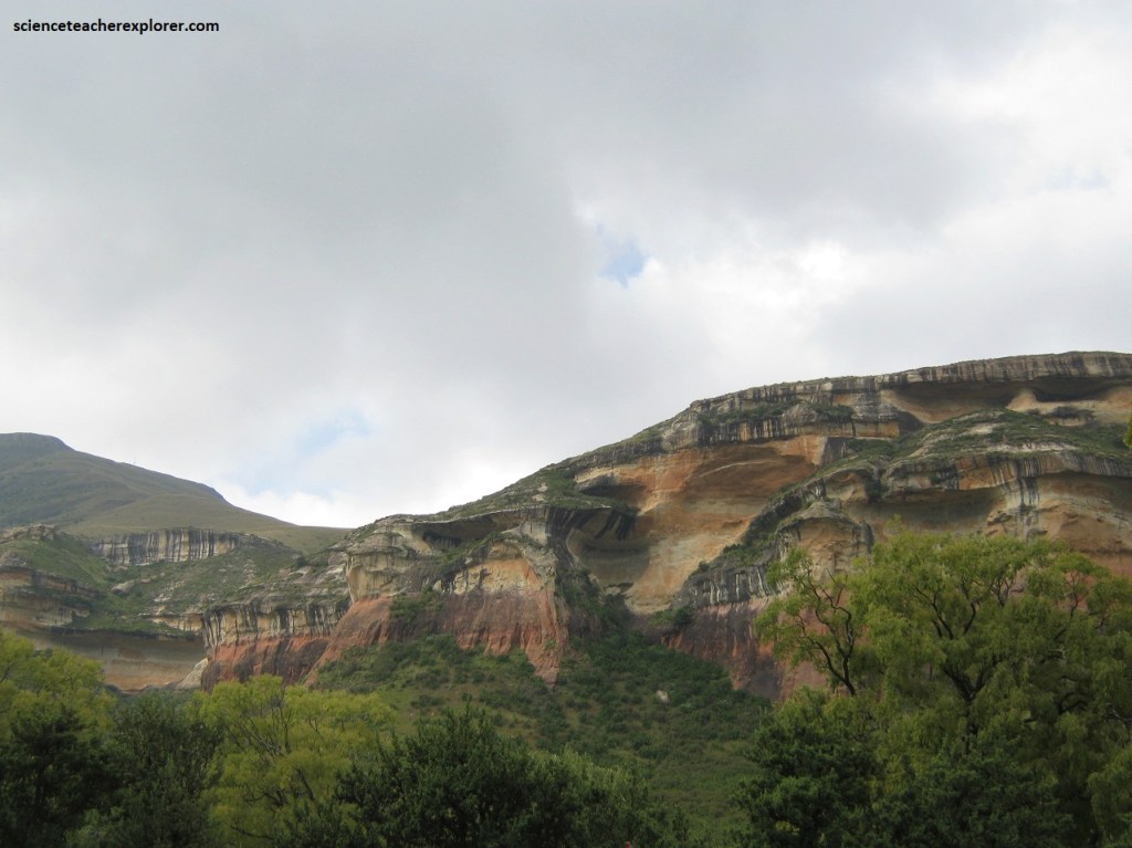
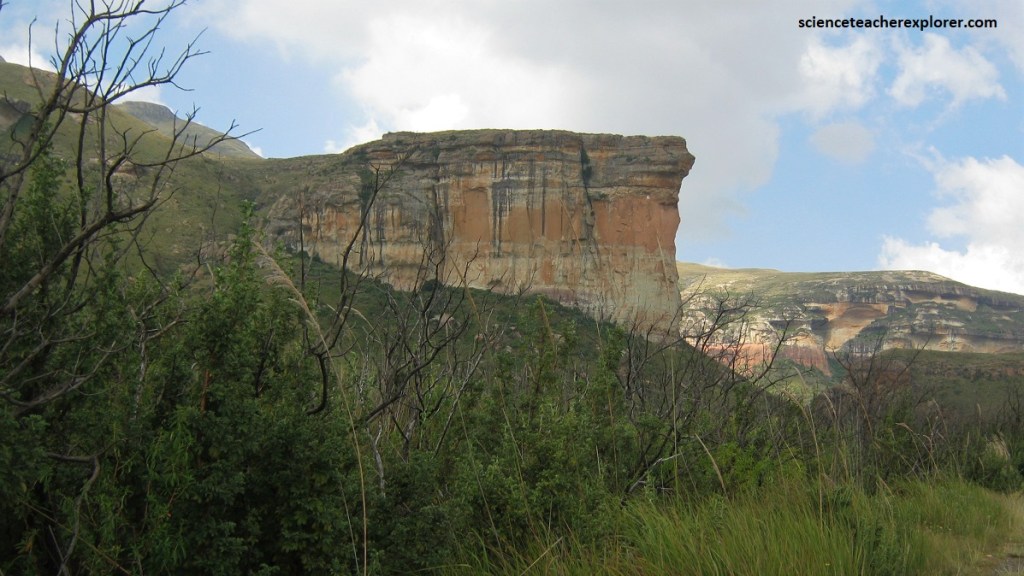
The Clarens Formation cliffs are over 100m high and the layering of the rock can be clearly seen. The more resistant layers actually appear to reach out from the cliffs.
Pictured above, most impressive are the spectacularly colored vertical sandstone landforms, providing textbook examples of weathering and erosion.
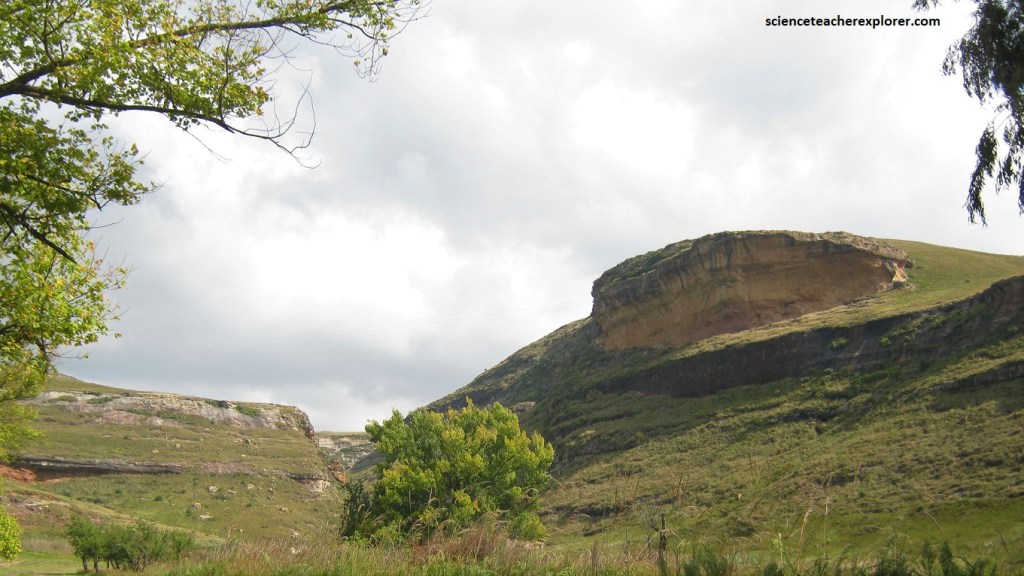
Pictured above, Cave-like overhangs are common, caused by differential sandstone weathering and undercutting.
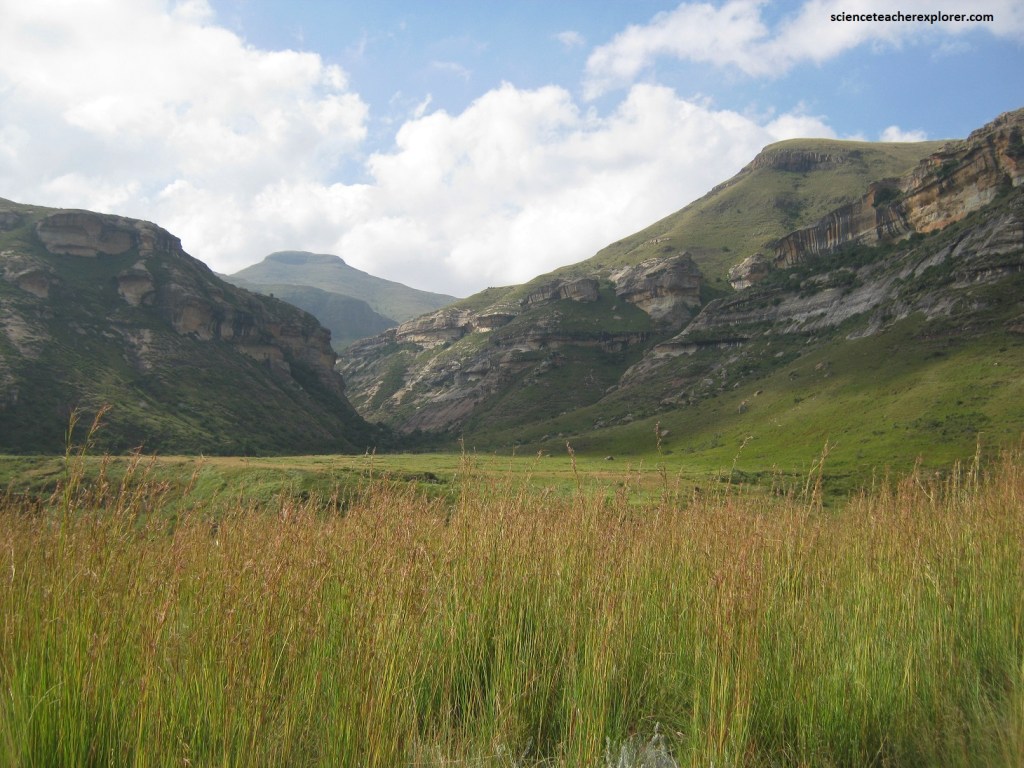
Pictured above, jutting out from the cliffs bordering the valley, is the Brandwag buttress, (a massive block of sandstone shaped like the prow of an ocean liner), is said to be even more spectacular than the Golden Gate.
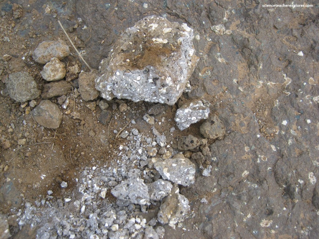
Pictured above, Golden Gate is well known for vertebrate fossils, evidence of life in a rich ecosystem before the entire subcontinent became a desert and was then overwhelmed by flood basalts. In 1977, fossilized eggs were discovered at a road cutting near Glen Reenen Rest Camp, close to the Rooidraal view-site. These eggs are from a large, vegetation-eating sauropod dinosaur known as “Massospondylus” that grew to a length of around 5m, (200 million years ago). Since then, at least 10 more nests containing 34 eggs have been found from the world’s oldest dinosaur communal nesting site.
Pictured above, below the Clarens sandstone, the Elliot Formation is seen only in the ‘lower’ river valleys, (west of the park). It consists of flat-lying beds of red mudstone and siltstone, and lesser, fine-grained yellowish sandstone.
The Elliot Formation was deposited on an alluvial flood plain around 200 million years ago, and in places contains abundant dinosaur remains, including nesting sites and fossil eggs, (explained above).
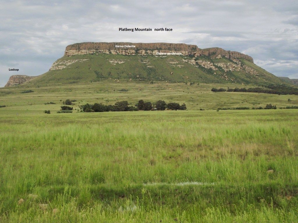
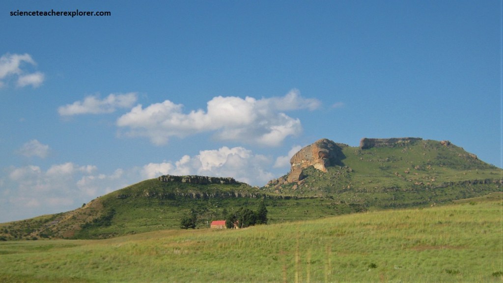
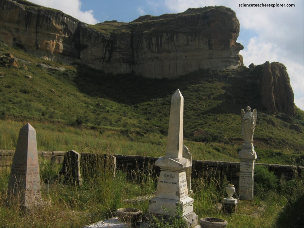
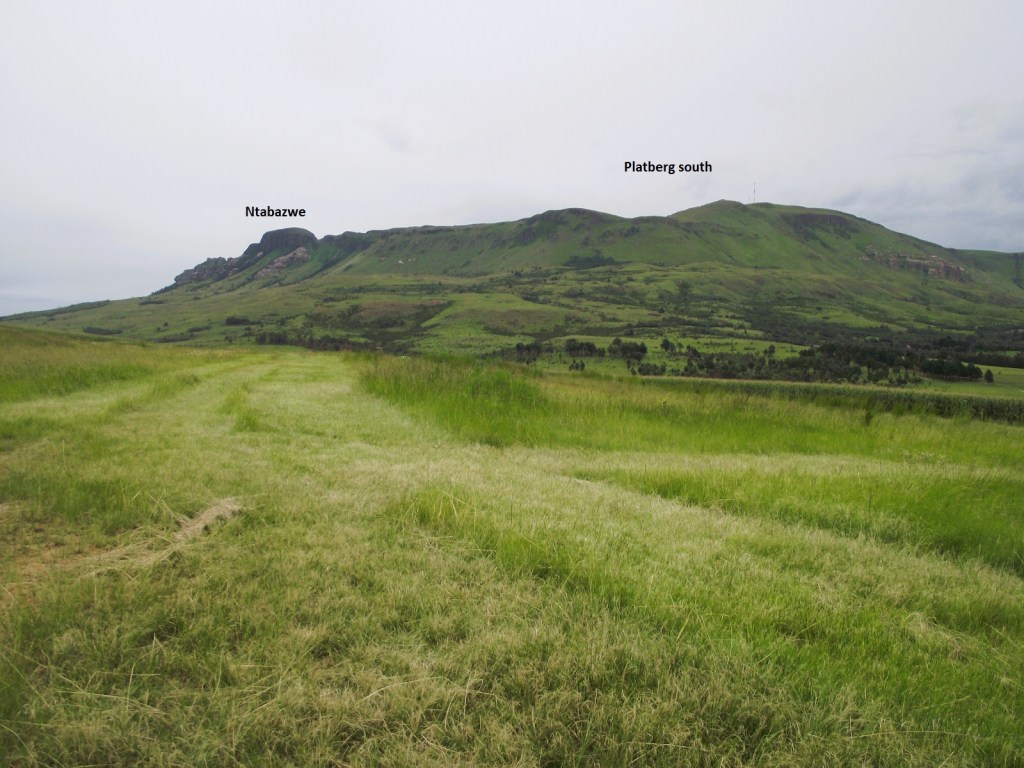
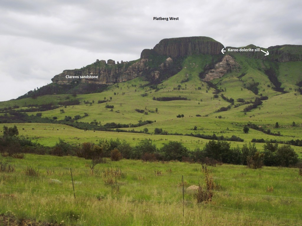
Pictured above, Platberg is positioned at the very top of the Karoo Supergroup. Here a flat-lying, sill-like body of Karoo dolerite overlies whitish sandstone of the Clarens Formation, which is some 190 million years old. Platberg is an inselberg, literally an ‘island mountain’.
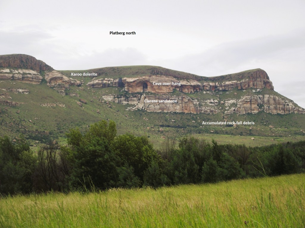
Encircling the mountain is a thick scree slope formed by the accumulation of weathered and eroded rock debris over many millions of year. Pictured above, the Clarens Formation sandstone was o windblown (aeolian) origin and is well known for its overhanging caves, (like in the Golden Gate area).
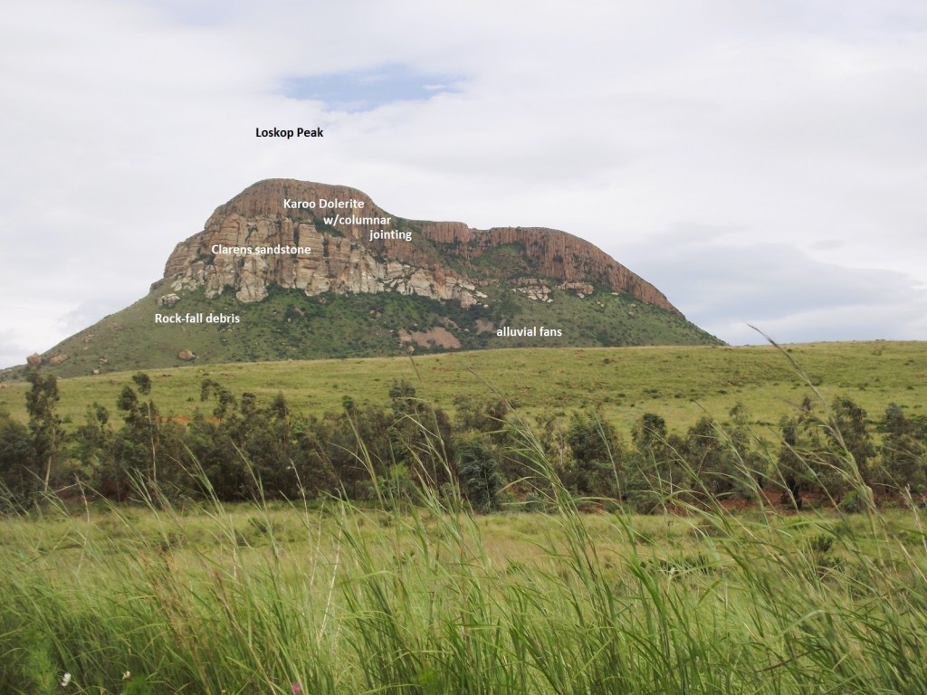
To the northeast of Platberg an isolated hill know as Loskop reveals the marked trasgressive nature of the sill cutting across beds of horizontal Clarens sandstone, providing good evidence of an intrusive origin for the dolerite, (pictured above). Alluvial fans made of collapsed rock debris are shown on the right.
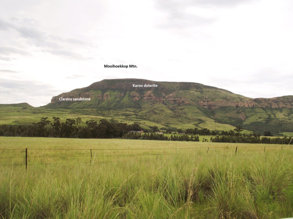
As mentioned, Platberg Mountain is capped by an outlier of Drakensberg basalt lava, as are the nearby smaller peaks of Mooihoekkop to the northeast and Loskop to the north. Platberg shows one of the most impressive occurrences of columnar jointing to be seen in South Aftrica.
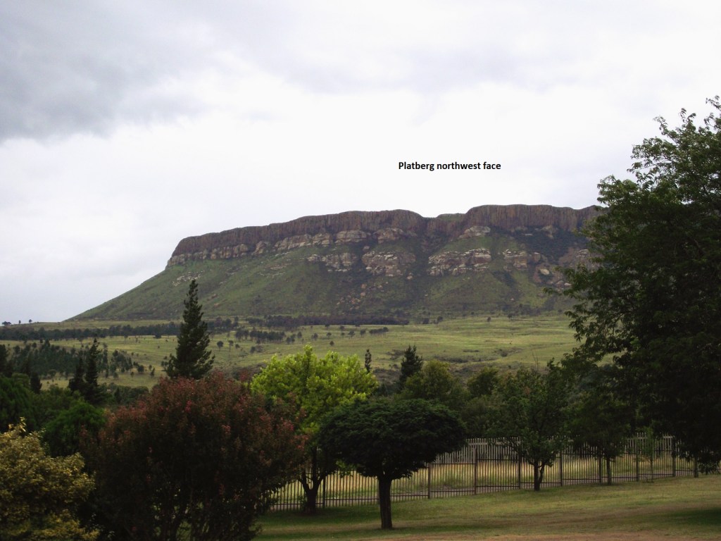
Pictured below, Platberg Mountain is aligned more or less northwest, is about 8 km long, up to 2 km wide and rises more than 500 m above the plain. It reaches a height of 2,395 m above the sea level.
The sill-like, dark capping of the Karoo dolerite is impressively columnar jointed, and is estimated to be up to 40 m thick. This is the same rock type that forms countless sills and dikes in the Karoo and is from the same magma that made the Drakensberg lavas around 183 million years ago.
It is geologically linked to the Drakensberg Escarpment, and is a fine example of a mesa or ‘table mountain’. The surrounding plain has been completely eroded down and is part of the long-live African erosion surface that formed following the break-up of Gondwana, leaving the mountain an isolated inselberg, a mere remnant of an earlier land surface.
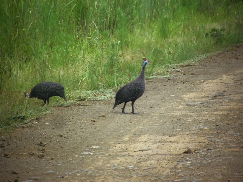
Picture below, is the Helmeted Guineafowl Numida meleagris. We saw it, while driving around the Platberg Mountain. The bare blue head, red crown and light brown casque is diagnostic. They usually forage in the open areas by scratching for food.