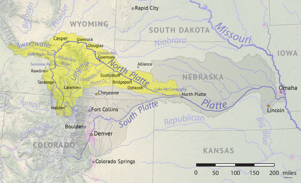
North Platte River
In the heart of Nebraska’s panhandle, where rolling prairies give way to remote, rocky plains, I drove west on US 26, the North Platte-River Road, in the late Spring of 2024.
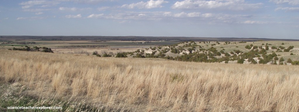
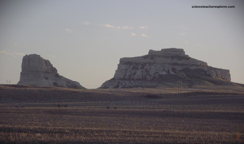
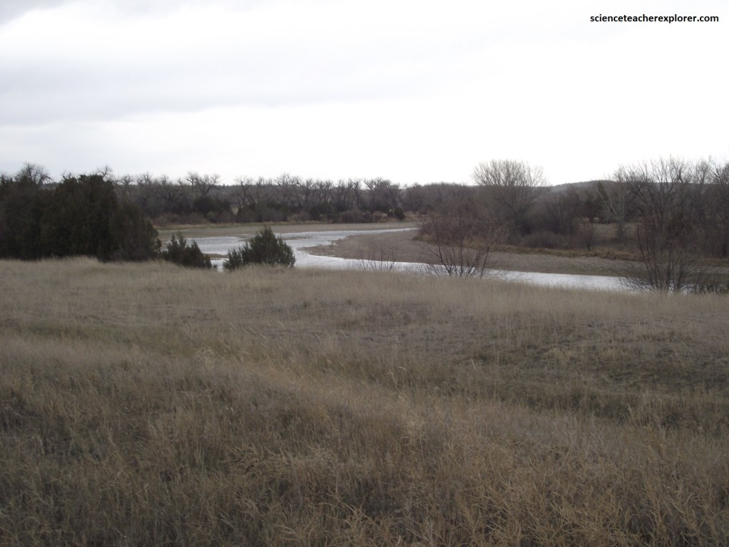
Imaged below, the Platte River has two forks, both originate in the high Colorado Rockies. I drove along the north fork of the Platte. The north fork and the south fork join in western Nebraska and eventually flow into the Missouri River.
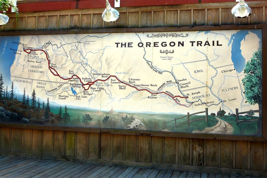
When French explorers tried, and failed, to navigated the shallow Platte River, they understood why the Oto Natives had given it a name that means “flat water”, and they following suit, calling it the Platte. But while this stream did not actually take travelers to the longed-for land of the West, it certainly led them there. In the mid-1800s, when the river was paralleled by the Oregon, Mormon, and California Trails, some 350,000 pioneers made their way across the Nebraska Panhandle during the greatest westward migration in America history. I followed them in spirit on the Platte River Road, US-26/92.
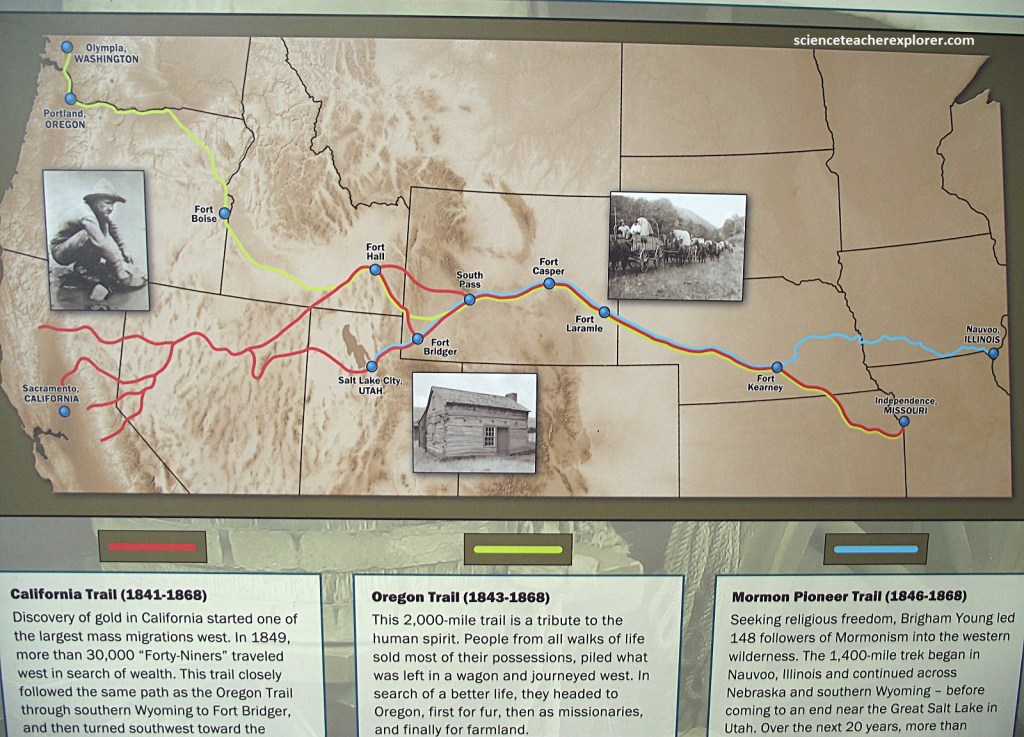
My plan was to explore/drive the pioneer trails next to the North Platte River, Ogallala Nebraska to the Scotts Bluff National Monument. Then continue on into Wyoming, following the North Platte River, past Fort Laramie to Independence Rock.
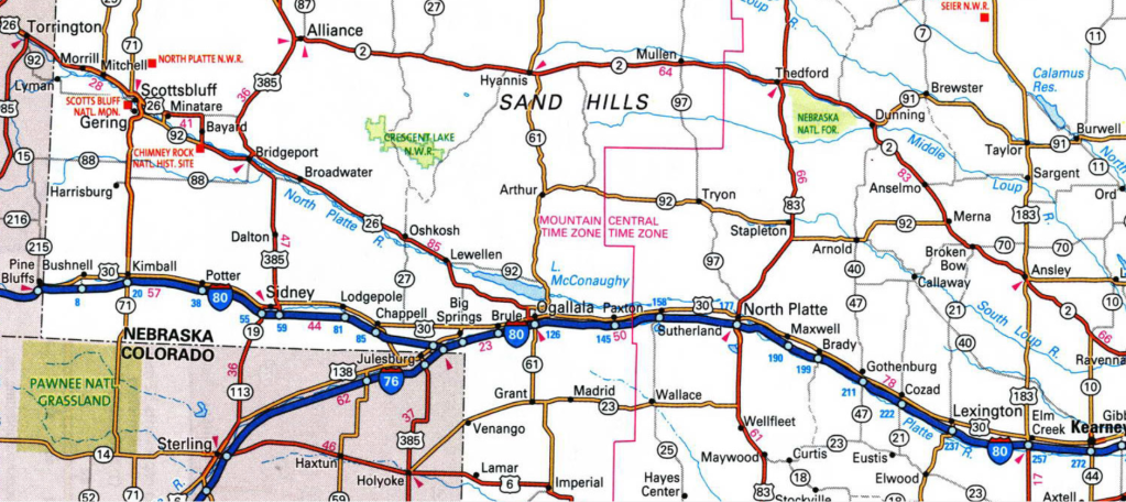
Image below, for generations Nebraska’s Platte Valley provided a natural east-west travel route for native peoples, fur traders, explorers, emigrants, and the military. The first known passage by white men along the Great Platte River Trail in the Keith County vicinity was in 1813. Robert Stuart and a part of fur traders were returning east from Astoria on the Pacific Northwest Coast.
The Astorians were followed in 1820 by Major Stephen Long’s exploring party that ascended the Platte and South Platte to the Rocky Mountains. In 1830 fur trader William Sublette led the first wagon caravan along the Platte to the trappers’ rendezvous in Wyoming. His trek proved that wagons could cross the mountains, showing the way for thousands of overland emigrants to come in the 1840s and 1850s.
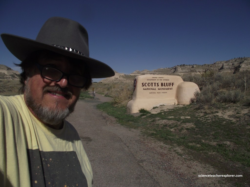
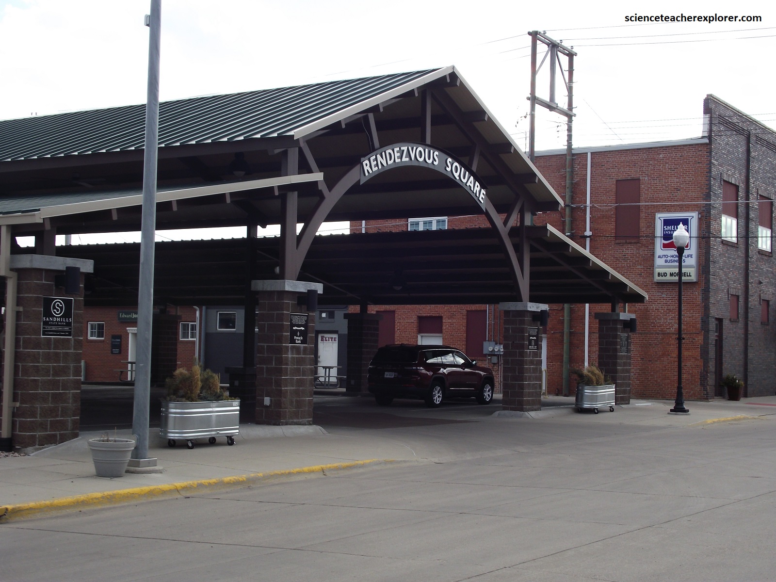
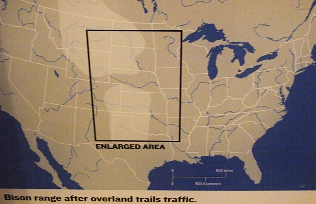
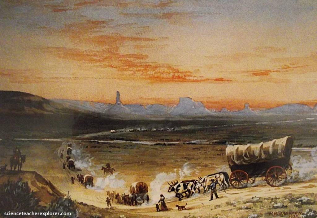
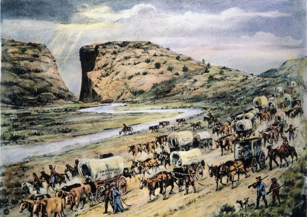
They called it the, “Gomorrah of the Plains”, and with good reason. Located at the end of the long, lonely Texas Trail, Ogallala was the place where rowdy cowboys were finally able to let off some steam. Pictured below, the town was so godless that “amongst its half hundred building, no church spire pointed upward. Though the Ogallala of the Old West was certainly no place for women and children, the town of today off a delightful family fare. {Images below were found and taken in Ogallala, Nebraska 2024 }.
Just a short drive north from Ogallala, Lake McConaughy, (with more than 161 km of sandy shore and 35,000 acres of clear, deep water). Lake McConaughy, formed by a dam, (Kingsley Dam), across the North Platte, is the largest body of surface water in Nebraska. The reservoir provides water for irrigation, flood control, power generation, and recreation. The extensive sandy beaches developed from erosion along the shoreline of the sandy sediments that surround the lake, (the Sand Hills along the north side and the Ogallala group along the south side). The Ogallala group, the last sheet, (from three), of sediments to spread over the plains at the end of Tertiary time. These sediments are mostly sands and some gravels, punctuated by infrequent volcanic ash beds, (the ash originated from eruptions far to the west). Most of these sediments come from the Laramide orogeny, producing the Laramie Mountains of Wyoming, the Front Range of Colorado, the Black Hills of South Dakota, and other uplifts that formed the present-day Rocky Mountains.
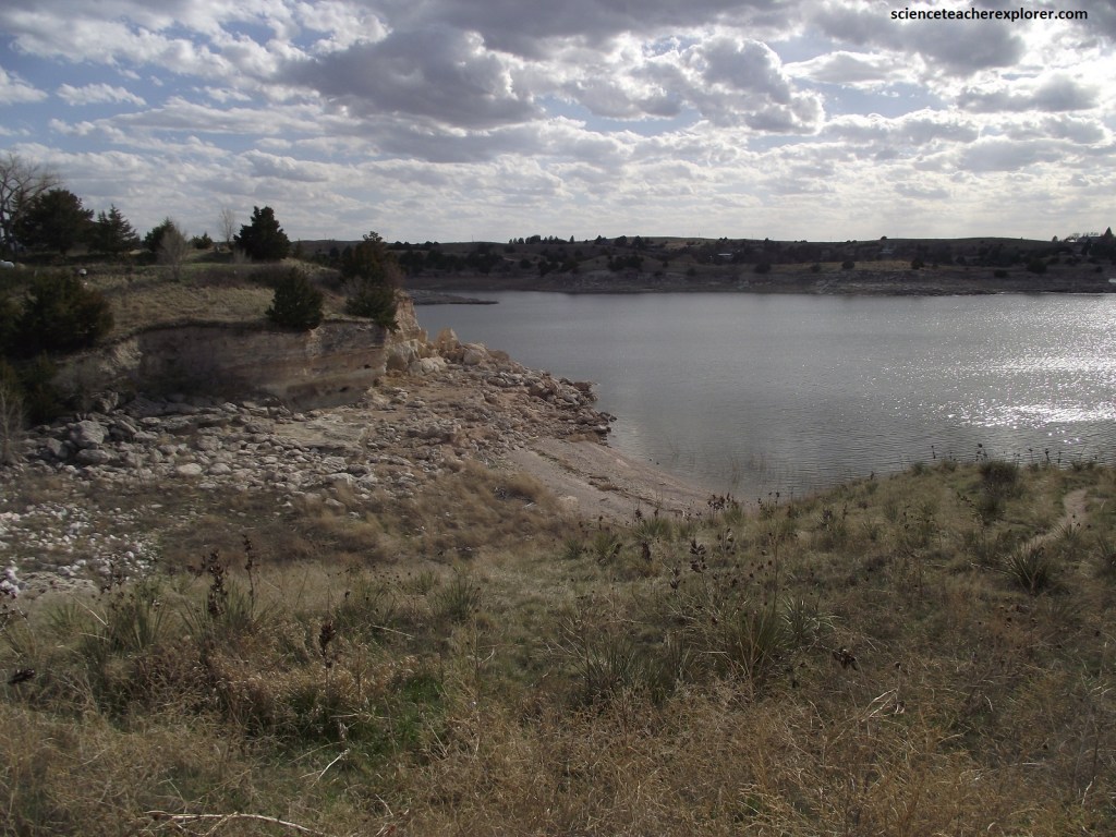
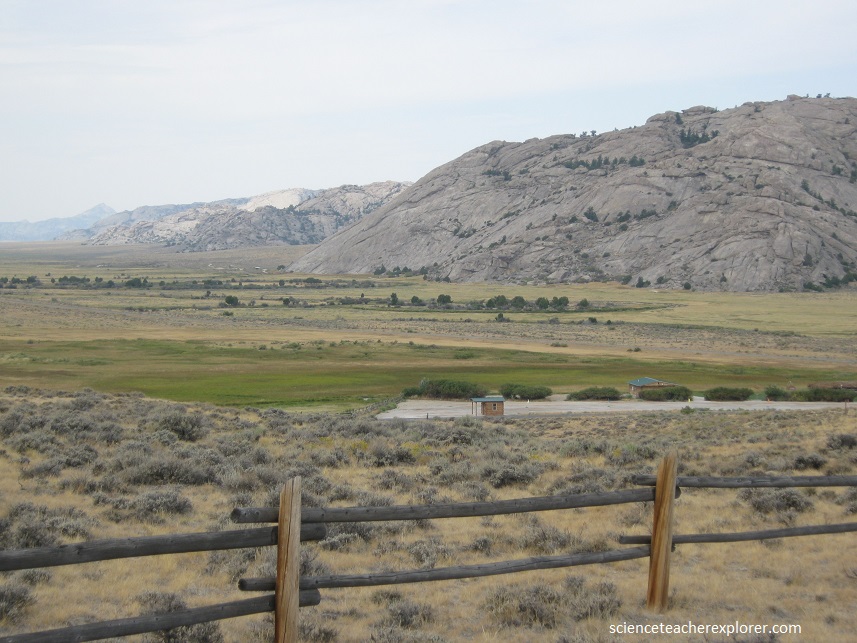
Following US 26 west of Ogallala took me up onto the Gangplank surface. The Gangplank is a high, smooth, and very gently sloping surface between the South and North Platte Rivers, and the portion of US 26 just south of Lake McConaughy is one to the best places to see it. Here, the surface is also known as the Cheyenne Tableland. US 26 climbed up to the Gangplank from the Platte River floodplain near Ogallala gulch, which is cut into the sediments that form the surface. Ogallala gulch may have served as a spillway for Lake Diffendal, (the earlier natural lake of Lake McConaughy) some 10,000 years ago, so that when water levels were high enough, water flowed over the divide and into the South Platte River.
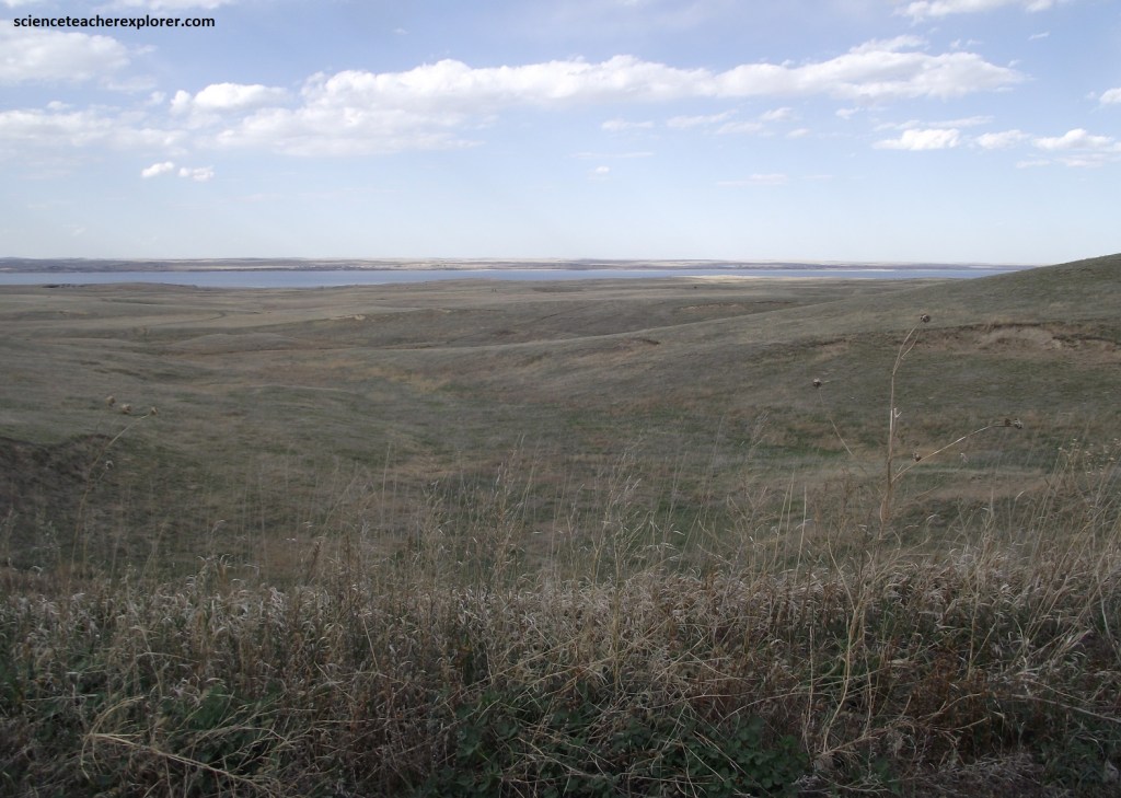
Picture above, US 26 reaches a remarkably flat area. Here the Gangplank surfac is especially well preserved and is more easily noticed A few million years ago, and especially after about 600,000 years ago, the overall sedimentary dynamics of western Nebraska changed from accumulation of sediment, (the Ogallala Group), to an erosion-dominated system.
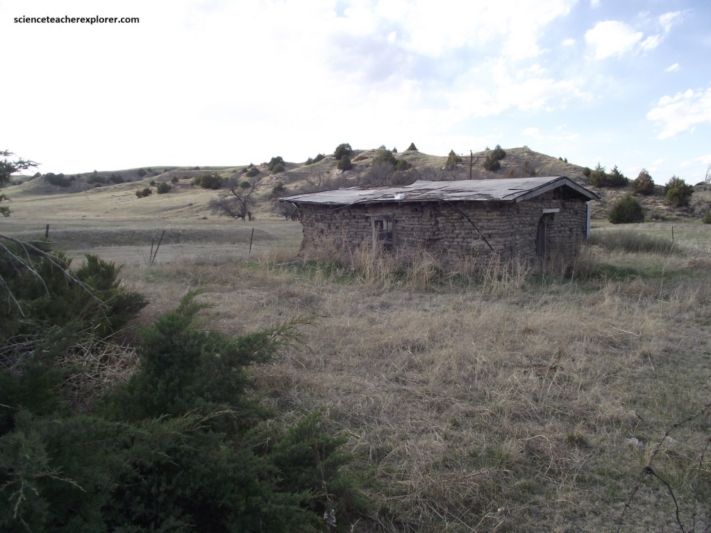
Ash Hollow is a small north-south drainage that empties into the North Platte River near the western end of Lake McConoughy. The trail descens from the Gangplank through Ash Hollow to the welcoming ribbon of riparian vegetation and the sustenance of the North Platte River. Windless Hill was the steepest part of the decent, and easing loaded wagons down this stretch required caution and considerable nerve. Pictured above, the stones surrounding the area are the remains of the homestead dwelling of Reverend Dennis B. Clary, a pioneer Methodist Minister, who received final patent for his homestead in 1899. Using a horse drawn cart fashioned from available materials, he hauled stone to this site for a two room house. For years this was a land mark in Ash Hollow and marked the location of Windlass Hill. It was a popular stopping place for settlers traveling from the North Platte Valley area to the railroad at Big Springs, some 32 km to the south.
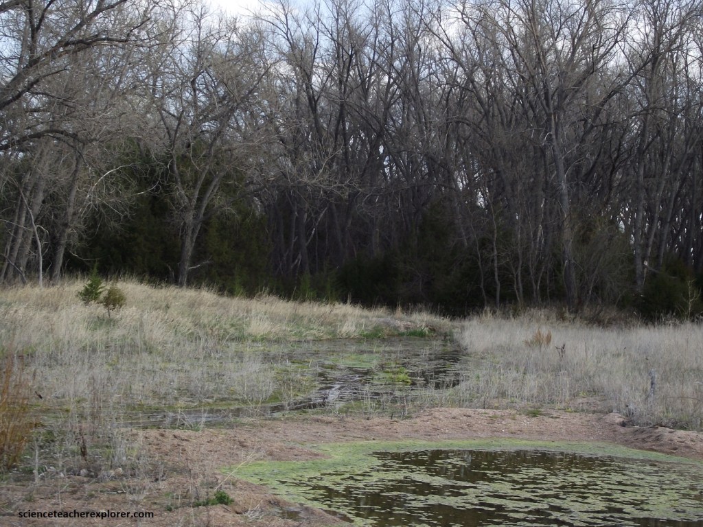
For some 6,000 years, spring water has drawn visitors to this oasis on the plains. Traces of their presence remain throughout the 1,000 acre of Ash Hollow State Historical Park, which is named for its shady ash groves. Near the visitor center is a rock shelter that served as a native campsite for 3,000 years.
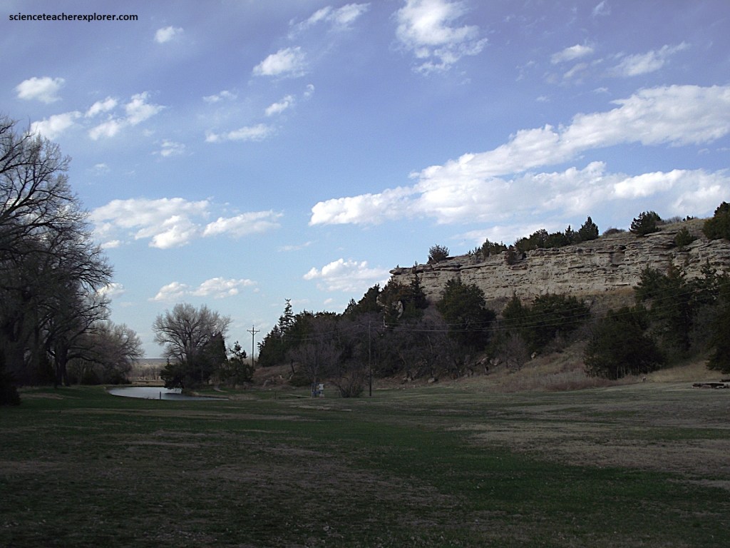
Pictured above, the Ash Hollow bluffs are carved into the Miocene-age Ash Hollow formation, which is the youngest formation in the Ogallala group. Capping some of the bluffs and forming very distinctive ledges are resistant horizons that are typically several feet thick. The multiple ledges of the Ash Hollow formation paint a picture of a cycle of deposition in a fluvial channel or floodplain environment followed by a prolonged period of stability, (probably thousands of years), during which time soil formed in the surface material. Fossils of camels, rhinoceroses, and archaic elephants occur in the Ash Hollow formation. 4 or more volcanic ash lenses that originated from volcanoes far to the west are interbedded with the Ash Hollow strata in this area. Two have been dated at 8 & 6.8 million years by fission-track methods. The 2 samples are separated vertically by 40m, and suggest a long-term sediment accumulation rate within the Ash Hollow formation of 33m/million yrs..
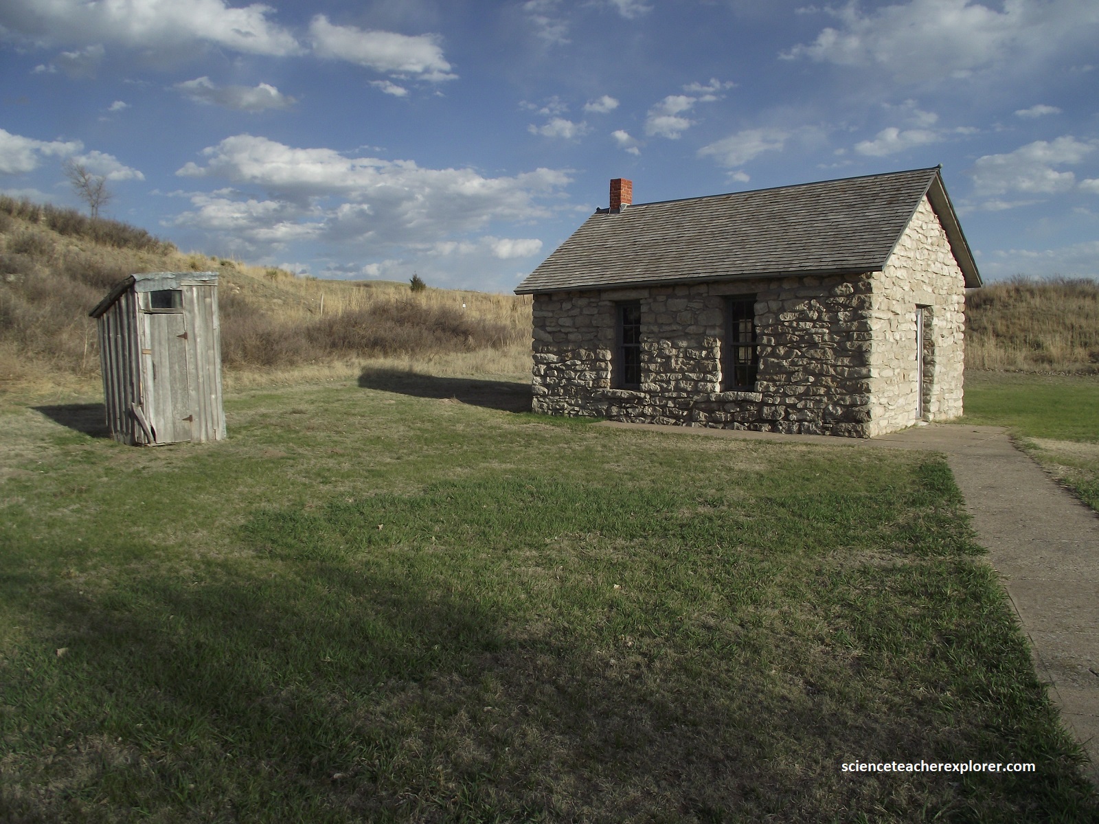
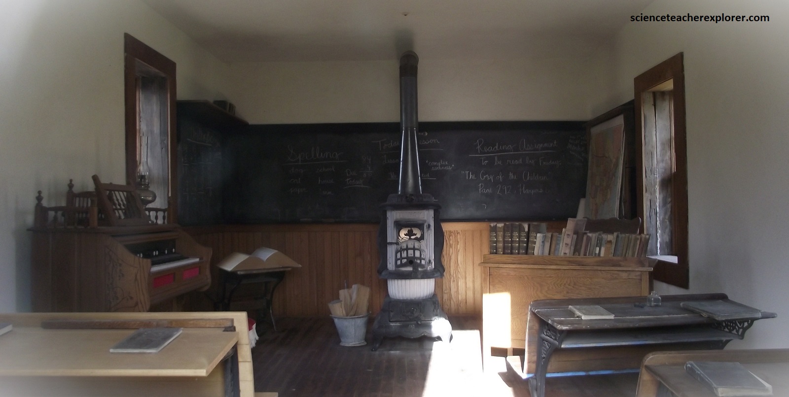
Residents of the district 55 built this stone Ash Creek Schoolhouse in the summer of 1903. rock quarried from the nearby hillsides was hauled in and laid in lime and sand mortar. A nearby rancher donated the quarried lintels above the doors and window. This building, pictured above, replaced an older sod schoolhouse located east of Windlass Hill. From 5-12 students attended this school in the years from its construction until 1919.
US 26 descends through Ash Hollow, then crosses the North Plate River floodplain, (pictured above). Continuing northwest, cross over the North Platte River, which parallels US 26 as the road heads westward across the prairie. (Nourished by snowmelt from the Colorado Rockies, the 1,0711 km long river merges with it’s smaller sibling, the South Platte, to form the main-stem Platte River in central Nebraska.)
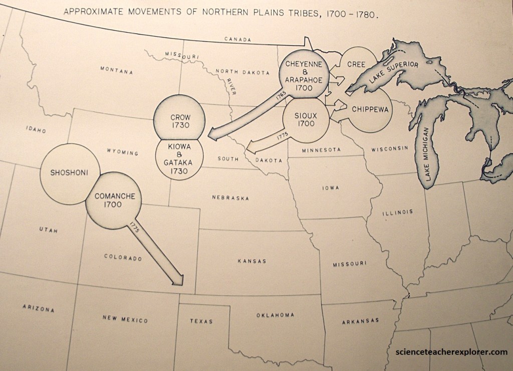
The Great Plains is a place of unlimited solitude and abundant plant and animal life. Woven into this place of fragile beauty is a long history of human occupation. This wealth of natural resources attracted the first humans to the Northern Plains nearly 12,000 years ago and sustained them for generations.
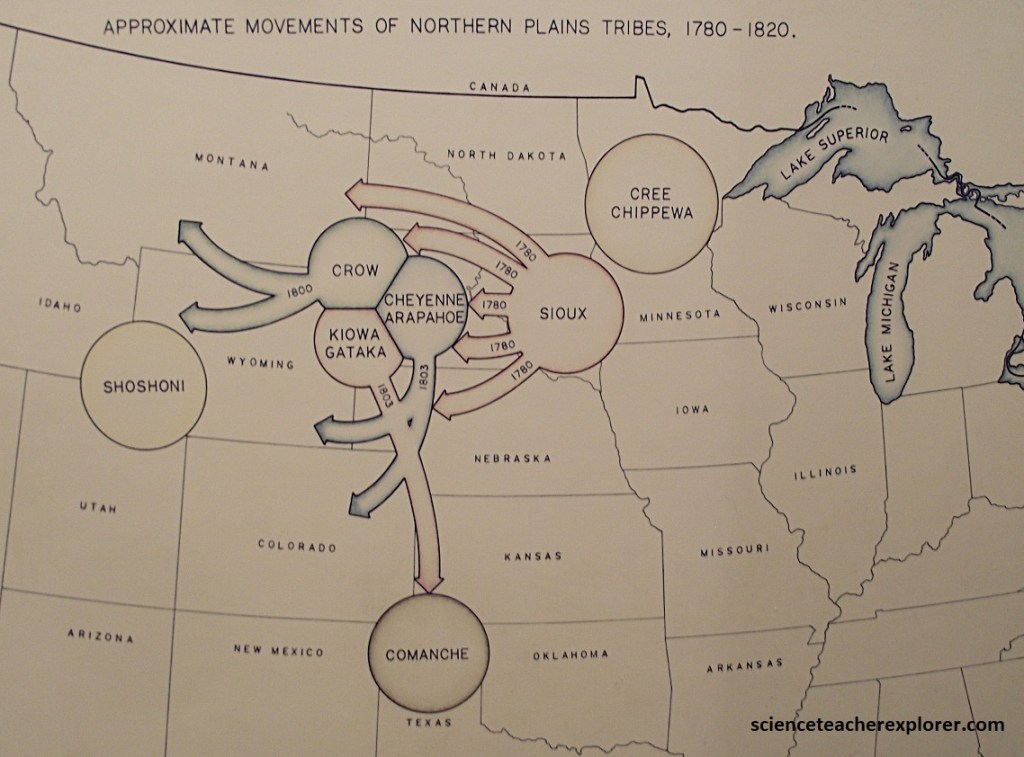
Contact with Europeans brought rapid, dramatic change to the cultures of the Northern Plains. Acquisition of the horse in the mid-1750s made the native peoples more mobile and efficient users of the land and its resources.
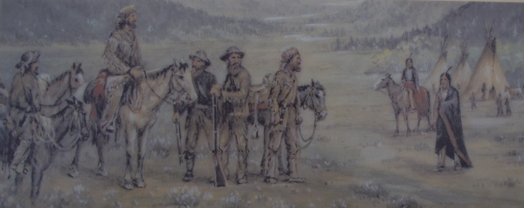
Following the Louisiana Purchase in 1803, Thomas Jefferson sent the Lewis and Clark Expedition to map the land and catalog the natural wealth of this vast acquisition. New of these abundant resources motivated fur trappers to penetrate this region in search of fur bearing animals. After 1812 successively larger groups of trappers ventured into the Northern Plains and Central Rockies. Contact with these trappers accelerated cultural change amoung the native peoples and created an insatiable demand for European trade goods. The hey day of the fur trade set the stage for the interaction of two very different cultures.
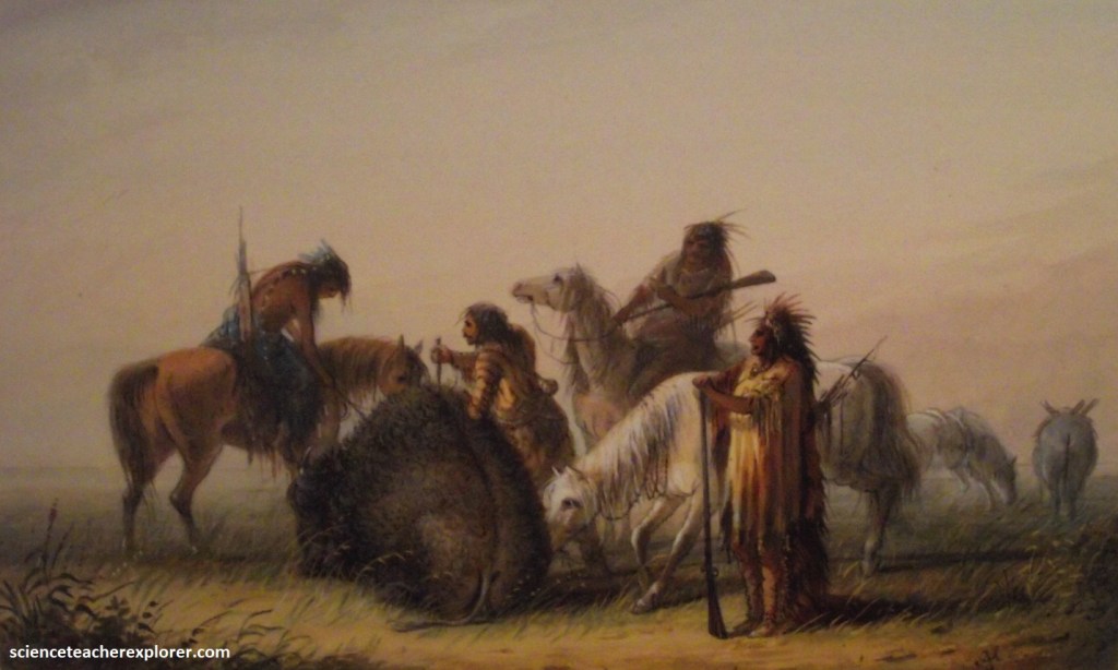
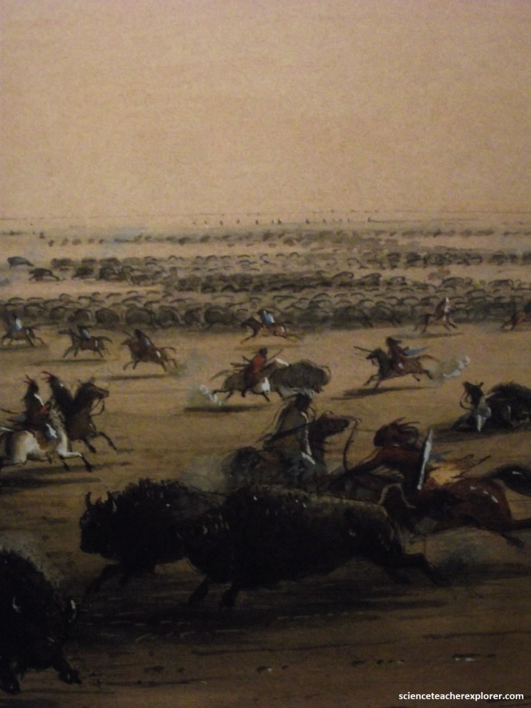
Bison and other wild animals made the first trails through the North Platte River Valley. American Native followed their pathways for travel hunting, and carrying goods and information throughout the west. Like American Natives, fur trappers and traders relied on the North Platte River as a transportation route. The river widened and narrowed depending on the season and weather. The width of the river could make it difficult to cross. This force people to stay on the north or south side of the watercourse.
As mentioned above, the North Platte River Valley was home to heads of bison and flocks of birds, all drawn to the river. These were only a fractions of the wildlife supported by this waterway. Grass that grew along the banks also attracted elk and bighorn sheep. The river brought people from different cultures here to hunt and fish. Usually they had amicable relations. Sometime they clashed, mostly over land and resources.
American Natives had numerous uses for bison besides food. Hides produced tipi cover, clothing, drums, and horse riding accessories. Bison hors became utensils and toys. Bison bones were also used to make scrapers, knives, and paintbrushes. Decline of the bison had a major effect on the Pains Indians who felt a sense of spiritual kinship with the animal. Before the arrival of Euro-Americans, 30-70 million bison roamed North America. By the end of the 1800s, fewer than 1,500 bison remained.
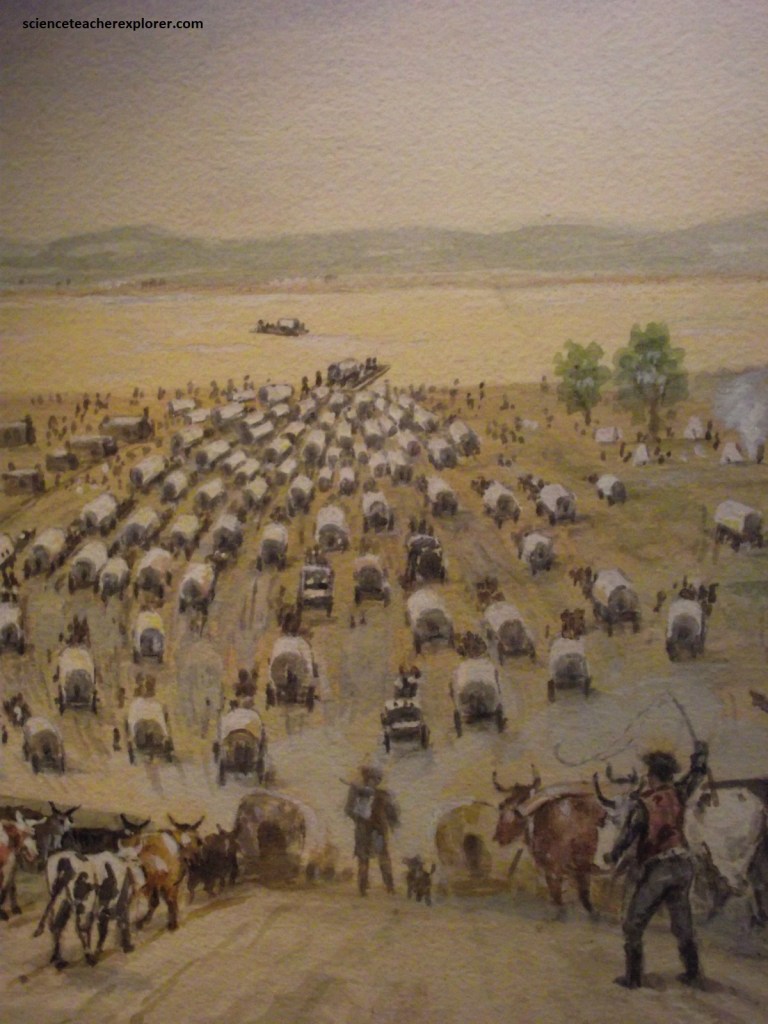
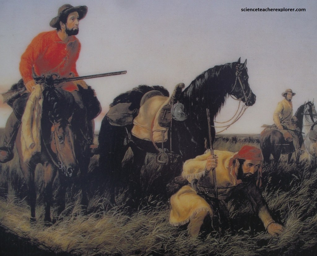
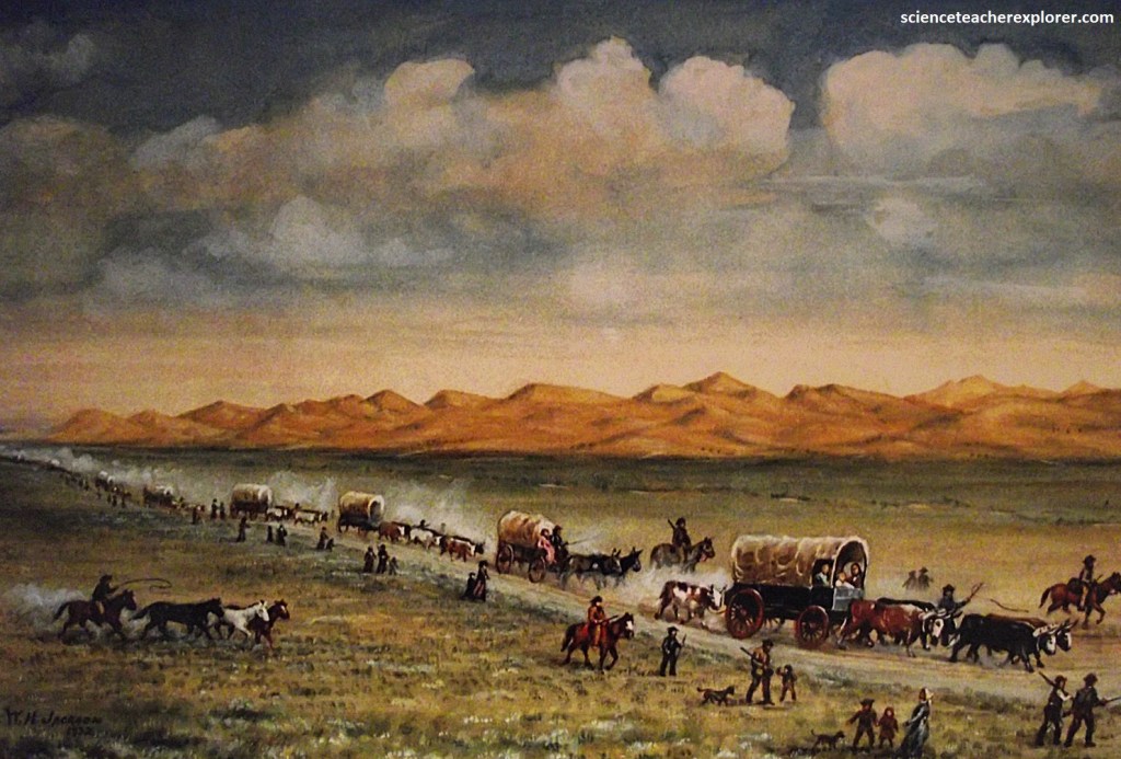
In the early 1800s, travelers began to carve trails through the country. Wagon trains of people moved through the Platte Valley following the river. Each year the numbers of travelers increased, and the land started to feel the strain. The trail developed deep ruts and groves from the wheels of the wagons and handcarts. Hungry draft animals mowed down the grassland that was once abundant on the prairie. Campfire remains and discarded supplies littered the landscape. By 1852, between 40,000 and 70,000 individuals were trekking the terrain.
The bison population declined quickly as grazing ground decreased and sport hunting increased. It became difficult for the American Natives to provide food and other necessities for their families. Trail users also had a had time finding buffalo chips for fuel.
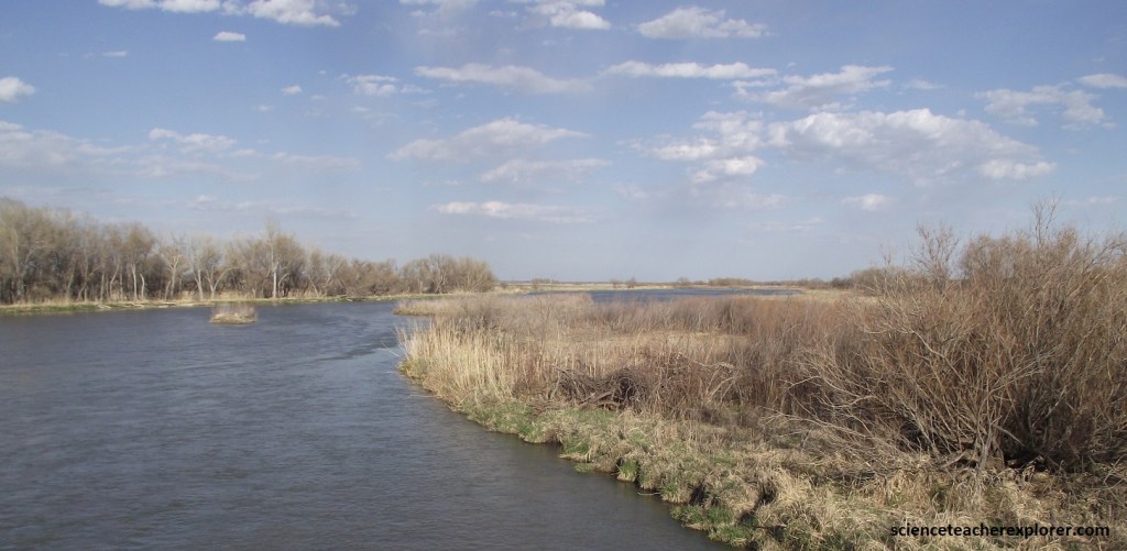
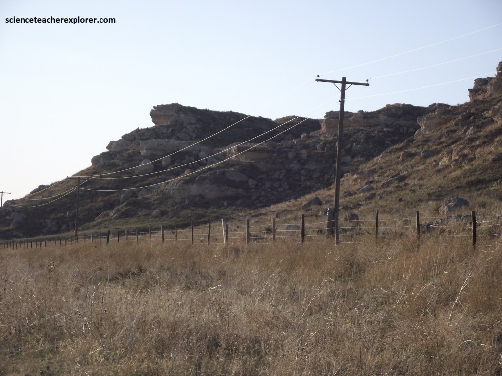
Pictured above, the North Platte River here is a broad, sandy, multi-channel, braided river-system with abundant riparian vegetation. West of Oshkosh, US 26 runs along the foot of small Bluffs of Ogallala group strata with some older Brule formation strata, (mid-Tertiary), at the base.
A well-defined series of old channels, filled with sediment up to 100m thick, parallel the road at distances from several hundred meters to 2 km. These represent an ancient river system similar to the Platte, parallel to but higher and offset to the north from the modern river.
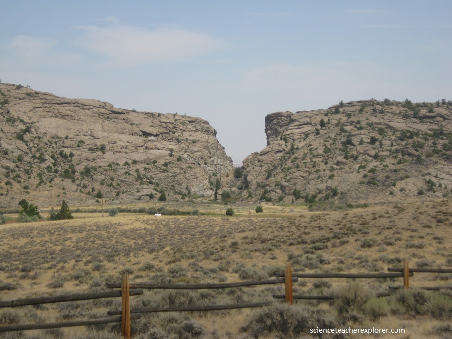
Pictured above, “Ancient Bluff Ruins” is one of the few Mormon place names still in use along the Mormon Pioneer Trail. Brigham Young’s pioneer’s camped just west of here and explored these bluffs on May 22 & 23, 1847. As the first rugged country the travelers had encountered, the bluffs inspired some to exuberant play and others to thoughts of ancient towers, castles and ruins seen in their former European homeland. Other travelers made journal entries noting distinct changes in the plant life and climate they had encountered along the trail. Here the bluffs are farther north from the road, and Arikaree group strata begin to intervene between the Brule formation and overlying Ogallala group strata.
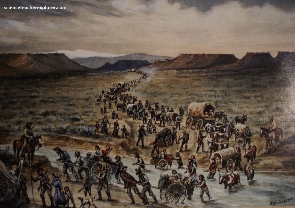
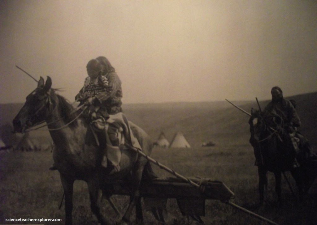
Imaged above; fleeing religious persecution, Brigham Young led members of the Church of Jesus Christ of Latter-day Saints (Mormons) from the Midwest to Utah. Between 1846 and 1868, 70,000 Mormon pioneers made the journey passing the North Platte River area. Their handcart and wagon trains stayed mostly on the north side of the Platte River to avoid other travelers. Church members often traveled back and forth along this trail to help other pioneers make the trip.
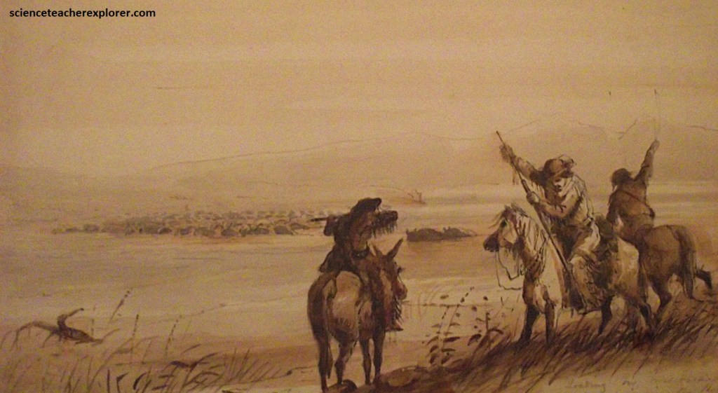
The 1848 discovery of gold in California greatly increased traffic on the trail through the North Platte River trail. Gold-seekers, (nicknamed ’49ers’). rushed to northern California in homes of striking it rich. The ’49ers were most often men traveling on the south side of the Platte River. By the end of 1849, 25,00 more people traveled the California trail. Over 100,000 more people would arrive in California over the next 2 years.
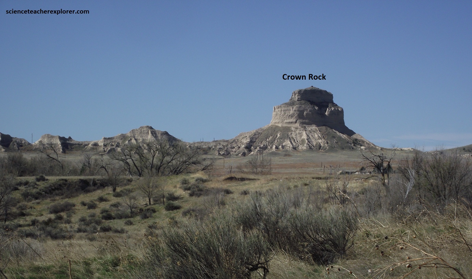
As I crossed to the south side of the North Platte River at Bridgeport, (pictured above), I could see Wildcat Ridge to the south. The first lonely outposts of this feature are Courthouse Rock and its companion Jail rock, small buttes near the confluence of Pumpkin Creek with the North Platte. Courthouse Rock and Jail Rock, (so named because they reminded the pioneers of structures back home), were the first of several natural “road signs” encountered on their grueling 3200 km journey across the plains.
Pictured above, a short drive south of US 26 on NE 88, Courthouse Rock is a pleasant diversion and is easily accessible. Hundreds of overland emigrants mentioned Courthouse Rock in their diaries. Often called a “castle” or “solitary tower,” the name Courthouse was first used in 1837. Courthouse and Jail Rocks, rising some 133m above the North Platte Valley, are erosional remnants composed of clay, sandstone, and volcanic ash.
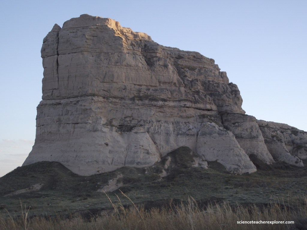
Pictured above, the lower parts of Jail Rock are the massive clay siltstones of the Brule formation. Above are Arikaree group sediments with ash horizons and sands with a plethora of cross-beds and channels. Cross-beds form whenever a flowing medium, such as water or wind, deposits sediments in ripples, sandbars, or dunes.
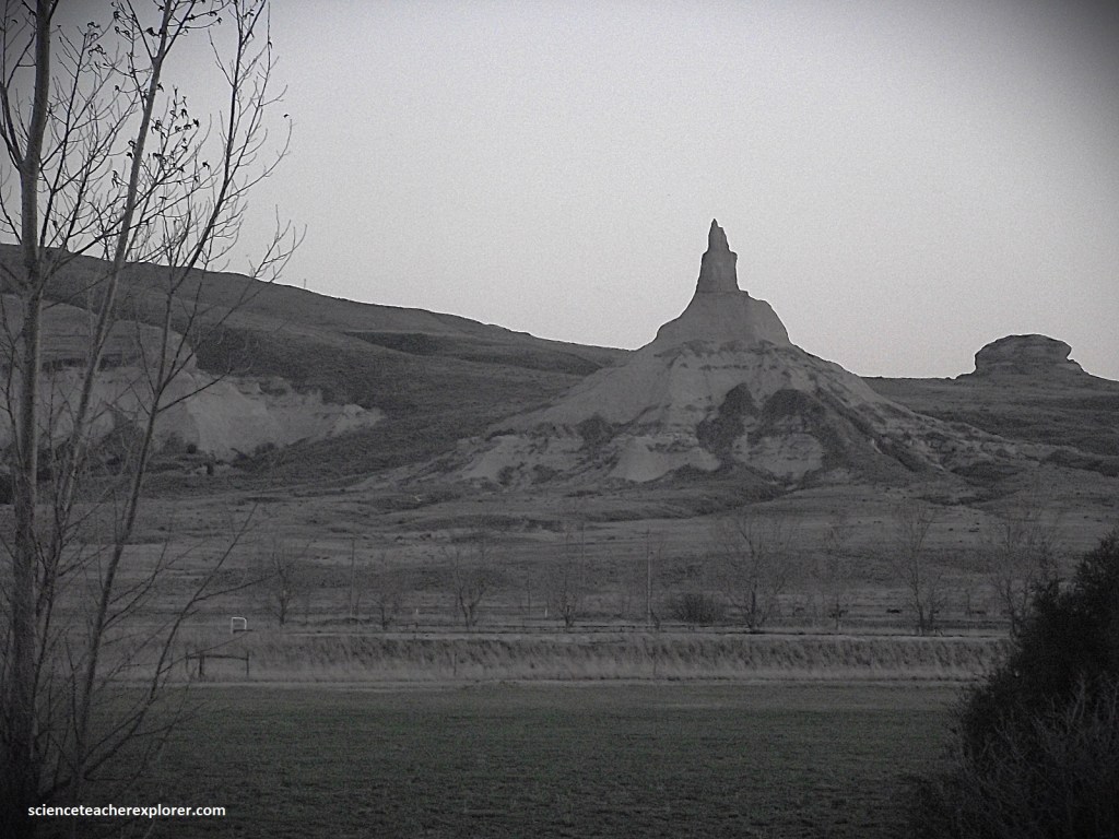
A bit farther along the way, on NE 92 from Bridgeport, the solitary spire of Chimney Rock punctuates the naked plains. Pictured above, Chimney Rock looked especially dramatic after dusk, when it was illuminated for several hours. {Note: In Bridgeport, U.S. 26 turns north, crosses the river and climbs the gentle valley wall before turning to head west to Scottsbluff. I preferred to follow NE 92, which does a diagonal route along the North Platte to Scottsbluff. This road stayed on the south side of the river, passing Chimney Rock}.
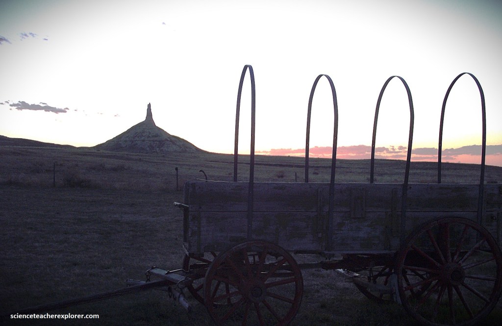
Of all the strange rock formations beside the Oregon Trail, none intrigued pioneers more than this lonely column that rises to a height of nearly 167m. Visible from as far as 48 km away, it signaled travelers that they were about to begin the second leg of their journey, (a trek across much rougher terrain).
New territory in the Northwest, also drew families dreaming of rich farmlands, economic stability, and a desire for a new life. Trekkers on the Oregon Trail followed a route forged by trappers and missionary parties through the North Platte River area. Each day had a predictable schedule, (rise at dawn, eat, pack the wagons, rest at noon, travel till afternoon, set up camp, and make dinner.
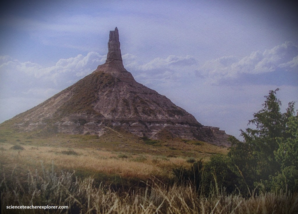
Pictured above, Chimney Rock is a pinnacle cut from Arikaree group strata. While it looks delicate, it has persisted since pioneer times, when it was an important landmark along the Oregon Trail.
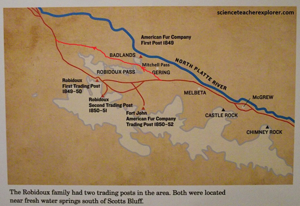
Members of the Robidoux family were experienced fur traders and trail guides. They opened a much-needed trading post and blacksmith shop south of Scotts Bluff in 1847. The next closest trading post was nearly 75 km way at Fort Laramie. The Robidoux post was a place to trade and purchase item, get water at the springs, and rest on the journey. Trading posts also served as gathering places for mail, new, and information on trail conditions.
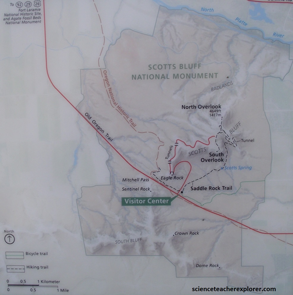
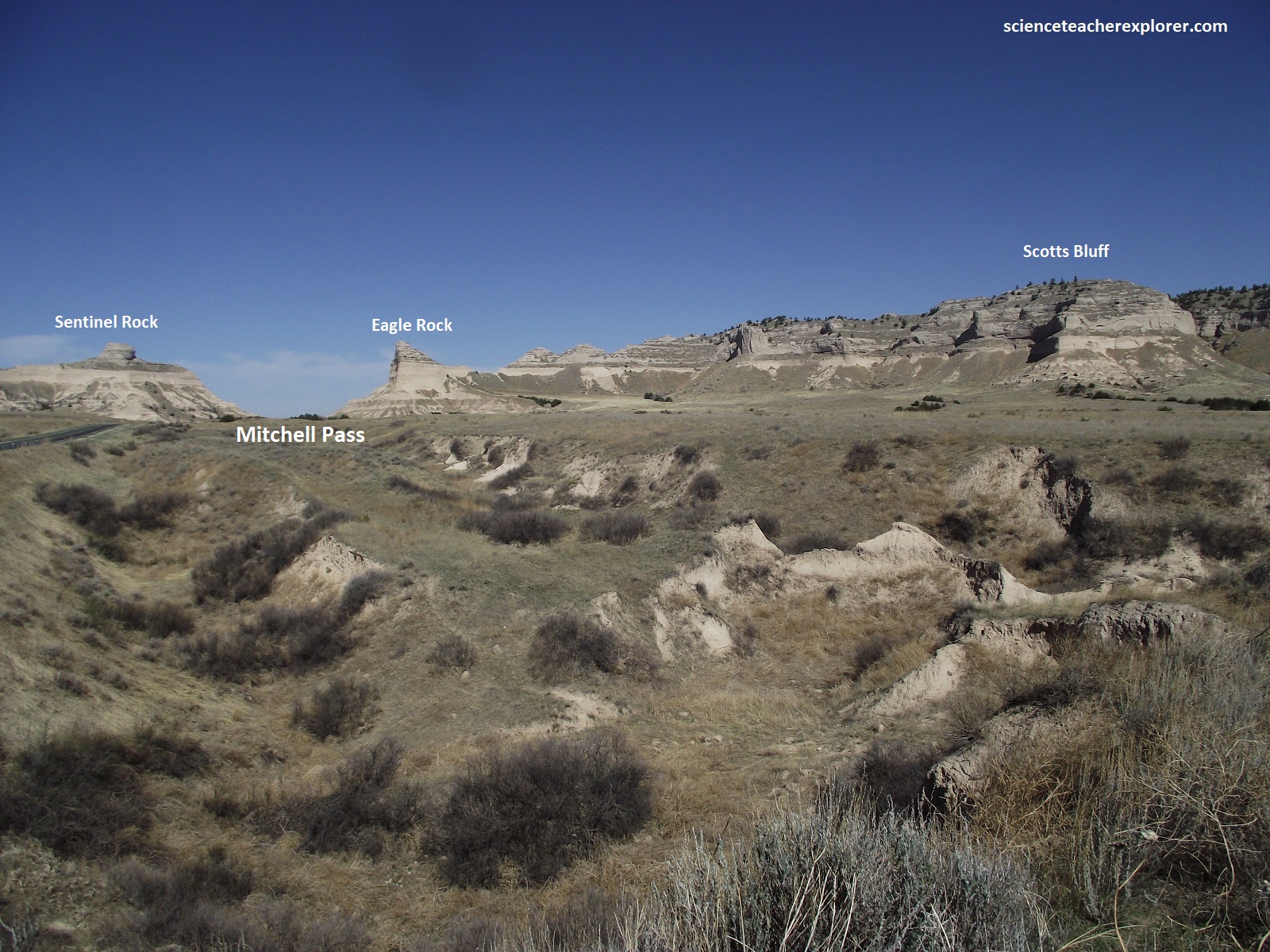
The Robidoux Pass and the Mitchell Pass are both routes through the Scotts Bluff area on the Oregon Trail, but the key difference is that Robidoux Pass was the original route used by early emigrants, while Mitchell Pass became the preferred route later on due to its shorter distance and closer proximity to the North Platte River, making it more convenient for wagon trains; essentially, Mitchell Pass is considered the “second Scott’s Bluffs Pass” while Robidoux Pass is the “first”.
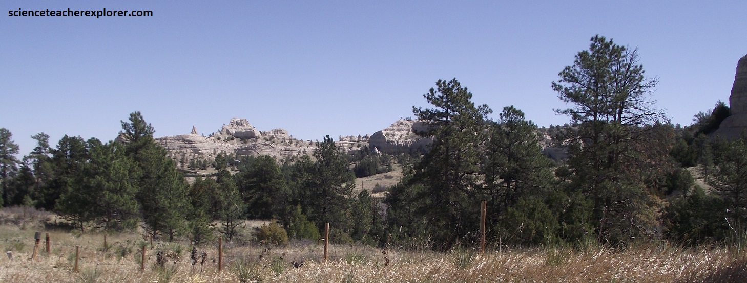
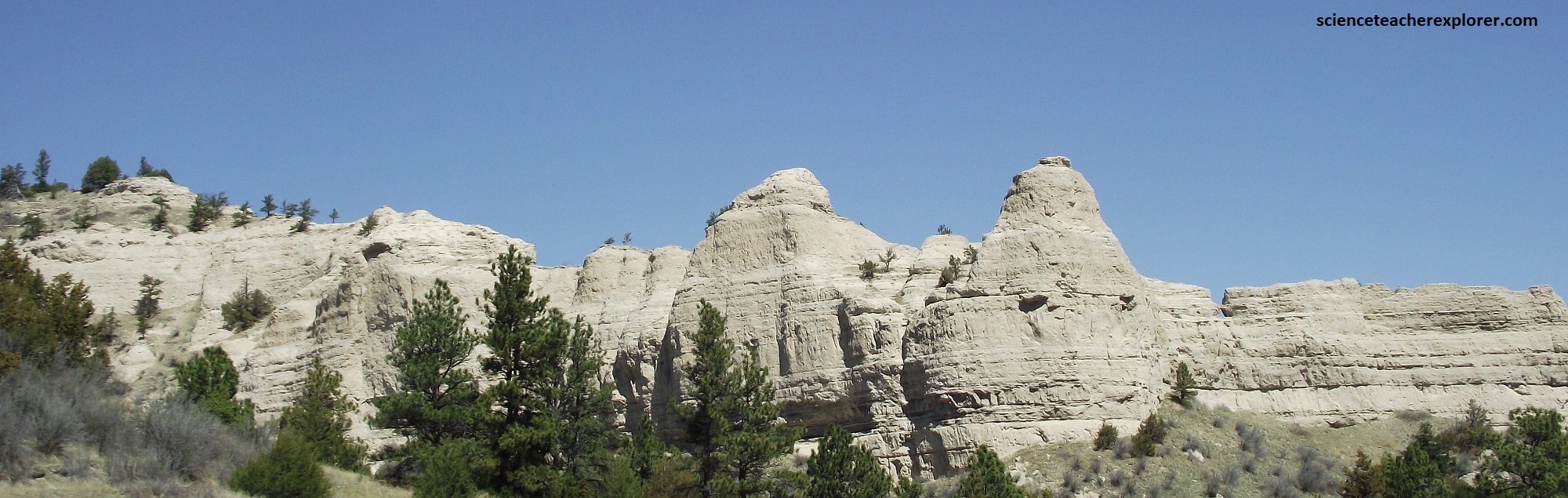
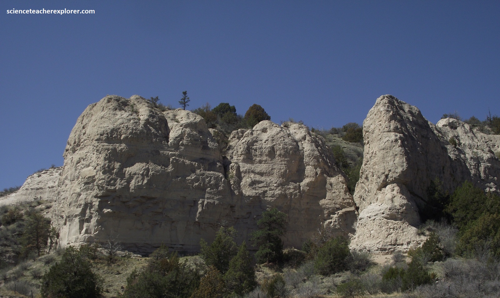
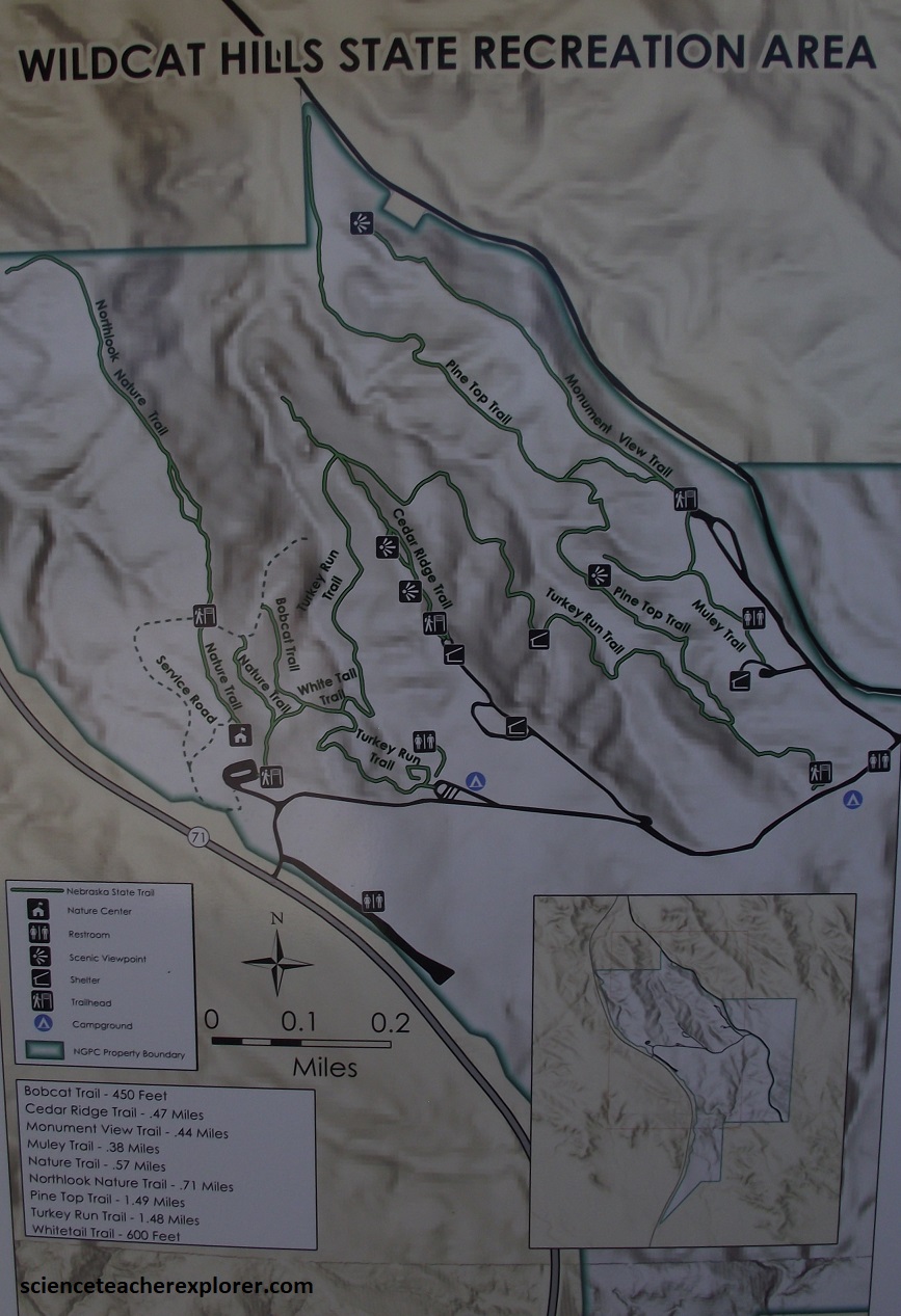
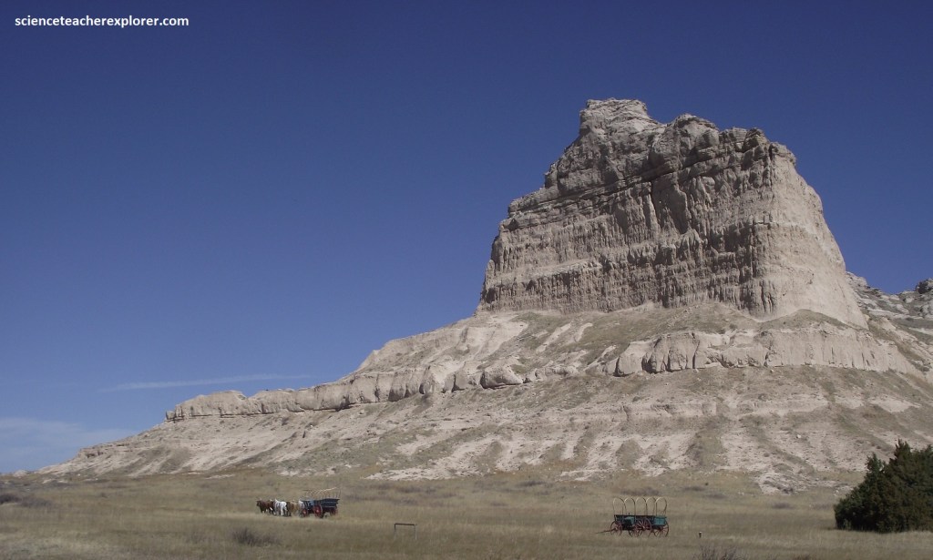
Driving northwest on NE 92, I came to the small town of Gering, Nebraska where I turned left, (south) on NE 71. After 16 km, I approached the Wildcat Hills & Ridge. Pictured above, encompassing 935 acres of rocky buttes and forested canyons, the Wildcat Hills offered 4.8 km of rugged hiking trails, stone shelters with fireplaces, and a magnificent view of the North Platte Valley.
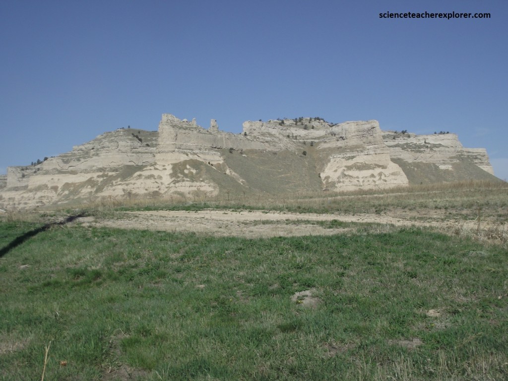
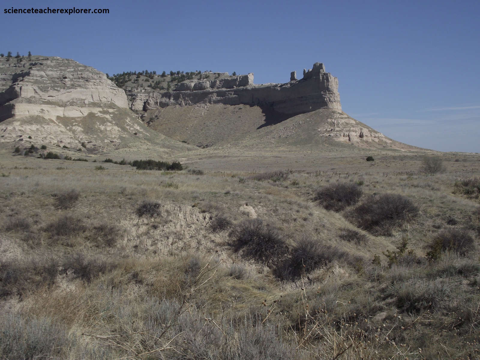
Scotts Bluff first appears as a dot on the horizon. But the fact that it loomed in the distance for days told approaching pioneers that, “Whatever it was, it was big”. When they finally reached this gigantic mound of clay, sandstone, and volcanic ash, they were awed by its dimensions: over 167m high and a kilometer wide.
Once thought to be the tallest point in the state of Nebraska, Scotts Bluff is a striking natural landmark. Rising from the plains, over 244m higher than the North Platte River, it has beckoned to hunters, explorers, emigrants, traders and vacationers over the centuries. For travelers from the east, it gives a welcome visual relief from the monotony of the plains.
Named for Hiram Scott, an unfortunate fur trader who died near the base in 1828, the buffs were once part of a higher plain. Only a few elevations remain after rivers carried away the soft sedimentary stone which wind, water and humans continue to erode. Layers of sandstone, siltstone, Brule clay, volcanic ash and pipy concretions of limestone are exposed along the faces of the bluffs, telling the story of geologic processes in the area.
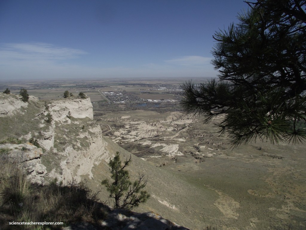
Pictured below, few people could enjoy this view until the 20th century. After Scotts Bluff National Monument was established in 1919, local residents lobbied the Park Service for easy access to the top. The first project was the Scout Trail on the east side along with a picnic area. In 1931, the director of the Park Service visited and agreed to build a road to the summit. Depression Era program enrollees dug tunnels, graded the road and parking area. Young men of the Civilian Conservation Corps (CCC) planted trees, sodded the side of the road, built a picnic area in Mitchel Pass and built many of the present park structures of adobe.
The story of the rock layers of Scotts Bluff began 33 million years ago. Wind and flowing water brought sediments and volcanic ash to this area from the Rocky Mountains. Layers of these sediments became the rock layers of today. Limestone caps the top of the area’s bluffs. This hard rock cover slows erosion, but the forces of nature are relentless. Scotts Bluff will continue to change over time. The underlying layers became compressed by overlying sedimentary rocks. Some of the sediments in the rocks here have an igneous origin. Volcanic eruptions to the west of Scotts Bluff created large amounts of ash. The ash sometime mixed with other sediments and at other times formed distinct layers.
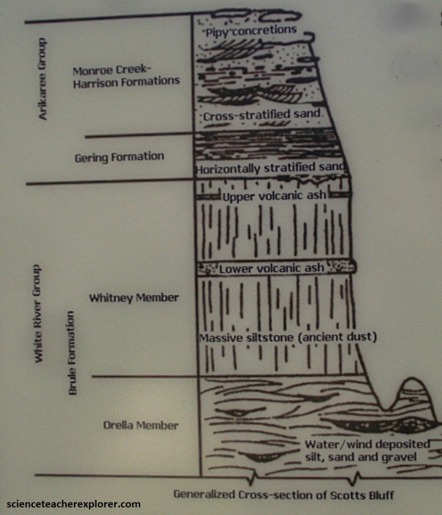
22 million years ago, the surface of the plains was as high as Scotts Bluff, (gently sloping landscape composed of sediments from mountains to the west). About 3 million years ago, the Platte River and its tributaries began to erode the high plains. Bit by bit, water carried away massive volumes of soil and rock, crating canyons that grew wider and wider.
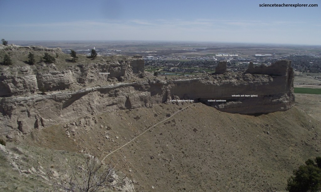
Since sedimentary rock is the softest type of rock in geology, Scotts Bluff erodes easily. Scattered through the top layer of the bluff are “pipy concretions” of hard calcium carbonate. This “cap rock” has kept the bluff from eroding faster by protecting the softer layers below. While harder than the surrounding rock, the slender horizontal bodies of rock called concretions still belong to the sedimentary grouping of rocks.
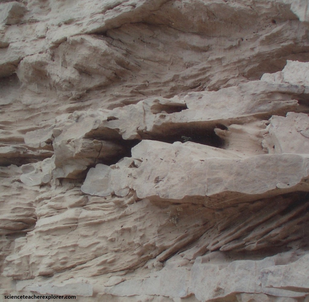
The pale concretions are lime deposits from underground water. Note that knobs at the end of Saddle Rock have been protect from erosion by erosion-resistant cap rocks. Pictured above, at the tunnel site, the white ash layer consists of tiny, wind-borne glass shards erupted from western volcanos. Underneath the ash, oxidation has stained the sandstone a rusty brown.
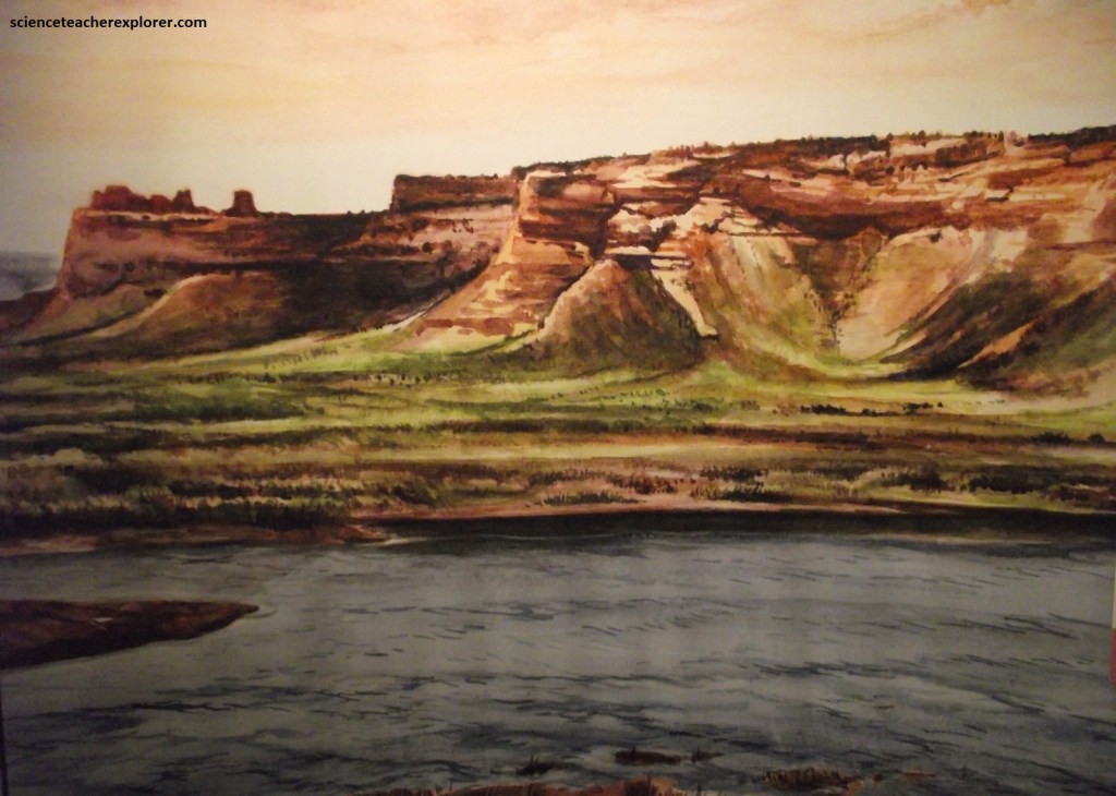
Looking west from Scotts Bluff in the valley of the North Platte River, the emigrants got their first good look at the Laramie Mountain range, (the beginning of the Rocky Mountains). The Laramie Range, like the rest of the Rocky Mountain Foreland Ranges, is a block of deep, ancient basement rock squeezed upward through younger overlying layers of Paleozoic and Mesozoic strata. Today these layers, (once flat-lying, but now shouldered out of the way), lean like tilted books against the rising core of the mountain, (imaged below).
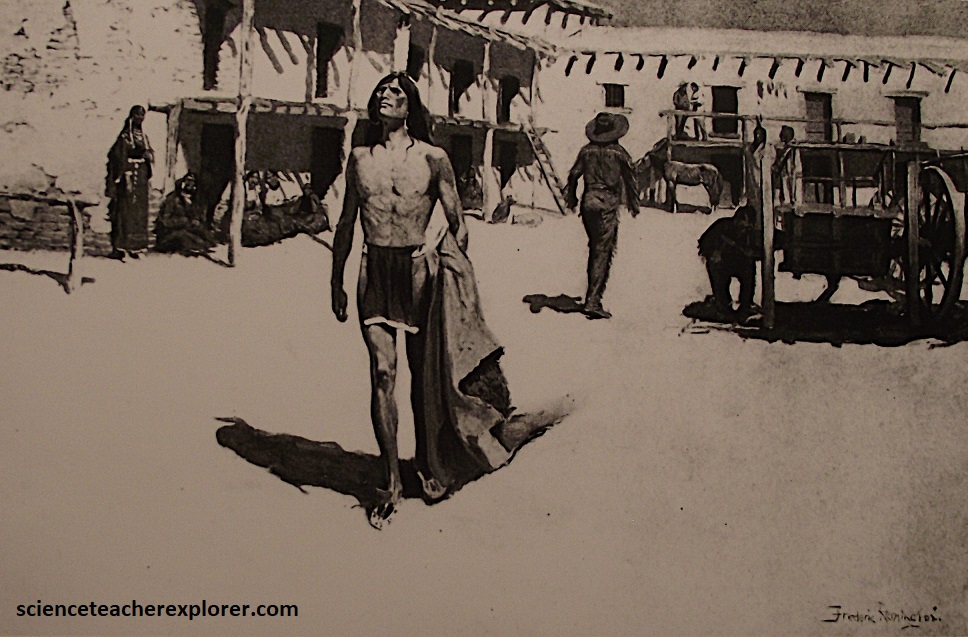
The western Great Plains roughen as they rose toward the Laramie Range. Aridity asserts itself more boldly on the land, and grass gave way inexorably to sagebrush and greasewood. However, Fort Laramie lies at the confluence of the Laramie and North Platte rivers. Established as a trading post by trapper William Sublette in 1834, it was first called Fort William until 1841. Conflicts between Natives and trappers were relatively rare at this time. Instead, mountain men often took Native wives and established themselves in Native families. Trade was mutually beneficial and, for the most port, honestly conducted.
Through Fort William’s gates came many legendary figures of the fur trade era, (the Sublette brothers of William, Milton, and Josh, Tom “Broken Hand” Fitzpatrick, John Colter, and Jim Bridger), assisting overland travelers in their journey to the Pacific Coast. The mountain men were truly the vanguard of the great migration West. The letters, reports, and tall tales that filtered east excited a nation to the seemingly limitless land, wealth, and possibilities that awaited in the West.

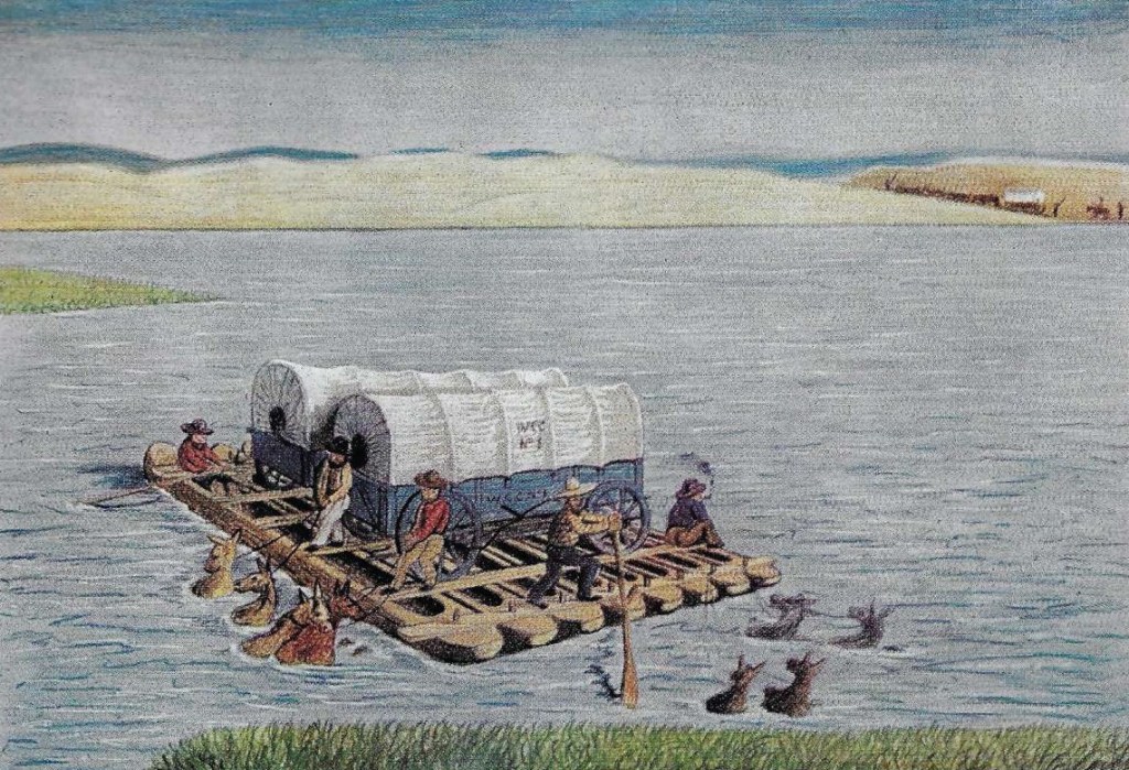
Prior to 1830, supplies were brought to the trappers’ rendezvous by pack tain. That year, however, the partnership if Jedediah Smith, David Jackson, and William Sublette tried a new method, (wagons!). This was the first use of wagons on the route of the Oregon Trail.
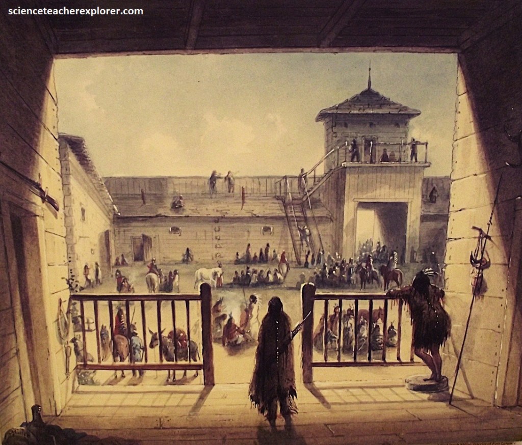
Imaged above, Fort John was built in 1841 to replace deteriorating Fort William. By that time, the giant American Fur Company owned the Laramie river fur trading post, which competed with the newly constructed neighboring Fort Platte. The role of the post on the Laramie was about to change dramatically however, as the United States began to move west. Farmers heading for Oregon, Mormons seeking religious freedom near the Great Salt Lake, and argonauts bound for the California gold fields, mingled with mountain men from another era, and Native Indians, through whose land the emigrants passed. All converged at Fort John, (truly the crossroads of a nation moving west. The U.S. government bought Fort John for $4000 in 1849, and expanded in into a military post, and called it Fort Laramie.
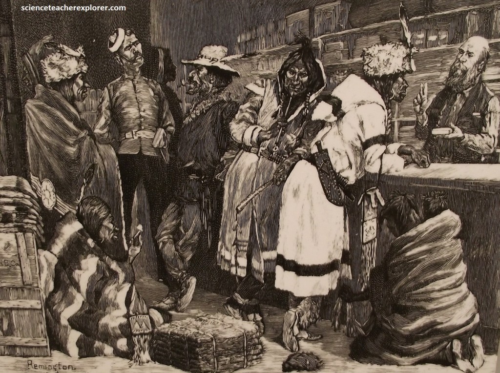
As relations between whites and the America Natives worsened through the 1850s, Fort Laramie became a key staging point for the U.S. Army’s anti-Indian campaign. [Before that, in the 1840s, the fort was a bustling center of commerce on the western Great Plains. Crowds of Sioux and white traders lived in sprawling nomadic camps around the fort, bartering and bargaining with each other and with passing emigrants.
By the 1860s, almost 500,000 settlers lived west of the Rocky Mountains. Rapid, dependable communication between east and west had become a necessity. The first transcontinental express mail service was launched in the spring of 1860; the celebrated Pony Express. Yet shortly after the first hoofbeats were heard, workmen began stringing miles of galvanized iron wire to tie the nation together. With the completion of the Transcontinental Telegraph in October, 1861, messages were flashed almost instantly from shore to shore.
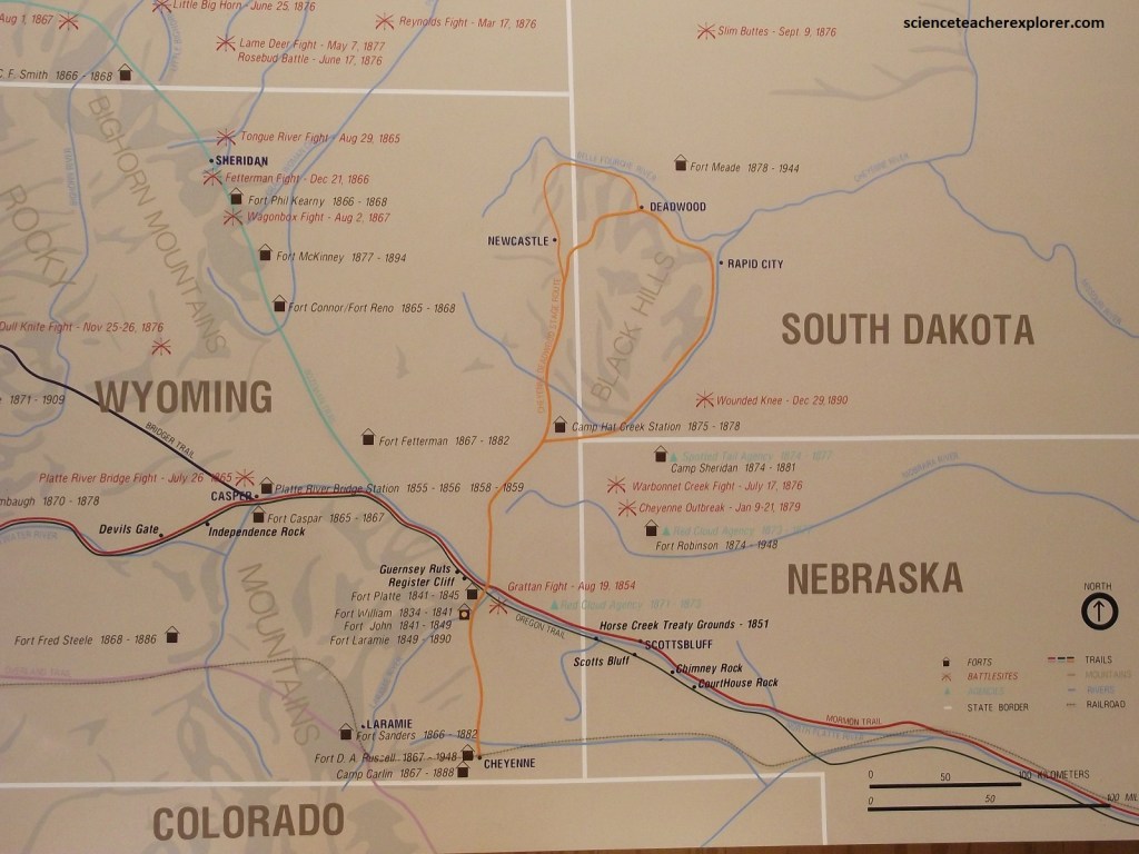
At the outbreak of the Civil War, troops were withdrawn from most western forts and sent east. Volunteer units at Fort Laramie face the daunting task of keeping hundreds of miles of telegraph line and the Central Overland mail route open and operating. Between 1864 and 1868, Native Indian attacks on military outposts, telegraph stations, mail stages, and civilians increased. The opening of the Bozeman Trail infringed on Native territorial rights. By 1868, Red Cloud and his Sioux warriors had force the abandonment of the “bloody Bozeman” and driven the federal government to the peace table once more. {The historical photos below were taken in 1968 at Fort Laramie during the Sioux and Lakota Peace Treaty meetings, (image taken from an interpretive sign on-site)}.
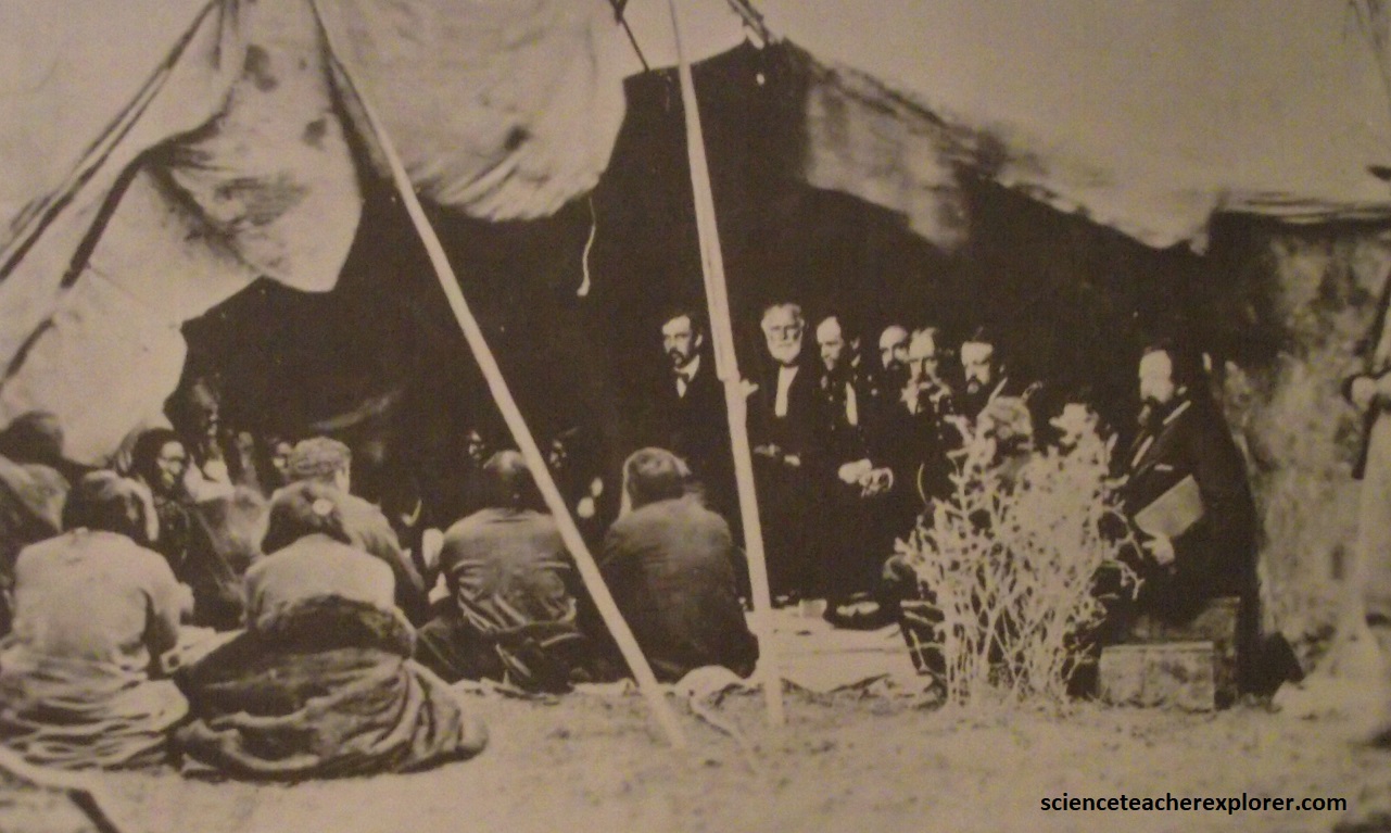
In 1868, members of the Lakota tribe met with the U.S. government and signed the Fort Laramie Treaty. The treaty defined geographic areas of territory for the Lakota and Sioux, which included the sacred Black Hills. [With the discovery of gold in the Black Hills miners flooded the area, impacting the Lakota claim on the land]. The Fort Laramie treaties of 1868 held the promise of lasting peace on the plains. Reservations were organized, and promises were made to keep out trespassers. Once again, peace was fleeting. The pattern of empty promises and broken treaties continued.
The opening years of the 1870s offered hope of lasting peace on the Northern Plains. Destruction of the buffalo herds by hide hunters left the Native with little choice but to settle on the new reservations in Dakota, where food and supplies were promised. However, new of gold in the Black Hills electrified the nation in 1874. Submitting to public pressure, in the spring of 1876, the army launched the Bighorn-Yellowstone Expedition to force the Native back to their agencies. Several major battles ensued, culminating in the defeat of Lieutenant Colonel George A. Custer at the Little Bighorn. The fate of the Native Indians were sealed.
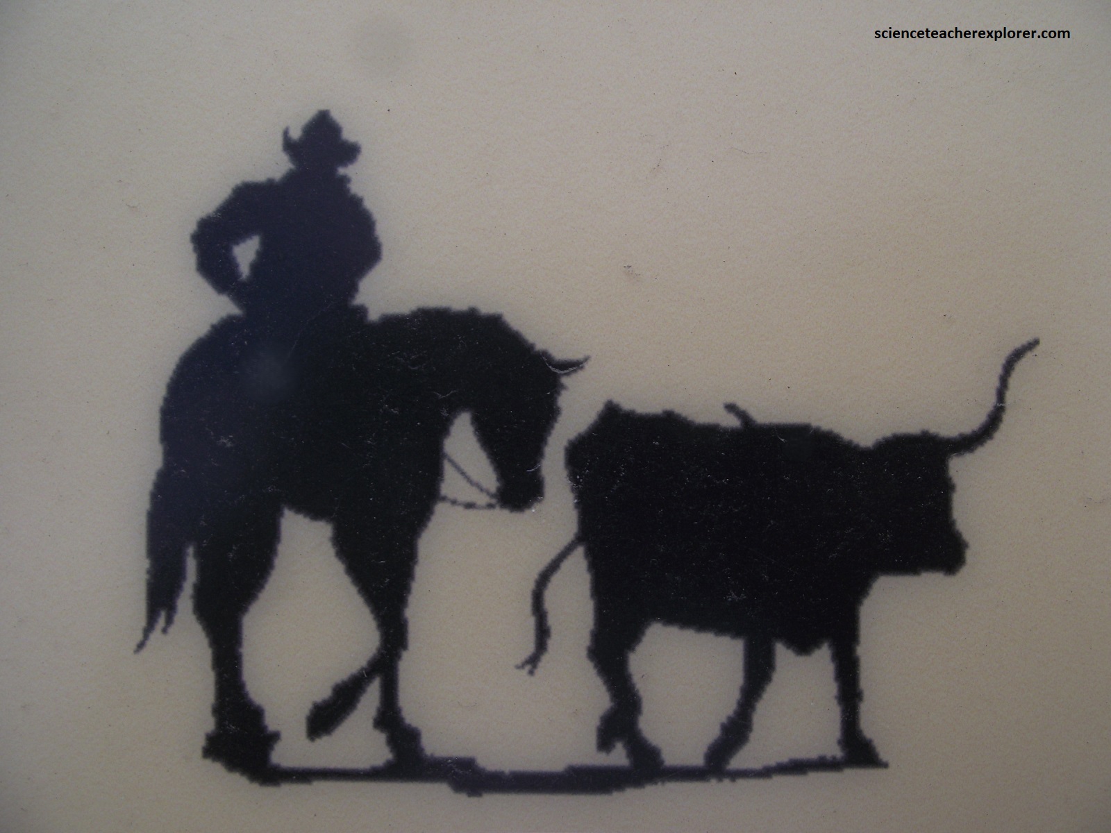
By the late 1870s, the Northern Plains Indian Wars were essentially over. Settlers now make their homes on former Native lands, and ranchers acquired great expanses of territory, where cattle replaced the buffalo. Fort Laramie was no longer a strategic outpost in the wilderness, but a fort whose military purpose was waning, a remnant of the old frontier.
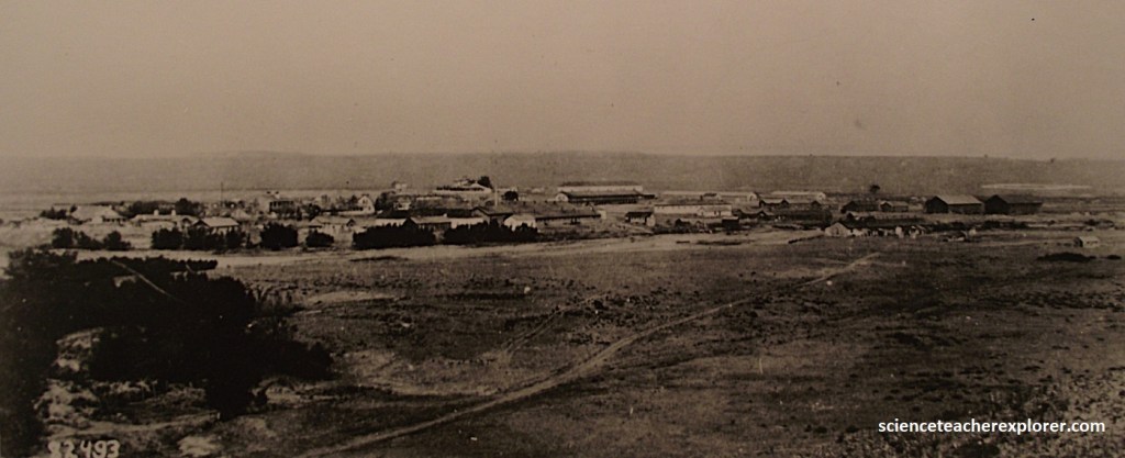
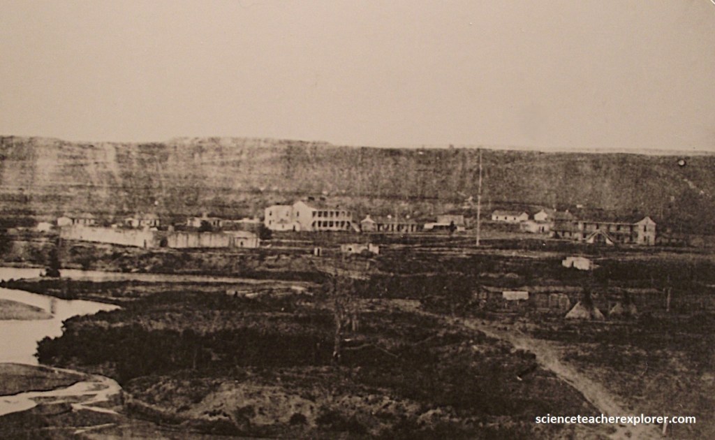
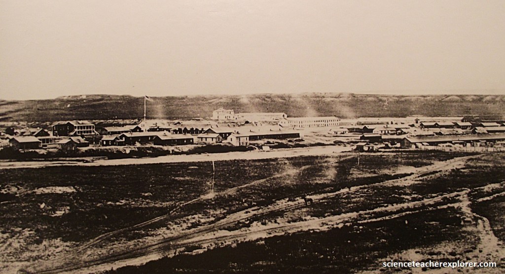
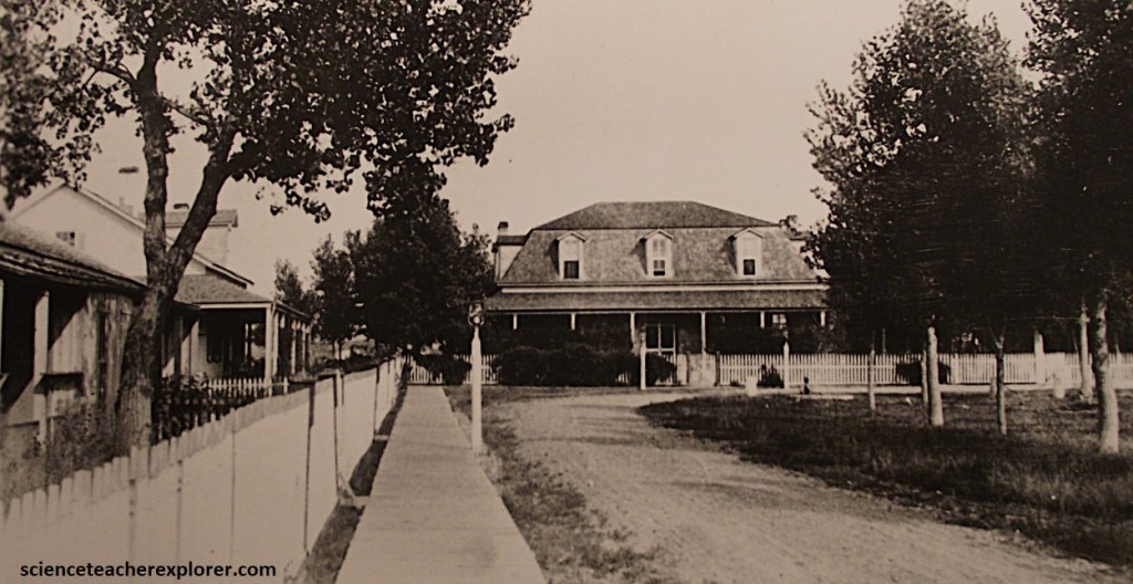
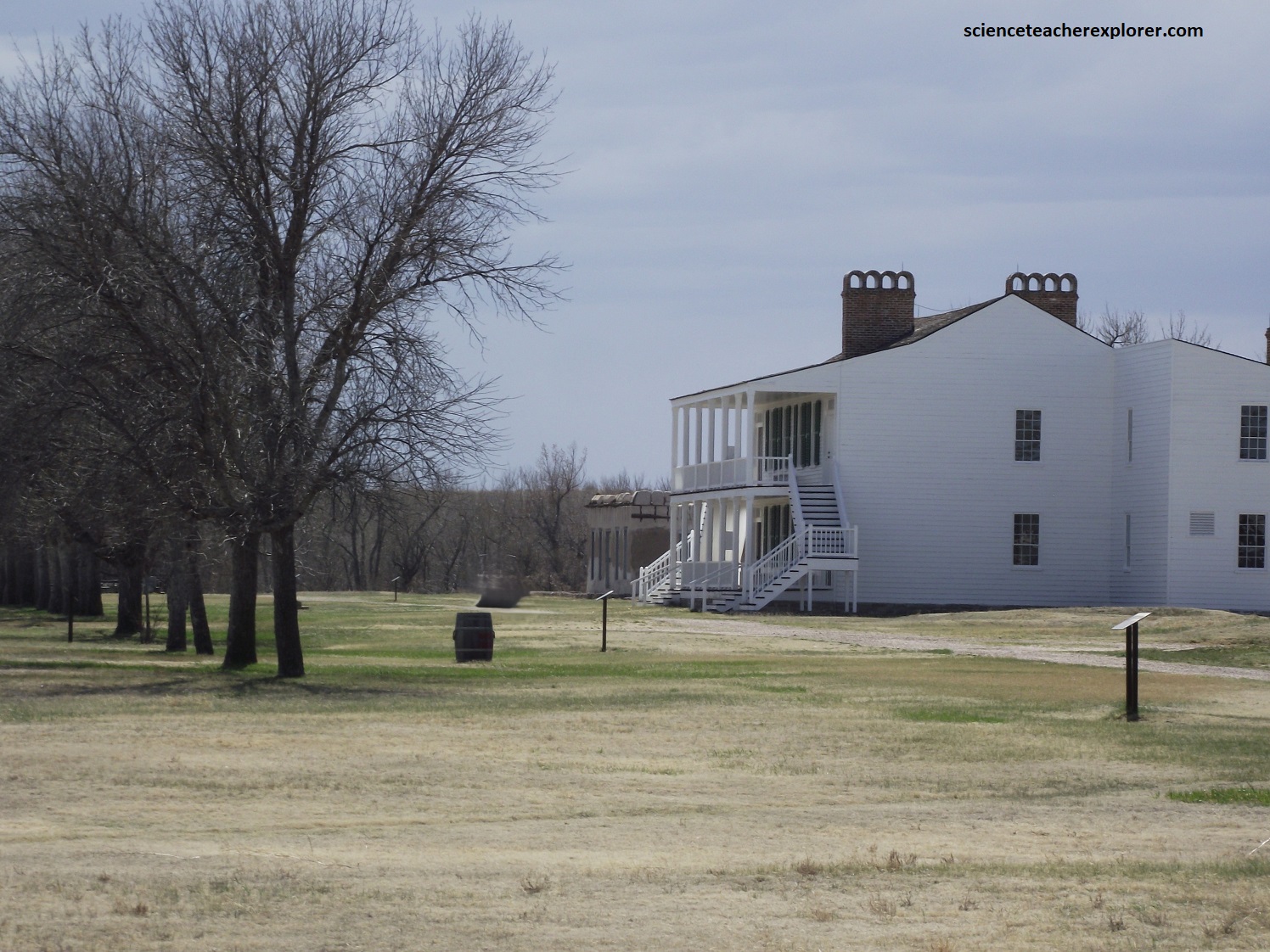
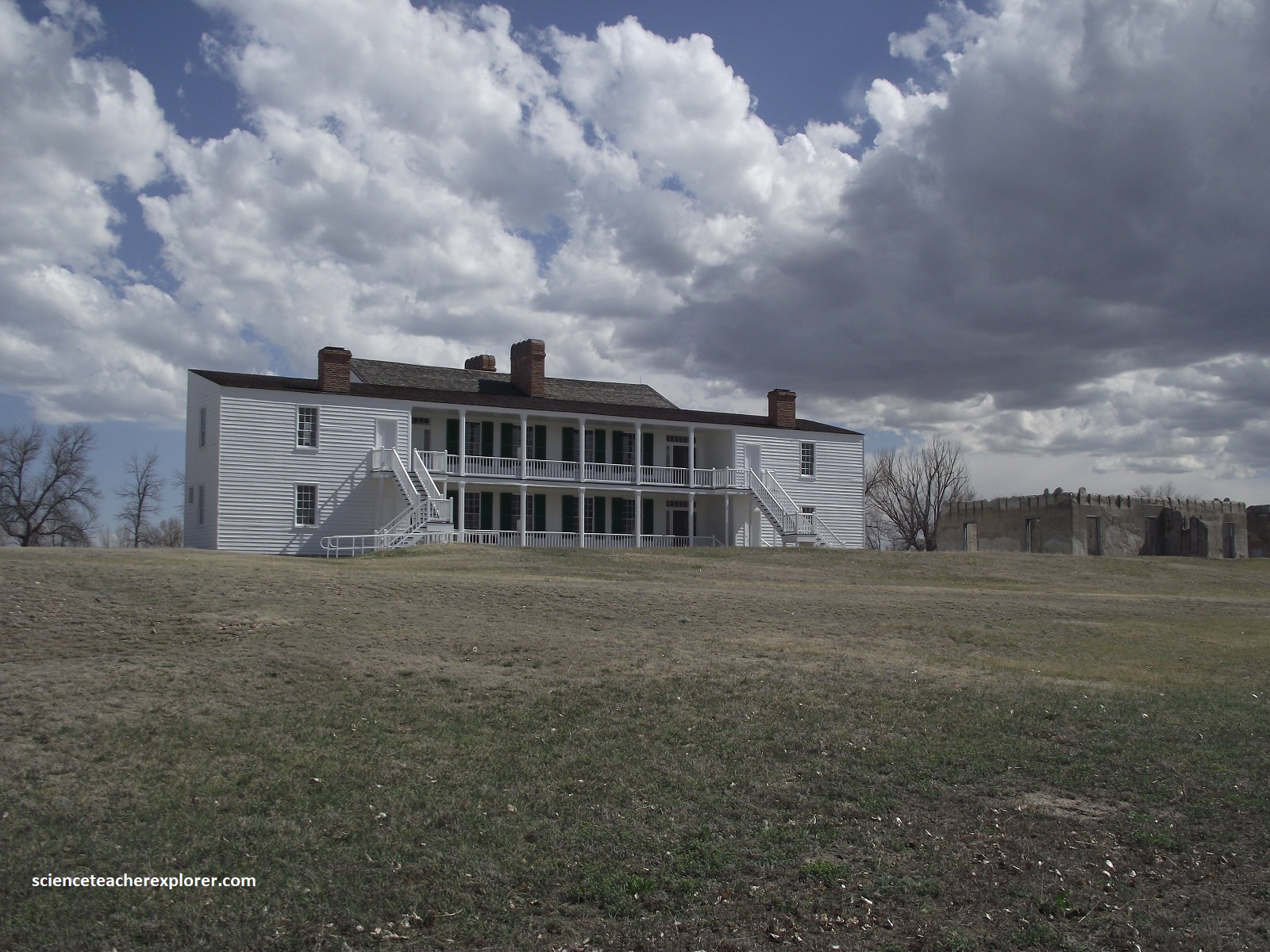
The 1880s were the golden year of Fort Laramie. Many old frame, long, adobe, and stone buildings were replaced by new lime grout structures. Streetlights, boardwalks, picket fences, and birdbaths lined Officers’ Row, (picture below).
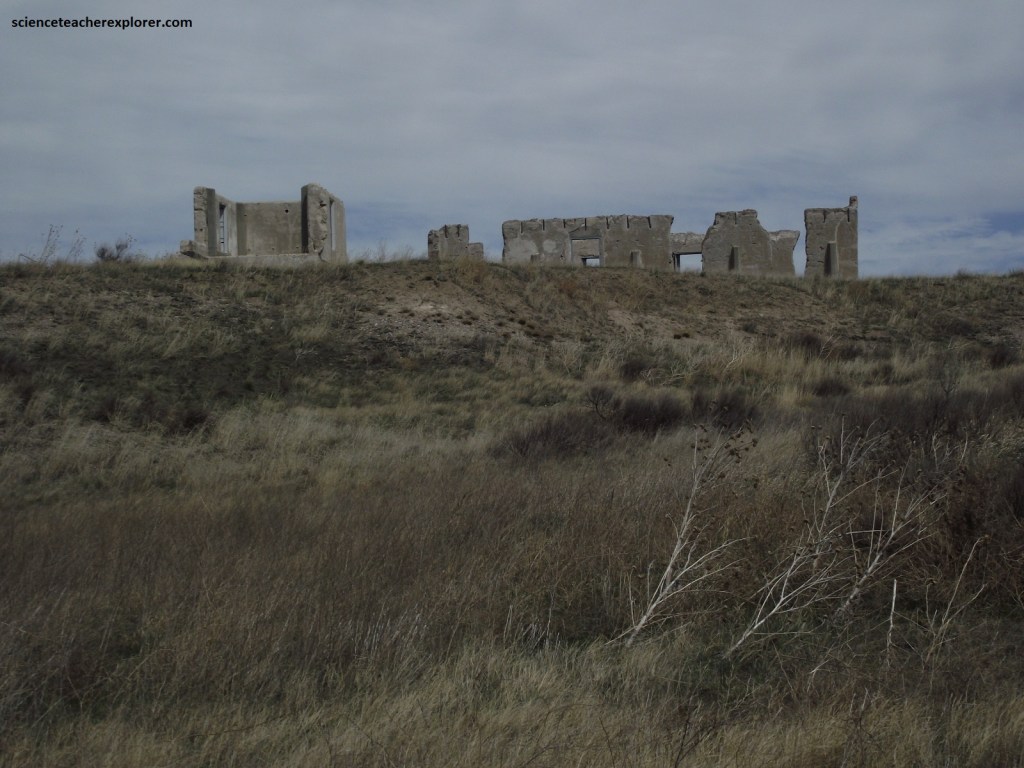
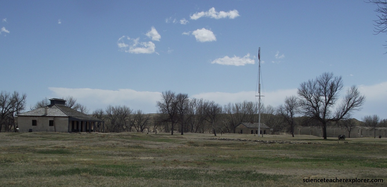
While the enlisted soldiers were occupied with routine drill, fatigue details, and occasional field maneuvers, officers spent many hours socializing, hunting, fishing, picnicking, and staging amateur theatricals. By the mid-1880s, a railhead with 48 km of Fort Laramie brought all the amenities of the late Victorian Life. However, the last cavalry unit rode away in 1883, leaving only the infantry to garrison the fort. 1890, the end of the era, Fort Laramie abandoned, Wyoming proclaimed a state, the last major Indian conflict on the Northern Plains at Wounded Knee Creek, and the Superintendent of the Census declared that the American frontier had ceased to exist. Fort Laramie was then auctioned off and eventually turned into a State Park in the early 1900s. I visited it in 2024, (pictured below).
Pictured above, Post-Trader John S. Collins erected a hotel on this location to provide lodging for the gold seekers. Collins christened the new establishment the Rustic. The hotel also served as headquarters for the Cheyenne and Black Hills Stage Company.
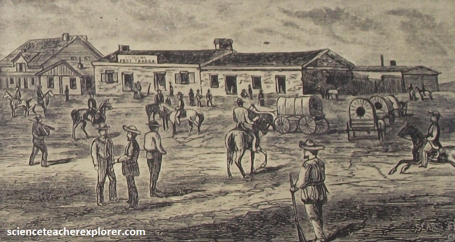
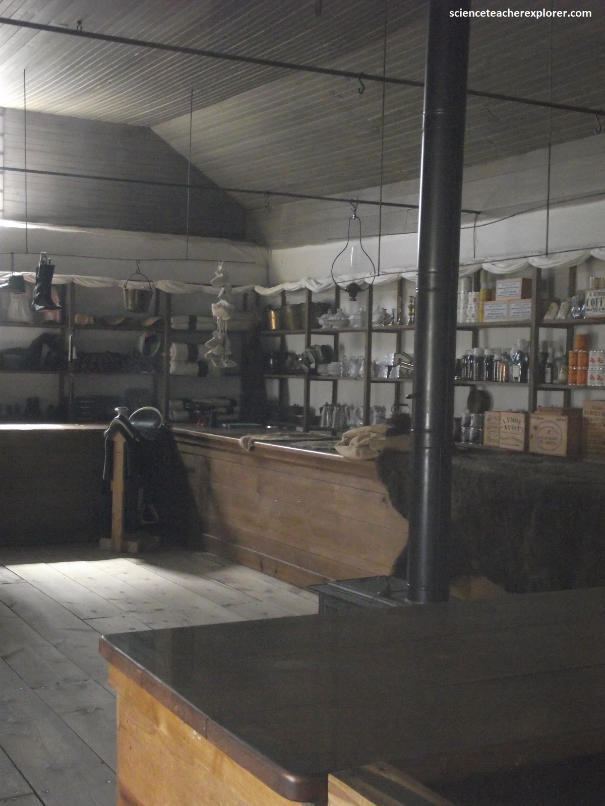
Pictured above, is “Sutler’s Store” at Fort Laramie. Parts of this building date from the earliest periods at Fort Laramie. The adobe portion on the left, built in 1849, housed the Post Sutler’s Store. In 1852, the right section was added and used at various times as the Sutler’s office, the Post Office and game room. The sketch above was taken from an interpretive sign on-site that indicated it was Sutler’s Store in 1875.
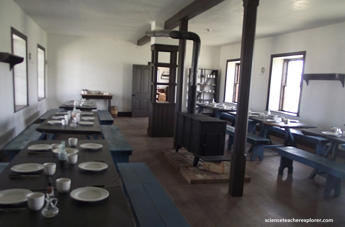
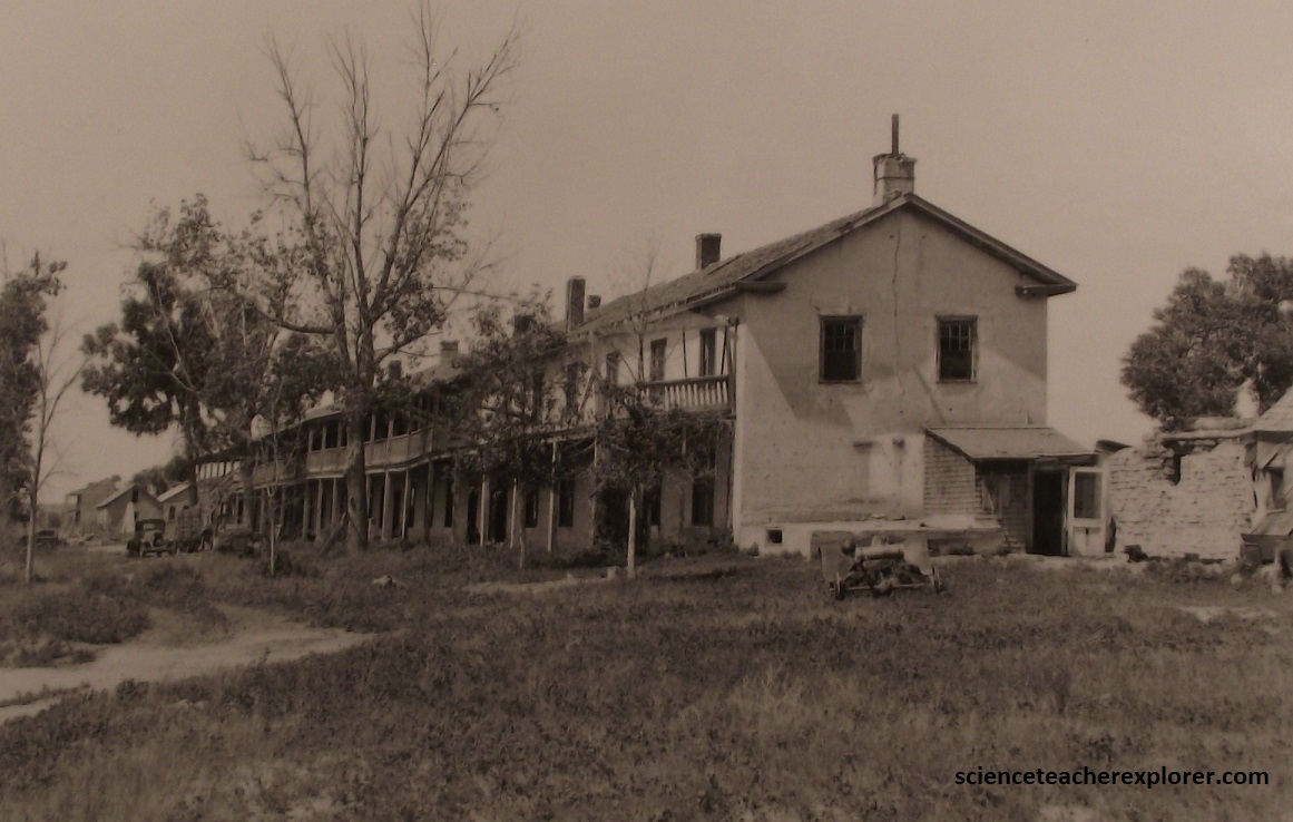
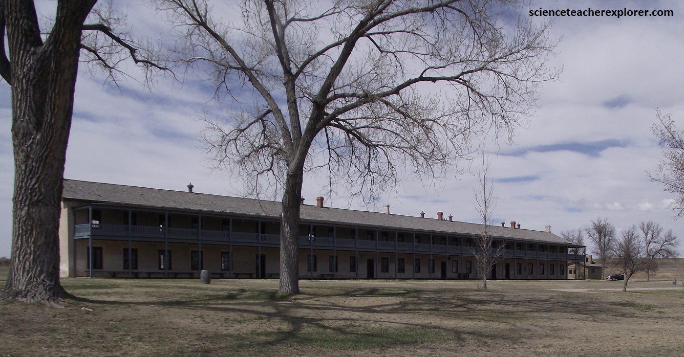
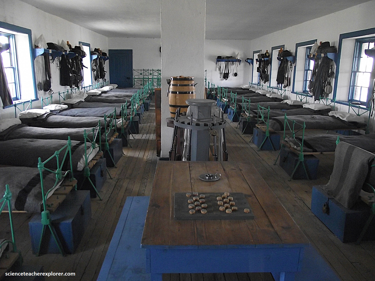
Picture above, is the only surviving enlisted men’s barracks at Fort Laramie. {The historical photo was taken from an interpretive sign on-site and said to be taken in the early 1900s}. The building proper was completed in late 1874 and was designed to provide quarters and other needed support facitities for two companies of soldiers. The veranda, although originally planned, was not added until 1883. As constructed the entire second floor was made up of only two equal, large rooms. These were the company dormitory bays or squad rooms were the enlisted soldiers lived. Each could house about 60 soldiers or one company. On the first floor below each squad room, the building was divided into a kitchen, messroom, cook’s room, storage room, wash room, library, armory and orderly room for the N.C.O.’s and non-commissioned officers room.
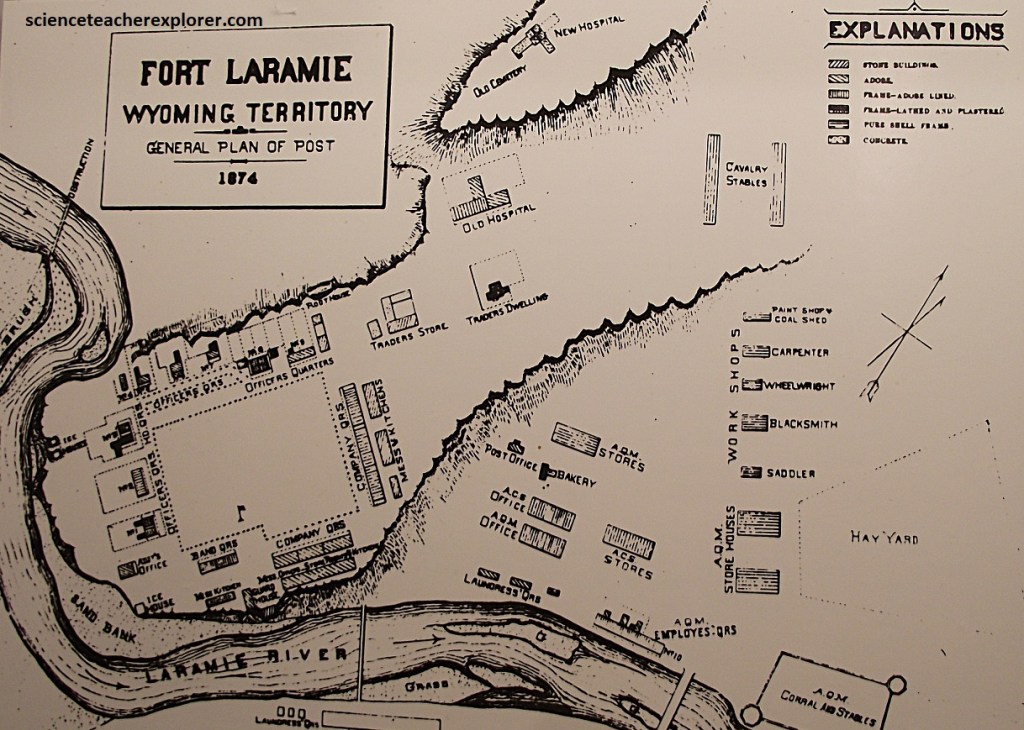
Now, in 2024, the National Park Service manages the Fort Laramie National Historic Site and identifies 36 significant physical remains that provides the adequate background for the what occurred here during the Westward Expansion… including the people associated with its history. Included among the 36 remains are 13 standing buildings, several building foundations, and 11 standing ruins. I highly recommend the visit.
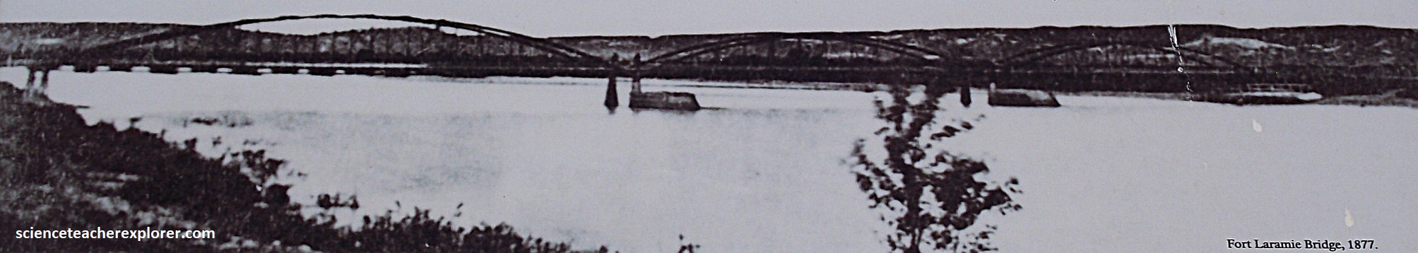
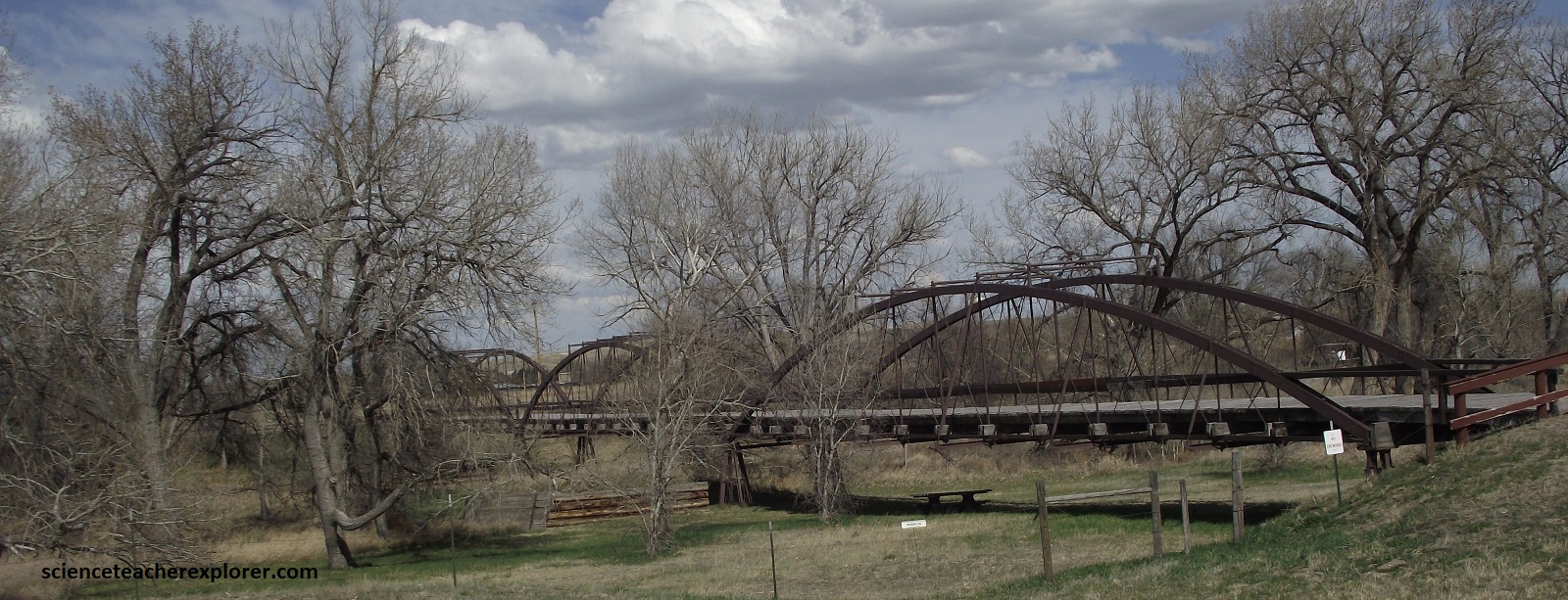
Pictured above, once broad and turbulent, the North Platte River posed a formidable obstacle to 19th century travelers. High water made it nearly impossible to cross the river for several months each year. The crossing became less dangerous by 1850 when ferry service was established to meet the growing volume of military and emigrant traffic. Frequent ferry accidents and slow crossing speeds continued to impede travelers until a permanent bridge was built. The triple-span Fort Laramie Bridge was constructed between 1875 and 1876 for $15,000. Rubble filled, log ice breakers protect the unique I-beam piers supporting the bridge. Spanning 134m, this bridge is the best-preserved King Iron Bridge patent tubular bowstring bridge in existence. {Note the historical photo above is taken from an interpretive sign on-site}.
Pictured above, west of Fort Laramie, the land rises rough and calloused toward the foothills of the Laramie Range. Ledgy bluffs of Arikaree Group strata, (a Tertiary-leftover bits of the Great Plains layer cake), pop up like stone scabs across the landscape.
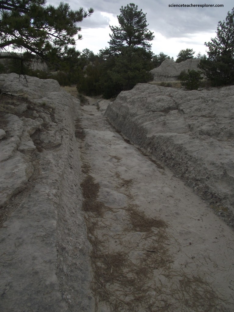
In the evermore-dissected terrain, emigrants had to veer away from the North Platte River for long stretches, with tough pulling over hills and across ravines. Two kilometers south of present Guernsey, Wyoming, an outer bend of the river runs up against an 27m high bluff of Arikaree sandstone, (Late Oligocene & Early Miocene). Unable to pass along the riverbank, everyone had to climb up and over the bluff. All wagons followed the same narrow track over the bluff, excavating a 2m deep defile today called Deep Rut Hill, (pictured above).
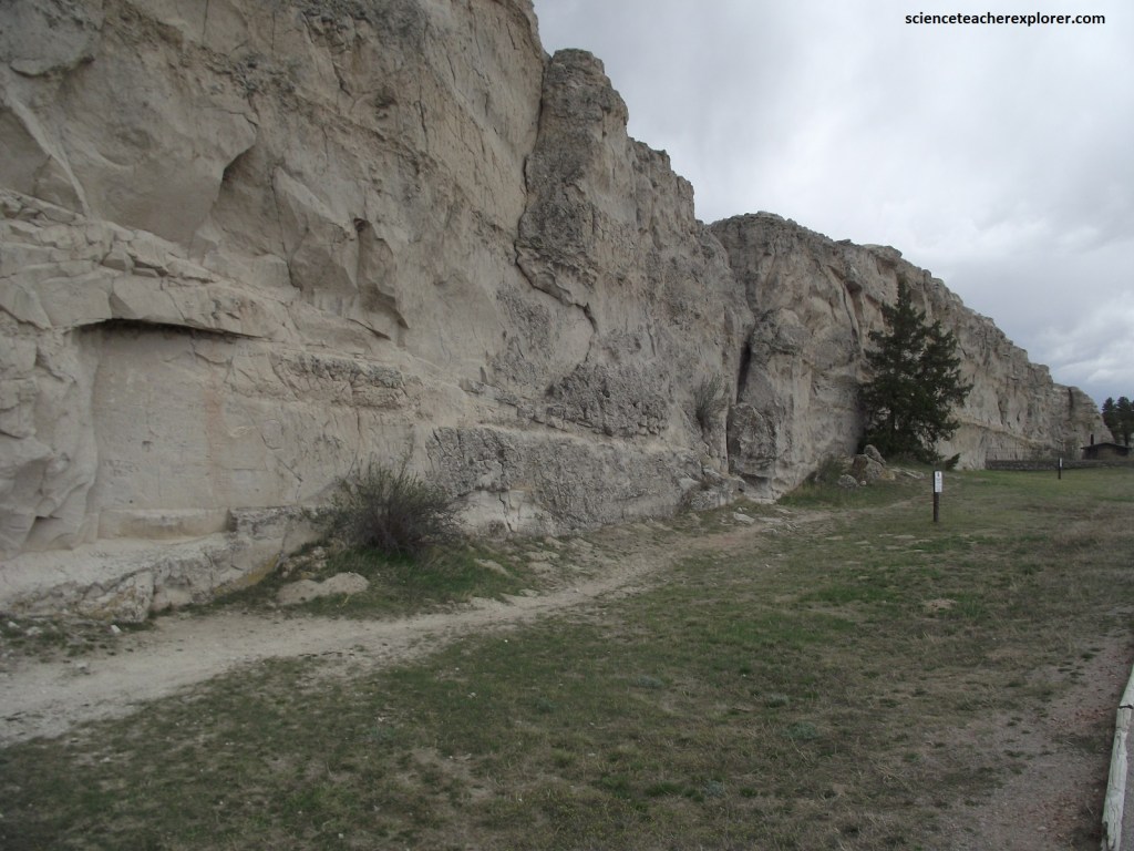
Pictured above, a few kilometers away, on the inside of a wide bend in the North Platte, stands Register Cliff, (a long wall of Arikaree sandstone riddled with emigrant signatures). The soft rock is easily gouged with a stick or knife, and emigrants often carved their names with great calligraphic flare.
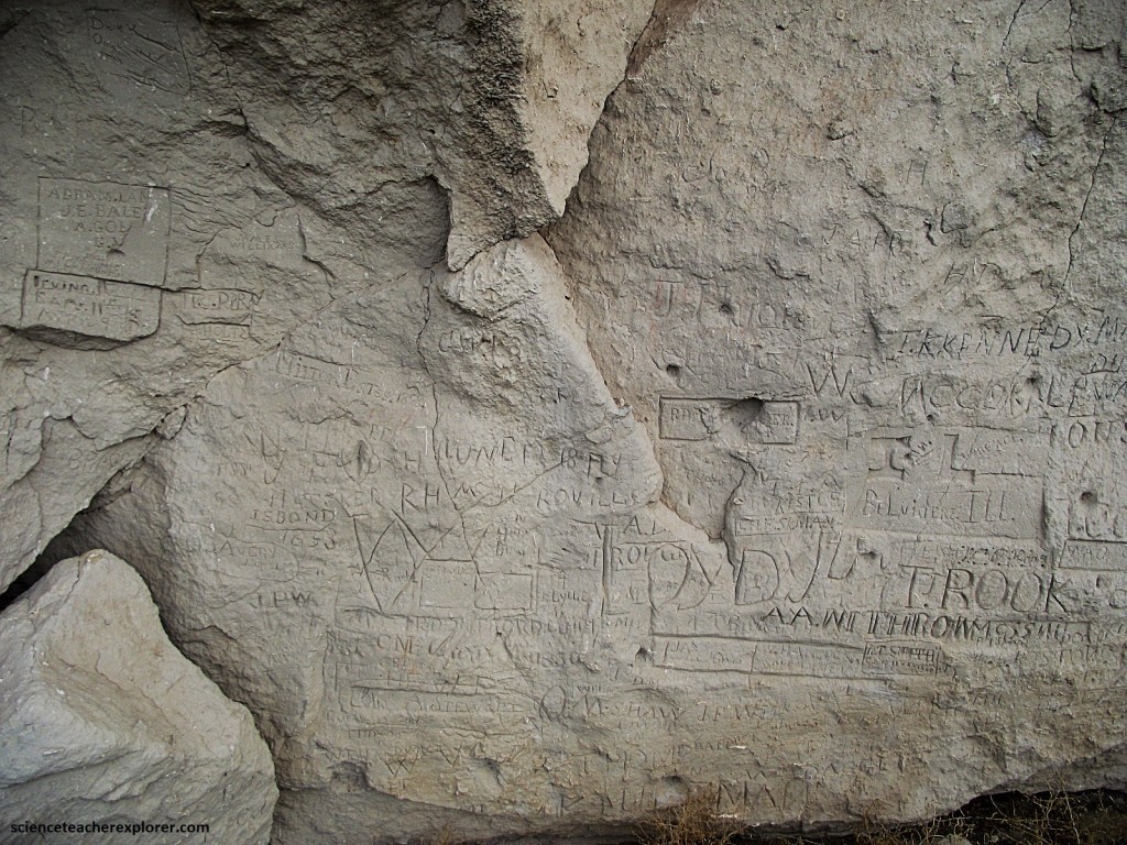
The names go on for more than a hundred meters along the cliff face. Other names are here too, far more numerous though not so worthy. They oftenct across and obscure original emigrant signatures.
Pictured above, Register Cliff, also known as ‘Sand Drew’, was the first camp west of Fort Laramie. Beside these sandstone cliffs near the North Platte river, emigrants stopped to set up camp, pasture their animals, and rest from the hardships of trail life. It is common to see cemeteries at river crossings along the trail. The crossings themselves were dangerous. The graves of several unknown emigrants are in the cemetery here at Register Cliff.
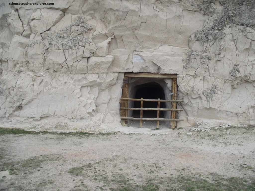
Pictured above, a root cellar for storage of produce was essential before the days of supermarkets. The Frederick family blasted an opening into the cliff face for storing potatoes and other vegetables. The constant temperatures kept produce cool in the summer and protected it from freezing in the winter. In the mid-1850s, a small trading post just west of the cliffs provided supplies to emigrants traveling west. Later, a pony express station, known as Sand Point or Star Ranch Station was based here.
West of Register Cliff and Deep Rut Hill, further travel along the North Plate becomes impossible. For many miles upstream from present Guernsey, the river winds mostly of red sandstone and limestone. To bypass the narrow & rocky canyons, the emigrants had to veer off along a detour that would take them face-to-face to the foothills of the Laramie Range, (a region called the Black Hills). Countless ravines, carved out by streams charging down from Laramie Peak, cut directly across the trail. Many emigrants abandoned their wagons in the steep ravines and pressed on with whatever they could pack on the backs of their animals. But, others pressed on through the ponderance of the spectacular displays of bent and riven rock all around.
The detour through the hills comes where the North Platte river crosses the Hartville Uplift, (a broad hump of arching rock strata, 48 km across, rising like an oval blister on the land. The river, rather than taking an open route around the uplift to the north, slices straight through it, cutting three deep canyons in quick succession between today’s towns of Orin & Guernsey, Wyoming, (pictured below).
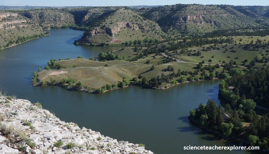
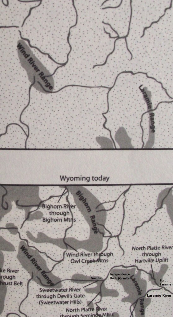
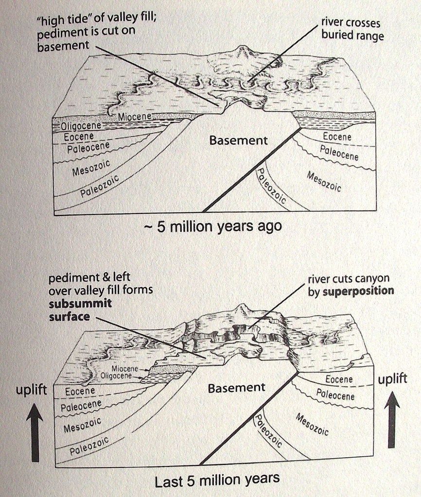
Like on the Hartville Uplift, many rivers in the area seem to punch straight through ridges and uplifts, (even though where an easy way around lies nearby. As the matter of fact, the North Platte River punches through three major obstacles on its way to the Great Plains. First it cuts through the Seminoe Mountains to make Seminoe Canyon, then through the eastern Granite Mountains to make Fremont Canyon, and then through the Hartville Uplift to form Glendo, Wendover, and Guernsey canyons. This river has been able to cut through mountain ridges because they once flowed high above obstacles. Imaged below, five million years ago, Exhumation started to occur in Wyoming. Only the highest mountain summits poked above the layers of sand and gravel. Rivers established paths across this buried landscape, often by chance crossing over hidden mountains. During the Exhumation of the last 5 million years, the eroding rivers cut down through the once-buried mountains to establish the path we see today. (Note the locations of the Hartville Uplift and of Devils Gate in the image below.
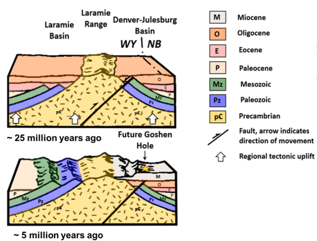
The Foreland Ranges, (Hartville Uplift, Laramie Range & the Wind River Range), began to rise about 75 million years ago in response to sideways compression of Plate Tectonics. Rock debris eroding from the mountains filled up the valley and continued to do so after the ranges stopped rising, (imaged below).
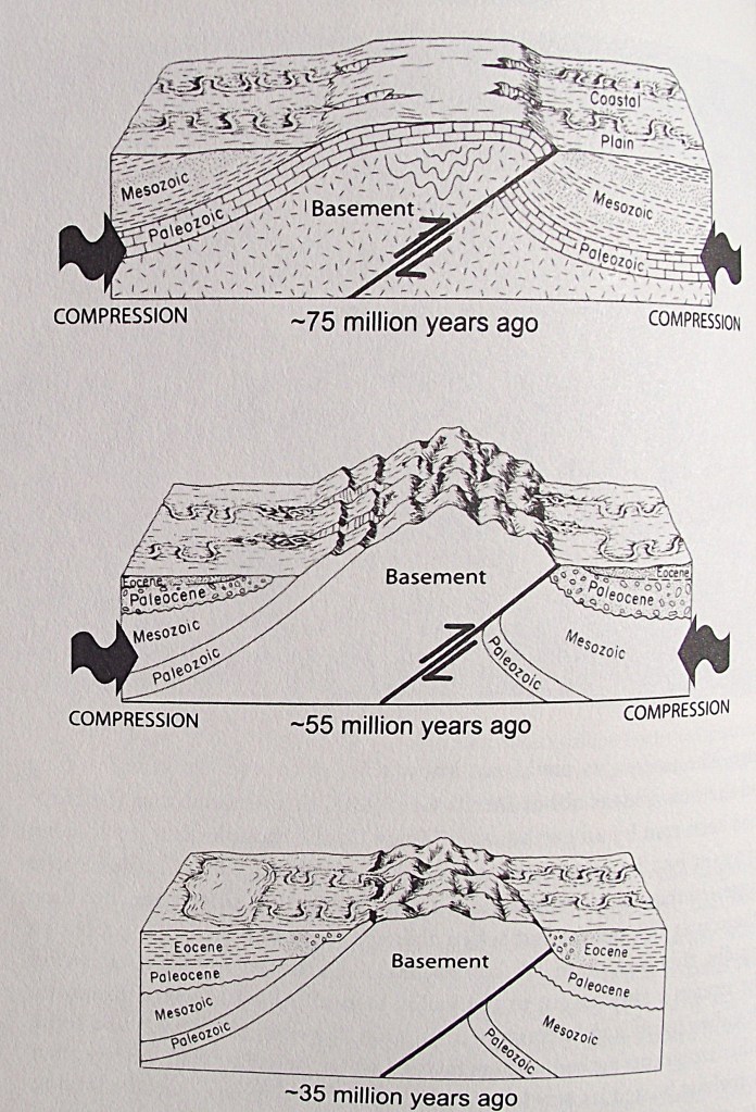
By about 5 millions years ago, the debris had nearly buried many of the mountains. Rivers established paths across the buried mountains, and pediments were notched around some of the exposed peaks. Eventually the rivers sliced through the once-buried mountains, and the pediments were raised to their current elevation to become today’s sub-summit surface that the pioneers used to travel on, (imaged below).
After passing through the gauntlet of the Black Hills, the emigrants gained the North Platte River again in the area of Deer Creek, (near present Glenrock, Wyoming). They were now on the north side of the Laramie Range, and their route upstream would take them west past the mountain. Somewhere in the next 64 km, (between Deer Creek and Bessemer Bend), the pioneers had to cross to the north side of the North Platte River. Further travel upriver beyond Bessemer Bend the river heads south, whereas the trail needed to lay west, overland toward the Sweetwater River. {Note that Bessemer Bend is southwest of present day Casper, Wyoming).
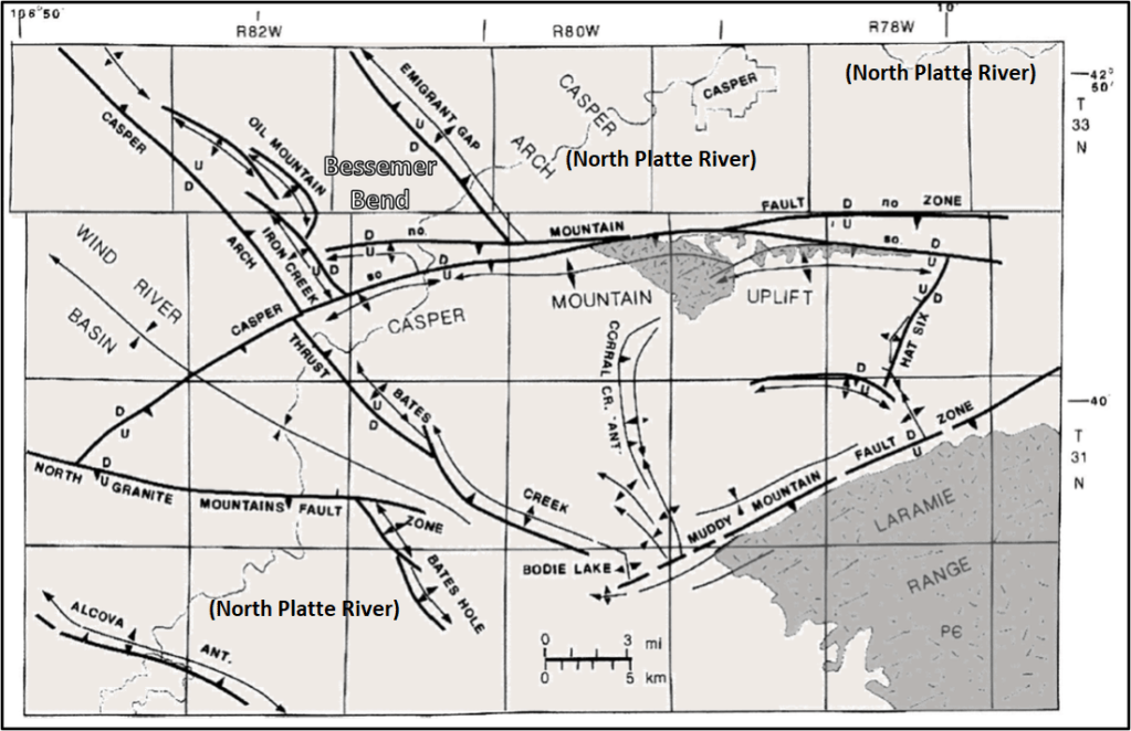
Through present-day Casper & the Bessemer Bend area, the trail passes through the eroded cores of anticlines, (huge arching folds of rock strata), and through synclines, the reverse of anticlines, where the strata bow down in the middle. Image below, is a geological map of anticlines and synclines along the North Platte River. Anticlines & synclines are prime locations to explore for petroleum reservoirs in the Cretaceous Mowry Shale.
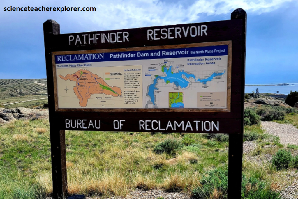
Eighty kilometers and 3 days’ travel south west from the Bessemer Bend or the North Platte River crossing, the emigrants reached the banks of the Sweetwater River. The valley of the Sweetwater points like and arrow west to South Pass, (the halfway point of the journey). Note that the confluence of the North Platte River and the Sweetwater River is now the Pathfinder Reservoir, (picture below).
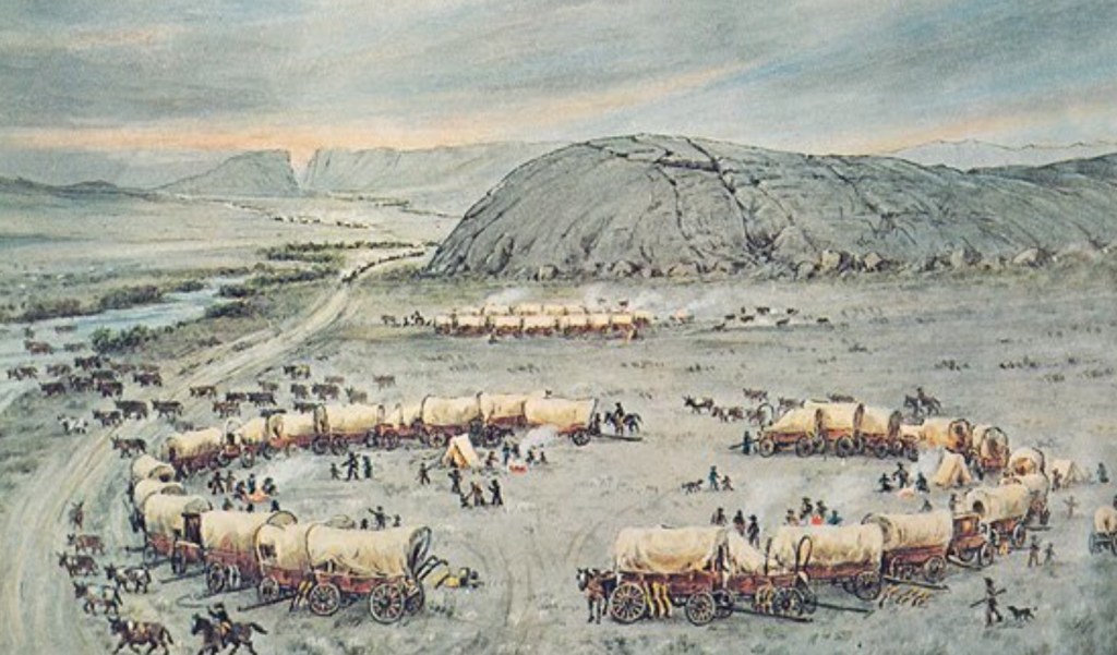
A few kilometers upstream from where the pioneers gained the Sweetwater River, they came to Independence Rock, (a kilometer long ridge of granite that rises like a whaleback from the sagebrush sea of the Sweetwater Valley. Earlier, (a few years before), I stopped by the Historical Landmark of Independence Rock, Wyoming in 2012.
Independence Rock, located in modern-day Wyoming, was the second big monolith the emigrants came across on their journey from the east. Many of the pioneers signed the rock with axle grease.
Independence Rock is what geologists call a “pluton:” a big body of igneous rock (in this case, a granite that is over one billion years old) that cooled slowly under the surface of the earth and then was slowly exposed by erosion of the surface layers. The rock is ancient even by geologic standards: more than 2.6 billion years old, (more than half the age of the Earth itself). It is part of the Sweetwater Hills, which stretch west for 80 kilometers along the course of the Sweetwater River. This granite belongs to a 2.6 billion year old basement rock that belong to large portions of the Laramie Range, Wind River Range, and other Wyoming mountains. Close up, the granite is a dazzling array of quartz, plagioclase, orthoclase, and mica minerals. Marble-sized phenocrysts of plagioclase feldspar poke up brusquely from the surface, standing high while the surrounding matrix crumbles away.
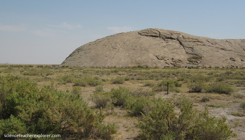
Independence Rock is more than 1.6 km in circumference and stands up to 45 m higher than the surrounding areas. It gets its name from its main function on the trail: travelers who weren’t at Independence Rock by Independence Day were lagging behind, and in danger from possible bad weather in the mountains ahead.
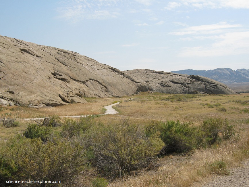
Located next to the pleasant Sweetwater River, Independence Rock was a popular place for emigrants who had made good time to take a little rest. Many of them carved their names into the wind-polished surface, and today it serves as a historical record book.
Ten kilometers southwest of Independence Rock, emigrants on the Oregon/California/Mormon trail, encountered another major trail landmark: Devil’s Gate. Here, the Sweetwater River has carved a narrow cleft in the granite that is about 123 m deep and 500 m long. The cleft is 10 m wide at the base but nearly 100 m wide at its top.
Millions of years ago, sediments from eroding mountains and ash from volcanoes filled the basins between the mountains. Rivers cut indiscriminately though softer sediment and harder rock. One such cut, once the sediment again eroded away, has left Devil’s Gate.
Pictured above, although the cleft was too narrow for wagons to pass through alongside the river, emigrants frequently stopped to hike around these rocks and carve their names. By the early 1850s, trading families were running a post at Devil’s Gate and another at nearby Independence Rock. Mostly these were French-speaking men with Shoshone wives and families.
3.2 km to the northwest of the picture above, nestled at the foot of the Sweetwater rocks, lies Martin’s Cove. Here Captain Edward Martin’s exhausted company of Mormon handcart emigrants sought shelter from a severe early winter storm in 1856. The Martin Company, low on provisions and traveling late in the fall, first encountered winter weather in late October near present day Casper. Of 576 men, women and children, approximately 145 died along the trail before finally reaching Salt Lake City the last day of November.