Chimney Rock, CO 2011
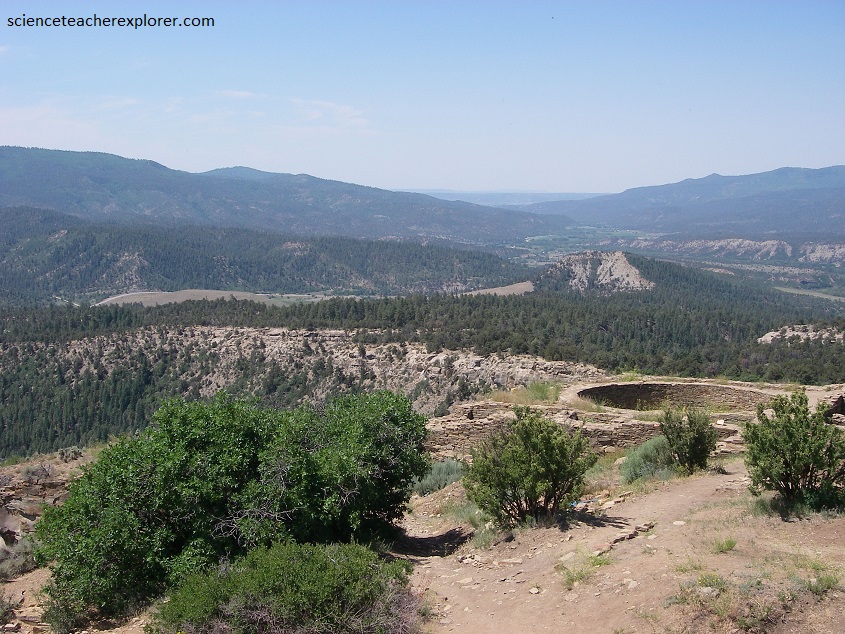
While in there area trekking, Becky (my wife) and I explored the archaeological site of Chimney Rock in Southwest Colorado. An access road winds northwest up the mountain from Highway 151 to the parking lot on the chimney rock High Mesa.
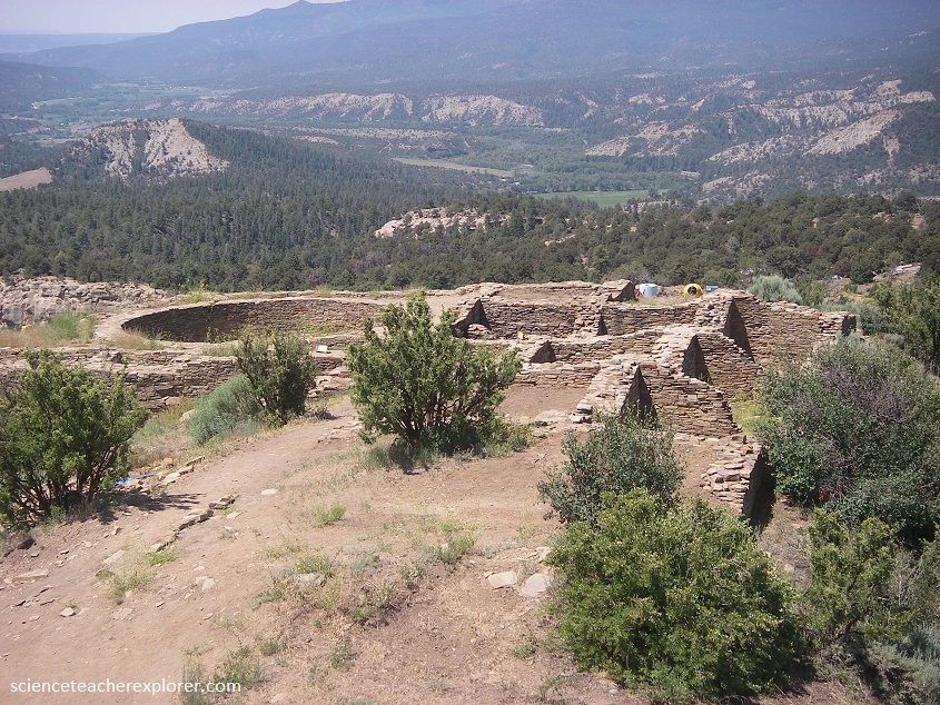
The Chimney rock archaeological area consists of the ruin of the High Mesa site group and six other communities surrounding it. It is estimated that some 1,200-2,000 people lived in these villages during the 1000s and that these people were a social unit. Experts suggest that there must have been a religions impetus to inspire building on this high mesa where the nearest good farmland and an abundance of water lay in the valley a thousand feet below.
Archaeologists have amassed considerable evidence that the great structures at Chimney Rock were in fact built for the express purpose of gathering as many people as possible to witness the standstill in one of the few places on earth where geology provides the necessary frame. The two ridges are sandstone in composition.
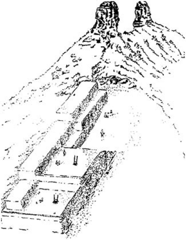
The most persuasive evidence comes from dendrochronology, tree ring dating, which places the two major episodes of construction at Chimney Rock 18 years apart and coincident with the northern lunar standstills of 1076 and 1094. The architecture provides additional clues: While the masonry of the Great House is indisputably Chacoan, the siting of the house is wildly strange.
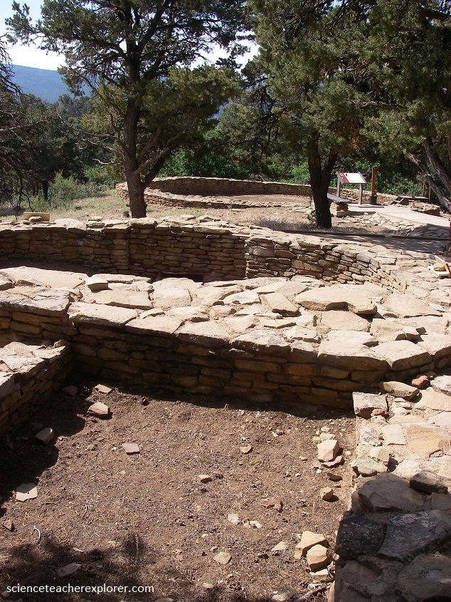
The Chimney Rock house was built of six million stones, 25,000 tons of earth and clay and 5,000 logs, and its construction required laborers to haul wood, food and water from the valley floor, 3 km away and 350 m down in elevation. And rather than center the house on the mesa, where one would expect, they shoved it right to its northern edge, creating the broadest possible platform from which to see the moon rising between the rocks.
So what was it for? Most archaeologists argue that the massive, decades-long effort to build the Great Houses, and the marking over several generations of the rhythms of the moon, served to unify Chacoan society across broad reaches of desert and time. Others emphasize political authority: the ability to predict the movements of the moon would have bolstered the leadership’s legitimacy, particularly because the Chacoan florescence coincided with an extraordinary degree of celestial activity.
Between 1020 and 1100, 70 lunar eclipses could be seen from Chaco Canyon. The supernova of 1054, which created the Crab Nebula, was visible even in daylight for 23 days. Halley’s Comet passed in 1066. Total solar eclipses were visible in Chaco and Chimney Rock in 1076 and 1097.
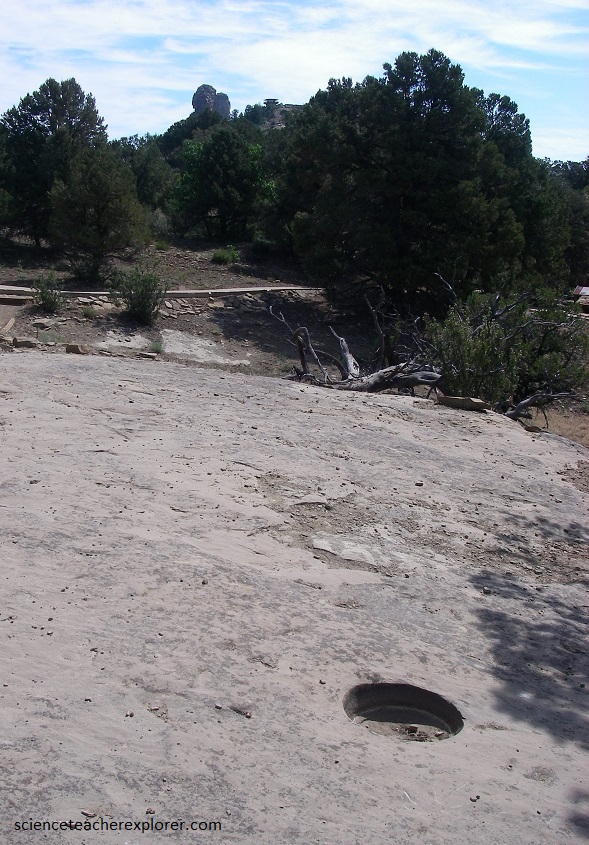
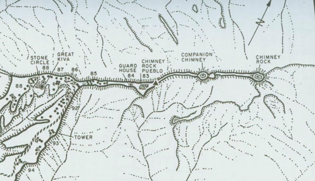
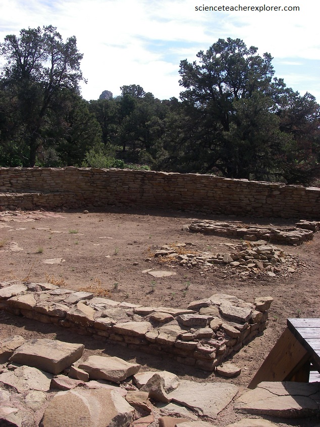
At Chimney Rock, all four quarters of the year are marked by man-made features using natural or man-made foresight. A stone tower near the present-day parking lot likely was a solar observatory marking the winter solstice sunrises over the east slope.
From the stone basin, the Ancestral Puebloans could watch the sun rise over the north wall of the Great House on the summer solstice.

Across the Piedra River on Peterson Mesa, the structure in the Chacoan architectural style could have been a vantage point for watching the sun rise between Chimney Rock and Companion Rock on both the spring and fall equinoxes.
The Great House Pueblo is a natural observatory for another astronomical event—the major lunar standstill. The moon’s orbit of earth oscillates or wobbles, gradually causing the moon to rise at different points on the horizon over the years. The entire cycle of wobbling north to south and north again takes 18.6 years to complete. At each end of its swing, the moon pauses for about three years, rising at the same point on the horizon before beginning to move back toward the opposite end of the swing. This pause is known as a major lunar standstill.
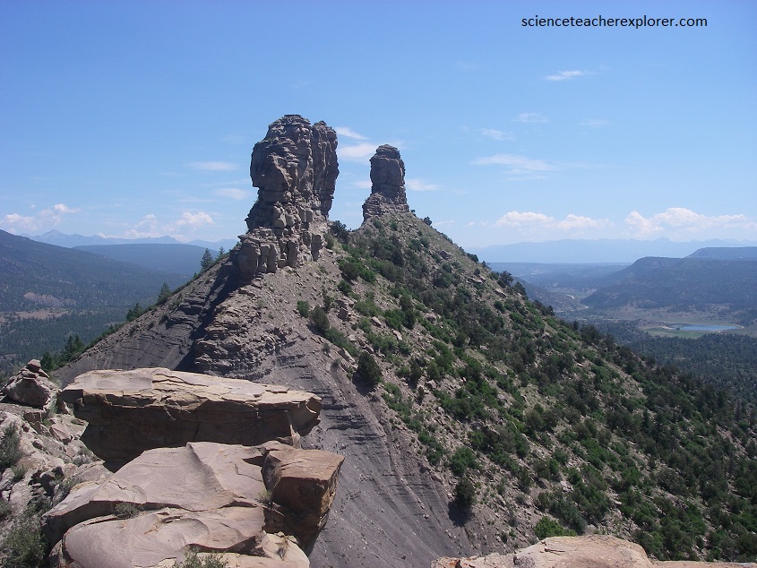
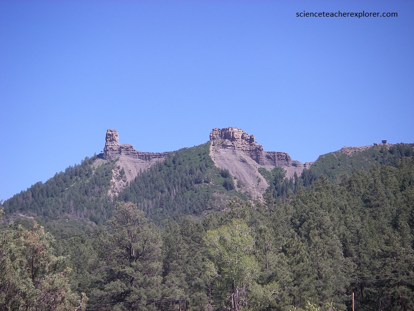
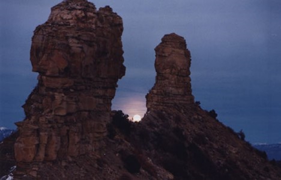
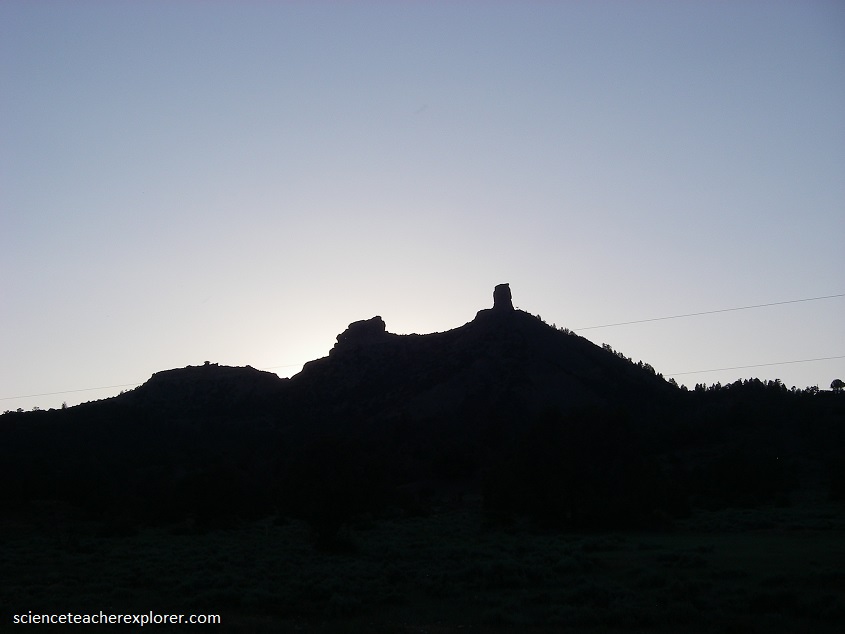
The majestic natural sandstone pillars of Chimney Rock have a unique connection to the major standstill of the moon. Seen from the Great house, the stone towers are slightly out of line with each other, framing a narrow window of sky between them, (pictured above).
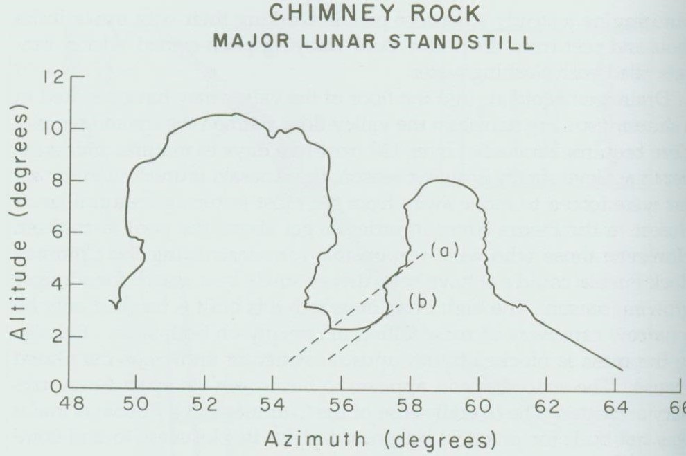
Imaged above, at sunset near the day of winter solstice during the major lunar standstill, the full moon rises exactly between the stone pillars, caught in this thin window of sky, and is visible only from this one-vantage point high on the narrow mesa. The platform stands at the only spot where the moonrise can be seen at the peak of the 18.61 year cycle.
Certainly, anyone who was on the Chimney rock mesa curing the lunar standstill could not have missed the moonrise between those stone pillars. Lunar standstills occurred in 1056-1057, 1075-1076, 1094-1095, and 1112-1113. Tree-ring dates place the periods of major construction of the Great House Pueblo at 1076 and 1093, (anticipating the next standstill).
The alignment between the Great House and the Chimney Rock pillars and the moon is real. It has been calculated, surveyed, and confirmed. The question that remains unanswered is its cultural and spiritual importance to the Ancestral Puebloans of Chimney Rock. Was the lunar standstill an event of spiritual awe and wonder to the Ancient Pueblos or just another pretty but meaningless happening in the sky?
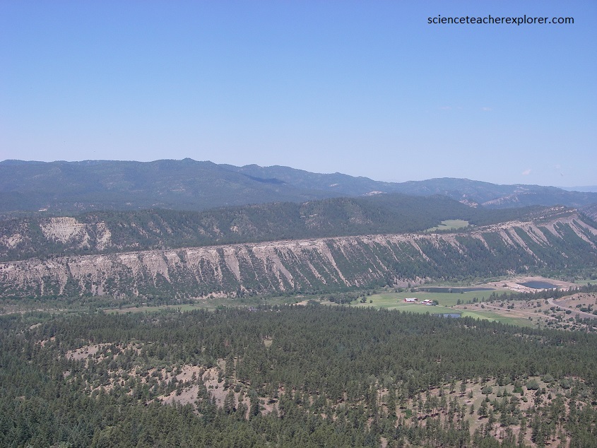
Chimney Rock and nearby Companion Rock are formed of the 70 million-year-old Pictured Cliffs Sandstone. Approximately 100 meters thick, the unit is formed of marine sandstones with small layers of interbedded shales deposited during the final retreat of the Western Interior Seaway. The Pictured cliffs Sandstone overlies the Lewis Shale, deposited in the sea when it was deeper.
The pinnacles provide a striking example of differential erosion in which the overlying sandstone erodes much more slowly than the under-lying shale. Here, the Lewis Shale and Fruitland Formation (sandstone, shale, and coal) have eroded more quickly, leaving the resistant Pictured Cliffs Formation standing high in the landscape.
