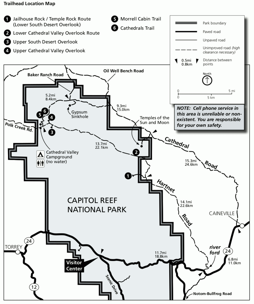
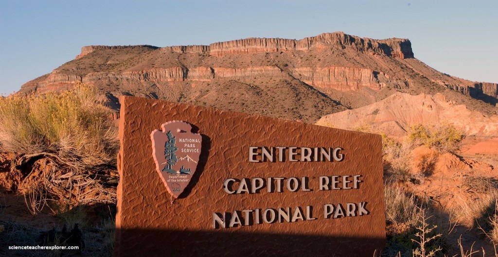
Cathedral Valley, UT
In June of 2010; I did a significant exploration of the northern section of Utah’s Capitol Reef National Park called Cathedral Valley. My trekking group took the 90 km dirt loop through Cathedral Valley for the stunning desert panoramas and view the massive monoliths that erupt from the valley floor. This is one of the most beautiful scenic drives in all all of Utah.
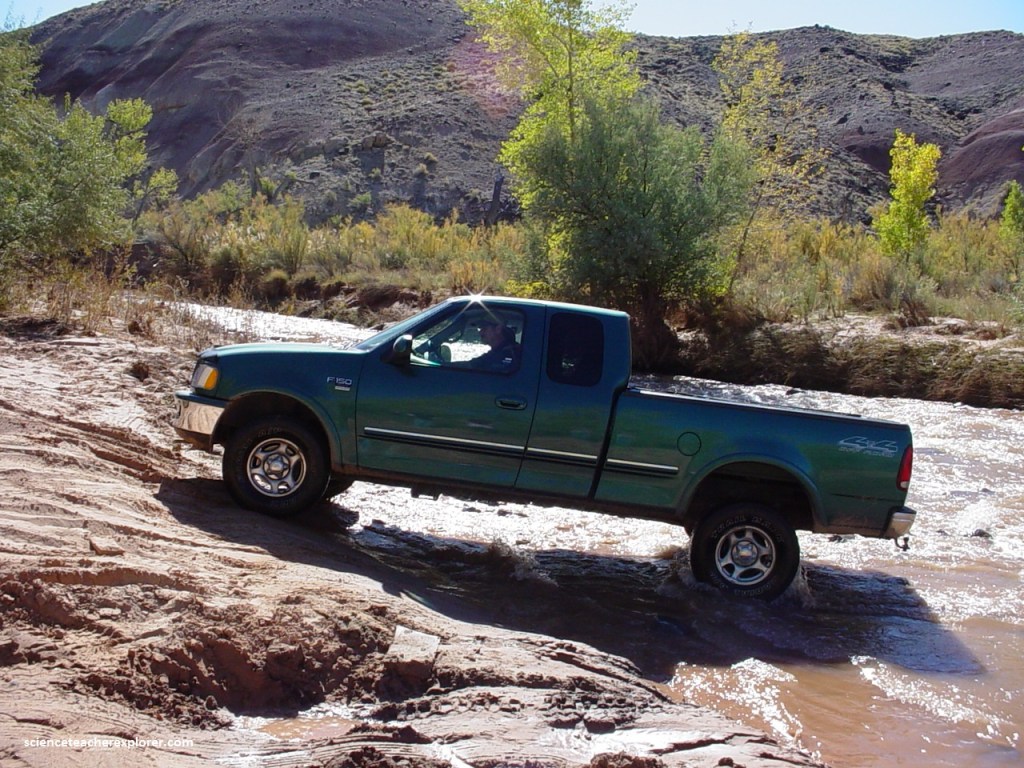
My trekking group had decided to go clockwise around the loop, starting at the Harnet-Road River-Fjord at (mile marker 91 on SR 24) to make sure our vehicles could cross the Fremont River. There is no bridge over the Fremont River. It was a little over 16 km east of the Capitol Reef Visitor Center. The Fremont River is pretty shallow in this spot (usually about a 40 cm or less) and has a hard, rocky bottom. But June was a little early for this attempt.
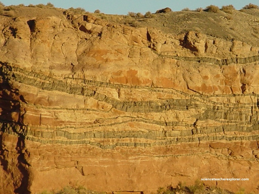
After the Harnet-Road River-Fjord, we reached the Bentonite hills 12 km in.
Pictured above, the soft rounded hills made of colorful layers of pebbled Bentonite Clay felt more like something you’d see on an alien planet rather than Earth.
Picture below, getting up close, the clay almost looked like jagged popcorn. It was formed millions of years during Jurassic times when mud, silt, fine sand, and volcanic ash were deposited in swamps and lakes.
The clay is powdery to drive on when dry, but becomes incredibly slippery when wet. The hills are composed of the Brushy Basin shale member of the Morrison Formation.
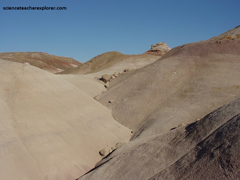
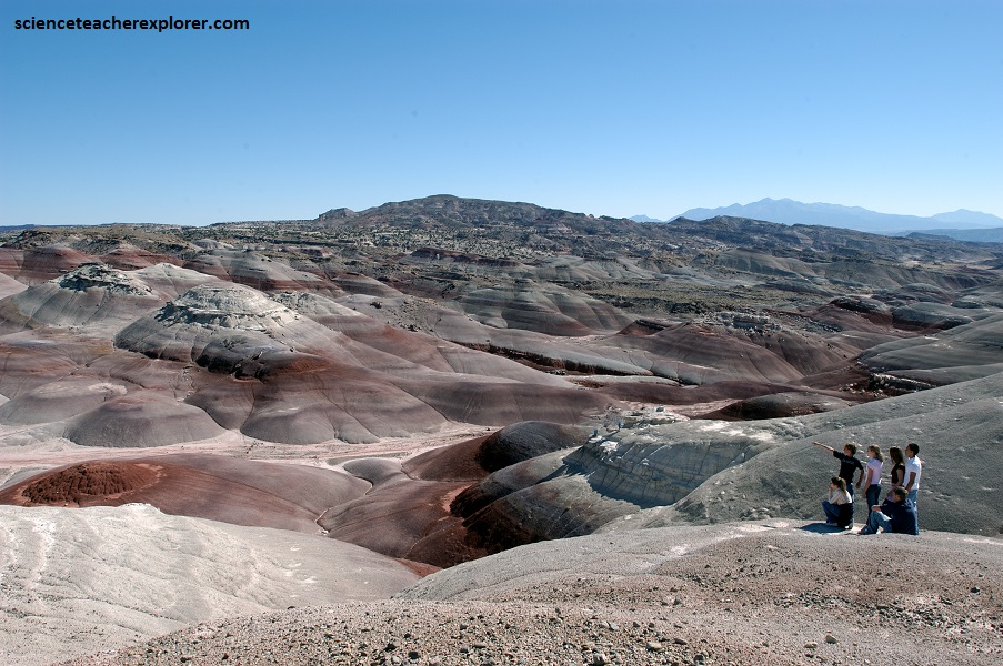
Pictured below, the “Bentonite Hills” among the Hartnet Road and the Painted Desert on the Cathedral (also known as the Caineville Wash) Road appear as softly-contoured, banded hills in varying hues of brown, red, purple, gray, and green.
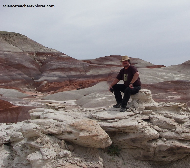
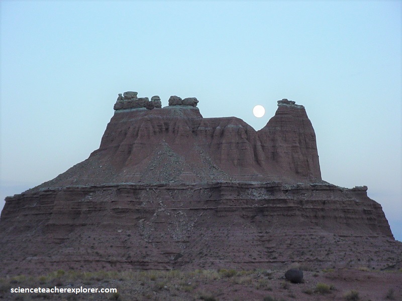
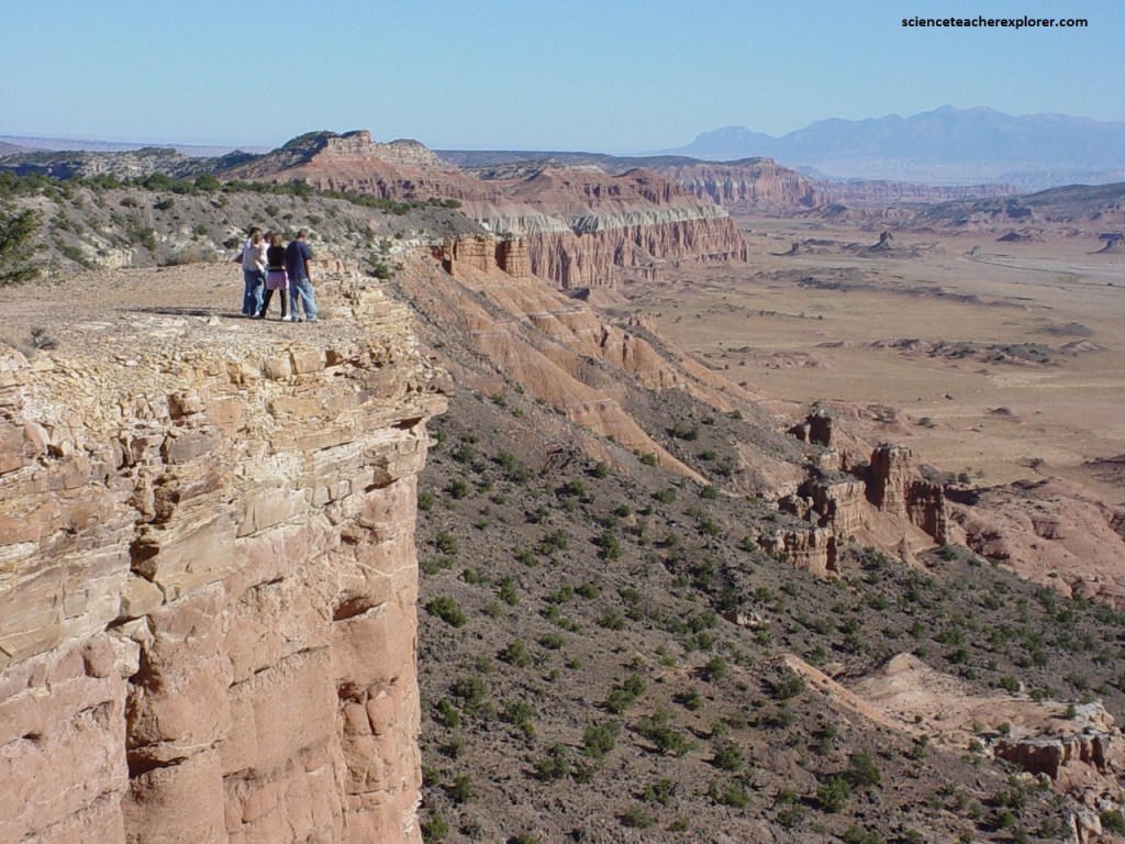
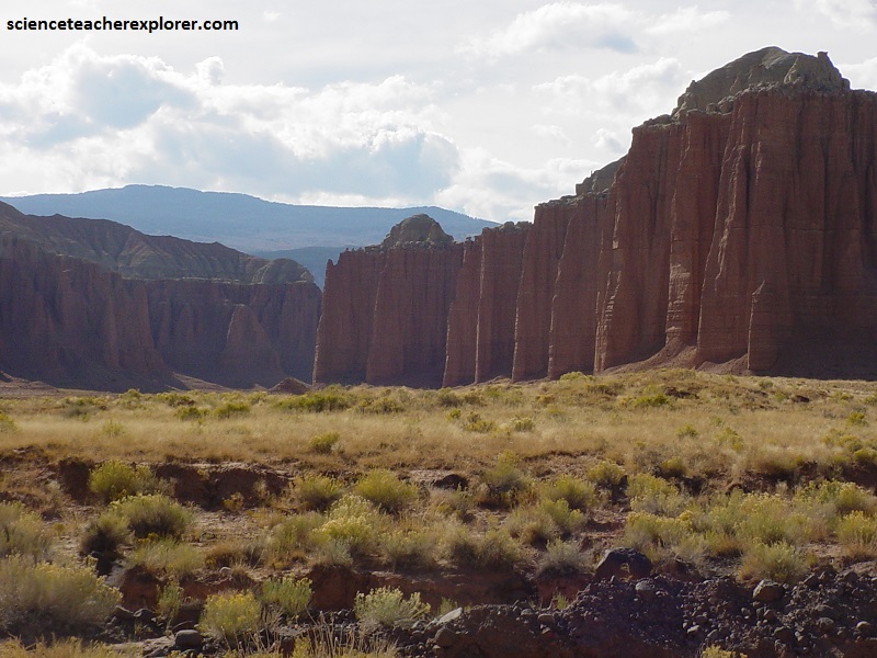
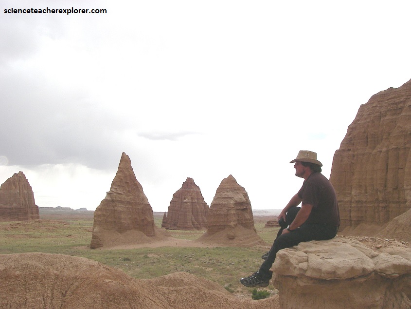
Up the road from the “Bentonite Hills”, there is a parking lot to visit the “South Desert of Cathedral Valley”. From the vehicles, there is a 0.5 km trek that takes you to the Lower-South Desert-Overlook where you can look out over the expansive valley and spot Jailhouse Rock, Temple Rock, and Thousand Lake Mountain, (pictured below).
Pictured above and below, the South Desert is a long, narrow valley that runs parallel to the strike of the Water-pocket Fold monocline. In the near distance, Temple Rock, composed of Entrada Sandstone, rises 152 m from the valley floor.
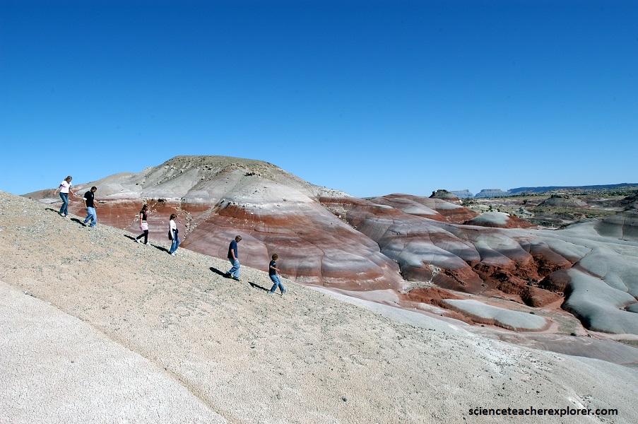
Pictured above, from Lower South Desert-Overlook (located midway through the valley), you can see rock layers ranging from the gray, ledgy Morrison atop the cliffs to the east to the white Navajo Sandstone slick-rock and domes high on top of the Fold.
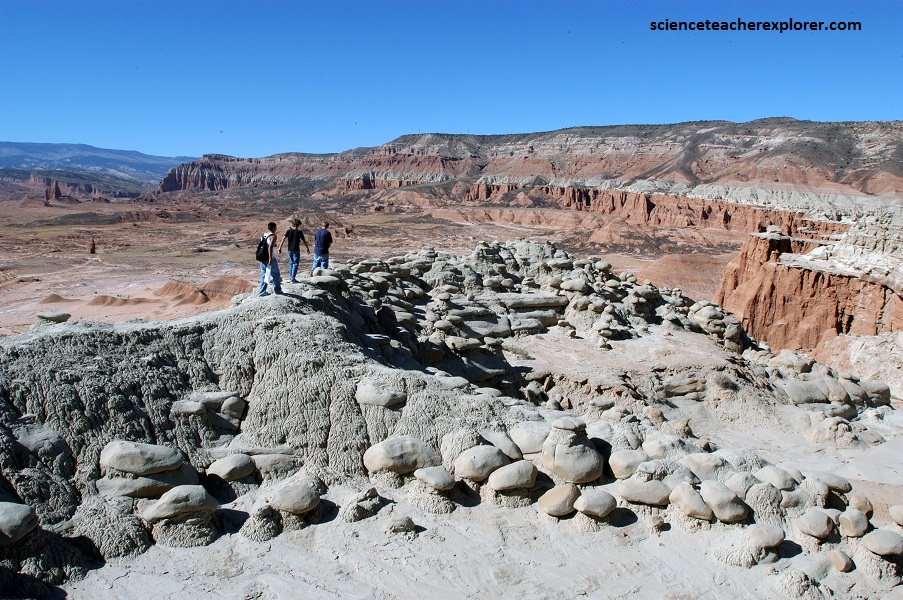
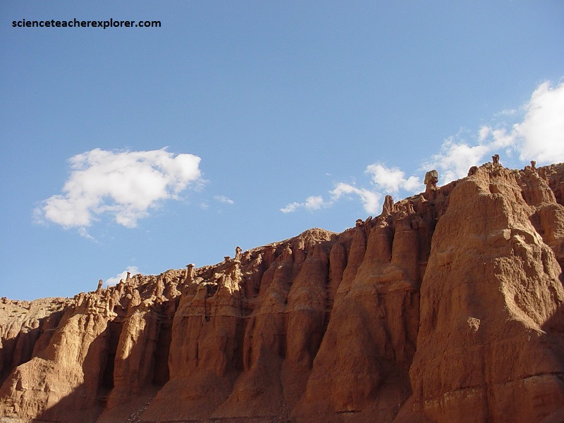
Pictured above, 18 km down the road and we stopped at the Upper-South Desert-Overlook, viewing the same valley but from the opposite side than the previous photo.
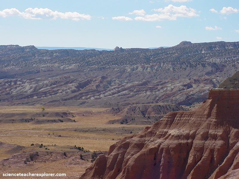
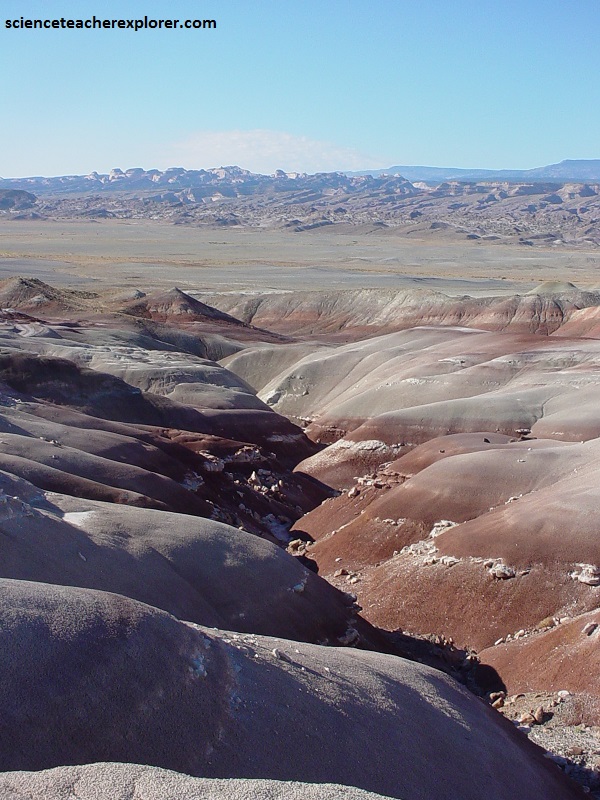
Pictured above, The South-Desert valley extends 32.2 km from the Upper-South Desert-Overlook southeast to Hwy 24.
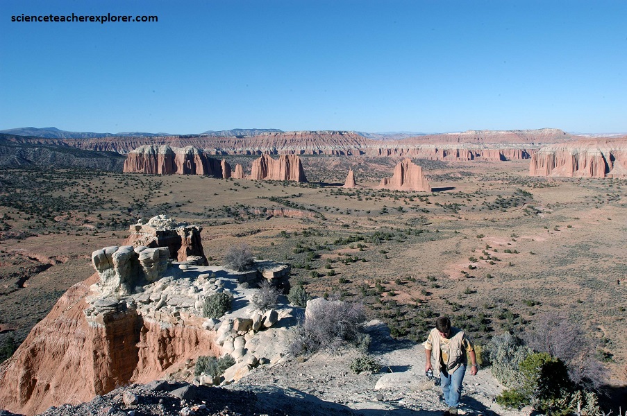
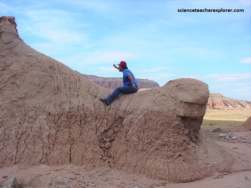
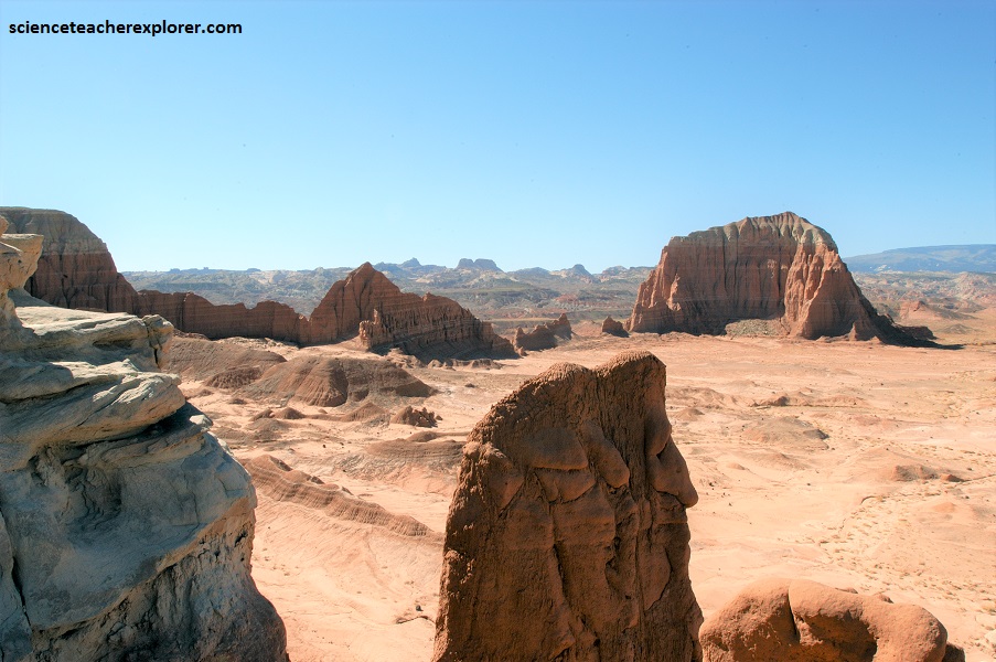
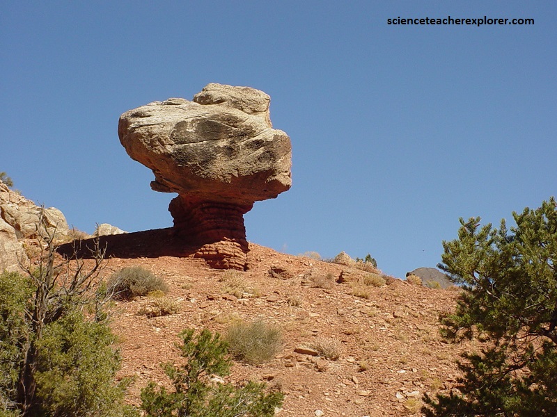
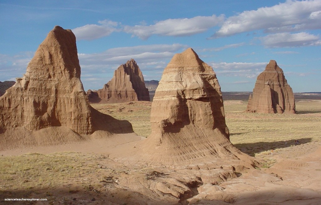
Upper and Lower Cathedral Valley offer exquisite views of sculptured monoliths with intriguing names. The valley is also walled in by fluted Enstrada sandstone cliffs, and the occasional monolith juts up out of the desert floor. This valley is also dotted dark green with bushy piñon-juniper trees.
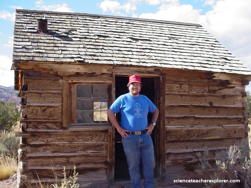
Pictured above, the Morrell Cabin was was built in the 1920s on the nearby (towards the west) Thousand Lake Mountain by Paul Christensen. It was a summer house for his family at their sawmill. Around 1935, Christensen gave up his sawmill and sold the cabin to Morrell, a local cattleman. Morrell took it apart and moved the cabin to Cathedral Valley, where he reassembled it on its present location. The building served as winter camp for Morrell’s cowboys until 1970, when the family sold the cabin to the National Park Service. In this desert environment, the land couldn’t support so many animals. So, wide-spread damage from overgrazing made ranching unprofitable.
The monoliths are composed of the earthy, buff-pink Entrada Sandstone. Deposited 160 million years ago in the Jurassic period, this fine-grained sandstone formed by the deposition of sand and silt in tidal flats. It crumbles easily to a fine sand which is rapidly removed by water; therefore, talus (debris) slopes do not form and Entrada cliffs tend to rise sheer from their base.
Pictured above, above the Entrada Formation, the grayish-green sandstone and siltstone of the Curtis Sandstone forms a hard cap rock on some of the monoliths and higher cliffs and buttes, protecting them from erosion. Above the Curtis is the thinly-bedded, reddish-brown siltstone of the Summerville Formation.
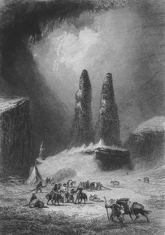
In the winter of 1853, John Charles Fremont passed through Utah and Colorado, attempting to find a northern railroad route to the Pacific Ocean. The expedition was difficult and the explorers were forced to eat their horses before stumbling upon a Mormon settlement. Fremont took care to document their journey, hiring a daguerreotypist, “Solomon Nunes Carvlho”, a Jewish South Carolinian. Most were destroyed, but this one survived and was unknown of it’s location until, “Cathedral Valley” was discovered to the general public in the 20th Century.
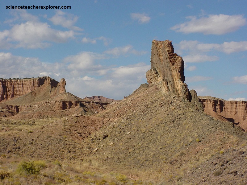
Pictured above, is the exact spot that one of the surviving images of Carvlho Daguerreotypes, depicting rock monoliths located in the North District of Capitol Reef, known as “Mom, Pop, and Henry.” They are actually part of the “Jericho Walls” of Cathedral Valley.
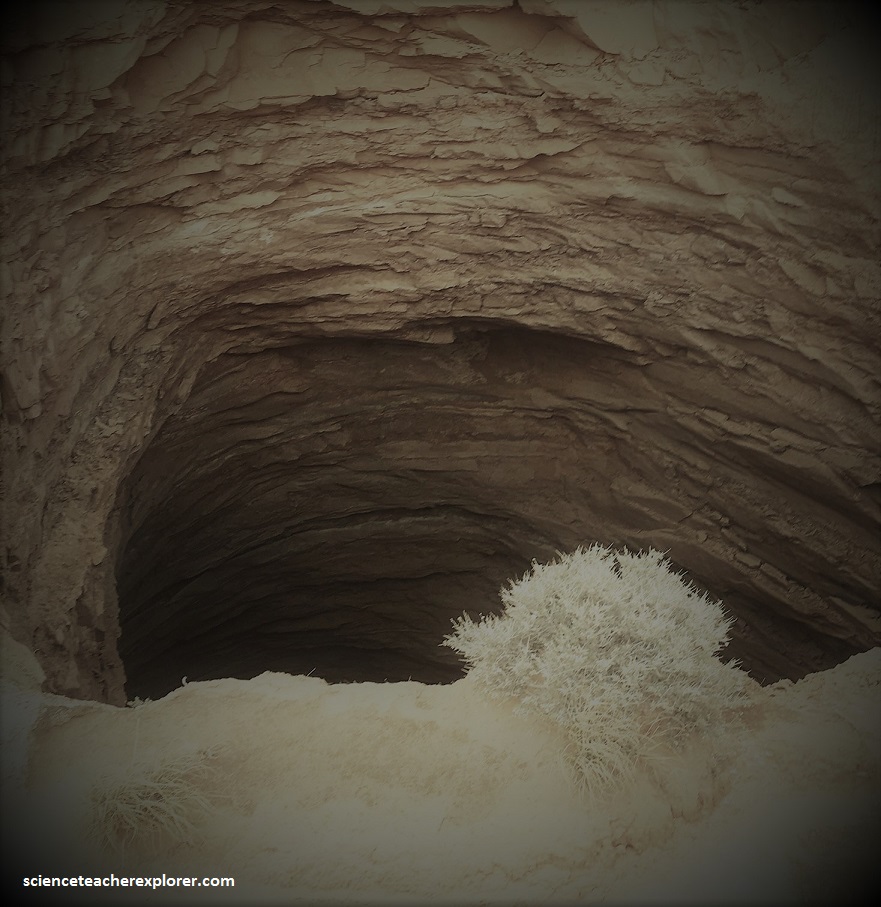
Pictured above, the Gypsum Sinkhole is where groundwater dissolved a buried gypsum plug. The cavity left behind has collapsed under the weight of overlying rock layers. This collapse has created a large sinkhole nearly 15 m in diameter and 61 m deep.
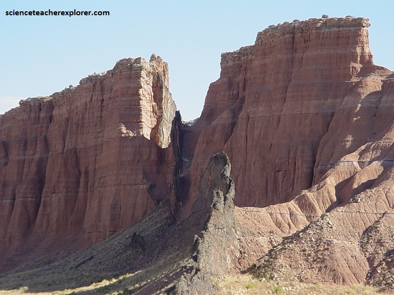
The dikes and sills seen in Cathedral Valley formed as recently as 3-6 million years ago. Dikes (pictured above) and sills (pictured below) are the result of molten lava flowing into vertical joints (dikes) or between horizontal layers of sedimentary rocks (sills), then solidifying. More resistant to erosion than the surrounding layers, the lava rock outcrops provide a stark and rugged contrast, forming jagged ridges and pointed outcrops.
Pictured below, Glass Mountain is a large, exposed mound of selenite crystals. Selenite is a variety of gypsum (CaSO4•2H2O) in the form of glassy crystals. The crystals of glass mountain are somewhat unusual in size and in the massiveness of the deposit. Glass Mountain formed as a result of groundwater flowing through the Entrada Sandstone. This water carried dissolved gypsum, which started to crystallize, forming what has been called a “gypsum plug”. This plug is now being exposed as the soft Entrada Sandstone erodes away and it’s occurrence is the opposite of the “Gypsum Sinkhole” explained above.
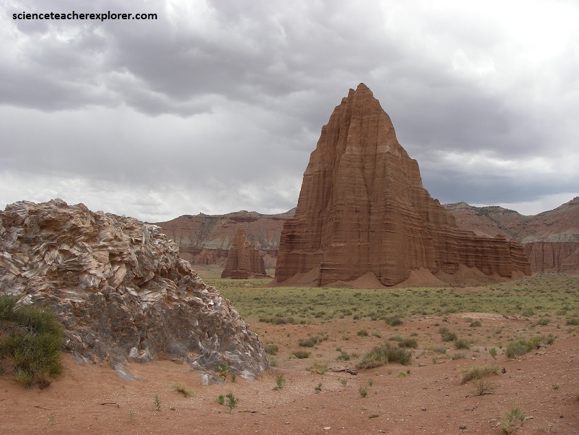
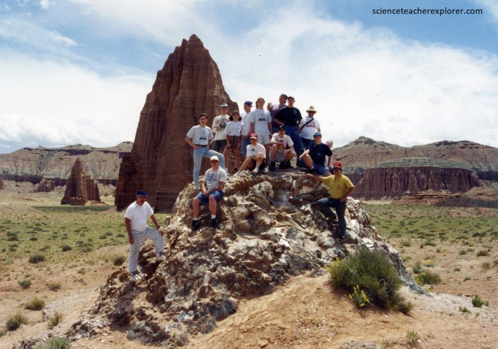
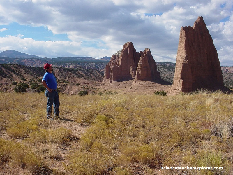
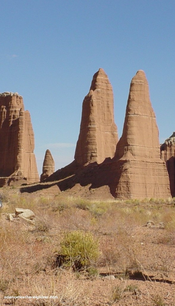
The temples of the “Sun and Moon” are the massive monoliths made of pinkish-red Entrada sandstone that Cathedral Valley was named for.
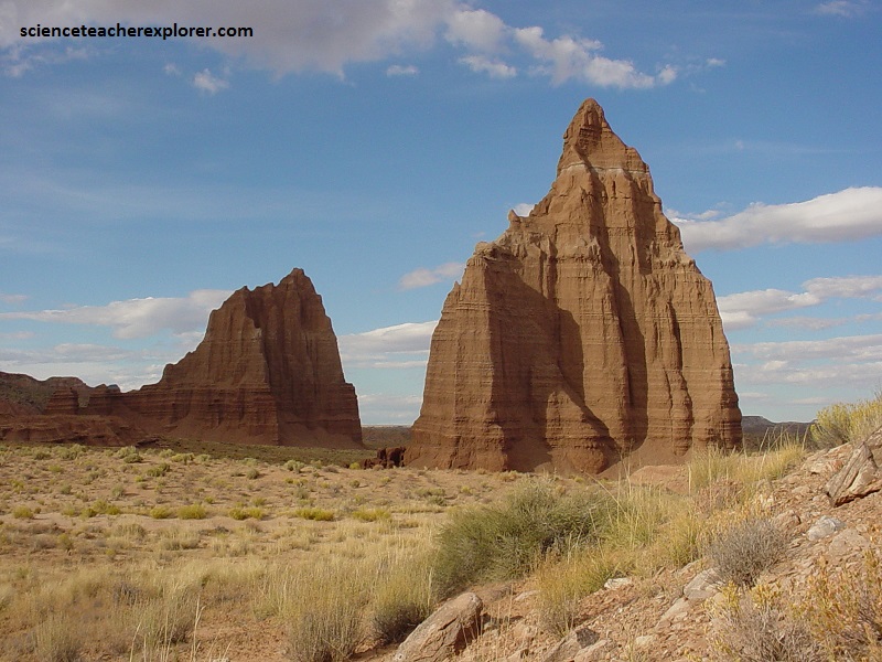
Pictured above, the road goes right by the Temple of the Sun and the Temple of the moon, so you can get up close and really feel how high they tower above. The free-standing Temple of the Sun towers over 122 meters above its surrounding terrain and the free-standing Temple of the Moon towers nearly 90 meters above its surrounding terrain. They are north and south of each other, with the “Sun” in the north.
Pictured above, both “Temples” are composed of unfractured, buff-pink Entrada Sandstone. The sandstone, which was originally deposited as sandy mud on a tidal flat, formed about 160 million years ago during the Jurassic period as a giant sand desert, the largest in Earth’s history.
Cathedral Valley was so named in 1945 by Charles Kelly, first superintendent of Capitol Reef National Monument, because the valley’s sandstone monoliths reminded early explorers and local-prospectors of ornate, Gothic cathedrals, with fluted walls, alcoves, and pinnacles.