Parashant N.M., AZ
In the summer of 2005, I decided to explore the new “Parashant National Monument”. Actually, the Grand Canyon-Parashant National Monument (sometimes referred to as “Parashant National Monument) is located on the north-western edge of the Grand Canyon in northwest Arizona.

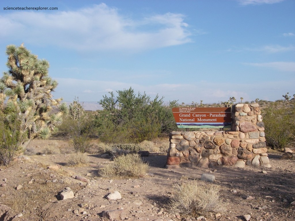
The monument was established by Presidential Proclamation 7265 on January of 2000. To explore it, I decided to enter the monument from the western side on Gold Butte Road. I entered Gold Butte Road from I-15 at exit 112 in Nevada.
To explore the “Parashant National Monument”, I decided to enter the monument from the western side, byway of Gold Butte Road. I entered Gold Butte Road from I-15 at exit 112 in Nevada, (pictured below).
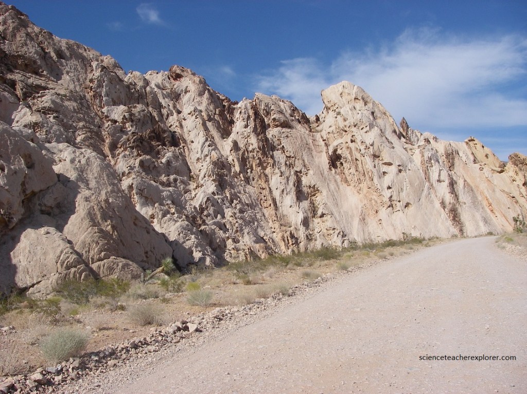
Pictured below, my first geological destination was “Whitney Pocket”, (32 km from exit 112 on I-15 on Gold Butte Road). At Whitney Pocket we see the beautiful, variegated Navajo or Aztec Sandstone which was formed ~180 million years ago in a huge sand desert. Most of the sandstone was formed as large sand dunes. The dunes were later colored red, pink, orange and yellow by small traces of iron.
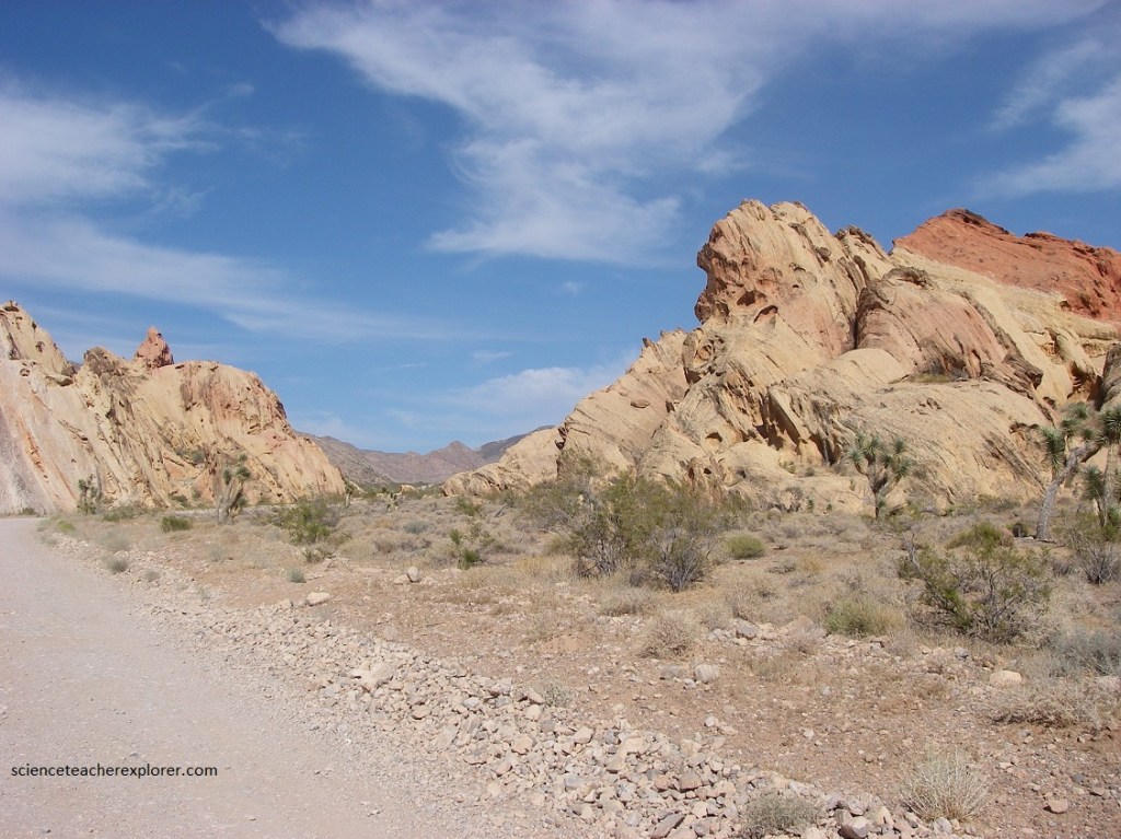
The Aztec Sandstone is made up of two units. The lower resistant sandstone unit (100 meters thick) is tan to off-white in outcrops but pinkish in fresh exposures. Cross-bedded lenses can easily be observed. The upper and less resistant unit (200m thick) consists of alternating white quartz arenites and red silty sands.
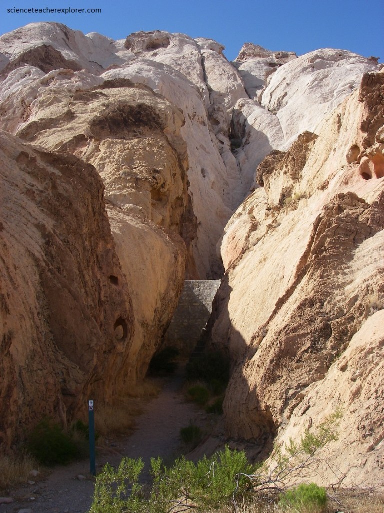
Pictured below, on the south side of the Aztec Sandstone outcrop, is a cistern that is tucked away in a short slot canyon that was built by the CCC. The dam is several feet thick and has steps on both sides.
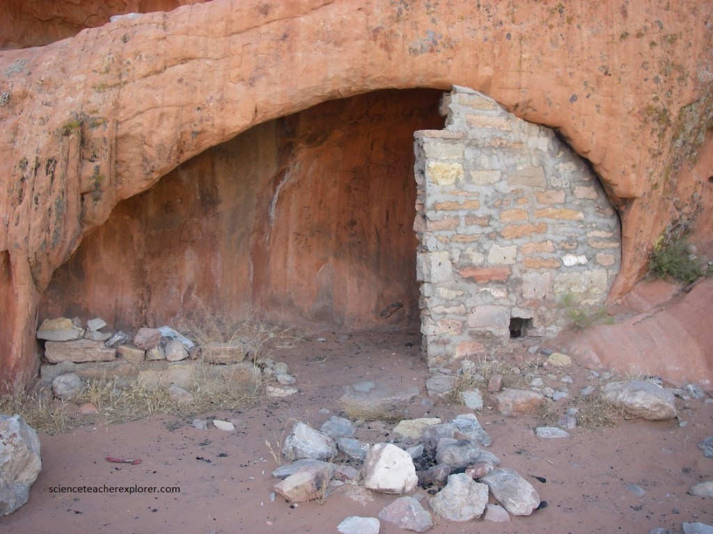
Pictured below, directly across the road from the cistern, is another outcrop of sandstone that has various ruins that are left over from the CCC camp. This little alcove has a natural vent hole in the roof. In the wall that is still standing you can see the air intake. A little further down the cliff is another cubby hole that may have served as an oven.
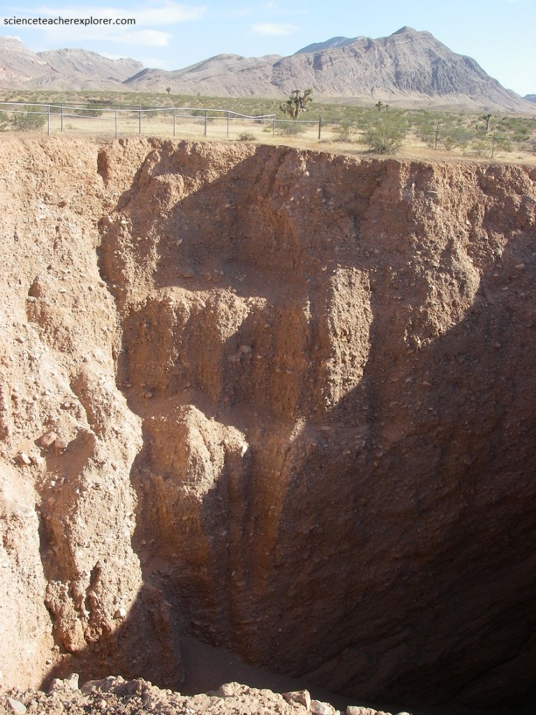
Pictured below, (6 km south of Whitney Pocket), is the “Devil’s Throat”. This large sinkhole formed in 1908, when cowboys working in the area were startled by a roar and a column of dust in the distance. Upon investigation, they found a section of the desert floor had collapsed into a pit. It’s believed this was caused by the dissolution of gypsum in the subsurface. Gypsum, calcium sulfate, like limestone, is barely soluble in water and the soils underlying this area are rich in the mineral. It’s thought that moving groundwater, over time, leached out enough gypsum to form a void, which then collapsed.
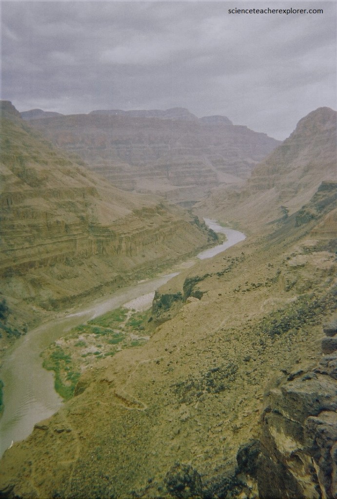
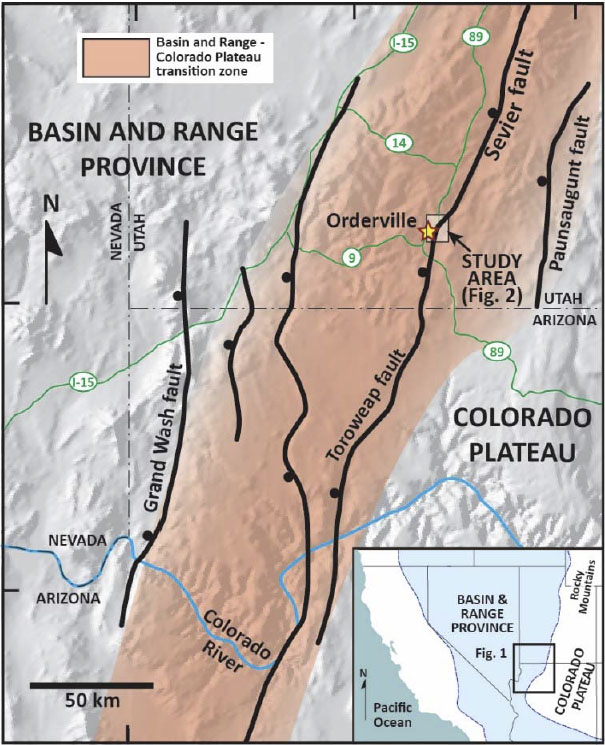
As I continued on the Gold Butte Road, towards the Parashant National Monument boundary, I cross the “Grand Gulch Fault Zone”. The Grand Wash Fault marks the boundary between the Basin and Range and the Colorado Plateau. The national monument is a very remote and undeveloped place jointly managed by the National Park Service (NPS) and the Bureau of Land Management (BLM). There are no paved roads into the monument and no visitor services. The distances involved, require one to camp along the way with extra gasoline tanks.
This remote area of open, undeveloped spaces and engaging scenery is located on the edge of one of the most beautiful places on earth, the Grand Canyon. Despite the hardships created by rugged isolation and the lack of natural waters, the Parashant Monument has a long and rich human history spanning more than 11,000 years, (pictured above), and an equally rich geologic history spanning almost 2 billion years. Full of natural splendor and a sense of solitude, this area remains remote and unspoiled.
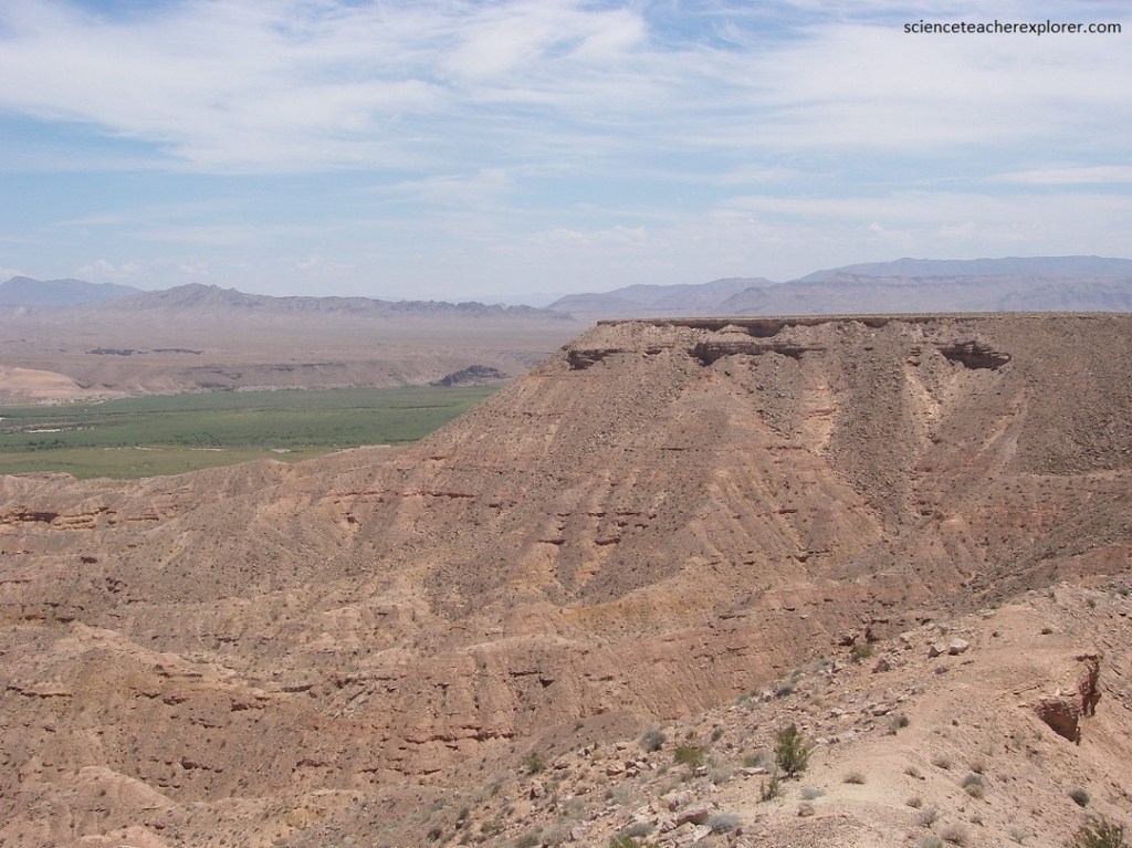
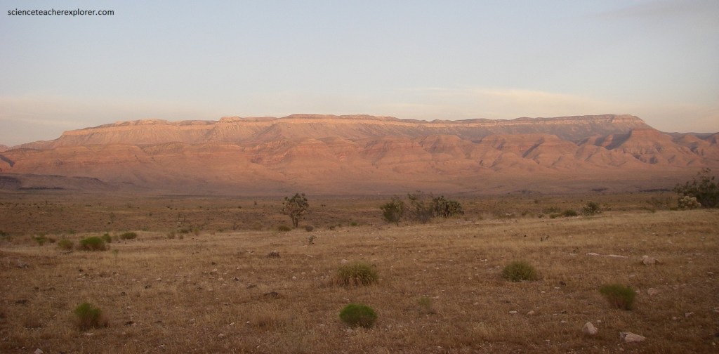
The boundary between these two large geologic provinces creates some of the most spectacular scenery in the Parashant Monument. As I travel the area, the enormous vertical escarpment of the Grand Wash Cliffs clearly marks the transition, with the pinyon-juniper uplands of the Colorado Plateau province visible on top to the east and the Mojave Desert in the Basin and Range province to the west.
The “Grand Walsh Fault” is a high-angle normal fault that is the dominant structural feature of the area and trends from southwest Utah into west-central Arizona, through the Parashant Monument. Vertical displacement of the Grand Wash Fault blocks is estimated to be as much as 3,300 meters near the Colorado River and even more further south into west-central Arizona.
The landscape east of the Grand Wash Cliffs is within the Colorado Plateau, and geologic formations comprising the cliffs are, for the most part, the same as those in the Grand Canyon exposed further to the east and south. The landscape immediately west of the Grand Wash Cliffs begins the familiar Basin and Range topography. So, the Grand Wash Cliffs represent a rather abrupt transition between two major geologic provinces.
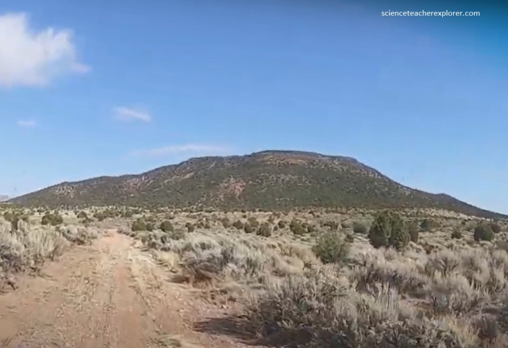
From “Pakoon Springs”, I headed toward Poverty Mountain through “Hidden Canyon” on a 4WD road (pictured below). The Grand Wash Cliffs juxtapose the colorful, lava-capped Precambrian and Paleozoic strata of the Grand Canyon against the highly faulted terrain, recent lake beds, and desert volcanic peaks of the down-dropped Grand Wash trough. The Shivwits Plateau here is capped by volcanic rocks with an array of cinder cones and basalt flows, ranging in age from 9 million to only about 1000 years old, (pictured below on Poverty Mountain).
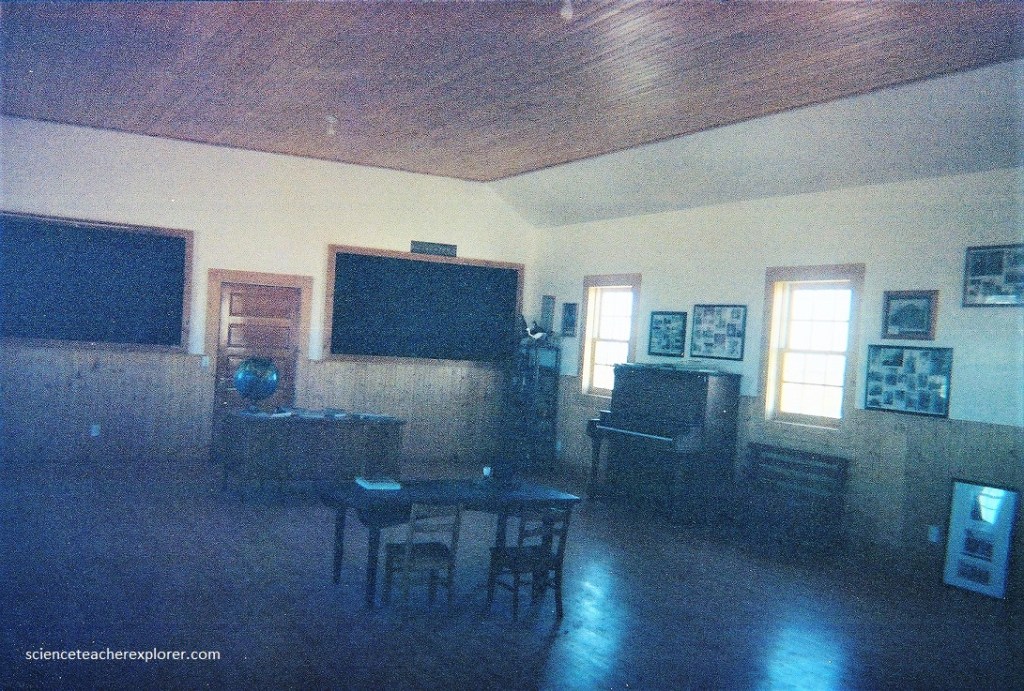
Once I by-passed Proverty Mountain on the southside, I headed towards the “Mount Trumbull School House” to the east, (pictured below). The Mt. Trumbull Schoolhouse was built in 1918. It was used for a school, church, dance hall, and town meeting facility. As the population around the schoolhouse dwindled, it fell into disrepair. In 1966, its doors closed. Then in on July 31, 2000, arsonists burned the building down.
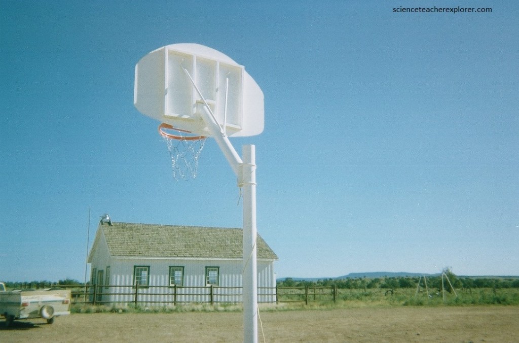
However, a restoration committee made the decision to build a schoolhouse replica, (pictured above and below). The restoration was completed in partnership with some of the descendants of the first settlers of Mt. Trumbull, the BLM, and contributions from the public. The Mt. Trumbull Schoolhouse was rededicated on October 13, 2001.
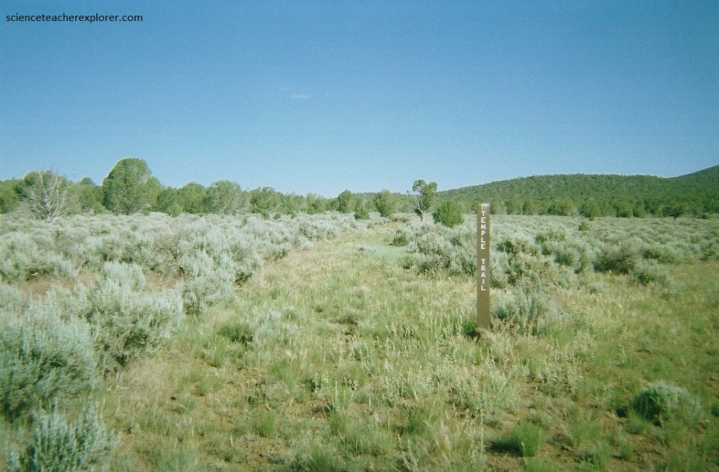
Pictured below, early historic sawmills provided timber that was hauled 113 kilometers along the Temple Trail wagon road from Mt. Trumbull down the Hurricane Cliffs to St. George, Utah. Ranch structures and corrals, fences, water tanks, and the ruins of sawmills are scattered across the monument and tell the stories of the remote family ranches and the lifestyles of early homesteaders.
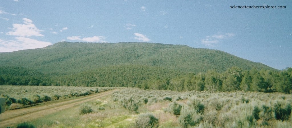
Pictured below, the Mt. Trumbull mesa is capped by a 3.6 million year old dark grey basalt lava flow, one of the first eruptions in the Uinkaret volcanic field. The Uinkaret volcanic field is an area of monogenetic (erupted once) volcanoes in the Parashant National Monument.
At the south end of the Shivwits Plateau are several important tributaries to the Colorado River, including the rugged and beautiful Parashant, Andrus, and Whitmore canyons, (I’ve explored the related ridges of “Kelly Point & Twin Point Overlooks at another time). The Plateau here is capped by volcanic rocks with an array of cinder cones and basalt flows, ranging in age from 9 million to only about 1000 years old.
Pictured above, the ponderosa pine ecosystem in the Mt. Trumbull area is a biological resource of scientific interest, which has been studied to gain important insights regarding dendroclimatic reconstruction, fire history, forest structure change, and the long-term persistence and stability of pre-settlement pine groups.
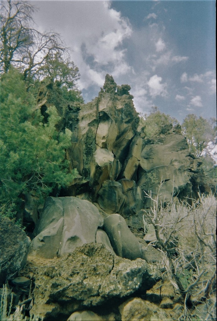
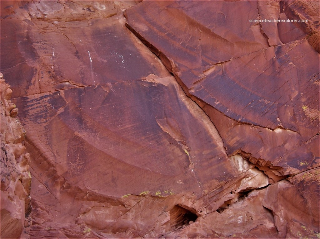
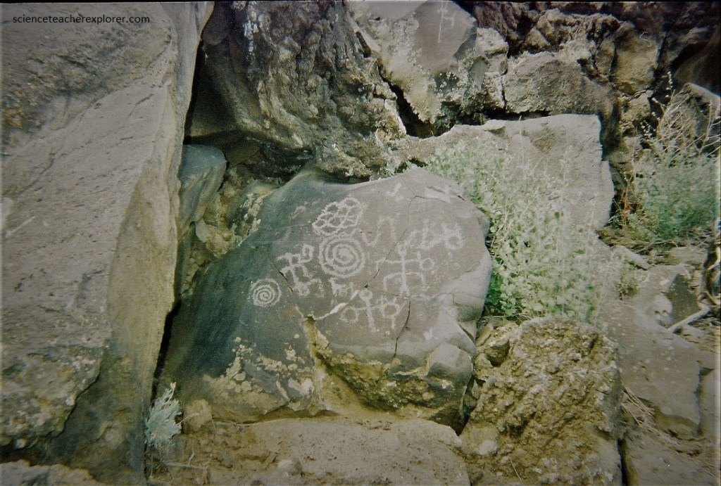
Pictured above and below, the Nampaweap Petroglyph Site is on the southern slope of Mount Trumbull. “Nampaweap” is a very large with hundreds of individual petroglyphs covering the face of the lava flow at the head of Nampaweap canyon.
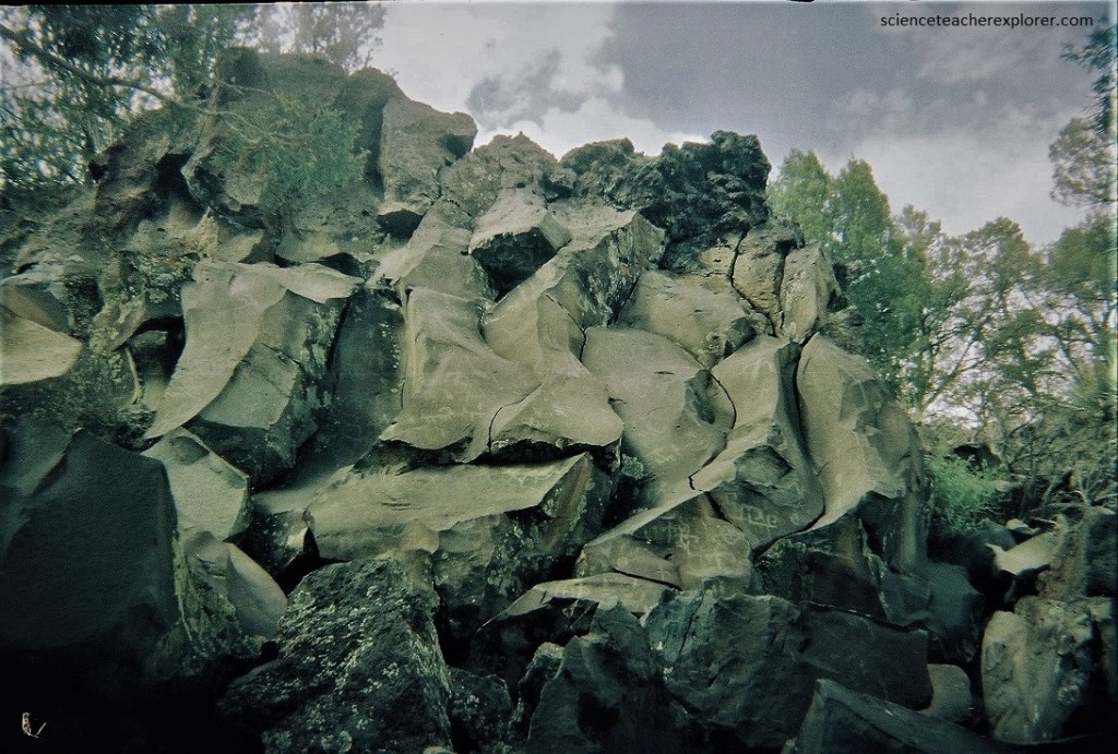
The Nampaweap canyon is a natural corridor from the Colorado River to the Ponderosa pine forest on Mt Trumbull and the wetland around Nixon Spring. There are a large variety of symbols represented at this site including the nearly universal anthropomorphic figures, (pictured below).
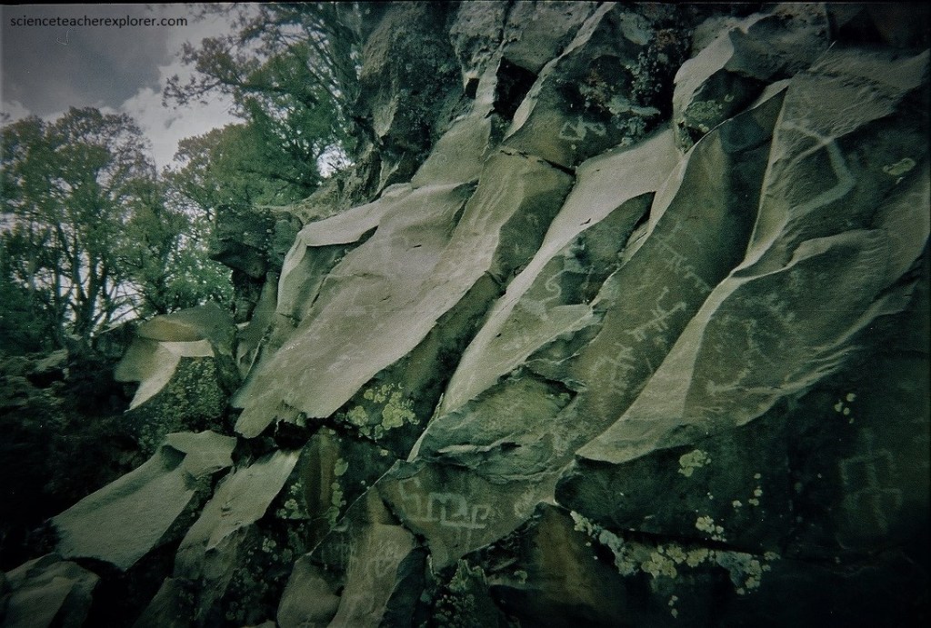
Pictured below, the basalt rocks, which have fallen off the canyon wall, are literally littered with petroglyphs. There are many images of goats (the locals called this “Billy Goat Canyon” for a reason), as well as some geometric designs and I-don’t-know-what-all-else. This is considered the largest rock-art site in the Parashant National Monument. Part of what makes the petroglyphs so special is that they are virtually untouched.
Current evidence indicates that the monument was utilized by small numbers of hunter-gatherers during the Archaic Period (7000 B.C. to 300 B.C.). Population and utilization of the monument increased during the Ancestral Puebloan Period from the Basketmaker II Phase through the Pueblo II Phase (300 B.C. to 1150 A.D.), as evidenced by the presence of pit houses, habitation rooms, agricultural features, and pueblo structures.
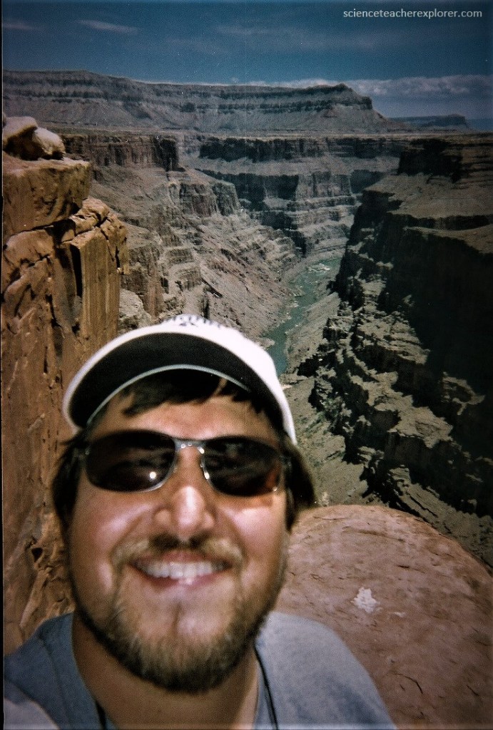
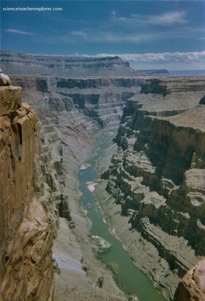
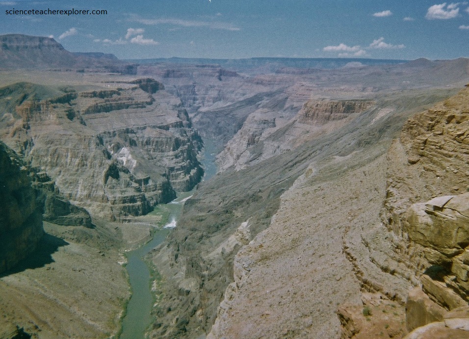
Pictured below, 27 km southeast of the Mount Trumbull Ranger Station, is the spectacular Toroweap Overlook. This overlook is the only viewpoint in the National Park from where the Colorado River can be seen vertically below. The overlook stands 910 m above the river. From rim to river, the sheer walls off of Toroweap Overlook consist of layers of sandstone and limestone with almost no mudstone.
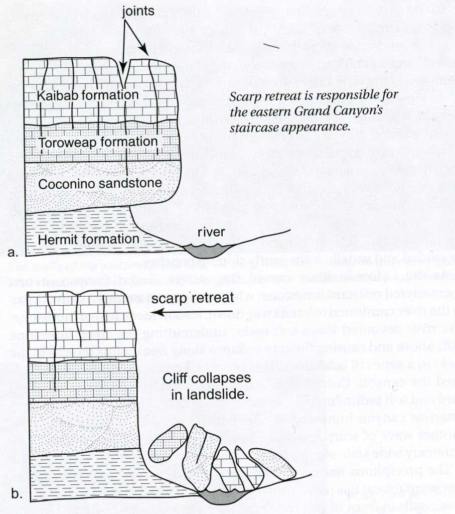
East of Toroweap Overlook, the Colorado River also encountered the same resistant sandstone and limestone seen here, which also supported a narrow canyon. However, as the river continued to erode its way down, it soon met a bed of mudstone. The river devoured these soft rocks, undercutting the steep limestone cliffs above and causing them to collapse along weak joints in a series of landslides or scarp retreats that widened the canyon. The result is the eastern canyon’s extremely wide stair-stepped appearance, (imaged above).
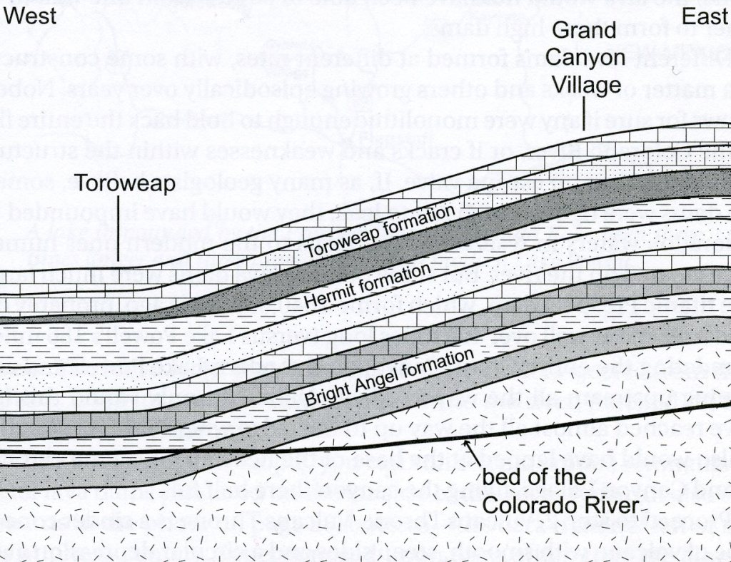
Due to gradual changes in sedimentary environments in the region 280-270 million years ago, layer of rock that consist of mudstone in the eastern canyon are instead composed of more resistant rocks below the Toroweap Overlook. Additionally, the Bright Angel shale, (a thick mudstone layer that forms on the Colorado River bench east of Toroweap), is only just now being eroded at Toroweap because the western Grand Canyon was not lifted as high during the area’s most recent episode of mountain building, (imaged above).
Toroweap’s vertical cliffs owe their existence to ancient events before and during the uplift of the Colorado Plateau. The area’s volcanic features, however, derive from much more recent tectonic events.
The Mt. Trumbull lava flow cap protects the colorful Moenkopi Formation beneath that would have otherwise been eroded away long ago. The Uinkaret volcanic field has spawned at least 213 known eruptions since the previously mentioned 3.6 million year old Mount Trumbull cap, including seventeen lava flows that poured into the Grand Canyon and dammed the Colorado River. The most recent eruption was at Little Springs approximately 960 years ago. Its lava flow can be seen just south of Mt. Trumbull near the Toroweap Overlook, (pictured below).
Pictured above, the Colorado River was dammed by lava flows multiple times from 725,000 to 100,000 years ago. Just west of the Toroweap Overlook the “Lava Falls” can be seen spilling over the rim and falling to the river. Nearby is Vulcan’s Throne, a cinder cone from the period of volcanic activity. While some believe that these lava dams were stable, lasting up to 20,000 years and forming large reservoirs, others think they failed quickly and catastrophically as massive floods. Lava flows traveled downriver 121 km. Geologists have found that within the last 640,000 years, lava has poured into the Grand Canyon at this very spot no fewer than 13 separate times. Each flow filled the narrow gorge from wall to wall,, forming a plug that dammed the flow of the Colorado River.
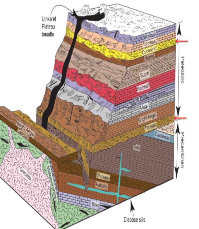
At Toroweap the layer of soft Hermit Shale is about 260 meters thick, much thicker than farther east. Erosion of this layer formed the broad Esplanade Platform on the resistant Esplanade Sandstone. Further erosion formed a deep side canyon, draining into the Colorado. The Toroweap Fault underlies the valley, and volcanic activity along the fault resulted in the Uinkaret volcanic field, from where lava flows filled the side canyon. Sediment and lava flows eventually filled the side canyon to the level of the Esplanade Platform.
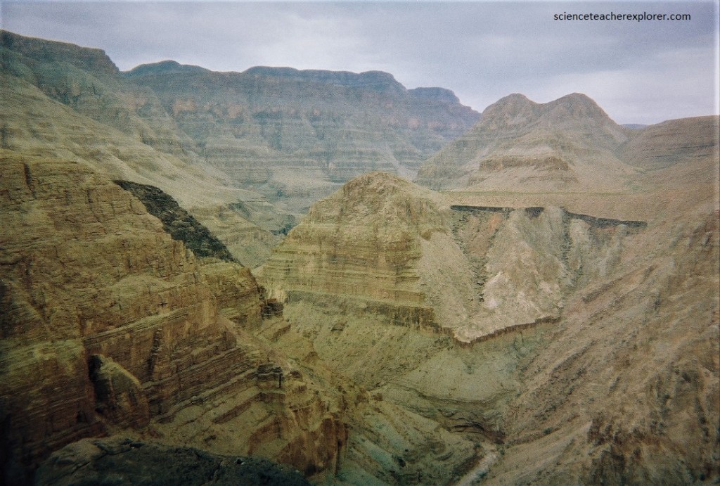
Pictured below, Whitmore Canyon Overlook differs from the other overlooks over the Grand Canyon in that it is located on a lower rim. The view over the river from the overlook is excellent both upstream and downstream, as it is not too high above the river.
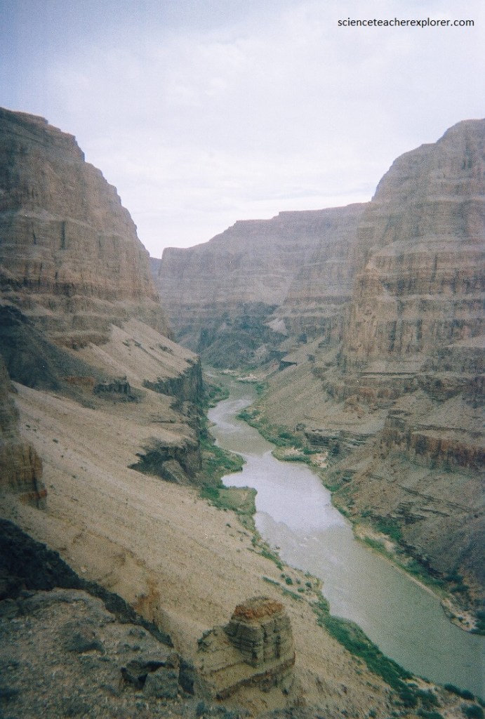
Whitmore Canyon Overlook offers the easiest access to the Colorado River inside Grand Canyon National Park, along its Whitmore Trail, with only 300 meter elevation loss to reach the river.