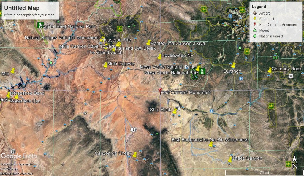
Hovenweep NM, UT 2011
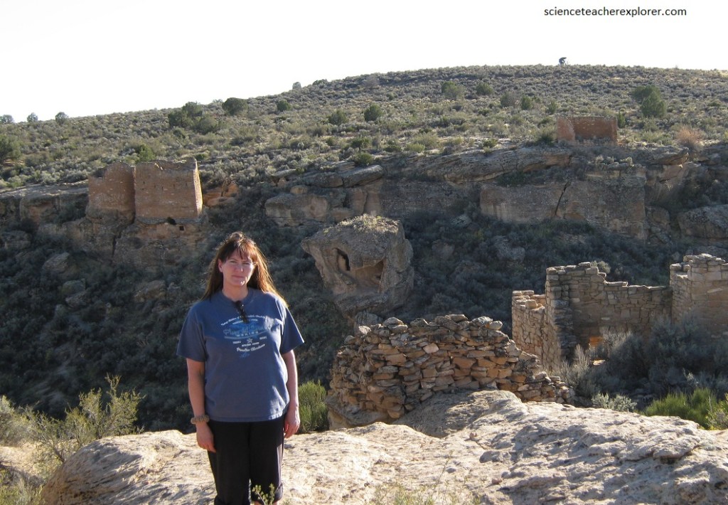
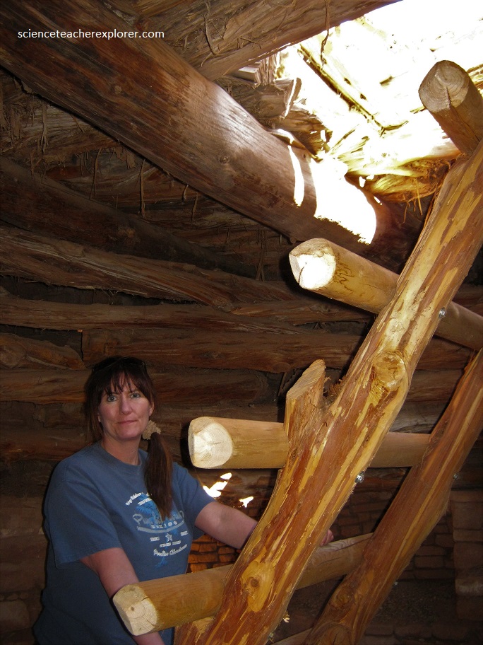
In October of 2011, Becky (my wife) and I explored Hovenweep National Monument in Southwestern Utah. Hovenweep includes clusters of masonry-walled buildings concentrated at the heads of shallow arid canyons along the Colorado-Utah border about 75 km west of Mesa Verde, Colorado. Tall towers, outlines of multiroom pueblos, tumbled piles of shaped stone, small cliff dwellings, pottery sherds, and rock art lie scattered across the canyon landscape leaving little doubt that a sizeable population once lived in this ruggedly beautiful, high desert setting.
The Hovenweep village were a part of the Northern San Juan-Montezuma Valley settlement pattern of 1100 to 1300 AD. Prior to 1100 AD the natives of the Hovenweep district were living in clusters of unit pueblos on the mesa top; then for reasons that are not clear, these people moved to the heads of the canyons. It was the same phenonenon that occurred about the same time at Kayenta, Canyon de Chelly and Mesa Verde. Despite marginal growing conditions, the ancestral Pueblo people here, raised corn, beans, squash, and other crops in small fields and terraces, often using check dams for irrigation. Additionally, they used solar calendars and astronomy to calculate growing seasons.
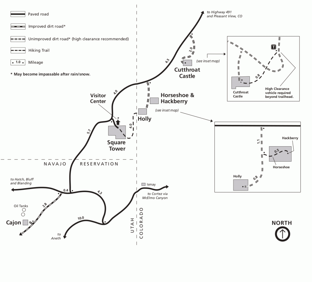
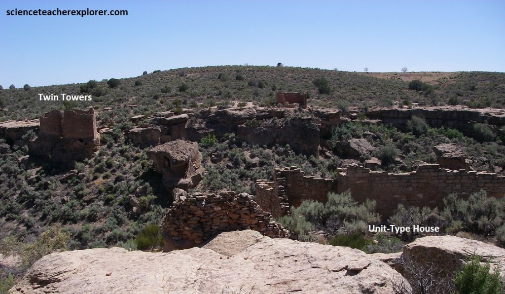
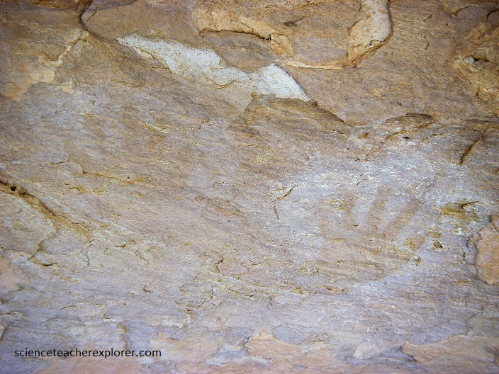
Despite seven centuries of weathering, many large structures and tall tower walls still stand as tributes to their builders. The intricate stonework crafted by these ancestral Pueblo masons is also revealed in the finely hewn stones, sharp corners, and smooth curves of Hovenweep’s architecture. Rubble mounds show that even more structures were once significant parts of these villages. The ruins in Square Tower and Ruin Canyons near the Hovenweep National Monument ranger station are the center of Hovenweep villages. Towards the east are Cuthroat Castle ruins. Hackberry ruins, Horseshoe ruins, and Holly ruins. To the southwest are the Cajon ruins. Becky and I visited all of them.
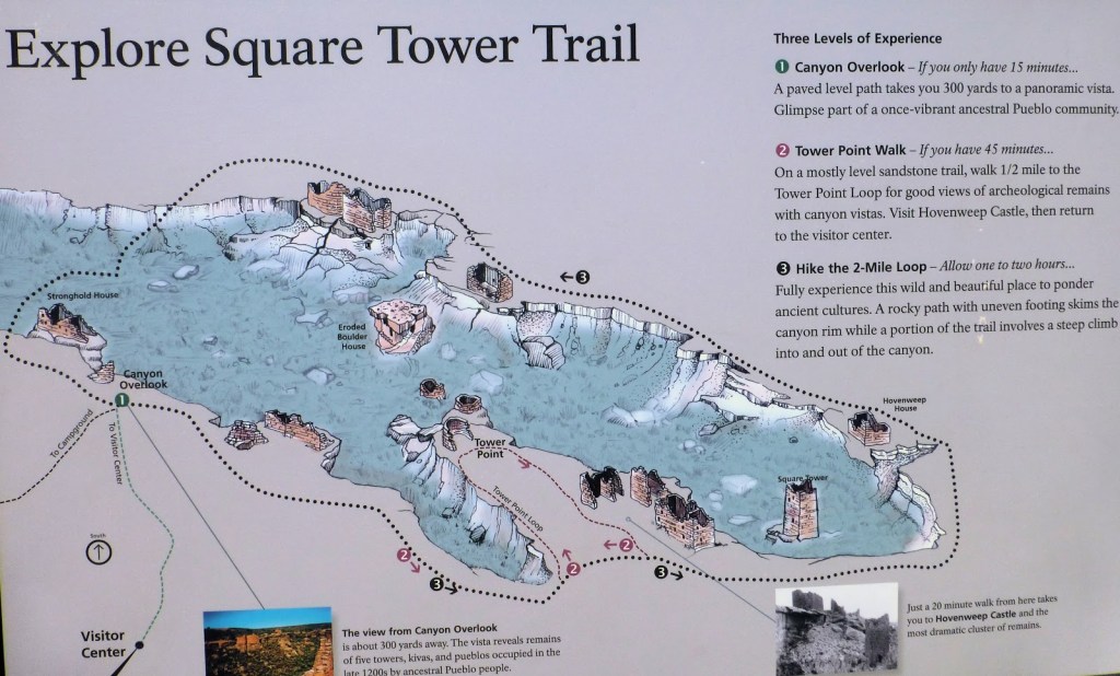
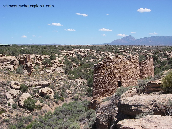
Pictured above, the setting for ruins of the Square Tower Group at Hovenweep National Monument. Nearly thirty kin kivas were once scattered along the slopes on both sides of this canyon among the many stone masonry housing units. At the head of the longer left-handed fork stand the Square Tower, Hovenweep House, and Hovenweep Castle along with another eleven kivas. A number of granaries tucked beneath the cliffs and rainwater check dams are scattered about among the main residences.
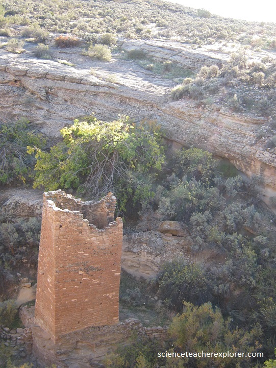
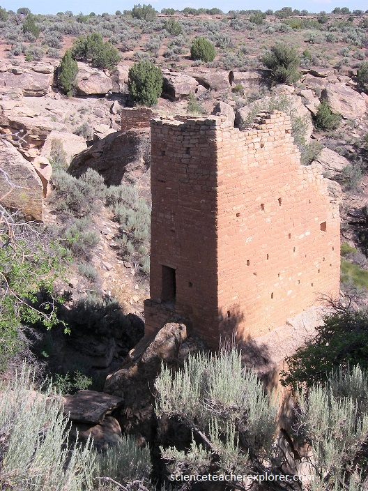
Pictured above, the Square Tower was build of sandstone masonry that rises 2 stories high from its foundation on a sandstone boulder near the bottom of the canyon. Such a location would not support a protective purpose, but it does lie just below the canyon’s most productive spring.
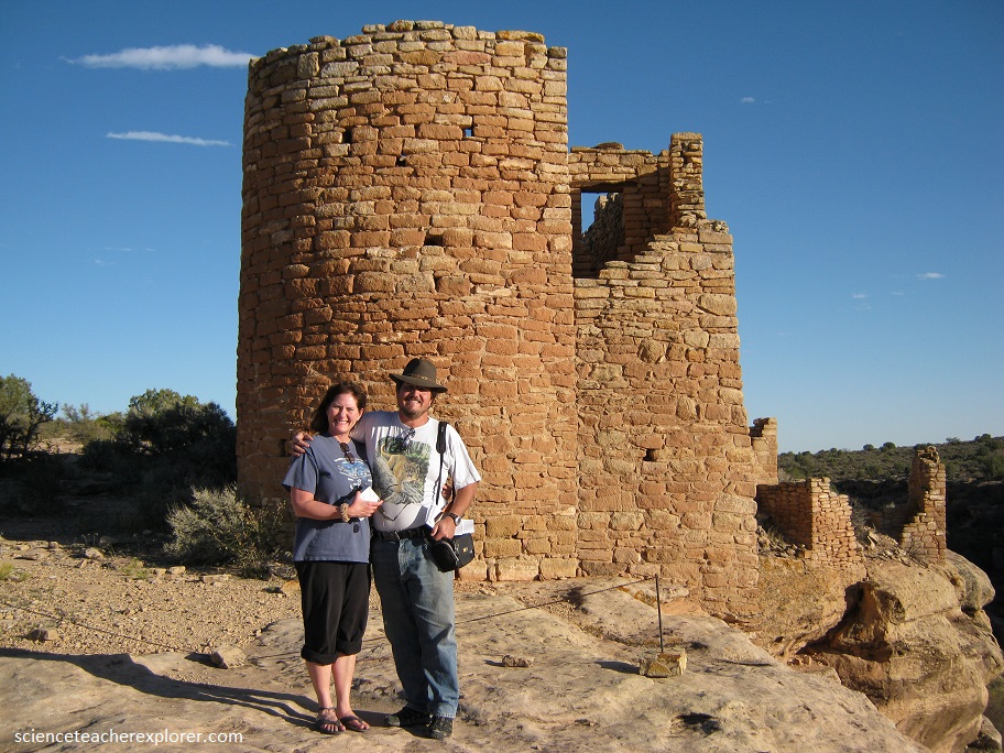
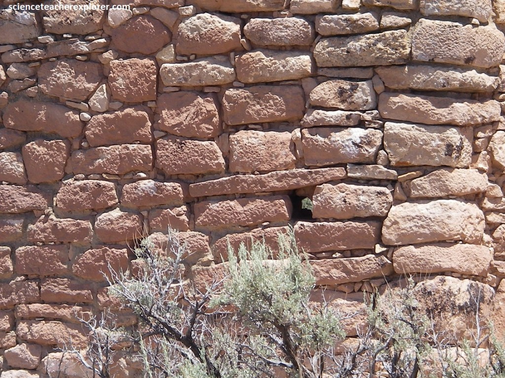
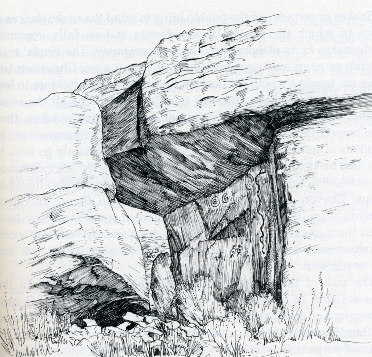
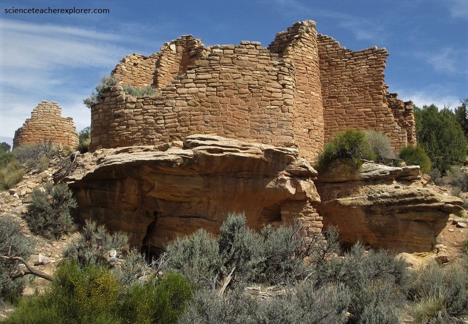
Pictured above, Hovenweep Castle at the head of Square Tower Canyon. The standing walls on the cliff edge represent only the best-preserved portion of the main living quarters for this ruin group. Study the image of Hovenweep Castle above, in particular at the wall immediately to the right of and connecting to the large tower. Notice the small port at mid-height. One other port at the same height and a small door can also be picked out on the wall to the right, i.e., running along the canyon edge. Those two ports and the door were likely used to define a solar calendar on the inside wall of the room. Tree-ring dating has shown that this “sun-room” was added in 1277, well after the main part of Hovenweep Castle was completed in 1166, and may well have been designed specifically as a solar observatory
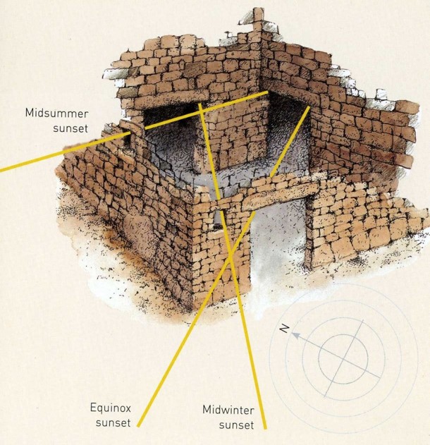
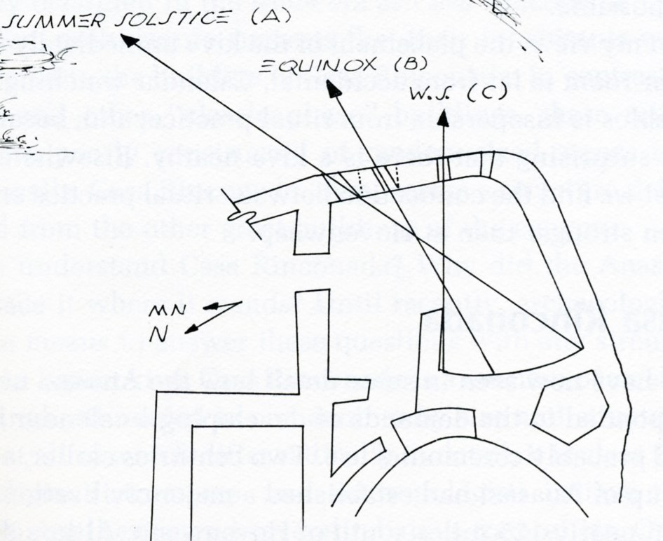
The basic idea behind the use of ports or windows is to track the day-to-day motion of the Sun along the horizon as illustrated schematically (above). The diagram shows a top view of a hypothetical room, with geographic North pointing to the right and East pointing down. The thin solid lines are oriented toward the directions of the rising sun at the equinoxes and summer and winter solstices, for a latitude of 36o N. The angle between the equinox and two solstices lines is then very close to ± 30o. At the summer solstice sunrise, sunlight shining through a small opening in the East-facing wall will illuminate the back wall at a single location. As days and weeks go by the rising Sun moves towards its equinox rising azimuth, which causes the light spot to move leftwards along the back wall to a point, at the autumnal equinox, continuing all the way to the winter solstice point. At this point in time the rising Sun begins to move back northward along the horizon, so that the light spot also reverses direction and heads rightwards, reaching a point at the vernal equinox and all the way back to the beginning point upon completing the yearly cycle.
The day-to-day motion of the light spot is a mirror image of the rising sun’s day-to-day azimuthal displacement along the horizon. The amount of day-to-day linear displacement of the light’s spot is also directly proportional to the depth of the room. Appropriately placed markings on the back wall along the direction of the moving light spot can then be used to construct a calendar. For a room 2 m deep with the front wall facing directly East, the daily linear displacement is 3.4 cm per day at equinoxes, down to 6 mm per day 10 days before solstices, and falls to a mere half a millimeter the last two days before and after solstices.
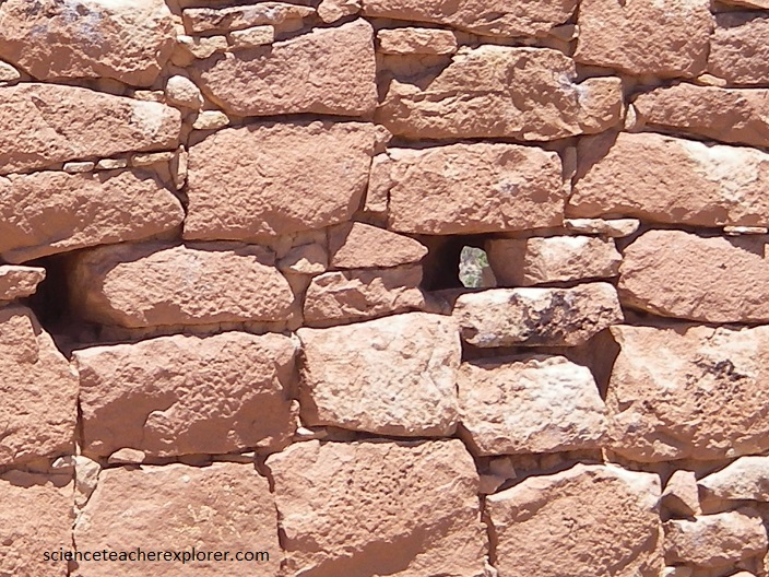
One practical difficulty to overcome in designing solar observation ports is the fact that the masonry technique of the Ancient Pueblo people lead to rather thick walls, which limits the range of azimuth from which the rising Sun can be observed. An obvious way to overcome this problem is to design ports with diagonal sides more or less parallel to the intended direction of observations. It might then become necessary to have three ports to “define” a full-year wall calendar inside the room. This was the approach used at Hovenweep castle and Unit-type house, another nearby Hovenweep dwelling.
In the far southeastern room of Unit-Type House it is can be seen: At summer solstice, about an hour after sunrise elsewhere in the canyon, the sun finally rises above the massive boulder to the east and streams through the northernmost port to fall on the southwestern corner of the this room. On the winter solstice, the sunbeam falls in the north corner of the interior western wall of the room, next to a small, low wall jutting out from it. The equinox beam lights up a spot midway between this small wall and the southwestern corner.
Imaged above is a potentially accurate calendar device using ports and architectural features to define the passing of the year.
Picture above, by narrowing the size of the ports sufficiently with plaster, accuracies of a day or two in determining the solstices would be possible. Nearby and adjacent to the room is a round Kiva.
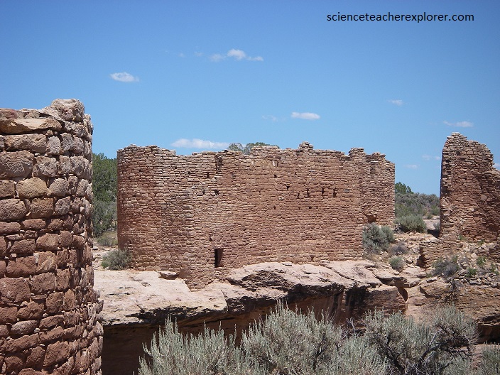
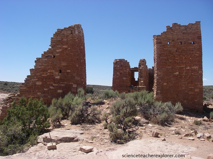
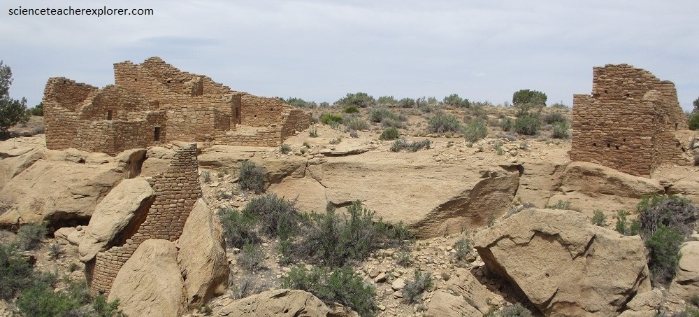
Pictured above, Rimrock House and Eroded Boulder House stand among the rubble of many fallen buildings as testimony to the sizeable masonry village that existed at the canyon junction below Tower Point about 800 year ago.

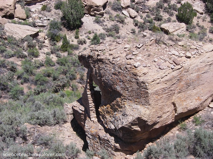
(Pictured above), The rubble atop Eroded Boulder House indicates that the ruins below the overhang were only a portion of the building.
Pictured above, The Twin Towers in the Square Tower Group. The separation between these two buildings was necessitated by the separation of the two sandstone boulders upon which they were built. These were probably two-story dwellings built with curved walls to conform to the shapes of the rocks on which they stood. Such solid foundations have preserved them from the ravages of normal deterioration.
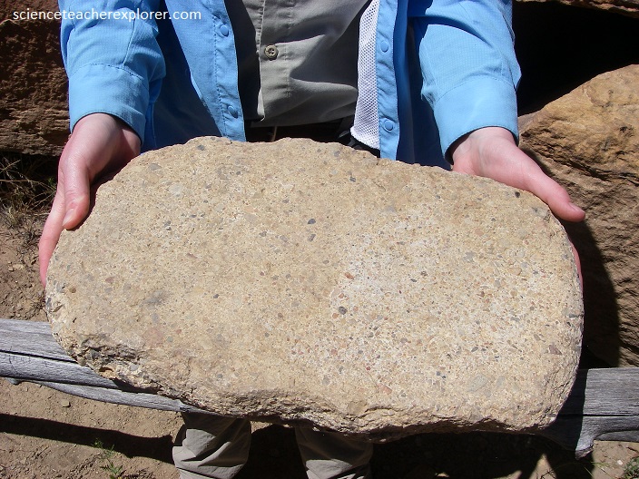
Hovenweep is part of a region called the Colorado Plateau, a high desert covering the four corners in the southwest. 90 percent of the Colorado Plateau is the San Juan River Basin, or land that water drains through to reach the San Juan River. This drainage carved the winding canyons in Hovenweep, giving shelter and water to plants and wildlife, and later people. At Hovenweep, the top rock layer is Dakota Sandstone. Dakota Sandstone is made up of yellow/gray sandstone, mudstones, and a few thin beds of coal. (Pictured below), this layer represents transitions from river to swamp to marine conditions and was deposited 30-70 million years ago (late Cretaceous period). Ancestral Puebloans used the sandstone to make manos and metates, tools used to grind corn. More evident today are the still-standing towers and castles made of the same.
Below the Dakota Sandstone is Burro Canyon Formation, the only other rock stratum visible in Hovenweep. Burro Canyon Formation is made of white conglomerate, green shale, mudrock, and sandstone layers with interspersed pebbles and cobbles of chert as well as limestone and quartzite. This layer was deposited by an ancient river and floodplain over 100 million years ago (early Cretaceous period). Ancestral Puebloans used rocks from Burro Canyon Formation to make tools like chert knives and arrowheads.
Pictured below, the “Holly Group” at Hovenweep. To the left is Holly House with Holly Tower in the center and Tilted Tower to the right. Additional ruins cover the talus slopes between the standing buildings including some 12 kiva depressions. A stone and earth dam at the edge of the cliff behind Holly Tower fed the spring in the canyon head.

Many ancient agricultural societies depended on the movements of the Sun, Moon, and stars to determine the seasons. By watching the sky the Ancestral Puebloans knew when to plant crops, plan annual events, and keep track of time. With the aid of existing natural features, observations of the sunrise and sunset could be interpreted as a solar calendar by observers as it’s position in the sky changes throughout the year. {The images below were taken from an interpretive sign on-site}
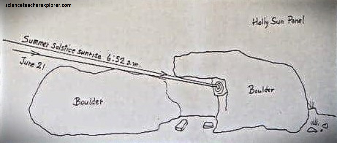
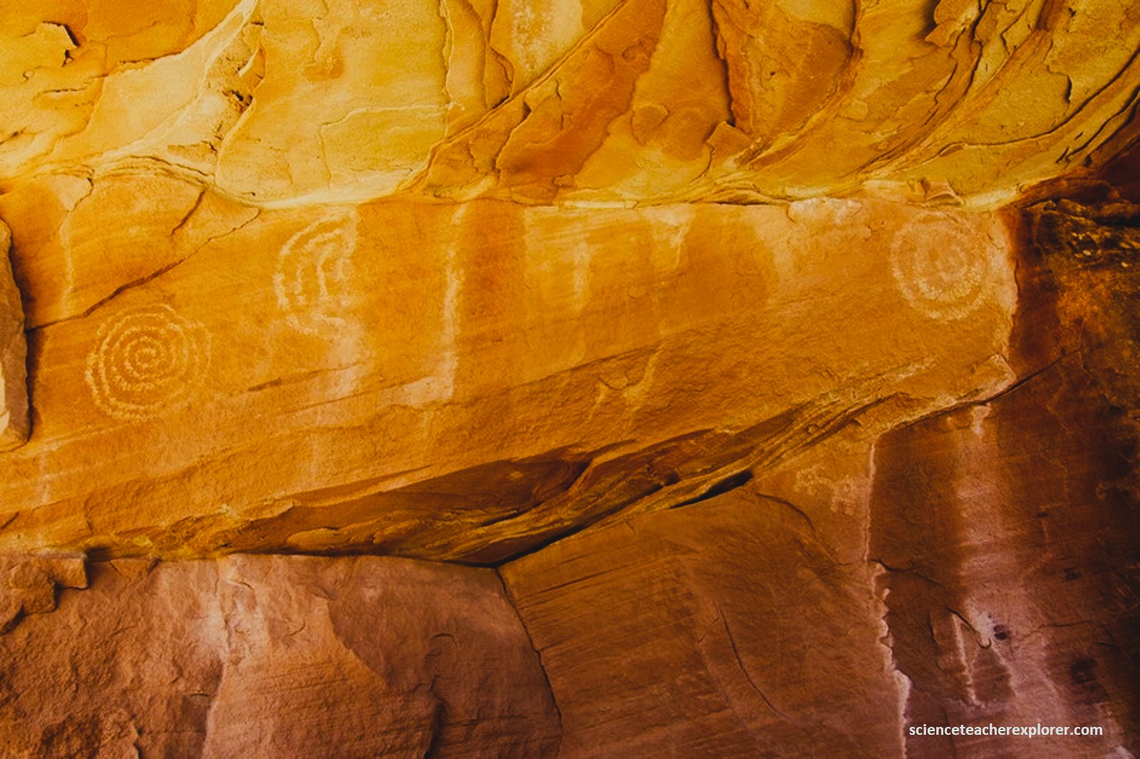
The Holly Solstice Panel, (picture above), uses it’s coincidental location of two large boulders that have fallen away from the canyon wall. On the summer solstice the rising sun shines through a small slit on the upper edges of the boulders allowing a narrow band of light to pass through. This ‘sun dagger’ begins as two beams of light then gradually join one another illuminating the centers of two petroglyphs, (a spiral and a pair of concentric circles), a meter apart. {Note the Sun Dagger time-lapse video by Daniel McVey of this site}.
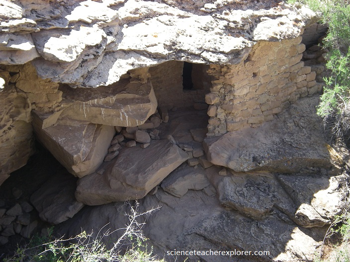
Pictured below, this two-story building was built on a sandstone boulder in the center of the small canyon head where it could be reached by a set of toeholds cut into the rock itself. The building fits very closely the limits fixed by it’s foundation and rises gracefully amid the structures of the group around it.
Pictured below, Standing buildings and wall are indicated by stonewall symbols, the limits of collapsed building rubble and visible kiva depression. These ruins are found on the rim of Hackberry Canyon. This settlement was built on the east branch of Hackberry Canyon, one kilometer of Horseshoe.
Pictured below, the Cutthroat Castle Ruin is the most interesting and spectacular of the outlying ruins of the Hovenweep cluster. It is situated on an offshoot of the Hovenweep Canyon about 10 km northeast of the visitors center.
Pictured above, the main preserved building at Cutthroat consists of a horseshoe house with several attached rooms on the right. A tunnel leads through a crevice in the bedrock floor behind the kiva in the center of the photograph to a two-story rounded room below the ledge.
Pictured above, all three of these buildings stood at least two stories tall. A circular tower built on and around several large sandstone boulders on the slope of the west ruin. the builders carefully fitted their masonry blocks to the boulders to produce the desired circular building plan on a remarkably uneven surface.
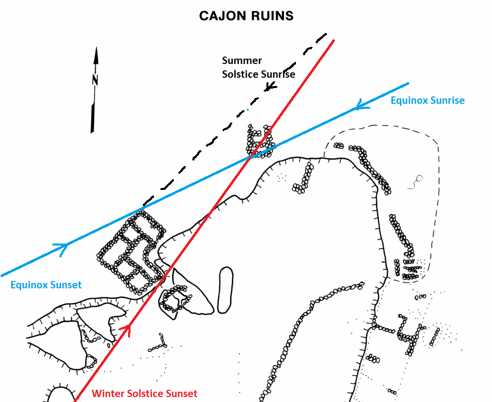
Imaged above, shadows cast between these two buildings at sunrise and sunset throughout the year define a solar calendar that would be obvious to all the dwellers of this isolated set of buildings overlooking the Aneth oil fields to the south. Beginning at the autumnal equinox, as the setting sun passes the equator moving south, it also passes south of the line defined by the south wall of the tower and the northeast corner of the western building. Thus, on the evenings after the equinox, this building casts a shadow on the tower. Each successive day from the autumnal equinox, beginning at the south end of the tower, the shadow moves slowly northward until it completely shadows the tower. This shadowing continues through the fall until, at the winter solstice, the shadow falls only on the west wall of the tower, the south wall receives sunlight because the southern edge of the shadow falls vertically along the southwestern corner of the tower. Then, as the new year proceeds from the winter solstice, the process is reversed until the vernal equinox, when the tower receives no shadow from the other building at all. However, after the vernal equinox, the role of the buildings is reversed and the tower casts a shadow across the western building at sunrise from the vernal equinox until sometime near or on the summer solstice.

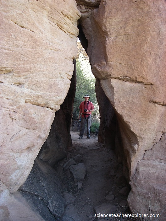
Additionally, Becky and I explored Montezuma Canyon, northwest of Hovenweep National Monument. There we found 3 newly constructed Kivas to explore (picture below and above).
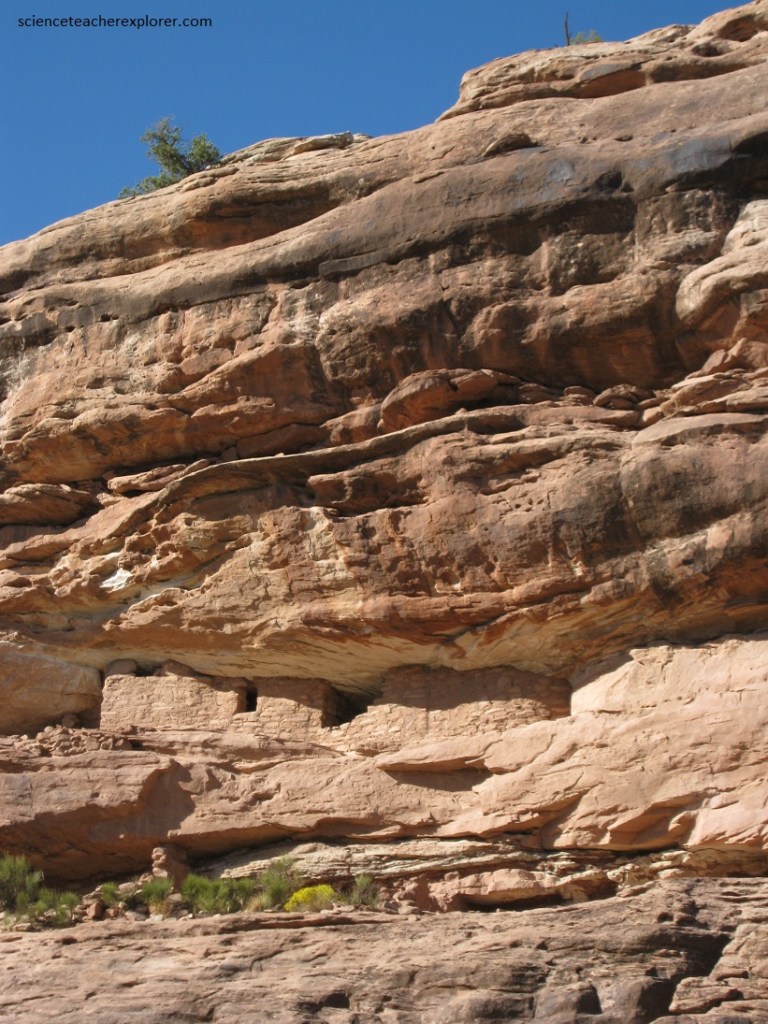
Pictured below, we found several Ancient Pueblo structure built high in the cliffs along the Montezuma Canyon, (northwest of Hovenweep N.P.)