Lake Titicaca, Bolivia
On July 19th, 2019; I flew into La Paz, Bolivia to explore country’s natural wonders. I rented a Toyota, 4-runner to do the deed. On the next day, I drove out to Lake Titicaca.
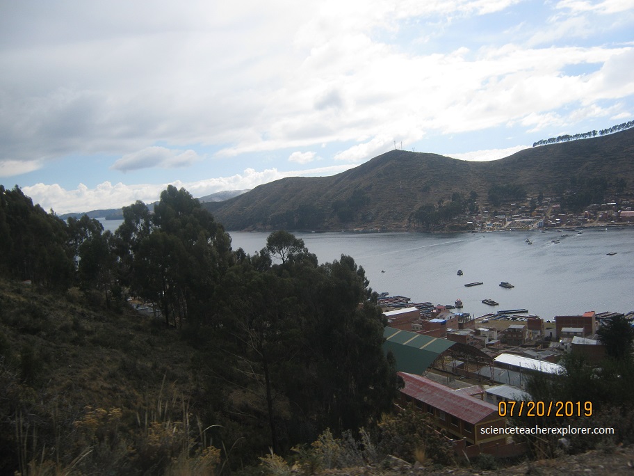
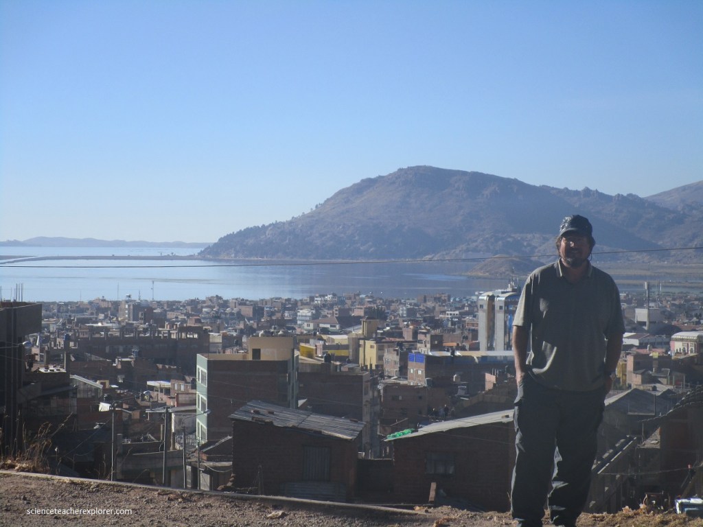
Lying across the border between Peru and Bolivia, under the snow-capped backdrop of the Cordillera Real mountains, is this vast inland sea or Lake Titicaca.
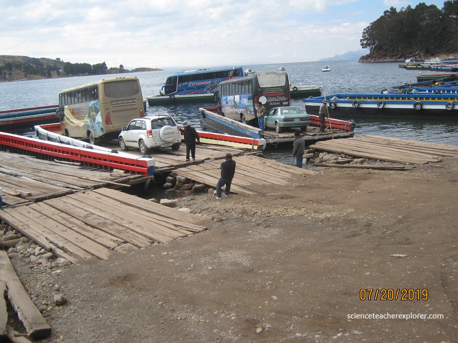
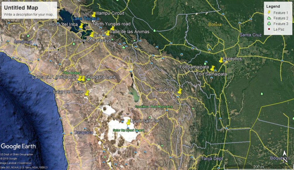
My initial destination was to make my way out of La Paz and head north to a ferry in San Pablo. There, I would ferry across the Tiquina Strait to San Pedro, (all-in-Bolivia). Lake Titicaca consists of two nearly separate subbasins connected by the Strait of Tiquina, which is 800 m (2,620 ft) across at the narrowest point. Once in San Pedro, I would drive to the other side of the peninsula to Copacabana, Bolivia.
Lake Titicaca has a surface elevation of 3,812 m (12,507 ft). The “highest navigable lake” claim is generally considered to refer to commercial craft. For many years, the largest vessel afloat on the lake was the 2,200-ton (2,425 U.S. tons), 79-m SS Ollanta (a steamer).
The Tinajani Basin, in which Lake Titicaca lies, is an intermountain basin. This basin is a pull-apart basin, created by strike-slip movement along regional faults starting in the late Oligocene and ending in the late Miocene. The initial development of the Tinajani Basin is indicated by volcanic rocks, which accumulated between 27 and 20 million years ago within this basin. They lie upon an angular unconformity which cuts across pre-basin strata. Lacustrine sediments of the Lower Tinajani Formation, which are exposed within the Tinajani Basin, demonstrate the presence of a pre-Quaternary, ancestral Lake Titicaca within it between 18 and 14 million years ago.
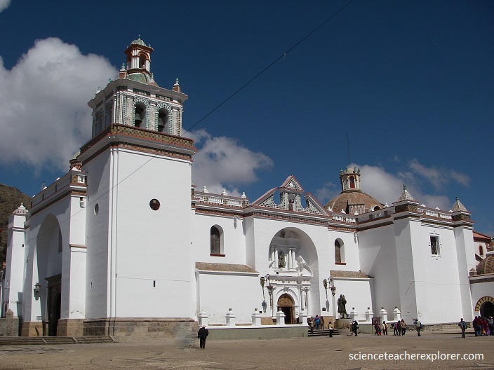
Once in Copacabana, Bolivia I visited the famous Basilica, Basilica of Our Lady of Copacabana. Our Lady of Copacabana is the patron saint of Bolivia. Then I took a hike up the stairway to the Cerro Calvario.
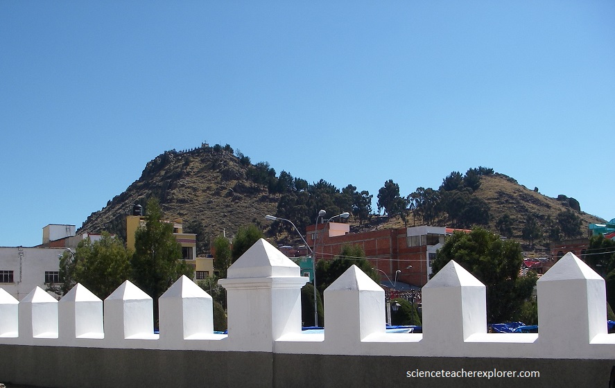
Cerro Calvario (Calvary Hill) is a hill in Copacabana lined with small monuments representing the 14 Stations of the Cross. On Good Friday, thousands of pilgrims journey to Copacabana – some on foot for the entire 158km distance from La Paz – to do penance on Cerro Calvario. At dusk, a solemn candlelit procession begins at the Basilica of the Virgin and winds through town, led by a statue of Christ in a glass coffin and a replica of the Virgen de Candelaria. At the summit of Cerro Calvario, pilgrims light incense and buy mini replicas of various material possessions that they hope the Virgin will grant them during the year.
With the help of some of the locals, I was also able to visit Horca del Inca. The Horca del Inca (“Inca Gallows”) is an interesting trilithic structure used for astronomical purposes by the pre-Incan Chiripa people. Despite its name, the Horca del Inca was built by the pre-Inca Chiripa culture in the 14th century BC as an astronomical observatory. Rituals on the winter soltice June 21 were also held here.
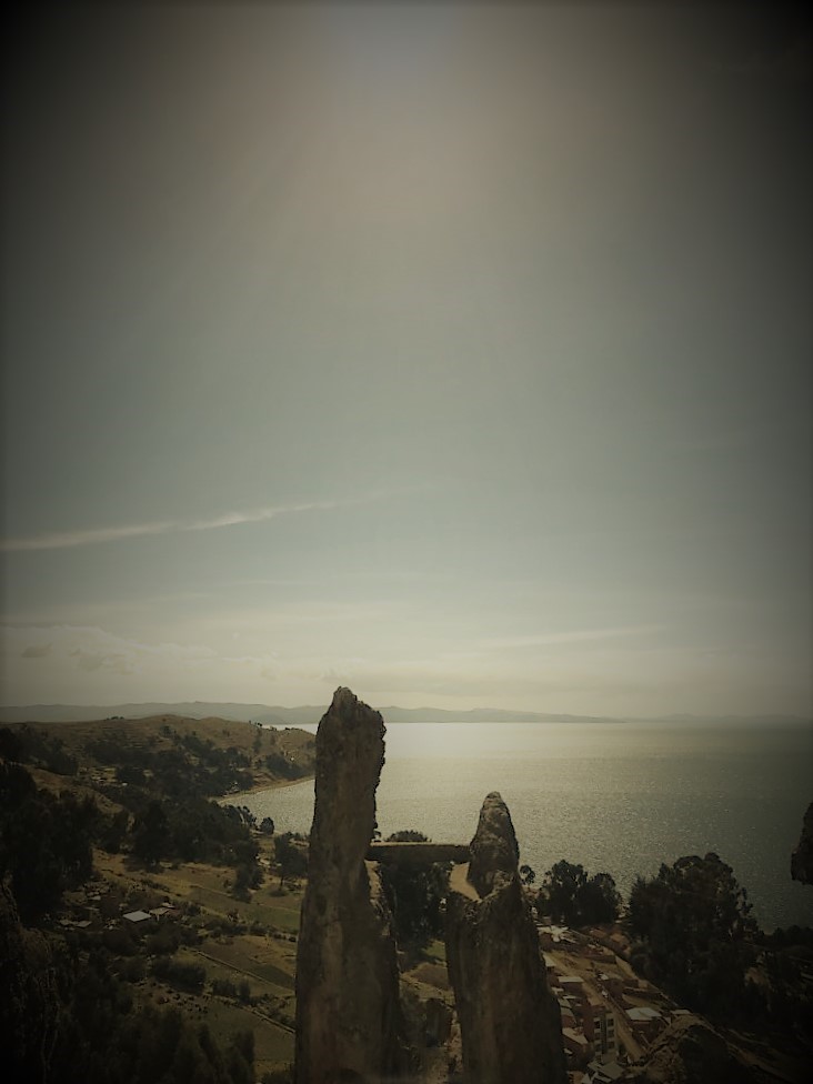
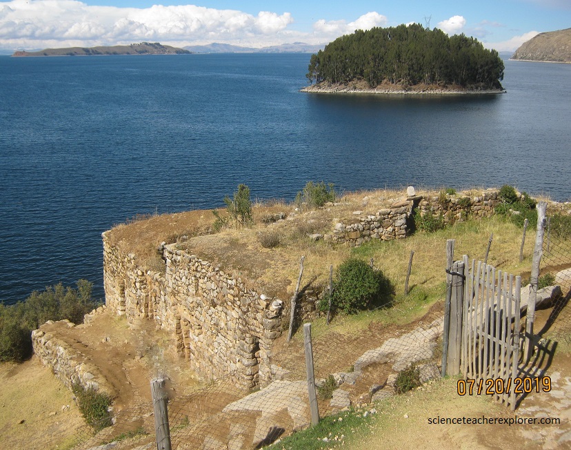
I booked a 3 hour tour to Isla del Sol in the late morning of July 20th. The lsla del Sol is said to be where the gods came down to found the Inca dynasty and bring wisdom to the local people.
According to their origin myth, the first Incas, Manco Capac, son of the Sun god Inti and his sister/wife Mama Ocllo, daughter of the Moon, left Lake Titicaca in search of a place to found their empire. On the Island of the Moon, a small island in this sacred lake, the Incas later founded a “convent” of virgins. The most favored of these virgins learned ceremonial rites to prepare them to marry Inti (although this, unfortunately, required that they give up their life on Earth). The lesser virgins at the temple were taught domestic skills such as planting, spinning, weaving, and medicine.
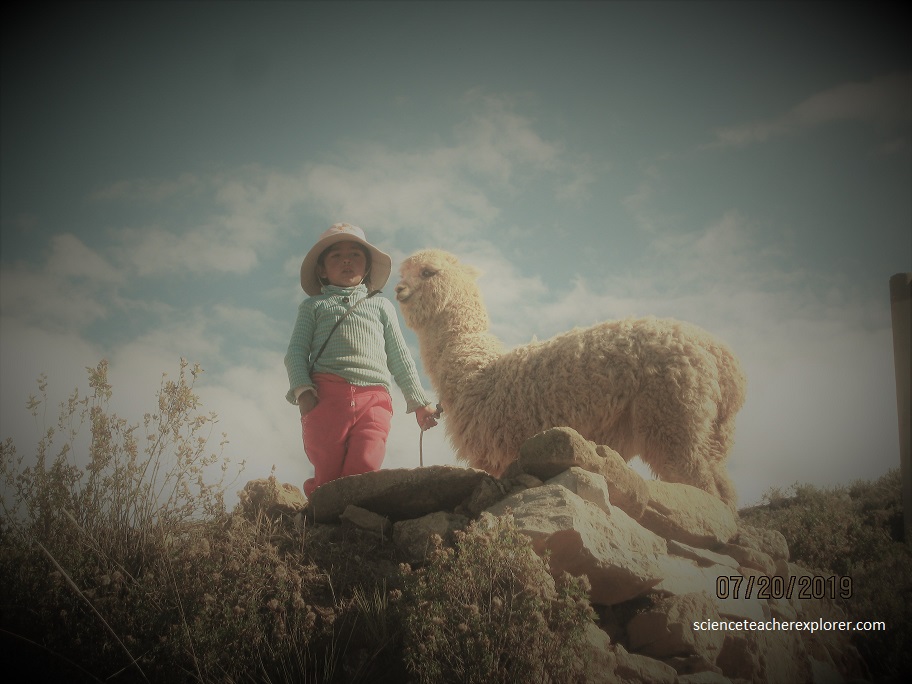
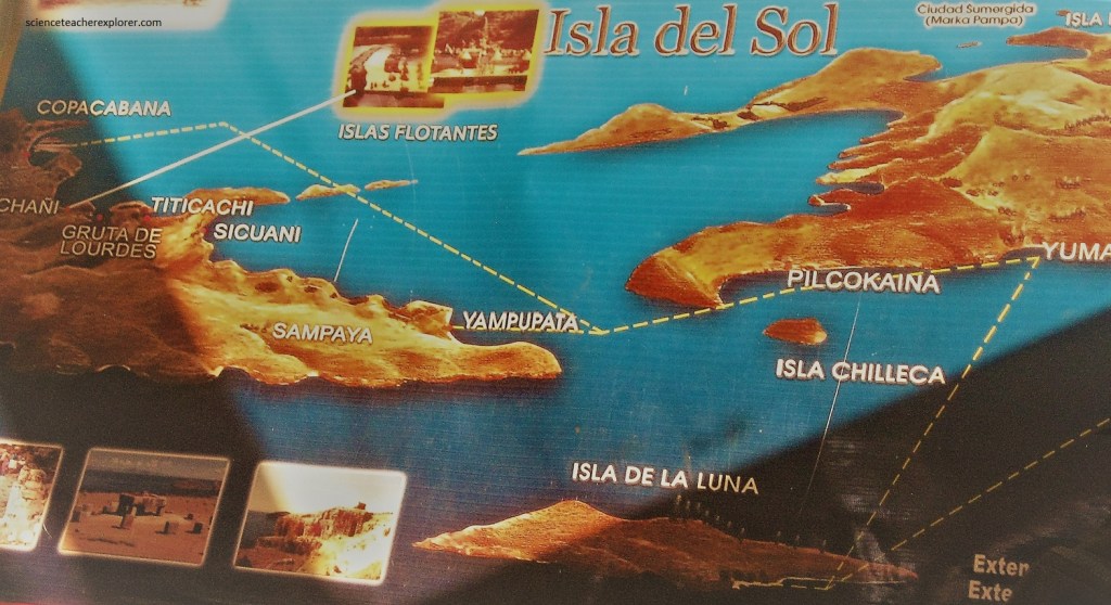
Isla del Sol (Island of the Sun) is an island in the southern part of Lake Titicaca. It is part of Bolivia, and specifically part of the La Paz Department. Geographically, the terrain is harsh; it is a rocky, hilly island with many eucalyptus trees. There are no motor vehicles or paved roads on the island. The main economic activity of the approximately 800 families on the island is farming, with fishing and tourism augmenting the subsistence economy. It is populated by the indegenous Aymara group who call it Tit’kaka, which is thought to stem from the Aymara words tit (puma) and kala (rock), as the shape of the lake is said to look like a puma hunting a rabbit.
Isla del Sol is one of thirty-six islands in Lake Titicaca in the otherwise arid Altiplano region of Bolivia, lying 3,812 m above sea level. Situated at the southern end of the lake, it island is divided into three parts: Yumani in the south, the sandy beach area of Ch’alla in the east and Challapanpa in the north. The island measures 14 sq. km and takes three hours to cross on foot.
The first Inca Manco Cápac is said to have emerged from a prominent crag in a large sandstone outcrop known as Titi Qala. Manco Cápac is the son of Inti the Andean deity identified as the sun.
The sacred flower of the Incas is called cantuta, although in Cuzco people know it more by its Quechua name, qantu. The plant is a kind of small branchy, bush that stands two to three meters high. Its flower comes in the form of an elongated bell. You can find it in yellow, pink, and intense red with the green back leafs (color of their flag). Locals say the flower was a colorful beauty that left the Incas amazed. They promoted its cultivation throughout Tawantinsuyo, the Inca Empire. They dedicated it to the Sun, their god. In this way it became known as the sacred flower of the Incas.
After, coming back to Copacabana, I drove across the border to the west part of Lake Titicaca and stayed the night in Puno, Peru. My trekking destination was the Uros Islands of Lake Titicaca.
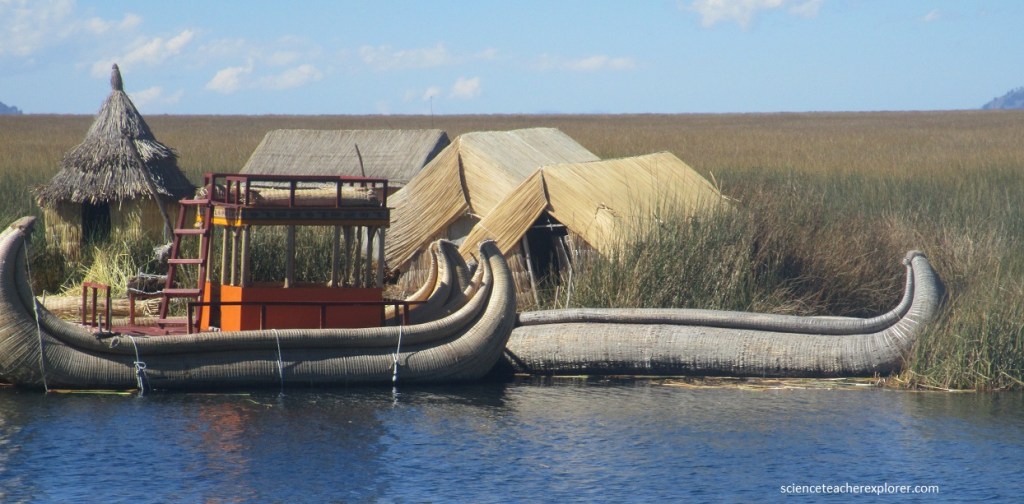
In Puno, I booked another tour to the Uros Islands. The tour company owned their own reed boat. The boats were built in style similar to the people from many centuries ago to give you an idea of how they navigated the lake. The Uros Islands are not geological entities, instead the Uros people of Peru have constructed them out of lake Titicaca’s abundant tortora reeds.
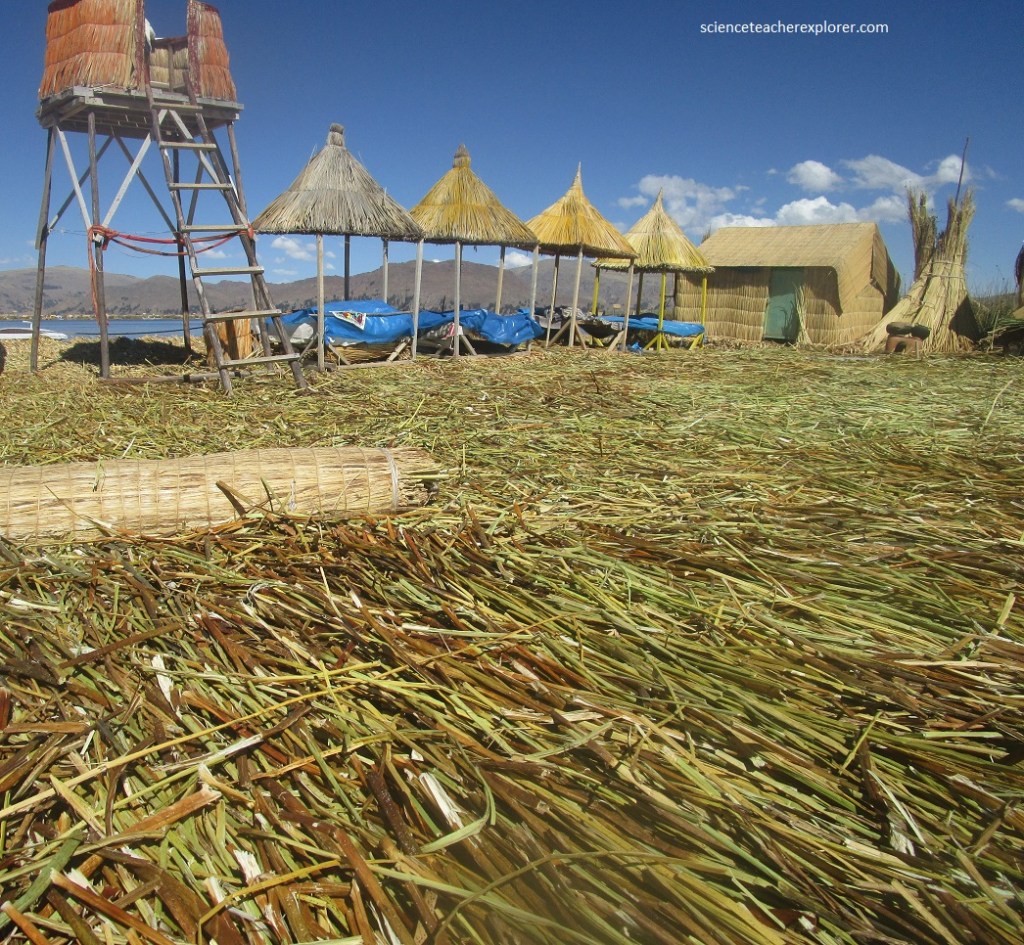
Reed layers are added to the top of existing “islands” as the lower layers rot. There are 41 big islands, some of which are many human generations old. Newly married couples might make their own island, and teenagers wanting space to study have been known to make private mini-islands. I found the 1 meter deep surface spongy and difficult to walk on, like a giant waterbed.
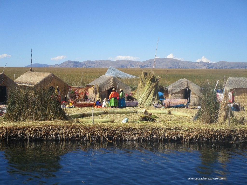
The Uros also make their boats, furniture, and houses from reeds and they eat the reed’s tuberous roots. There are some wooden building, each with flying buttress-like supports to spread the weight. Pushed out of their traditional lands by the Incas, the Uros took to the lake to escape persecution and land taxes. Now heavily intermarried with neighboring Ayamara people, the Uros became extinct in 1959. But their unique reed-based culture is still alive.
