El Malpais, NM 2013
In July of 2013, I had the opportunity to explore El Malpais National Monument in New Mexico. El Malpais National Monument is part of the Zuni–Bandera volcanic field in west-central New Mexico. The Zuni-Bandera volcanic field has produced many basaltic lava flows, some with a-a characteristics, and some that are paheohoe. There are also a number of well-preserved cinder cones that can be visited, as well as many lava tubes, some of which contain perennial ice. The Zuni-Bandera volcanic field is an excellent site for studying physical volcanology of basaltic magmatic systems.
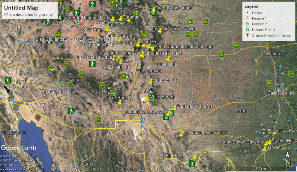

The Zuni–Bandera volcanic field began erupting about 700,000 years ago, but the El Malpais episode occurred less than 60,000 years ago. The youngest lava flow at the national monument is 3,900 years old and represents the most recent volcanic eruption in New Mexico; this eruption produced the McCartys flow. El Malpais National Monument preserves a portion of this young flow, as well as its vent, the McCartys cinder cone, which is the youngest volcano in New Mexico.
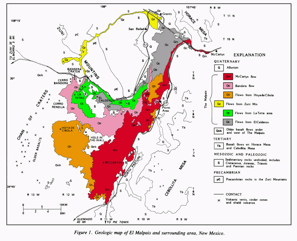
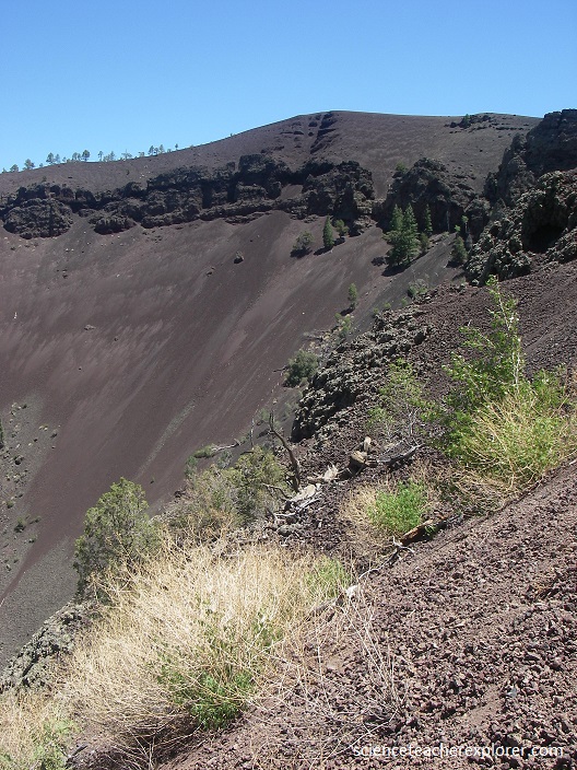
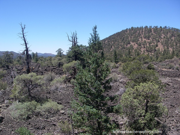
When I was there, I visited the Bandera volcanic flow. Pictured below, the Bandera flows originated from Bandera Crater, a double cinder cone about 150 m high and 1 km in diameter.
The eruption of Bandera Crater and its associated flows was the second youngest volcanic event in the Zuni-Bandera Volcanic Field. Like many other cinder cones in the Zuni-Bandera Volcanic Field, Bandera Crater is breached to the southwest, probably due in part to local prevailing winds.
The eruption of Bandera Crater and its associated flows was the second youngest volcanic event in the Zuni-Bandera Volcanic Field. It has been dated to have erupted about 10,000 years ago.
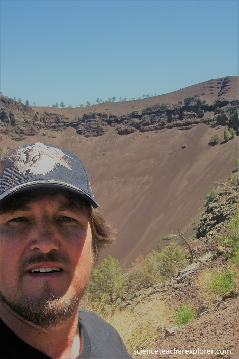
Pictured above, like many other cinder cones in the Zuni-Bandera Volcanic Field, Bandera Crater is breached to the southwest, probably due in part to local prevailing winds.
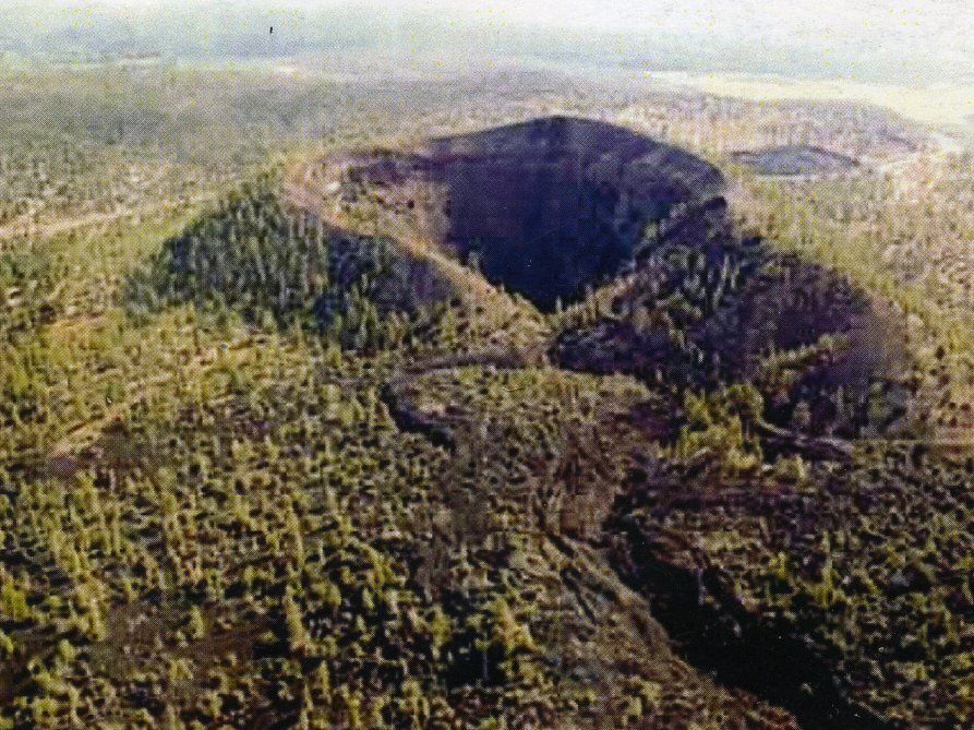
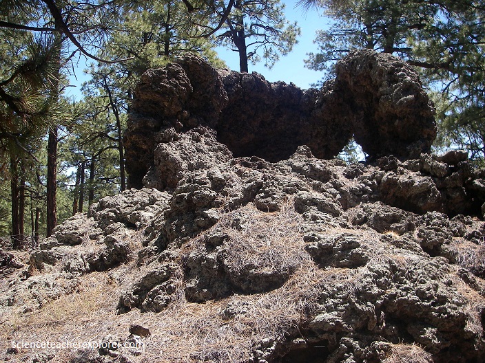
A large lava tube, intermittently collapsed, extends about 29 km south from the breach in the Bandera crater wall and a commercial ice cave is located in a collapsed portion of the tube near the Candelaria Trading Post. The Ice Cave is located in the lava flow and specifically in a section of collapsed lava tube. At one end of the collapse is a one room cave in which just the right set of geological conditions have combined to form a natural ice box.
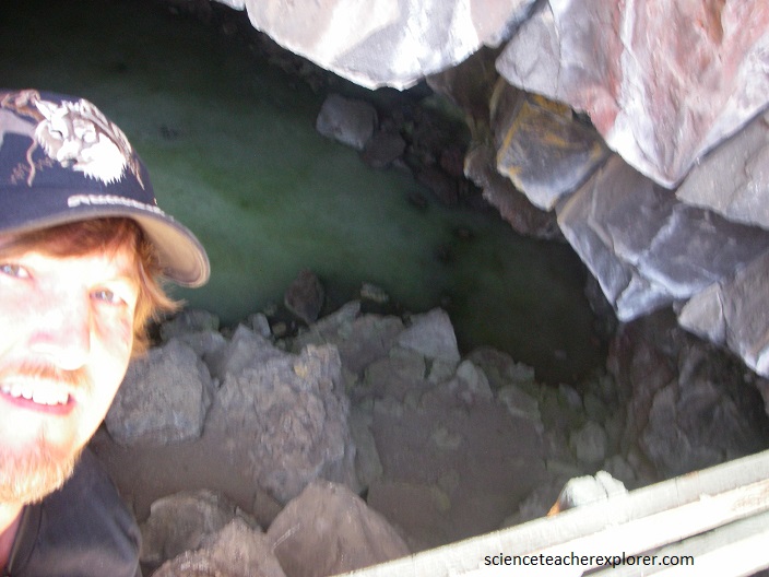
The temperature in the cave never rises above 31 degrees Fahrenheit. As rain water and snow melt accumulate in the cave, it collects on the ice deposit at the bottom and freezes new layers of ice every year. Scientific research has indicated that the ice has been forming in the cave for over 3400 years. Inside the ice box, the floor glistens blue-green with layers of natural ice that reflect light from the entrance. A form of arctic algae causes the green hue, whereas the ice is created when snow meltwater and rain seep underground and freeze in the cold dense winter air that sinks into the cave.
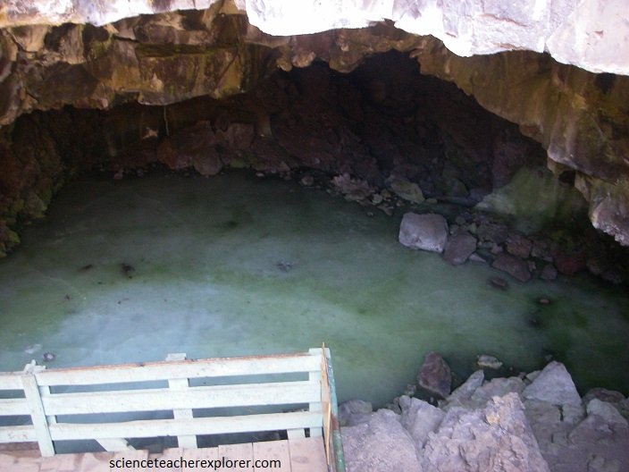
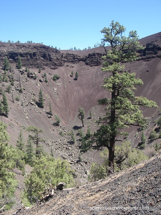
Pictured above, the Ice Cave is a unique natural phenomenon that occurs in lava tubes (although very rarely) around the world. For lava tube ice cave formation to occur, just the right combination of characteristics have to be present. Lava tube caves are composed entirely of lava which is porous and riddled with air bubbles. The lava walls, floor and ceiling act as insulation. Another important factor is the physical shape of the cave itself. It must be able to trap cold air in the cave and prevent warm air from entering and circulating. An ice cave must have a floor structure that will allow water to collect rather than drain or leak through fractures.
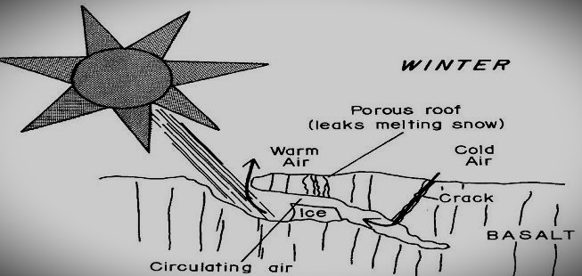
During the cold months of winter, the snow melt and water trapped in the cave will freeze and depending on the ventilation properties of the cave, that ice will serve to keep the temperature in the cave cold throughout the year. Over time, as ice continues to accumulate, a critical mass of ice may develop transforming the cave from conditions that allow seasonal cold and ice deposits to a perpetual ice cave.
Early Spanish explorers who encountered the extremely rough lava-flow surfaces named the area “El Malpais,” meaning “The Badlands.” The geologic importance of the area has been recognized since at least the 1930s, when El Malpais was first proposed as a national monument. El Malpais National Monument and adjacent El Malpais National Conservation Area were formally established in 1987 and are managed by the National Park Service and the U.S. Bureau of Land Management, respectively.
One of its many striking features in the area, is the old growth forest and twisted trees that have grown on the lava bed. The reason that the trees grow twisted is likely due to the subsurface conditions that these trees are rooted in. The trees have to twist and contort their root systems to grow in the lava rock and extend to the sun, thus the tops of the trees are affected and often grow to be twisted.
