Chichen Itza, MX, 2002
My wife, (Becky), and I ventured to Mexico in 2002 & 2021 to trek and explore the Yucatan Peninsula via Cancun. One of our primary spots to explore were the Mayan ruins of Chichen Itza. Chichen Itza is truly a world-class site and should be seen by all visitors to Yucatan. It is one of the largest and most studied sites on the Yucatan Peninsula and is better preserved than most.
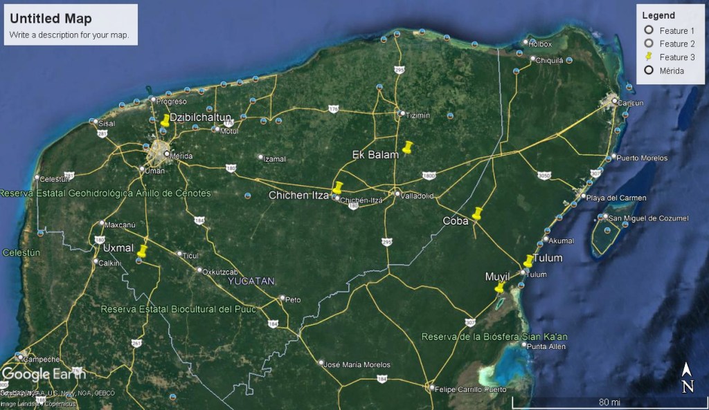
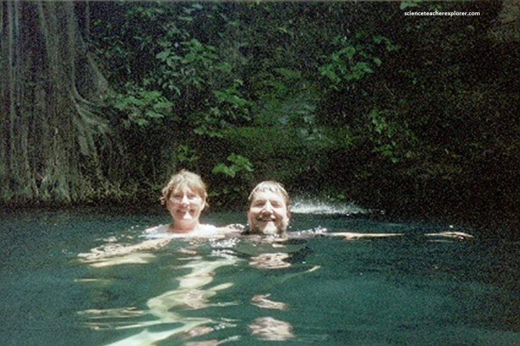
Driving in this part of Mexico, between the states of Quintana Roo and Yucatan, is incredibly easy. The land is flat, the highways are relatively straight, and it’s a tourist-heavy section, meaning it is safe and protected. The drive is about two hours (193 km) each way, with ample opportunity to stop and take in extra sights along the way. We decided to stop and swim in a Cenote near Chichen Itza. Take highway 180 D west. It is a toll road but much faster, (freeway).
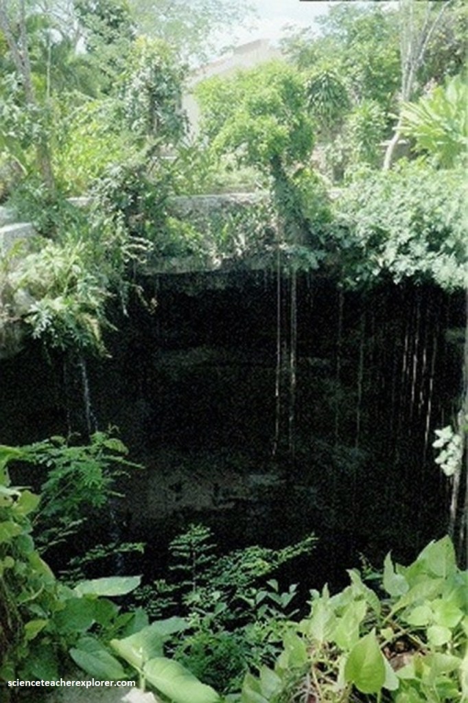
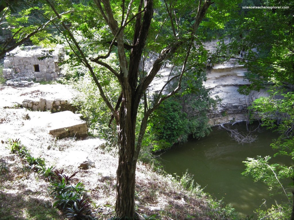
Pictured above, a cenote (seh-NOH-tay) is the Maya term for a natural freshwater sinkhole, a geological feature found in the northern Yucatán Peninsula of Mexico. There are no rivers in the Yucatan; the regular high rainfall (130 cm rain falls every year) simply trickles through its calcareous landscape. Once below ground, the water forms a thin layer of water called a lens aquifer. Those aquifers flow horizontally, carving sinuous underground caves, and when the ceilings of those caves collapse, sinkhole openings to the surface are created, forming a cenote.
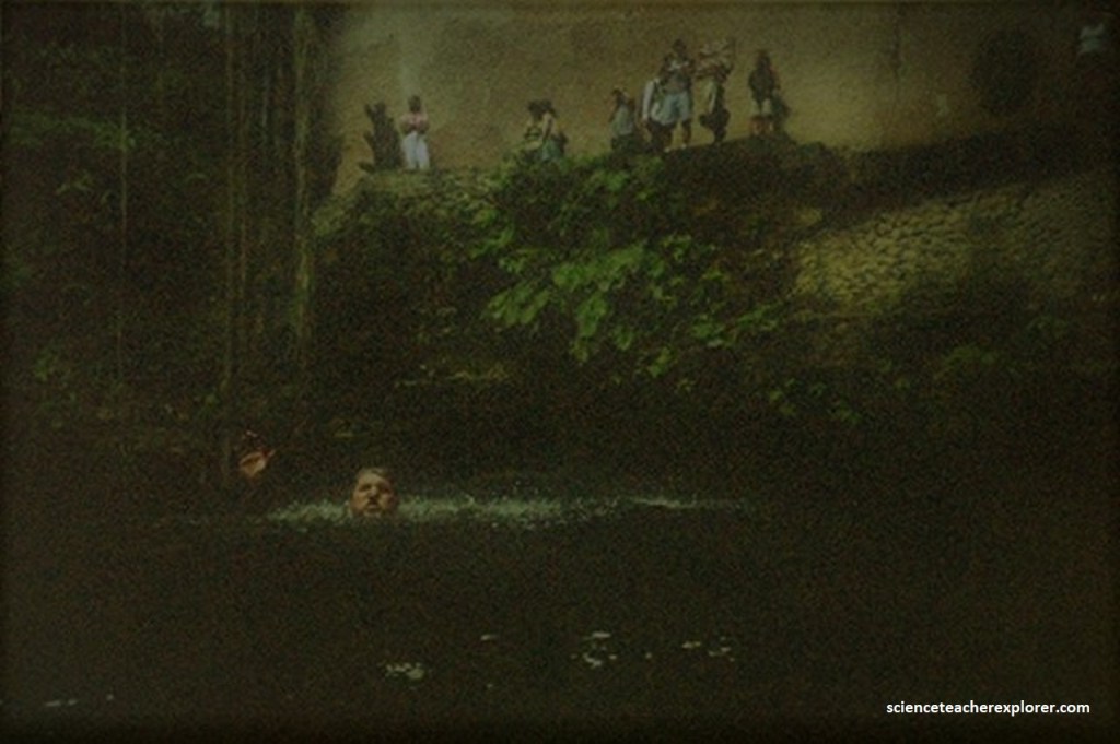
We stopped at the Ik-Kil Cenote. Ik-Kil was located at a close distance to Chichen Itza, on the highway to Valladolid, Mexico. It was arguably one of the most beautiful cenotes of Mexico. Pictured above, in order to reach the water had to jump down 26 meters to the water. The water was 40 meters deep while its diameter was 60 meters.
The waters of Ik Kil were considered sacred by the Mayans who performed here human sacrificing to their rain god. Bones and jewelries were found in the deep waters of this cenote by archaeologists and speleologists.
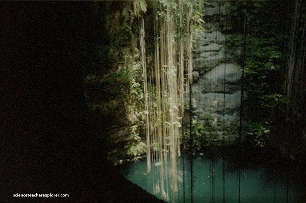
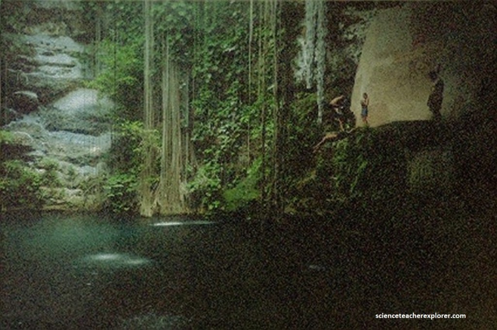
Pictured below, there are vines which reach from the opening all the way down to the water along with small waterfalls. There were blind black-catfish which continually nibbled on my flesh.
To the ancient Maya, cenotes were passageways to the underground world of Xibalba. They were often also associated with the rain god Chaac, and sometimes said to be his dwelling place. As the only natural source of freshwater, cenotes are and were essential resources to people living in the Yucatán.
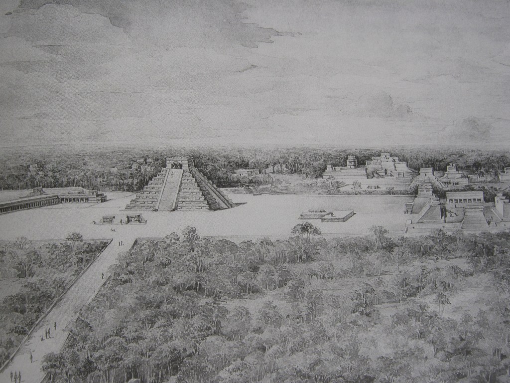
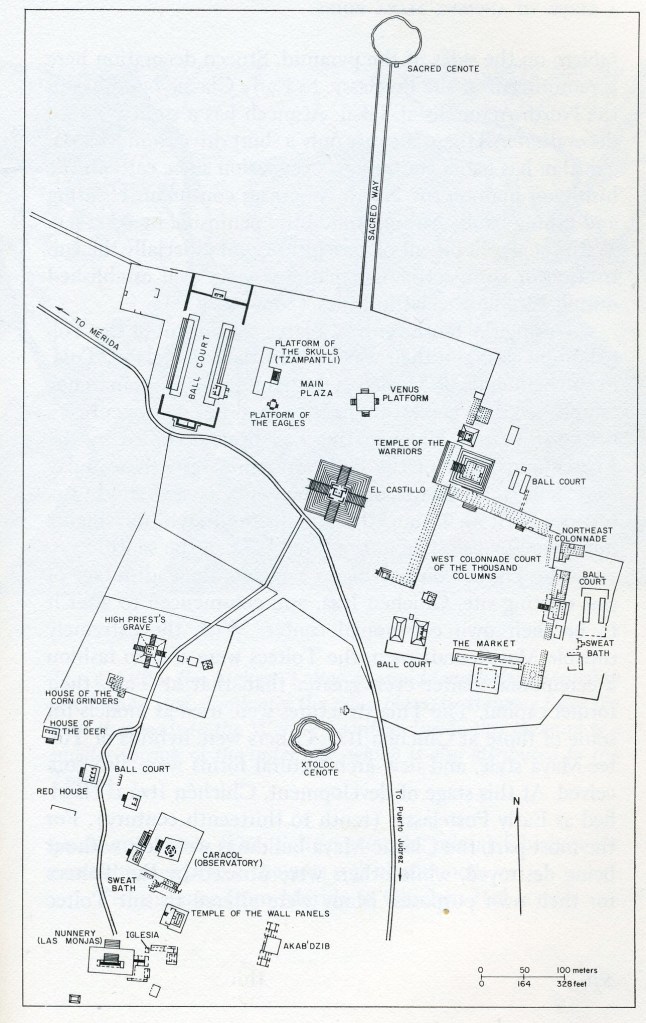
The ruins of Chichen Itza was easily covered by us in breaking them into two areas: (1) structures north of the service road; and (2) structures immediately south of the service road, (imaged below).
There are two principal styles of public architecture at Chichen Itza. The first is a local variant of the Puuc style found at sites in west-central Yucatan and northeastern Campeche [This architectural style began at the end of the Late Classic period (840 A.D.) but experienced its greatest extent during the Terminal classic period (1100 A.D.)]. The other style is partly derived from the same roots but is vastly enriched by elements and concepts from other parts of Meso-america, notably the Gulf Coast, Oaxaca, and central Mexico. Investigators of Chichen Itza proposed the Puuc-style were “Maya” and the features found (serpent-deco, Chac-Mools, warrior-successions) in the other style were “Toltec.”
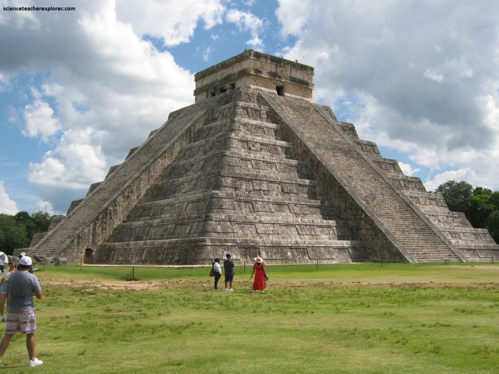
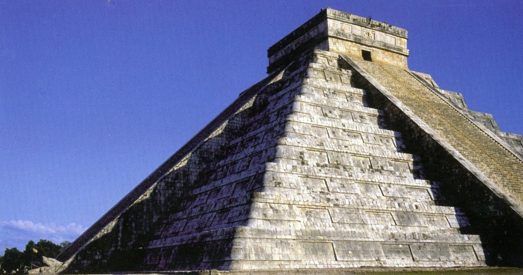
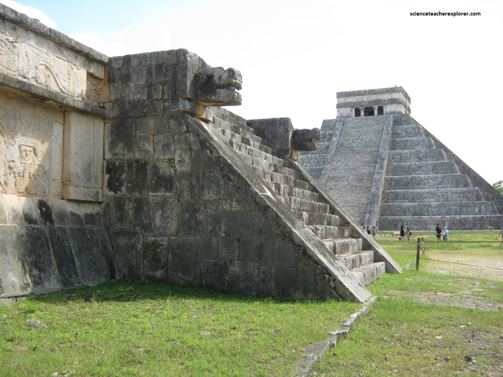
Pictured above, as we approached Chichen Itza from the west, El Castillo (also called the Temple of Kikulcan), towered above the vegetation and was visible from some distance away. It was near the entrance to the site and was centrally located in a large open area called the North Terrace, or “Central Plaza”; like the other principal structures in the north area of the site, it is “Toltec” style.
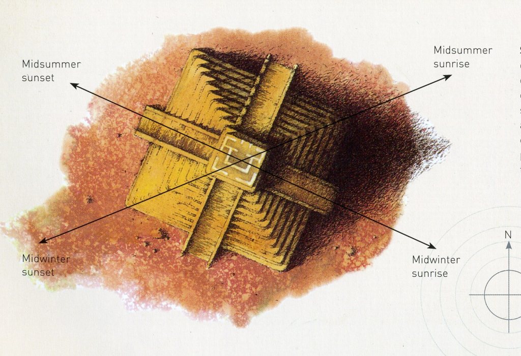
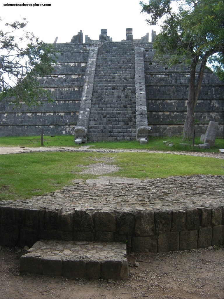
Pictured above, the nine-tiered step pyramid of Kukulcan is 24 m high. A staircase runs up the center of each of the pyramid’s four sides; at the top is a two-story temple. The 91 steps of each staircase, added to teh top platform (4 x 91 + 1), total the 365 days of the Maya year. The square base of the pyramid is oriented to all four solstice directions: the northwest face is aligned to midsummer sunset; the southeast face to midwinter sunrise; and the diagonals to midwinter sunset and midsummer sunrise (image below).
Pictured below, thousands of visitors show to see the effect of light and shadow on the northern staircase at the equinoxes, (equinox hierophany). On lookers see the setting sun cast a shadow from the terraces of the northwestern corner of the pyramid onto the western side of the balustrade of the northern staircase. At the climax of the display, the sun illuminates a continuous zigzag running from the top of the pyramid to its base, where the balustrade terminates in the head of an enormous snake that is also bathed in sunlight. In this way the sun creates the luminous body of the divine Kukulcan, (the feathered serpent). Kukulcan is the Maya name for the Aztec deity Quetzalcoatl, who was strongly associated with the planet Venus.
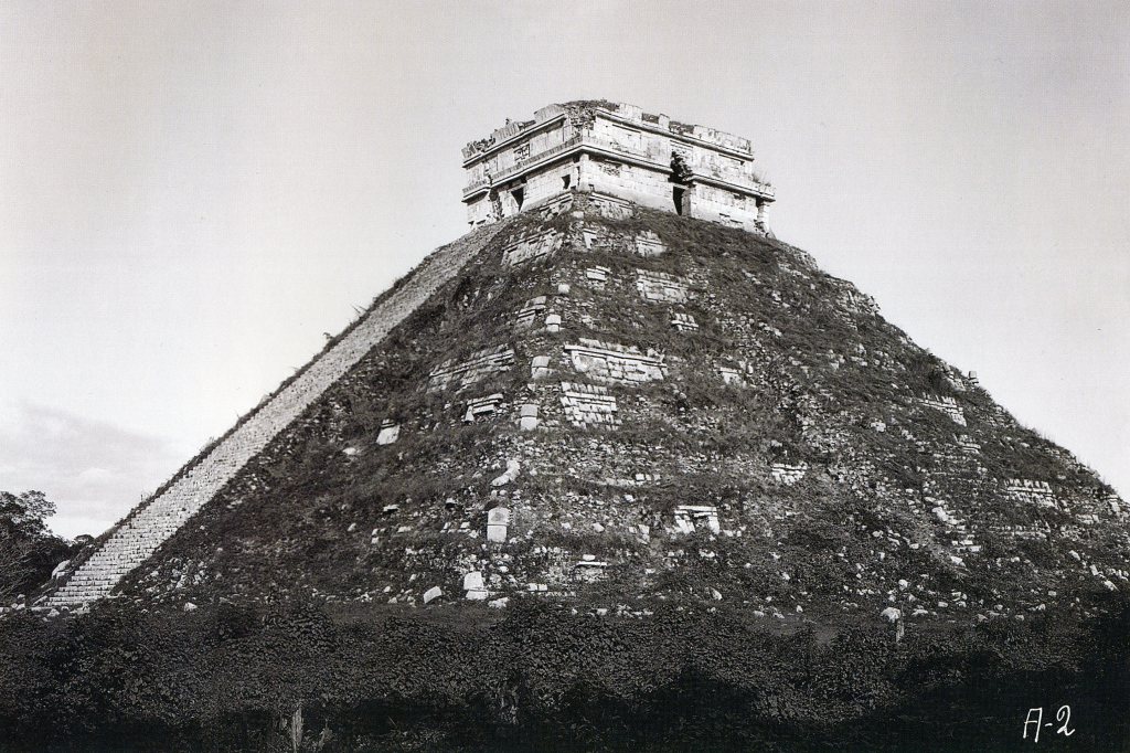
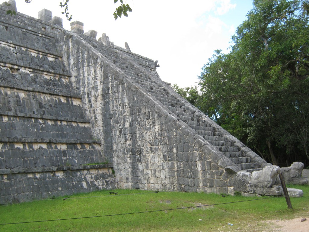
The visible structure covers a smaller earlier one (of similar plan), and some interesting sculpture is found on the inside of the latter. The inner structure was discovered during excavation. A tunnel was cut into the outer structure, and a stairway was located, which is the entrance to the inner structure. The entrance is at the base of the north side of El Castillo, but the inner temple can be visited only during certain hours.
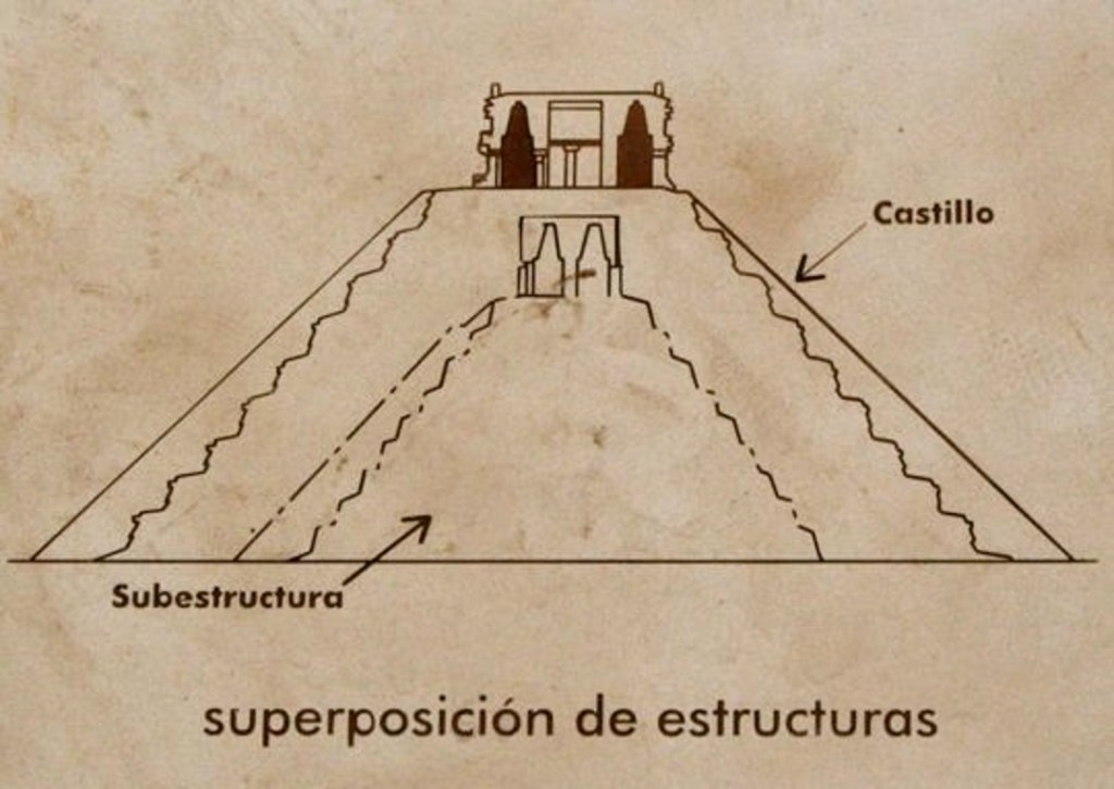
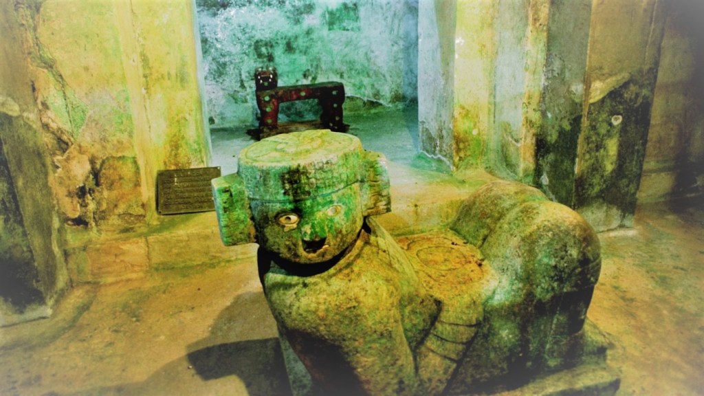
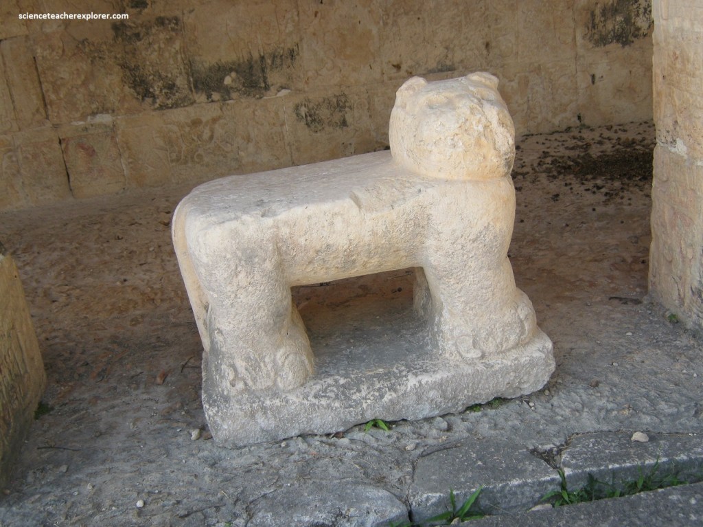
Inside, you will see a Chac Mool and a throne in the shape of a jaguar at the top of the stairs. Unfortunately, they are protected by bars, which interfere with taking pictures. Pictured below, the jaguar is painted red with Hematite and has some jade incrustations depicting the jaguar’s spots and jade balls representing the eyes. A turquoise mosaic disc was found on the seat of the throne. The four fangs of the Red Jaguar have been identified as gastropod mollusk shells
Climbing the exterior of El Castillo was much more pleasant and afforded delightful views of the north section of the site.
Video below, the temple on top of El Castillo was used exclusively by priests who performed sacred rituals at a height that brought them closer to the gods in the sky. Priests ascended one of the four staircases to reach the temple—the pyramid was never meant to be entered.
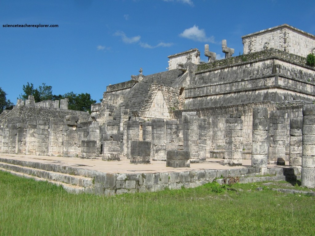
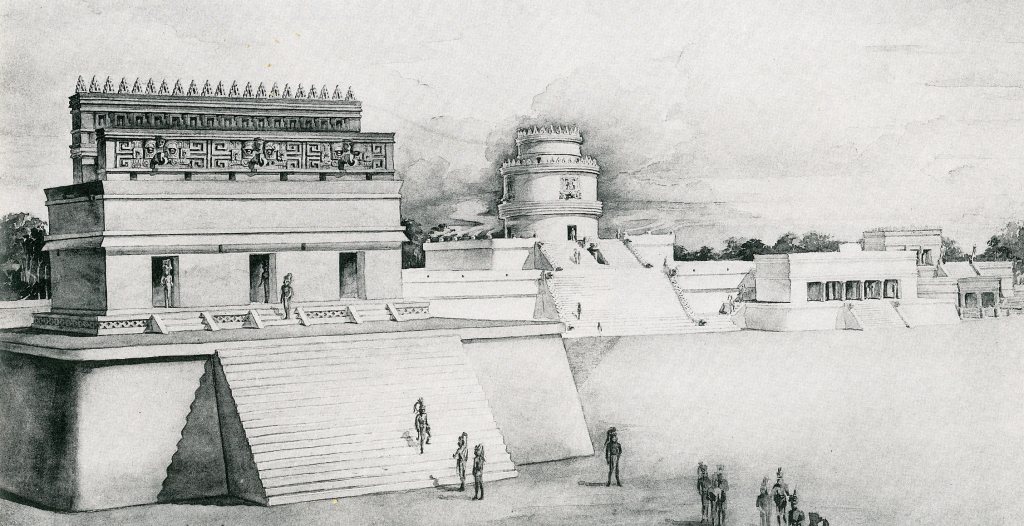
The top of El Castillo was a good spot for videos or photos of the Temple-of-the-Warriors, which lies to the east. Pictured below, the “Temple-of-the-Warriors is composed of a pyramidal base rising in three tiers, with a temple on top, approached by a stairway on the west side. There was a large colonnade of stone pillars carved with figures of warriors at the base of the structure on the west side.
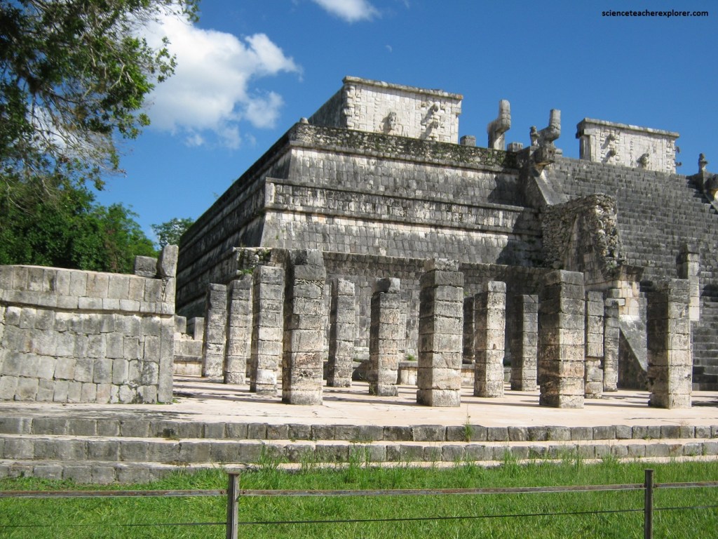
Imaged below, at the entrance to the temple there was a Chac Mool and two beautifully carved serpent column; at the rear are small Atlantean figures supporting an altar. The facade of the temple had sculptures depicting Chac, the Maya rain god.
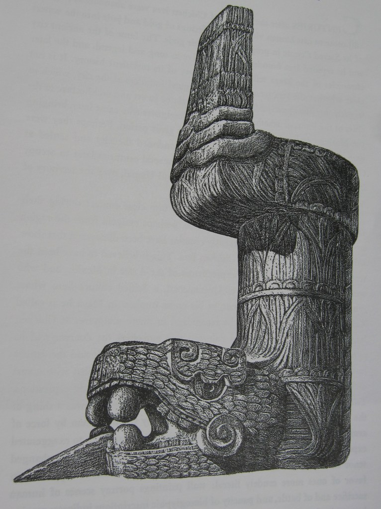
The Temple-of-the-Warriors also had at least two construction phases. There is an earlier inner temple, with pillars sculptured in bas-relief, which retain much of their original color, and murals once adorned the walls of the inner structure. There are also a Chac Mool and the heads of the serpent columns inside, (pictured below).
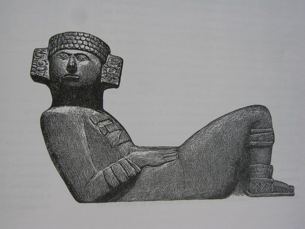
Imaged above, this type of statue (the Chac Mool) is not found in the southern Maya area, but common in many other regions from central Mexico to Costa Rica. It is a semi-recumbent figure, lying in a preposterously uncomfortable position, with its head always sharply turned over one shoulder. It holds on its body a round disc or shallow basin, possibly a repository of offerings. The name Chac Mool, translated as Red Tiger, which seems to point to the spread of a specific religious cult previously unknown among the Maya.

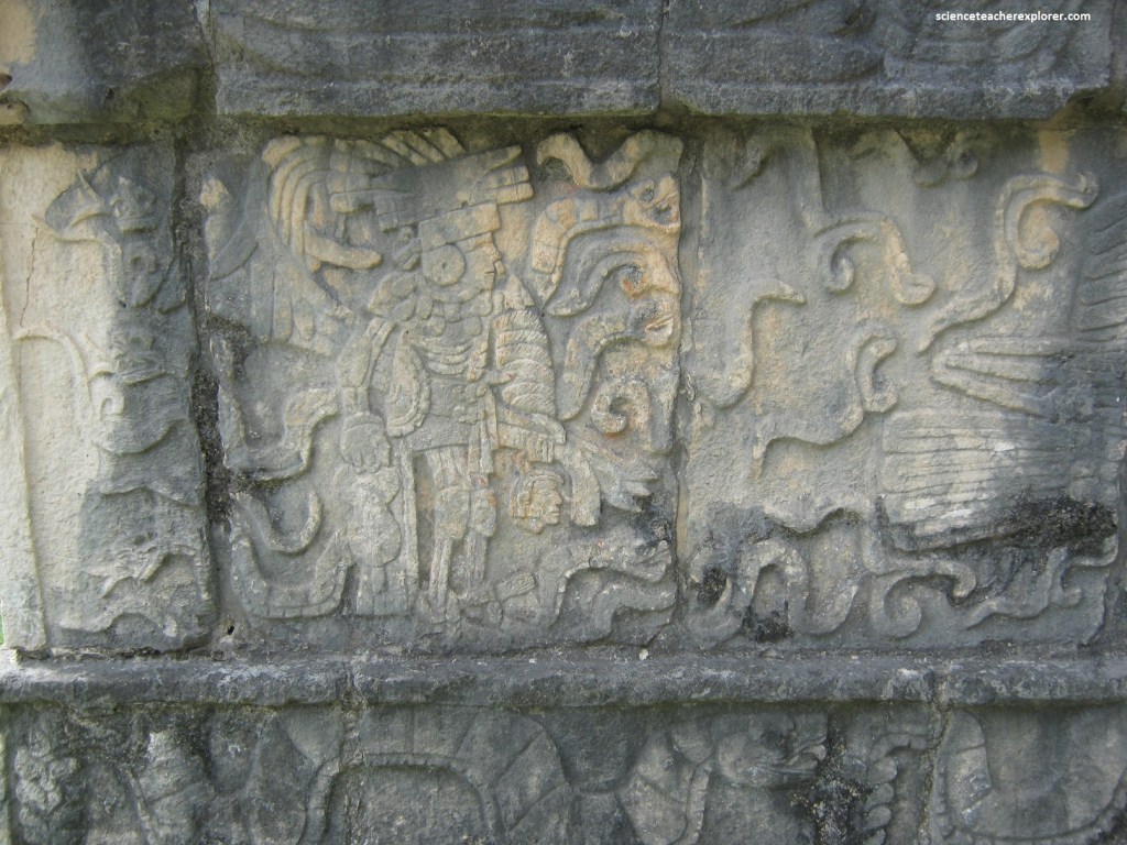
Pictured above, the Temple-of-the-Large-Tables got its name because of the overlapping levels that give the appearance of plateaus. This temple built next to the one of the Warriors, is a small pyramid of four levels that previously culminated with a temple with two serpent columns. Although it’s not preserved in its entirety, the first level of the frieze is still noticeable, which is carved in stone and placed on the ground in front of the staircase leading to the temple. It shows a procession of jaguars among trees and spears. On the second level, a plumed serpent is carved.
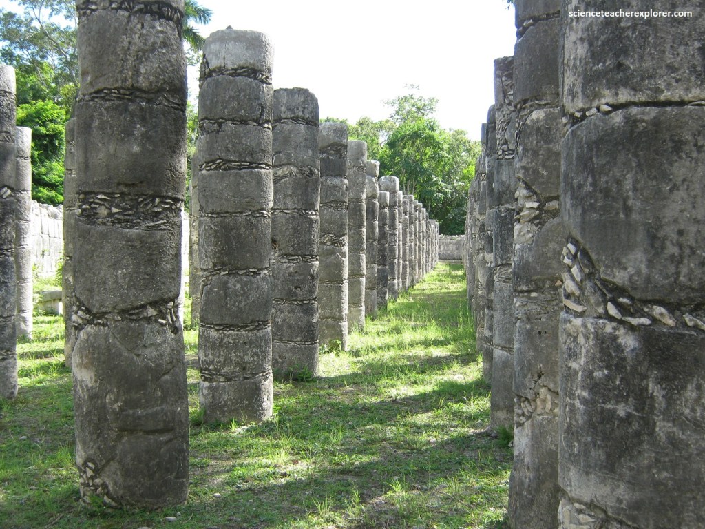
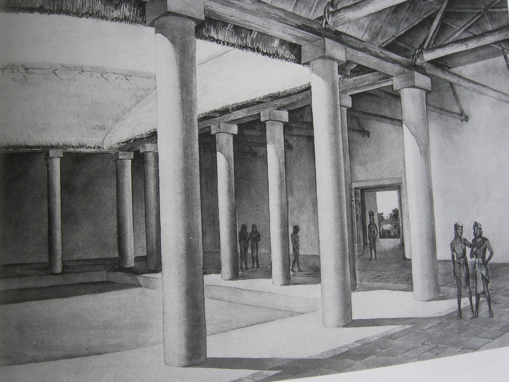
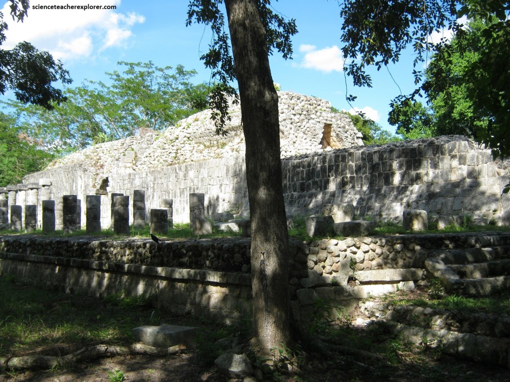
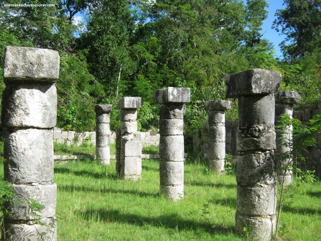
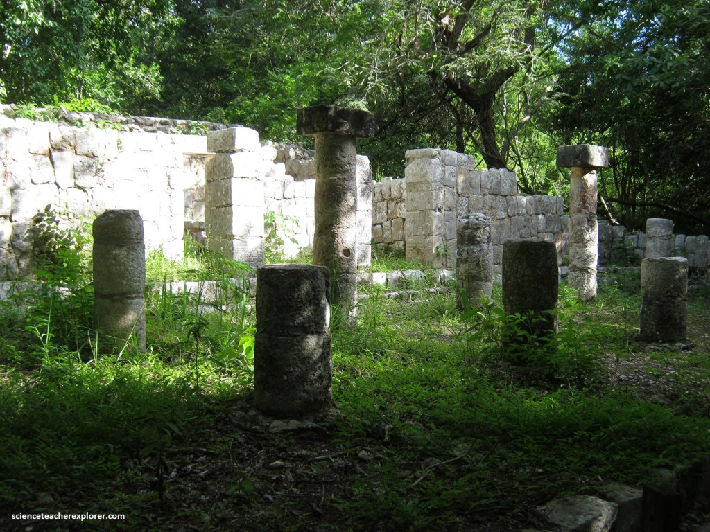
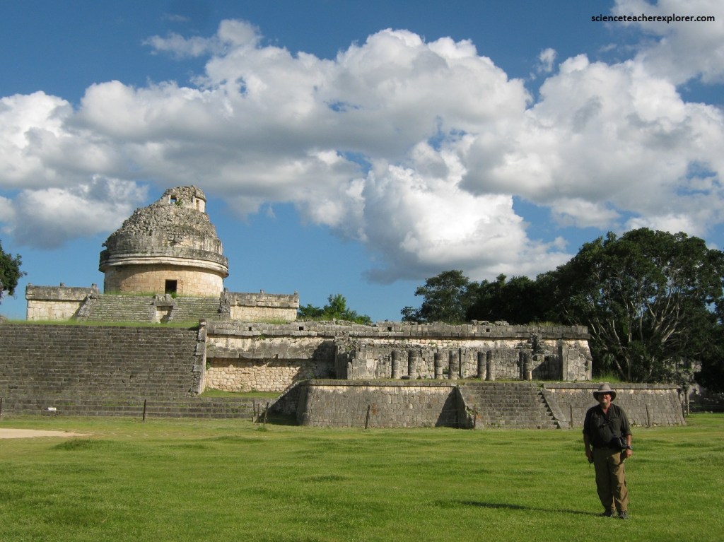
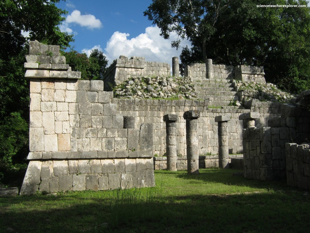
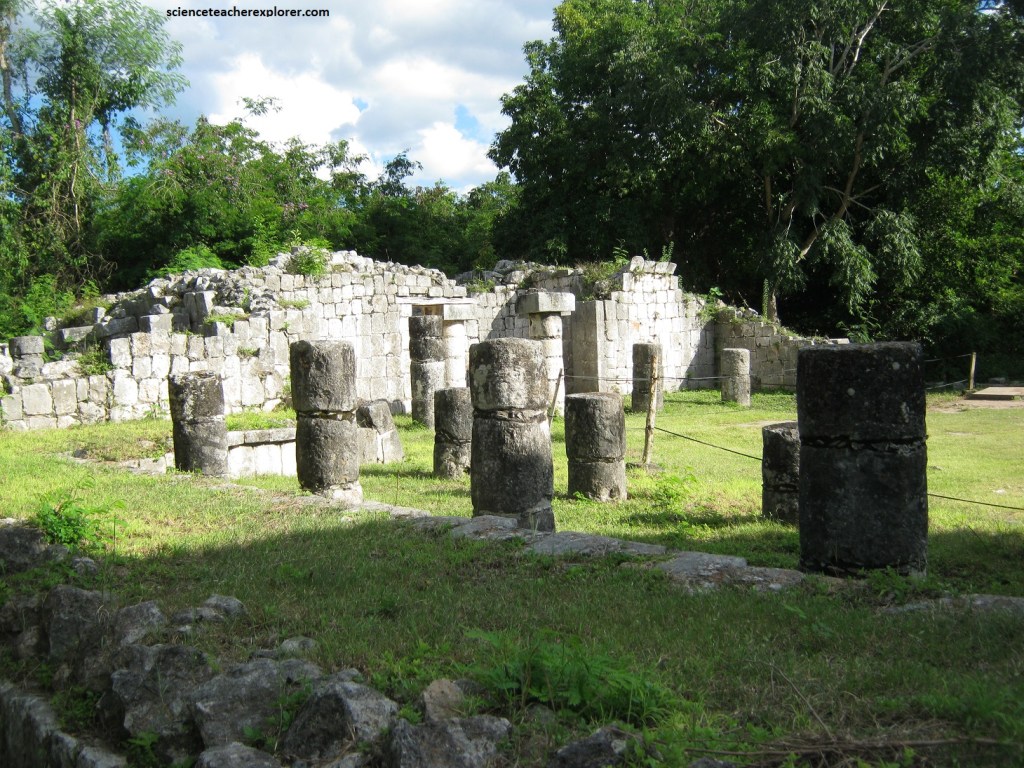
Pictured above, a large courtyard adjacent to the south of the Temple-of-the-Warriors, was surrounded by numerous ruined buildings know collectively as the “Group-of-the-Thousand-Columns”. The many columns were originally roofed over, forming a colonnade part way around the courtyard.
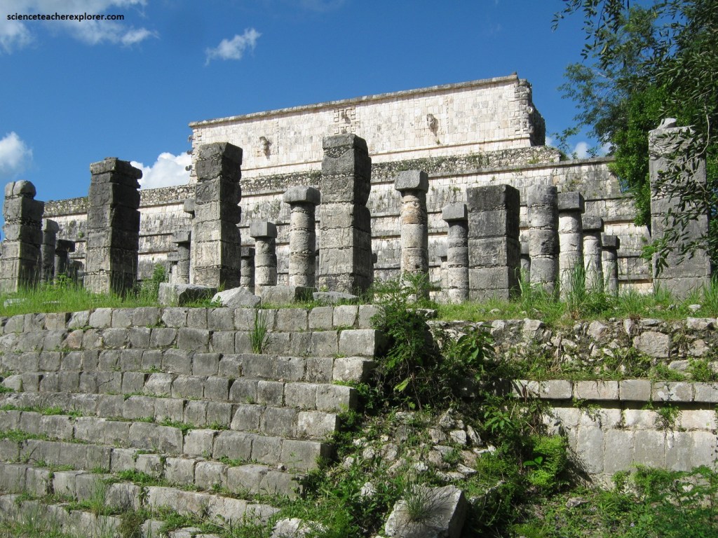
Pictured above, on the southside of the courtyard is the Mercado or Market. It was built on a slightly elevated platform. There was an interesting carved altar in this area and a square patio surrounded by tall columns with simple capitals. The perimeter of the patio was probably roofed with thatch, (imaged below).
Pictured below, the southern access and the juncture with other elevated columns to the north indicated that the colonnade was used to isolate events that occurred in the plaza.
Pictured above, at least two construction stages are evident in this sequence of buildings. In the first, there were four vaulted bays sustained by columns and stucco walls covered with multi-color painting. In the second, the two eastern bays were enclosed in order to build rooms on the second floor. the Northeast Colonnade was incorporated during the period from 900-1200 A.D.
Originally, this colonnade was a large space covered with a vaulted roof, which rested upon a long row of columns. Pictured above, this building which encloses the south-eastern angle of the Plaza clearly shows the modifications it underwent due to the construction of multiple inner walls. It is not clear whether these walls were, necessary to offset the instability of the building, or were related to changes in the use of the original spaces. It has accesses to the Steam Bath Courtyard and others towards the Plaza of the Thousand Columns.
From here we returned to the Central Plaza and headed north again to the Venus Platform, (pictured below).
Pictured above, the Venus Platform was a square platform that had a stair on each of its four sides and may have been used as a dance platform. It was decorated with bas-relief sculptures and three-dimensional serpent heads. Due north of the Venus Platform we came to a trail (built atop an ancient Maya “Sache”) that continues north 300 meters to the Sacred Cenote, (pictured below).
Although the cenote is a natural formation, it may have been altered to achieve its nearly circular shape. It was about 60 meters in diameter, and its side rises 27 meters above the water level. The “Sacred Cenote” was apparently not used as a water supply but was reserved for rituals and human sacrifice involving the rain god. The notion that the sacrificed victims were all beautiful young virgins was disproved when human remains of young children and older adults, both male and female, were discovered. The “Sacred Cenote” was in a depression, and the surrounding dense vegetation cut off most of the air. The heavy atmosphere and buzzing insects created a hypnotic effect, and we could easily imagine this as a place of human sacrifice. Pictured above, there were remains of a small temple on the edge of the cenote.
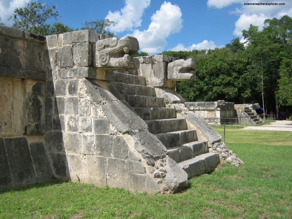
When we returned to the Central Plaza, we headed right and visited the Platform-of-the-Tigers and Eagles. Pictured above, these were similar to the Venus Platform, but smaller, and their decorative motifs included jaguars and eagles holding human hearts in their claws, (pictured below).
North of these platforms was the skull Rack, or Tzompantli. The sides were covered with bas-reliefs; some depicted skulls in profile, except for the corners, where they were shown full face. Oddly enough, each was different for the other and has its own personality. Other reliefs showed warriors in full regalia, (pictured below).
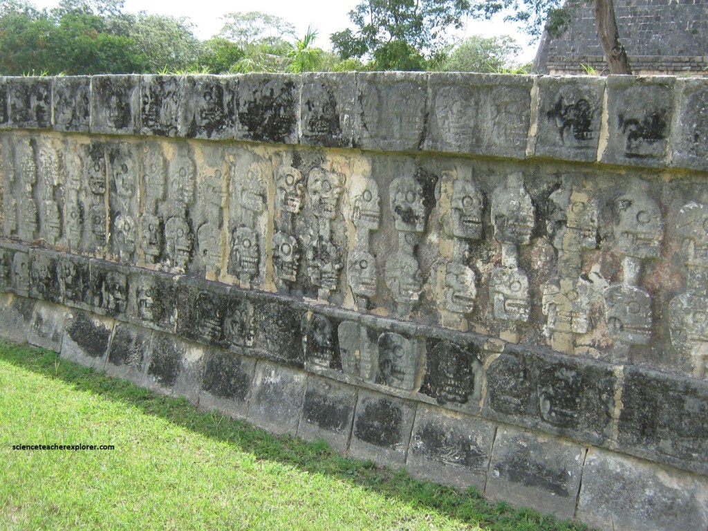
Pictured above and below, Tzompantli is a Mexican word designating a wooden rack on which skulls of sacrificed prisoners were publicly displayed, and it was given to this platform because its lateral wings depict rows and tiers of human skulls impaled on stakes.
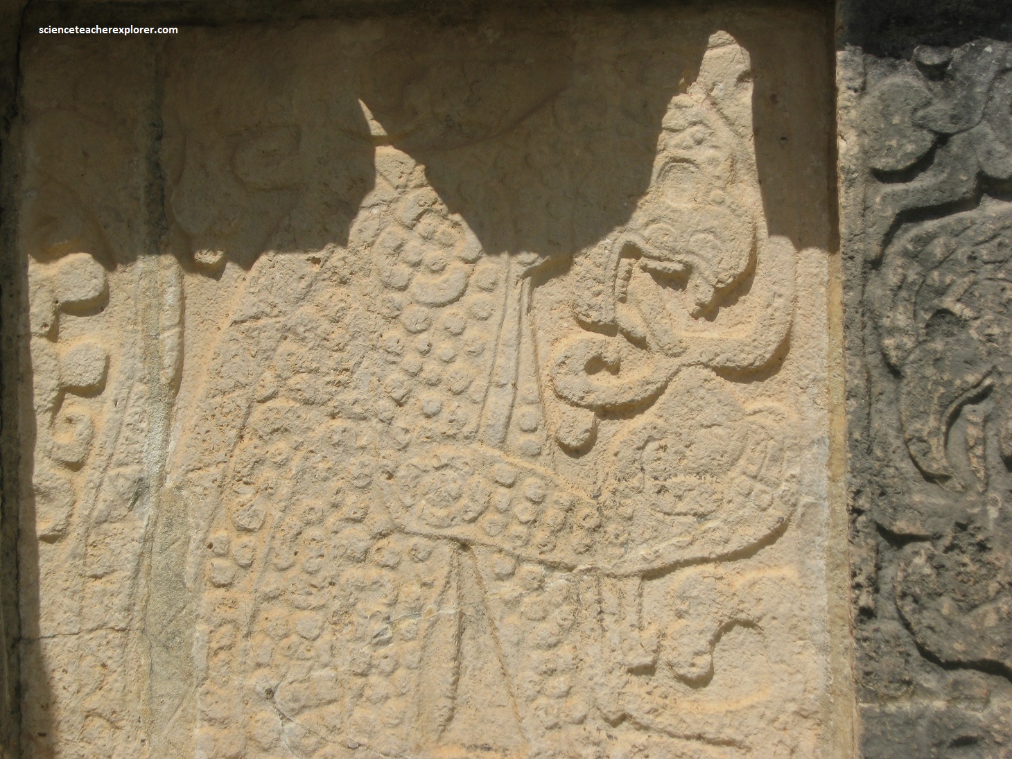
Pictured above, on the Tzonpantli’s eastern wing, are Eagles portrayed with many snakes and grim figures of emaciated warriors holding severed human heads. Skulls are not rare motifs in Maya art and human sacrifice was occasionally depicted, but they are usually executed with dignified restraint; but nothing compares with this rude and vigorous portrayal of a practice that reflects not the piety of sacrifice but the vengeful intent of mass execution of enemies and the preservation of their heads as trophies of war.
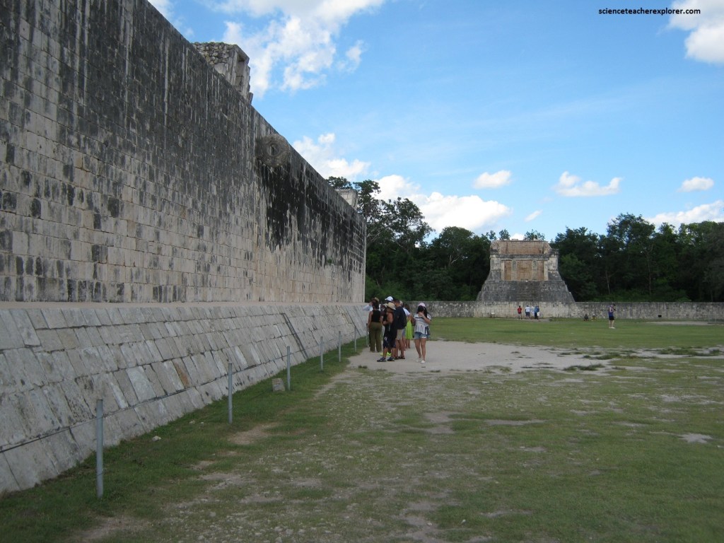
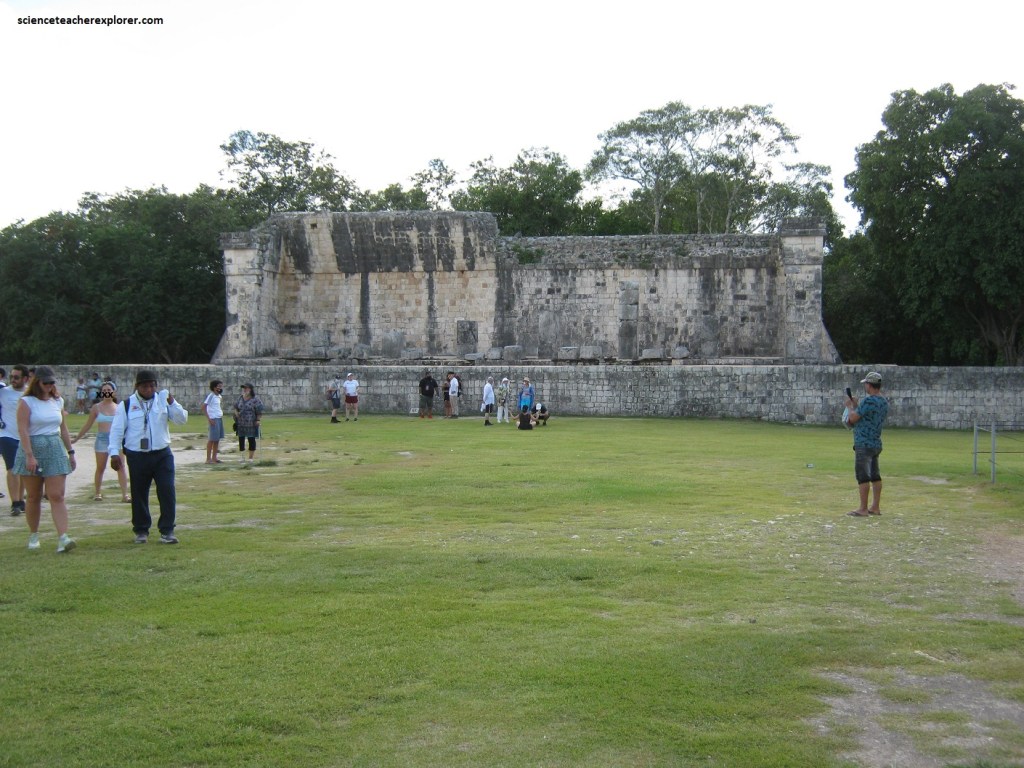
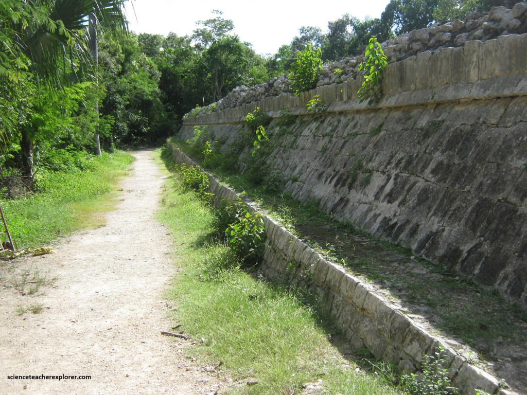
We now headed west to the Great Ball Court, the largest in Mesoamerica; it walls measure 91 meters long, but the playing area extends some distance beyond. There were interesting bas-relief carvings on the lower walls of the ball court depicting ball game activities and ritual sacrifice, (video below).
The video above and pictured below, a small temple lies at each end of the ball court, and from in front of the north temple (the Temple of the Bearded Man) a person speaking in a natural voice reportedly can be heard at the other end of the court, about 150 meters away.
Pictured above, the Temple of the Bearded Man gets its name from some bas-relief carvings on the inside of the temple.
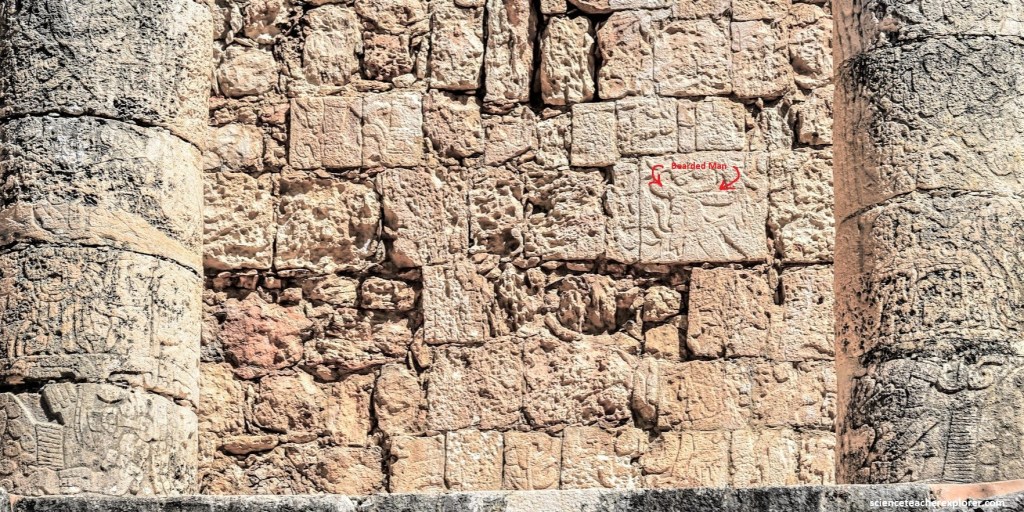
Pictured above, There were two columns at the entrance to the one-room Temple of the Bearded Man, and these, the interior walls, and the remaining portion of the vault were completely covered with bas-reliefs.
Pictured above, the larger temple at the south end of the ball court also has remains of columns with carvings, but the walls and vault surfaces are plain.
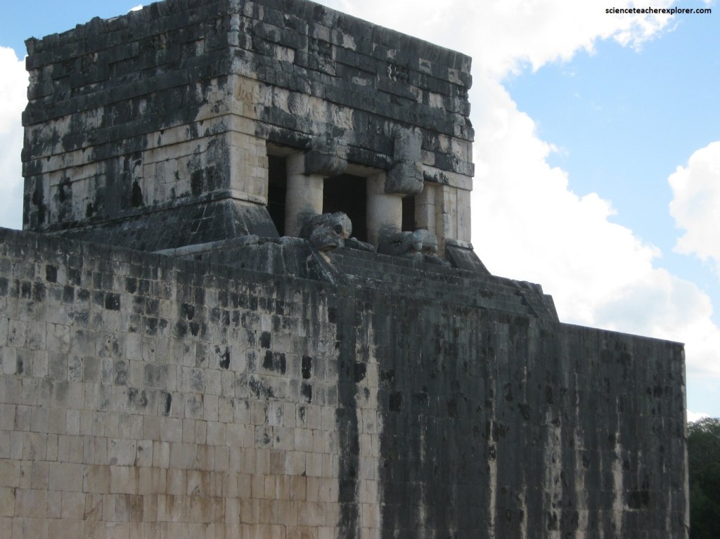
Pictured above, even more interesting is the Temple of the Jaguars on top of the south end of the east wall of the ball court, and reached by a steep stair. The roof of the temple is supported by carved serpent columns similar to those at the Temple of the Warriors, and in an inner chamber there area a few fragments of murals. A carved wooden lintel spans the doorway to the inner room.
Pictured above, on the first level and facing east of the Temple of the Jaguars, had a room that was polychromed with bas-reliefs on pillars, walls, and vault in a goo state of preservation with a simple three dimensional sculpture of a jaguar, (possibly a throne).
After the visit to this northern section of Chichen Itza, we continued to the South Group. When we reached the South Group, we first came upon the Temple of Xtoloc, (pictured below).
Pictured above, the Temple of Xtoloc is located beside the Xtoloc Cenote, which is the second largest cenote in the center of Chichen Itza, and from which it receives it’s name. It probably was used in religious ceremonies, perhaps related to the cenote. It’s construction dates from 900-1200 A.D. On the pillars of the temple there are sculptured personages representing warriors and priests. There is an alter in the interior of the third chamber, originally decorated with bas-reliefs of plants, birds and mythological scenes. In front of it and beneath the floor, a container of offerings with human remains was found. The facade faces west and due to an alignment which includes a simple altar, a path of stone slabs and a natural rock outcropping marked by rows of cut stone, the central entrance of the temple relates physically to the platform of the Ostuary.
Pictured above, the Platform of Venus is very similar to the one of the same name in the Central Plaza. In the center of one of it’s panels there is a relief of Serpent Bird Man, which is considered to be the representation of Quetzalcoatl, (Kukulcan as the “Morning Star”). Towards the stairway, one can be seen what has been interpreted as the “Knotting of the Years” alongside the planet Venus. The platform was originally painted in red, green, ocre, blue and black. An offering, consisting of a skull of a decapitated man, was found in the eastern stairway. The round Platform, one of the few buildings so shaped in Chichen Itza, held a container with offerings and a small stone paved area. The function of these buildings was probably as podiums for ceremonies, rites or dances.
Pictured above, Sacbe 5 is a road which connected the Northern Plaza with the Observatory. It was built in three stages: the first two provided a simple line of stones outlining the road, while in the third stage there were walls, slightly higher than those observed today. The earth wall, dating from an earlier period, was probably built as a base for an enclosure or defense structure made of perishable material, and eventually connected Sache 5 with the northern side of the Temple of Xtoloc. It was built out of re-used stones, of which there are many column bases and decorated stones.
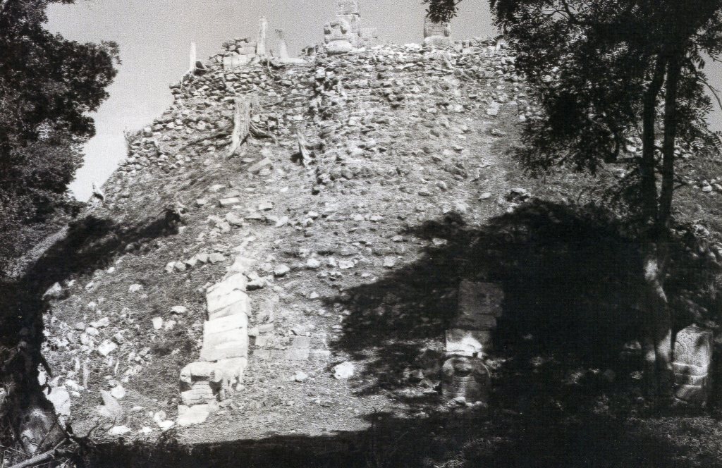
Although mostly ruined, the Ossuary, (or the Grave of the High Priest), is similar in design to El Castillo, though built on a smaller scale, (pictured above). There are remains of serpent columns on top, pillars carved with human figures, and the temple walls. near the base of the Ossuary are some carved-stone panels.
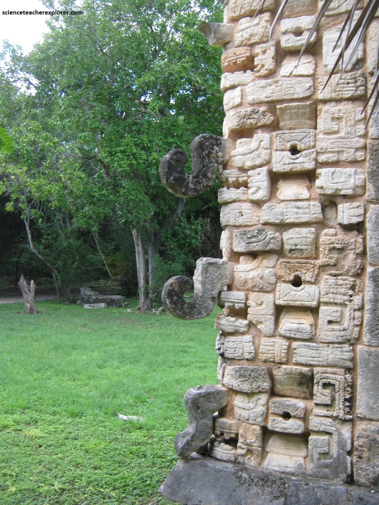
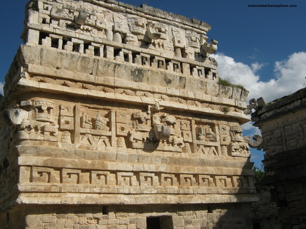
Pictured above, the Corner which was once located at the top of the Ossuary. There was a total of 16 of these stone masks, four at each corner. They may represent rain gods (Chaac), Kukulkan, or Itzamna, supreme gods and patrons of the linages. They are derived from the Puuc and fully demonstrate the syncretism that the lords of Chichen Itza practiced.
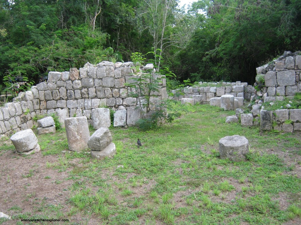
Pictured above, these form a series of chambers with large interconnecting porticos which must have served as a residence for people or families related to the upkeep and ceremonial use of the Ossuary complex. The abundant earthenware and numerous fragments of grinding stones found, indicate that the complex had a domestic use or was linked to the great public festivals which included food preparation. A the same time, the Atlantean Columns and the substantial architecture indicated that the complex was inhabited by people of a higher social class. It dates to the Terminal Classic-Early post Classic periods (900-1200 A.D.).
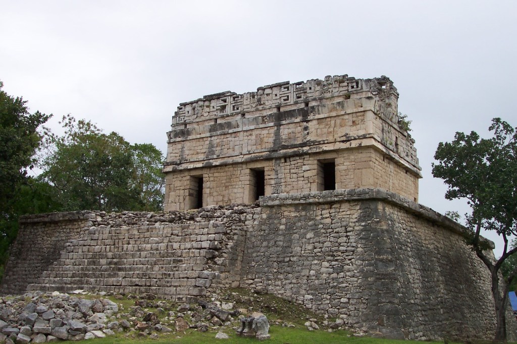
Continuing south on the trail, we came upon the “Red House” or Chichan-Chob on the right. Pictured above, this small temple was built on a platform with rounded corners and was reached by a stairway on the west side. Simple medial and cornice molding, a perforated central roof comb, and a flying facade with Chac masks form the exterior decorations. The walls were plain between the upper molding and below the medial molding, giving a feeling of sober restraint. The Red House (so called because of a red strip painted on a wall) is Puuc style. Its other name, Chichan-Chob, is Maya and probably means somethin like “small holes,” referring to the latticework in the roof comb.
We then followed the main trail south to the Caracol, which lied to the left. This is one of the most imposing structures in the South Group, (pictured below).
Pictured above, the Caracol is a round structure on top of a lopsided square base and is very unlike other meso-american monuments, with their straight lines and right angles.
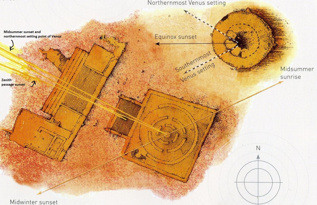
Caracol is Spanish for “snail”, and this building is named for the spirlling staircase it encloses. The walls contain narrow windows that seem to frame celestial events occurring at or near the horizon, (notably the northernmost and southernmost settings of Venus). Other alignments may include the setting sun at the winter solstice and equinox, sunrise on the summer solstice, the sun’s zenith passage, the heliacal rising (first appearance in the eastern sky before dawn), of stars such as Canopus, Castor and Pollux, and the setting of Fomalhout. {{Castor and Pollux are the two brightest stars in the constellation we know as Gemini. Viewed from the Caracol at Chichen Itza, these two stars can be seen to rise at the position of the sun at the summer solstice, (the time when the all-important rains were at their heaviest, bringing fertility essential to a successful harvest). In Maya lore, Caster and Pollux were known as the Turtle, an animal that for the Maya represented the Earth itself.}}
The ruinous state of part of the structure limits our understanding of the Caracol use. The Caracol is sometimes also known as the “Observatory”, but its visual resemblance to a modern astronomical observatory is purely coincidental. However there must have been a very significant purpose incorporated in the design of such an atypical building.
Pictured above, due south of El Caracol was the Temple of the Sculptured Panels. The panels were on the north and south exterior walls of the lower portion of the building, and a rocky path lead to the temple on the top from the south side. The panels depicted a battle among war captains who struggled for control of Chichen Itza. The reliefs also included images of plants and animals. It is assumed Templo de los Tableros Esculpidos was used for fire rituals.
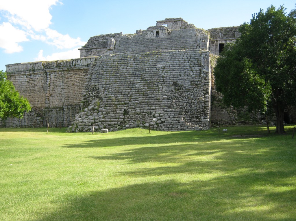
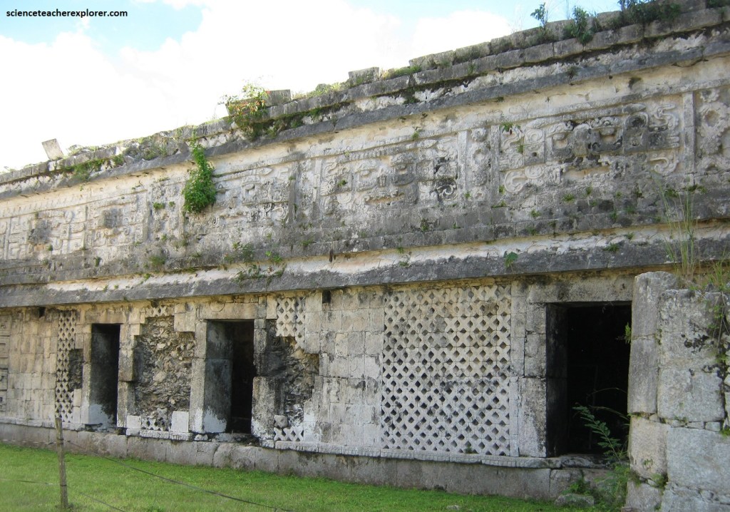
Pictured above, a short distance southwest of the Temple of the Sculptured Panels were two of the most interesting building in the area. The largest was Las Monjas, or the Nunnery, with its annex; it was 70 meter long, 35 meters wide, and more than 17 meters high. This building saw several building stages, leading to its present impressive size.
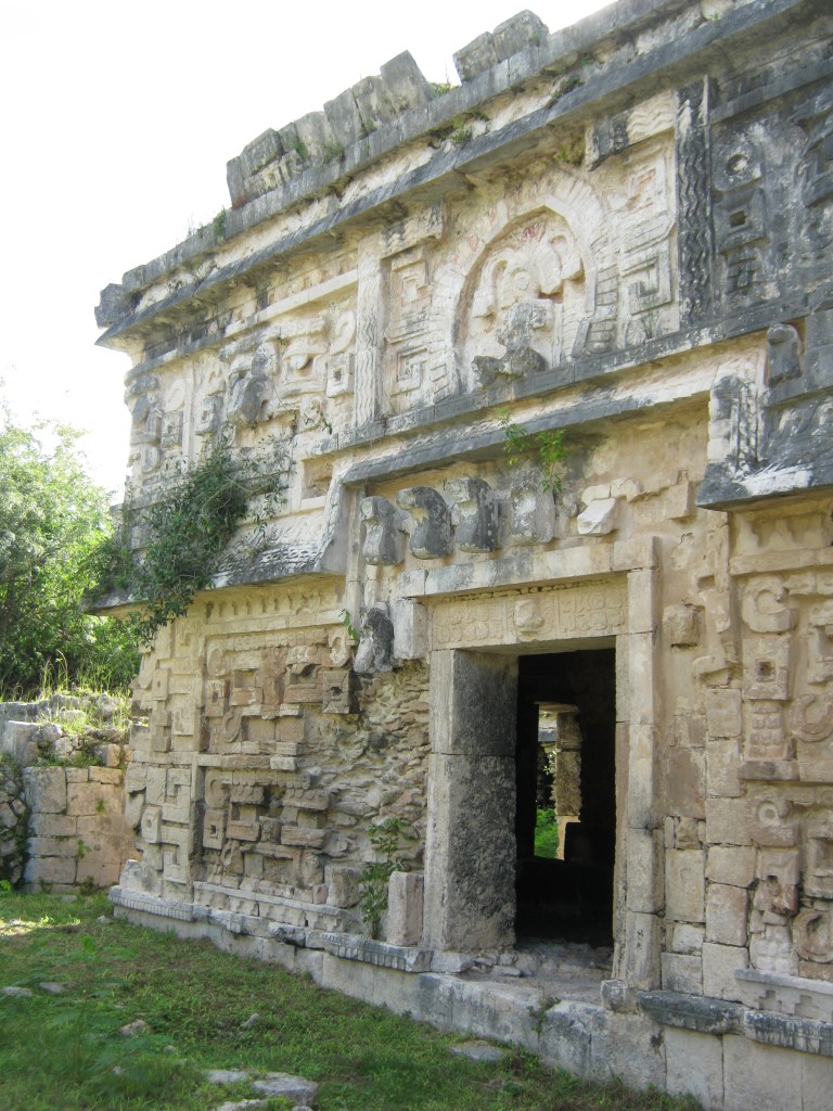
There was much interesting detail here, especially in the form of Chac masks. A doorway in the east face of the annex formed the open mouth of a monster, a feature associated with the Chenes style, although the rest of the structure was in Puuc style. The upper level of the Las Monjas had some carved lintels still in place. As mentioned and pictured above, the entrance resembled a cavernous mouth below a dignitary seated on a sky-band inside a niche of arched feathers. There is a long inscription above the door.
Pictured above, near the annex of Las Monjas was the diminutive La Iglesia, (the Church). The lower walls were plain, but the upper facade and roof comb were a riot of Chac masks, many complete with curling snout. These were accompanied by stepped-fret patterns and other interesting designs.
Pictured above, on the small Southwest Patio, there is a structure with a warrior relief on the extended back wall of a long bench.
Pictured above, about 100 meters east by foot trail was the Akab-Dzib (“Obscure Writing”), names for some hieroglyphs appearing on a lintel (including a date equivalent to 870 A.D.). This structure was built in at least two stages. The central portion was constructed first, and the flanking north and south wings were added later. The Akab-Dzib was undecorated except for simple medial and cornice moldings.
