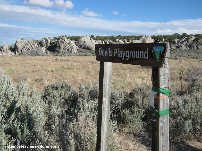
Devil’s Playground, UT
During August of 2012, I explored a relatively unknown geologic curiosity found in a remote region of northwestern corner of Utah.
From the northern I- 15/I-80 interchange in Salt Lake City, head north on I-15 for 69 miles to Tremonton (exit 382). Travel northwest on I-84 for 37 miles to exit 5. Turn left on Highway 30 and travel 16 miles to Curlew Junction (a junction with Highway 42). Turn left (southwest) and proceed 74.5 miles to the Emigrant Pass road. Turn right (north) and drive approximately 8.5 miles to the Devils Playground sign.
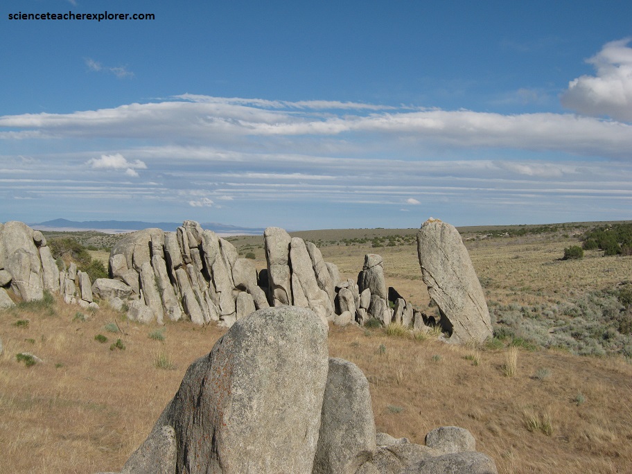
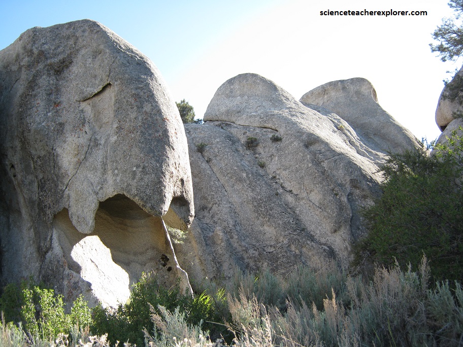
Devils Playground consists of Tertiary-age (approximately 38 million years old) granitic rock formed from a cooling magma body that intruded overlying Paleozoic (400 to 300 million years old) sedimentary rocks.
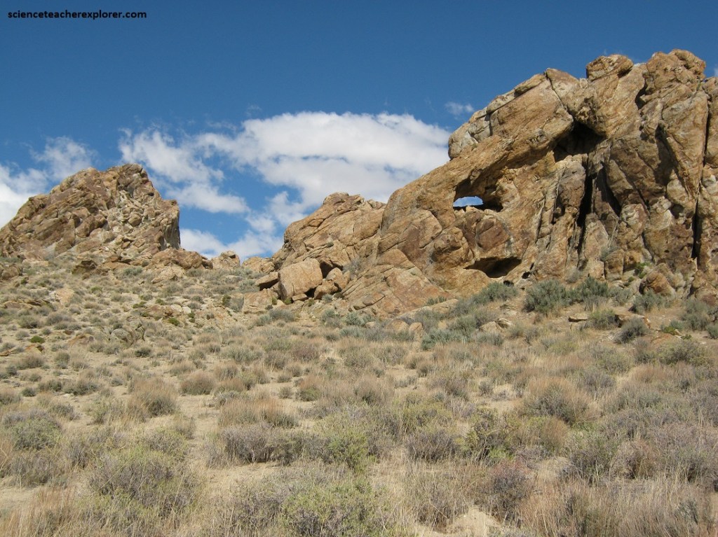
Pictured above, known as the Emigrant Pass pluton, this intrusion covers an area of approximately 26 square kilometers in the southern part of the Grouse Creek Mountains.
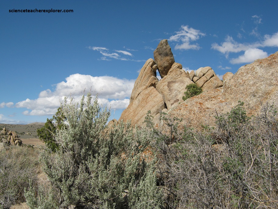
Later, small magma bodies intruded into the granitic rock forming pegmatites (coarse-grained igneous rocks with interlocking quartz crystals, usually found as irregular dikes or veins).
Basin and Range faulting and uplift of the Grouse Creek Mountains (approximately 13 million years ago) subjected the region to extensive physical weathering (surface water runoff and freeze-thaw), which over millions of years slowly peeled off the overlying sediments and sedimentary rocks.
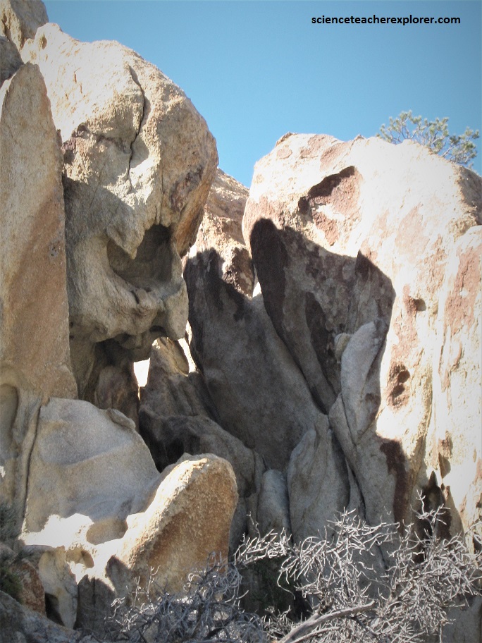
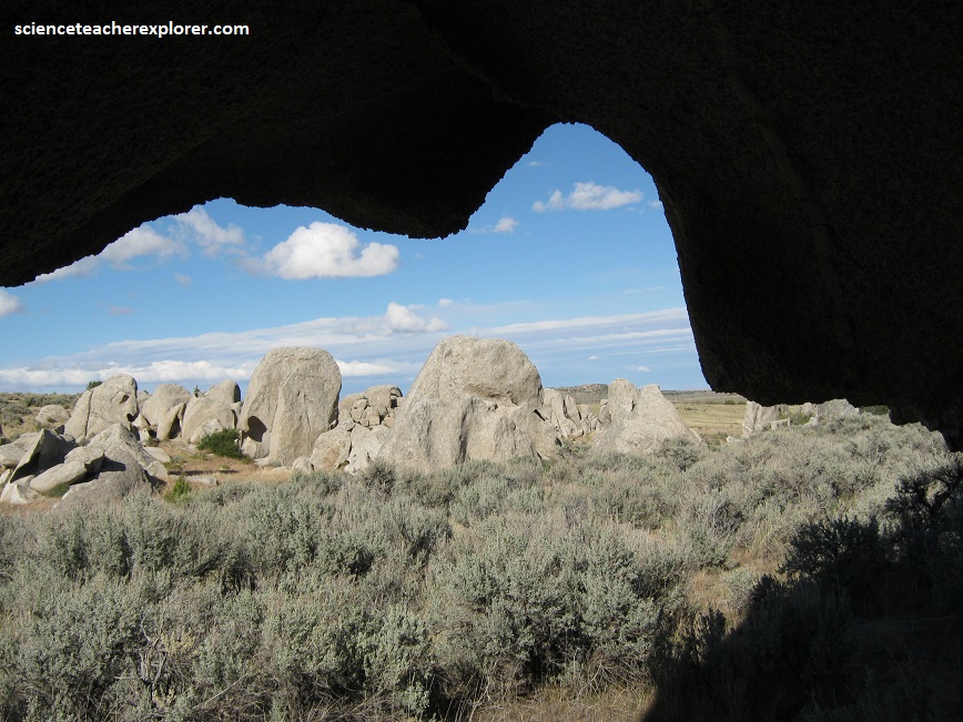
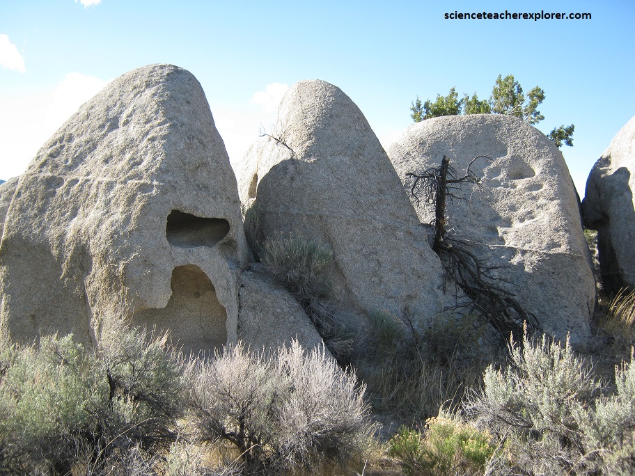
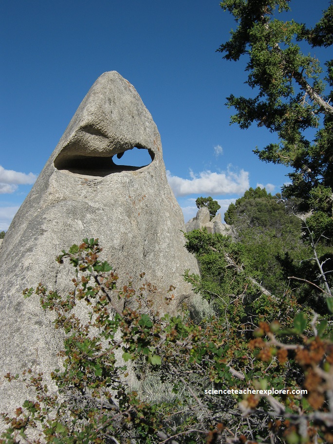
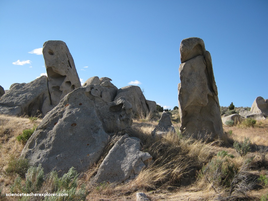
Once the rocks were uncovered, physical and chemical weathering (a variety called spheroidal or onion-skin) began attacking the rocks.

In spheroidal weathering, joints or fractures create initial openings allowing surface water to access the rock from all sides.

Water seeping along these fractures slowly decomposes or alters the mineral composition of the granitic rock, causing the rock to weather inward. As a result, rounded shells of decomposed rock are repeatedly loosened and peeled off the un-weathered core like the skin of an onion.
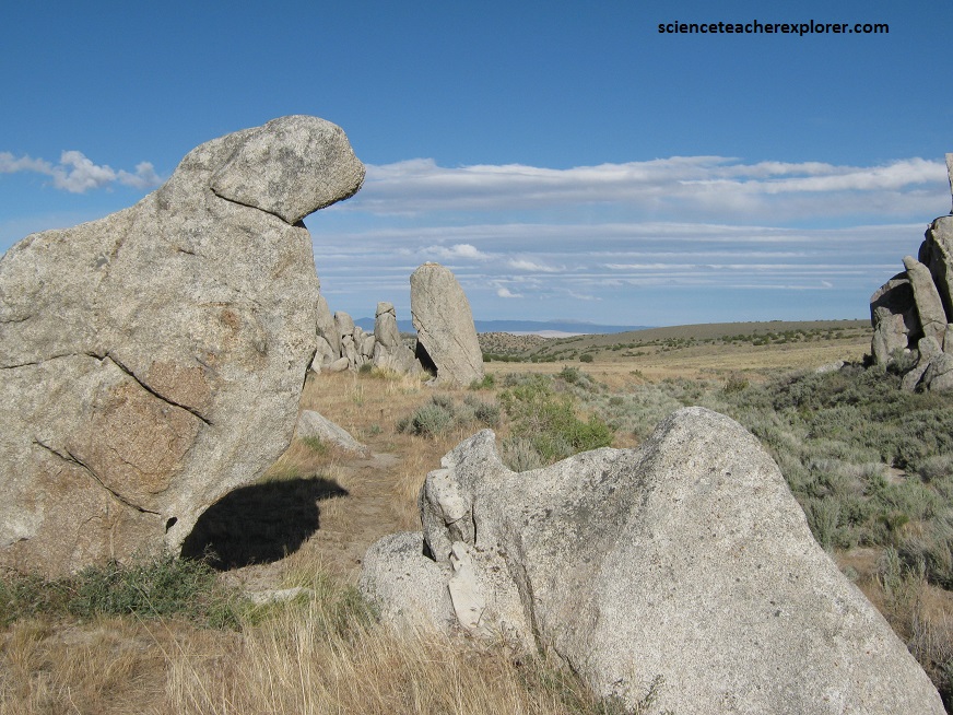
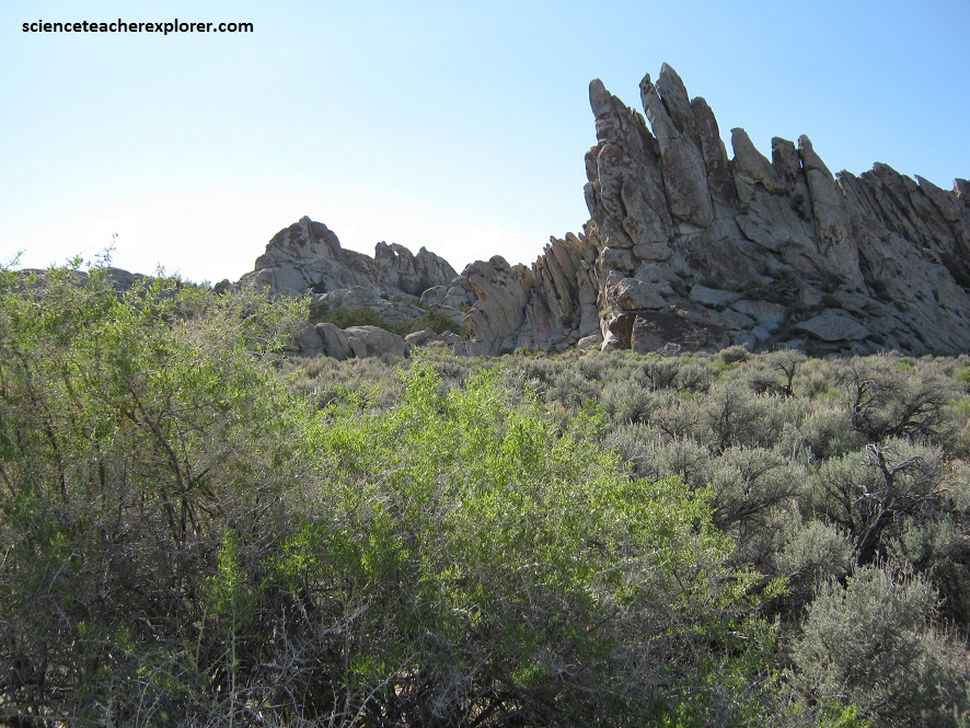
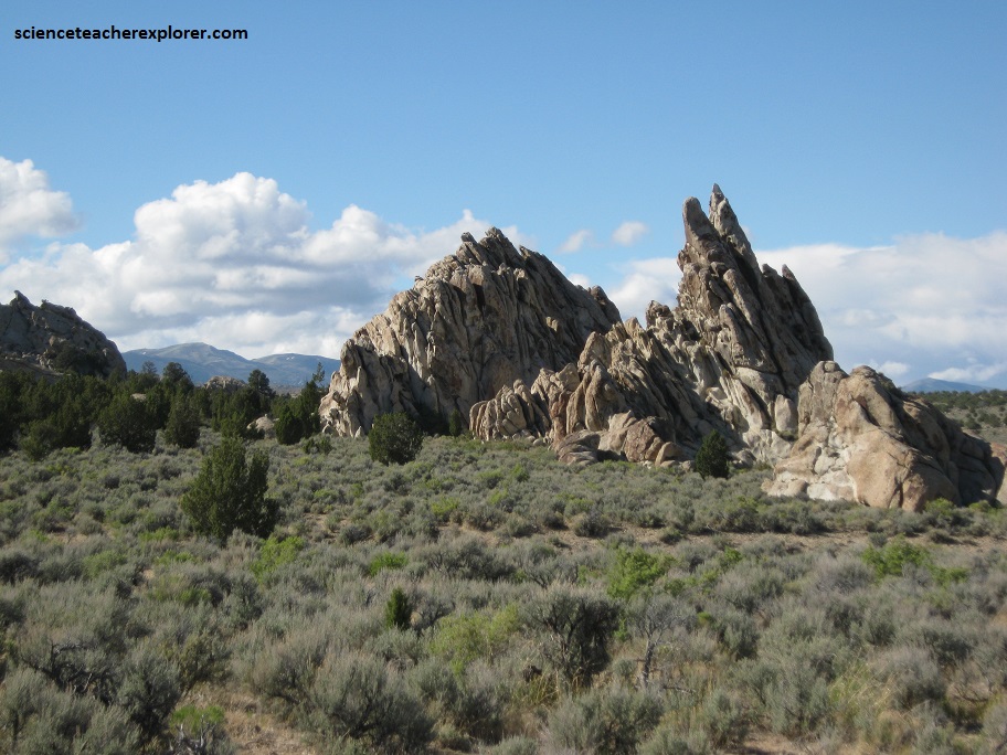
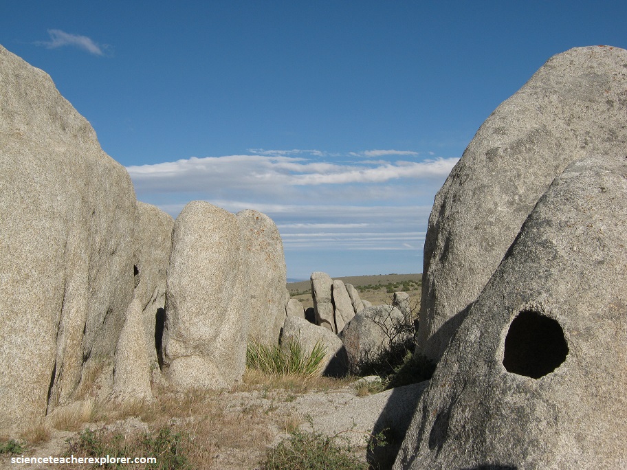
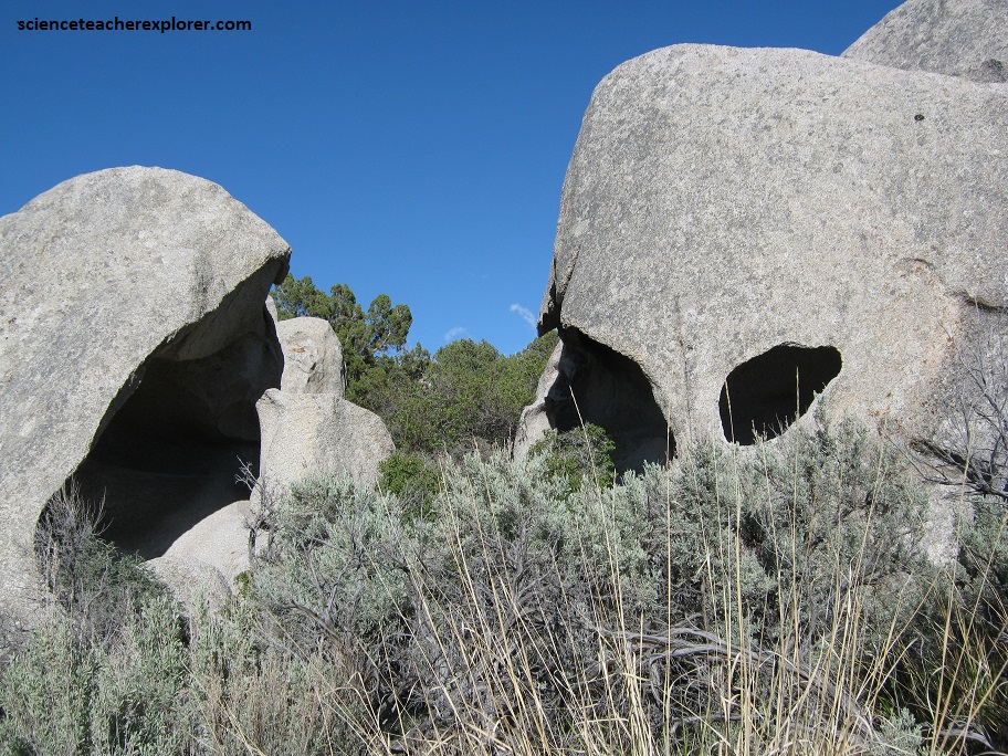
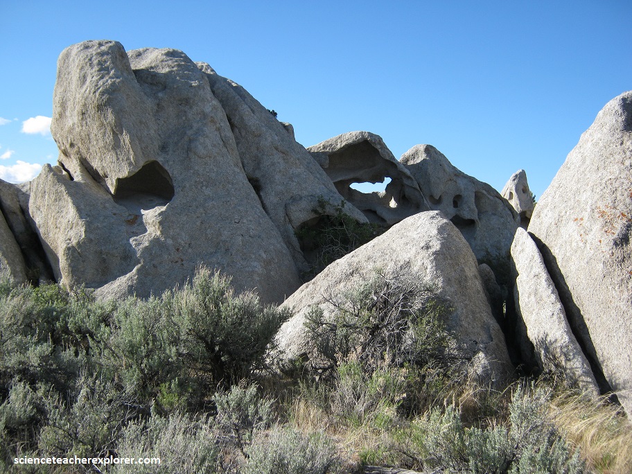
Pictured above, all of the “devils,” alcoves, spires, arches, and small caves found at Devils Playground can be attributed to these physical and chemical weathering processes.
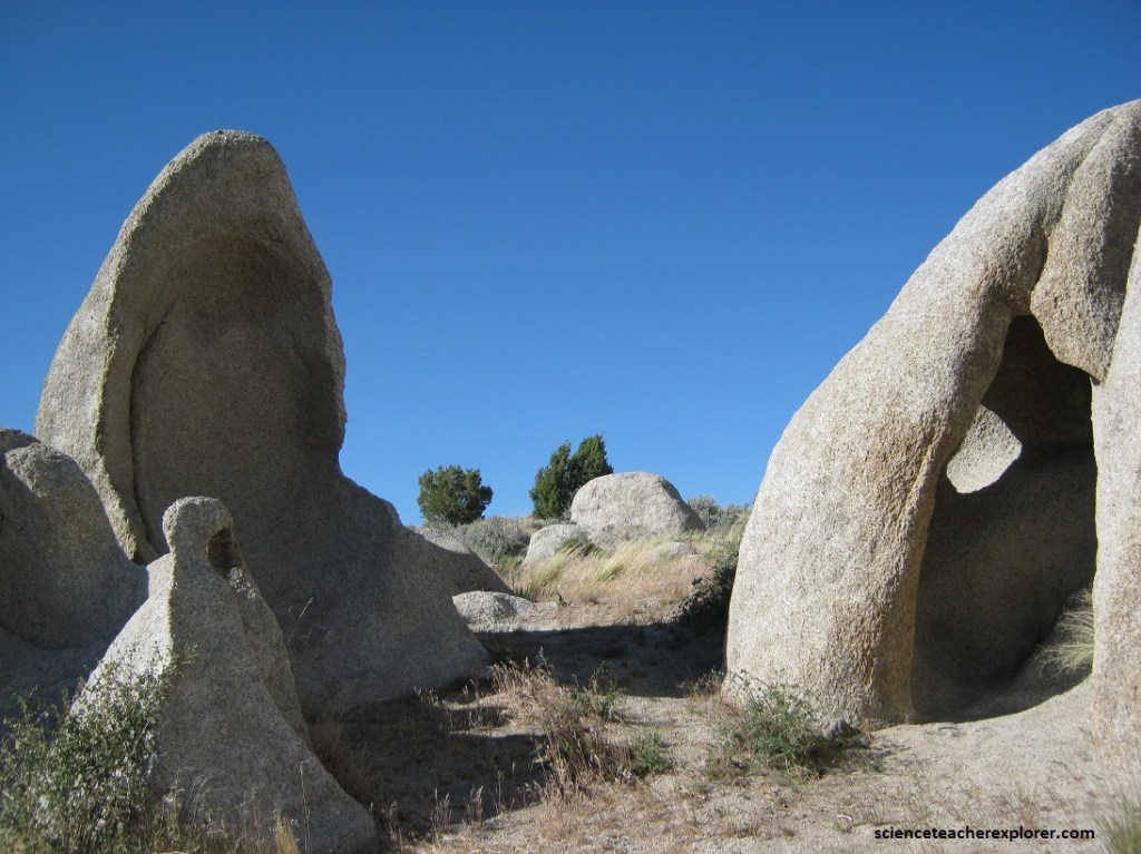
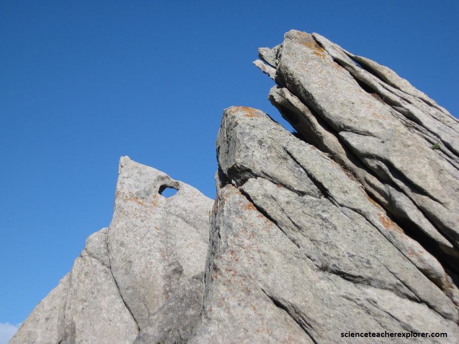
The rate of weathering is greatest along the corners and edges where fractures and joints intersect because they have a greater surface-area-to-volume ratio than the rock faces.
Eventually, physical and chemical weathering will destroy all of these artistic forms of nature. However, these processes will continue to sculpt new features as long as physical and chemical weathering expose granitic rock at Devils Playground.
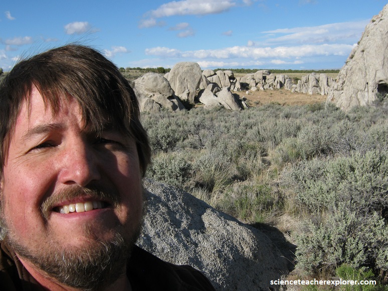
The rock is quite grainy and exfoliating. It is not good for rock climbing, but weathers into interesting shapes.
The Devil’s Playground is a good place to have some idle time! The area is a unique geologic feature in north west Utah where granite is exposed and has eroded into large fins, domes, spires, and boulders.
Roads provide easy access to the area with lots of opportunities for wandering amongst the boulders and for primitive camping. I loved scrambling on the boulders and into the many pockets and arches.
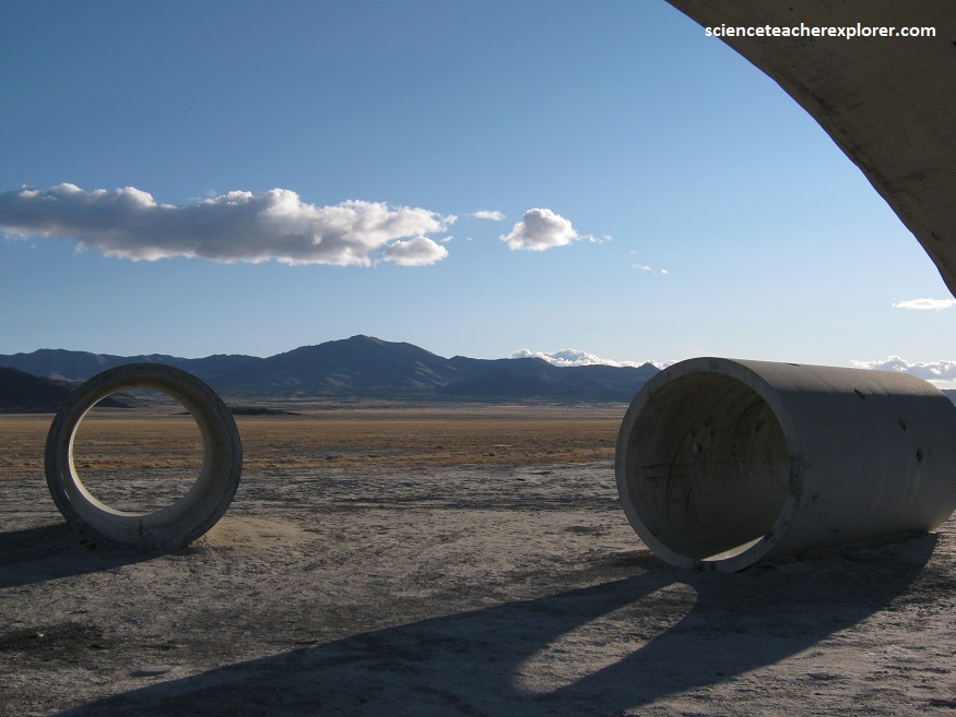
Just a few kilometers southwest of the Devil’s Playground, is the Sun Tunnel site. Pictured below, Nancy Holt, an artist exploring the human perception of time and space, earth and sky, built the Sun Tunnels as a unique art project completed in 1976. The four tunnels are concrete tubes laid out in an X shape, each drilled with holes to pattern the constellations of Draco, Perseus, Columbia, and Capricorn.
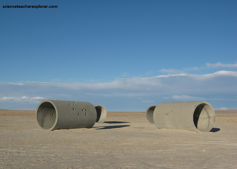
Pictured above and below, the “Sun Tunnels” are massive – 3 m high by 6 m long. They sit in a remote valley in the Great Basin Desert, east of the Lucin Railroad site. Nancy Holt has said her tunnels bring the sky down to earth, with the dazzling effect of light bouncing through the tubes. Two of the tunnels align with the setting and rising sun during the summer solstice and two line up during the winter solstice.
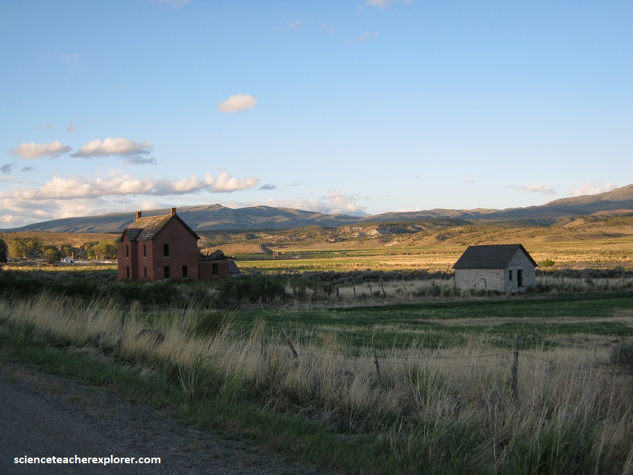
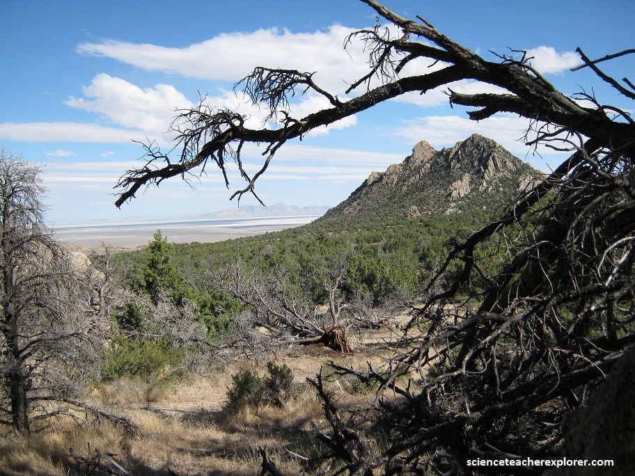
Northwest of the Devil’s Playground is Grouse Creek, Utah. Pictured below, Grouse Creek is a small ranching community located in the northwest corner of Utah. It borders Nevada on the west and Idaho on the north. Grouse Creek is a peaceful little community where approximately 125 people live. There is a small cooperative store, an elementary school, a U.S. Post Office, a Bureau of Land Management Office, and a church.