Bryce Canyon N.P., Utah
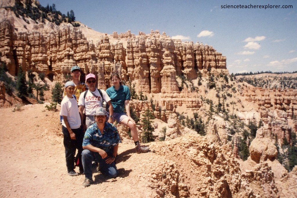
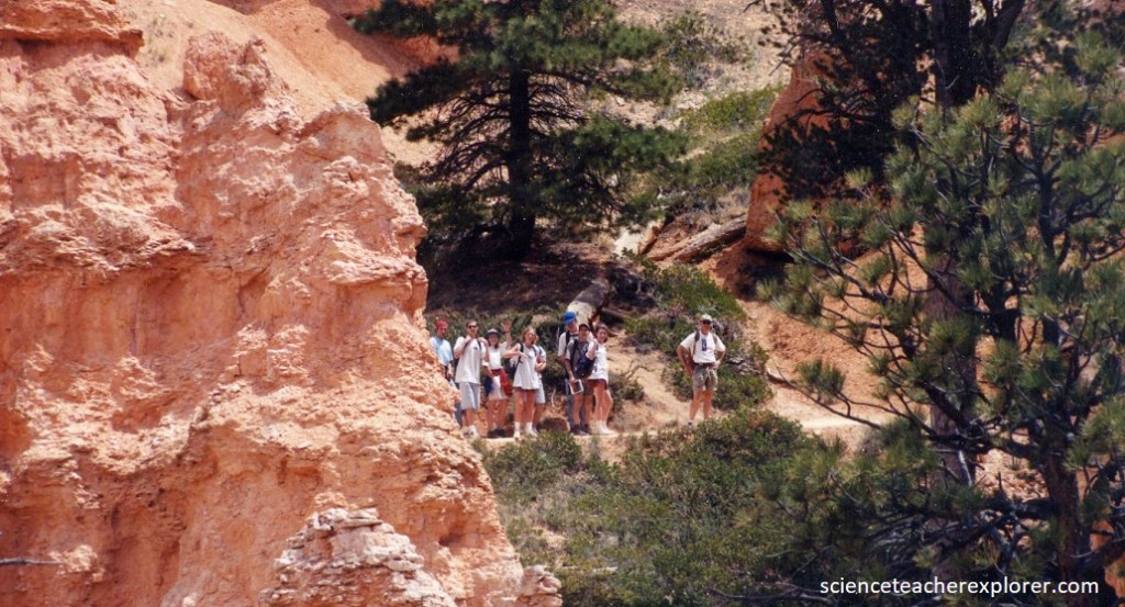
Being raised in Southern Utah, near Panguitch, I’ve been to Bryce Canyon National Park several times in my life. It was in 1992, 1998 and 2010; when I took a group of students, to explore Bryce Canyon National Park.
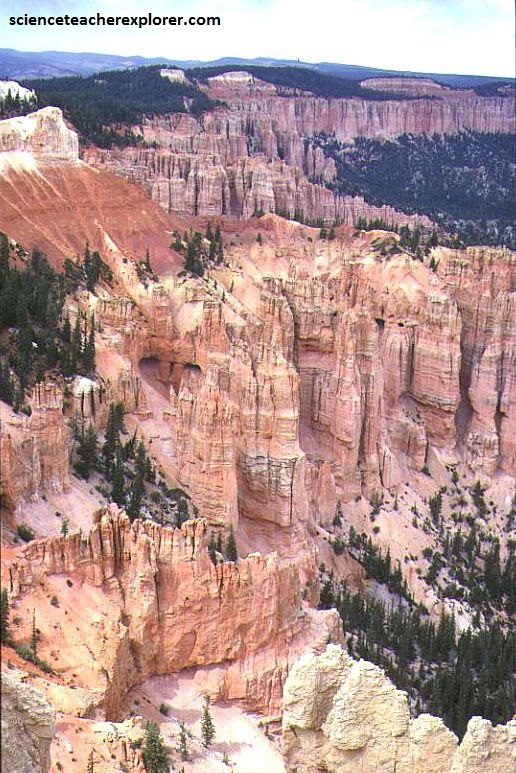
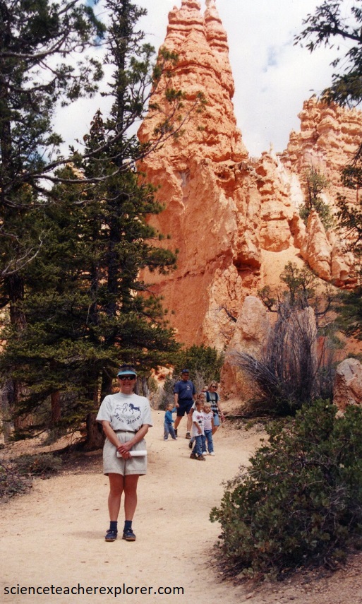
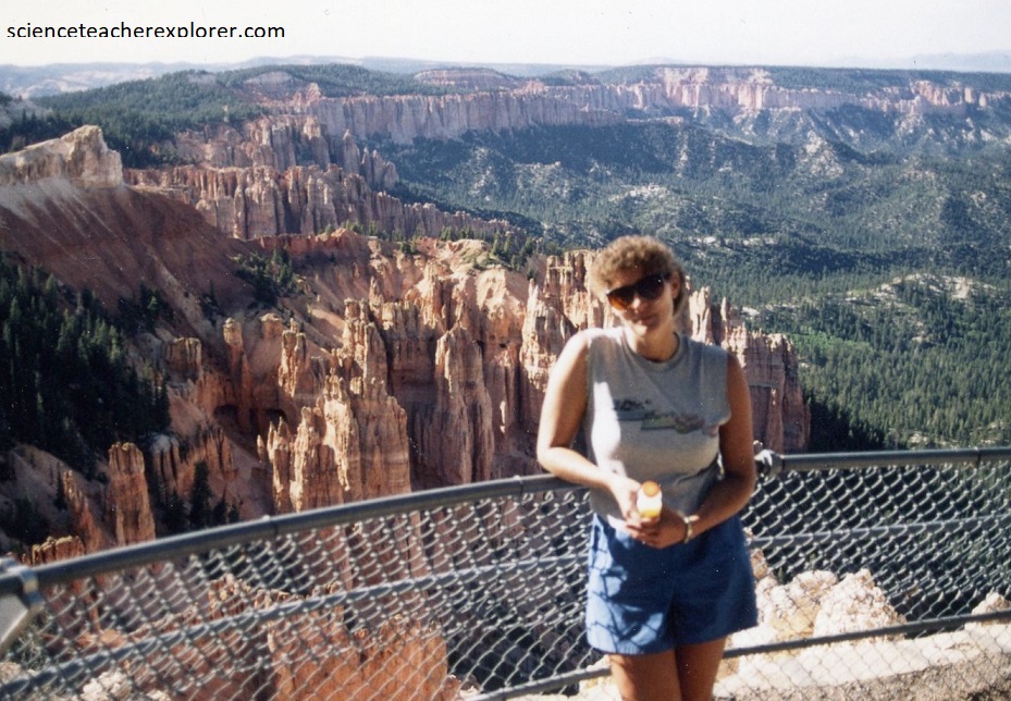
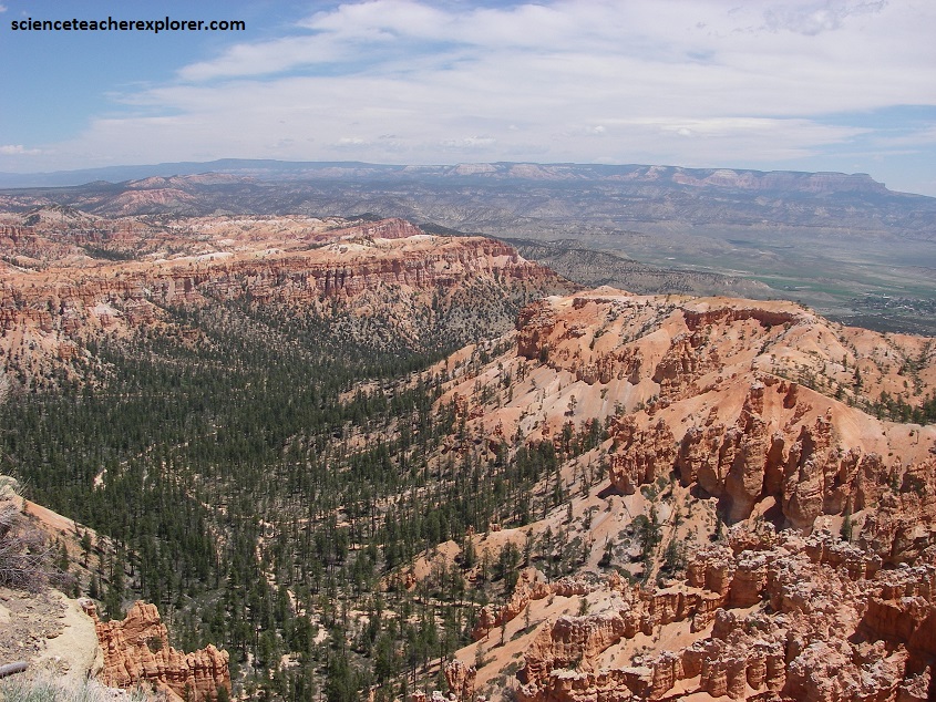
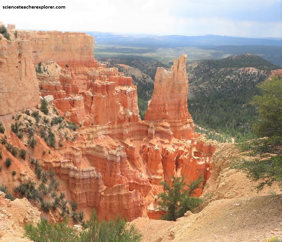
The scenery at Bryce Canyon, with its unusual spires and hoodoos of colorful rocks, make it one of the most beautiful places in the United States.
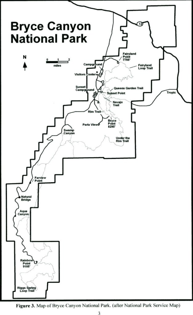
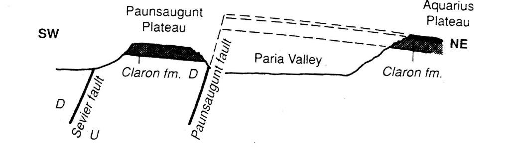
Bryce Canyon is located in the high plateaus section of the Colorado Plateau, on the eastern side of the Paunsaugunt Plateau, which is bounded to the west by the Sevier Fault and east by the Paunsaugunt Fault.
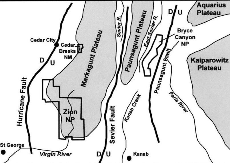
Headward erosion of the Paunsagunt Fault scarp by the Paria River and it’s tributaries in the Paria Valley has produced the spectacular scenery of the Bryce Canyon National Park.
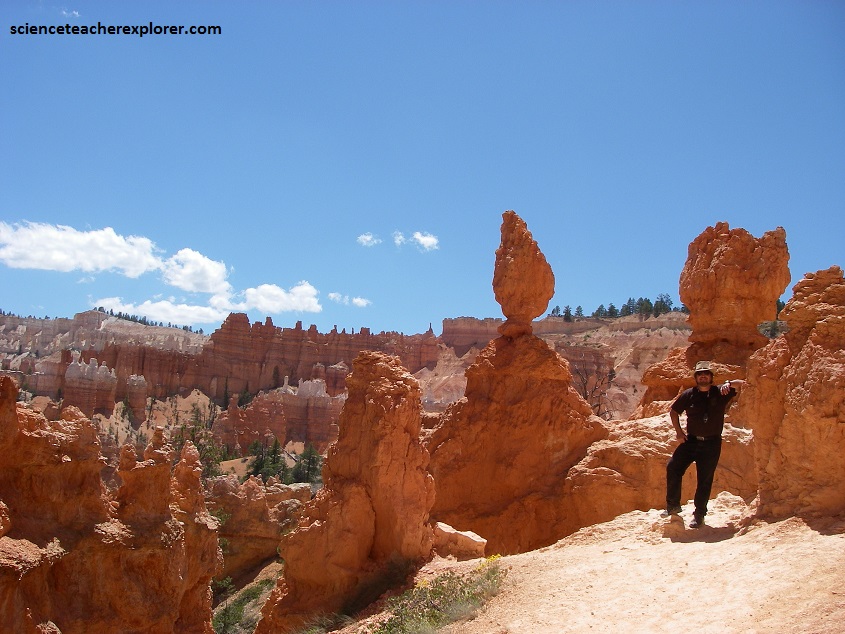
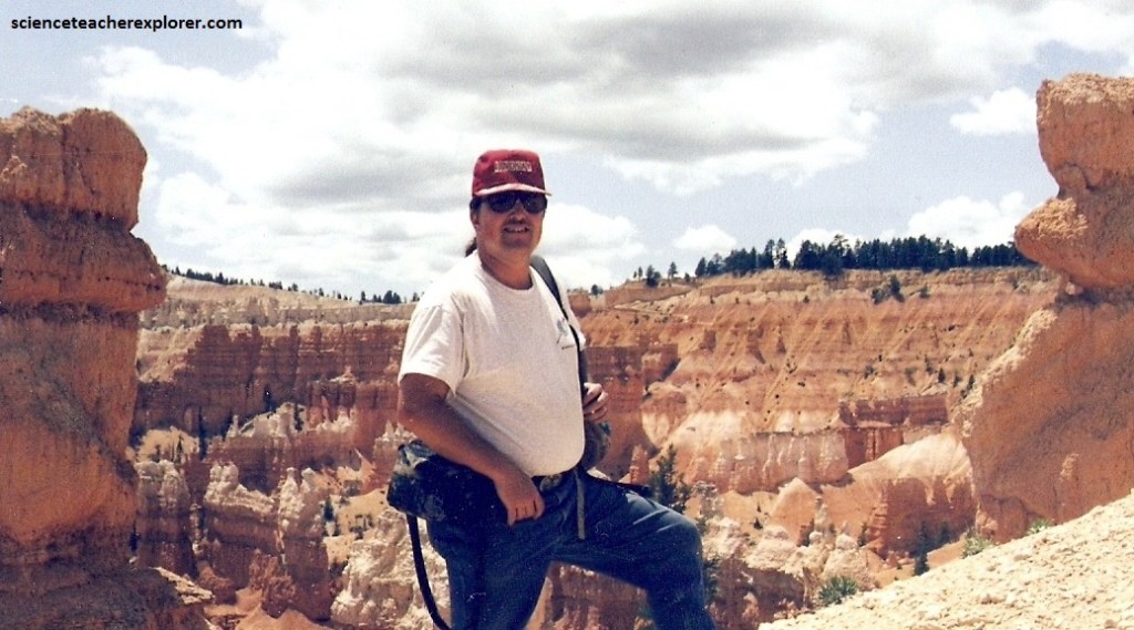
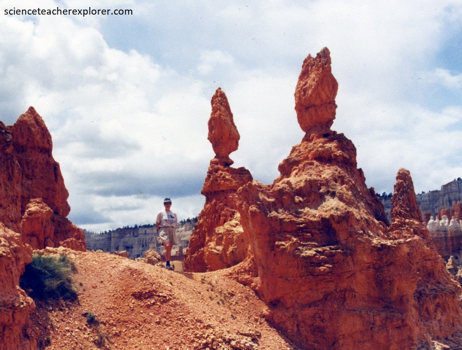
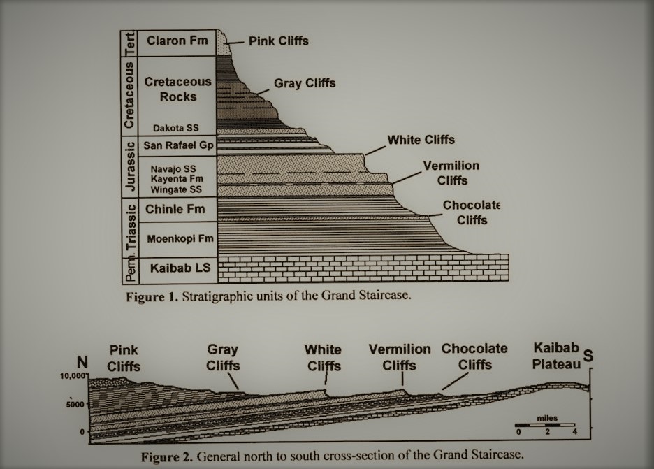
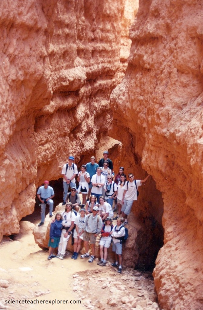
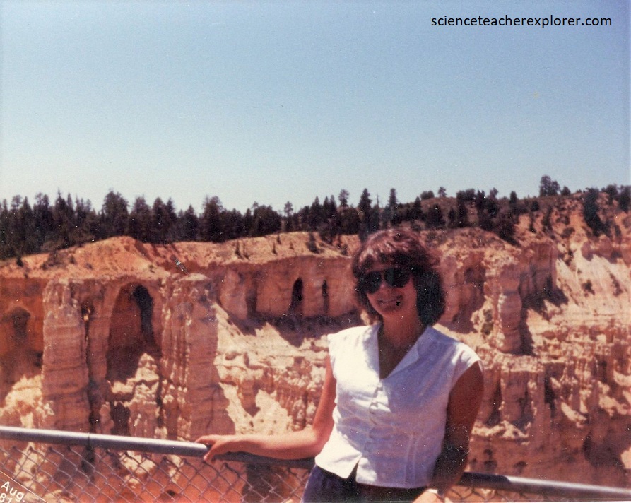
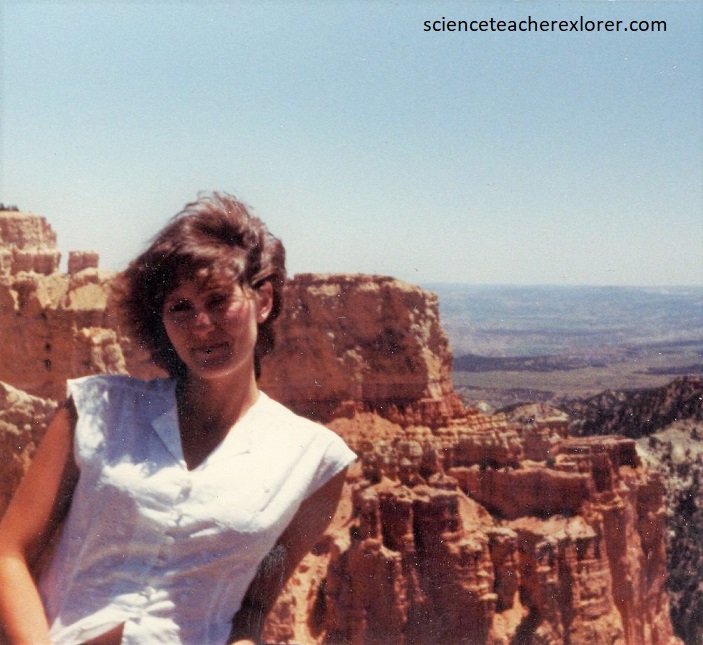
Pictured above, I’m standing within the hoodoos of the badlands in Bryce Canyon National Park. The badlands topography is carved into the Tertiary Claron Formation, which is assigned an age of Middle to Early Eocene. Pictured below, the Claron is divided into two members, the Upper White limestone and Lower Pink limestone.
Badlands is a name for highly gullied landscapes that occur throughout the west, where easily eroded rocks are highly dissected.
The badlands of Bryce Canyon National Park are unique with labyrinths of box canyons, sheer walls, mazes of fin-like ridges, fluted columns, and pedestals.
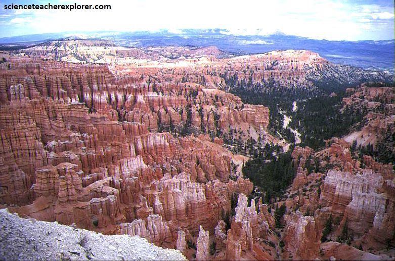
The landscapes of Bryce are distinctive because of a very special combination of factors such as rock type, geographic position and climate. Bryce Canyon is not a true canyon but a series of amphitheater shaped basins formed by headward erosion along the Paunsaugunt fault scarp.
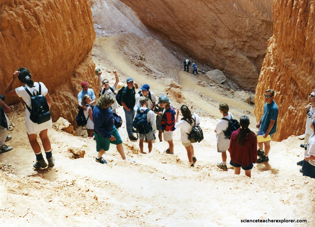
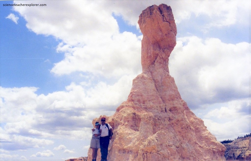
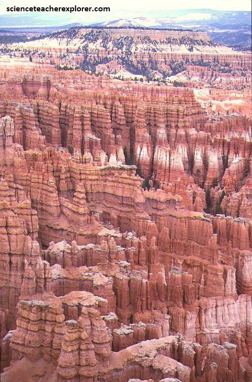
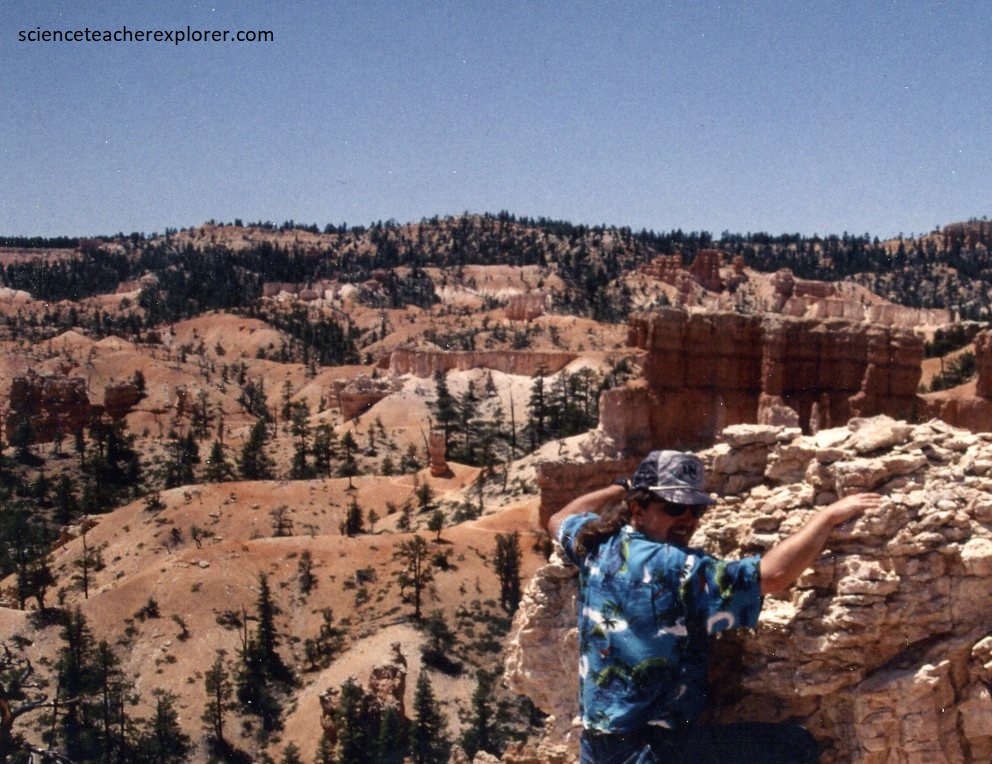
Pictured above, the rates of weathering and erosion at Bryce are 0.5 m every 100 years. Tributaries coming off the rim drop 170 m- 500 m in less than 0.5 km. This very steep gradient means large quantities of material can be carried away by streams during flash floods.
Bryce Canyon National Park experiences up to 275 freeze-thaw days per year, making frost wedging an important weathering process in this area. Frost wedging occurs when water within the rocks freeze and expands, breaking the rocks apart. Repeat melting and freezing of the water accentuates this process.
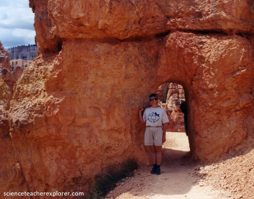
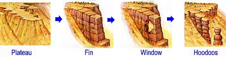
A grid-work of horizontal bedding planes, (deposited by an ancient lake), cut by vertical joints determines the pattern, shape and detail of the badlands. Water flow is focused along joints accentuating weathering and erosion of these planes of weakness. Eventually the joints are enlarged, forming deep slots, leaving behind vertical walls of rock. Pictured below, windows and arches can form within these walls of rock. Further dissection causes the roofs of arches to collapse, resulting in vertical pillars known as hoodoos.
The rocks at Bryce contain numerous joints and fractures. Joints differ from faults in that there is no movement or displacement of the rocks on either side of the fracture. The joints are near vertical and occur in parallel groups, or sets forming a complex system trending North. The joints formed either as a result of strain generated by large-scale crustal movement, or the release of pressure by erosion and removal of overlying sediments.
The Pink Limestone Member of the Claron Formation is composed of rocks with varying degrees of hardness and resistance to weathering. Alternating beds of carbonate-rich and carbonate-poor rocks gives the canyon walls their characteristic horizontal grooves and protrusions.
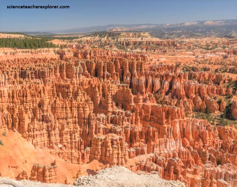
The massive layers consisting of freshwater, (lacustrine), white limestone and dolomite resist erosion, whereas, the bedded pink and orange clay and silt rich layers readily give way to erosion. The massive carbonate rich units often form pedestals of protective cap rocks that shield the softer underlying beds from erosion, (pictured above).