Guilin, China 2011
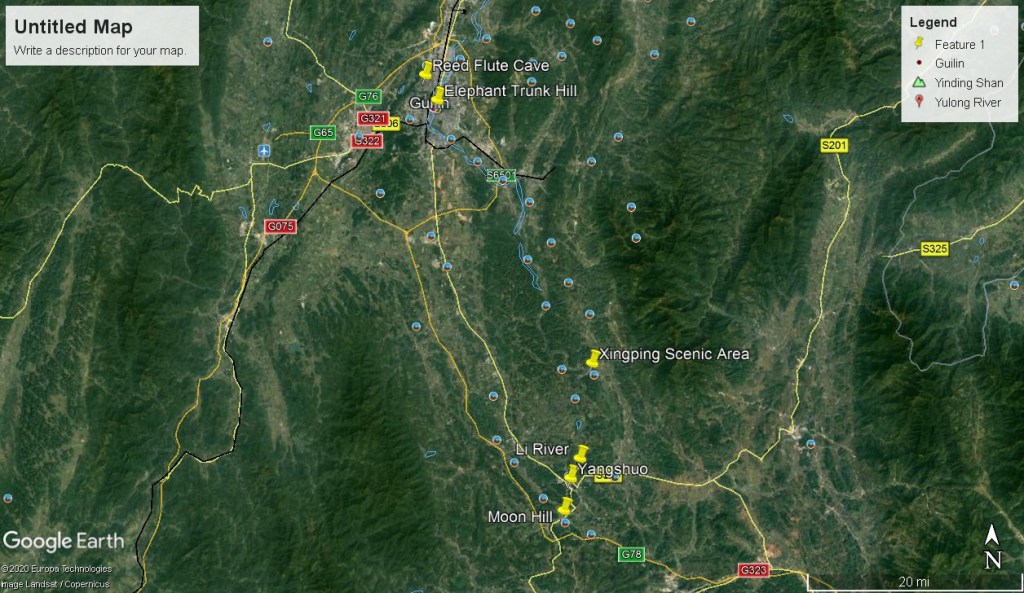
In July of 2011, my trekking group and I found our way, exploring the northeast of the Guangxi Zhuang Autonomous Region of Guilin, China. There, we stayed at a Hostel in the nearby small town of Yangshuo, China. Our plan was to explore the Lijiang (Li) River between Yangshuo and Guilin.
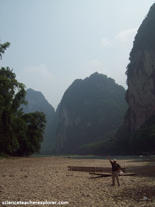
Pictured below, near the hostel that we stayed in, Moon Hill has an elevation of 380 m, while the hill is 230 m in relative height and 410 m in length. The arch is about 50 meters in height.

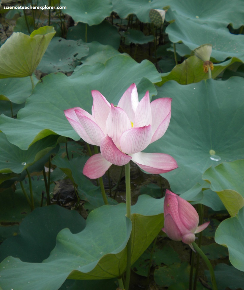
Pictured below is the Nelumbo nucifera, also known as Lotus Plant, is one of two extant species of aquatic plant in the family Nelumbonaceae. It is often colloquially called a water lily. Lotus plants are adapted to grow in the flood plains of slow-moving rivers such as the Li-River.
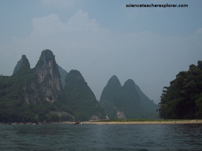
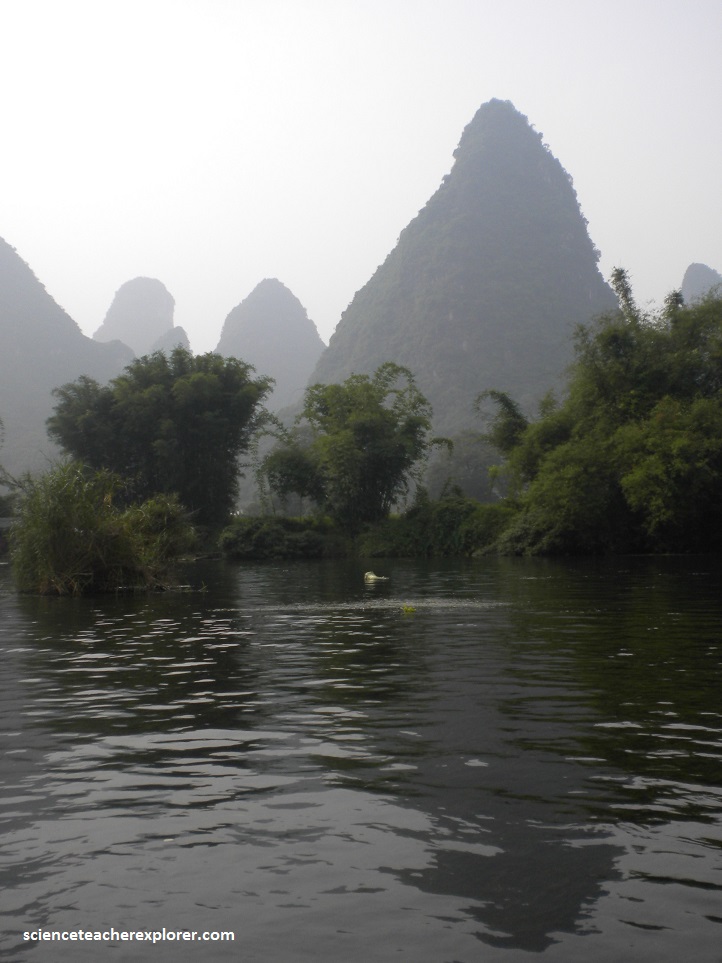
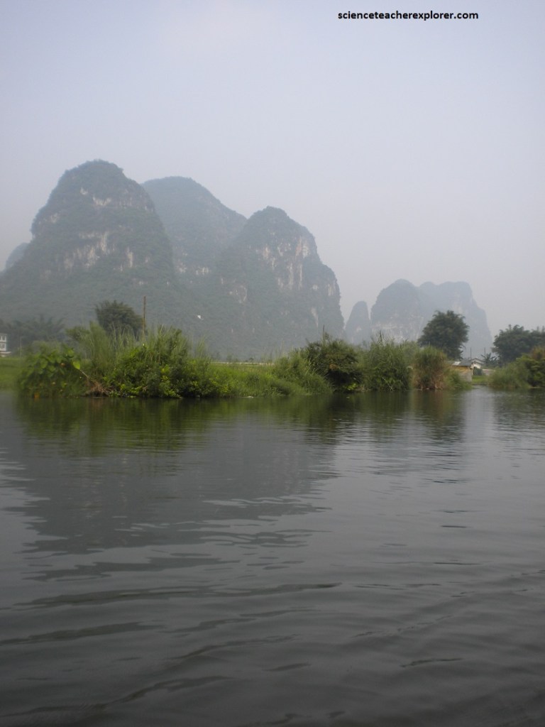
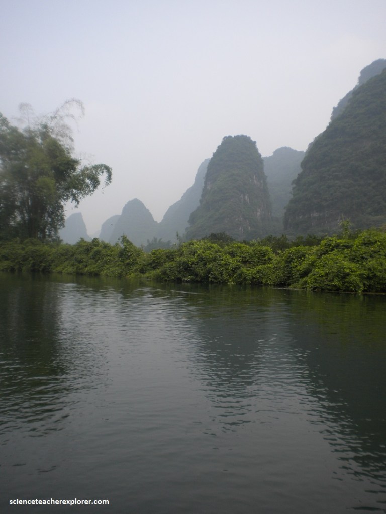
Rows of steep-sided limestone hills rise from an otherwise flat landscape of paddy fields alongside a 120 kilometer stretch of the Li River in southern China.
Pictured below, on the Li River you can see fishermen in traditional costume with a very special and time-honoured way of fishing; they use cormorants to catch fish. After sunset the fishermen on bamboo rafts suspend strong lights over the water to attract the fish. The cormorants, which are tethered with rings round the base of their necks, jump off the rafts and dive on the fishermen’s command. They catch the fish and then disgorge them for the fishermen. The catch provides food and income for an entire family, and good cormorants are highly valued.

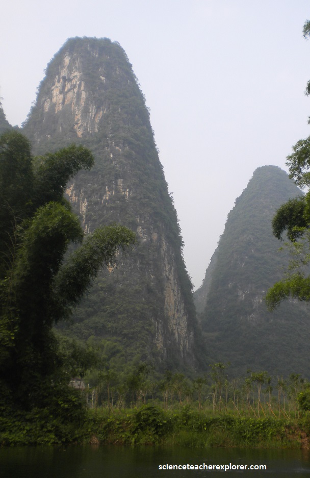
Guilin’s most renowned feature is it’s dramatic karst terrain. Rising sharply at odd angles, limestone peaks look like giant teeth growing out of the green plain.
Karst topography is characterized by many caverns and sinkholes that form by the dissolution of limestone or other carbonate rocks. The specific conditions for forming the magnificent topography of the Li-River are fourfold. 1. You need hard, compact carbonate rock, such as the Devonian limestone found around Guilin. 2. You need a strong uplift, in this case provided by the collision of India with Asia to form the Himalaya. 3. You need a Monsoon climate of high moisture during the warmest season. 4. The area must not have been scoured by glaciers, which this region wasn’t.

The Guilin and Yangshuo limestone was formed at the bottom of a warm, shallow sea about 300 million years ago, but earth movements pushed up the strata, and the wind, waves, and rain sculpted them into the shapes we saw there today.
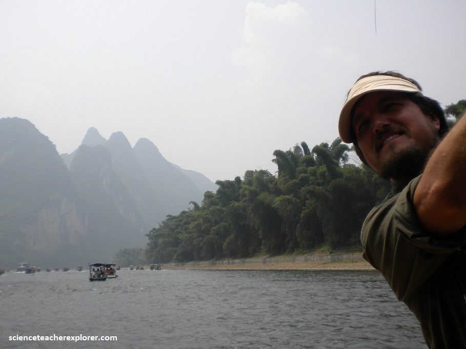
One of the highlights of my trekking group’s 2011 China trip, was a Bamboo Raft ride in the Yangdi-Xingping Scenic Area of the Li-River, (pictured below).
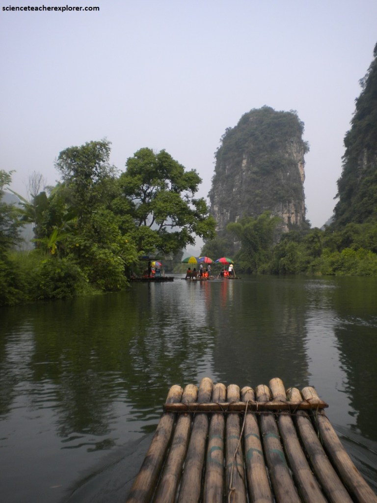
Pictured above and below, there are two types of karst landscapes that predominate on our bamboo-raft trip between Guilin and Yangshuo. Fenglin (peak forest or isolated towers) and fengcong (peak cluster or linked-base towers). The two types may have evolved sequentially from peak forest to peak cluster, or they may have evolved simultaneously.
Exposed now to the wind and the prolonged annual rain of a monsoon climate, the present land around Guilin begins to erode and to wash back out to sea along its rivers. Softer rock erodes evenly and steadily, and here the land remains flat. However, some of the rock is harder, weathering less easily, and patches of this rock begin to rise up over the plain, not to be flattened by the wind and the rain but to be sculpted by it, scoured by the weather into the peaks we see around us currently.
In those peaks we may see an echo of that ancient sea. The peaks are made of limestone. Limestone is formed in part from the shells and skeletons of marine animals. Devonian fossils are commonly found here.

What makes the peaks around Guilin so magnificent, is that they rise from flat ground, sudden and unprecedented, in stark contrast with the land around them. It’s an unusual landscape.
Pictured below, underneath Guilin’s conical hills is an extraordinary network of caves and tunnels that was cut into the limestone rock by underground rivers and streams. Some are enormous.
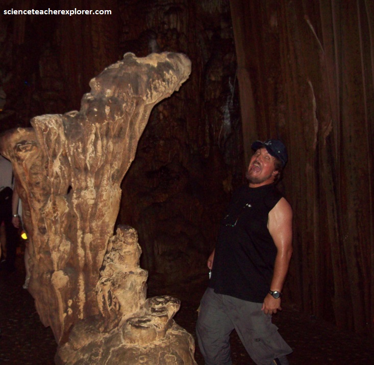
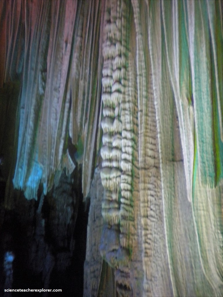
The cathedral-like Silver Cave and some of its neighbors have unusually large stalagmites and stalactites, some over 30 meters high. Even the caverns are vast.
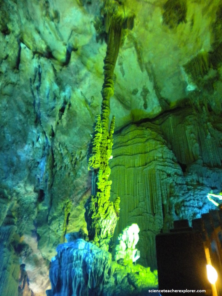
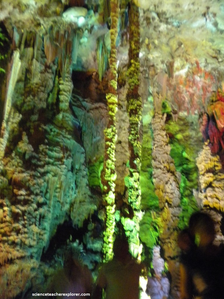
Pictured above and below, the Reed Flute Cave, which also is known as “the Palace of Natural Arts”, is 240m deep and 500m long and offers a majestic display of underground karst features such as stalactites, stalagmites, stone pillars, stone curtains and more. The Reed Flute cave gets its name from the reeds that once grew close to the entrance, which were cut and fashioned into flutes by the local people.
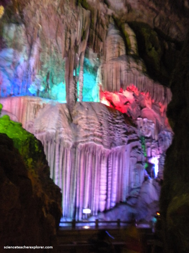
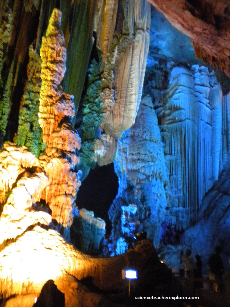
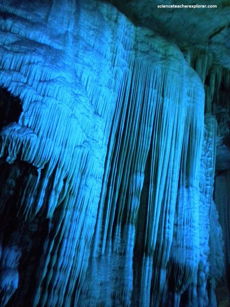
Additionally, we explored the Silver Cave nearby in Yangshuo (pictured above). Silver Cave is located in Maling Town of Lipu County, about 85 kilometers south to the city center of Guilin and 18 kilometers from Yanshuo. It is the largest karst cave in Guilin and fully shows the charm of the typical karst landform in south China. Some stalactites glitter like silver and diamonds under the colorful lights, giving the cave its name: Silver Cave. Because of the image attached to the name, there is a saying: “One will never be down and out as long as one reaches the Silver Cave”. The majestic, other-worldly features make the cave an outstanding example in the world of karst landscape.
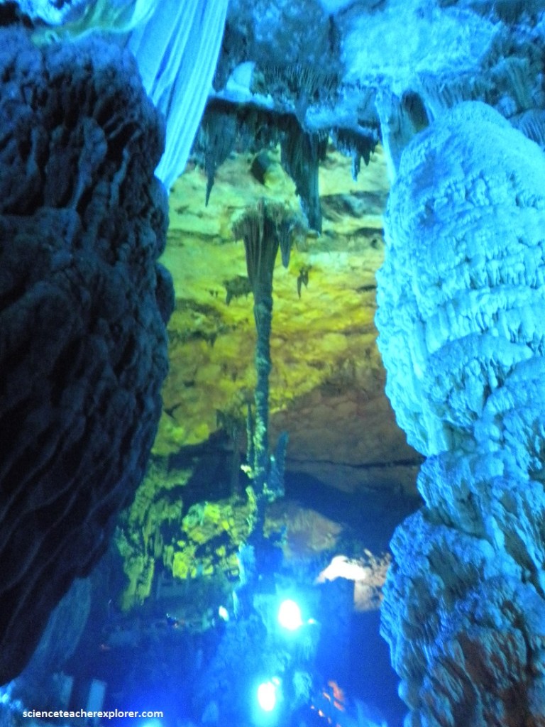
Along the narrow path, there are a variety of glamorous stalactites and stalagmites formed in different geological ages. For hundreds of thousands of years, water containing lime kept slowly dripping in the cave, creating this natural spectacle. The stalactites in vivid shapes resemble columns, towers, waterfalls, curtains, and even human figures. We marveled at the art of nature when standing in such a gorgeous crystal palace, (pictured below.)
During World War II, the local population hid in these caves for protection when the towns and villages were bombed by Japanese aircraft.
In the glittering colourful light, the formations take the form of birds, plants and animals in fantastic shapes and hues.
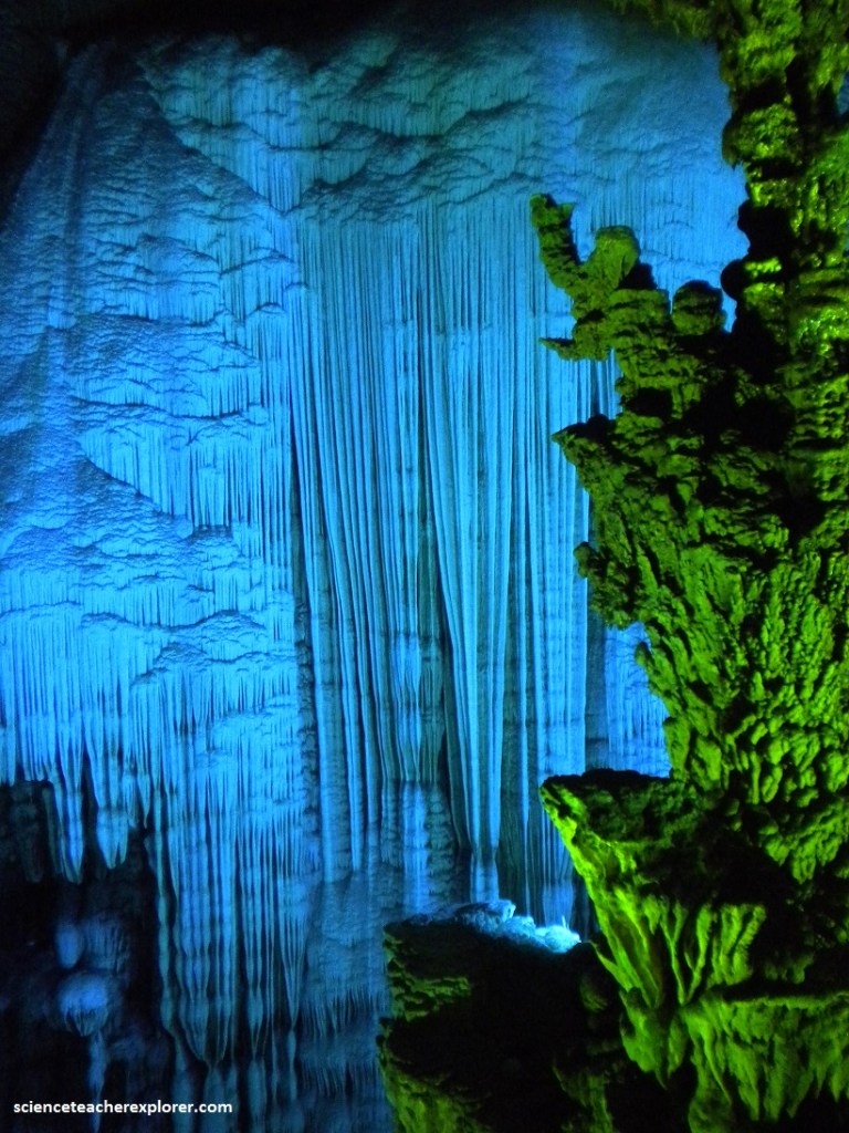
Pictured above, at the Flying Waterfall of Snow Mountain, we were bathed in the shimmering light of the cave. All the walls were snow white, and the stalactites cascaded majestically like a silver waterfall. We felt as if we were in a snow world, surrounded by waterfalls. Pictured below, in Jade Pool Fairyland, we wondered if the water was really colorful. In fact, the reflection in the lake constantly changed because of the subtle change of the light.
Winding 2,000 meters through twelve peaks, the Silver Cave is a multi-level cave ascending as high as 16 floors. It can be divided into three parts – the ground cave, the main hall, and the upper cave. The walk through the cave, took us 1/2 of a day without a guide. It was easy to get lost. Other caves were linked together with this cave.
As the limestone karsts above continued to rise and the softer substances were washed away, they became proper caves. The thick subtropical jungle helped feed carbonic acid into the subterranean caves. This carbonic acid (formed by plant matter interacting with water) breaks down rock via slow erosion over millions of years. Phosphates and calcium are separated from rock, broken down in the carbonic acid as it flows lower, and then deposited on new layers of rock. This can be seen as water drips from stalactites to stalagmites. Thus fantastical rock formations can be found in Guilin’s many caverns, particularly Silver Cave.
If there is a region in the world which has more interesting rock formations than Guilin, it could hardly have ones that are more imaginatively named. The best example of this is Elephant Trunk Hill, (pictured below).
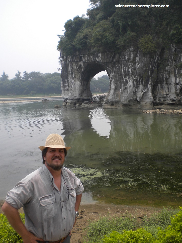
Pictured above, Elephant Trunk Hill, forms a huge arch on the city’s Li River, and in so doing resembles an enormous elephant drinking with its trunk. It is commonly regarded as the emblem of Guilin. Measured from the bottom of the riverbed, the hill is 200 m high, and from the surface, 55 m high. Jutting out from the riverbank, it is 108 m long and 100 m wide. The arch itself, (known as Moon-over-water cave because the full moon), reflected on the water, seems to float inside, (has more than 70 inscriptions from the Tang and Song Dynasties, etched on its inner walls).
