Kootenay N.P., B.C. 2022
Becky (my wife) and I drove to Canada to explore the Canadian Rocky Mountains in August of 2022. One of the parks we visited was Kootenay National Park.
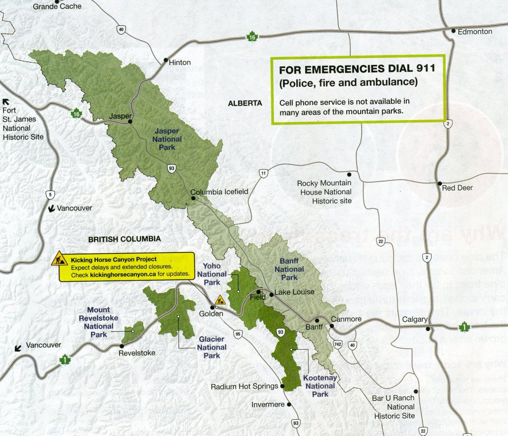
Kootenay National Park lies wholly within the Province of British Columbia. It consists of four different segments: the northern end comprises the drainage basin at the head of Vermilion River; the middle section is a belt at 90 degrees to the first, and it follows Vermilion River across the general trend of Vermilion Range and its extension in Mitchell Range to the southwest; the main southern part of the park is a strip along the Kootenay River valley; and a fourth part includes a jog to the westward, which takes in the valley of Sinclair Creek nearly to its junction with Columbia River, Kootenay Park with its irregular shape this straddles several different mountain ranges.
Kootenay National Park is an area of spectacular mountain scenery with rows of mountains alternating with open valleys Lengthwise it stretches for more than 97 km parallel to the northwest-southeast trend of the Rocky Mountains, and along its width it crosses the mountains and valleys in a series of jogs, from the divide leading to the Bow River valley on the northeast to Columbia river on the southwest.
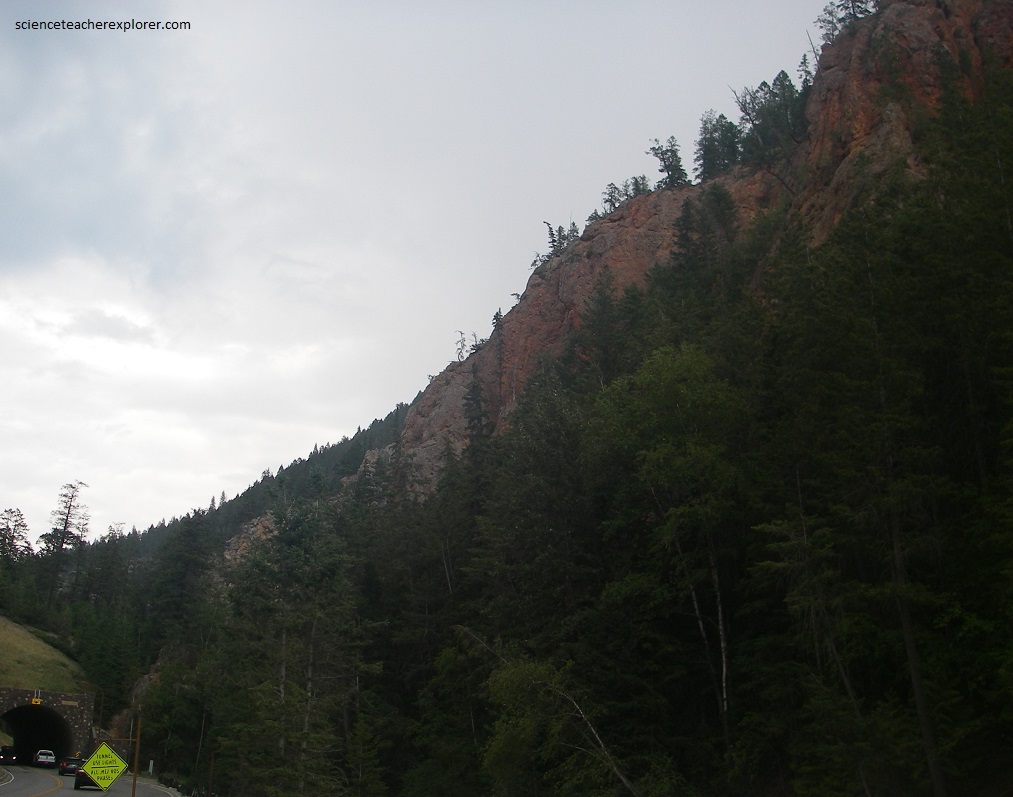
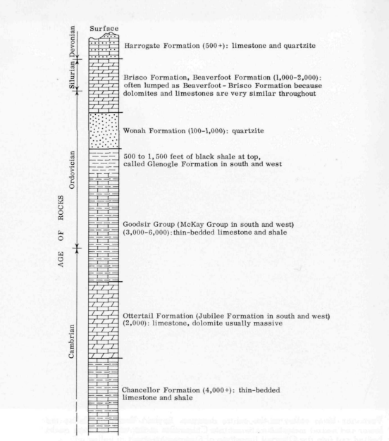
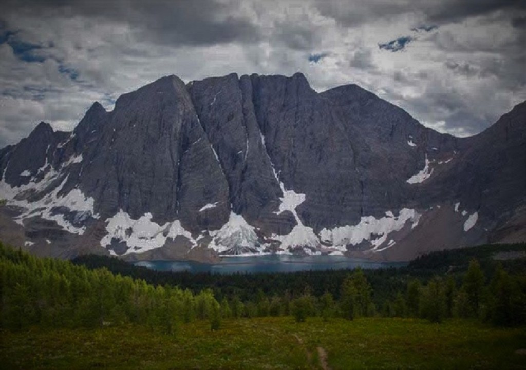
The mountain ranges along its northeastern boundary are cut into a great thickness of nearly flat-laying rocks so that peaks there look like layer cakes or ancient castles. All the rest of its mountains are cut into rock masses that have been folded and faulted severely to produce peaks of a wide variety of shapes and rock structure. The Hawk Ridge-Vermilion Peak mountains, Vermilion Range, and Mitchell Range within the Kootenay National Park, show rock sections and structures that allow their classification in the western sector of the “Main Ranges” found in the above image.
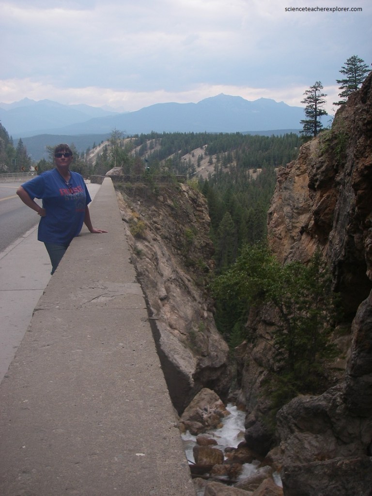
We decided to start our road-tour of Kootenay National Park at the Southwestern gate. To the west of this point lies the Rocky Mountain Trench, (a great gash in the surface of the earth that extends for more than a thousand kilometers northwestward from the United States border). The Rocky Mtn. Trench is occupied by sections of the Kootenay, the Columbia, the Fraser, and the Parsnip & Finley Rivers, and extends on up into the Yukon Territory. It appears that a system of faults underlies this Rocky Mountain Trench.
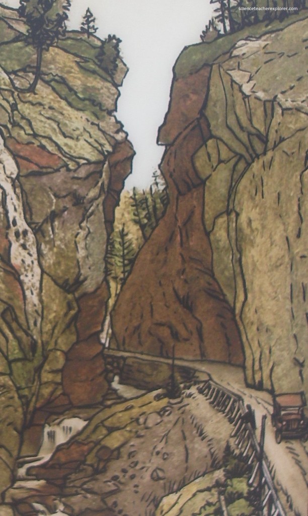
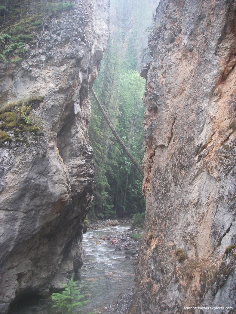
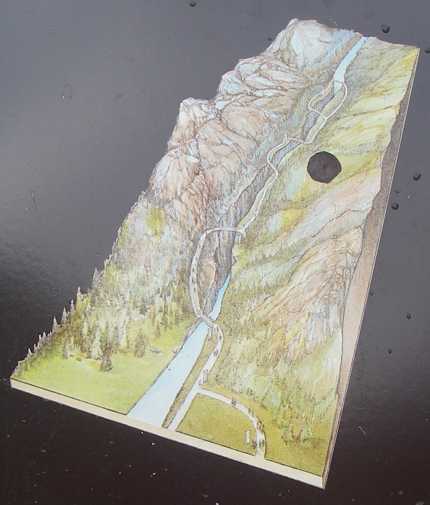
Our immediate first point-of-interest is Sinclair Canyon. Imaged above, work started on the road through Sinclair Canyon in 1911. Men widened the canyon cleft with pickaxes and dynamite. They threw a bridge over the creek and carved out a single lane for vehicles. Today, Sinclair Creek continues to deepen the canyon, now working below the modern highway.
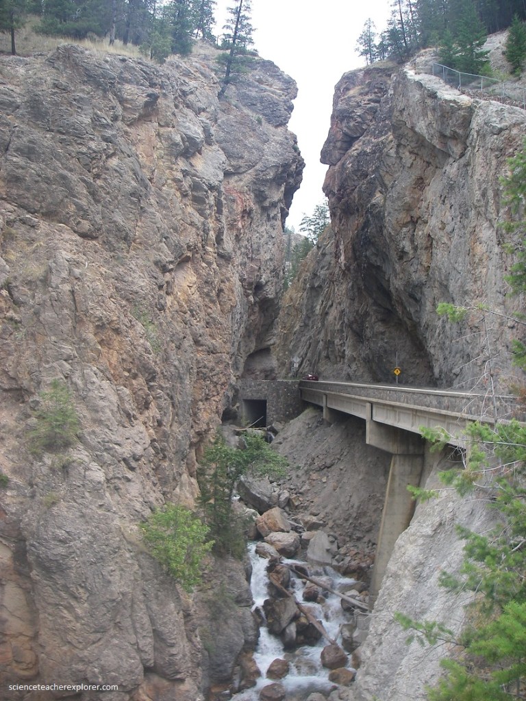
Sinclair Canyon is actually a deep narrow gash, cut into heavy limestone beds that trend across its course. Over long periods of time the small brook has gradually worn and dissolved its way through these limestone barriers.
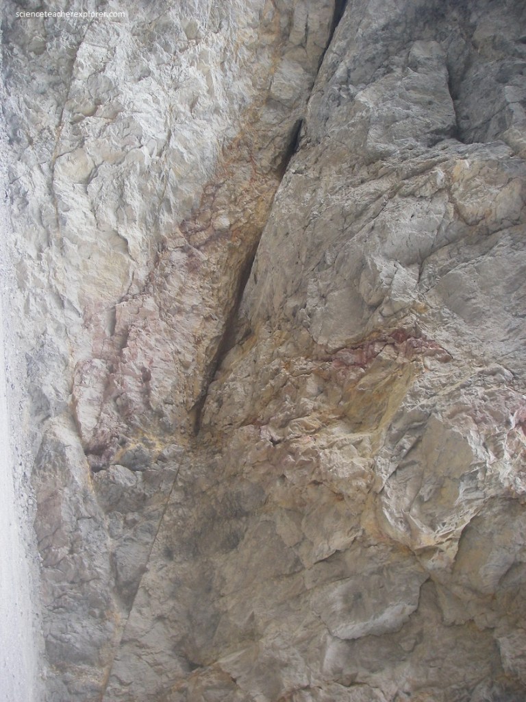
In the walls at the narrow part of the canyon, one can see several faults or breaks in the rock, and in some places quite different kinds of limestone are brought into juxtaposition by the movement along these faults. The rocks at the western end of the canyon belongs to the Beaverfoot/Brisco dolomite, of Ordovician and Silurian age. The rocks of these formations are stained pink by small quantities of iron oxide. On the upstream or eastern side of the separating faults the rocks belong to the McKay Group, or Lower Ordovician age. One of the faults which dips or slopes at 60 degrees to the west.
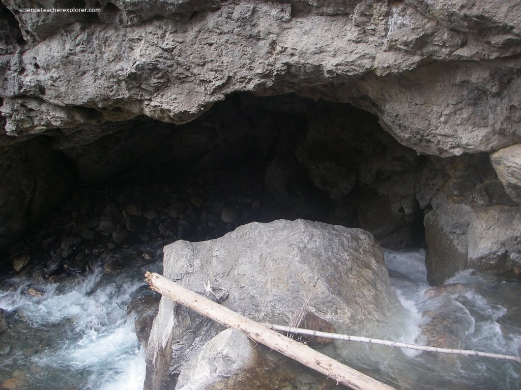
The gorge has been generally cut by the abrasive action of the stream and the sand and gravel which it carries in its headlong plunge to the valley flat below.
In some parts of the gorge, round ‘pothole’ shapes show where individual boulders and groups of boulders have been whirled round and round in the currents so that they drilled holes into the limestone.
Radium Hot Springs, with the houses, hotels, motels and stores, are in a slightly expanded part of the valley of Sinclair Creek.
Pictured above, banks of glacial till, [some of it roughly layered with a boulders accumulating from the cliffs above], make the flat bottom and some of the banks into which the road and house foundations are cut. To the east a strut of broken limestone, (stained bright orange with iron oxide), is visible as it comes down on one side of the valley, crosses and goes up the other. This is a “Breccia Zone” and was been made by the breakage of rocks along a fault system. By following the “Breccia Zone” along the mountains, a vertical relief of nearly 1200 meters can be seen on the surface.
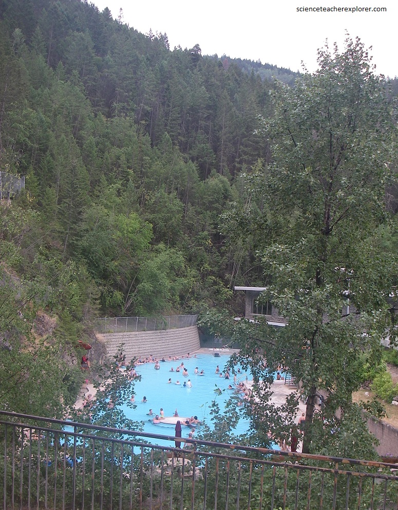
Pictured above, the hot-springs emanate from shatter zones with the Jubilee limestone on the south bank of the Sinclair Creek. The fault zones so clearly marked by the shattered and brightly stained zone is the controlling feature in the underground travels of the waters. In their underground journey the waters have become heated to a temperature of about 125 degrees Fahrenheit and have picked up numerous mineral compounds in solution. These are principally Calcium, HCO3 , and the Sulphates.
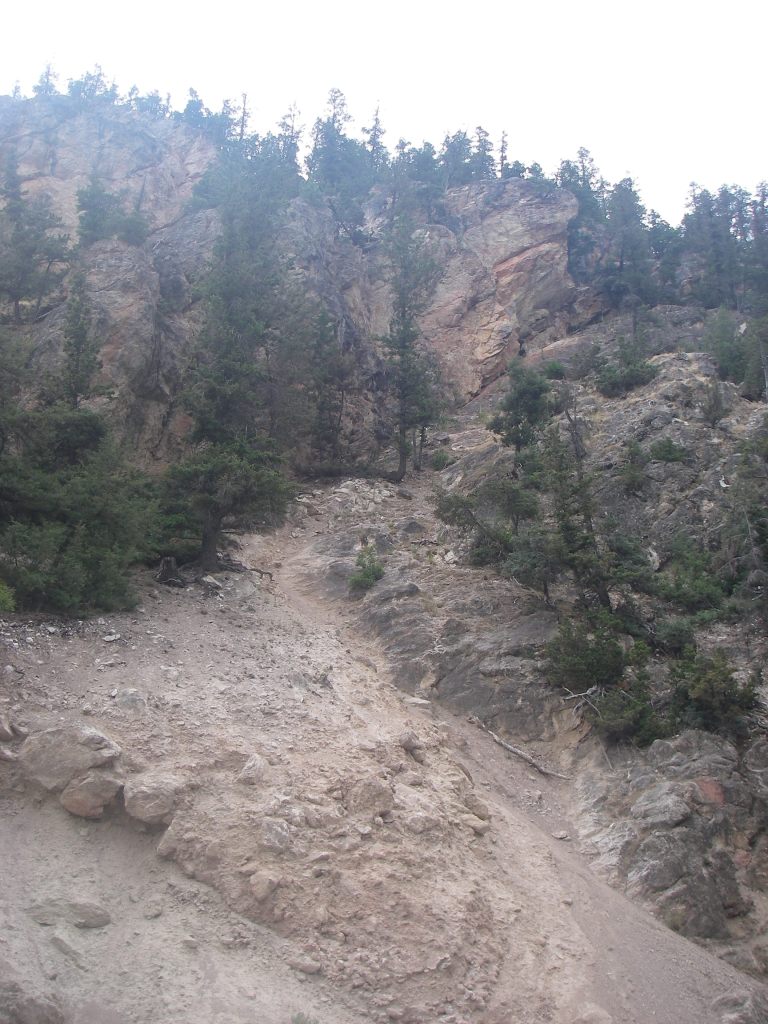
Pictured above, one kilometer up the road from the hot-springs is the infamous “Iron Gate”. The “Iron Gates” is a very narrow gorge cut through a strut of limestone which constricts the valley here.
Pictured above, Silt sand and pale yellow-brown bouldered rubble beneath the limestone cliffs have accumulated partly as a result of outwash from former glaciers in the valley, from stream deposits, and as talus from the crumbling cliffs above.
Pictured above, the “Redwall Breccia” is a bright orange-brown breccia made up of broken fragments of limestone of all sizes, from dust to great boulders 2-3 meters and stained by iron oxide. It marks the trace of a fault and is clearly visible everywhere it crops out because of the bright color.
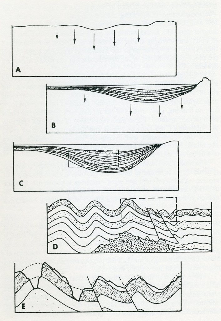
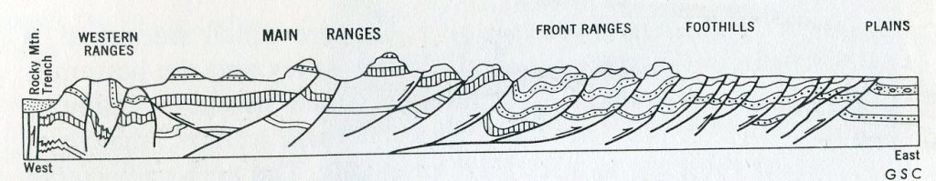
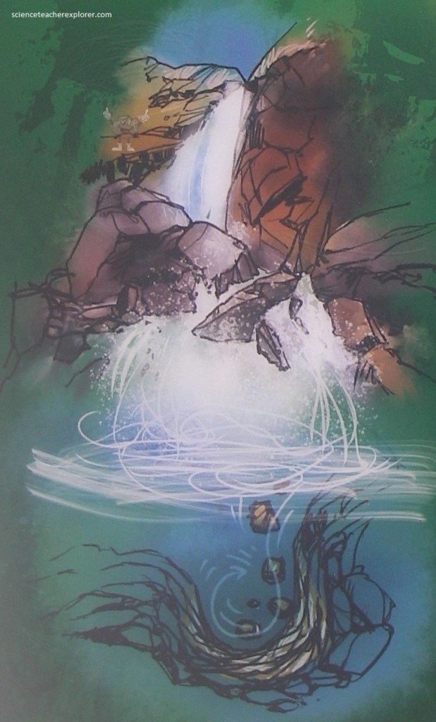
The spectacular peaks and valleys of the Canadian Rocky Mountains as we know them today are made of rocks which record a story that began more than 600 million years ago. At that time part of western North America began to warp downward to form an elongated trough as in “A” in the above image. Rivers poured sand, silt, and gravel into the lowland area. Down-warping continued until the trough was filled with a shallow sea, into which poured a steady flow of sedimentary materials, as in “B” in the above image. Down-sinking continues, but it seems to have been at a rate that corresponded closely to the rate of filling, so that sedimentation was always into shallow marine waters. The mass of sedimentary materials slowly changed to sedimentary rock as the load on top increased until it had a form like that in “C” of the above image. The main period of mountain-building was between 80-60 million years ago during the Laramide Orogeny. The trough area was then severely compressed so that the rocks in it were folded and broken. At about this time in the history of such mountains great masses of molten materials commonly appear in the cores of the folded and broken, eventually solidifying into granite. “D” is a depiction of this, in the image above. Uplift accompanied the folding and faulting, and as soon as the rocks emerged from the sea they were subjected to erosion. Rivers and glaciers carved the valley and formed the peaks as shown in “E” in the image above.
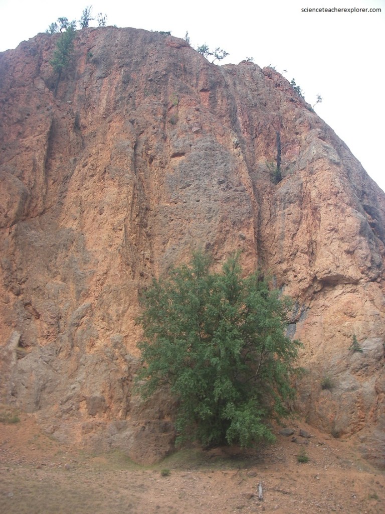
Pictured above, 7 km up the road from the “Iron Gate”, was a rainy view of Mount Sinclair, the northern-most major peak of the Stanford Range. The rocks in Mount Sinclair dip generally toward the west. The upper part of the mountain is made of Beaverfoot-Brisco rocks, of Ordovician and Silurian age. The white band close to the tree-line is the Wonah quartzite. Below that in the tree-covered slopes the dork Glenogle shale and McKay limestone make up the bulk of the mountain.
Pictured below, 8 km up Highway 93 from the “Iron Gate” is the Sinclair Pass and Lake Olive. To the west of this point the waters of Sinclair Creek drains westward. Lake Olive and waters east of here drain eastward via Swede Creek. Tis position, then, marks the divide between the drainage of Columbia River to the west and that of Kootenay River to the east. The highest point on Hwy. 93 lies a little to the east of Lake Olive (Sinclair Pass) at an elevation of 1630 m above sea-level.
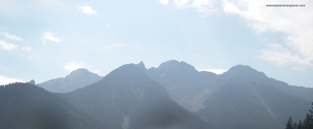
Pictured below, is a wonderful view, (at the bottom of the Kootenay River Valley), of the skyline of the Mitchell range to the east. The view due north shows the ragged skyline of Mitchel range which is cut into folded rocks of the Ottertail Formation (upper Cambrian) with some of the overlying Goodsir Group which straddles the Cambrian-Ordovician boundary. The sharp gully on the left is the valley of Pitts Creek. Kootenay river may be seen wandering along in the terraced valley bottom.
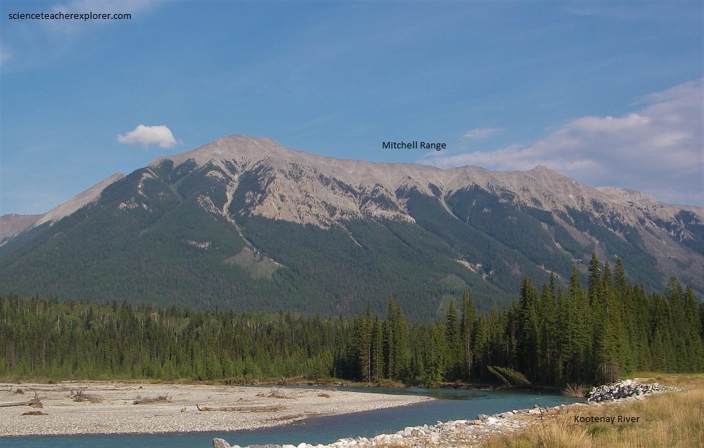
Pictured above, looking down the Kootenay River, is the valley of Cross River which cuts through the mountain mass of Mitchell Range. Mitchell Range gradually increases in elevation to the northwest as far as the break made by Pitts Creek. The rocks of this great block consist principally of the Ottertail limestone with some of the overlying Goodsir Group. The horizontal striping of the vegetation on the flanks of Mitchell Range opposite this photo-location is due to the parallel layering of the rock, with some layers providing better growing conditions than others.
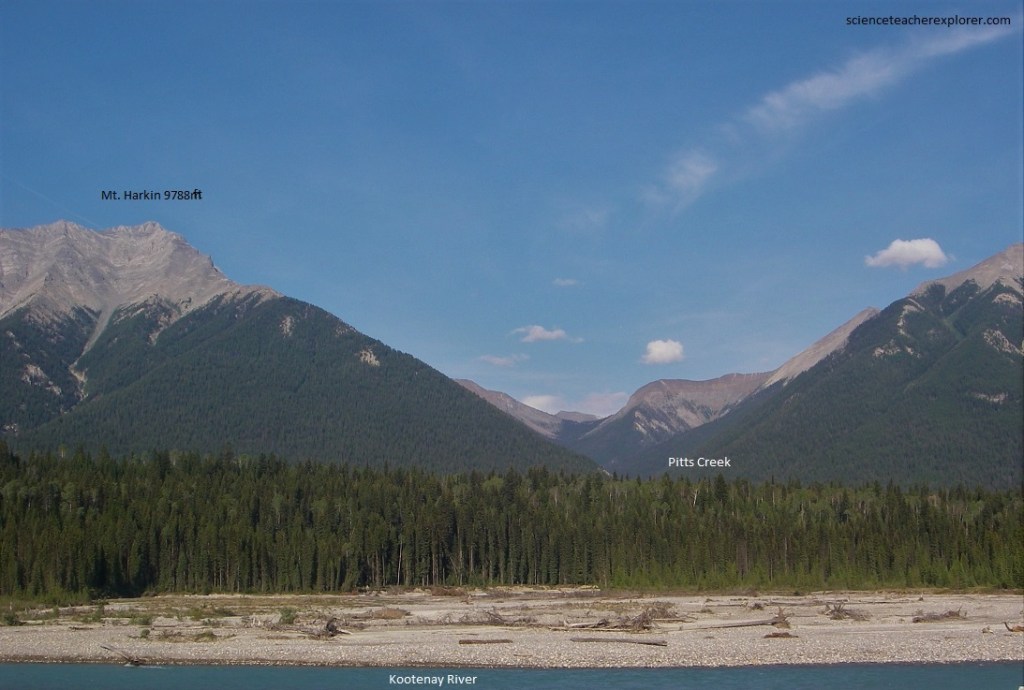
Pictured above and below, the Kootenay River wanders against banks of sand and gravel which are probably largely made of outwash from glaciers that once occupied the whole of this area. Beyond the break in the Mitchell Range, marking the course of Pitts Creek, Mount Harkin stands at some 9788 meters above sea-level.
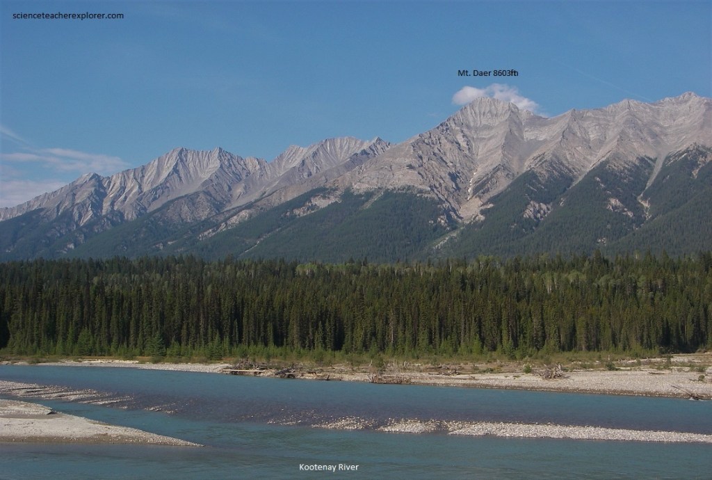
Pictured above and below, on the far side of the valley, from the bottom of the Kootenay River Valley, is a magnificent display of sharp angular peaks along the crest of Mitchell Range, beginning with Mount Harkin. Mount Daer, directly opposite, is in the Ottertail limestone. The minor peaks on its left show the pattern of rocks made when gullies cut across rock layers that dip more gently than the gullies themselves.
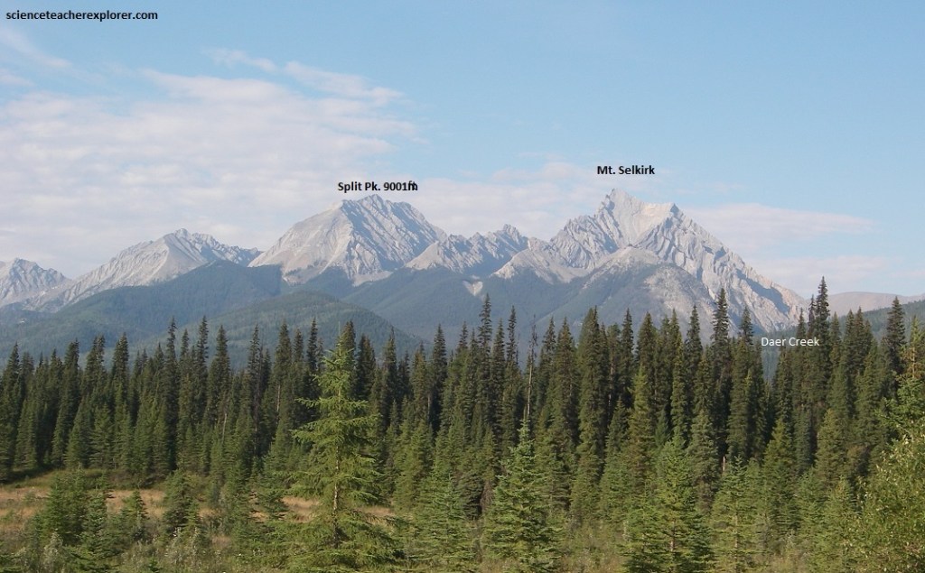
Mount Daer and the slightly lower subsidiary peaks to the northeast, (Mt. Selkirk and Split Pk.), shows the ruggedness that comes from differential erosion of multilayered rocks dipping steeply west and cut by a series of faults which dip generally to the east. The timber-line all along the western slope of the Mitchell Range is well marked, being higher on the spurs that are protected from snow and rockfalls and much lower in the gullies.
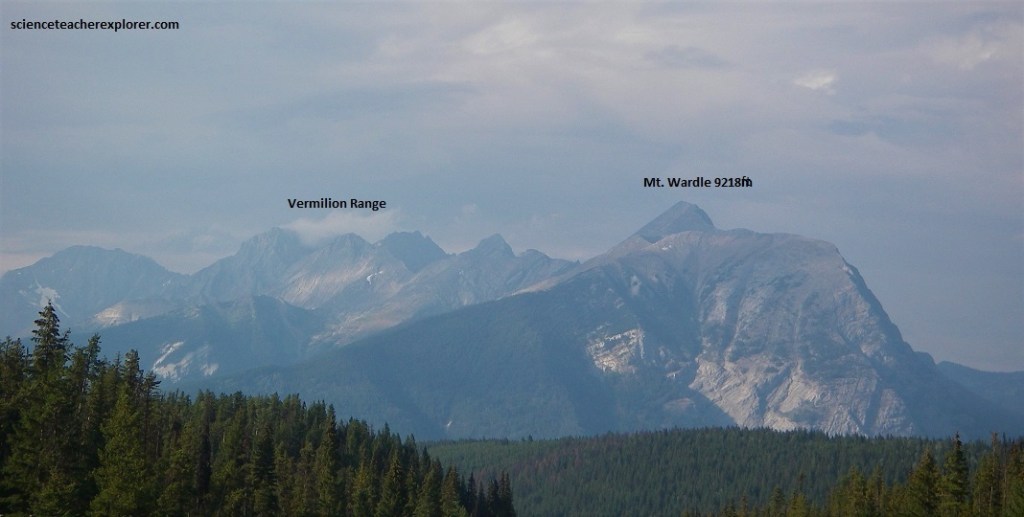
Pictured above, the bulk of Mount Wardle, the southernmost peak of the Vermilion Range, is cut into the limestone and shaly limestone of the Ottertail Formation and the Goodsir Group. The conspicuous gap to the right of Mt. Wardle is made by Vermilion River as it cuts across the trend of the mountains and separates the Vermilion Range to the northwest from Mitchell Range to the southeast.
Pictured above, the gap made by the Vermilion River separates the Vermilion Range to the northwest from Mitchell Range to the southeast. Below this point the Vermilion river makes a series of hairpin turns in banks of loose, unconsolidated, water-washed glacial debris. The rocks in the river below and in highway-cuts between this point and the Kootenay River are sheared and altered rocks of the Goodsir Group. They have been affected by movements along a great fault system, call the “White river Break”.
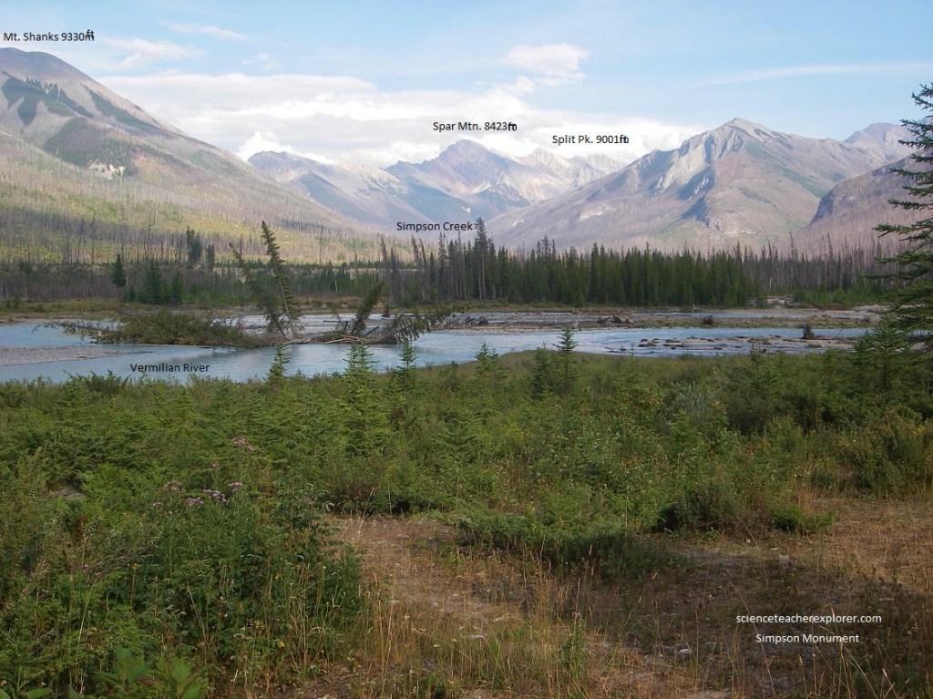
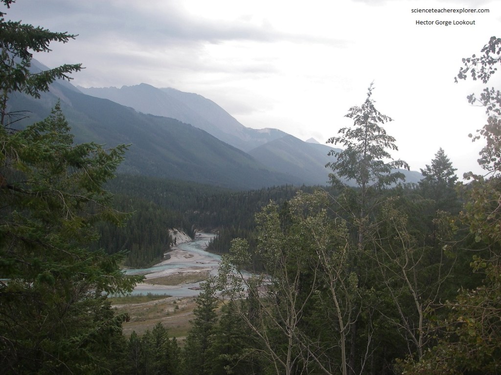
Pictured above, the nearby Simpson Monument is an interpretive site that signifies an old travel route through the mountains via Simpson Pass and Simpson River, joining the valley of the Vermilion-Kootenay system at this location. Pictured above is the southern end of Vermilion Range and we are facing the valley of Simpson River which makes a tremendous gash across the general northwest-southeast-trending mountain ridges in this area. To the east, the Ottertail limestone in Split Peak and its flanks to the north is clearly different from Spar Mountain which is largely cut into rocks of the Chancellor Formation.
Pictured above, northeastward from the Simpson Monument across the Vermilion River the mass of Hake Ridge extends off to the northeast. The rocks in Hawk Ridge, belonging to the Goodsir Group, have been tightly folded. The two long, parallel, nearly horizontal, light-colored ribs represent a single limestone bed of the Goodsir Group that has been tightly folded so that it appears in two different places. The two light bands visibly converge toward the northwest.
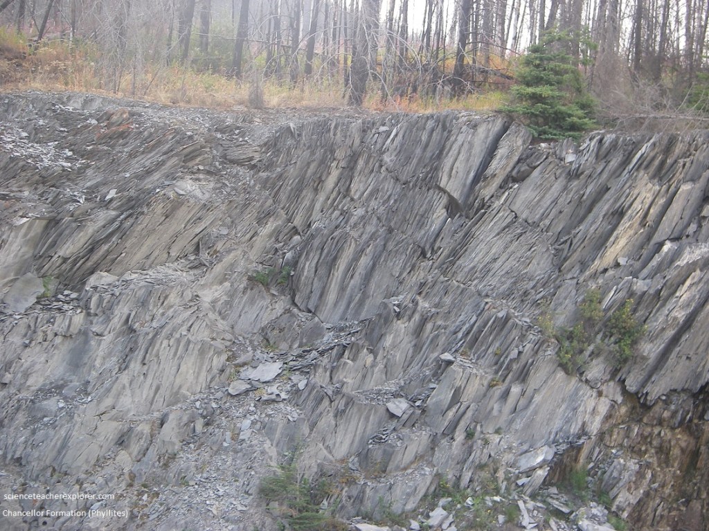
Pictured above, on the highway 93, near the Simpson Monument, is a dark grey slaty “phyllites” along the road belong to the Chancellor Formation. All along here the rocks show an excellent slaty cleavage and are commonly of silky appearance on the slaty surfaces.
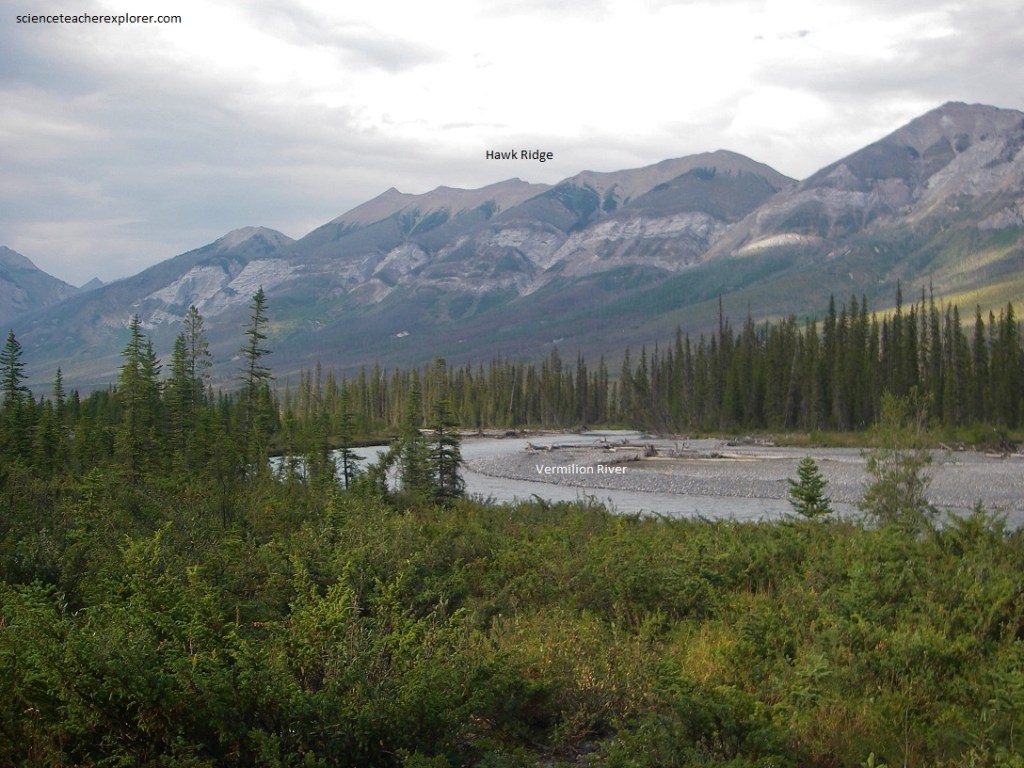
Pictured above, the Vermilion River crosses the Highway 93 in a narrow, rock-lined gorge, cut into rocks of the Chancellor Formation. The trace of the original bedding can be seen in outcrops to be very nearly horizontal, but the slaty cleavage dips generally about 45 degrees to the west in this area. Darker rocks of the Chancellor Formation outcrop in the near ridges to the west. Above and beyond, the Goodsir Group forms all of the visible part of Hawk Ridge. Beyond the crest, however, the rock formations change abruptly into nearly horizontal Cambrian rock formations of the group that form the spectacular scenery between Marble Canyon and the northeast gate of Kootenay National Park.
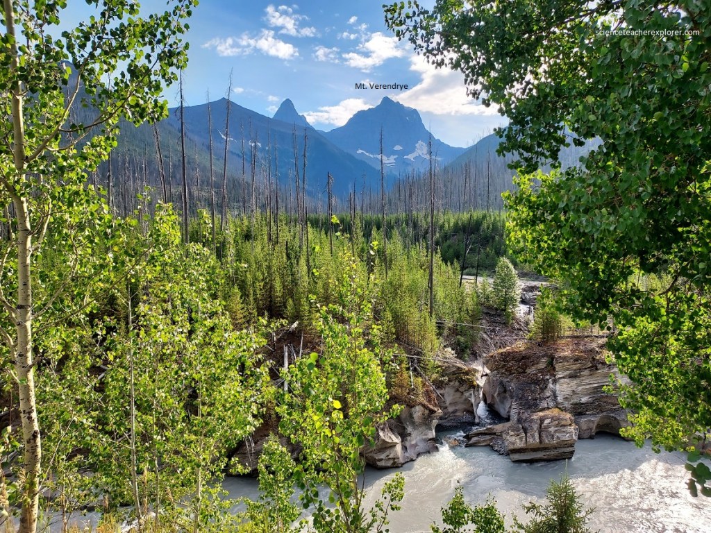
Pictured above, the great “Rockwall” of the Ottertail limestone with Mount Verendrye to the left looms above the lower slopes the lower slopes across Vermilion river from the main highway, just north of Vermilion Crossing. The main peak in the photo is Mount Verendrye, which reaches an elevation of 3,400 m above sea-level. Small glaciers and snowfields are visible on its lower flanks.
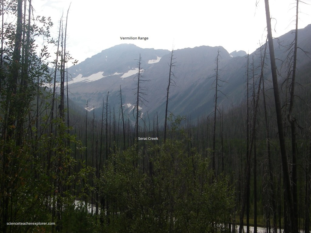
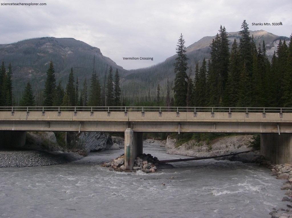
Pictured above, along highway 93 of the Vermilion River Valley, we get glimpses of the great cliffs of the “Rockwall”, which marks the eastern slope of the top of Vermilion Range. At many places it is visible in the gaps in the lower hills formed by the valleys of tributary creeks, (like the Serac Creek), to the Vermilion River.
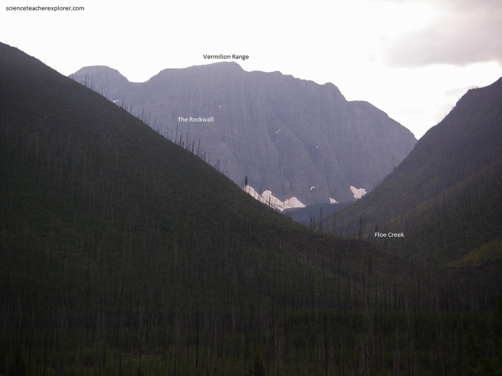
Pictured above and below, a walk of about 8 km along Floe Creek will take you to Floe Lake which lies in a magnificent setting below massive cliffs of Ottertail limestone in the Rockwall, the spine of Vermilion Range. The Rockwall is a series of great cliffs, as much as 670 m high, that occur all along the eastern spine of the Vermilion Range. The bedding in the Ottertail limestone in the Rockwall dips gently in and out around the spurs.
Pictured above, with its glacial-green color and masses of glacial ice and snow at the foot of the enormous cliffs, Floe Lake is one of the beauty spots of Kootenay National Park.
Pictured above, Numa Falls is a gorgeous waterfall in the midst of the Kootenay National Park. The waterfall itself is a cascade that flows as a part of the Vermilion River. Between Numa Creek and Floe Creek the flanks of the nearby hills provide unusual displays of snow-slide meadows. The waterfall seems to cut into the brownish Chancellor limestone rocks.
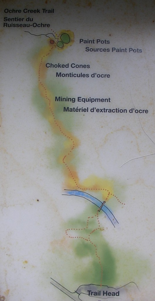
Pictured above, at the trailhead for the Paint Pots, the gravels on the bank of the Vermilion River are heavily rust-stained. This is due to large quantities of iron oxide which issue from a series of springs a few hundred meters inside the woods on the north side of the river. These springs may be reached by the trail from across the footbridge on the Ocre Creek Trail. A short trip into the woods took us into a very large bright yellow-brown ochre bog.
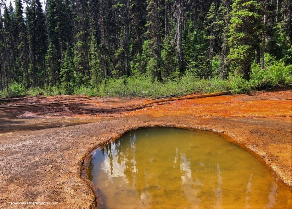
Pictured above, the large springs which issue from the earth and precipitates iron oxide in the form of various hydrous compounds such as limonite. The water of the springs evidently rises under pressure, for it builds up pools rimmed with the iron oxide and spills out through small gaps to form the unusual limonite-laden streams below.
Pictured above, a walking trail leads northwestward from the Marble Canyon Parking lot, through Marble Canyon along Tokumm Creek into some very beautiful mountain country.
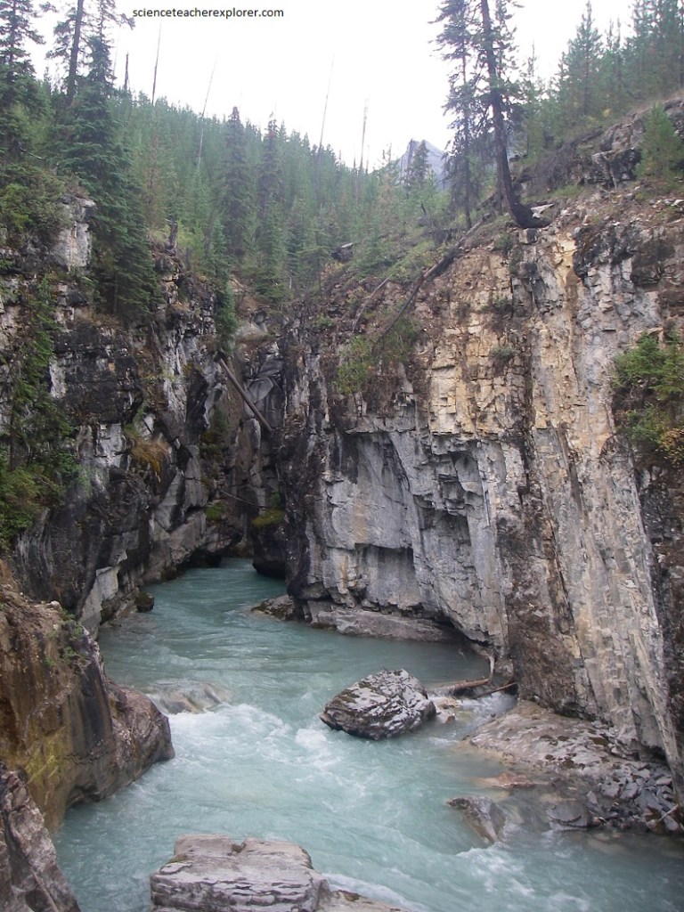
Pictured above, near the parking lot the rocks are white marbles which have come from the recrystallization of limestone. In many places along Tokumm Creek, coming in from the northwest, and along the main thread of Vermilion river, coming in from the northeast, the marble has been eroded into unusual patterns. In some places single boulders or groups of boulders have been whirled round and round in currents to wear very round potholes in the solid rock.
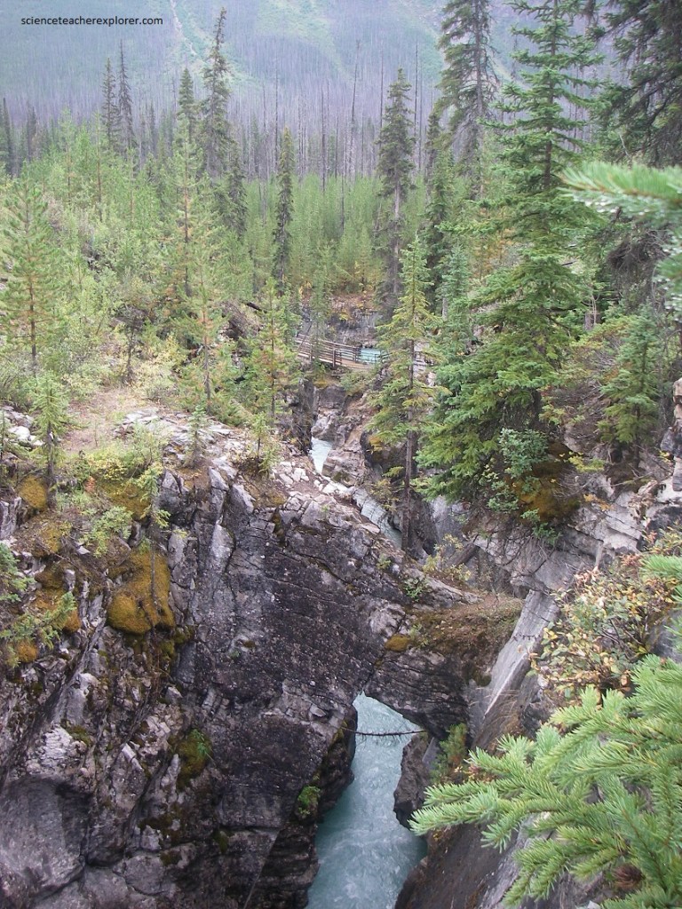
Pictured above, a lovely walk up the valley of Tokumm Creek along Marble Canyon to the upper waterfalls takes in many features of geological interest. At the head of Marble Canyon, Tokumm Creek tumbles over a lip of very white marble which may be one of the Cambrian limestone formations that has been recrystallized and altered because of its nearness to a large fault. The rushing waters of Tokumm Creek have carved a steep-walled gorge in marbleized limestone of Cambrian age.
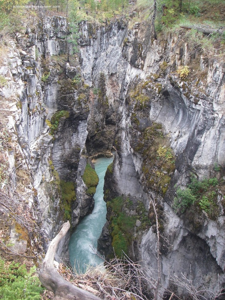
Pictured above, a 3-5 meter drop into a large pothole with violent water currents clearly visible in it is followed by a much higher waterfall into the main part of the canyon itself. The water seems to bypass the main stream to plunge into a deep hole, forming a more or less natural arch. There are several similar arches and partial arches lower in the canyon. It is probable that these begin by water leaking down cracks and joints in the rock, gradually dissolving and wearing away alternate channels.
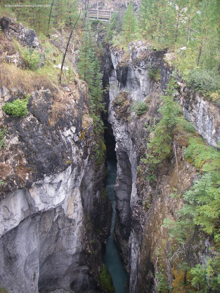
Pictured above, rounded potholes and parts of potholes are visible. The strong influence of joints and splits along the canyon is visible in several places.
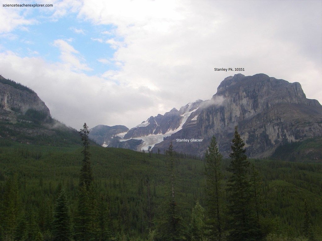
Pictured above, are the regular slopes of Stanley Peak with the complicated structures within its mass and the numerous scree slopes on its flanks. The upper cliffs of the mountains are cut in Eldon dolomite and the massive lower grey band is the Cathedral limestone. In between is the Cambrian Stanley formation, of which the famous Burgess Shale Type faunas (BST) are found. The Stanley Glacier BST fossils (approximately 505 million years in age), yielded noteworthy additions to understanding the BST fossils and their depositional environments.
In the Stanley Glacier area, the Stephen Formation is relatively “thin” (about 33 meters thick) and is probably the result of deposition at the distal edge of a marine platform. In 1989, an expedition party from the Royal Ontario Museum (ROM) located fossils from Stephen Formation talus under the glacier’s cliffs. Stanley Glacier BST shelly fauna includes characteristic Cambrian taxa such as hyolithids, brachiopods, and trilobites. Soft-bodied BST creatures such as the necktobenthic or nektonic arthropods and proto-arthropods also are part of the BST fauna.
Quartzites of the St. Piran Formation lie below the Eldon and Cathedral Formations and are exposed in the main road at and just east of the entrance to Kootenay National Park. Road-cuts in this vicinity expose stratified sands and gravelly glacial till with little evidence of layering. Glaciers on Stanley Peak and surrounding peaks of the Ball Mountain Group are visible up the valley to the southeast and pictured above.
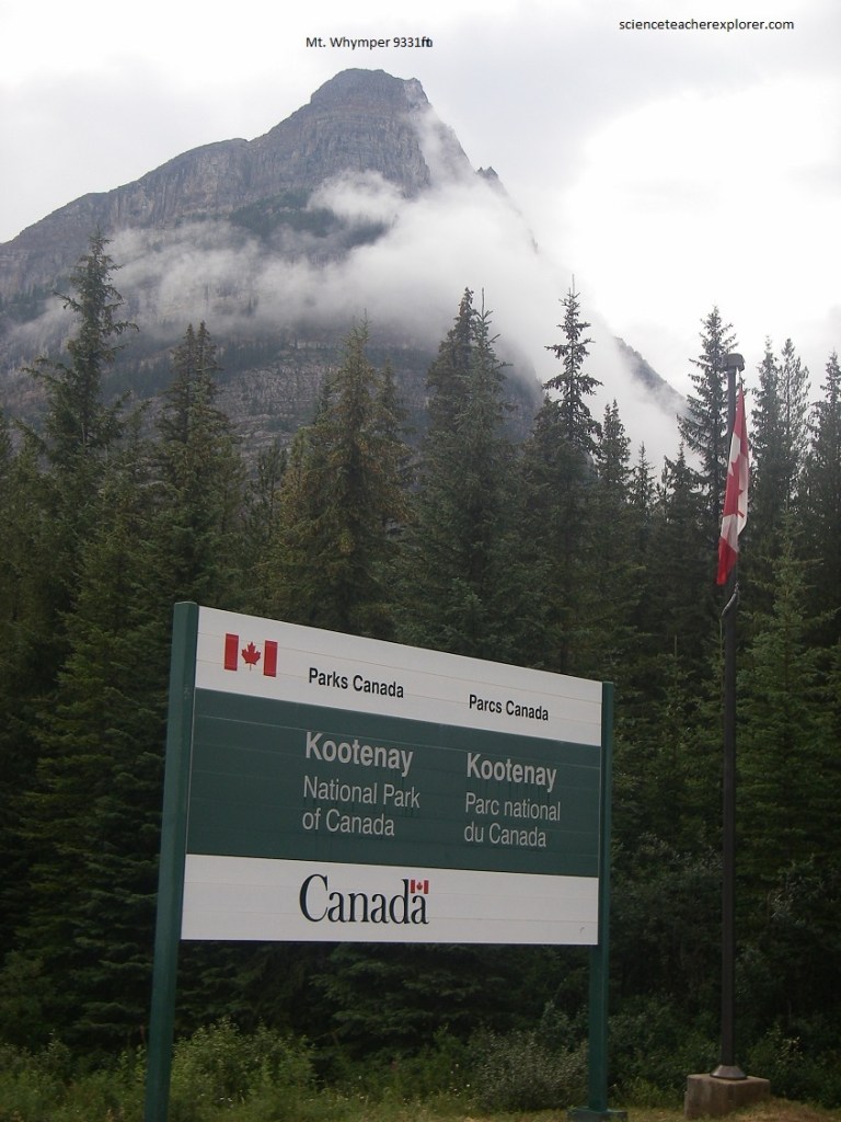
Pictured above, the boundary between Kootenay National Park and Banff National Park to the northeast is the continental divide. After stopping at the sign, we were able to look up the hillsides on both sides of the road and see the boundary as cleared lines through the woods going up the flanks of Boom Mountain northwestward and a subsidiary peak of Storm Mountain to the southeastward. The outcrops along the road in this area are of grey quartzites of the St. Piran Formation.
