Tainchi Lake, CN 2008
During August of 2008, I found myself trekking in Northern China, within the Tianshan Mountain Range. My trekking group and I flew into Urumqi, China to explore the northern tip of China when we had decided to explore the nearby Tainchi Lake for a couple of days.
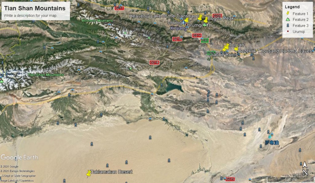
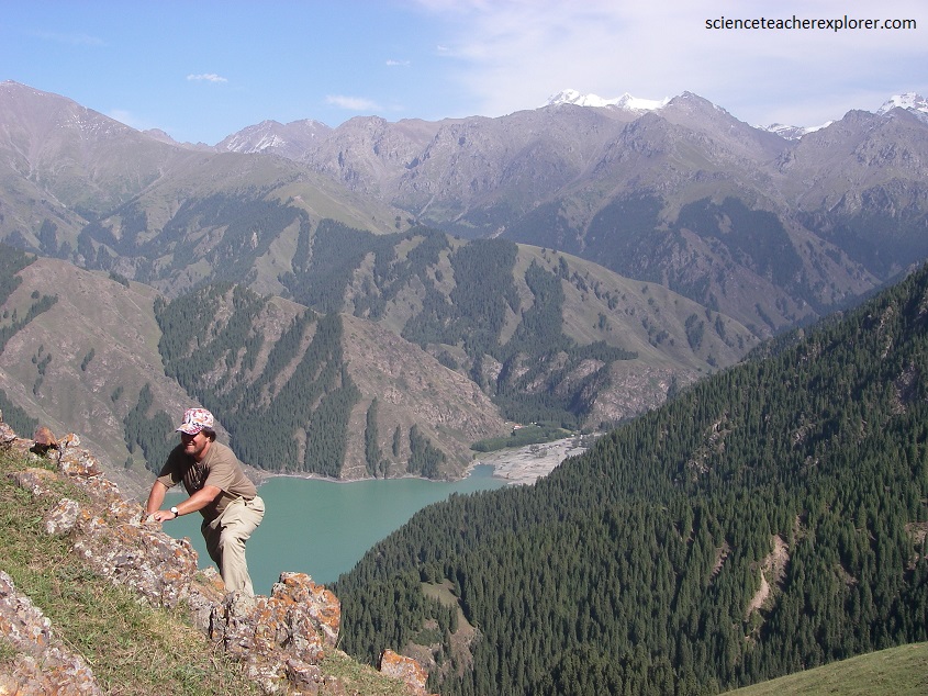
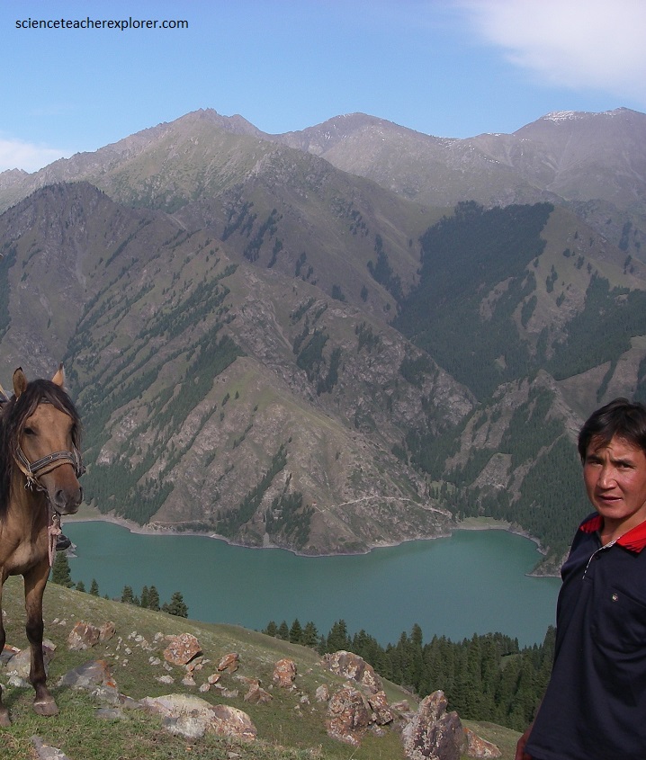
Tianshan’s Tianchi Lake, (Heavenly Lake), is located at the hill side of Bogda Peak in the Xinjiang Autonomous Region, about 97km east of Urumqi. The Tianchi Lake, (Heavenly Lake), on the Tianshan Mountains is a state-level scenic spot with a natural mountain landscape typical of the northwestern par of China. Distributed with vertical natural landscapes from evident snow lines to desert, it has a very fragile natural ecologic environment.
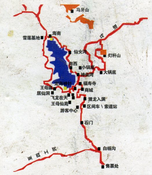
With an altitude of 1980m, Tianchi a natural crescent alpine lake that is 3.5 km from east to west, and 1.5km from north to south, with maximum depth of 105m.
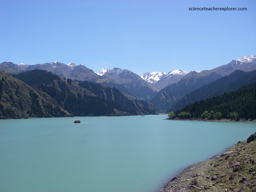
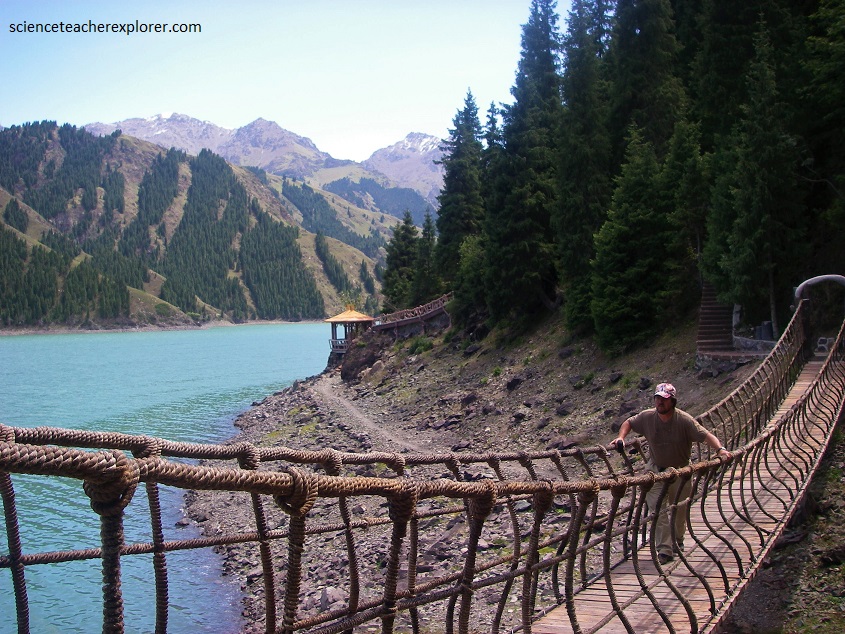
Pictured above, the greenish-blue water of Tainchi Lake is as radiant as the local China jade or just like a pearl surrounded by the thick growing firs and spruces.
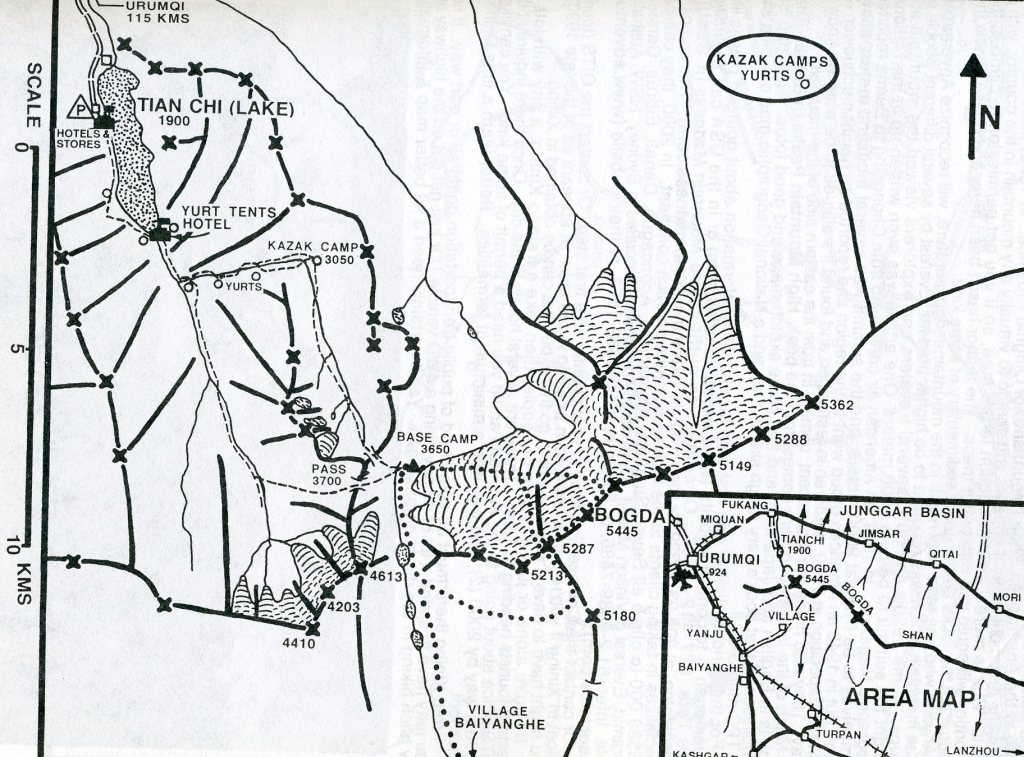
Tianchi or Heavenly Lake lies on the north side of the Bogda Shan (“Mountain of God”, Bogda is a Mongolian word meaning “God”) range of the Tian Shan Mountains, (Mountain of Heaven). My trekking group had decided to stay with a local minority group called the Kazakhs, (pictured below). I should not that the Kazakh people believe in Islam.
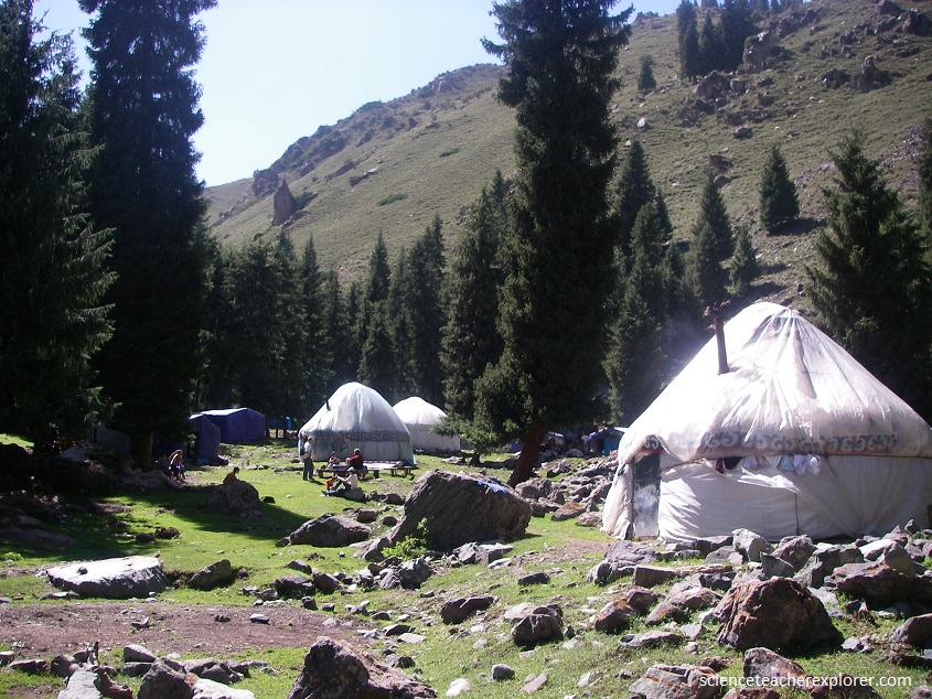
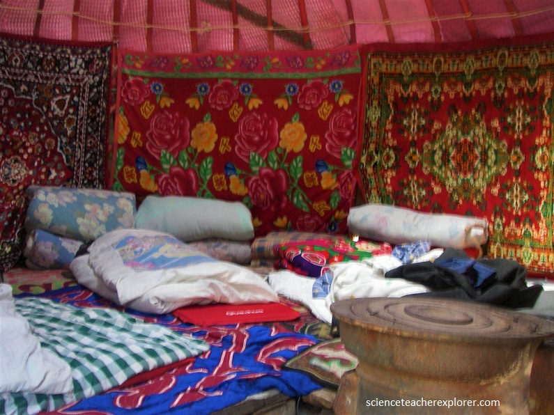
The Kazakhs are a mixed ethnic group with both Asian and Caucasian features. Traditionally, the Kazakh people are nomadic, tribal shepherds and ranchers of cattle, sheep, goats, and horses. They traditionally live in Yurts. Our Yurt was beautiful inside, with lots of brightly colored and decorated rugs, quilts and wall hangings, (pictured below).
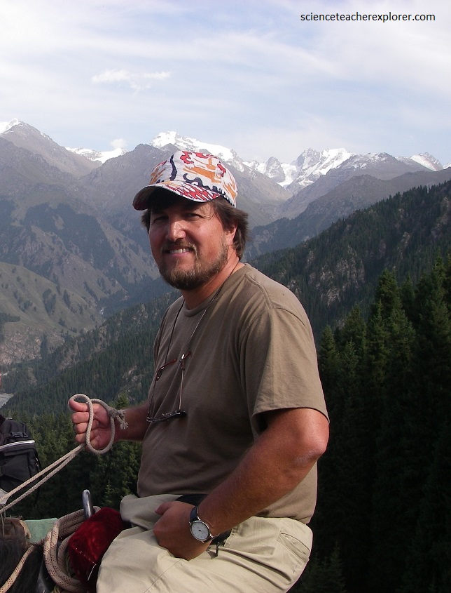
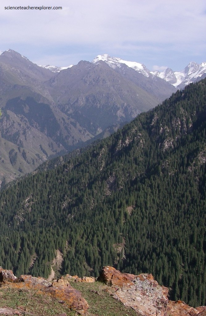
Pictured below, the next morning, my trekking crew saddled some of the Mongol Horses and rode to the top of a ridge to get a view of Bogda Peak. The mountains of the Tien Shan are composed in the main of crystalline and sedimentary rocks of the Paleozoic Era (i.e., about 540–250 million years ago).
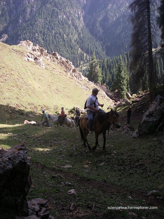
The basins that lie between the mountains, (such as Tainchi Lake) are filled with younger sediments that were formed chiefly by the erosive action of the area’s rivers. Granitic rocks outcrop over much of the area in the north and east of the Tien Shan Mountain Range or Bogda Peak Area.
The northern and eastern portions of the Tien Shan region underwent folding during the mountain-building period that occurred during the early Paleozoic; it has been uplifted dry land since that time, and its original sedimentary cover has been almost completely obliterated by erosion.

The Bogda Mountains, a northeastern branch of the Tianshan Mountains, records the complete Paleozoic history of the Tianshan orogenic belt.
At the end of the Early Permian, the West Bogda Trough was closed and an island arc was formed. The west Bogda area became an inherited catchment area, and developed a widespread shallow, deep and then shallow lacustrine succession during the Mid-Permian. At the end of the Mid-Permian, strong intracontinental collision caused the initial uplift of the West Bogda Mountains, (imaged below).
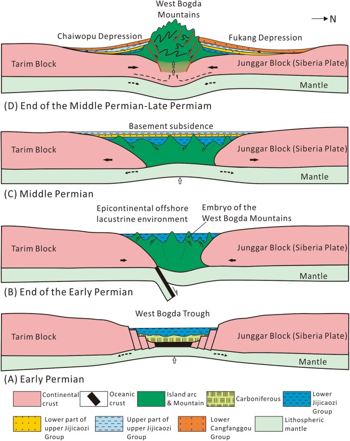
Imaged above, sedimentological evidence furthers confirmes that the West Bogda Mountains was a rift basin in the Carboniferous-Early Permian, and subsequently entered the Late Paleozoic large-scale intracontinental orogeny in the region.
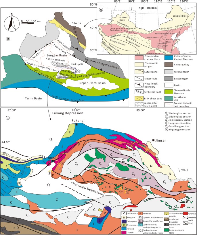
The tectonic and sedimentary evolution of the west Bogda area and the timing of initial uplift of the West Bogda Mountains were investigated at the website: https://www.nature.com/articles/s41598-018-19856-3 and is based on detailed sedimentological study of outcrops, including lithology, sedimentary structures, rock and isotopic compositions and paleocurrent directions.
Bogda Peak is the highest mountain in the Bogda Shan range, in the eastern Tien Shan mountains, China, at 5,445 m. Bogda Peak is a challenging climb due to its steep relief. Its sides slope at angles of between 70° and 80°. It was first climbed in 1981 by an 11-person team from Kyoto.
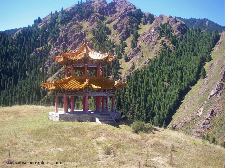
Centered on Tianchi Lake, Tianshan Tianchi National Park coverd four natural landscape zones, (snow-covered mountain, glacier and alpine lake, Thick forest, and a vast grassland). Picture below, a Taoist or Buddha site on our trek.