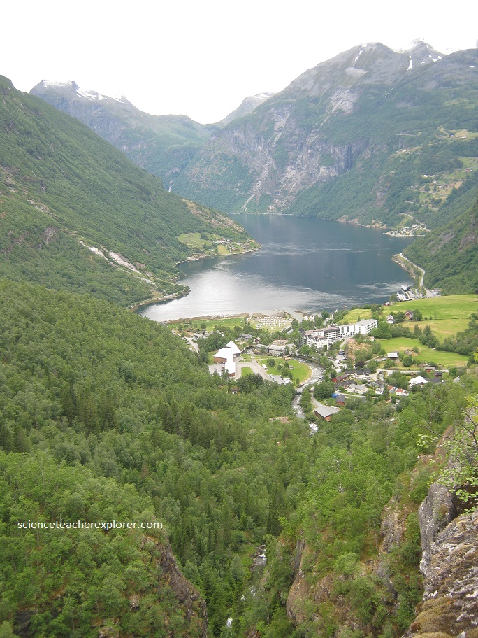
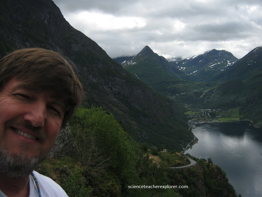
Geirangerfjord, Norway
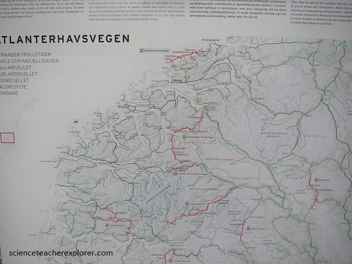
On June 23rd, 2018, I had the opportunity to drive the Trollstigen mountain road, after staying the night in Molde, Norway and just south of the Atlanterhavsvegen.
Tucked deep into the mountains off the western coast of Norway, the Trollstigen Mountain Road, (pictured below), is one of Norway’s most dramatic attractions.
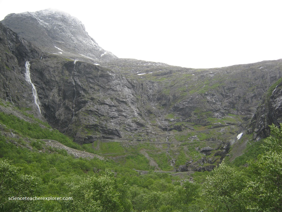
Dangerous conditions here include the incline, narrow driving space, and the poor traction and visibility that come with rain and fog. It’s one of the famous scenic drives in Norway.
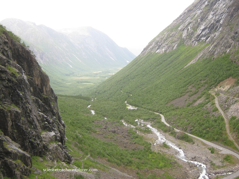
Pictured below, the Trollstigen Mountain Road route is known for its 11 hair-raising hairpin turns and steep, 9% gradient. Yet despite the dangers of the one-lane road. The historic Trollstigen road, was opened in 1936, and in 2005 the Geirangerfjord area was included on UNESCO’s World Heritage List.
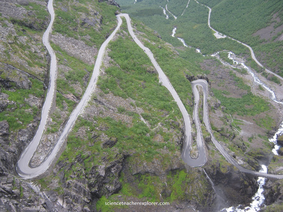
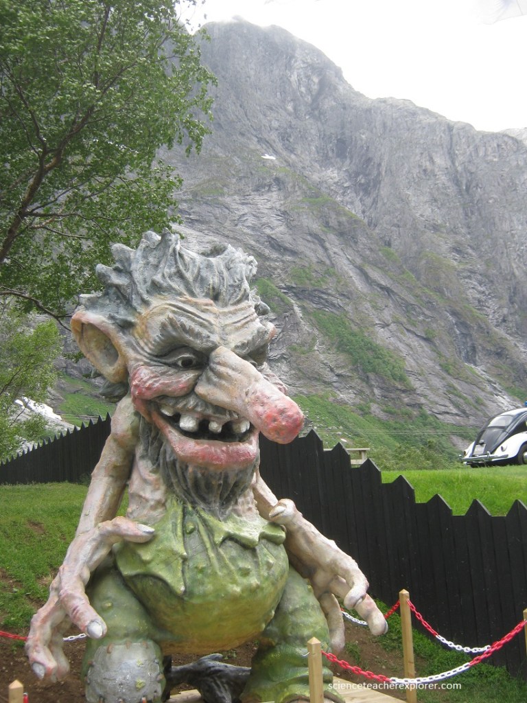
According to Norwegian folk legend, trolls roam through the mountains of Trollstigen every night, but change to stone when they are hit by sunlight each morning, (pictured below right). Clouded in a veil of mist, their stone bodies create an unbelievable mass of cliffs and winding beauty that mesmerize.
Just up the road from Trollstigen is the famous Geirangerfjord. Among the most famous and beautiful of the fjords is Geirangerfjord, located near the coastal town of Ålesund, (Pictured below).
During the last ice age, much of northern Europe was glaciated; covered by a large ice sheet known as the Fennoscandian Ice Sheet, which extended from Norway to the Ural Mountains and as far south as the UK. The movement of glaciers during the ice age is what formed the fantastic fjords that cut through Norway’s coastline today. Abrasion of the bedrock by ice and other material carried by glaciers cut a deep, steeply sided channel into the ground below.
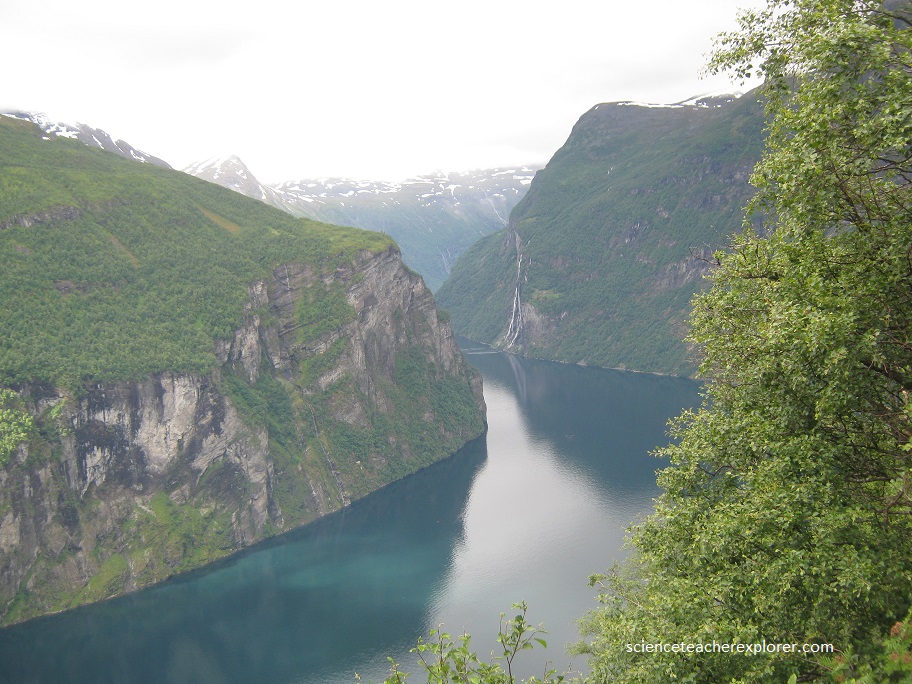
When the glaciers retreated, at the end of the last ice age, the long U-shaped channels they carved, filled with meltwater and connected the inlets with the ocean and creating the fjords like Geirangerfjord, (pictured above).