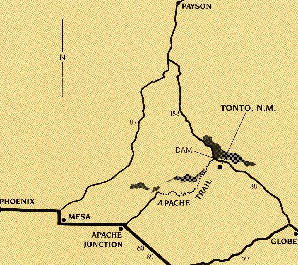
Tonto N.M, AZ 2010
While exploring Arizona during December, 2010; I made a brief stop at the Tonto National Monument. Tonto National Monument is located near Roosevelt Lake and is approximately 30 minutes north from Globe and two hours east from Phoenix. I began the morning, in Globe, Arizona with a visit to Besh-Ba-Gowah Ruins Archaeological Park.
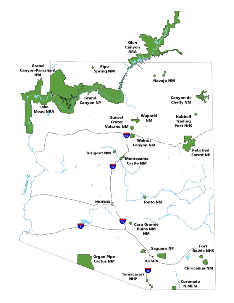
Besh-Ba-Gowah is a 200-room prehistoric Salado masonry pueblo located atop a broad ridge overlooking Pinal Creek. The site is situated one mile southwest from Globe, Arizona.
Pictured above, Besh-Ba-Gowah is a spectacular 200 room Salado pueblo occupied between 1250 and 1450 A.D.. Salado, a Spanish word meaning salt, is the name given to the prehistoric peoples who inhabited the Upper Salt River region between 1150 and 1450 A.D. Besh-Ba-Gowah is an Apache word meaning “place of metal” and is what Apaches first called the early mining town of Globe and Miami. this name was later given to the site.
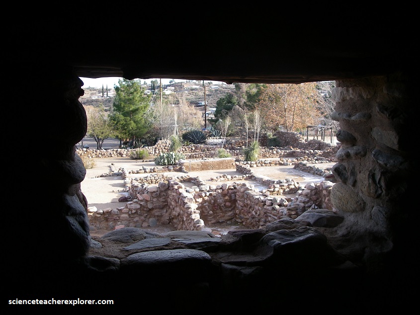
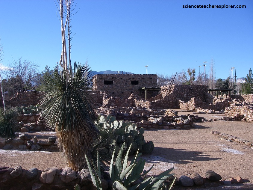
Pictured above, Besh-Ba-Gowah architecture consists of multi-storied, masonry room block clusters connected by long, narrow corridors or elongated plazas. These room blocks and corridors are situated around a large communal plaza area measuring 12 meters north–south by 27 meters east/west.
Pictured above, all walled architecture at Besh-Ba-Gowah consists of unshaped, large to moderate-sized, granite cobble masonry laid with a clay mortar. Evidence suggests interior room walls were commonly plastered with this mortar or a more calcareous mixture resulting in white-colored finished walls. There are some indications that at least selected exterior wall surfaces were also plastered with the original clay mortar. Often the basal masonry course consisted of upright vertical slabs, presently considered characteristic of Salado masonry architecture.
Over the geological history, layer upon layer of siltstone, sandstone, mudstone, and limestone were deposited on the tidal flats and in the shallow marine environment of the western continental shelf. This thick layer of Precambrian sediment, known as the Apache Group, formed the rocks now exposed in the great cliffs that tower above the Tonto Basin. Then followed millions of years during which the geologic record for this part of Arizona is eroded away and not known. However, during the late Mesozoic and early Cenozoic Eras, (50-100 m.y.a.) tremendous forces wrenched at the land. The plates of earth’s crust relentlessly collided, thrusting huge blocks of rock upward into jagged, towering mountain ranges. The rocks were ripped apart and contorted. Another cycle of erosion followed, wearing away the mountains.
During the Mid-Tertiary Orogeny, (15-25 m.y.a.), cataclysmic volcanic activity formed the Superstition Mountains and other ranges in southern Arizona. About 8-15 m.y.a. a final episode of deformation crudely defined the present topography of much of central Arizona. The Basin and Range Disturbance created vertical displacement along the fault lines, which lifted the major mountain ranges as basins collapsed between them. These basins then began to fill with rock debris washed down from the surrounding mountains. These sediments, known as the Gila Conglomerate, had accumulated to enormous depths, by the end of the Pleistocene, completely filling the downfaulted basins. The bottom portion of this formation was then tightly cemented by minerals, such as calcium carbonate and silica.
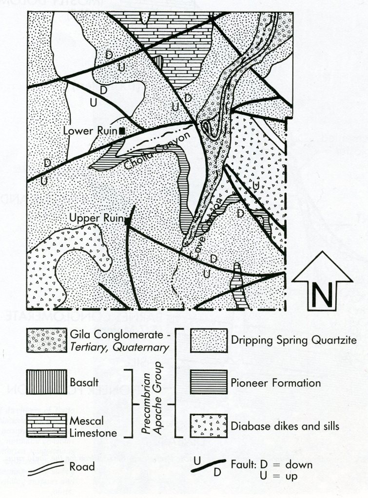
The forced of erosion finished sculpturing the Tonto Basin. Less than a million years ago, all of Central Arizona was gently uplifted some 1 to 2 thousand meters. This uplift initiated a new cycle of erosion that continues today. Only remnants of the Gila Conglomerate Formation can be seen today in the plaster which coats the cliffs near the Tonto cliff dwellings of the Salado people, (pictured below).
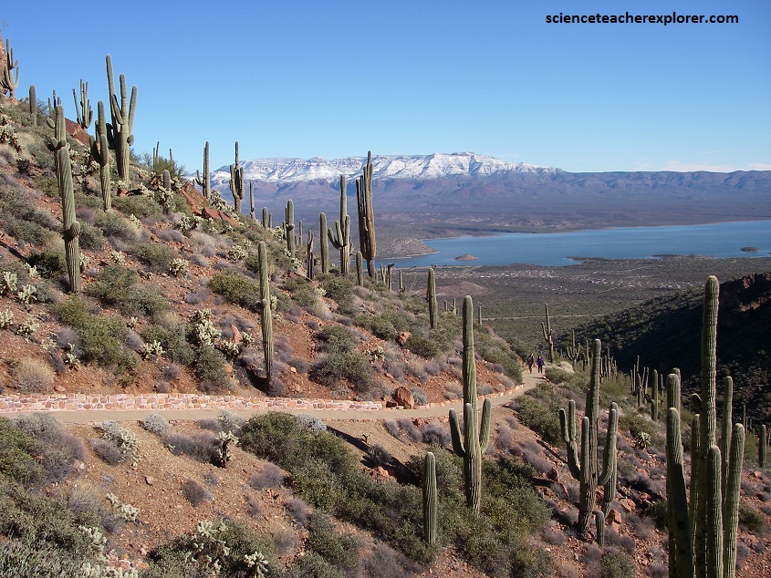
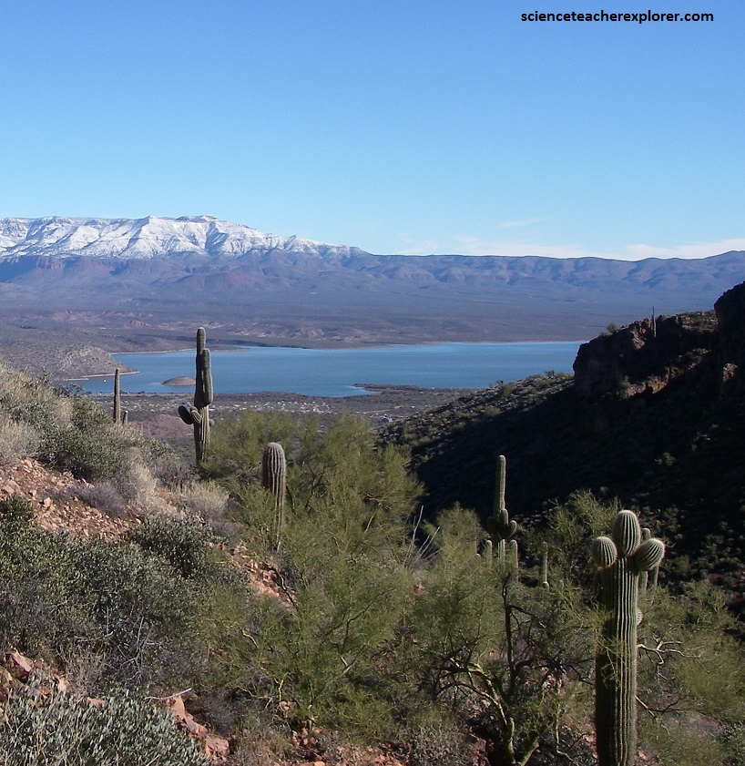
Pictured above, Tonto Basin is viewed from the Tonto National Monument that encompasses three rugged canyons with elevations ranging from 900 – 1,200 m, as well as the Salt River’s alluvial plain in the north. The park’s foci are two well-preserved Salado cliff-dwellings, Lower Ruin and Upper Ruin. I’m taking the picture from the Lower Ruin, looking east towards Roosevelt Lake and Tonto Basin below.
Some 200,000 y.a. water began to fashion caves in the ancient Apache Group sediments. These shattered seabed sediments appeared as cliff-forming strata that eventually sheltered Salado homes as caves. The sedimentary layer within the Apache Group that most affected the lives of the Salado is a 200m thick layer of sandstone/siltstone called the Dripping Spring Quartzite. This layer is especially susceptible to the weathering process known as Spalling, (the breaking off of thin layers of rock). The Spalling is caused by groundwater moving through the rock for thousands of years and causing the caves to form.

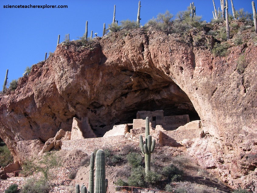
Pictured above & below, the Lower Ruin is a small “pueblo-house” built in a cave measuring 130 m wide and 10 m high. Situated some 120 m above the valley floor, the cliff dwelling looks out onto Roosevelt Lake in Tonto Basin, 5 km to the northwest. The Salado pueblo’s two-story walls, built atop loose fill, comprise rough, tapering courses (measuring 60 cm high) of local, uncut quartzite blocks adhered with a clay mortar mixed with gravel. The exterior was covered with tan-colored adobe clay, while mud was used to plaster the interior walls.
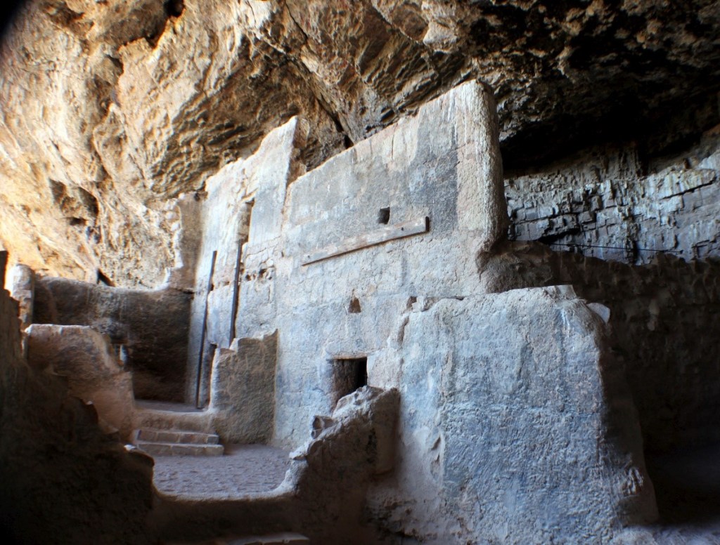
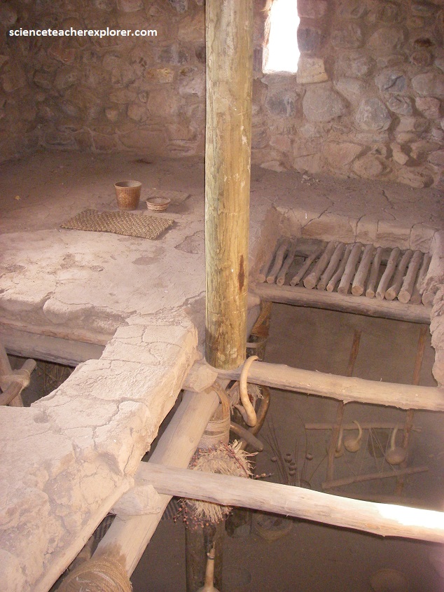
Pictured above, 10 doorways, rectangular and T-shaped, with wooden lintels punctuate the walls, as do loopholes on the second story. Floors are composed of packed earth and clay or bedrock, while roofs consists of one central bearing beam (viga) supported by a timber post and overlaid with sycamore or juniper poles (latía) and saguaro cactus ribs, grass, or reeds then covered with layers of adobe clay. The Lower Salado-Ruin was excavated by archaeologist Lloyd Pierson and stabilized in 1950. The above dimensions were provided from his personal notes, during that time. Apparently, steel tension rods and braces were installed to prevent lone masonry walls from tumbling, while the natural rock ledge was artificially built outwards to allow visitor traffic around the site.
Pictured above and along the trail to the Lower Ruins were informational signs about the native plants and animals that I would encounter on my climb to the ruins — especially all the varieties of cacti. Common types included the saguaro, teddy bear cholla, prickly pear, and barrel cactus.
