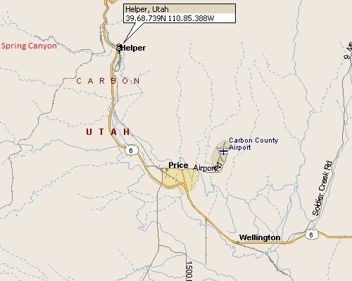
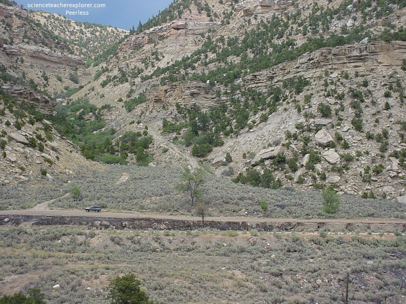
Spring Cyn., UT 2007
In 2007, I had this idea. If I used old Photographs from the historical past and match them with today, I would have a “before and after” system. Of course, somebody else had the same idea a year later and published a series of books about it. However, my first attempt was to collect a series of historical photos from the Helper, Utah Coal Mining Museum. The perfect location was west of Helper and is known as “Spring Canyon”, (where six mining camps existed over a distance of approximately 10 km).
Each camp, in Spring Canyon, was individual and distinct, but with each one separated a distance of only 2 km or less, the camps shared a commonality that other camps in the area did not have.
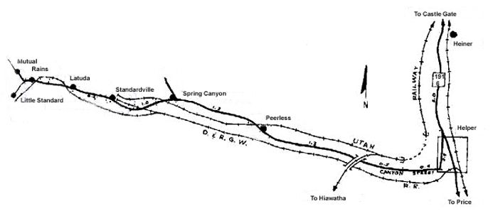
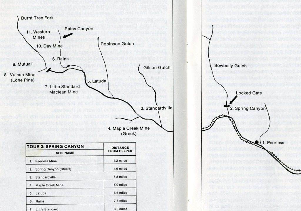
Beginning with Peerless and ending with Mutual, the Spring Canyon area towns and the nearby mines produced approximately 53 million tons of coal over the coarse of their lifespan. Mining began in the canyon by 1900, with most of the mines closing by the late 1950s. This left a canyon full of ghost-town locations.
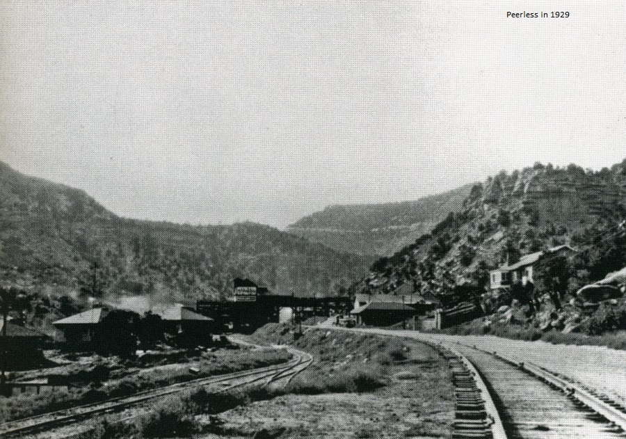
Pictured above, at the mouth of Spring Canyon, the Peerless Mine was established between 1916 and 1918. At its peak, Peerless employed nearly 150 men. The picture above shows the Peerless tipple with several company homes visible on the left and the school on the right. The two sets of railroad tracks belong to the Denver and Rio Grande Western and the Utah Railway.
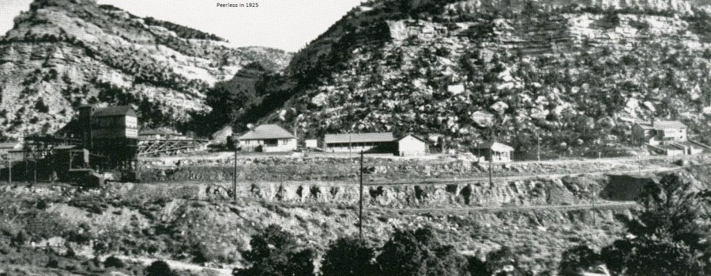
Pictured above, the photo shows the Peerless tipple with the tramway extending up the mountainside, the superintendent’s home, and homes of the mine-workers. The Peerless school is on the far right.
Pictured above, Peerless used to have around 30 homes, a store, school, mining office, post office, and a pool hall. It was in Peerless that the “gravity tramway” was developed. [Miners would use gravity to propel the mining carts up and down a hill. As miners filled train carts with coal, they were–through gravity–guided down the track towards town, emptied, and then being lightened, the carts would then move back up the track towards the mine]. Peerless was abandoned around 1954. Like all the other towns, most dwellings have been demolished without any ruins.
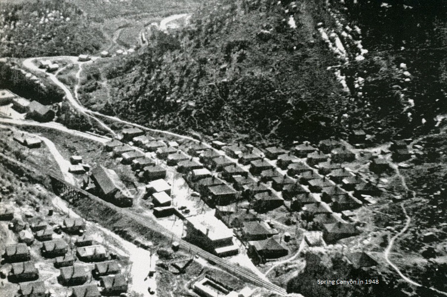
With the mine opening around 1912, the community of Storrs was founded and began to thrive with Nearly 1100 people. Storrs was named for George Storrs, the mine’s superintendent. However, the land around Storrs was initially bought by Jesse Knight. Jesse Knight was a member of the Church of Jesus Christ of Latter-Day Saints. The church disapproves of alcohol consumption and gambling. As such, Knight insisted that Storrs ban all saloons and gambling houses from being built. Spring Canyon had a number of four-room cottages. Most of which had hot and cold water–a big deal back in the early days. There was a store, hotel, school, and hospital. They even built a heated swimming pool. In January of 1914, a large avalanche occurred, killing 3 and destroying 4 houses. Pictured above, the tennis courts and town flagpole is on the cliff in the top left. The rows of neat company house lined each side of Sowbelly Gulch, while the business district was located at the base of the cliff below the tennis courts.
In 1924, George Storrs was indicted for mail fraud. Members of the town decided to change the name to Spring Canyon. However, George Storrs was eventually cleared of his charges, but by then, the name Spring Canyon had stuck. Spring Canyon Mine closed in 1954. By 2007, all of the buildings were demolished. Most all evidence of Spring Canyon is now gone.
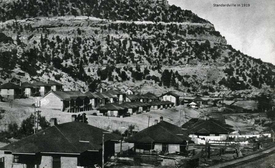
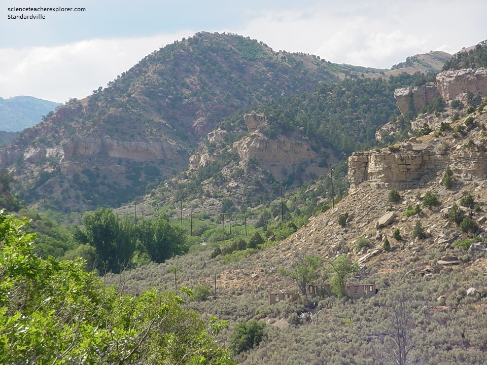
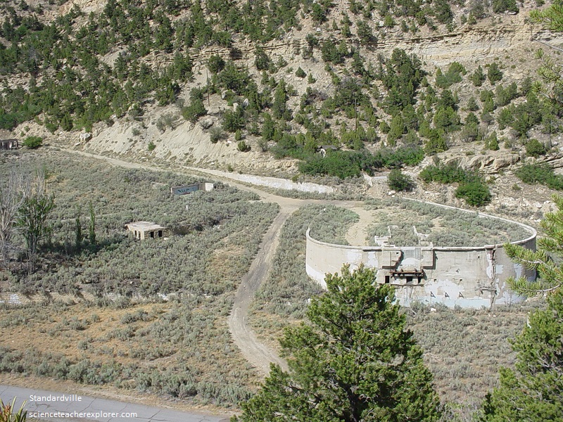
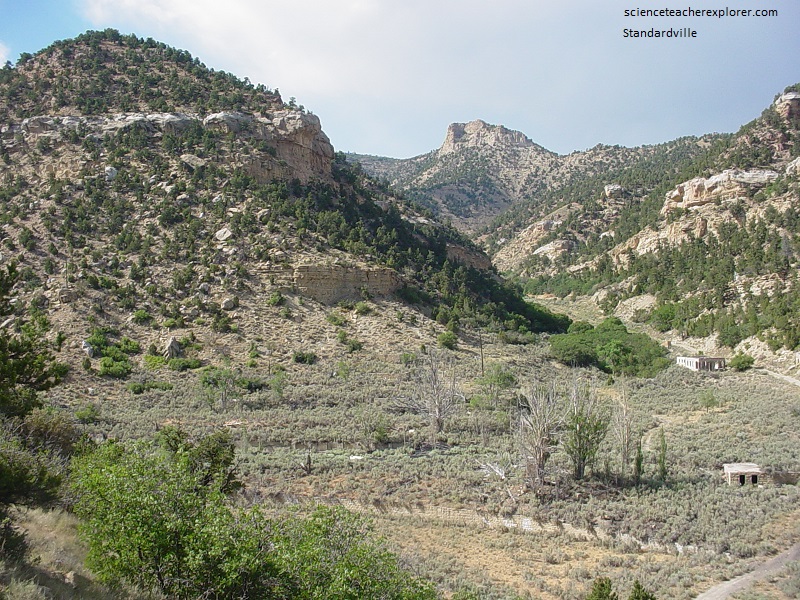
Pictured above, The mine at Standardville opened in 1912 and closed in 1950. Standardville had a company store, many apartments, a butcher shop, barber shop, hospital, recreation hall, tennis courts, and an elementary school. The Standardville Coal Company used in technology to make the coal mining operation as efficient it could be. The large tipple building, on the right of the photo, helped to quickly sort the coal into size without much breakage of the coal. The large white building in the middle of the photo is a two-story amusement hall.
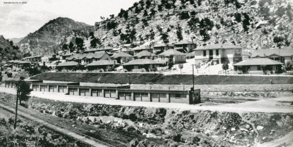
While Standardville became the model of the modern coal camp, it had no culinary water. Pictured above, Standardville shows the lovely company homes with their neatly manicured yards, the school, and the rows of garages for automobiles. At its peak, there were roughly 200 children attending the school.
In 1922, a mining-strike turned violent in Standardville. The Miners attacked a train of replacement miners at the tunnel near the current Castle Gate Subdivision. Mine guards chased the attackers. During the ambush, a mine guard was killed. The mine superintendent and another miner were injured.
In the 1920s, Standardville had a tragic explosion in the Standard Mine . The explosion, (caused by firedamp gas), killed 20 men (29 men were in the mine at the time). A cave-in occurred during a rescue operation, killing 3 more. Five of the surviving men survived due to the wisdom of one of the miners, who at the sound of the explosion, quickly wrote a note informing any reader where they would be hiding. He left the note in the pathway and then quickly guided his fellow miners to the secured area. Without that note, they would have never been found.
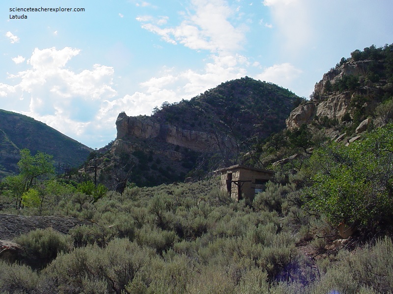
Just west of Standardville is the site of the mining camp called Latuda. Initially, Latuda was called Liberty. When the post office was built, the common name of Liberty caused confusion with the United States Post Office. In 1923, per the request of the post office, Liberty changed its name changed to Latuda, (in honor of Frank Latuda). Frank Latuda first opened the Liberty Fuel Company. Latuda had a population of around 300 people.
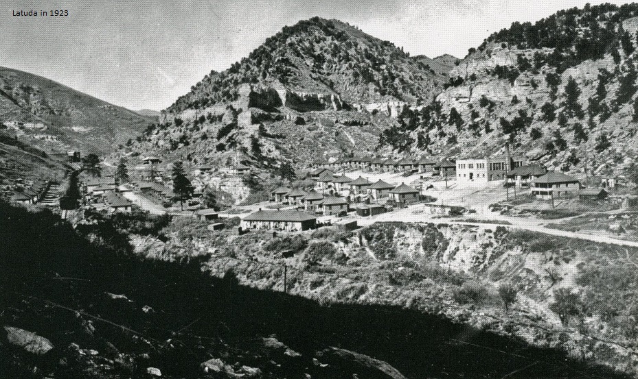
Pictured above, the Liberty Fuel Company build 35 homes plus with a large rock school-house. In the upper left portion of the photo, the mine office and mine tipple can be seen.
Set so close to the canyon wall, the town was devastated in February 1927 when a massive snow slide occurred. A number of homes were buried, killing two miners.
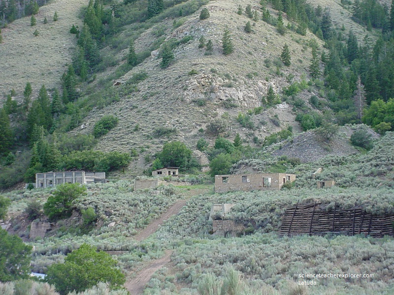
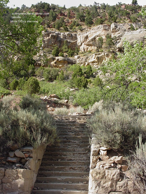
Latuda was home to the infamous mining office that has been the basis for legends regarding the White Lady Ghost. Pictured below, one can still see a set of stone stair cases leading to where the building once stood.
Like all the other towns, the community of Latuda dissolved after the demand of coal dropped. By 1967, the town was completely abandoned.
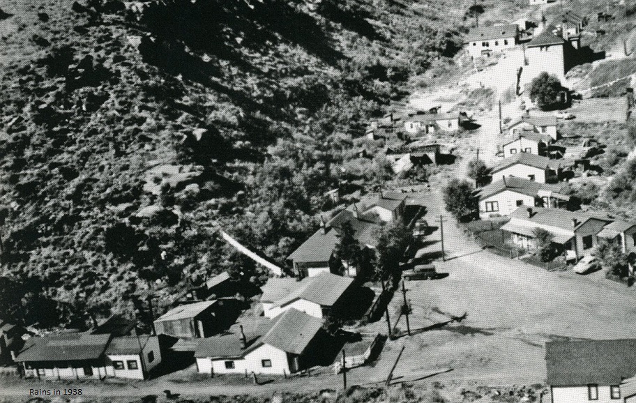
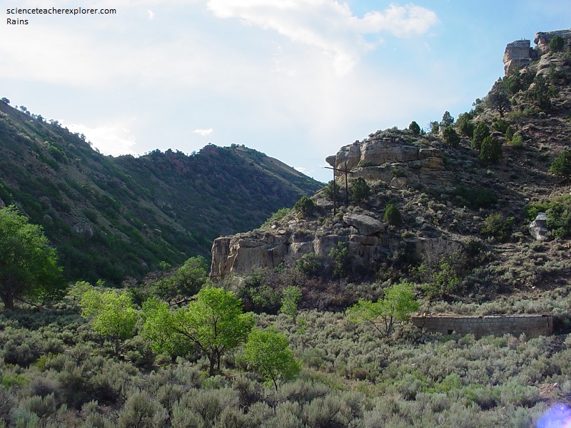
Pictured above, the “Rains Mining Camp” got its start in 1915 when prominent mining engineer Leon Felix Rains garnered the interest of P.J. Quealy, (a coal operator from Wyoming), in investing in the coal lands west of Standardville. The Carbon Fuel Company was organized and the land was purchased from the government. Leon Rains served as president of the company. Interestingly, Rains had been a grand opera singer until he became interested in the coal industry, first gaining his experience selling coal in California. Later, Leon Rains worked as the general manager for the Standard Coal Company from 1913 to 1914, before starting the Carbon Fuel Company. The photo above shows the mine superintendent’s house on the corner and the school-house in the upper right corner.
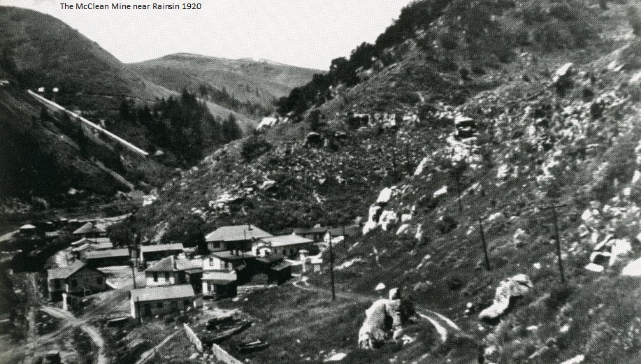
At it’s peak, “Rains” reached a population of over 400 people with dances, free movies and talent shows. Pictured above, the picture shows the nearby Maclean Mine. The Maclean Mine was located high up on the mountainside across from “Rains”. Although the Maclean was owned by the Standard Coal Company, the coal was processed at the Rains tipple. The homes at Rains were small but comfortable, and soon the town had blossomed to include its own store. In 1921, a 210-man crew produced 158,133 tons of coal and the population of the town of Rains approached 500. However, when crews were temporarily increased, many of the additional single miners often lived in tents. The Rains Mine production peaked in the mid-1920s and gradually declined thereafter.
The Maclean Mine closed in the 1940s after mine caught fire. The fire was still burning deep underground when I was there in 2007. The main, Rains Mine closed in 1930. However, in 1935, the Utah Carbon Fuel Company bought the property and extended its underground workings until 1956.
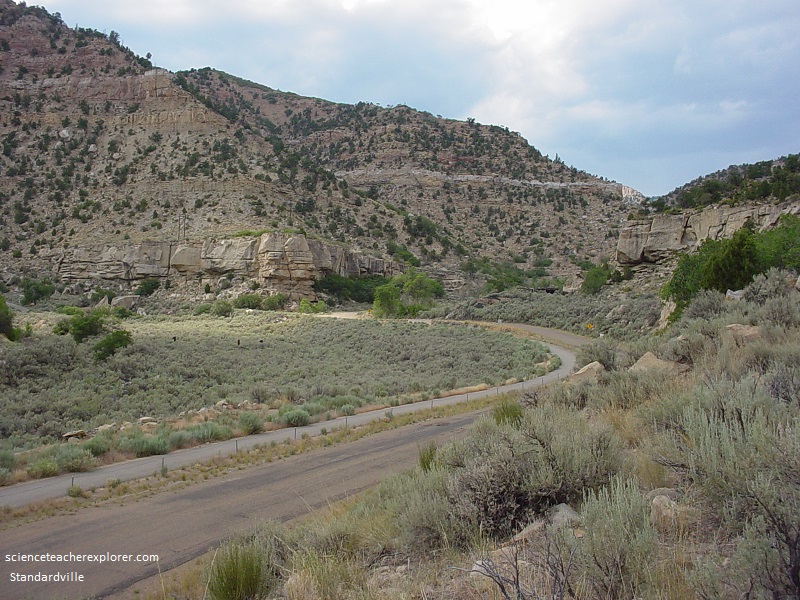
As one drives towards the end of Canyon Road, the ability to continue up Spring Canyon is blocked by private owners.
As one drives towards the end of Canyon Road, the ability to continue up Spring Canyon is blocked by private owners. However, at the end of the road is a large building called the “Mutual Store”.
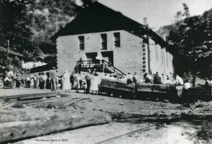
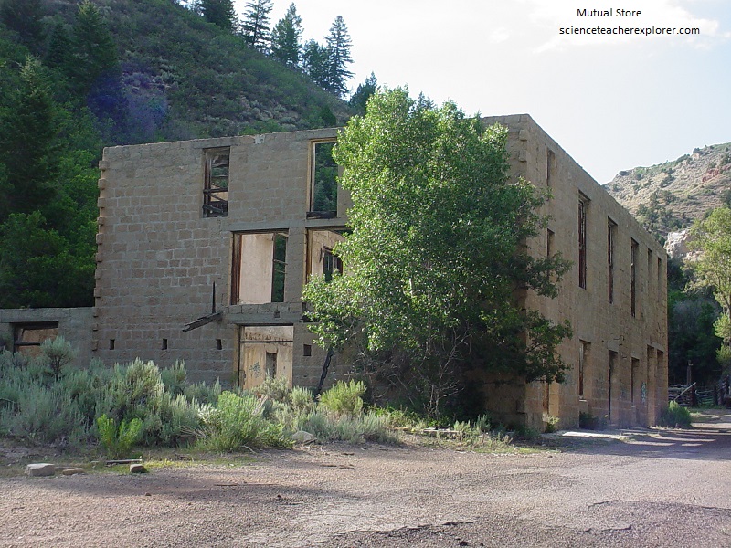
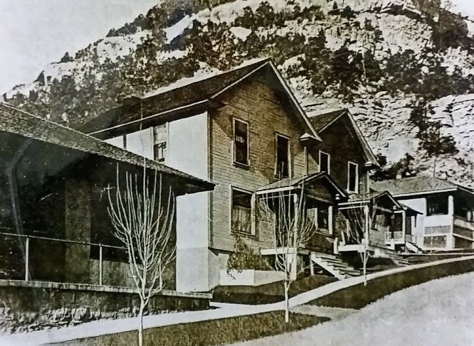
Pictured above is a large company store for the community of Mutual. Mutual was known for its pretty and well-kept homes, (pictured below). Unlike most mining camps of the era, the Mutual Store was independently owned and operated by John Columbo. The two-story stone building became the focal point of community activity with an amusement hall on the second floor. This space served several uses, including a union hall, movie theater, dance floor, and boxing arena. It also had a pool hall, saloon, and a doctor’s office.
Since the Mutual ghost-town site was on a posted “Private Property”, I was unable to get a picture from 2007. However, the Mutual Coal Mine was opened in February 1921. The Mutual Coal Company developed it and the land was acquired by a state and government lease and from lands formerly leased by the Carbon Fuel Company and the Morton Coal Company. The Mutual Coal Company ceased operations in 1938, but several smaller operations were established in the immediate vicinity during and after World War II. From 1921 to 1931, the Mutual Mine produced more than 1.5 million tons of coal, rated one of the best domestic coal in the territory. Its mining operations were taken over by the adjacent Carbon Fuel Company, which extended its own underground workings into the Mutual mine.
