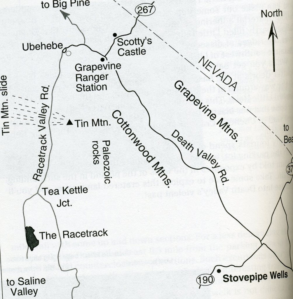
Racetrack Playa, CA
In December of 2006, the University of Utah Natural History Museum had me run an educational 4 day tour to Death Valley National Park. One of our side trips were to explore the mysterious location called the Racetrack. Nestled in a remote valley between the Cottonwood and Last Chance Ranges, the Racetrack is a place of stunning beauty. The Racetrack is a playa, (a dry lakebed), best known for its strange moving rocks. The road to Racetrack Valley begins near Ubehebe Crater. Normally, it is recommended for high-clearance vehicles with heavy-duty tires as it can be rough and washboard.
On the way to Ubehebe Crater turnoff, my tour participants decided to make a brief stop at Scotty’s Castle (72 km north of Stovepipe Wells). Hidden in the green oasis of Grapevine Canyon in far northern Death Valley is the Death Valley Ranch, or “Scotty’s Castle” as it is more commonly known.
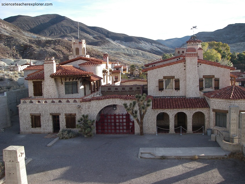
Scotty’s Castle is named for gold prospector Walter E. Scott, although Scott never owned it, nor is it an actual castle. Scott found an investor and convinced a Chicago millionaire named Albert Mussey Johnson to invest in Scott’s gold mine in the Death Valley area. Though initially angered when the mine turned out to be fraudulent, Johnson was fascinated with the colorful Scott and the two men struck up an unlikely friendship. By 1937, Johnson had acquired more than 1,500 acres in Grapevine Canyon, where the ranch is located. The Johnson’s hired an architect and built the house seen above. Later they sold it to Death Valley National Park.
Amazingly, the springs of Grapevine Canyon provided the water supply for the ranch and were used to generate electricity. Pictured below, the springs, located about 91 m higher than the villa, generated enough water flow and pressure to turn a Pelton wheel, which ran the generator that furnished the villa’s electricity. The power was regulated and backed up by the large bank of nickel/iron batteries in the house’s tunnels. The springs provided enough water to meet all the needs of the ranch, with enough left for other uses.
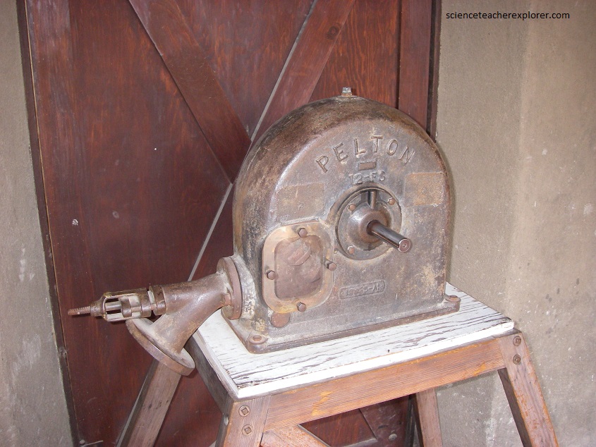
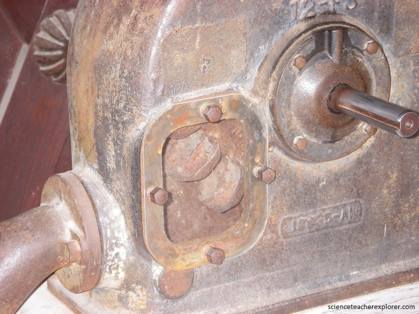
What amazes me is the small amount of water that causes the “Pelton” generator to work. Pictured below, nozzles direct forceful, high-speed streams of water against a series of spoon-shaped buckets, also known as impulse blades, which are mounted around the outer rim of a drive wheel. As the water jet hits the blades, the direction of water velocity is changed to follow the contours of the blades. The impulse energy of the water jet exerts torque on the bucket-and-wheel system, spinning the wheel; the water jet does a “u-turn” and exits at the outer sides of the bucket, decelerated to a low velocity. In the process, the water jet’s momentum is transferred to the wheel and hence to a turbine. Thus, “impulse” energy does work on the turbine to create electricity.
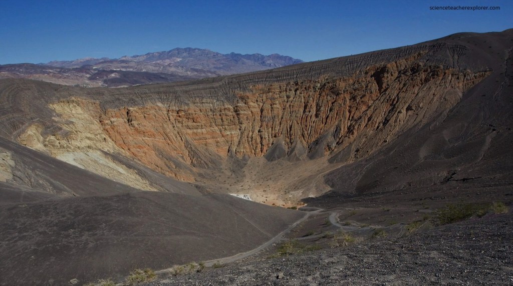
Only a few thousand years ago, great explosive eruptions blasted out this 1 kilometer wide, 200 meter deep crater, (pictured below). Molten rock rose along fractures and mixed with ground water in the alluvial fan deposits. The superheated water flashed to steam and blew out both the fan rocks and volcanic fragments called cinders. Pictured below, Ubehebe Crater is 106 km north of Furnace Creek Visitor’s Center. At the crater wall you can see the older fan deposits that are light in color in contrast to the darker beds of cinders that were dumped on top. The sudden change in color of the rocks about 50 meter below the rim marks the transition. Cinders were scattered over 16 square kilometers around the crater by the violent explosions, and for the dark gray soil that is now sparsely dotted with desert holly bushes.
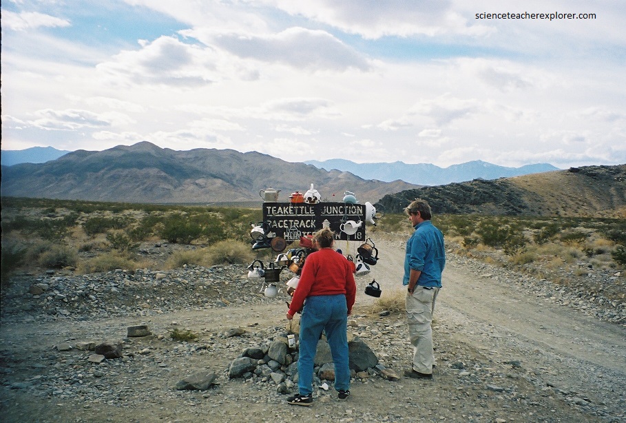
Once we left Ubehebe Crater and drove on a graveled 4WD road for 32 km, we reached Teakettle Junction, (pictured below). According to the locals, it is said to show early settlers that there was water nearby. The tradition is to bring a new teakettle and to either inscribe your message on it or to write a letter and put it in it. This is said to bring good luck to those that leave a kettle and to provide an exciting sign for future travelers.
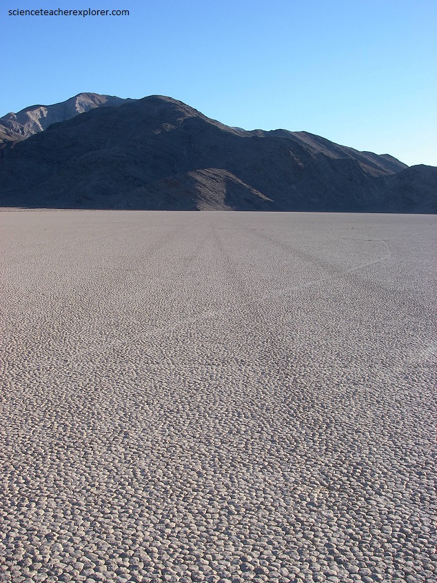
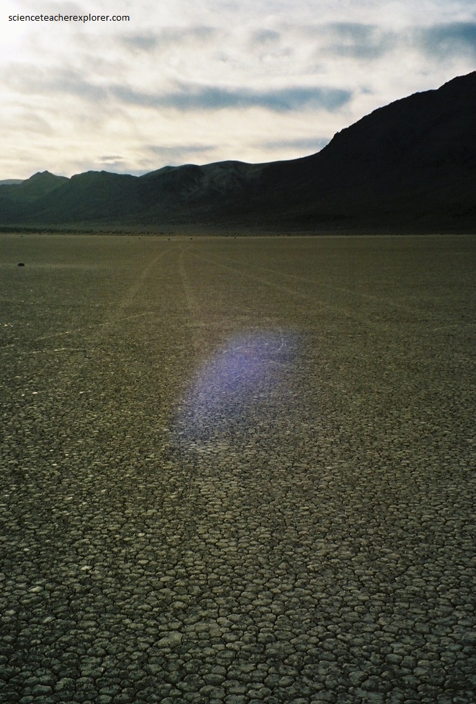
The Racetrack Playa is a dry lakebed that sits at an elevation of 1240 meters in Racetrack Valley, between two north prongs of the Panamint Range. Ubehebe Peak, at 1893 meters, looms just 1.4 km west. The playa measures 4.5 km north to south and up to 2.1 km east to west. The lakebed is extremely flat, firm, and vegetation-free. A surveyed leveler shows the north end is 3.8 cm higher than the south end.
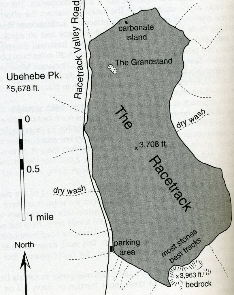
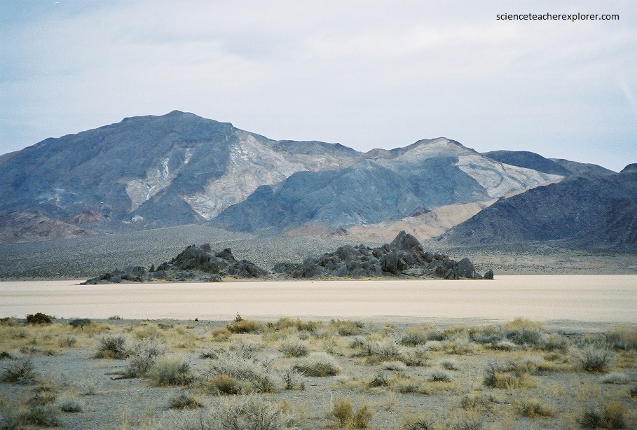
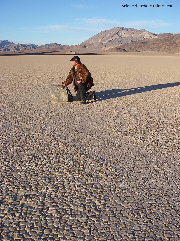
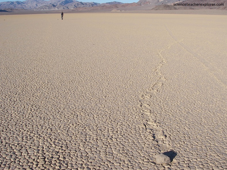
Imaged above, the Racetrack Playa lies directly against a steep, 283 meter high mountain face of carbonate rock called dolomite. Alluvial fans containing a variety of stones border all but the playa’s south shore. The dolomite rock face supplies most of the abundant stones, cobble to boulder size, strewn over the playa, especially near the south end, (pictured below).
Many of the stones are irregular fragments of dark dolomite; fewer are smooth-sided joint blocks of intrusive igneous rocks, mostly of tan feldspar-rich syenite, derived from out crops on adjoining mountain mountain slopes, (pictured below).
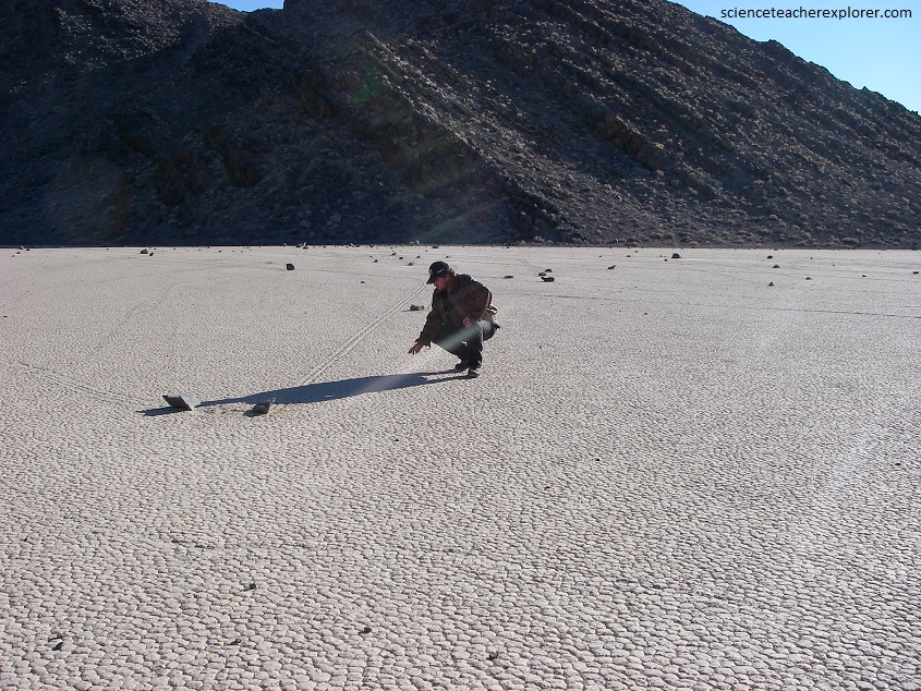
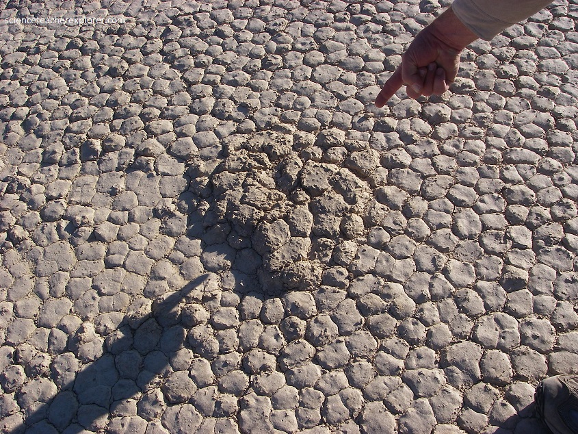
Pictured above, mud cracks cover most of the Racetrack’s surface. The mud cracks are old, semi-permanent features outlining polygons 5-10 cm in diameter and about 3 cm deep. They form as the playa’s mud surface dries and shrinks, radiating from regularly spaced centers, usually in sets of three crack at 120 degrees to each other. The cracks intersect with other cracks from other centers to form polygons. Polygons on The Racetrack are mostly irregular shapes.
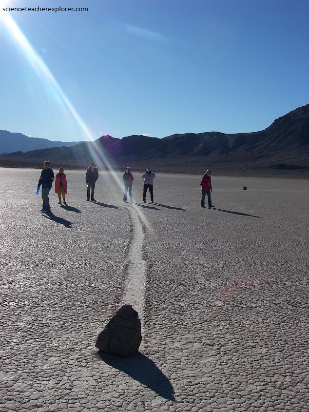
The playa’s name comes from its oval shape and the unusual bedrock islands near its north end, “The Grandstand” (24 m high), and smaller neighboring carbonate-rock knob, (pictured below). [These islands could be a grandstand and a judges’ stand]. The playa’s name also fits for the rocks that mysteriously sail across the playa surface when conditions are just right, leaving tracks that record their travels in the soft, wet mud.
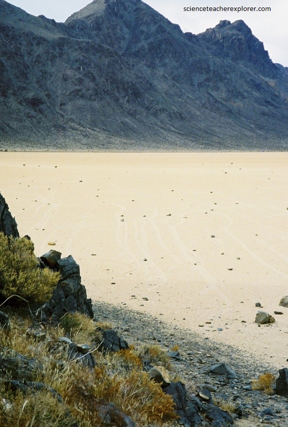
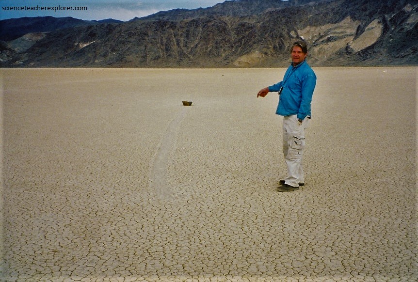
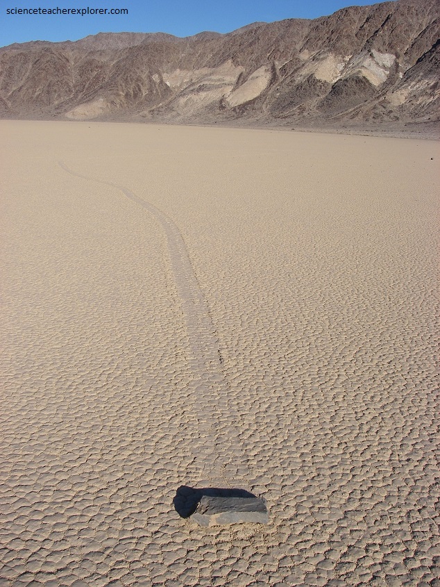
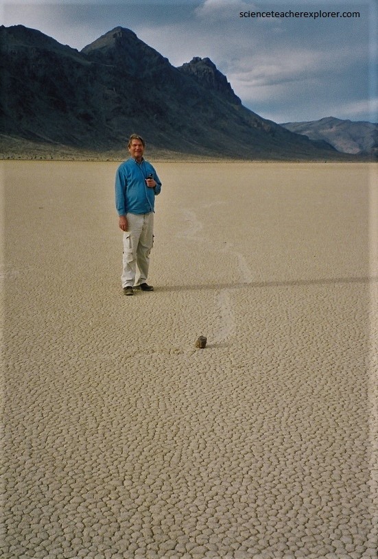
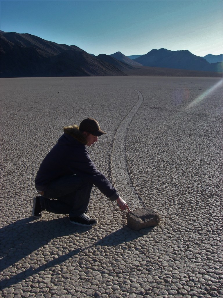
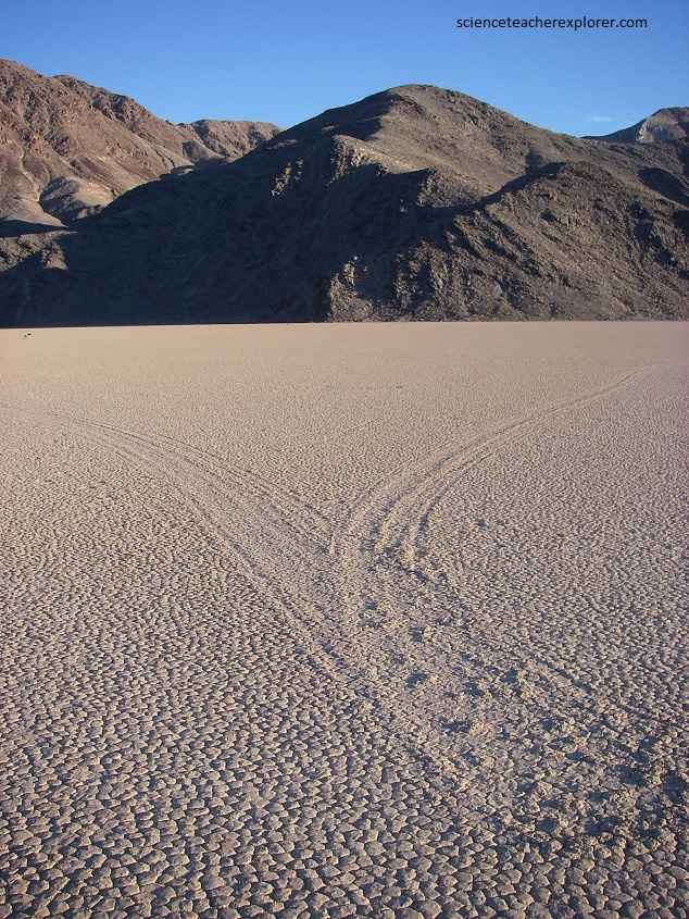
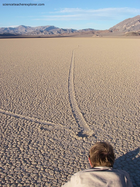
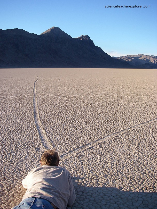
Pictured below, stones move across the playa surface, leaving distinct tracks in the wet mud tens to hundreds of meters long, a few centimeters or 30 or more centimeters wide, and a couple of centimeters deep. The longest continuous track we could find during our visit was 660 meters.
Racetrack stones move only every two or three years on average. Pictured above, we notice that if the track is striated, the stone will have similar irregularities on its bottom. If the track is perfectly smooth, then the stone is smooth. Additionally, the track’s width changed if the stone rotated around a near-vertical axis while moving. We noticed stones with rough bottoms steer fairly straight paths, like a well-keeled boat. Smoot-bottomed stones wobbled and wandered, like a boat without a keel, leaving gracefully curving tracks.
As a stone moved across the muddy playa surface, it pushed a bow wave of mud ahead of it, as a boat does on water. As it traveled, the stone continually shoved aside the mud of the bow wave, making the levees. Some stones moved fast enough, (probably a km/hr), to toboggan up on the outside of a curve, shoving more mud in that direction and crating an asymmetrical levee. {I noticed two stone tracks colliding and ricocheting with ample velocity to accurately depict a two dimensional collision}.
Pictured above, ultralong tracks form in segments, (not in a single episode of movement). Segments in long composite tracks look fresher toward the distal end, which is generally to the north or northeast on The Racetrack.
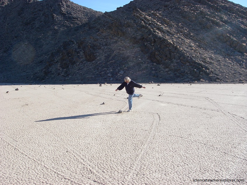
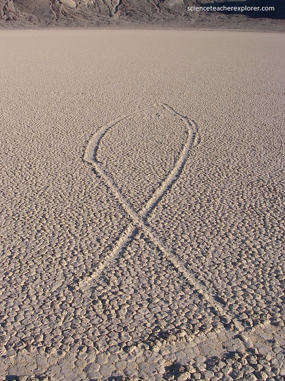
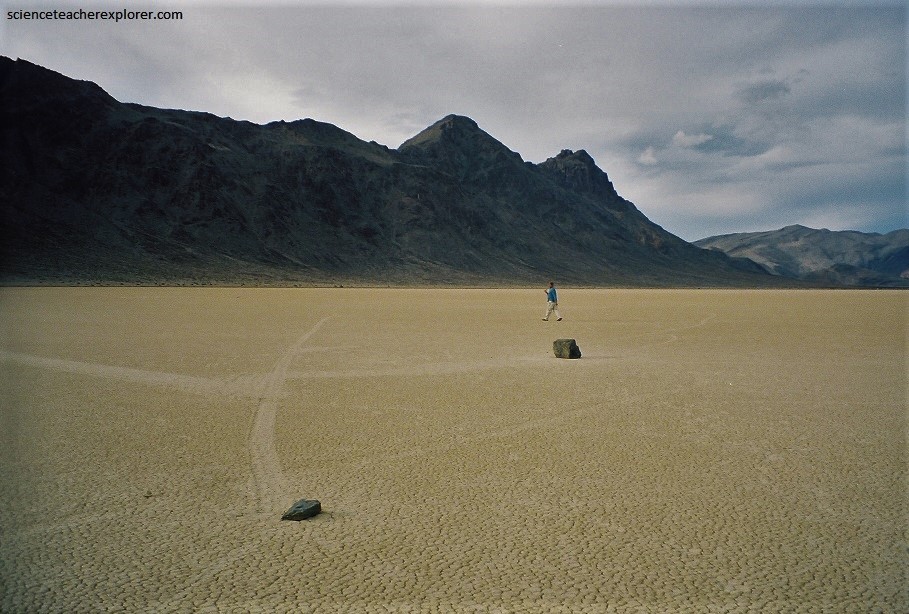
Pictured above, on the south part of the playa, the prevailing direction of movement is to the north-northeast, but the tracks commonly divert 30 degrees of more to either side of north, and occasionally a track reverses direction, (pictured below). Note how the stones moved into a group without disturbing the other stones. It seems that the stones that moved in the same episode commonly inscribe similar but not in duplicate patterns.
Over the years, people have proposed a variety of weird mechanisms for moving the stones, some just short of invoking little green men from outer space. Most trained investigators of the problem accept wind as the motivating force. Some researchers feel that wind alone cannot accomplish the task and that wind-driven sheets or floes of ice into which the stones are frozen are required, (pictured below).
Pictured above, shows evidence of ice sheets that may have existed in the past and causing scrape marks up to 70 meters wide on the playa and small, ice shoed, pebble ramparts along the south shore.
Pictured below, one unusually large stone, (a rectangular dolomite block measuring 70 by 50 by 30 centimeters and weighing about 320 kg, rested on the end of an old, straight, 200 meter long track that started on the south shore. This would take an incredible force to move this stone. However, the track seems to point that out with some deviated segments along the way.
Even more mysterious is the fact that there seems to be an absence of stones further north on the playa. If this has been occurring for several decades, then you would think that the playa would be full of stones all the way to north end. What happens to all the stones? Why do they seem to disappear after a while? Picture below is a clue…….
Most serious scientists have long favored wind as the force that moves the stones. However, how much wind does it take to start the large stones moving? Physicists have analyzed conditions within the boundary layer of wind blowing across any flat, smooth playa surface. Over most terrains, the boundary layer is around a meter thick, but observations and calculations show that over a sooth play it can be as thin as 6 centimeters. This small boundary layer is a zone of unusually high shear stress, (stress that increases with increasing wind velocity and decreasing boundary layer thickness. The physicists’ calculations suggest that stress within the boundary layer is a force capable of starting stone to move. Once any stone starts to move, it takes only about half the initiating force to keep it going due to its inertia.
Water fully floods the Racetrack only rarely, but local sheets of water, (a few centimeters deep), commonly lie on parts of the playa in winter. Wind moves these sheets back and forth across the play’s surface and win-driven water up to 12 centimeters deep has been reported.
Pictured above, for stones to move, wind must blow with great force when the playa surface reaches a state of maximum slipperiness on the clay. The tracks show that stones literally sail across the play surface, probably at velocities of several kilometers per hour.
The transporting force is capable of both sliding and rolling small cobbles, branches, bushes, boulders and sheets of thin ice. It has moved stones weighing up to 200 kg tens to hundreds of meters in a single episode.