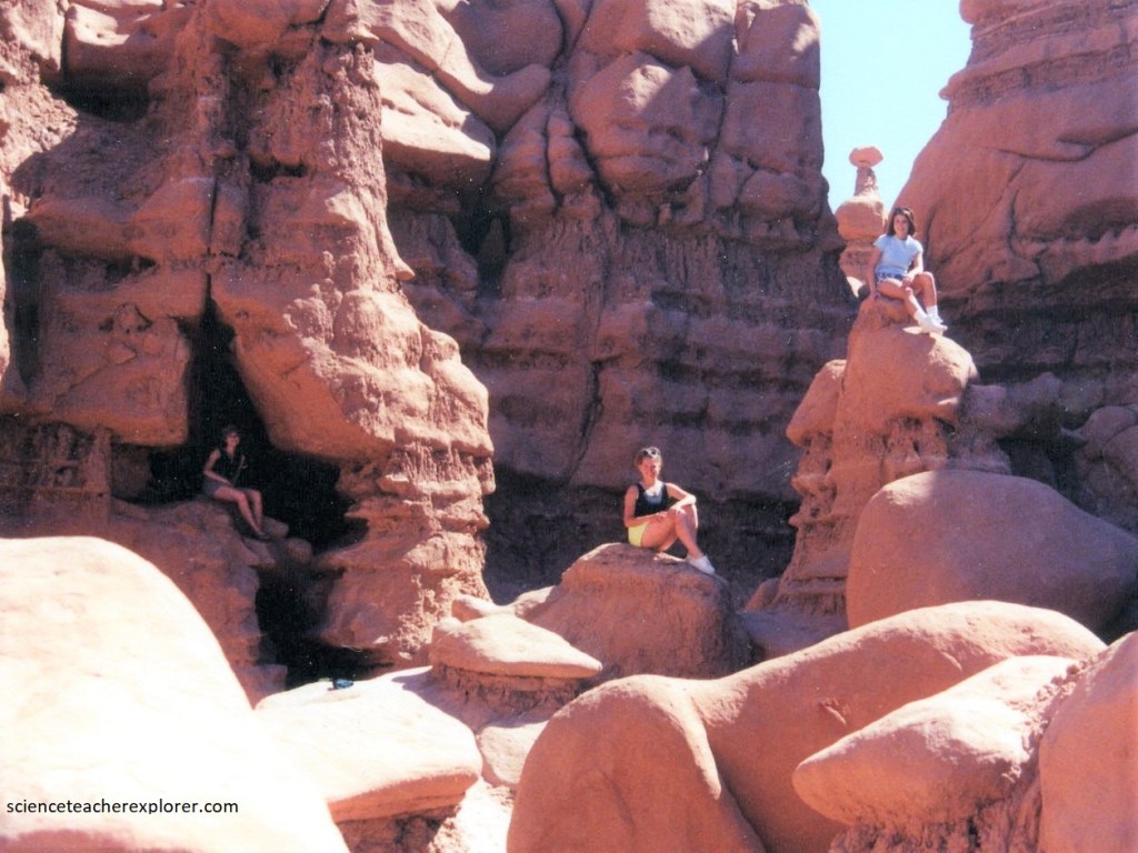
Goblin Valley, Utah 2007
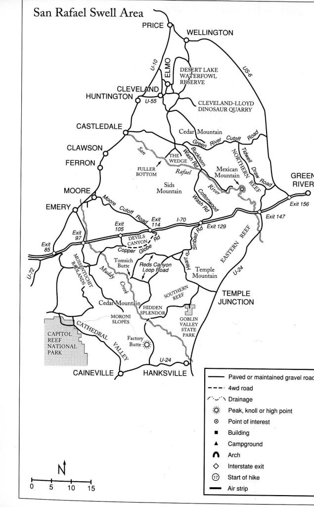
In the Spring of 1999 and 2007, and after trekking the San Rafael Swell, by way of “The Chute”; I took my students and advisors into the “Goblin Valley State Park to explore. To get there, you go 39 km south of I-70 on Highway 24, then turn at Temple Mountain junction, and follow signs 19 km to Goblin Valley State Park.
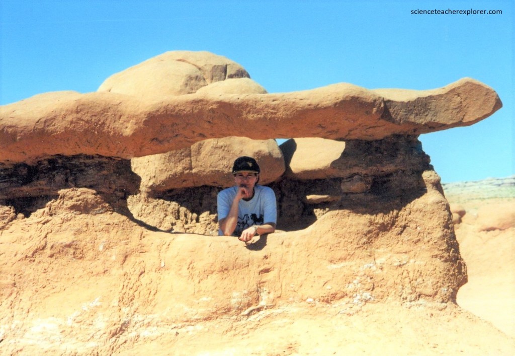
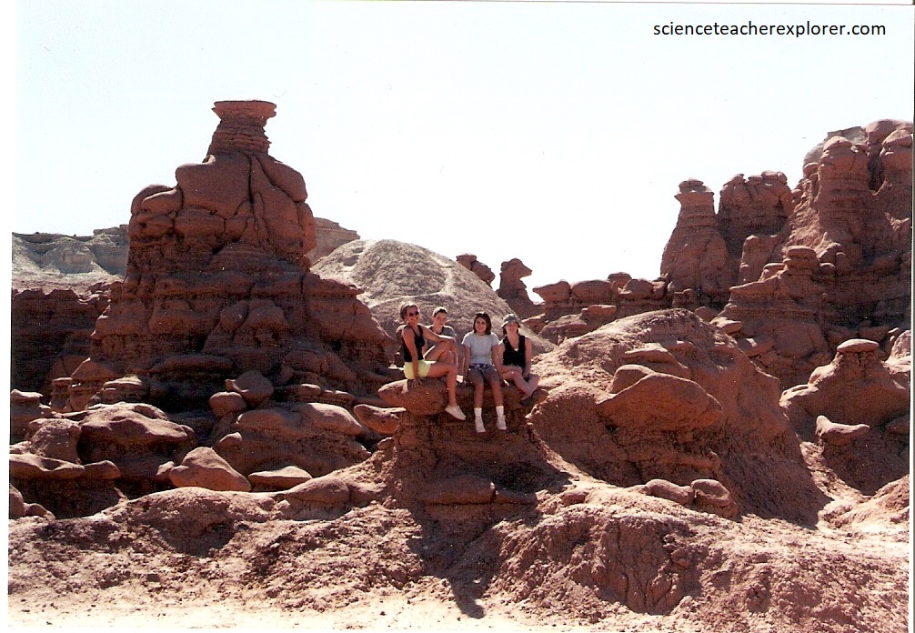
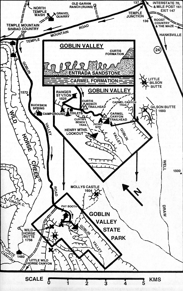
Goblin Valley State Park features thousands of hoodoos, referred to locally as goblins, which are formations of mushroom-shaped rock-pinnacles, some as tall as several meters. The valley is about 0.8 km wide and 3.2 km long. 5 sediment deposits, 4 from the Jurassic time and 1 from the Quaternary time, are visible in the park.
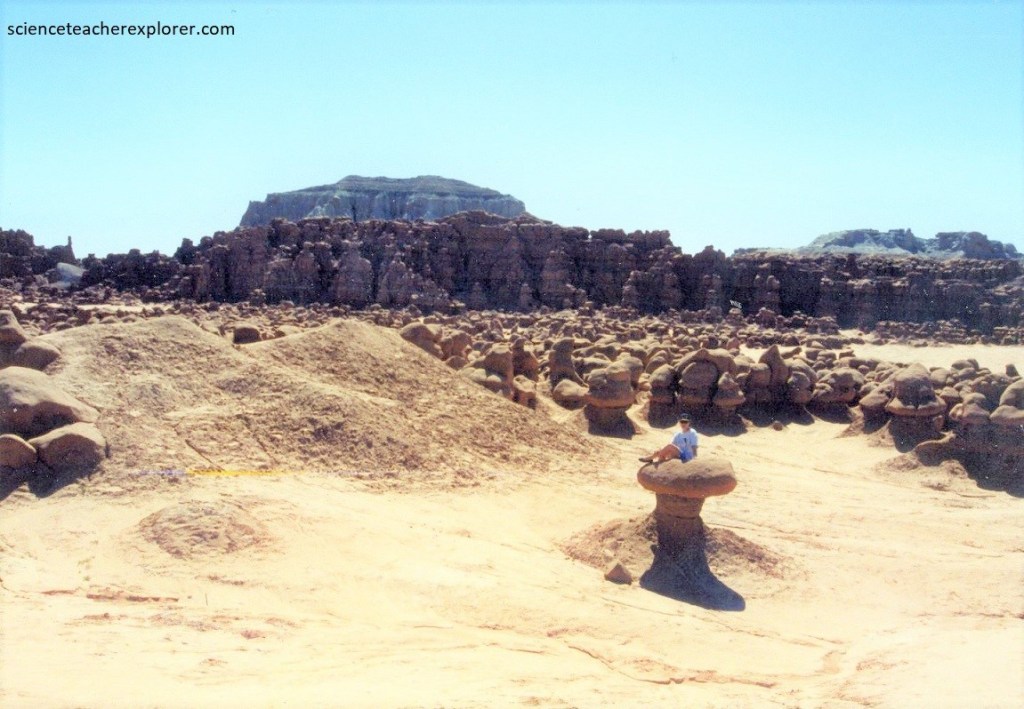
The unusual stone shapes in Goblin Valley result from the weathering of Entrada Sandstone. The Entrada consists of debris eroded from former highlands and redeposited on a former tidal flat of alternating layers of sandstone, siltstone and shale. Note that the interbedded layers of shale and siltstone in the Entrada formation erode and weather more quickly than the harder sandstone. These varying degrees of resistance result in ledges of sandstone that overhang indented, softer layers of shale and siltstone. The sandstone cap protects the softer layers, granting a hoodoo with longevity, but eventually will give way and topple to the floor.
The rocks show evidence of being near the margins of an ancient sea with the ebb and flow of tides, tidal channels that directed currents back to the sea and coastal sand dunes, (imaged below).
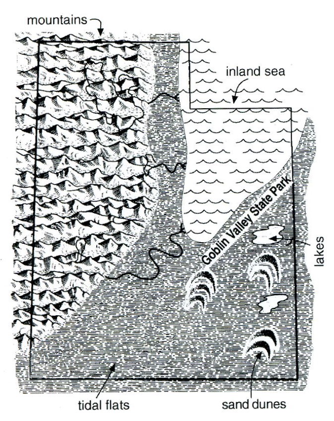
Imaged above, the Entrada sandstone from which the hoodoos developed was deposited in the Jurassic period around 170 million years ago. Much of eastern Utah was a dry Sahara-like desert, but shallow seas intermittently covered what is now the area of Goblin Valley State Park. Northwestern Utah consisted of granitic highlands. The silts, sands, and clays that comprise the rocks now exposed in Goblin Valley State Park were formed primarily from erosional debris shed from these highlands and redeposited in seas, on shorelines, in river channels, and on playas.
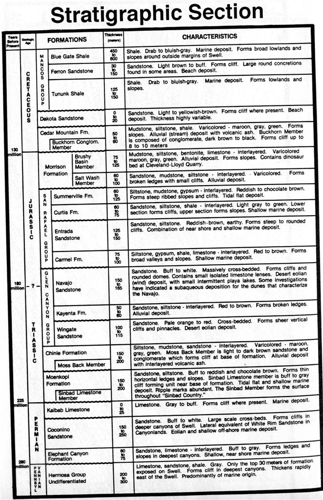
Fracture patterns within the Entrada sandstone beds created initial zones of weakness. The unweathered joints intersected to form sharp edges and corners with greater surface-area-to-volume ratios than the faces. As a result, the edges and corners weathered more quickly, producing the spherical-shaped ‘goblins’.
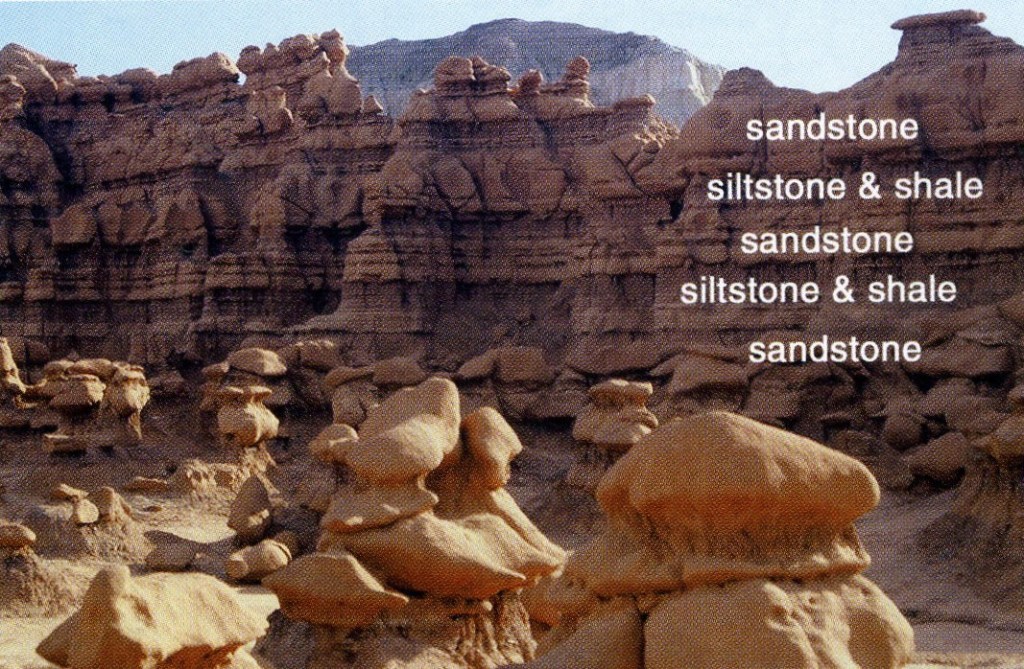
Above the Entrada lies the greenish-grey Curtis Formation, which is overlain by the Summerville and Morrison Formations, respectively. Ripple marks in the Curtis formation in the park record fluctuations in sea level and wave activity on that ancient ocean’s beaches. In later Jurassic time, the sea fully retreated. River systems replaced it and continued deposition. Ultimately erosion, spurred by the Colorado Plateau’s uplift 10 m.y.o. excavated the valley to what we see today.
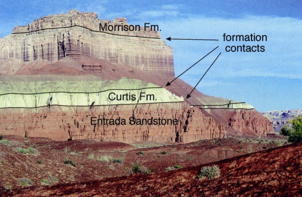
Pictured above, the Summerville formation, the chocolate-to bone-colored unit second from the top, formed in a tidal flat after the inland sea retreated. Numerous white gypsum veins in the Summerville probably resulted from periodic evaporation in these tidal flats or in ponded seawater. The Morrison formation, the youngest layer, is visible only at the very top of Wild Horse Butte, (pictured above). This formation developed as the river systems that dominated late Jurassic time here deposited a conglomerate of silt, clay, sand, and gravel on the floodplain.
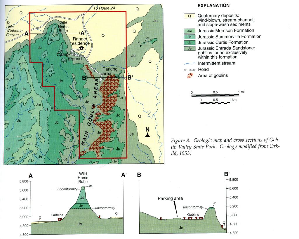
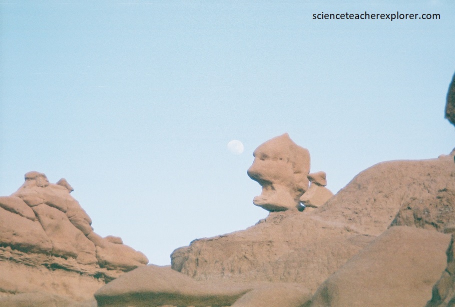
Pictured below, the interbedded and underlying shale and siltstone beds of the Entrada Formation are less resistant to weathering and erosion than the sandstone beds that form the goblin bodies. Combined with spheroidal weathering of the sandstone beds, these softer shale and siltstone beds give the goblins their often elongated shapes, flat bottoms, stacked appearance, and the pedestals upon which they are displayed.
While we were there, Goblin Valley was prominently filming the movie “Galaxy Quest” (1999) as an alien planet. The eroded sandstone dunes in the valley inspired the design of the fictional planet’s rock monsters. We hung-out and watched the film-crew do their work.
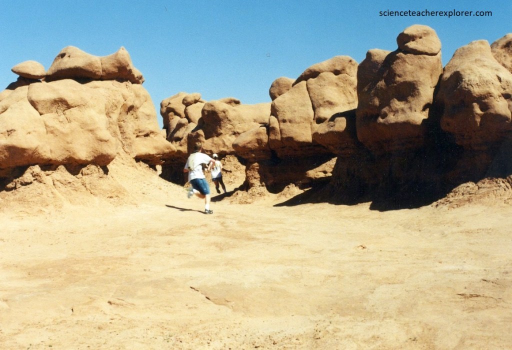
My students and advisors wandered through the labyrinth of rock creatures, and felt the bizarre, ominous vibes of the goblins.
Animals and plants are scarce in Goblin Valley because of the lack of water and food. The valley floor was comprised of bedrock. Because of a deficiency of soil and vegetation, water is not absorbed into the ground and rainfall results in flash flooding.
The goblin valley was first discovered by cowboys but its significant discovery was in the 1920s by Arthur Chaffin. In 1949, Chaffin returned to explore the spectacular location and named it Mushroom Valley. The area was claimed by the state of Utah, and officially named a state park on August 24, 1964.
Goblin Valley State Park has three valleys to walk through simply named Valley 1, Valley 2 and Valley 3. Visitors are free to roam the area as they want. Valley 1, closest to where one enters, contains a small sampling of modest sized goblins. Valley 2 boasts taller examples and a much more narrow canyon giving a completely different perspective. Finally, Valley 3 is the furthest valley often making it the least visited and perfect for those seeking seclusion.
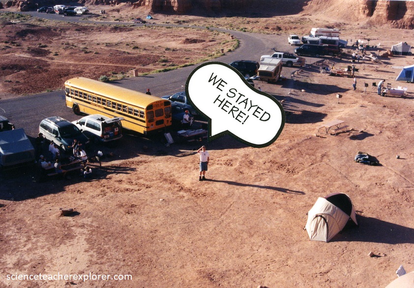
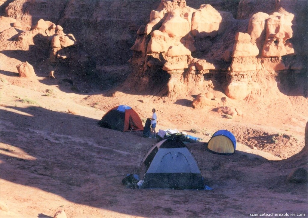
Pictured below, there was a very nice campground less than a kilometer from the main observation area that consisted of a group site that could accommodate 35 people.
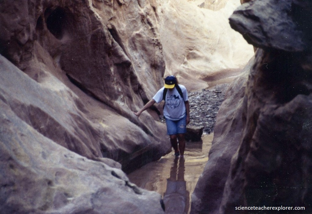
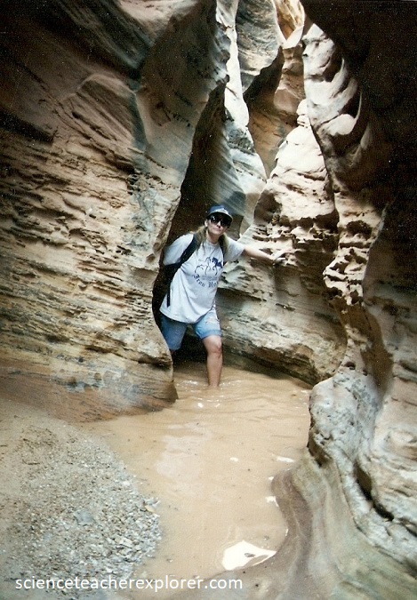
Because it is just 8 km from the popular Goblin Valley State Park, is easily explored, and has narrow passages as fine as any other Southwest slot, Little Wild Horse Canyon is an absolute must for a side trip. It only took 2 hours of our time to thoroughly explore it, (pictured below).
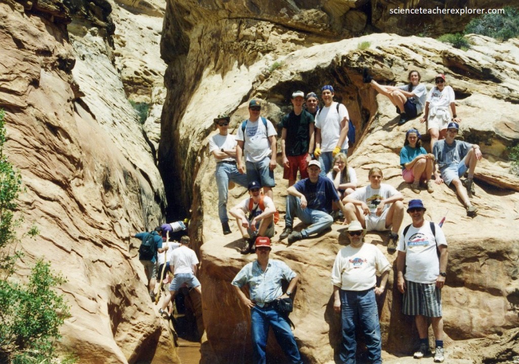
The usual plan in 1999 and 2007 was to combine a trek with neighboring “Bell Canyon” – this is an 13 km loop that in addition to the two narrow gorges also passes high, colorful cliffs and much interesting exposed, eroded rock.
The surrounding landscape has seemingly endless layered, eroded rocks of every color – mainly shades of green, grey, purple, green and white.
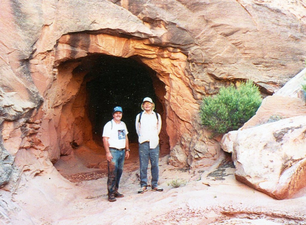
Behind the “Little Wild Hors Slot Canyon” (west), the canyon opens up, revealing a hidden valley behind the reef. Pictured below, on the left of the slot canyon, is an entrance to an old mine. This uranium mine was dug into stream-deposited sandstone and conglomerate in the Moss Back Member of the Chinle Formation. During the 1950s, the Colorado Plateau was a hotbed of exploration for uranium, spurred in part by government guarantees for the discovery of weapons-grade uranium ore. The bulk of the uranium was found in the ancient streambed sand and gravel of the Chinle and Morrison Formations.