Titus Canyon, CA 2015
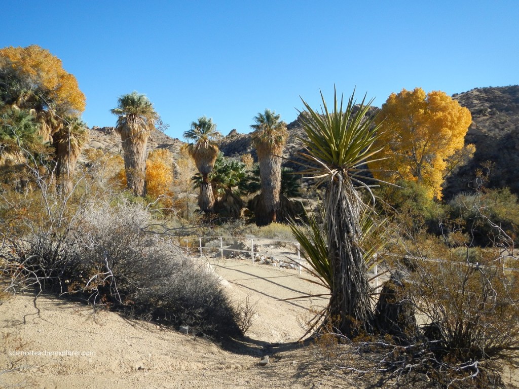
On our way to Indio, California in November of 2015; my wife (Becky) and I took a small side trip on the Titus Canyon Road near Death Valley National Park. So we headed for Beatty, Nevada. On our way we stopped and explored a small desert oasis we found next to the highway near Scotty’s Junction, (pictured below).
Once Becky and I left Beatty, Nevada towards the Titus Canyon Road, a few kilometers away, we had the opportunity to explore the Rhyolite Ghost-town.
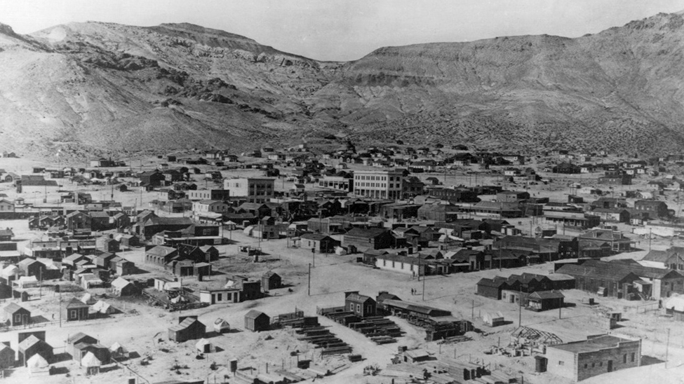
Rhyolite sprung to life overnight. This community quickly became the epicenter of the Bullfrog Mining District in the early 1900s, and aside from a swelling population, it boasted 50 saloons, 35 gambling tables, 19 lodging houses, 16 restaurants, several barbers, and a public bath house. To add to an already growing population, a hard-to-imagine FOUR daily stagecoaches connected “The World’s Greatest Gold Camp” to Rhyolite, ushering in a steady flow of people to Nevada’s newest gold discovery.
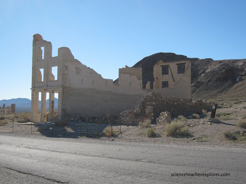
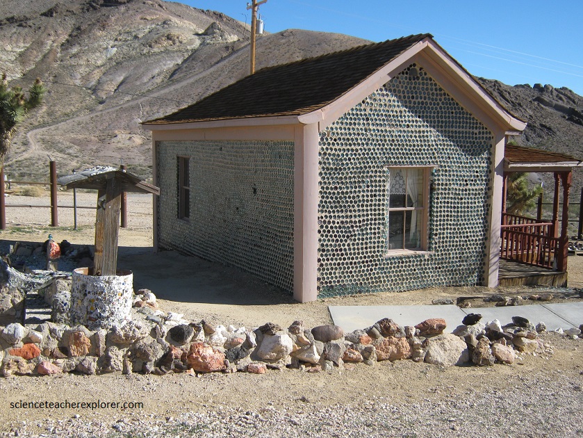
While Rhyolite and the Bullfrog Mining District produced more than $1 million within three short years [about $27 million by today’s standards,] this boomtown declined almost as rapidly as it came to life. Like most other has-been mining communities, the high-grade ore began to diminish in 1906 and completely disbanded by 1910. One of the attractions in Rhyolite is the restored “Tom Kelly Bottle House” pictured below. Restored for a Paramount Pictures film in 1926, the house still stands today and is the oldest and largest known bottle house in the United States.
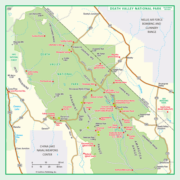
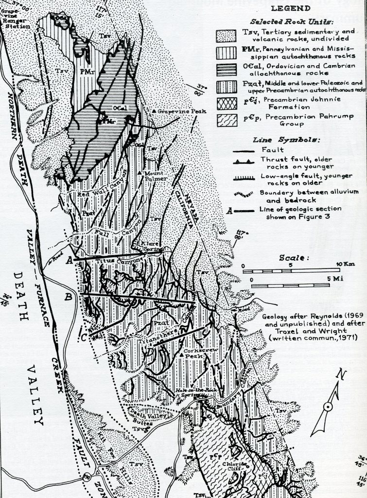
Titus Canyon Road is a one-way dirt road. The road starts outside the National Park on Daylight Pass Road near Beatty, Nevada. Running west into the park, the road climbs over two high points in the Grapevine Mountains (including Red Pass at 5,240 ft elevation), drops past the ghost town of Leadfield, and finally descends through the narrow and sinuous canyon for which the road is famous. Finally, the road descends onto the alluvial fan to Scotty’s Castle Road that leads to Furnace Creek in Death Valley National Park.
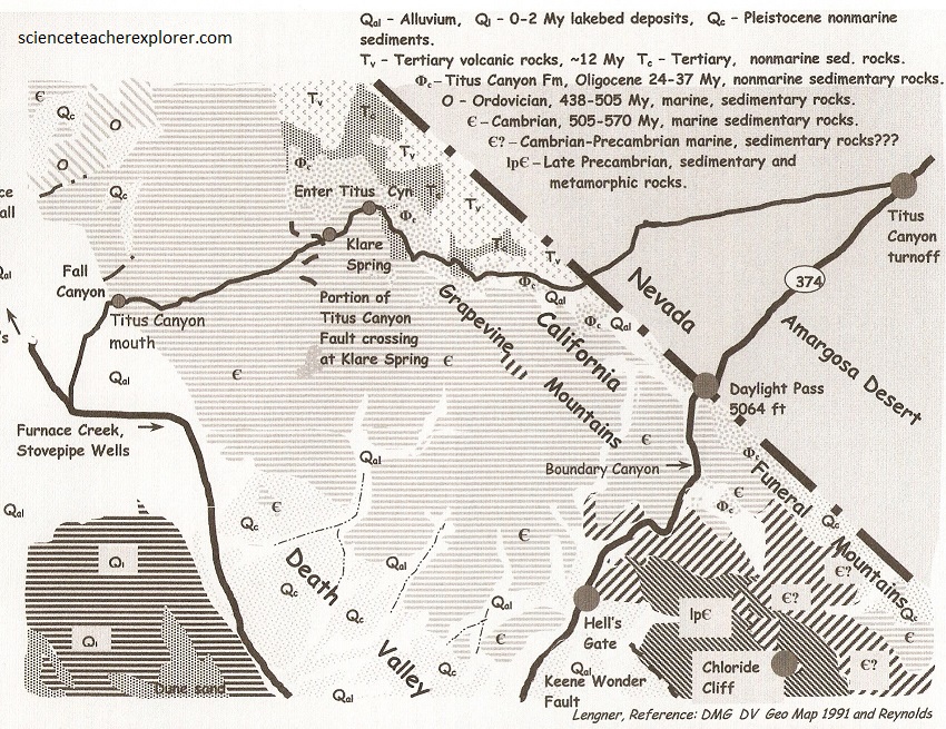
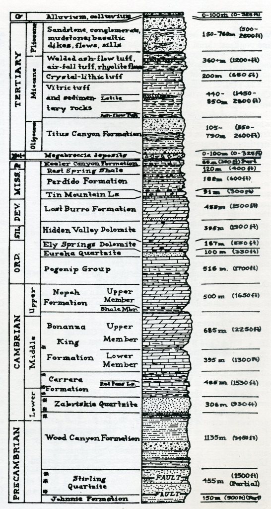
This one-way road took us across the Grapevine Mountains, beginning in the upper reaches of the Amargosa Valley near Rhyolite, and ending in Death Valley. Both the geology and scenery were spectacular. The trip began in Upper Tertiary volcanic rock, descends through the Oligocene Titus Canyon formation, and continues down through Paleozoic strata. The Paleozoic strata are deformed into a mountain-scale overturned folds, so the lower reaches of the canyon within overturned rock.
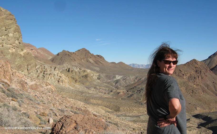
In the above photo, the nearby light and dark multicolored peaks and hills are underlain by Tertiary volcanic rocks, whereas the craggy peaks behind them consist of Paleozoic sedimentary rocks. Of these, the red-colored peaks are part of the Cambrian Zabriskie Quartzite. The volcanic rocks consist predominantly of felsic lava flows and welded tuffs that are about 22-20 million years old.
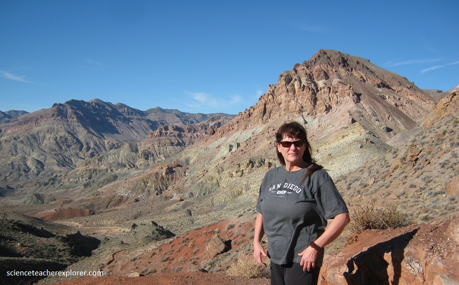
Pictured above, the lower Paleozoic rock stratigraphy becomes evident, and subdued topography in between is underlain by the Oligocene Titus Canyon Formation. The Titus Canyon Formation consists mainly of green-colored conglomerate, sandstone, and red and green shale deposited in river and lake environments. This was also the formation that Donald Curry found the Titanothere skull in the 1930s and giving this formation it’s name.
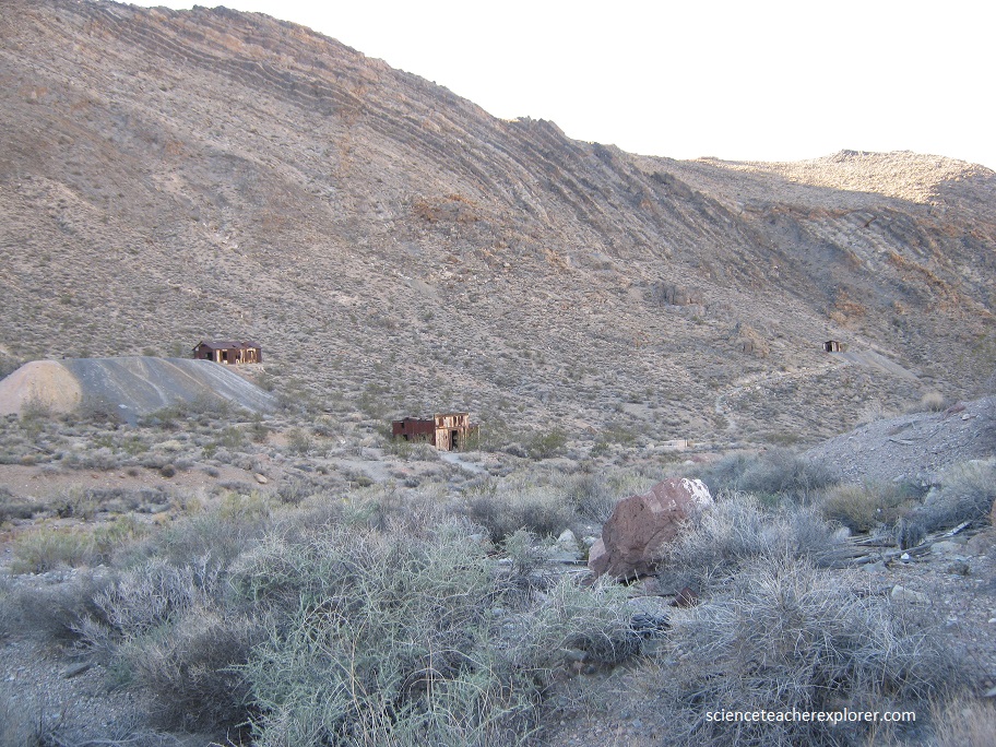
Pictured above, Leadfield marks the site of a large, but low grade body of lead ore that was promoted on the Los Angeles stock exchange in 1927 as a high grade body, accompanied by exorbitant and sometimes fraudulent claims of it’s value. No lead was actually produced from the mine, but many investors lost a great deal of money. Behind the buildings, the Bonanza King Formation dips steeply eastward. It is faulted against the less steeply dipping Titus Canyon Formation.
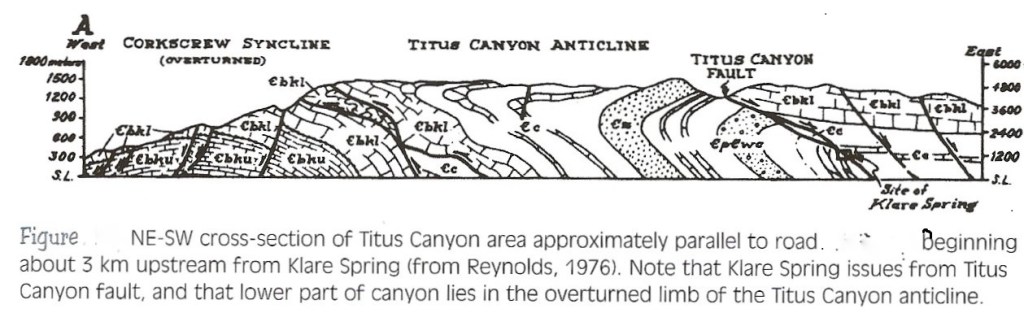
A few kilometers west of Leadfield is Klare Spring. Klare Spring issues from the Titus Canyon fault, a low-angle normal fault that dominates much of the structural geology of Titus Canyon. In general, the fault places the Cambrian Bonanza King formation above the fault against older rocks below the fault. After crossing the Titus Canyon Anticline, the road enters an antiformal syncline and synformal anticline. The rocks here are in the overturned limb of the much larger Titus Canyon Anticline. These folds are upside down. Therefore, the antiform is actually a syncline and the synform is an anticline, imaged above.
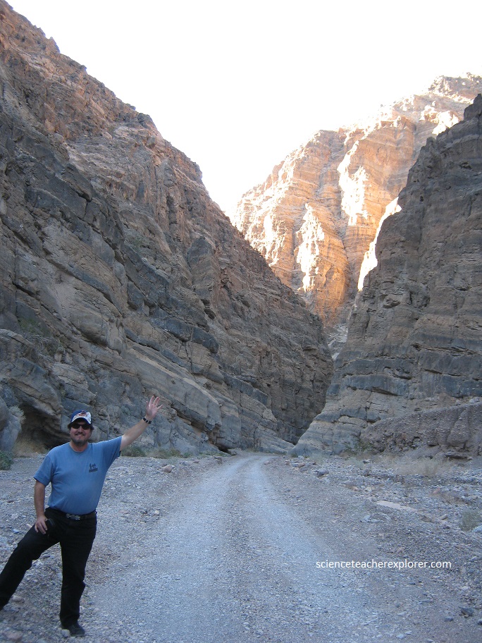
Pictured below, the road enters the narrows of Titus Canyon. I’m standing next to the complex folding of the Bonanza King Formation.
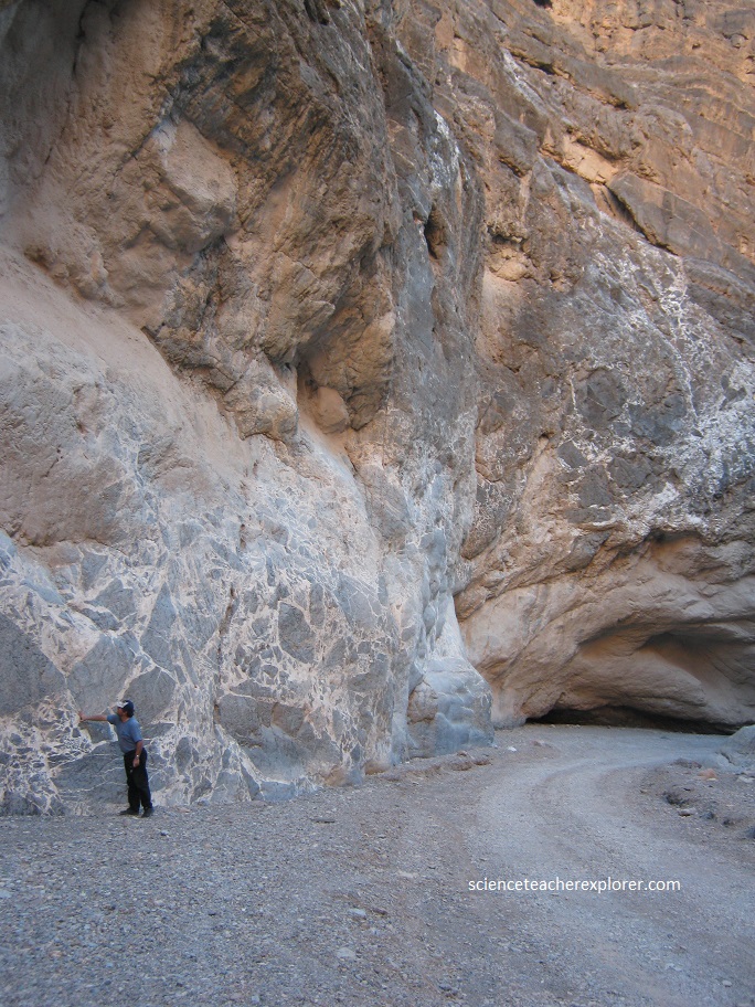
Pictured below, I’m standing next to a mosaic-wall of broken limestone blocks re-cemented with white calcite. Many of the blocks do not touch each other, but appear to be floating in the white calcite. It is therefore likely that the fracturing and calcite mineralization occurred in many stages, each of which gradually separated individual blocks. The breccia is probably not a product of faulting, however, because there are no obvious faults here. Instead, it may be related to progressive fracturing and calcite mineralization during late stages of folding.
Intersection of Titus Canyon road with main highway is a steep berm, which is a fault scarp on the Northern Death Valley Fault Zone.
