Calf Creek Falls, Utah
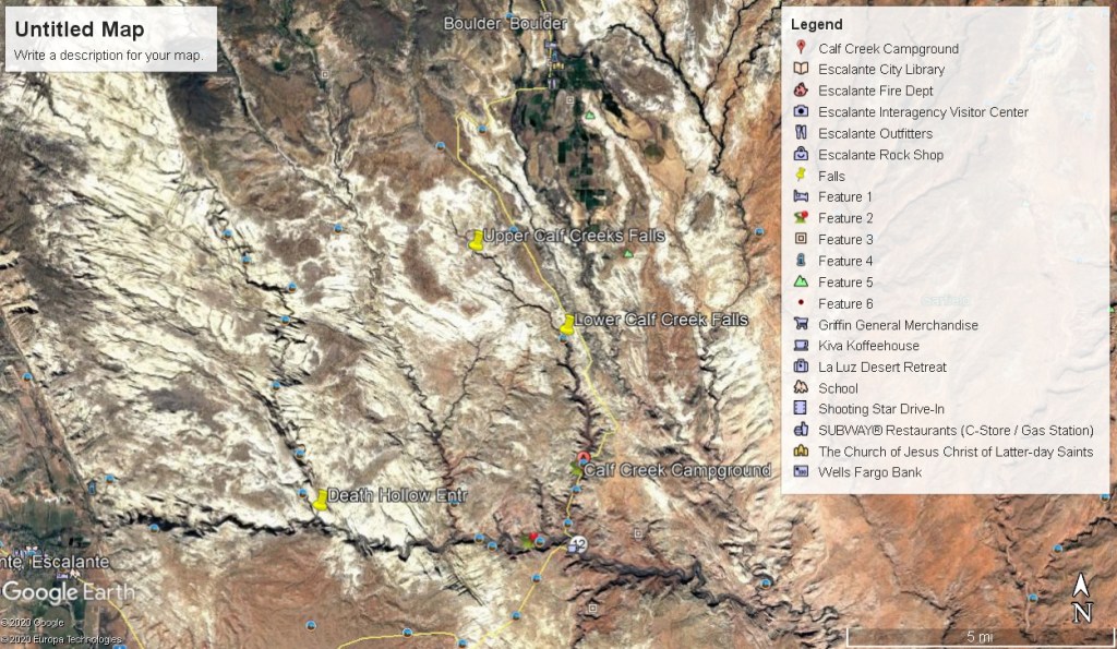
I’ve been to the Calf Creek Falls many times, but in June of 2010 I took a small group there to specifically educate them to the Geology of it. The Calf Creek Falls lie within a drainage next to Hwy 12 (between Escalante and Boulder) in Utah.
The section of Hwy 12, between the towns of Escalante and Boulder is considered one of the most scenic stretches of highway in the United States.
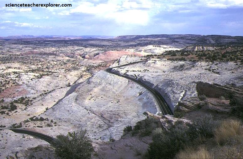
Just before the town of Boulder, the road’s famous “hogback” passes precariously over a razor-thin section of slickrock (the Southwestern term for large swaths of sandstone). The terrain drops steeply down each side of the road, providing vistas of the canyons and cottonwood-lined creeks below. One of these creeks (on the west-side of the Highway), Calf Creek, has carved a deep canyon in the Navajo Sandstone (white) and Kayenta (red) Formation.
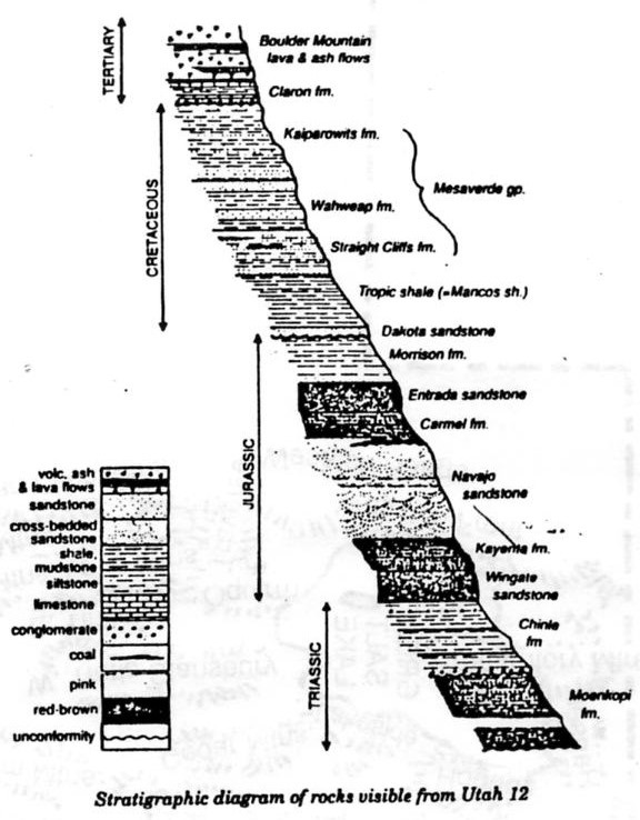
The Navajo Sandstone in this area frequently occurs as spectacular cliffs, cuestas, domes, and bluffs rising from the desert floor. It can be distinguished from adjacent Jurassic sandstones by its white to light pink color, meter-scale cross-bedding, and distinctive rounded weathering. The Navajo Sandstone frequently overlies and inter-fingers with the Kayenta Formation. Together, these formations can result in immense vertical cliffs of up to 670 m. Both are of the early Jurassic age.
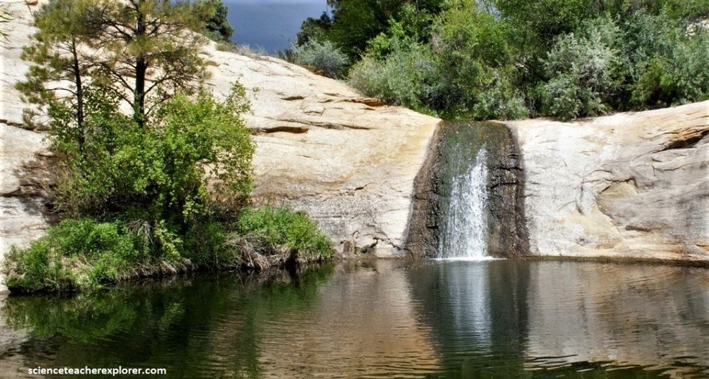
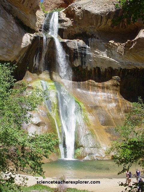
Pictured above, is the Upper Calf-Creek Falls. Finding these falls can be a bit challenging. It is found on an unmarked spur road, located approximately 30 km north of Escalante on Hwy. 12 and approximately 10.7 km southwest of Boulder. The dirt road to the trailhead can be found on the west side of the road between mile markers 80 and 81. The very rough and rocky road leads 0.161 km to the trailhead parking area on the rim of Calf Creek canyon. The trek is off into the canyon below, on slick rock, 1.61 km to the bottom.
Calf Creek, has carved a deep canyon in the Navajo Sandstone and slightly into the Kayenta Formation, creating Lower Calf Creek Falls, one of the most scenic oases in the western United States.
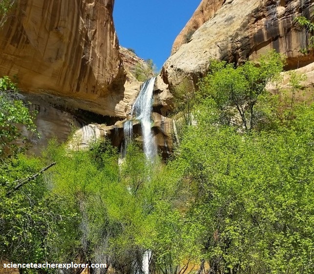
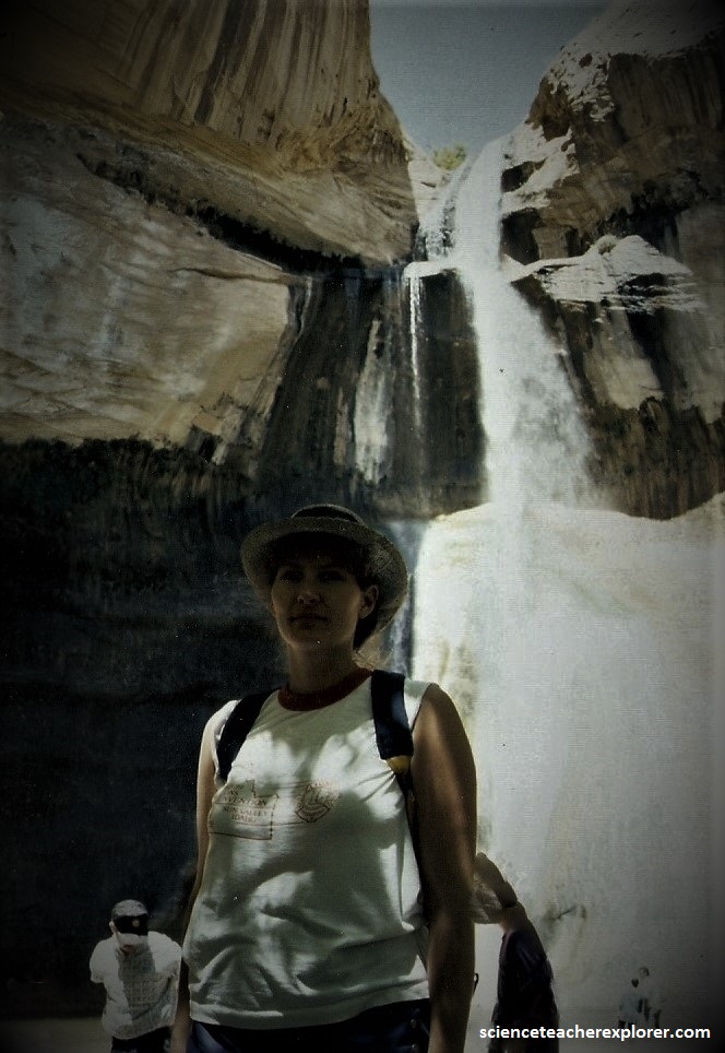
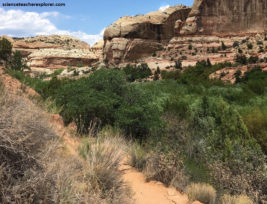
From Calf Creek Recreation Area, you can hike 10 kilometers through the canyon to the 38-meter waterfall, which plunges into a large pool enclosed on three sides by sandstone walls.
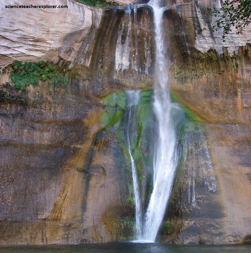
Green algae and hanging gardens on the sandstone walls make for colorful photos, (pictured below).
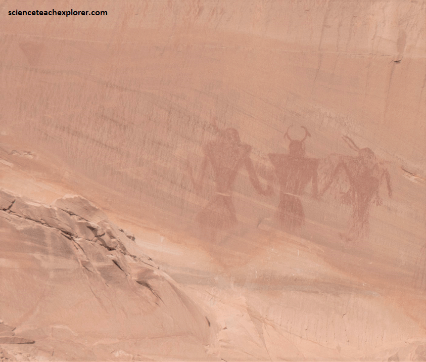
Points of interest along the self-guiding trail towards and away from the falls, include a panel of ancient pictographs high on the sandstone walls across the canyon. At signpost #8 from the trailhead handout, you can look across the canyon at the base of a smooth cliff face streaked with desert varnish. If you look closely (better yet through binoculars), you can see three human-like figures painted in red wearing headdresses and holding hands, (pictured below).
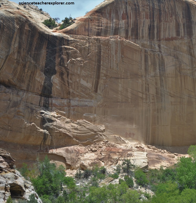
Pictured above and below, these pictographs (which are painted, as compared to petroglyphs, which are pecked) were created by the Fremont people, who lived in this area from about 700 – 1300 AD. The pictographs are about 3 km from the falls.