El Pinacate, MX 2002
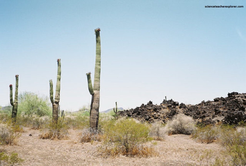
In June of 2002, a trekking buddy, Leory Webb, and I decided to fly to Pheonix, Arizona and drive to Puerto Penasco, Mexico. We were on reconnaissance mission to determine if we could introduce a Scuba Diving Tour to Puerto Penasco. Puerto Penasco is a small city located in the northwest of the Mexican state of Sonora, 100 kilometers (62 mi) from the border (through Lukeville) with the U.S. state of Arizona. It is located on the northern shores of the Sea of Cortez on the small strip of land that joins the Baja California Peninsula with the rest of Mexico. The area is part of the “Altar Desert”, one of the driest and hottest areas of the larger Sonoran Desert, (pictured below).
We spent about a week there. The warm sea surface temperatures of the northern end of the gulf causes Puerto Peñasco to have a much warmer climate than coastal cities on the Pacific both in the Mexican and American Californias. The temperatures of 40 °C (104.0 °F) were very common and even the nights were hot and muggy due to the warm-water influence.
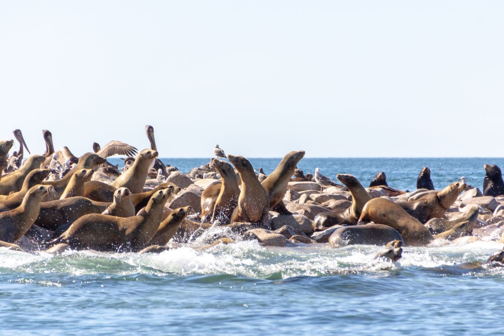
As we explored the city, the only outfit we could find that did any Scuba Diving Tours was a company called “Lobo del Mar”. They took Leory and I out to Isla de San Jorge to scuba with the very friendly sea lions.
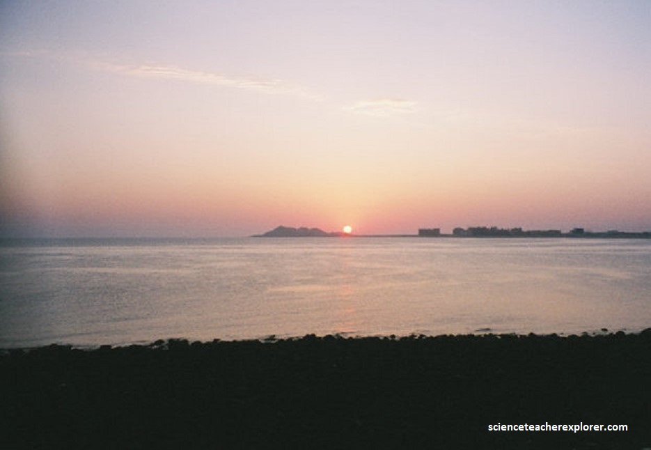
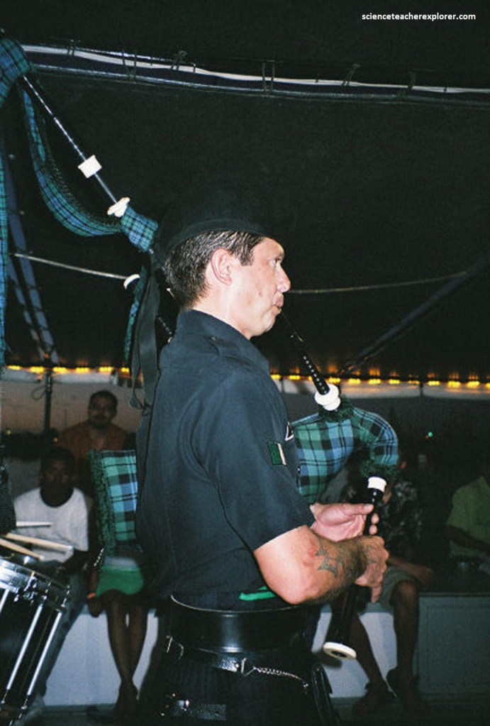
However, the “Lobo del Mar” specialized in a Sunset Cruise with Belly Dancers, (pictured below). After our scuba adventure with the local sea-lions, Leory and I were treated with Scottish-Concert and Belly-Dancing Cruise.
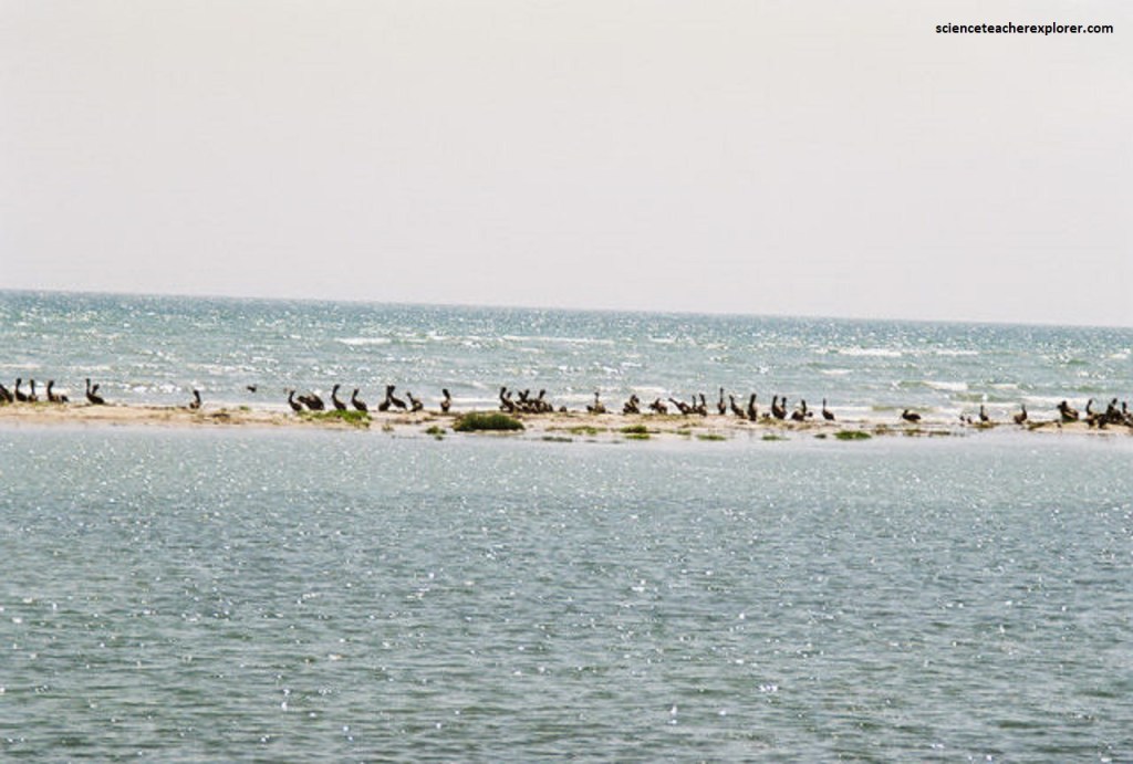
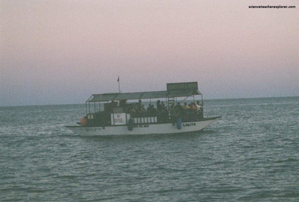
This was a wonderful day-trip to Isla San Jorge, better known as Bird Island. This little island is located 45 km (28 miles) south east of Puerto Penasco and the only way to get there is by this boat, (pictured below).
Isla San Jorge is best known for it’s playful sea lion colony and a huge variety of birds. However, we felt that the cost of the tour was a bit to expensive for an educational-group to book this tour and cruise. However, we enjoyed the cruise while we were there.
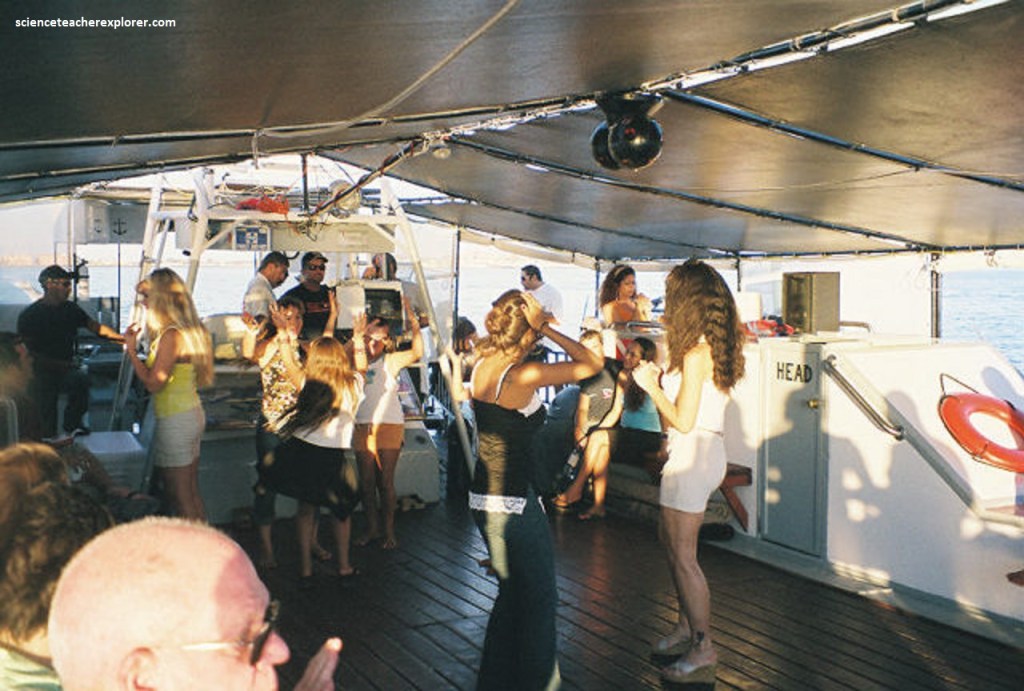
After our scuba-diving adventure, we returned to the shore to drop-off the scuba-gear and then picked up a group of tourists for the Sunset Cruise. Meanwhile, many of the female scuba-diving masters we were with, changed into their Belly-Dancing outfits, (pictured below).

Lobo deo Mar was an all-family band and dance troupe based in Washington State that seemed to have moved to Puerto Penasco to run this business. However, they eventually moved to South Padre Island, Texas after Leory and I were there in 2002.

On our way back to the United States, Leory and I decided to explore the “Biosfera El Pinacarte”, north of Puerto Penasco, Mexico. El Pinacate and Gran Desierto de Altar Biosphere Reserve are located in the Sonoran Desert about 40 minutes north of the city of Puerto Peñasco and the Sea of Cortez.

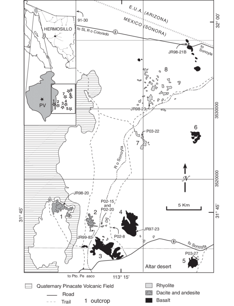
The Pinacate volcanic field comprises a 1,500 km2 area of Pleistocene lava flows with over 400 cinder cones and 8 maars. The volcanoes in the Pinacate are monogenetic, (meaning they erupt only once and each have a unique magmatic signature). The field today is part of El Pinacate and Gran Desierto de Altar Biosphere Reserve and is also a UNESCO World Heritage Site.
The variety of landscapes there, results in extraordinary habitat diversity. The diversity of life forms across many different taxa is notable with many species endemic to the Sonoran Desert or more locally restricted to parts of the Reserve. This subtropical desert ecosystem reportedly hosts more than 540 species of vascular plants, 44 mammals, more than 200 birds, over 40 reptiles, as well as several amphibians and even two endemic species of freshwater fish.
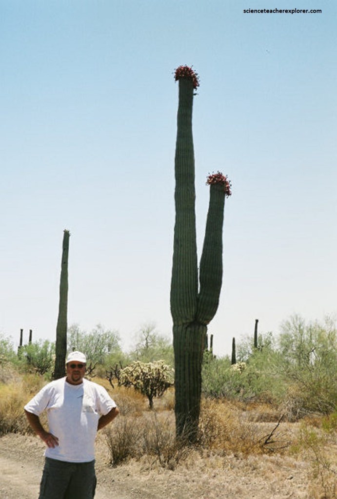
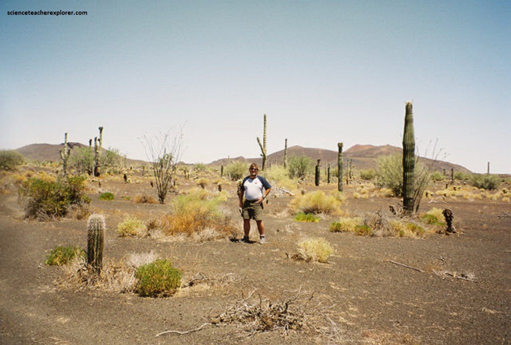
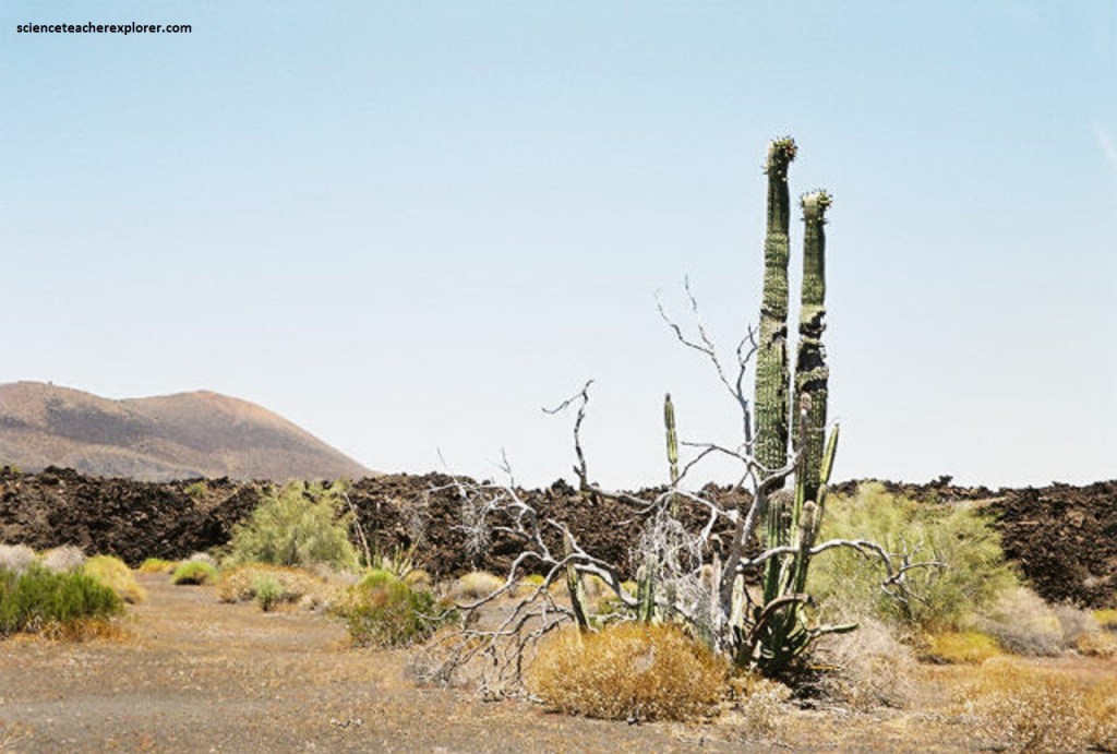
The Saguaro (Carnegiea gigantea ) is a tree-like cactus species that can grow to be over 12 meters (40 feet) tall. It is native to the Sonoran Desert in Arizona and the Mexican state of Sonora. Saguaros have a relatively long lifespan, often exceeding 150 years. They may grow their first side arm around 75–100 years of age, but some never grow any arms. Arms are developed to increase the plant’s reproductive capacity, which leads leads to more flowers and fruit. A saguaro can absorb and store considerable amounts of rainwater, visibly expanding in the process, while slowly using the stored water as needed. This characteristic enables the saguaro to survive during periods of drought. A saguaro without arms is called a “spear”.
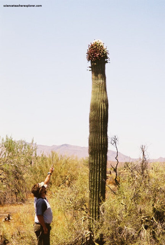
Pictured above, the white, waxy flowers on a Saguaro Cactus appear in April through June, opening well after sunset and closing in midafternoon. They continue to produce nectar after sunrise. Flowers grow 8.6–12.4 cm (3.4–4.9 in) long, and are open for less than 24 hours. Since they form only at the top of the plant and the tips of branches, saguaros growing numerous branches is reproductively advantageous. The ruby red fruits are 6 to 9 cm (2 to 3 in) long and ripen in June, (while we were there) each containing around 2,000 seeds, plus sweet, fleshy connective tissue.
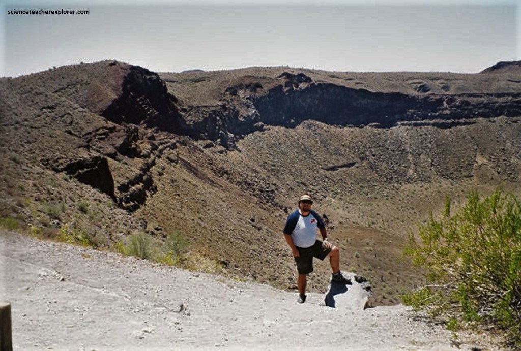
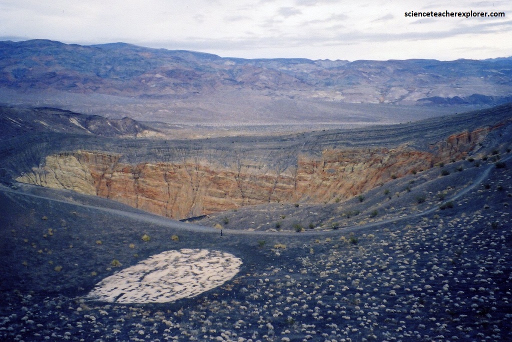
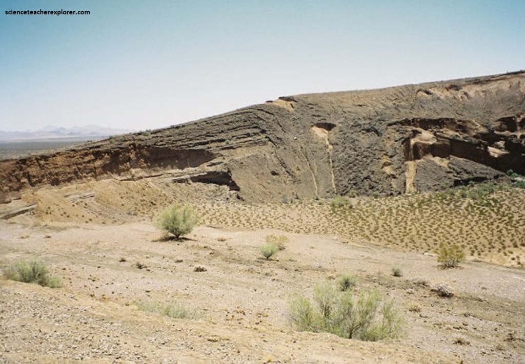
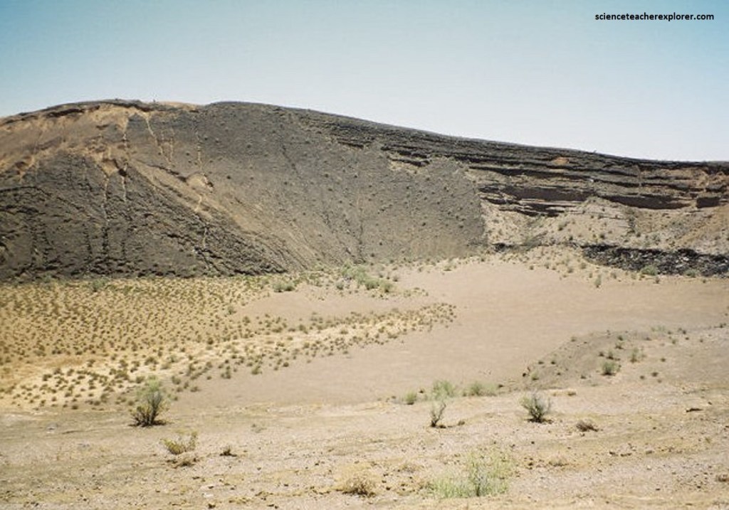
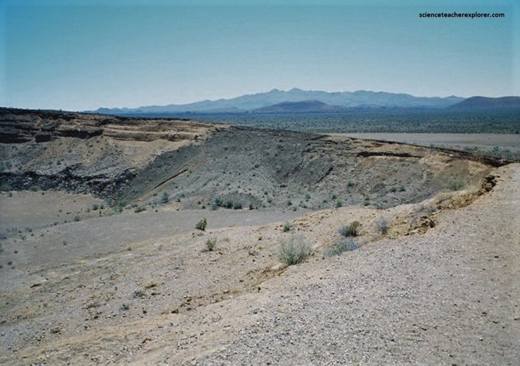
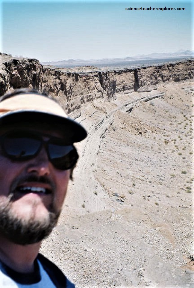
The eastern portion of the El Pinacate volcanic field, (which was accessible by our vehicle), contained the youngest cones and was mantled by an extensive tephra deposit. One of the most impressive features on our route was a large maar caldera, Crater Elegante, formed 32 thousand years ago in an explosive eruption when groundwater interacted with magma, (pictured above and below). The crater is 1,609m wide by 244m deep.
The caldera measures nearly a mile in diameter and is the largest maar in the field. The most visually striking feature in the area is the concentration of a total of 9 additional enormous, deep and almost perfectly circular Maar (steam blast) craters, believed to originate from a combination of eruptions and collapses, (like the Crater-Elegante).
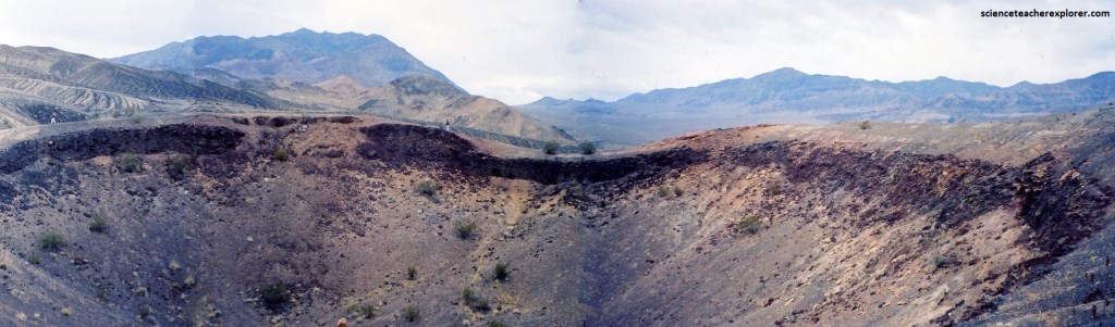
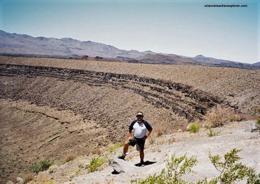
This geographical area is visually outstanding through the stark contrast of a dark-colored zone comprised of a volcanic shield and spectacular craters and lava flows within an immense sea of sand-dunes.
The Pinacate Shield, culminating in the Sierra del Pinacate, first erupted 15-12 million years ago and again 10-1.5mya. Lava last flowed 13,000 years ago but the present shield volcano, (Crater Elegante), is dormant.
Pictured above, it rises gently from a pavement of Tertiary and Quaternary sediments and was formed by the gradual extrusion of fluid basalt lavas from fissures in the rock, the lava running up to 20 km from the source and covering some 228,000 ha with thick flows of black and red alkaline vesicular basaltic lava.
Pictured below, most of the plants have developed adaptations to the extreme conditions, including extremely long seed dormancy, a perennial habit which adapts to arid conditions where rainfall is usually uncertain, and small leaves to prevent water loss through evaporation; others retain their energy-producing chlorophyll in bark or leaves, which develop only when conditions are optimal. Four plants in the site have special federal protection: Acuna cactus Echinomastus erectocentrus acunensis (nationally endangered), barrel cactus Ferocactus cylindraceus, desert ironwood and night blooming cereus Peniocereus greggii.
Pictured above, the rolling sandy plain is punctuated by many small volcanic eruptive forms: over 400 cinder and ash cones, the result of lesser explosions of gas and pyroclastic debris, domed mounds of ejecta, cindery debris and by ten huge quite circular maar craters (including the Crater Elegante) formed by the explosion of steam from underground water superheated by rising magma, with ensuing implosion of the core.
These were the most notable features of the El Pinacate and Gran Desierto de Altar Biosphere Reserve. They were typically wide, shallow, almost perfect circles ringed by a rim of tuff formed of light material ejected as the center collapsed. The floors were mostly flat, often with a grove of dryland trees growing on the dry lake bed (playa) in the center.
Pictured above, the Cerro Colorado tuff cone is one of the most prominent features of the Pinacate volcanic field. This oblique view from the northwest shows the 1-km-wide crater with its high point on the south rim, (pictured below).
Pictured above, the tuff beds at Cerro Colorado dip inward up to 20-25 degrees at the south rim, much more steeply than at the low-rimmed Crater Elegante. Cerro Colorado’s crater was formed during several episodes of phreatomagmatic eruptions from multiple vents, during which portions of the tuff cone slumped into the crater.
Cerro Colorado Crater, a prominent landmark at Pinacate, Sonora, Mexico, has a minimum age of about 150 years, as determined from physiographic evidence; a geologic age not greater than that of the most recent ash falls at Pinacate; and an archaeological age probably not exceeding 1000 years, as indicated by pottery shards included in these ash beds.
El Pinacate and Gran Desierto de Altar Biosphere Reserve is relatively undisturbed and has an outstandingly high level of physical integrity to a greater extent related to its harsh environment.
