Head of Sinbad, UT 2010
In May of 2010, I lead an educational group to view the “Rock Art” and Geology of the San Rafael Swell along I-70. The San Rafael Swell is located due south of Price, Utah, and southeast of Castle Valley, Utah. It’s northeast of Capitol Reef National Park, west of Green River, Utah. Interstate Highway 70 runs right through the middle of the Swell, which provides the single best access route to the heart of the uplift.
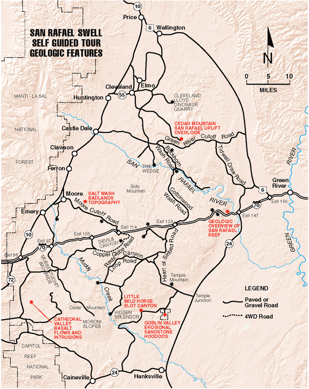
The San Rafael Swell is an egg-shaped anticline or uplift measuring about 125 kms by 65 kms, which runs roughly north-northeast to south-south west. The land is dry and has scant vegetation, therefore the rocks and /or geology are exposed.
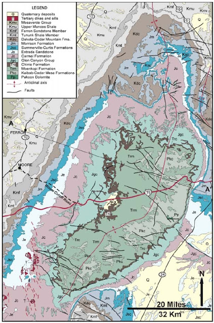
Pictured above, throughout millions of years, uplift and erosion (which occurred simultaneously), have created rings of cliffs around the Swell, with oldest rocks exposed in the center, the younger rocks on the outer edges of the structure.
Imaged above, the eastern border of the Swell is referred to as “The Reef”, where the strata have been folded into a nearly vertical position and forms an almost impenetrable topographic barrier. The folding of this strata resulted from movement along an ancient deep-seated vertical fault in Precambrian rocks. This caused the younger overlying rocks to drape over the fault zone as the western fault block was uplifted. Strata on the other three margins of the Swell have been folded much less severely, resulting in the formation of an asymmetric anticline.
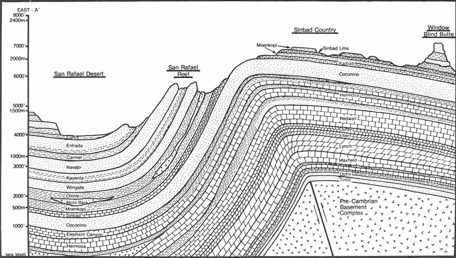
One of the more prominent features of the San Rafael Swell is the Reef, which is made up mostly of the Navajo, Kayenta and Wingate Sandstone Formations. This forms a huge cliff completely circling the Swell making travel difficult and scenery spectacular (pictured below).
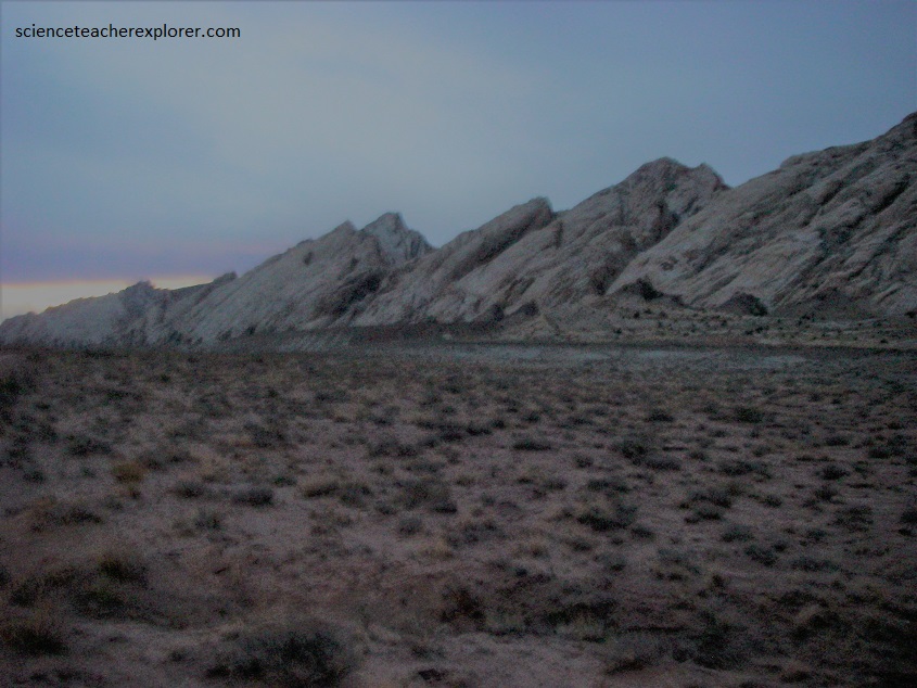
Pictured above and below, its’ these cliffs, (best seen on the eastern side ad just south of I-70), which make this part of Utah so fascinating.
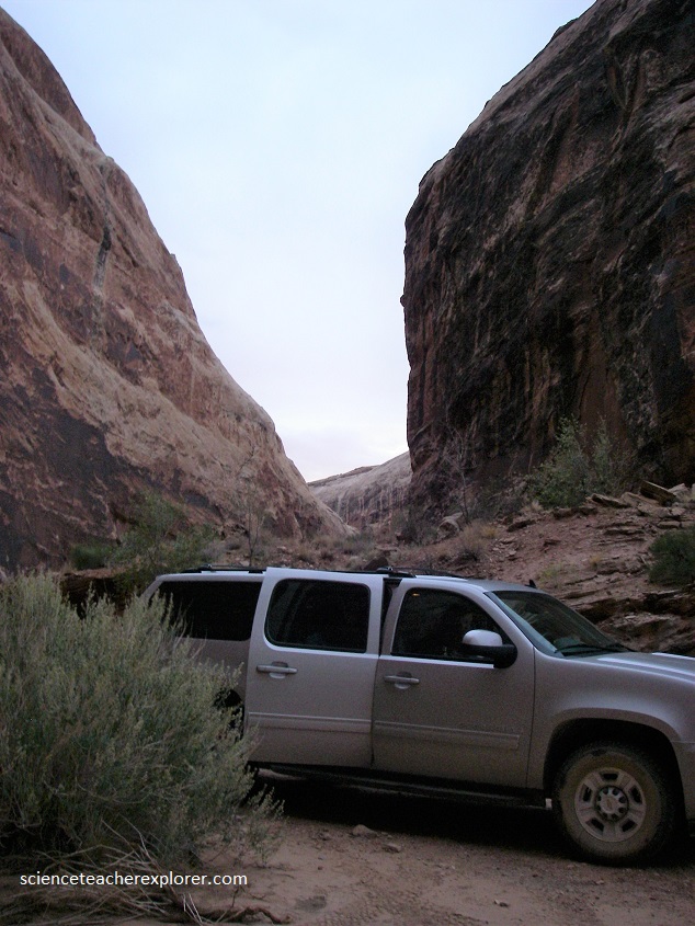
Our first stop on the tour, was to visit the first dry canyon cutting through the San Rafael Reef, three kilometers to the north of I-70. In 4-wheel drive vehicles, we visited the “Black Dragon Canyon”, using the axis roads between mp 144 and mp 145 on I-70. After entering the canyon, the walls of the Navajo Sandstone ledges rise quickly and the canyon becomes more narrow but the vehicles can pass through. After about 2 km up the canyon, we come across the American Native Rock Art that we’re looking for and a parking lot, (pictured below).
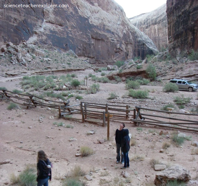
The American Native Rock-Art are found on the right-hand canyon wall, (heading west), underneath an overhang. These are the famous “Black Dragon” Rock Art. Pictured below, they remind me of a string of beads except that short straight lines were used instead of round beads.
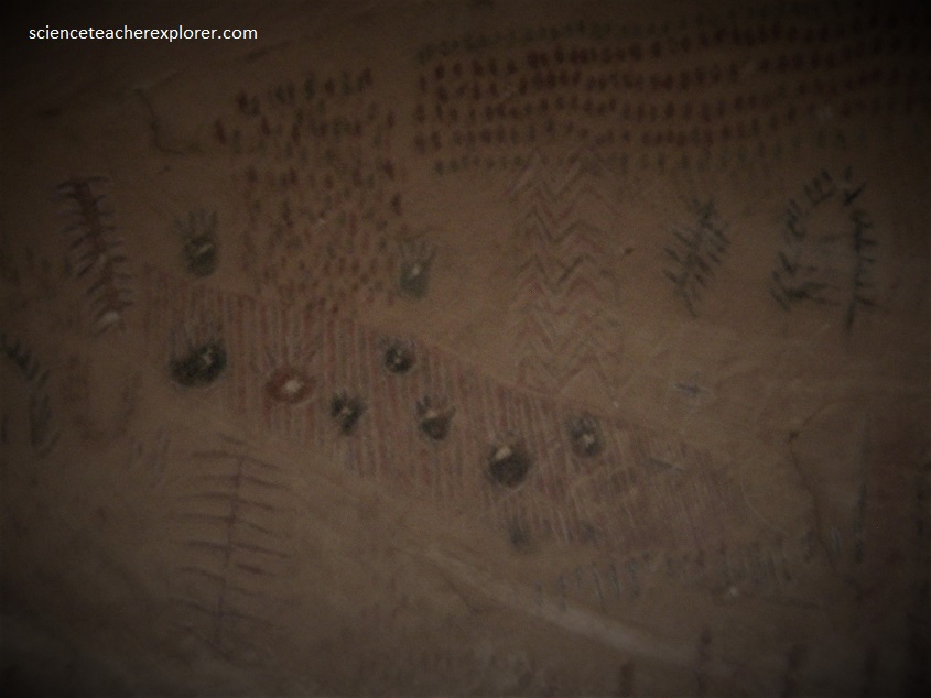
Pictured below, on the left for about 30 meters, the talus is clinging high up on the ledge so we have to look much higher to see a red dragon with wings and the tail of a serpent. He appears to be shooting fire in front of him.
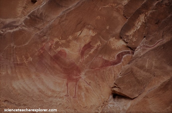
Pictured below, to the left of the dragon, are three strange figures which appear to be 2.6 m tall.
Picture below, the right-hand side of the dragon, is a five-legged Baboon with one of the legs just a stub and a human form.
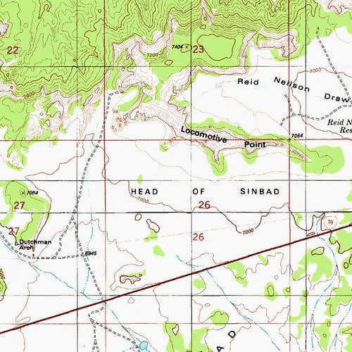
From “Black Dragon Canyon” we went back to I-70 and drove west to Exit 131 (mile marker 131). Getting to our next destination, The “Head of Sinbad”, was quite complicated and confusing. From the cattle guard on the south side of the underpass, we followed the graded dirt road signed U24/Goblin Valley/Temple Mountain, for 6.3 km. We then turned to the right (west) fork for 1.6 km to a tee. Again, we turned right (west) and traveled 2.7 km to another fork. From there we took the right (north) fork for 3.7 km, to a concrete underpass under I-70 and a BLM sign. The BLM sign was located at a major road junction of the San Rafael Swell known as the “Head of Sinbad”. From the BLM sign, we traveled north, under the I-70 freeway, using the concrete underpass.
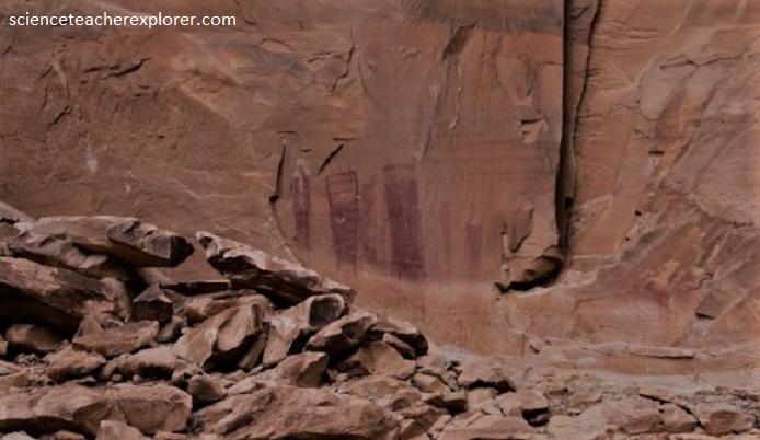
On the North side of I-70 the dirt road forks again. The right fork lead us to the center of a long rock butte known as “Locomotive Point” which was approximately 2.4 km from the underpass. To reach the Head of Sinbad pictographs, we again followed the right fork for 0. 4 km until we reached another tee. Turning right (east) at the tee, we followed the main road. The panels were located near the center, on the south side of Locomotive Point. There were two Barrier Style pictograph panels enclosed inside a log BLM fence, (pictured below).
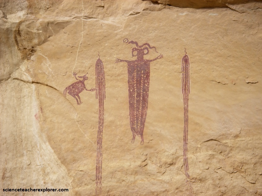
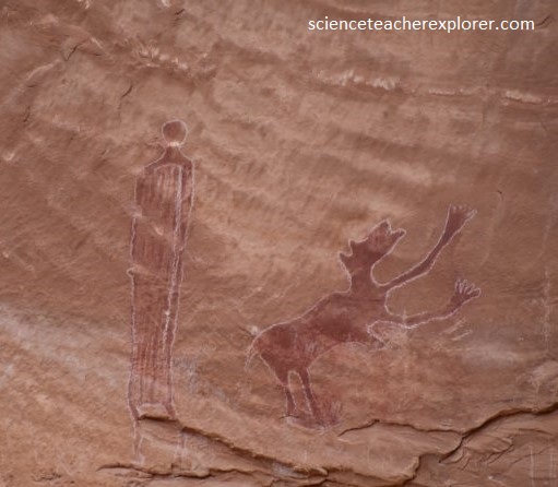
Known as the Head of Sinbad Panel, this “gallery” displays some outstanding examples of Barrier Culture art, and no one knows exactly what all the figures represent. The western panel is the better one, with two distinct groups of figures, (pictured above and below). The eastern panel, unfortunately, has suffered damage, not from humans but rather from a collapse of a piece of the cliff.
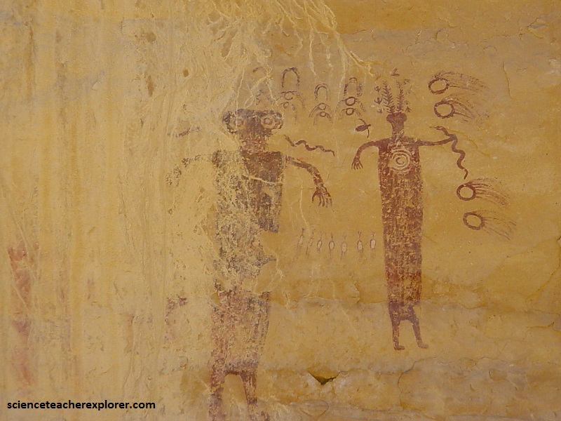
Pictured above, they are also Kachina-type figures – one is holding a snake in its hand and the other has it near its mouth. It appears that their feet are showing movement, perhaps dancing in a ceremony. This panel may be a depiction of a snake dance that is reminiscent of the Hopi Snake Dance, where the members carry handfuls of snakes and even hold them in their mouth. The Hopi believe snakes are their ancestors.
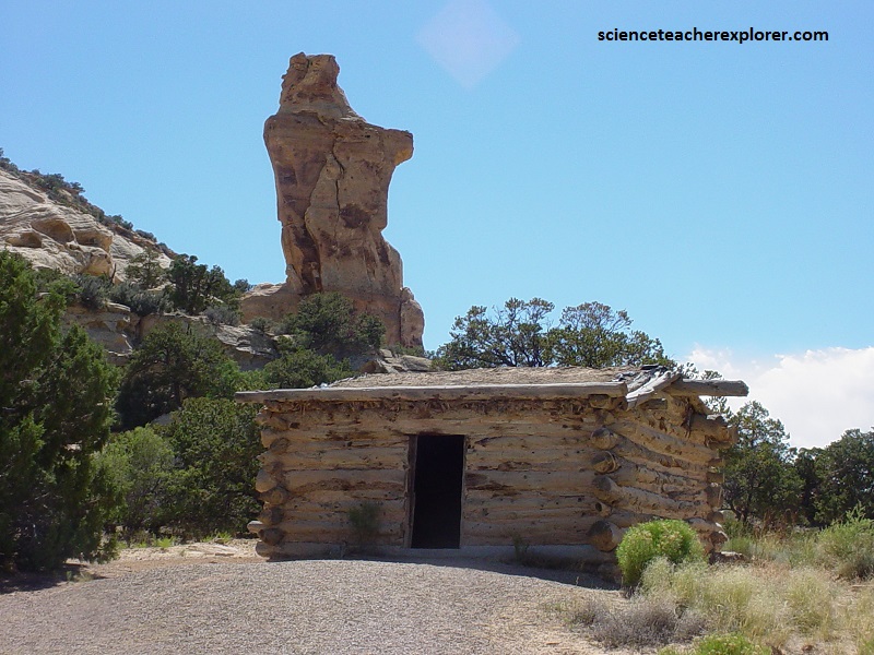
From Locomotive Point, we went back to the underpass and turned south under I-70. Within a few kilometers west of the underpass is Swasey’s Cabin. At the Sinbad location, though evidence suggests the Swasey’s first entered the area in the 1880s and kept cattle in Jackass Corral, which was constructed on 1905. It wasn’t until March, 1921 that the family built the cabin known as the “Cliff Dweller. Up to that time, they had simply camped beneath the overhangs in the nearby cliffs. According to early accounts, the “Cliff Dweller” Cabin was furnished with two bunks with springs, a wood range, chairs and a table. Under the cliffs is a small spring and a cave that kept cool year around to store meat. The cliffs circling to the north, west, and south of the cabin are made of Wingate Sandstone that are level.
