The Chute, Utah 2008
On Memorial Day weekend of 2008, I took a group of students to the San Rafael Swell to trek and explore “The Chute” of Muddy Creek. This trip would be a repeat from 9 years earlier, during May of 1999. I’m covering both trips on this page.
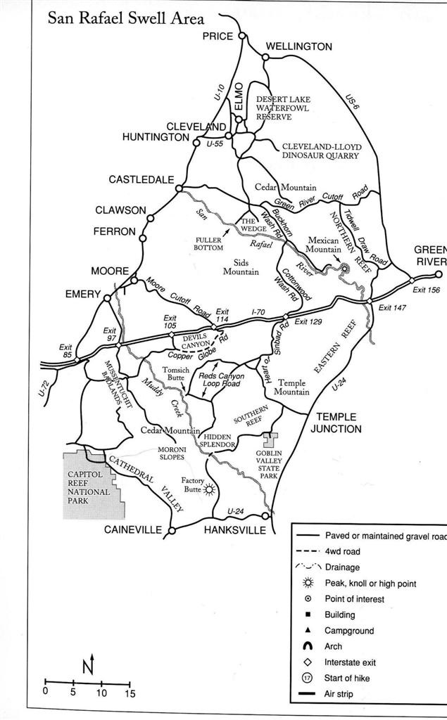
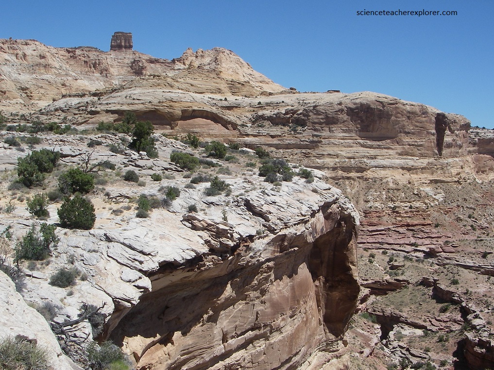
The Chute of Muddy Creek is located in the extreme southern end of the San Rafael Swell. The Chute is found on the inside of the Reef and in between Tomsich Butte and the “Delta or Hidden Splendor Mine”. Imaged above, to get there, leave highway 24 at Temple Junction near mile posts 137. Drive west to Tan Seep and turn southwest. We began the trek near Tomsich Butte, (Tomsich Trailhead) & walked down-canyon towards “The Chute”.
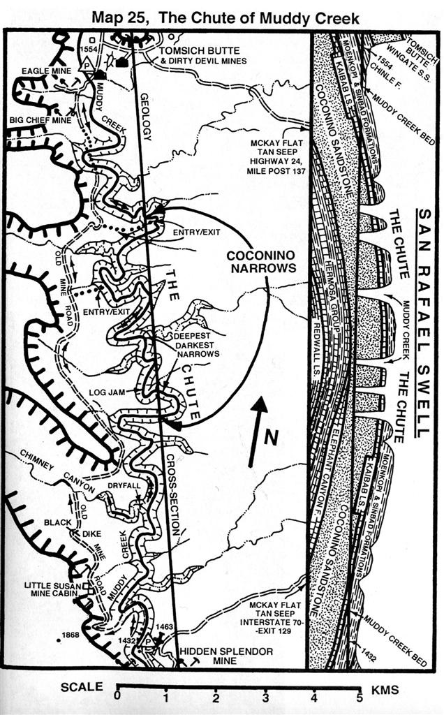
The Chute of Muddy Creek was a non-technical canyoneering adventure. The route was 24 km long and required 10 hours from the Tomsich Butte trailhead to Hidden Splendid Mine trailhead.
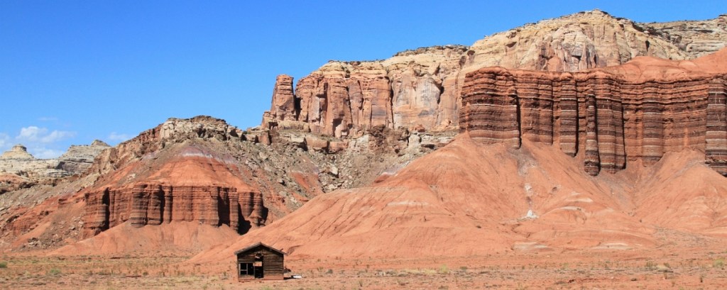
Pictured above, we first visited the Torval Albrecht Cabin, (built in 1976). It is situated in a spectacular valley, below the Moenkopi Cliffs. It is just a few kilometers northwest of the Tomsich Trailhead, (our destination). This area is geologically formed with the oldest rocks within the San Rafael Swell.
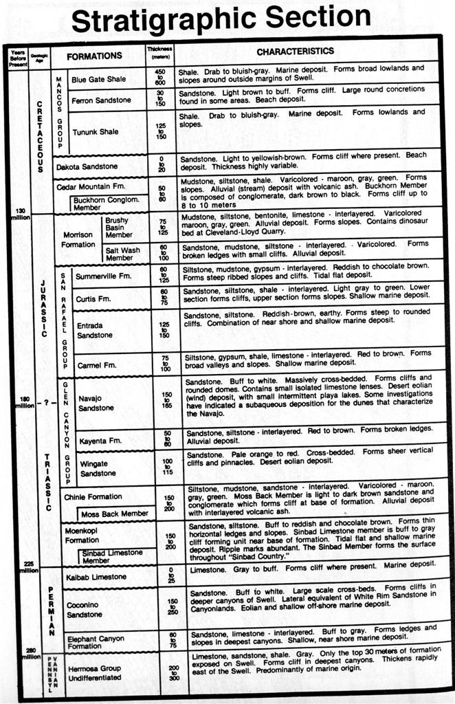
Most of our trek in “The Chute”, occurred within the Permian “Coconino Sandstone”. The Permian time period, (250-225 million years ago) began and ended with deposition of sequences of evaporites (salt and gypsum) in a large structurally isolated section of the Paradox Basin, (a Cordilleran Geosyncline). The salts formed from rapid evaporation of the shallow seawater in the Basin. Seawaters became very salty due to a lack of circulation with waters of the main body of the Cordilleran sea. This was caused by the Emery Uplift, which formed a moderate subaqueous barrier between the two seas. The Coconino sandstone was formed in a eolian and shallow off-shore marine environment.
Pictured above, Hondoo Arch is clearly visible on the canyon rim to the west of above the “Eagle and Big Chief Mines”. The Dirty Devil Mine at Tomsich Butte is located less than 1 km back up the road. the mines all contain numerous and interesting relics left from the Uranium boom of the 1950s. Uranium has been heavily prospected and extensively mined throughout the San Rafael region for some time. Most uranium ores are found on the Swell in the Mossback Member of the Chinle Formation. An example of uranium mining in the Chinle Formation is at the Tomsich Butte trailhead. The abandoned Dirty Devil Uranium mines at Tomsich Butte were started by W.J. Hanret and John Tomsich in 1951. The Mine expanded through 1956 and produced a considerable amount of ore. Sorry, I didn’t get pictures of the mines.
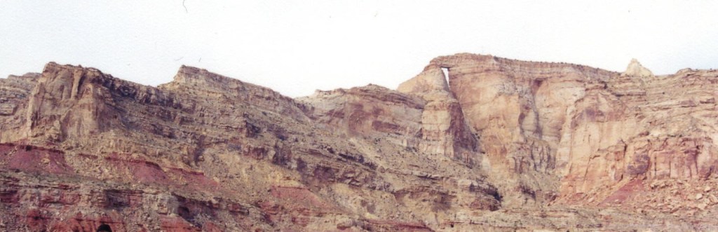
The San Rafael Swell forms a large oval-shaped structural upwarp called an antincline, which is 125 kms long and 65 km wide.
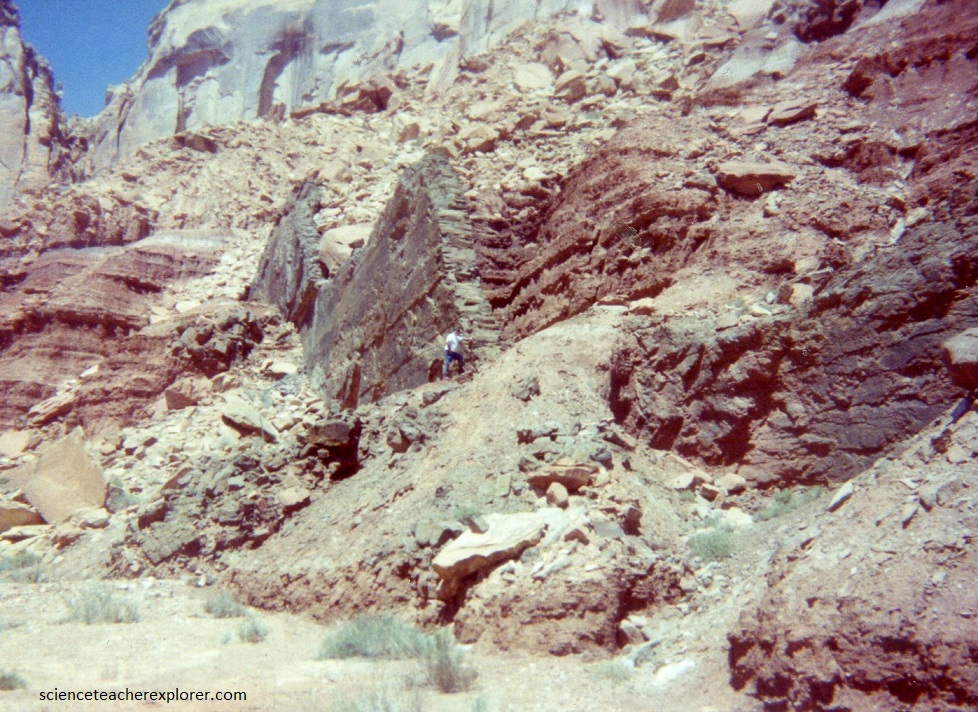
The eastern border of the Swell is referred to as “The Reef”, where the strata have been folded into a nearly vertical position and forms an almost impenetrable barrier, (imaged below).
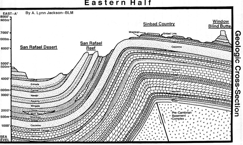
Imaged above, the folding of this strata resulted from movement, (Laramide Orogeny), along an ancient deep-seated vertical fault in Precambrian rocks. This caused the younger overlying rocks to drape over the fault zone as the western fault block was uplifted. Strata on the other three margins of the Swell have been folded much less severely, resulting in the formation of what is referred as an asymmetric anticline. “The Chute of the Muddy River” is found at the crest of the anticline.
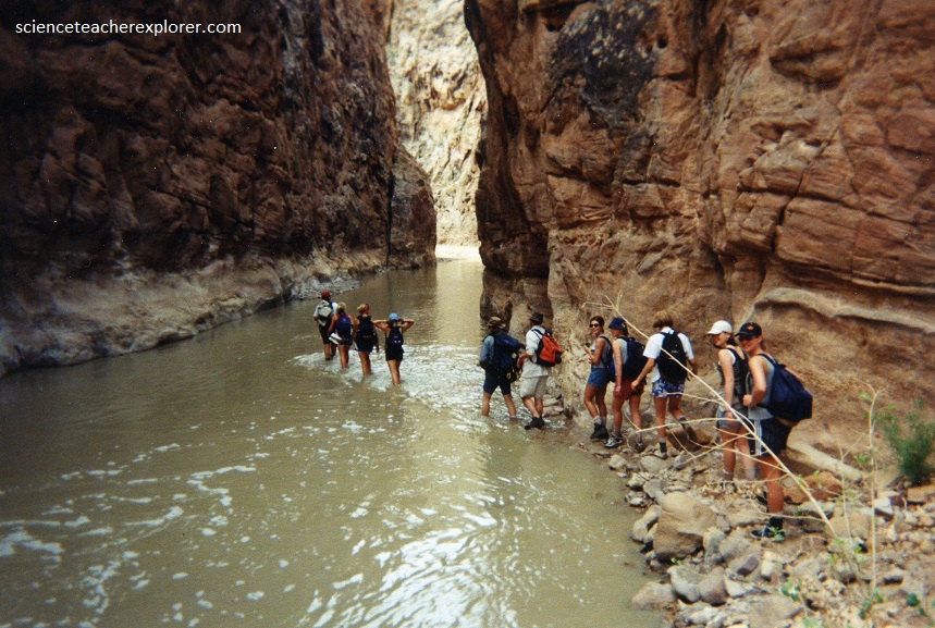
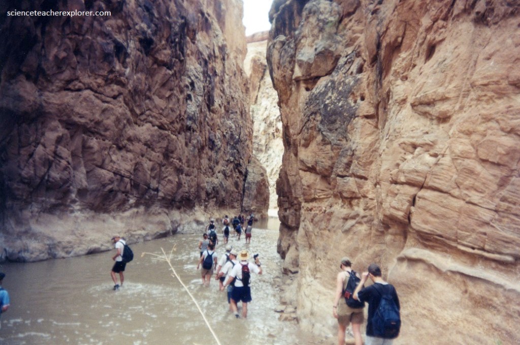
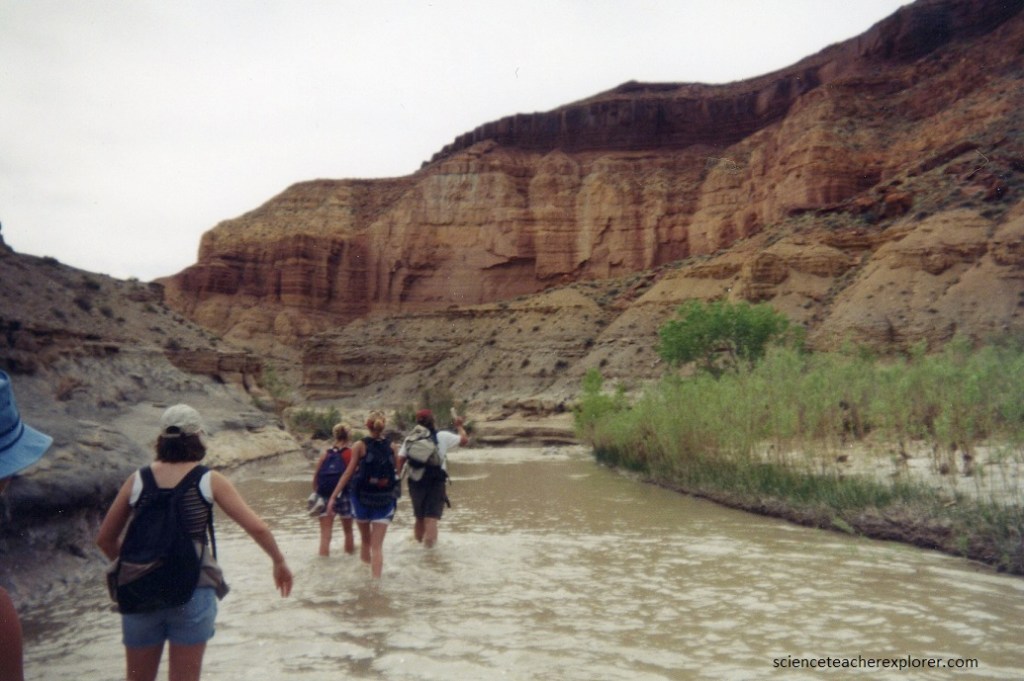
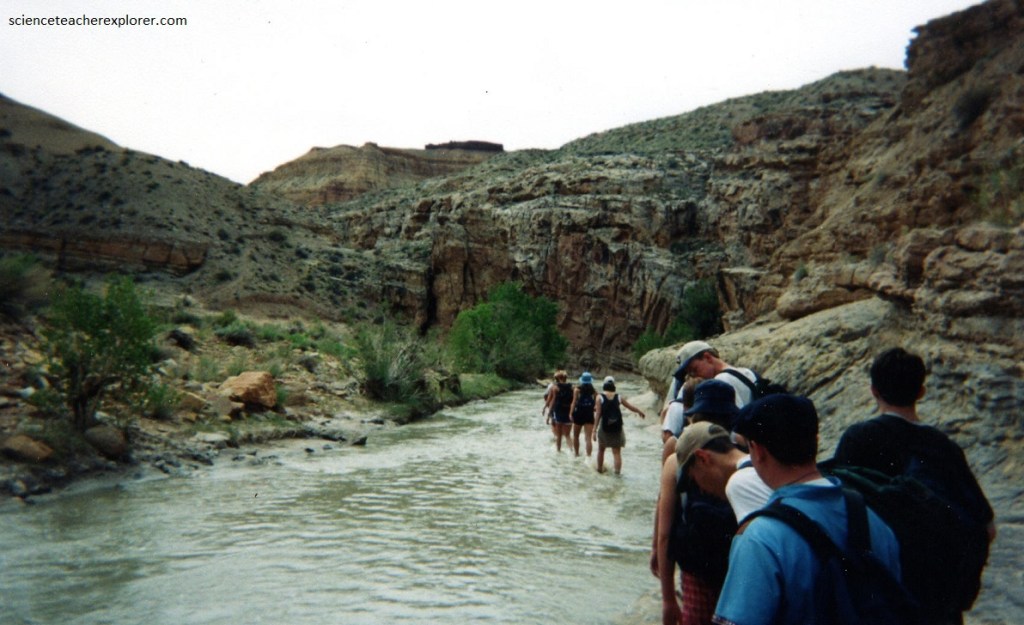
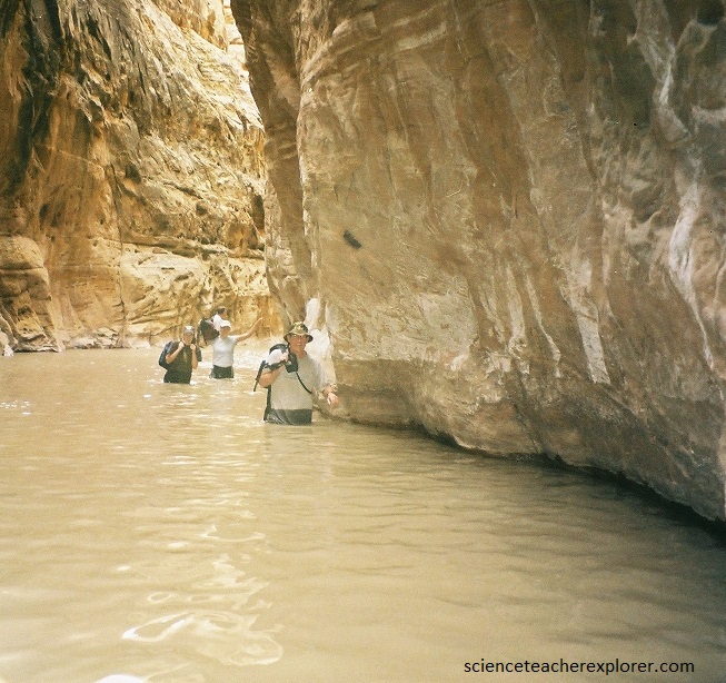
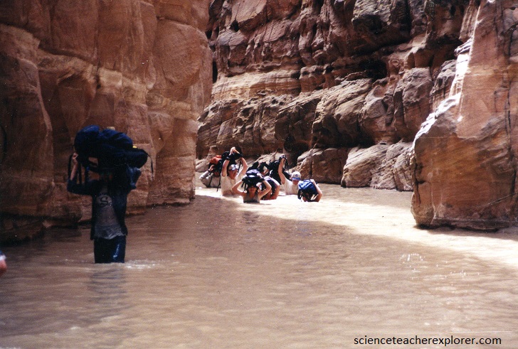
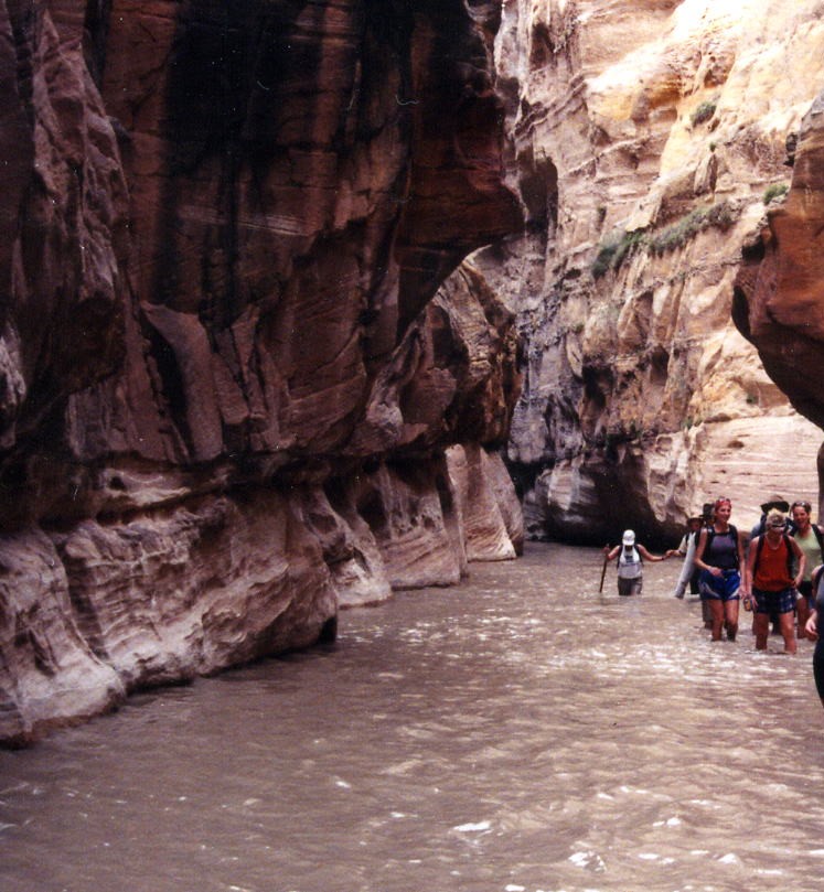
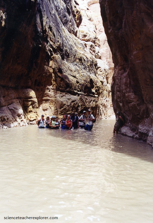
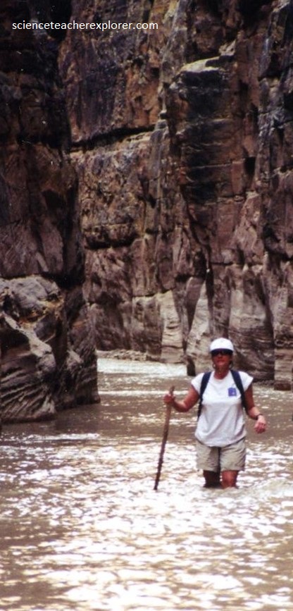
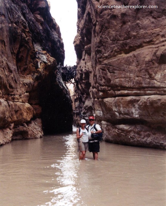
We were wading in ankle deep water for approximately half the routes. The trekking is easy with hardly any noticeable gain or loss in elevation.
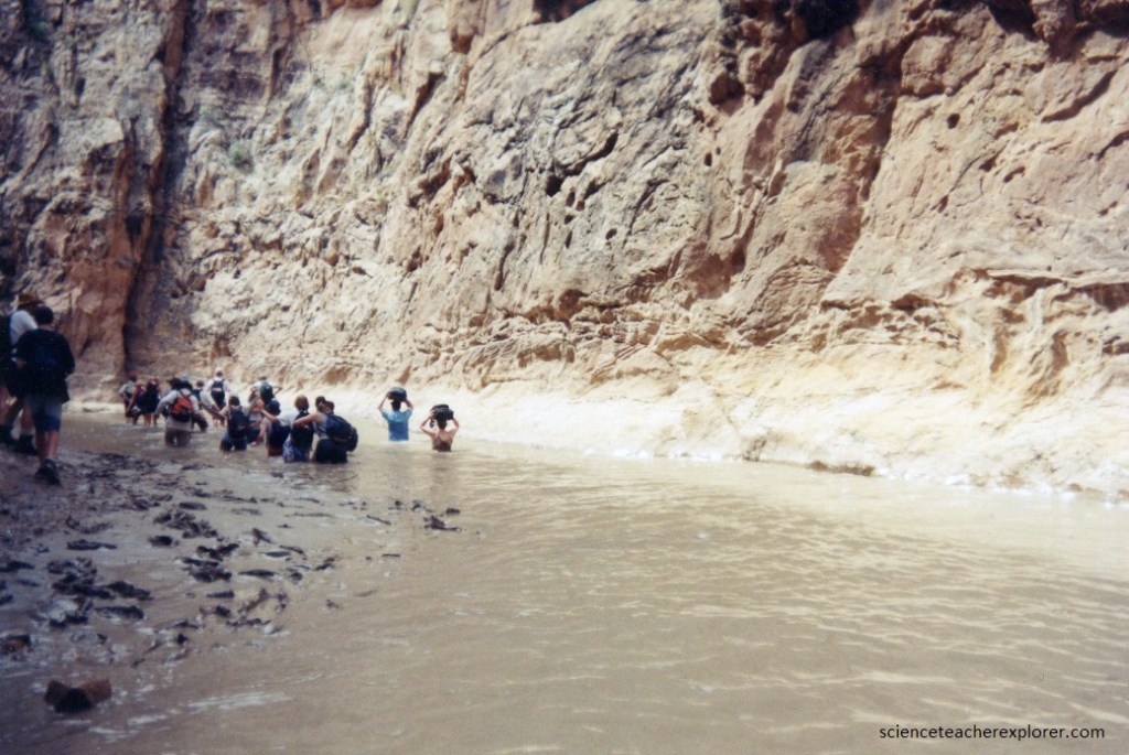
Pictured above and below; “The Chute” was never more than waist deep and usually only ankle deep, but we wasn’t surprised when we encountered a section of chest deep water, or even a short swim.
A walking stick or trekking poles are highly advised for this adventure. The creek bottom alternates between pebbles, gravel, sand, clay and large “sharp” boulders. On both trips, we were hindered by injuries of trekkers slamming their shins into a sharp boulder and cutting them to the bone. In 1999 an adult leader was sent back to the trucks at the beginning of the trek and rushed to the get stitches. In 2008, we had a student cut herself to the bone with a boulder at the 12 km mark. We ended up packing the girl out on a wilderness home-made stretcher for the remaining 8 miles and flying her out with a helicopter. We were afraid that she would get infected by the dirty water. The cut was stitched up, and she lives with a scar of the adventure today. So, I re-emphasize the use of walking stick and a “First-Aid Kit” is absolutely essential.
During the high “May” spring runoff, this trek is much more difficult. We did this hike when the Emery gage had a reading of 150 cfs on the Emery gage the hiking began to by difficult.
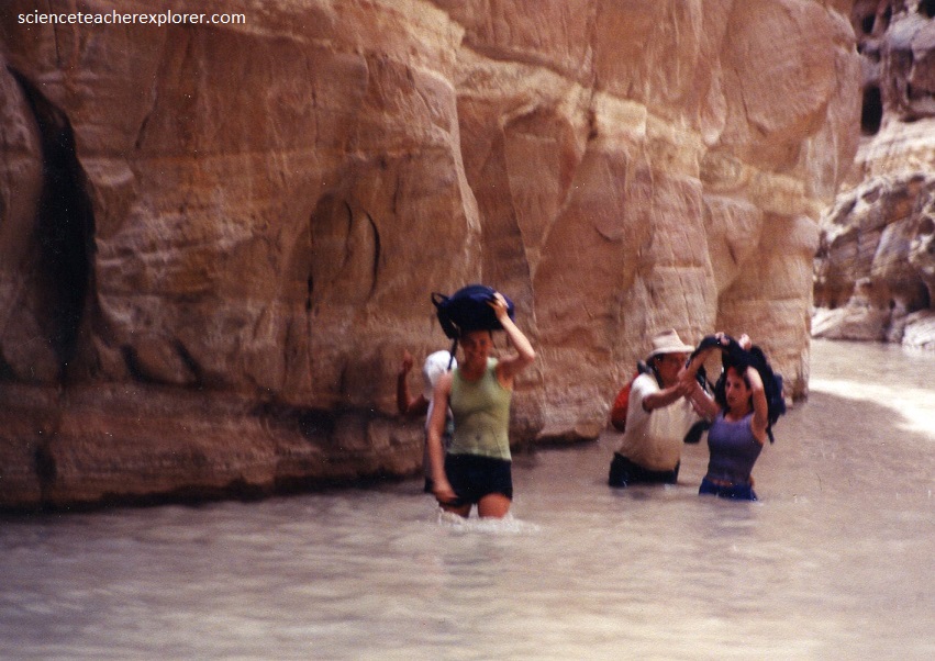
Although these treks required no swimming it was prudent to pack whatever we needed to keep dry into dry-bags. We also brought flashlights and warm jackets. We ended up using them.
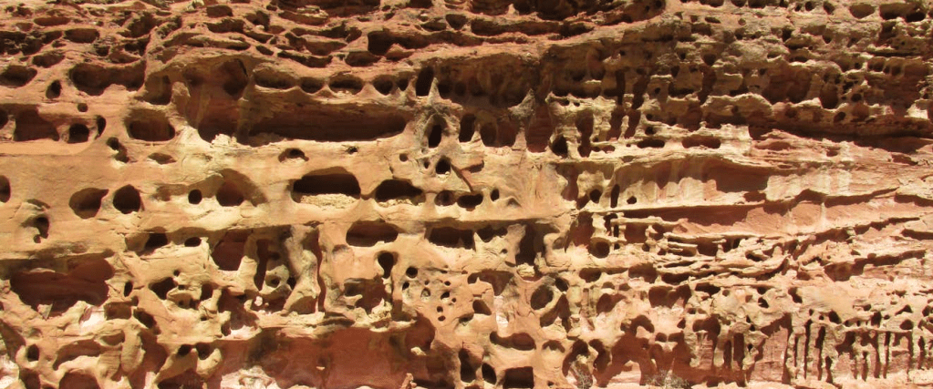
About half-way through “The Chute”, is a very tight tributary on the east side (known as Music Canyon), worth following for a while. This slot canyon contains interlinked potholes, pools and small dry-falls, all surrounded by nicely textured rock with curvy formations, and the upper parts (above several unclimbable dry-falls).
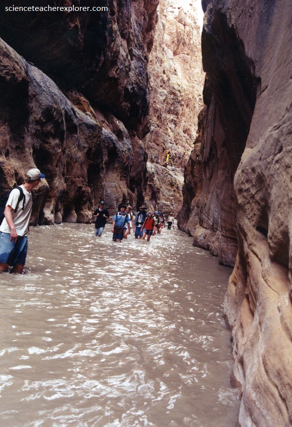
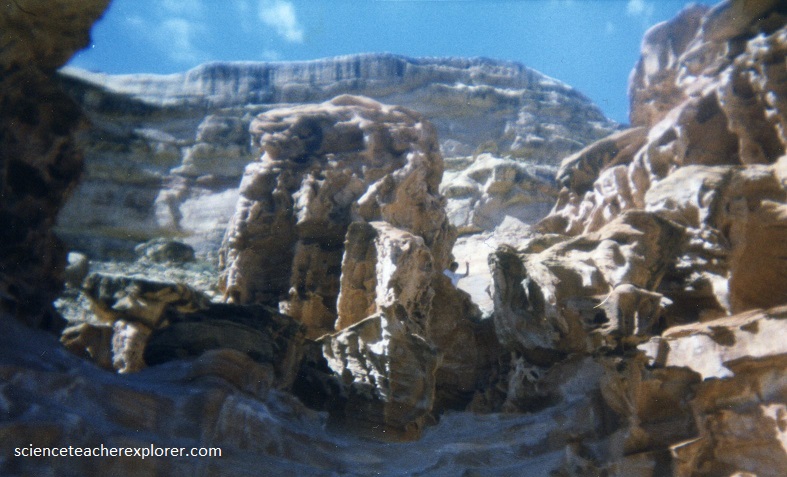
After Music Canyon, “The Chute” becomes an excellent deep shaded canyon with colorful walls, much closer together than before, (pictured below).
One overhanging alcove has a seep in the rocks above from which drips nice tasting water, a useful place to replenish supplies.
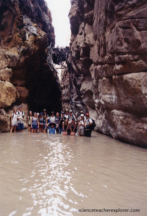
Pictured below, around another corner, and high above the streambed, is a log jam that seems now to be a semi-permanent feature, left by a huge flood many years ago.
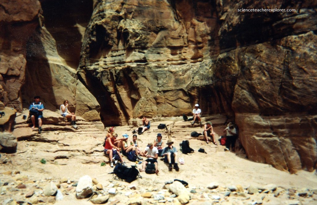
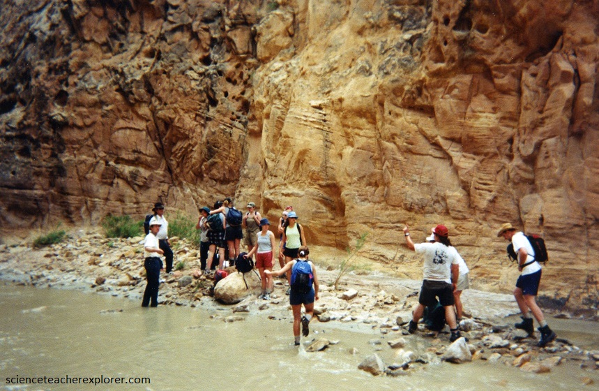
The canyon begins to widen after the next few bends and for those on round trip hikes this is a sensible point to turn back, 16 km from the trailhead. But we had somebody drive the vehicles around to the “Hidden Splendor Mine” trailhead.
Vernon Pick, a middle-aged electrician from Minnesota, discovered the Delta Mine (Hidden Splendor) at the southern trailhead in 1952. Vernon Pick reaped one million dollars from the mine before he sold it two years later to international financier Floyd Odlum’s Atlas Corporation for $9 million and a custom-converted PBY airplane. In November 1954 Life Magazine published and 11-page article titled “Vernon Pick’s $10 million Ordeal” that detailed the discovery of the Delta Mine. Publicity from this article greatly increased prospecting in the San Rafael Swell and surrounding Colorado Plateau and made the Delta Mine famous. Floyd Odlum renamed his new purchase the Hidden Splendor Mine. Odlum was certain the mine was a rich find and his geologists estimated the mine held 540,000 tons of uranium ore with an in-place value of forty dollars per ton. This would have made the mine worth nearly 22 million dollars. However, he never made back his money.

Chimney Canyon joins about 6 km downstream of the log jam – this is a large tributary that branches west, several times in its upper reaches and has much unspoiled scenery, (pictured above).
Pictured above, past this log-jam, the walls continue to recede and after a further 10 km the canyon approaches the inside of the southern San Rafael Reef. The exit trailhead at the Hidden Splendor Mine is reached by a short walk uphill.
