Chesler Park, UT 2014
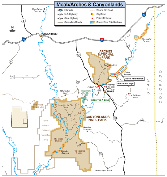
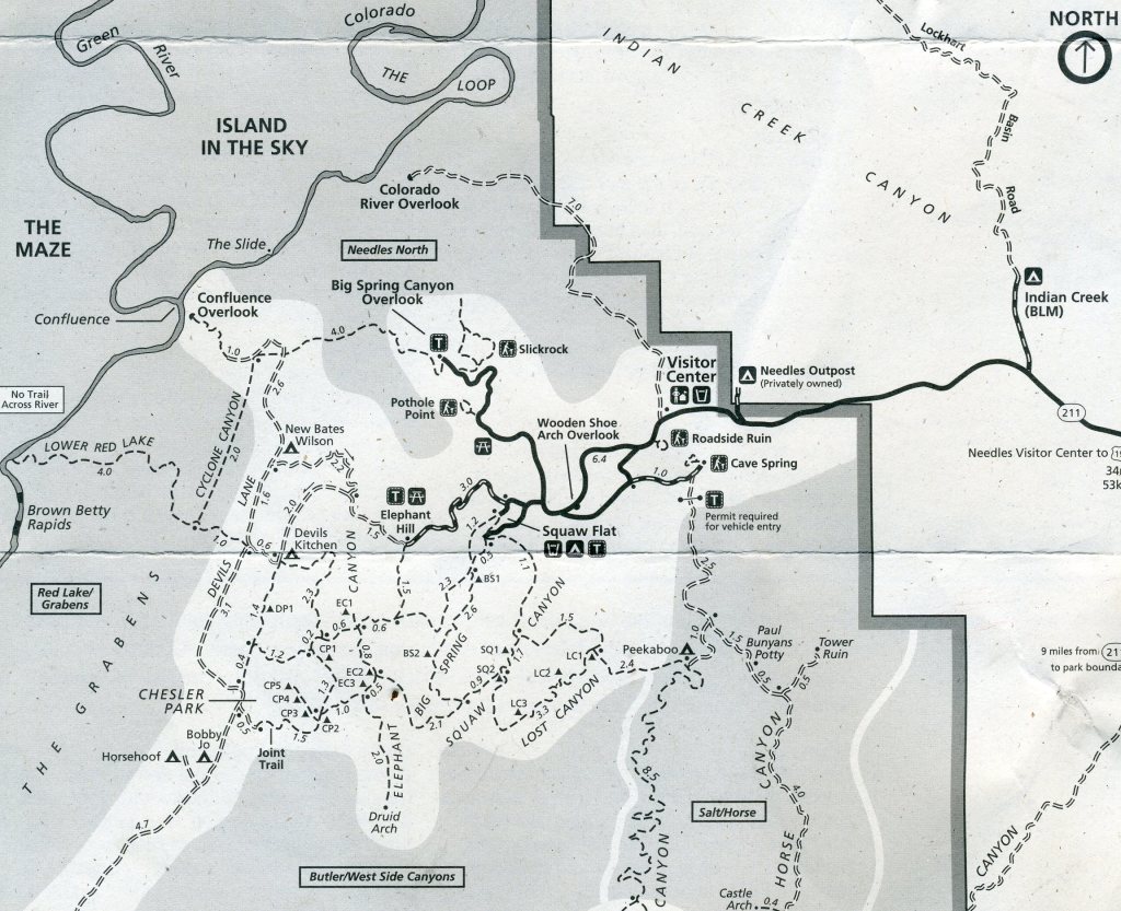
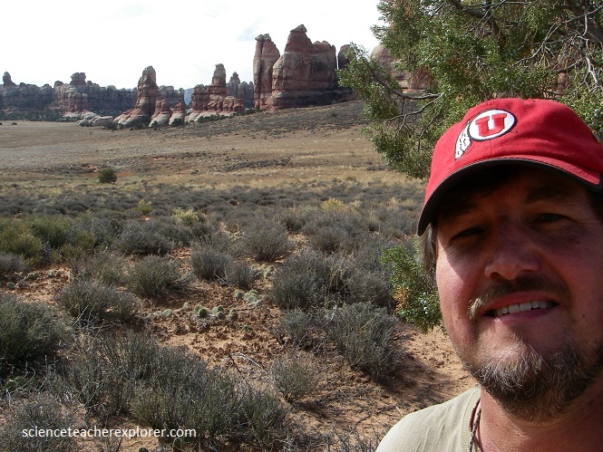
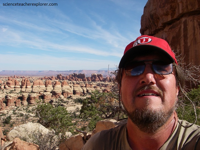
In August of 2014, I decided to explore and hike into Chesler Park, Canyonlands National Park in Utah USA. Chesler Park is within the Needles District of the Southeastern portion of Canyonlands National Park.
The rocks within the Chesler Park area is of the Permian time period or in Utah it is called the “Cutler Group”. Most of the rocks are reddish brown siltstones, sandy shales and sandstones deposited on oscillating shoreline and interfingered with deposits on beach dunes, in sand bars, and arkosic alluvial fans. The top layer is the “White Rim Sandstone” of which is a white, cross-bedded sandstone deposited in coastal dunes.
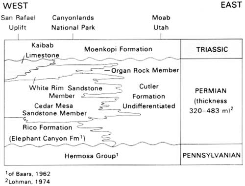
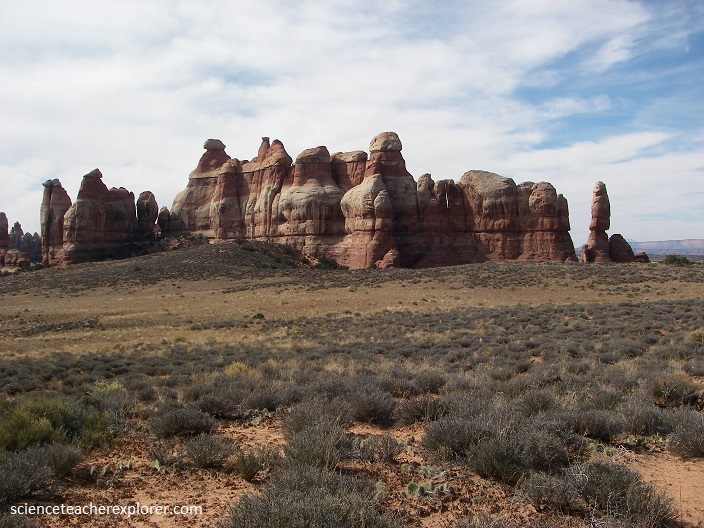
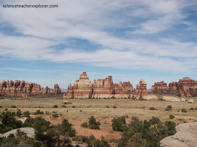
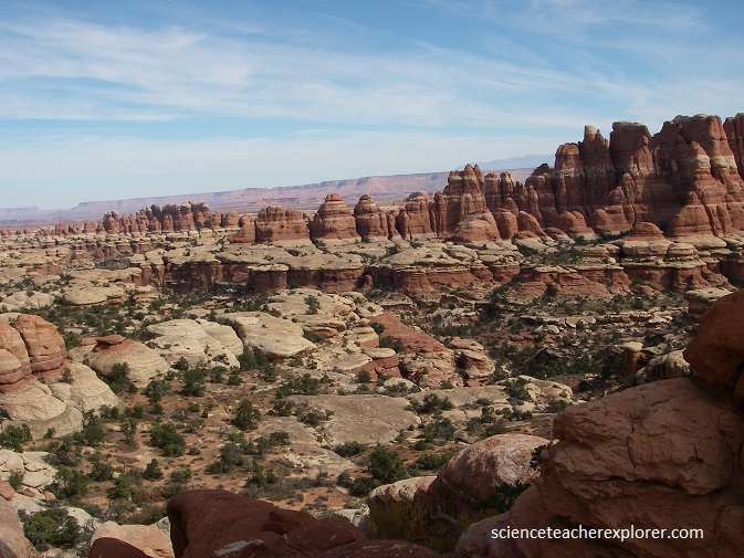
The Needles are a series of spires located to the southwest of Squaw Flat campground that surround the Chesler Park area of the Needles District. They are formed out of a resistant red and white sandstone layer called Cutler Group Sandstone which makes up most of the rock features in the Needles District. This 245 to 286 million year old layer was once a dune field on the eastern edge of a shallow sea that covered what is California, Nevada and western Utah today. Sand was blown in from this direction and formed the white bands in the Cutler Group Sandstone.
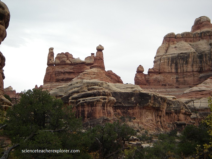
(Pictured below) The red bands came from sediment carried down by streams from a mountainous area near where Grand Junction is today. These layers of sand were laid down on top of each other and created the distinctive rocks seen below.
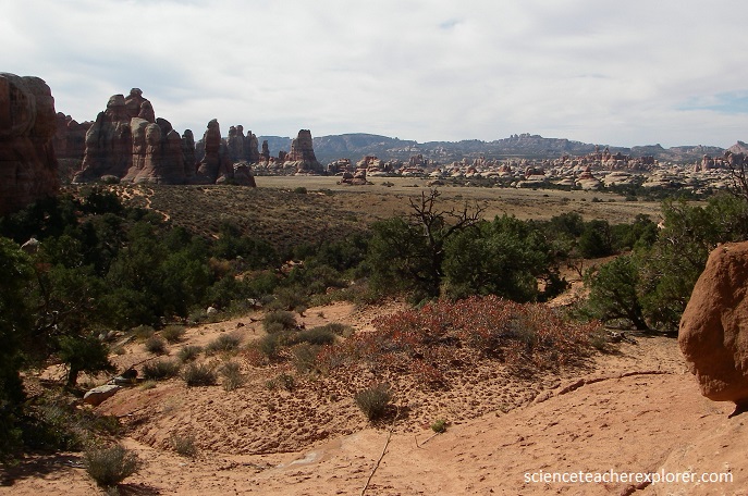
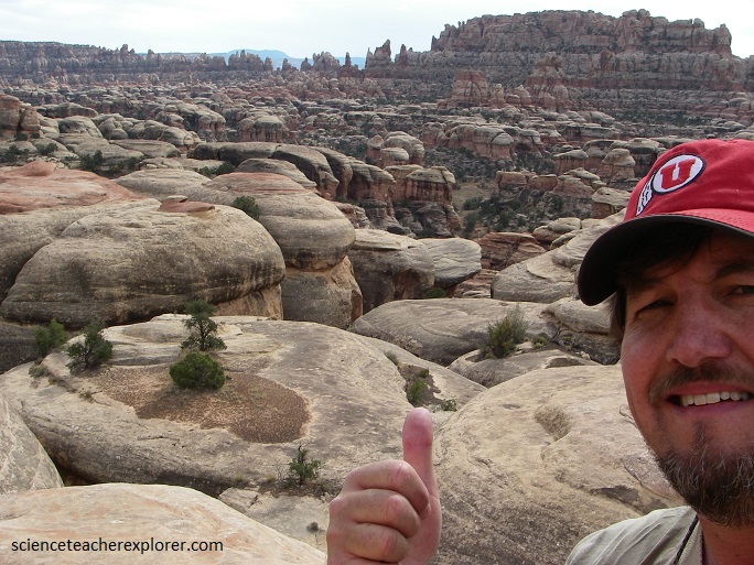
The name Chesler Park was given to an expanse of a thousand acres of flat, grassy land surrounded by pinnacles of the Cedar Mesa Sandstone.
Starting about fifteen million years ago, the Colorado Plateau was pushed up thousands of feet and rivers, such as the Colorado and the Green, cut down and carved deep canyons. Water, the primary force of erosion, eats away or weathers rock by attacking the cement holding the sand grains together. Moreover, during storms, rushing water knocks loose sand and rocks as it flows down washes causing additional erosion. The water naturally acts faster on areas of weakness within the rock, such as fractures and cracks. The Needles occur in an area with many fractures called joints.
The joints were formed first by the regional uplift, which begins around the Needles District and trends slightly southwest all the way to Northern Arizona. This uplift caused brittle, surface rock like the Cutler Group Sandstone to crack as it was bent upward, forming a set of joints in a northeast-southwest direction. This still kept the local formations horizontal in nature.
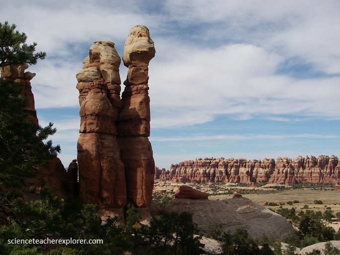
Later, a thick salt layer underneath the Needles district, known as the Paradox Formation, is the second cause of joint formation. The salt is flowing slowly toward the Colorado River and dragging the overlying layers with it. As the upper layers became stretched, they also fractured into joints. This action created a set of joints running northeast-southwest. In the Needles area, these two joint sets meet and form square blocks of rock between the joints. As water widened the joints, the squares were sculpted into pillars and spires seen in the pictures above and below.
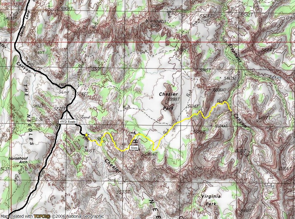
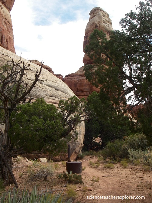
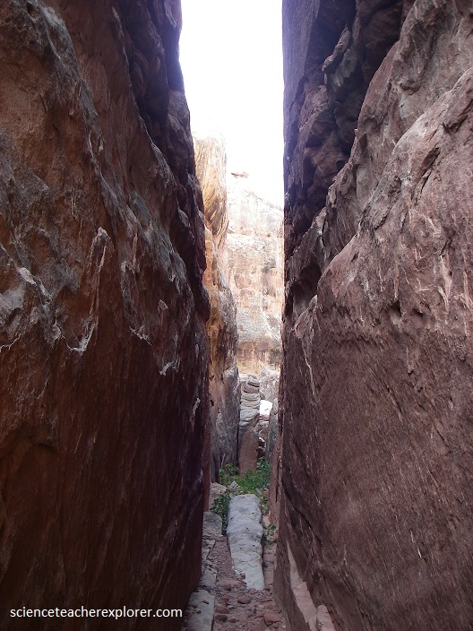
Frost action, with its alternate freezing, expanding, and thawing, also breaks up the sandstone. Loose sediment is removed by wind and runoff. The joint spaces gradually enlarge into narrow valley that separate the narrow walls called fins. the Needles themselves are similar to fins but have more cross-cross fractures. Pictured below, the Joint Trail, which goes through a crack in the Cedar Mesa Sandstone, is only a meter wide. It lead me into a great view of the “Needles” and the only way into a hidden valley called the “Virginia Park”.
The needles and pillars develop when two intersecting joint sets are spaced closely together. The second set of joints, which is at an angle to the first set, prevents fins from developing. Instead, pointed needles or rounded pillars evolve as weathering and erosion sculpture the rock.
Some pillars are capped by resistant material that makes balancing rocks. Where fins have developed, they tend to evolve into a line of pillars as weathering attacks cross joints.
As you can see, entering Virginia Park required some serious rock climbing skills. The fins and pinnacles are so abundant that makes the area impenetrable.
Pictured below, “Newspaper Rock State Historical Monument is a Utah state monument featuring a rock panel carved with one of the largest known collections of petroglyphs. It is along the access road into the Needles district 19 km from US 191 and 48 km from the park boundary. The 19 m2 rock is a part of the vertical Wingate Sandstone cliffs that enclose the upper end of Indian Creek Canyon, and is covered by hundreds of petroglyphs, (one of the largest, best preserved and easily accessed groups in the United States). The petroglyphs feature a mixture of human, animal, material and abstract forms that date from 9000BC to 1300AD.
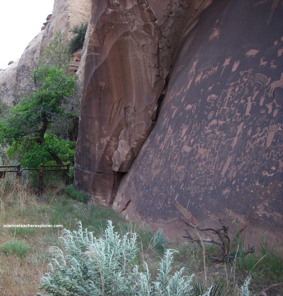
The origins of desert varnish are in part biological. Rock surfaces in arid regions host colonies of microbes. These bacteria, for example, Arthrobacter and Metallogenium, absorb manganese and iron from the air and use them in metabolic functions, just as we use food. The microbes secrete manganese oxide and iron oxide as waste products, forming a sticky film on rock surfaces. The more manganese oxide secreted, the blacker the coating; the more iron oxide, the more orange the coating. Clay, which composes up to 70% of desert varnish, arrives as windblown dust that adheres to the sticky manganese-iron coating. From then on, the clay acts as a protective barrier against the elements. Desert varnish layers are exceptionally thin, typically only 10 to 100 microns thick. It accumulates very slowly, averaging about 10 microns per thousand years, and exposed varnish is constantly assaulted by the elements. This makes it sort of a way to date these petroglyphs that have a variety of ages and cultural affiliations.
