Tatio Geysers, Chile
After exploring and trekking the San Pedro de Atacama area, I decided to join a tour group on July 12th, 2019; that took me into the Tatio Geysers. Located 89 km from the city of San Pedro de Atacama and surrounded by an astonishing scenery of arid beauty, Tatio Geysers are a volcanic geothermal field, where water and steam columns spring up violently from deep under the ground. Set at an elevation of 4,200 m (16,800 ft), these are the highest geysers in the world.
Water boils here at just 86 degrees Celsius, because at 4,200 m, water boils at significantly lower temperature. Tatio Geysers reach their peak of activity between 5:30 am and 7:30 am, when water columns reach up to 10 meters. This is why I had to get up really early to enjoy a good spectacle. Bear in mind that at that time the temperatures are extremely low, reaching up to -20°C at that elevation in the morning.
The ground is littered with chimneys and cones of crystallized salts, and the only water present is that which spurts out of the ground. Hot springs form pools with water temperatures of 60–80 °C (140–176 °F), which are often gently moving and surging and in the case of the warmer springs actively bubbling. These pools often contain ball-like rocks called oncoids and are surrounded by sinter rims, which have spicule-like textures. These sinter rims often form dam-like structures around deeper vents which are filled with water. Spherical grains develop in the hot springs as a consequence of hydrodynamic processes.
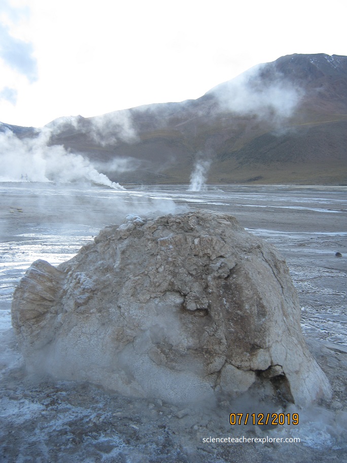
There are 110 erupting springs, of which 80 are active geysers and 30 “perpetual spouters,” making this the largest geyser field in the southern hemisphere. Note that the flowing water from the geyser-field drains from the springs and depositing sinter. Sinter can form fairly thick deposits and large aprons when sheet flow occurs, known as “discharge deposits”. Sometimes terraces are developed instead.
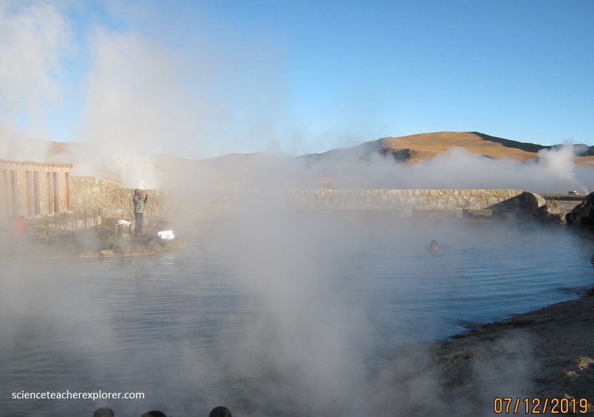
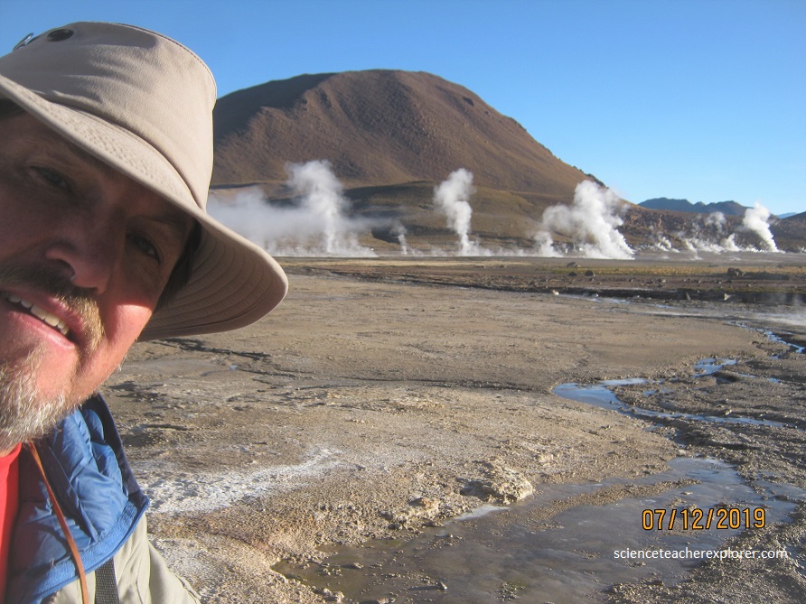
The shallow channels that run off the geyser field are filled with colonies of heat-resistant bacteria and algae that stain the place red and green. A few meters from the geysers the water has already cooled to a bath temperature, providing a home to a unique species of cannibalistic frogs and human swimmers, (pictured above).
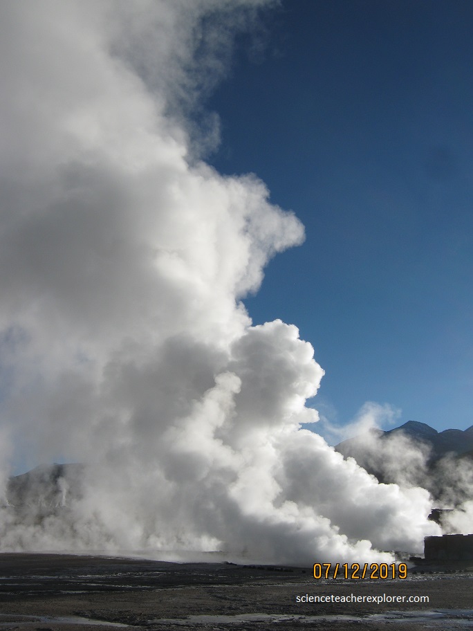
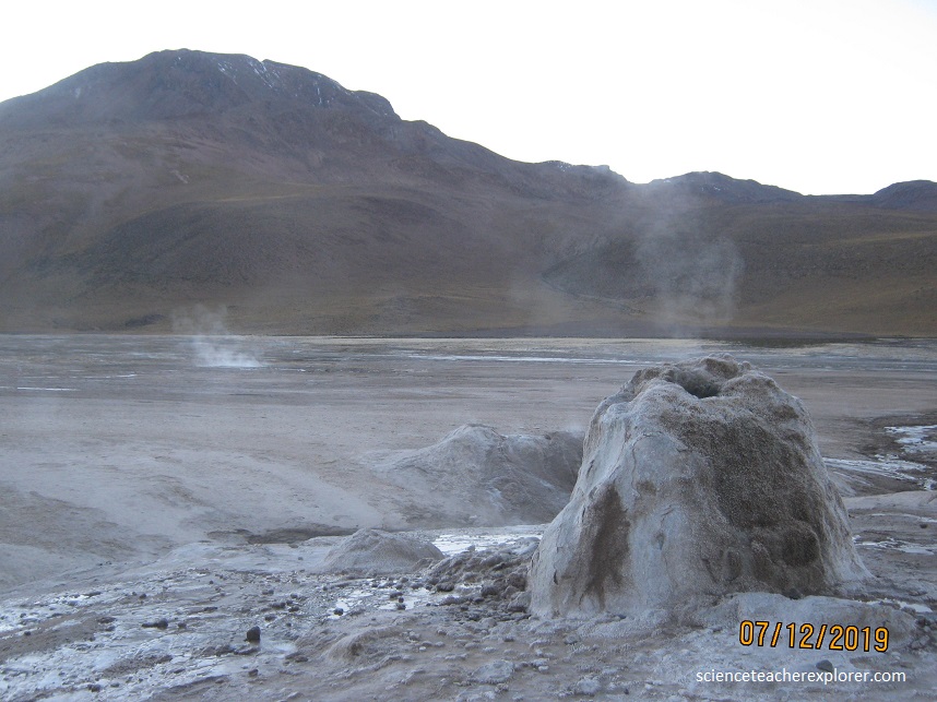
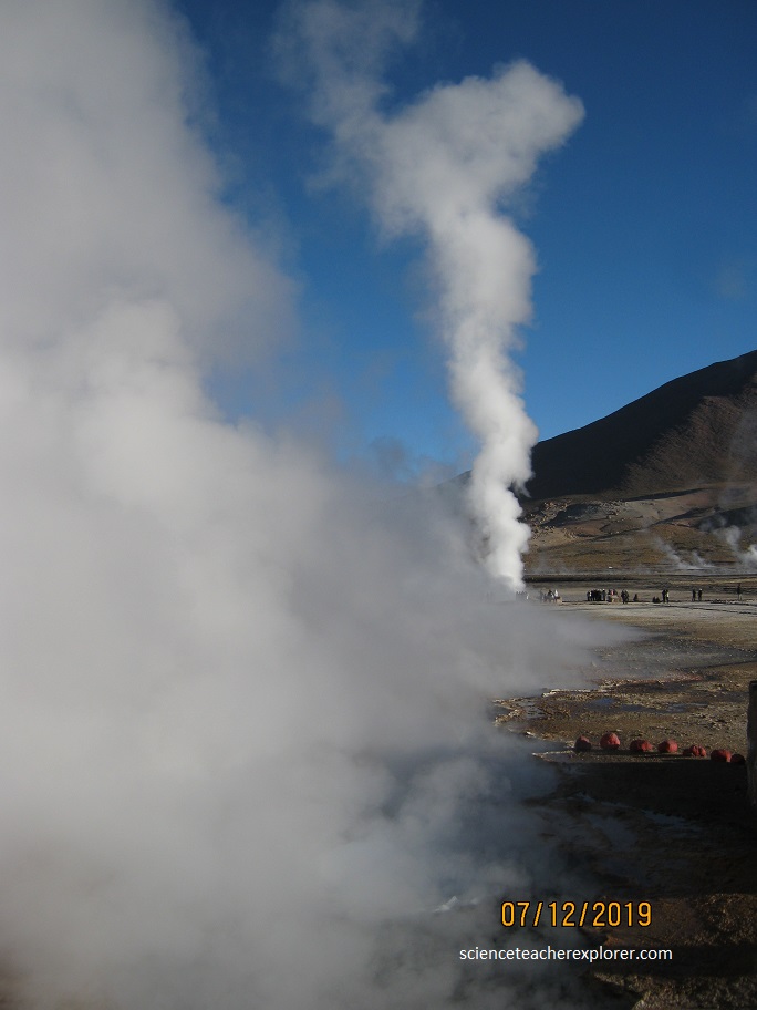
El Tatio is part of the Central Volcanic Zone, a segment of the Andes between 14° and 28° southern latitude where the Andes are volcanically active. This volcanism manifests itself with about 10 silicic caldera complexes of the Altiplano–Puna volcanic complex and more than 50 recently active volcanoes; Lascar in 1993 erupted and produced a tall eruption column. Steam vents are particularly noticeable in the morning hours when the steam columns emanating from them are particularly visible,and temperatures of 48.3–91.6 °C (118.9–196.9 °F) have been found (pictured above). Carbon dioxide is the most important fumarole gas, followed by hydrogen sulfide.The amount of water relative to these two gases is variable, probably due to condensation of water in the ground.
The Tatio region is dominated by andesitic volcanism producing lava flows until the late Miocene, then large scale ignimbrite activity took place between 10 and 1 million years ago. The geothermal field of El Tatio lies in a graben between the stratovolcanoes in the east and the Serrania de Tucle-Loma Lucero horst in the west. Mountains southwest of El Tatio include the 4,570–4,690-meter Alto Ojo del Cablor, while 4,812-meter high Cerro Copacoya is situated northwest of the geothermal field. Dacitic volcanism, older than the easterly stratovolcanoes, has occurred west of El Tatio.
The movement of the water in the ground is controlled by the permeability of the volcanic material and the Serrania de Tucle–Loma Lucero tectonic block west of El Tatio that acts as an obstacle. As it moves through the ground, it acquires heat and minerals and loses steam through evaporation. The water travels through a number of aquifers that correspond to permeable rock formations, such as the Salado and Puripicar ignimbrites, as well as through faults and fractures in the rock (pictured above).
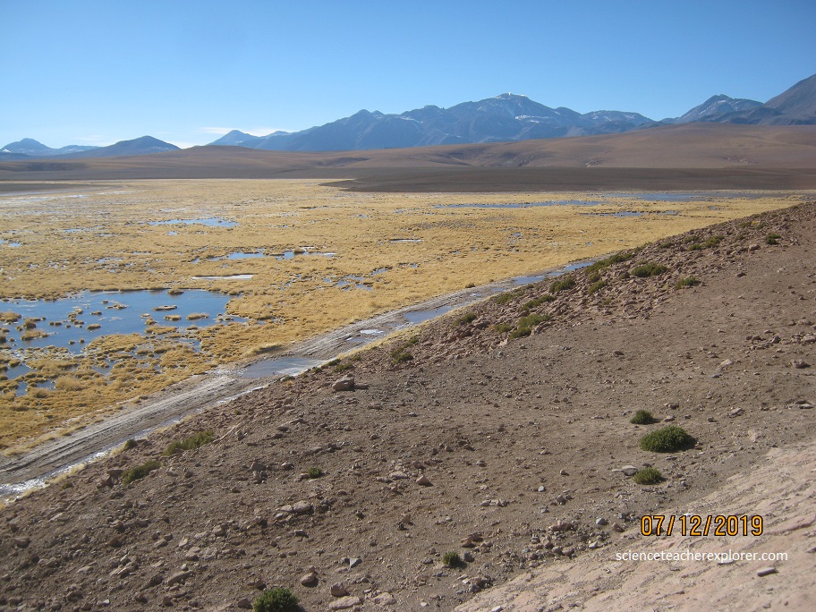
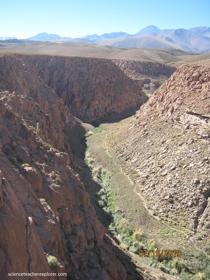
(Pictured above), drainage in the area is generally from east to west down the Western Cordillera, often in form of steeply incised valleys. The Rio Salado drains most of the hot spring water and has its headwaters in the field where it is joined by the Rio Tucle, (pictured below).
The Rio Salado eventually joins the Rio Loa, a major source of freshwater for the region; thus, El Tatio plays an important role in the regional water supply.
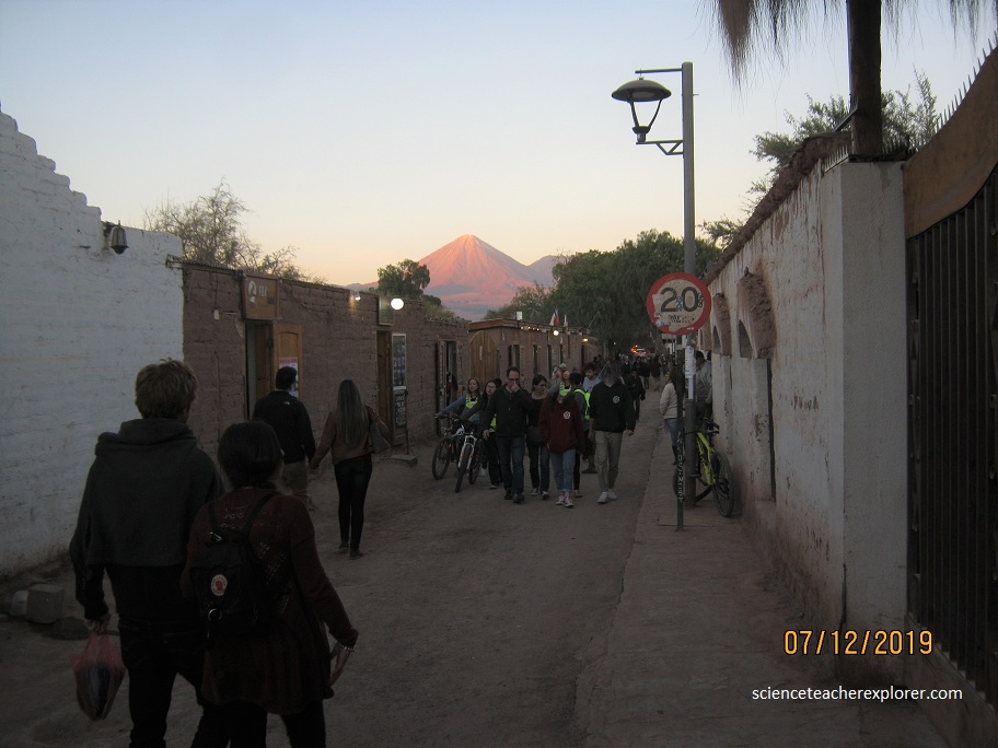
While exploring and trekking the Atacama desert from July 9th-13th, I stayed at a little bungalow in San Pedro de Atacama. San Pedro de Atacama is a Chilean town and commune in El Loa Province, Antofagasta Region. It is located east of Antofagasta, some 106 km southeast of Calama and the Chuquicamata copper mine, overlooking the Licancabur volcano (pictured below).