Dinosaur N.M., Utah
During June of 2010, I spent a significant amount of time exploring Dinosaur National Monument in North-Eastern Utah.
During the Jurassic era, the Dinosaur National Monument was a 60 m long sandbar in a river and the surrounding area was home to many dinosaurs. When they died, their remains accumulated on the sandbar where mud and silt slowly covered them. Over time silica minerals seeped into the dinosaur bones, turning them to rock and preserving their features. There they lay buried until 70 million years ago, when an upheaval of the Rocky Mountains tilted the land up to reveal their fossilized bones.
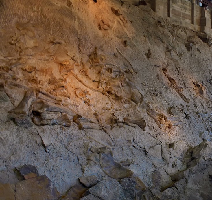
Pictured above, the list of dinosaurs found here is a veritable who’s who of famous Jurassic forms. Sauropods, the dinosaurs with the long necks, long tails, and stout tree-trunk sized legs, were the most common dinosaurs excavated at the site. These included the genera Apatosaurus (once also known as Brontosaurus), Camarasaurus, Barosaurus, and Diplodocus. The large, carnivorous theropods Allosaurus and Ceratosaurus have also been found here, as well as the vegetarians Camptosaurus and Stegosaurus. These dinosaurs represent the two great groups of dinosaurs, Camptosaurus and Stegosaurus are ornithischians (bird-hipped dinosaurs); the rest are saurischians (reptile-hipped dinosaurs). Dinosaur National Monument has long been one of North America’s most spectacular, and easily accessible, dinosaur localities.
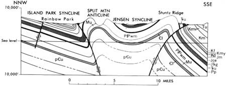
The monument is best known for its Jurassic dinosaur remains, but it also contains rocks that span 1.1 billion years of geologic history. Pictured above, Dinosaur National Monument is on the eastern margin of the Uinta Mountains. The Uinta Mountains formed in a similar manner as the Front Range of the Rockies. It is a basement cored, fault bounded uplift that formed by compressional forces during the Laramide orogeny, 70-30 million years ago. However, unlike other Laramide uplifts, (anticlines and synclines) which are oriented in a general north-south direction, the Uintahs are oriented in an east-west direction.
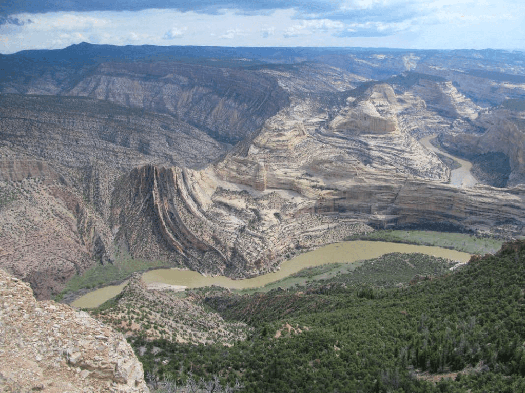
Pictured above, the steeply-tilted rocks may be part of the local monocline, (the huge step-like fold visible to the east). It’s broken by the “Mitten Park Fault”, with rocks to the east down-dropped relative to those to the west. Perhaps they were drug along the fault as the blocks moved past each other, creating the spectacular folds or enhancing those already there. These folded-faulted rocks lay deep underground until the Green and Yampa Rivers finally cut down far enough to expose them. Note that the Green River flows south behind a long sandstone fin, and is joined by the Yampa, which then turns back sharply to the west and north to Whirlpool Canyon.
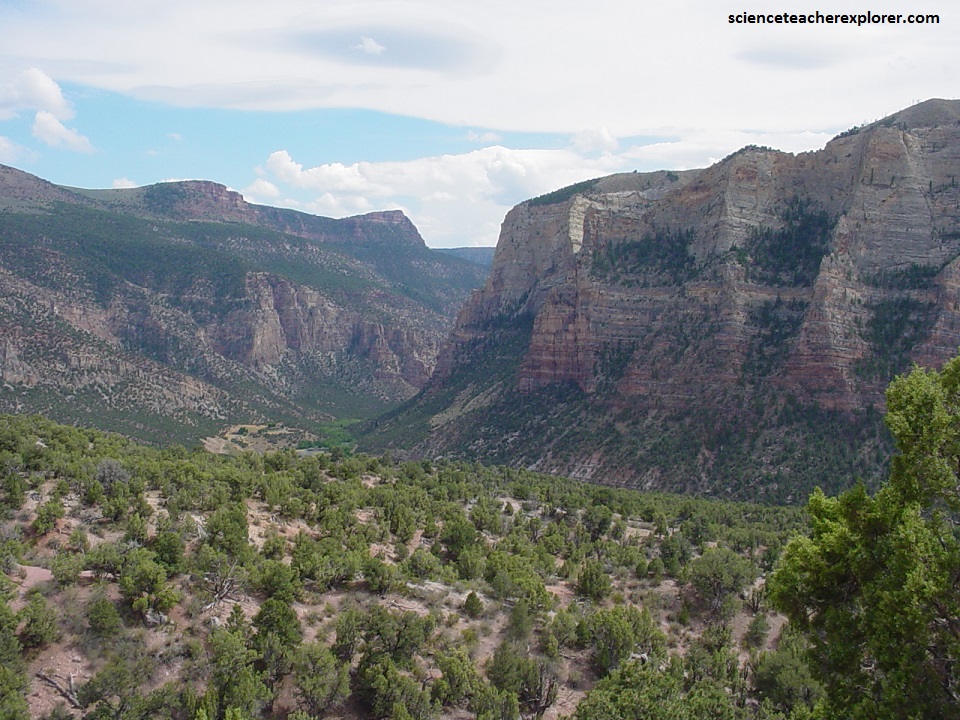
Pictured above, Whirlpool Canyon opens downstream through a flaring gateway into Island Park, which together with Rainbow Park is an attractive alluviated valley of a few square kilometers between Whirlpool and Split Mountain Canyons. Island Park is on the axis of a faulted asymmetrical syncline. It trend west between the main Uinta anticline to the north and the Split Mountain anticline to the south. The syncline axis is crowded against the flank of Split Mountain. Cretaceous rocks are preserved in the trough of the syncline. So, after meandering placidly through Island and Rainbow Parks, the Green River heads into Split Mountain Canyon, (an eroded anticline). Flowing swiftly across upturned beds, the river passes from Jurassic rocks at Rainbow Park onto Rock of Mississippian age in the core of the Split Mountain anticline.
Pictured above, from Rainbow Park, you see the Island Park Thrust fault and highly deformed Entrada sandstone. The Green River passes rock units that become progressively older as it travels downward. This is because it is traveling across the northern limb of the Split Mountain Anticline. Older, more resistant limestones and sandstones make up Split Mountain.
Pictured above, is spring-fed Jones Hole Creek, a sparkly stream that issues at full volume from openings in the Pennsylvanian Round Valley Limestone. Jones Hole is dominated by towering cliffs of Weber Sandstone in a picturesque and dramatic setting. The stream passes a fish-hatchery and flows south towards the Green River. It parallels with the Utah and Colorado State Line, one kilometer away. A nice walking trail follows the Spring to the Green River.
Enroute to the Green River the trail passes the Deluge Rock Shelter where the sandstone cliffs are decorated with numerous pictographic images that were painted upon the rocks many hundreds of years ago by earlier inhabitants of the area. Others are thought to be among the oldest pictographs in Dinosaur National Monument and are thought to be around 7,000 years old.
Pictured above, Browns Park is a picturesque intermontane valley that is broad, averaging about 6 km across, but is much longer than wide. Steep mountain fronts bound the valley on both sides, the mountaintops rising 1,000 m or more above the valley floor. The north front is more abrupt than the south, partly because it is bounded for most of its’ length by faults, which drop the valley side relative to the mountains.
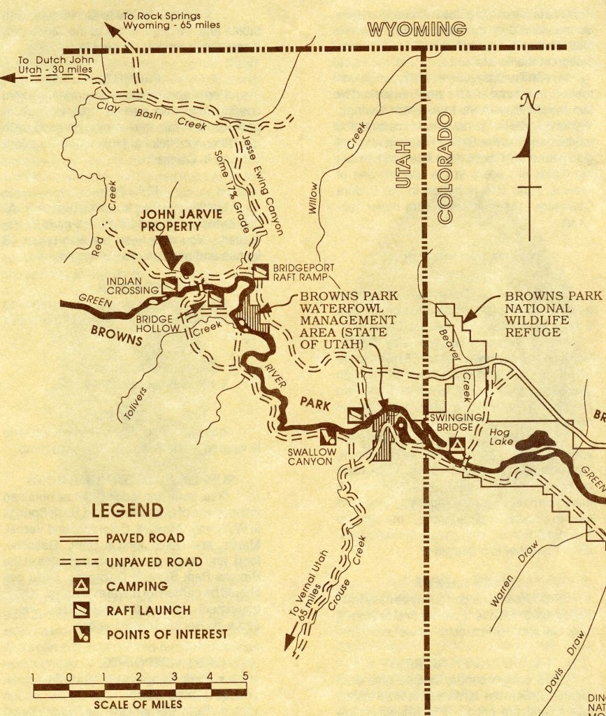
Browns Park gains most of its distinctive appearance from its thick fill of Tertiary gravel, sand, clay, and volcanic ash, (the Browns Park Formation). This fill forms the broad flat bottom of the valley, and its brilliant white exposure contrasts with the somber appearance of the nearby mountains. Flat-topped Quaternary terraces are characteristic, also.
Browns Park is doubly curious because of its structure. The Browns Park Formation accumulated on the floor of a preexisting canyon-like valley. The valley was formed partly by ordinary erosion and partly by down-faulting along the crest of the great Uinta anticline. Faulting probably helped to establish drainage there in the first place. As the fill accumulated, the contour of the old valley gradually softened, until it took the shape of a shallow elongate syncline. Thus, we have a syncline of deposition, modified by later faulting, superimposed on the crest of a folded anticline. The axis of the syncline is well north of the present valley bottom, which crowds the south margin of the valley.
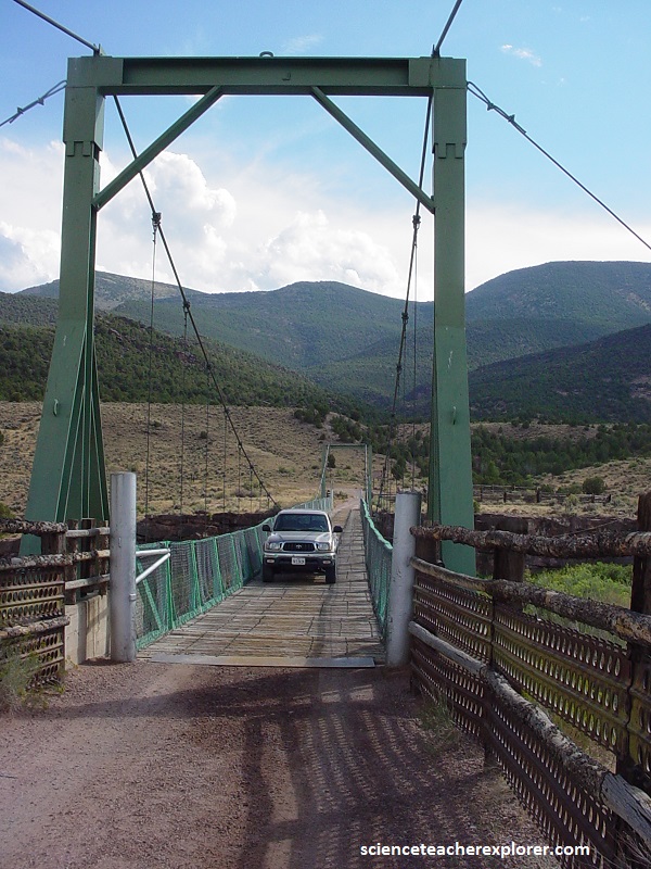
After entering Browns Park, the Green River flows swiftly but quietly for several miles across the Browns Park Formation. Just after crossing the axis of the Uinta anticline on the south side of the valley, the Green enters Swallow Canyon (a short but steep walled gorge) then to Lodore Canyon.
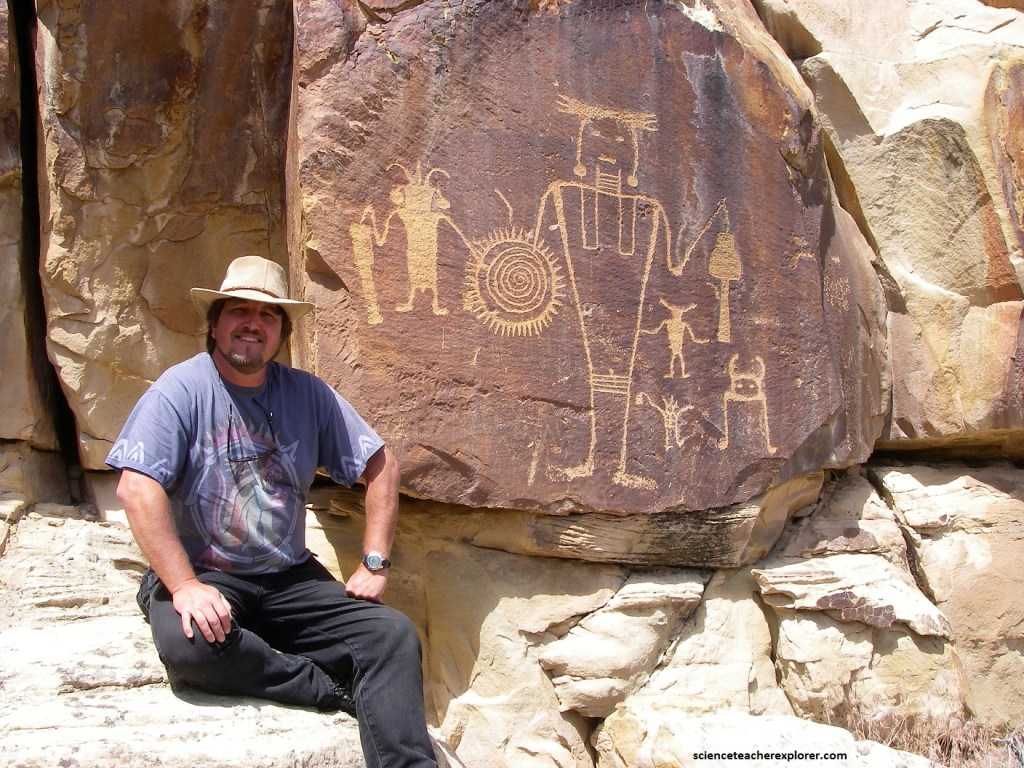
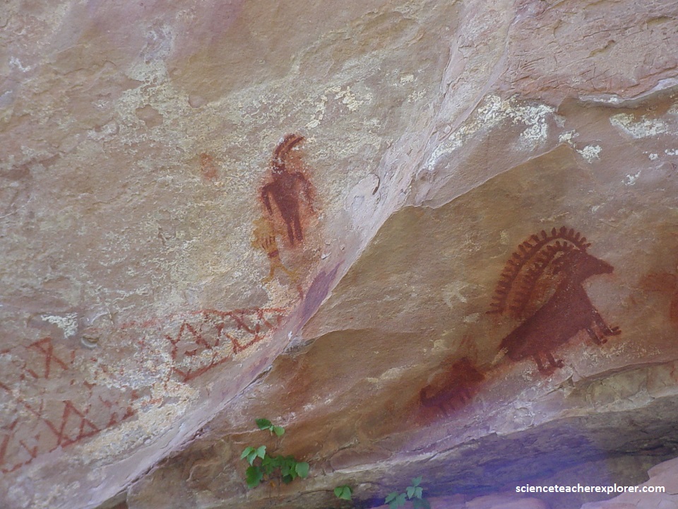
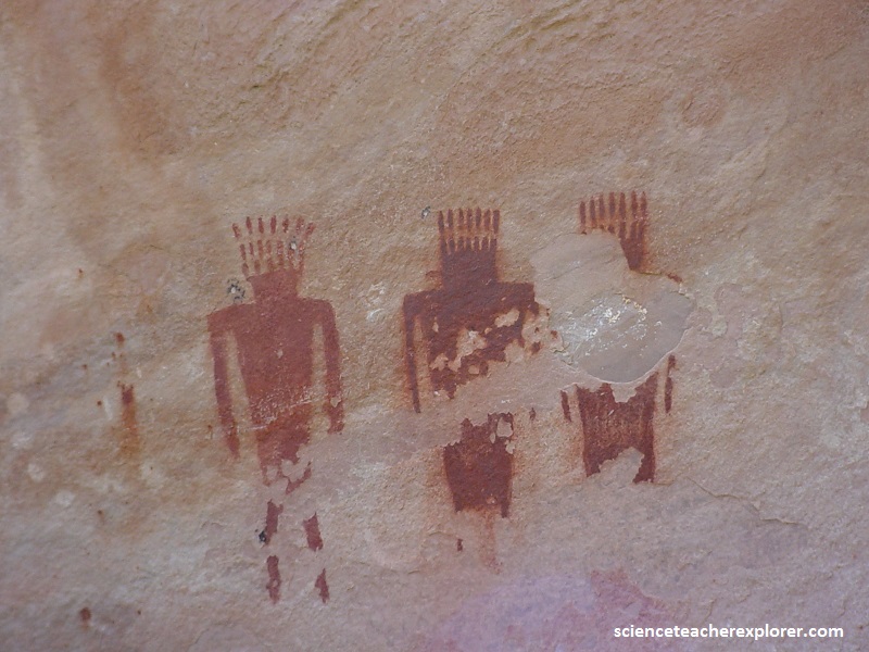
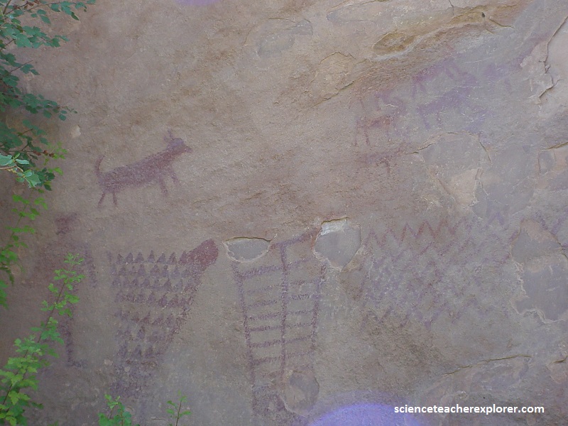
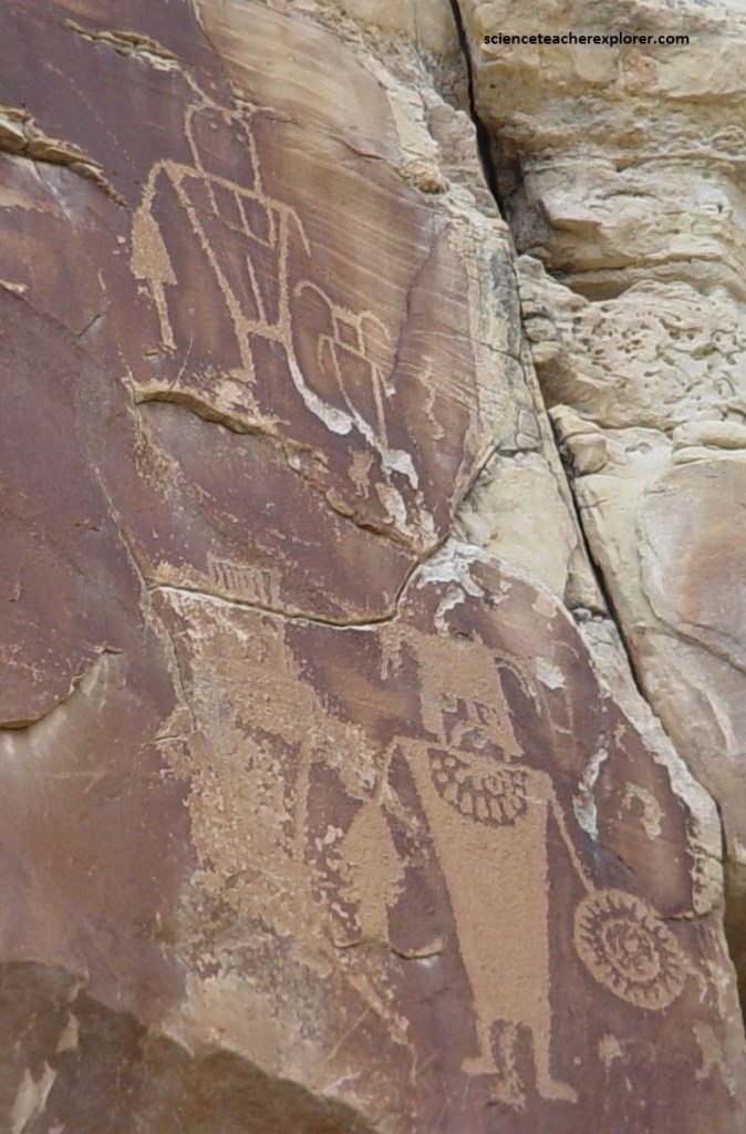
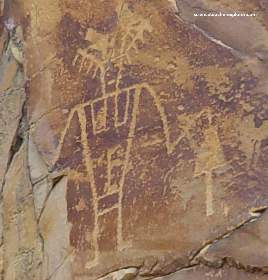
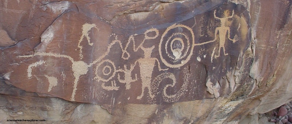
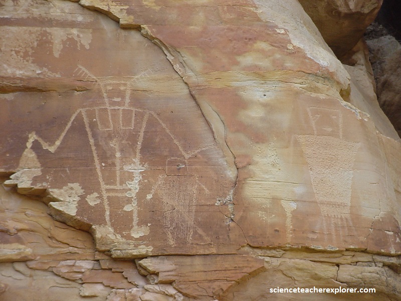
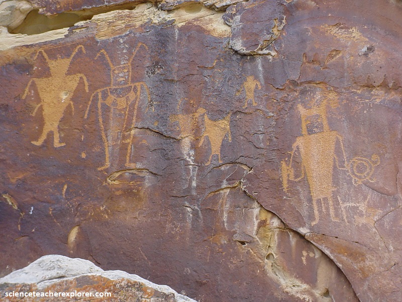
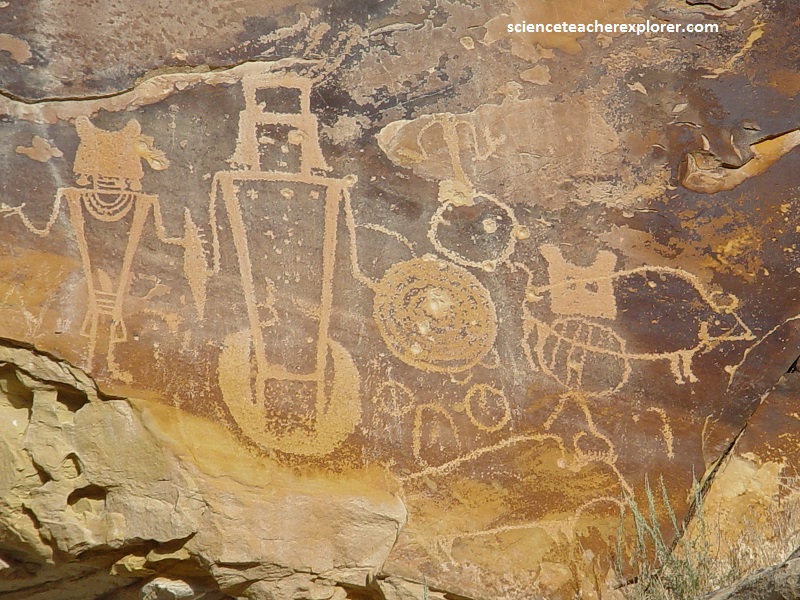
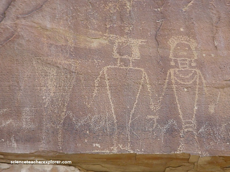
Picture above, the McKee Spring Petroglyphs are located in the Dinosaur National Monument near Vernal, Utah. The site boasts several panels of very well preserved Fremont/Classic Vernal style petroglyphs.
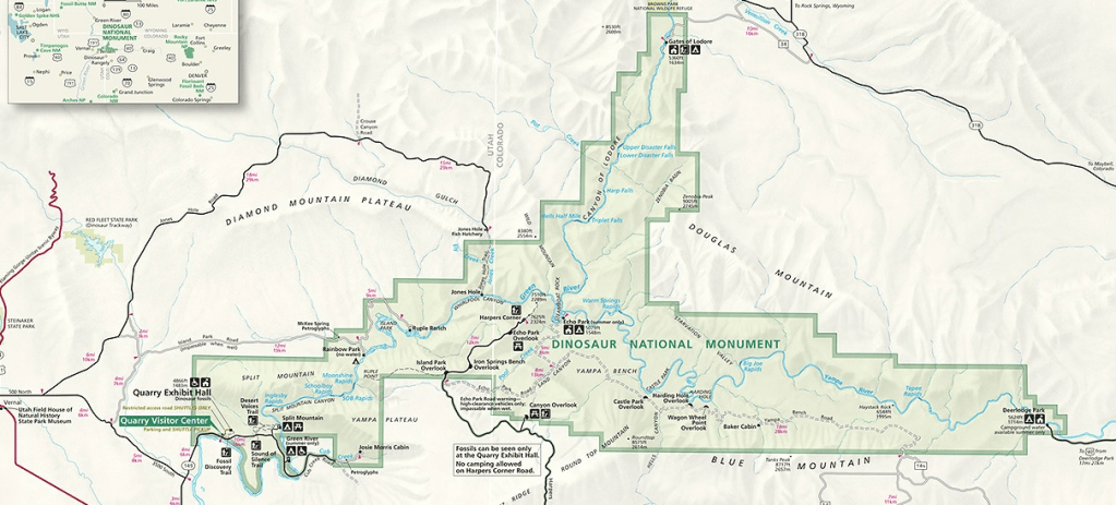
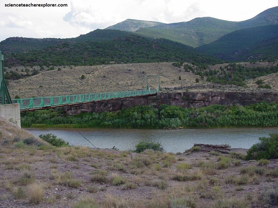
To get to McKee Spring and Island Park, from the Visitor Center, head back out on the entrance road and turn right onto the Brush Creek Road at the intersection of 9600 E and 3500 S. Follow the Brush Creek Road for about 12.5 km and turn right on to the Island Park Road. Then drive for 16 km to Mckee Springs Petroglyphs. Island Park is another 1 km
With some of the human figures, wearing necklaces and head-dresses, reminds me of the Aztecs of Mexico. It makes me wonder if this could be a connection to “Aztlan: The Mythical Homeland of the Aztec-Mexica”. Maybe, the Fremont Natives were depicting the enemy of a group of “Head-Hunters” looking for their Aztlan. This would help explain, why the Ancient Pueblos moved into the cliffs of the 4-corners region.
Another site, with the same human-head hunters is found in the nearby Dry Canyon of Vernal, Utah called the, “McConkie Ranch Petroglyphs”.
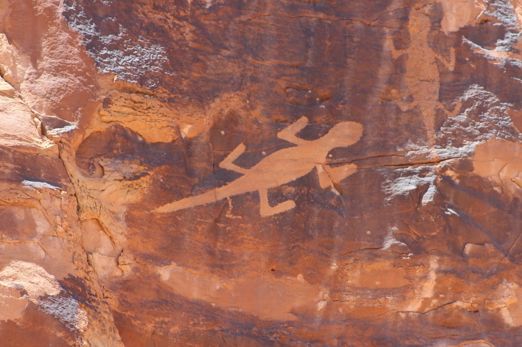
Additionally, near the Visitor’s Center, and on the other side of the Split Mountain cliffs, is an amazing, high quality petroglyph of a “Lizard”, (pictured below).