Jostedalsbreen, Norway
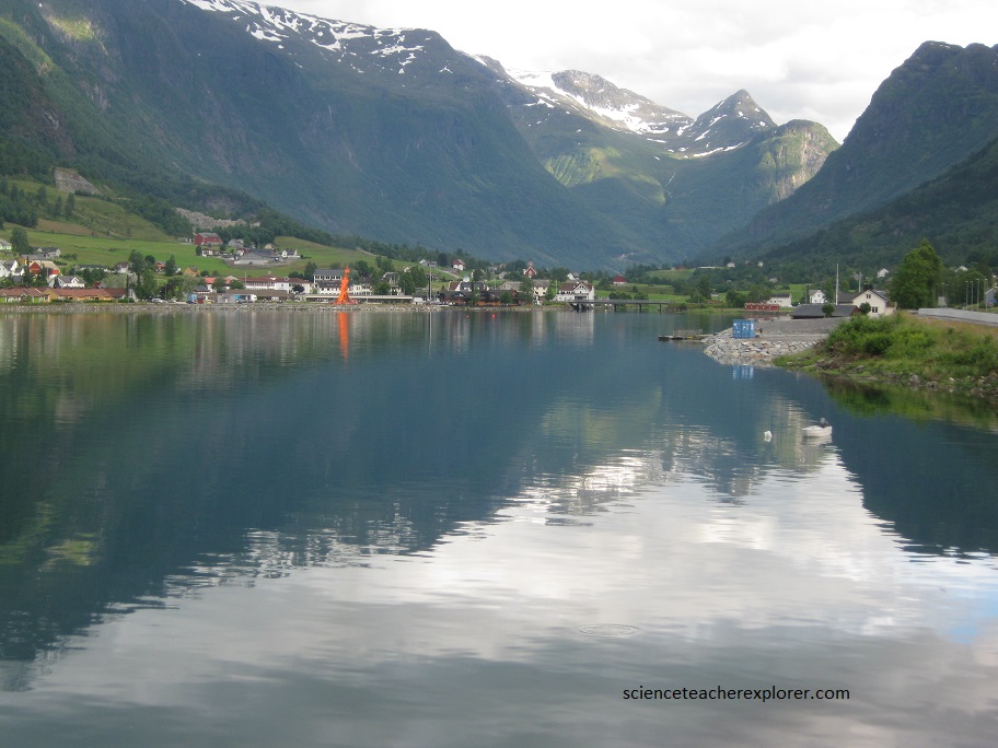
On June 23rd 2018, I stayed the night in a little town called Stryn. There, they were celebrating the Summer Solstice by building a giant fire for their gods, (pictured below).
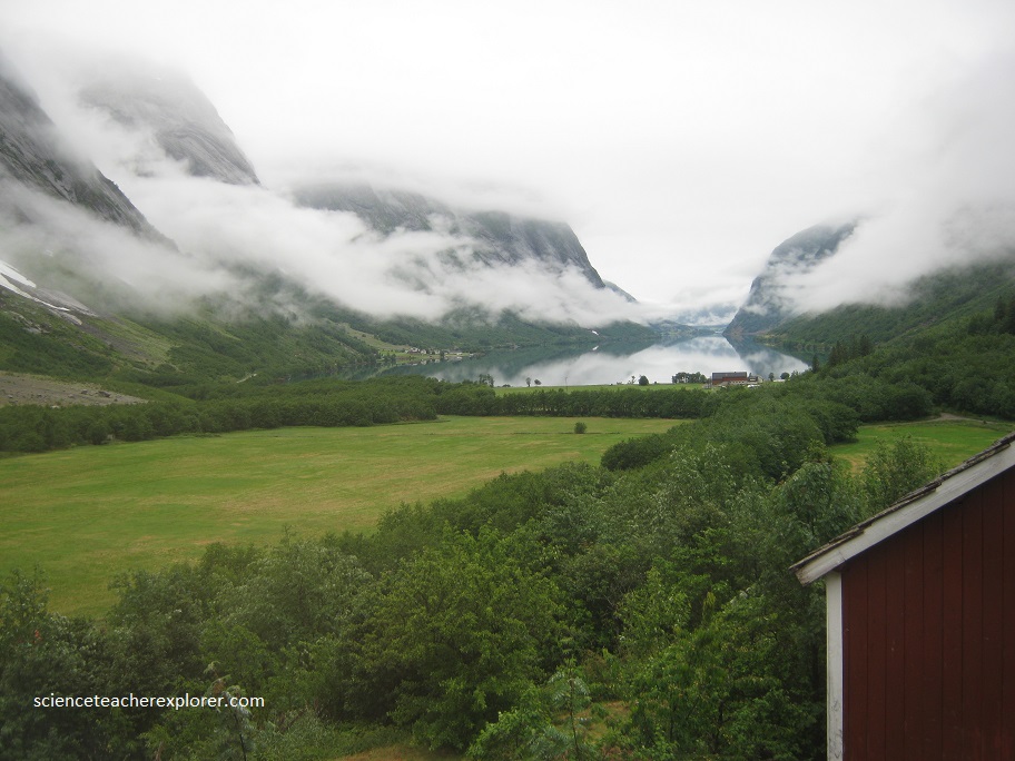
The next day I visited beautiful lake up a nearby canyon called Lovatnet Lake, (pictured below). Note how green the water is. Lovatnet lake is green because it contains clay particles and rock dust, carved out by glaciers and swept along by rivers. The glaciers are continuously crushing up rocks and stones. When the glacial water reaches the lakes and fjords, it looks green, especially when the sun shines.
That next day, I continued south to visit the Briksdalsbreen portion of the Jostedalsbreen.
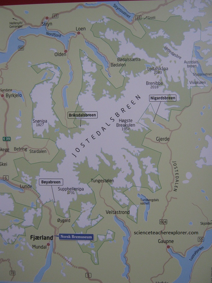
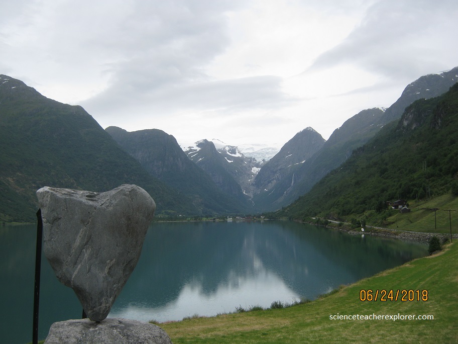
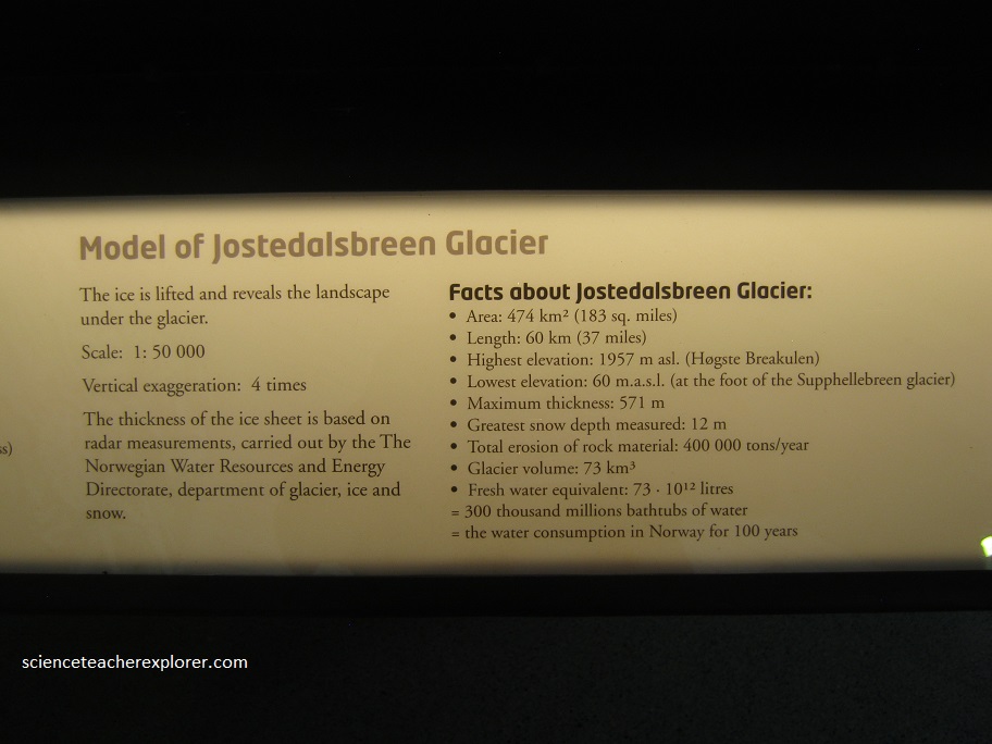
Jostedalsbreen, (pictured above), is the largest glacier on the European mainland. The main glacier rests on a mountain plateau west of the Jostedalen valley, hence the name. The glacier ice covers a total area of about 500 km2, while the national park is more than 1300 km2. Jostedalsbreen is a temperate glacier such that it is at melting point throughout the year, from its surface to its base.
The glacier is not frozen to the bedrock but flows along the slopes and through the valleys like a river, albeit at very low speed from 1 cm/day up to 100 cm/day (3 feet per day). Flow is highest at surface and middle causing the ice to crack and break up. Chunks of ice regularly falls from the edge or front of the glacier, a process known as ice calving.
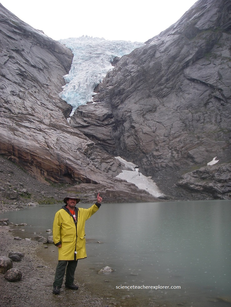
Briksdalsbreen, (pictured above), is a glacier arm of Jostedalsbreen, and is set in Briksdal Valley, at the end of Oldedalen Valley, in Stryn in Sogn og Fjordane County. This famous glacier arm lies in beautiful surroundings between high peaks and roaring waterfalls, dropping 1200 meters into the narrow Briksdal valley below. It is a spectacular sight.
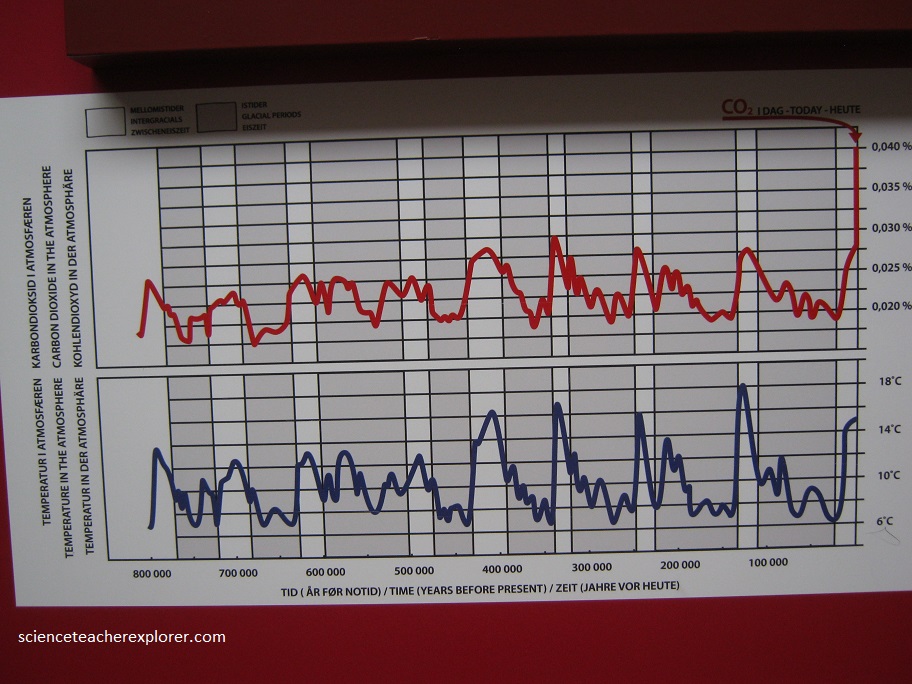
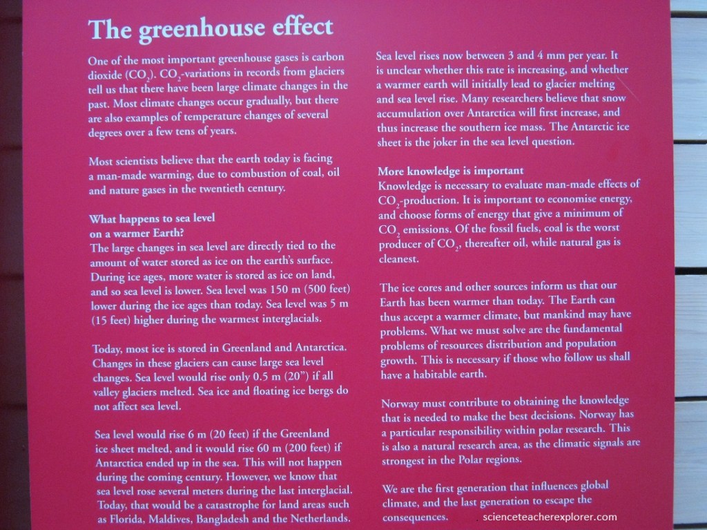
As mentioned above, I visited the Norsk Bremuseum in Fjaerland. There they had a great museum about glaciers and Climate change. Images below show panels about the correlation of “Climate Change Temperatures” (blue) and “CO2 Quantities” (red), in the atmosphere, (proxy taken from glacier cores).
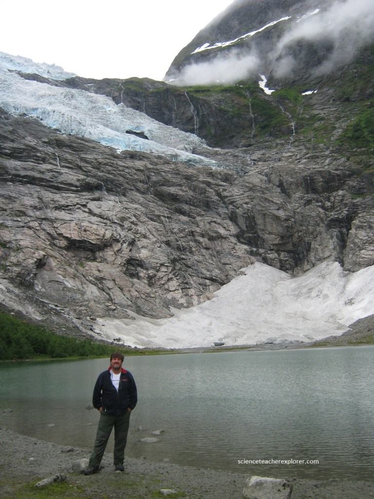
An additional glacier arm that I visited that day was the Boyabreen, (pictured below).
The meltwater from this giant glacier partly drains into Fjaerlandsfjord, a tributary of Sognefjord, (pictured below).