Crater Lake N.P., OR
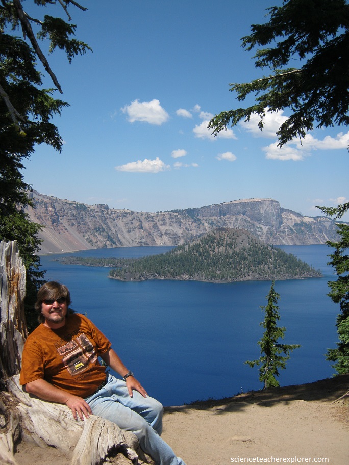
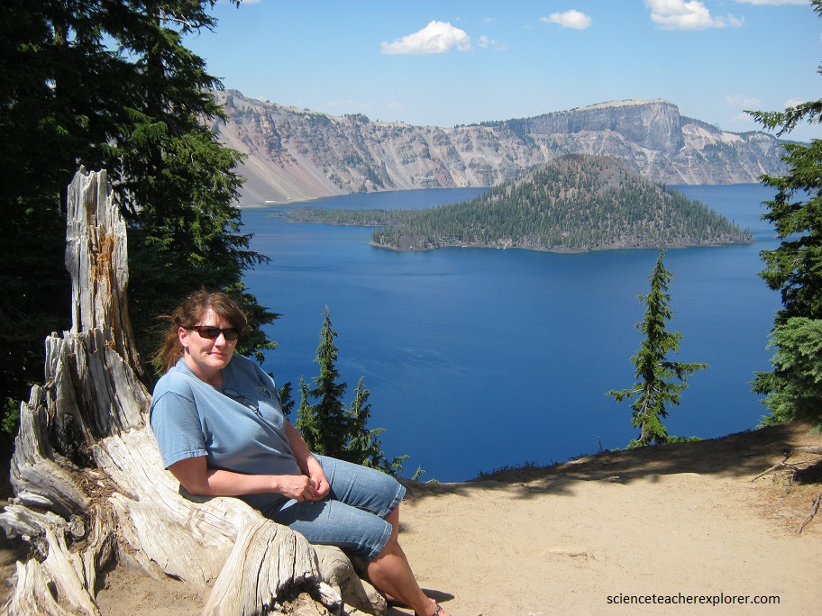
In August of 2013, Becky (my wife) and I was on our way back from vacationing in Point Arena, California; when we had the opportunity to explore Crater Lake National Park in Oregon; USA.
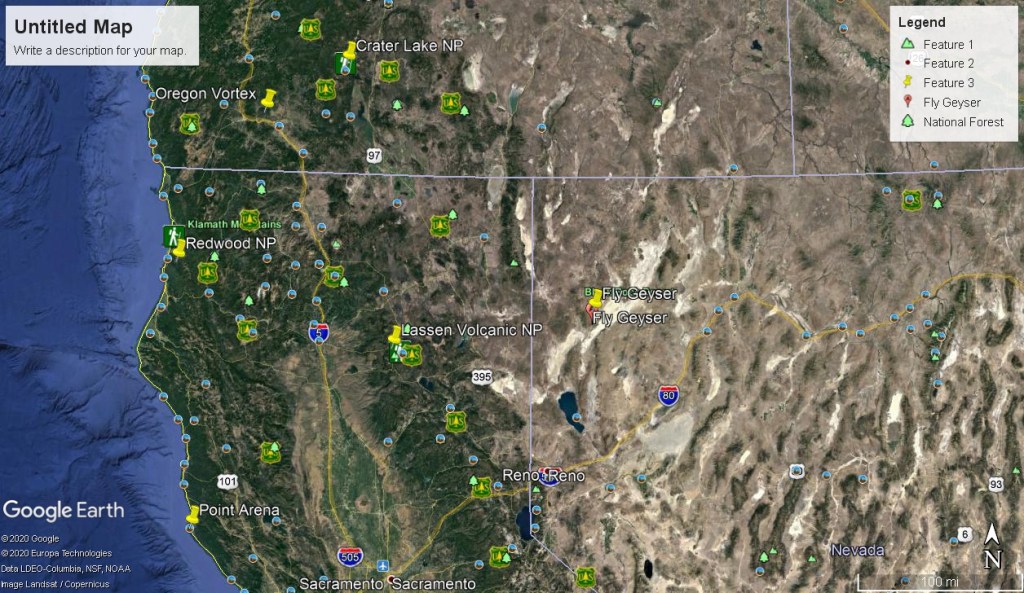
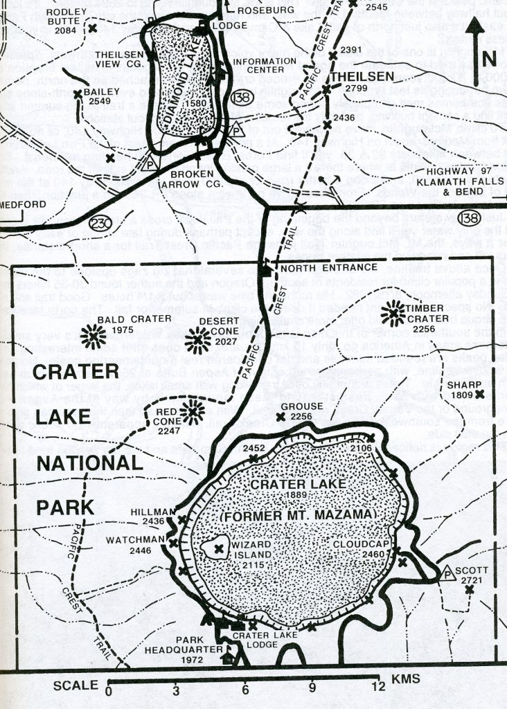
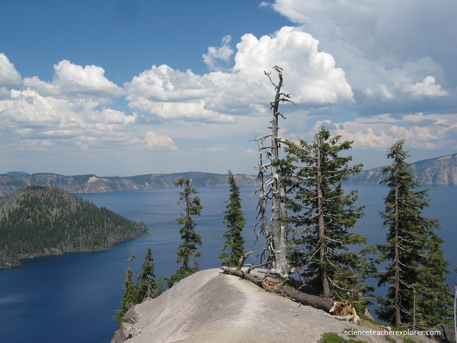
Crater Lake partially fills a 1,200-meter deep caldera, a depression formed by collapse of ancestral Mount Mazama during the violent eruption of 50 cubic kilometers of magma, or molten rock, about 7,700 years ago. Crater Lake National Park is an American national park located in southern Oregon.
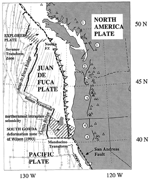
Volcanic activity in this area is fed by subduction off the coast of Oregon as the Juan de Fuca Plate slips below the North American Plate. Heat and compression generated by this movement has created a mountain chain topped by a series of volcanoes, which together are called the Cascade Range. The large volcanoes in the range are called the High Cascades. About 400,000 years ago, Mount Mazama began its existence in much the same way as the other mountains of the High Cascades, as overlapping shield volcanoes. Over time, alternating layers of lava flows and pyroclastic flows built Mazama’s overlapping cones until it reached about 3,400 m in height.
As the young stratovolcano grew, many smaller volcanoes and volcanic vents were built in the area of the park and just outside what are now the park’s borders.
Mount Mazama began its climactic eruption about 7,700 years ago, blowing out about 50 cubic kilometers of magma as pyroclastic materials (mostly rhyodacite pumice and fine ash) in at most a few days. The volcanic ash covered parts of the northwestern states to as far as central Canada.
http://oe.oregonexplorer.info/craterlake/geology.html
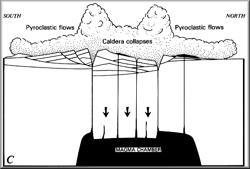
The climactic eruption was fed by magma that had accumulated in a chamber about 5 km below the surface. As the enormous volume of magma was rapidly removed to feed the eruption, the roof of the magma chamber collapsed, forming the bowl-shape depression known as a caldera. The caldera has a diameter of approximately 8 km north to south and 10 km (east to west, with an approximate depth of 1,200 m from the caldera rim to the lake floor. Pyroclastic flows deposited pumice and ash on all flanks of Mount Mazama and in valleys below.
http://oe.oregonexplorer.info/craterlake/geology.html
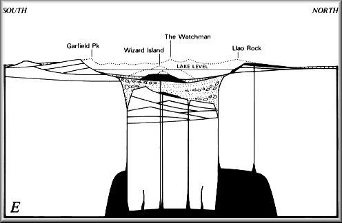
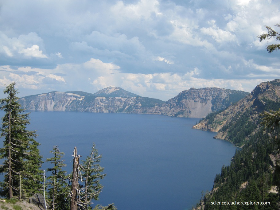
The caldera was partly filled with pyroclastic materials and rock debris from its unstable walls. Subsequent to the climactic eruption, all volcanic activity has occurred within the caldera itself. Renewed volcanism built the postcaldera volcanoes of the central platform, Merriam Cone, and Wizard Island.
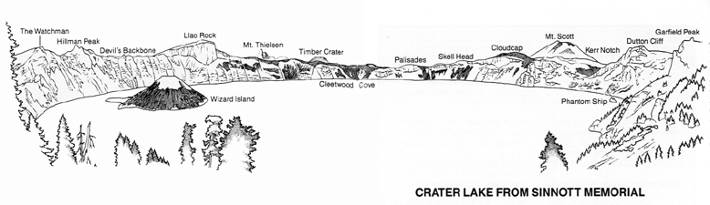
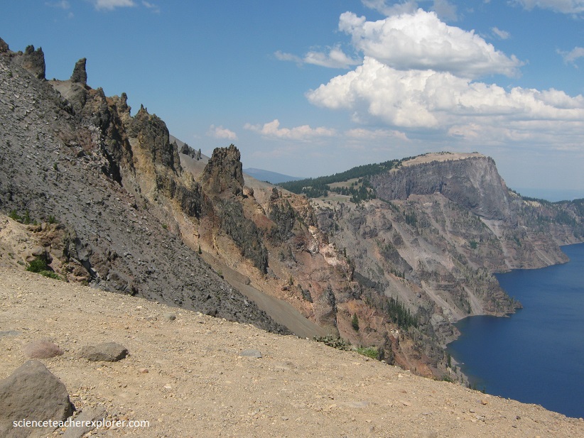
Pictured below, The dark rock spine that juts from the cliff between Hillman Peak and Llao Rock, reaching from the lake to the rim, is called the Devil’s Backbone. This 18 m wide, 420 m high rib of rock is a large dike, the geologic name for a blade-like intrusion of magma from underground that has been injected into a fracture. The solidified magma in the Devil’s Backbone dike is more resistant to erosion than the surrounding material, and stands out as a prominent vertical ledge.
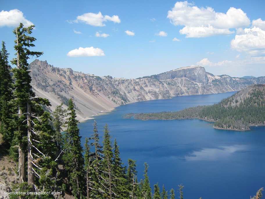
The lake is 594 m deep at its deepest point, which makes it the deepest lake in the United States, the second-deepest in North America and the ninth-deepest in the world.
Crater Lake has no streams flowing into or out of it. All water that enters the lake is eventually lost from evaporation or subsurface seepage. The lake’s water commonly has a striking blue hue, and the lake is refilled entirely from direct precipitation in the form of snow and rain.
