Yorkshire Dales, ENG
On August 11, 2016; I spent the day in the Yorkshire Dales, England.
The Yorkshire Dales topography and geology is dominated by the ancient Askrigg block; a part of the earth’s crust bounded to the south by the Craven fault system, to the west by the Dent fault, to the north by the Stainmore trough and to the east lies under the Vale of York.
South of the Equator, two ancient continents collided 400 million years ago closing the Iapetus Ocean. The sands, shales and mud of the seabed were squashed into greywacke rock that was raised up to the surface as buckled and folded hills before their tops were eroded into a flat plain, an unconformity under later deposition.
The Askrigg block moved northwards to the equator and down to the bottom of a new sea. This Carboniferous period had seas rich in shellfish, coral and plankton; which accumulated on the seabed. This 200m thick ‘Great Scar’ limestone is named from surface features such as Malham Cove. The sea level temporarily became shallow resulting in a fauna variation which increased the mineral deposition and created the white porcellanous band of rock.
Further tectonic action raised the Askrigg block exposing nearby landmasses to erosion washing material into the sea and led to the development of the Yordale series, a 300m deposit of alternating layers of shales, sandstone and limestone. As the sea became shallower, the area became a broad delta with coarse grained sandy deposits and plants washed in, creating the Millstone Grit series which forms the summit plateau in the area.
Eventually these seabed layers were brought to the surface where erosion would lead to what we see today. As the glaciers advanced and retreated, rocks would be deposited as surface till, erratics and moraines which created temporary dams. Melting ice formed lakes which burst forth gouging melt-water channels.
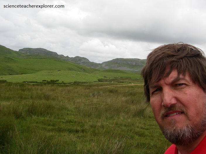
The Yorkshire Dales are a series of glaciated valleys carved into the upland area of the central Pennines, the central mountain ridge of England that extends from the north Midlands up to Scotland.
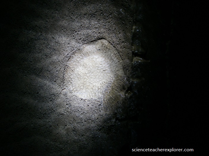
The peaks are more rounded with no sharp ridges, and the valleys or dales are more open. The region is one of the major karst or cave-forming areas in Britain, and there are many spectacular limestone features including reef knolls, (conically shaped and fossil-rich hills which formed as coral atolls in the shallow water of an ancient prehistoric sea). These can be found on Scosthrop moor above Settle.
Pictured above is Malham Cove. Malham Cove is a spectacular natural limestone formation which comprises a curved limestone cliff at the head of a valley. The limestone pavement at the top is a superb example of later karst or cave-forming weathering. The limestone was formed during the early Carboniferous (359-331 Million years ago), when sea levels rose and northern England was flooded by warm, tropical seas. At this time the area was about 10⁰ south of the equator.
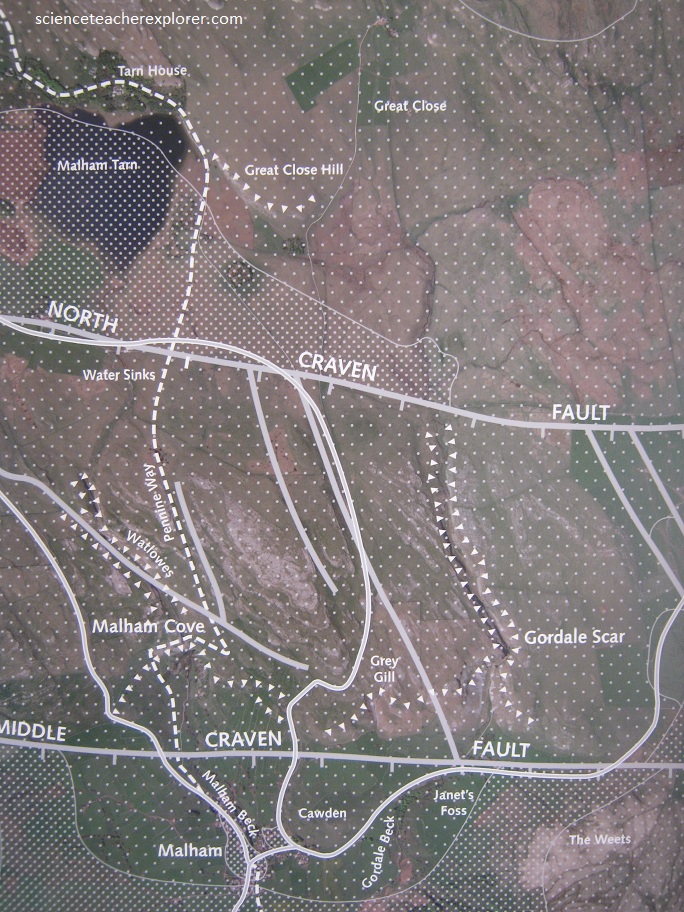
In the Malham area this limestone is known as the ‘Great Scar Limestone’ and can be seen at Malham Cove, Gordale Scar and on the plateau to the north. The distinct horizontal lines between the beds of limestone (bedding planes) indicate pauses in deposition.
The features seen today are a legacy of the action of ice and melting of this. It was the last of four ice advances within the last sixty thousand years, which had most significant effects. A large waterfall flowed over the edge of the cove as the glacier melted and eroded the lip to form a curve seen at Malham Cove.
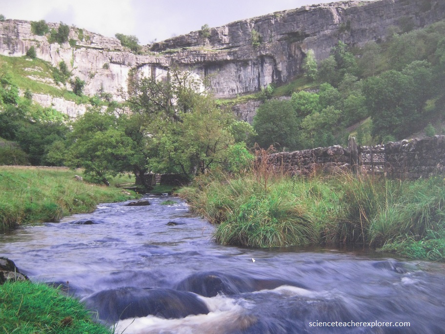
Pictured above, the Gordale Scar is the most awe-inspiring single feature of the Yorkshire Dales. Unlike the Malham Cove, which bares all on first sighting, the Scar has a far more intriguing nature. Once in its depths the grandeur of the overhanging cliffs up above can initially be too daunting to full appreciate the waterfalls: the upper fall spills in spectacular fashion through a circular hole in the rocks. The water is that of Gordale Beck, being funneled from the lonely moors to the green valley. Like the cove this is a valley cut back from the Craven Fault, formed by erosive action of ice and glacial meltwater, rather than being a collapsed cave.
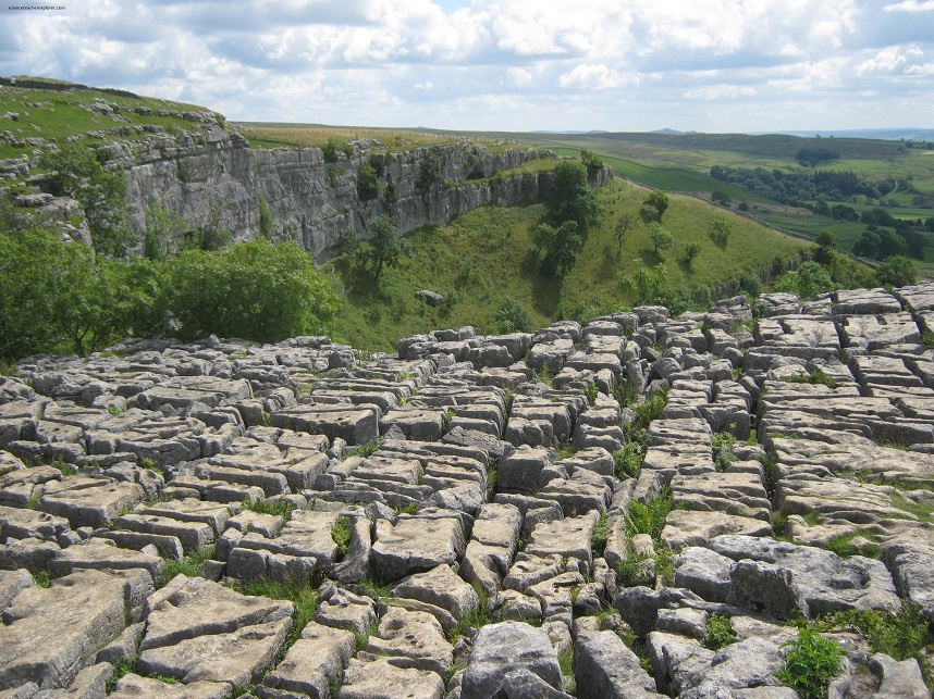
Eroding ice also scoured the limestone plateau north of Malham to create the bare limestone exposing it to water action. Since then the rain has been quietly dissolving the limestone and widening the fissures and also forming many of the caves in the area. The rain continues to slowly dissolve the limestone today. Above Malham Cove, the Great Scar Limestone forms a spectacular limestone pavement with grykes (fissures) formed by the solvent action of rainwater on joints in the limestone.
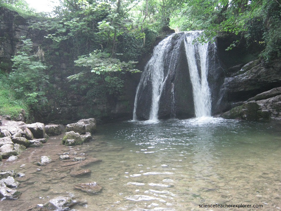
Picture above is Janet’s Foss, (a beautiful waterfall in its wooded setting). Legend has it that Janet, local fairy queen, had a cave behind the falls. More certain is that this wood is a rich habitat for a wide variety of flora and fauna.
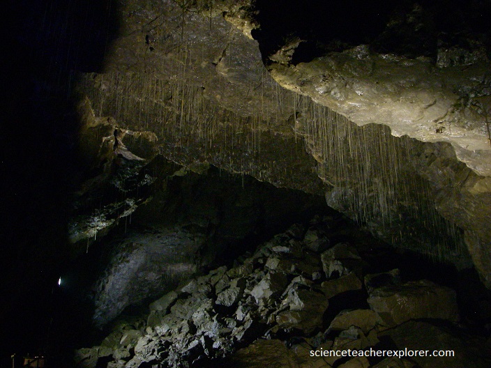
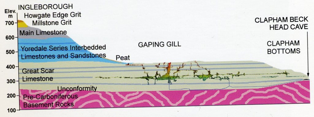
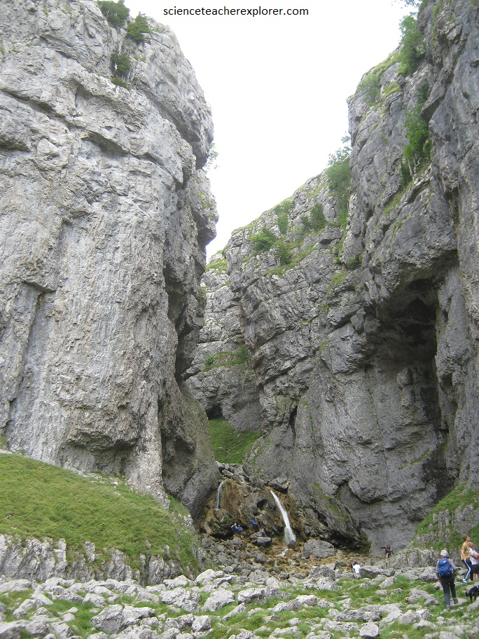
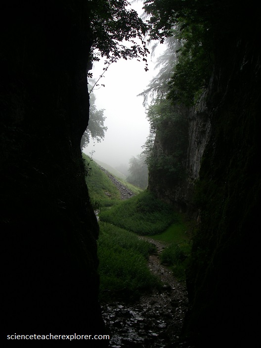
Just a few miles north of Malham Cove is the Gaping Gill, (imaged above). The Gaping Gill is the deepest shaft of England’s largest underground cave systems. The walk up from Clapham to the cave entrance, is amid the beautiful scenery of the Yorkshire Dales, and passes through a steep limestone gorge, (pictured below).
The carboniferous limestone in the area is porous, and the hills of the Yorkshire Dales are riddled with limestone caves and potholes. Cave development could start within the ‘Great Scar Limestone’, following faults, joints and beds with springs at the valley bottoms. Each ice age would erode more rock layers, deepen valleys and deposit glacial till. Glaciers would erode caves or block them with ice. High level passages were abandoned as water found new routes to lower springs in the freshly incised valleys.
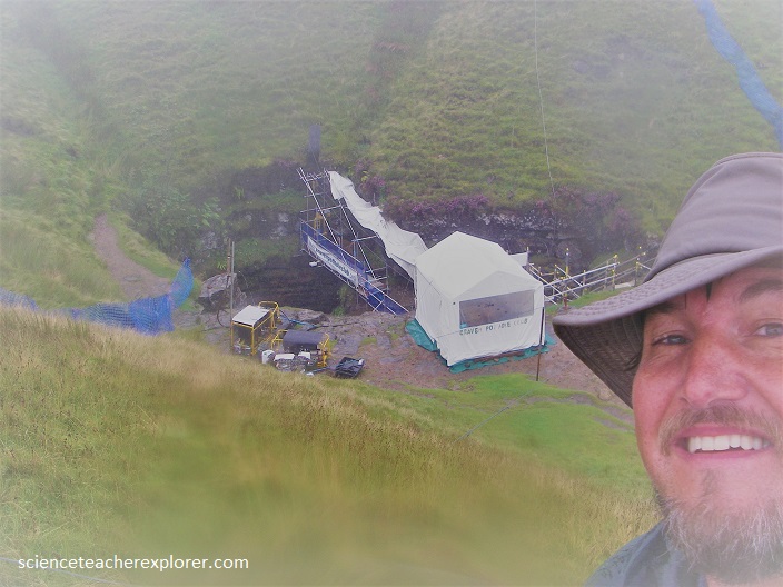
The only way to get inside the Gaping Gill was to attend a “winch-meet,” when local cavers lower visitors down in a metal cage on the end of a cable.
Since I was alone, the cave entrance watchman did the pleasure.
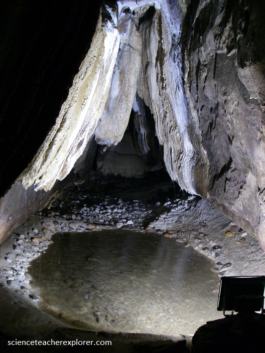
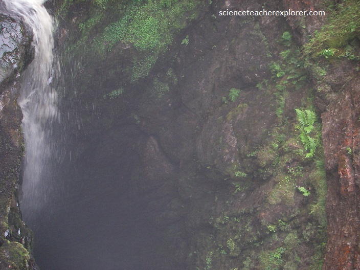
The huge chamber had been carved out over many centuries by the waters of Fell Beck, which have eaten away at the limestone rock, creating a subterranean waterfall twice the height of Niagara Falls. This is the highest free falling waterfall in the United Kingdom. By the time I reached the bottom, the water had fallen so far that it turned into a mist.
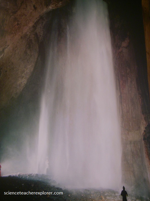
The Gaping Gill main chamber is a conjunction of a geological fault and joints exploited by the relentless pull of gravity upon Fell Beck in it’s headlong rush to the sea. The main chamber, aptly named the Hall of Winds, is misty and windy from the multiple waterfalls which drag air down with them.
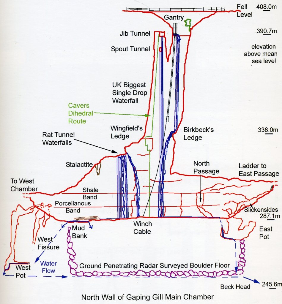
Looking at the north wall of the chamber, I saw the main waterfall on my right which was much diminished from normal because most of the water had been diverted down Rat Tunnel and created two waterfalls on the left, (pictured above). There were pools of polished boulders at the base of the waterfalls, many of these were the creamy colored porcellanous band limestone which was more resistant to erosion than the grey limestone. The main chamber was as far I was allowed to venture.
Nearby there were other interesting caves, (such as White Scar Cave), that were easier to visit, along with other unique limestone landscapes, such as the strange, lunar “limestone pavement,” which is home to many rare coral fossil’s.