Wupatki N.M., AZ 2010
During December of 2010, I made a point to explore the parks of Arizona. I approached Northern Arizona, through Page on U.S. 89 towards Flagstaff. On the way, I visited the Tuba City Dinosaur Tracks, the Sunset-Crater Volcano National-Monument, and Wuptki National Monument.
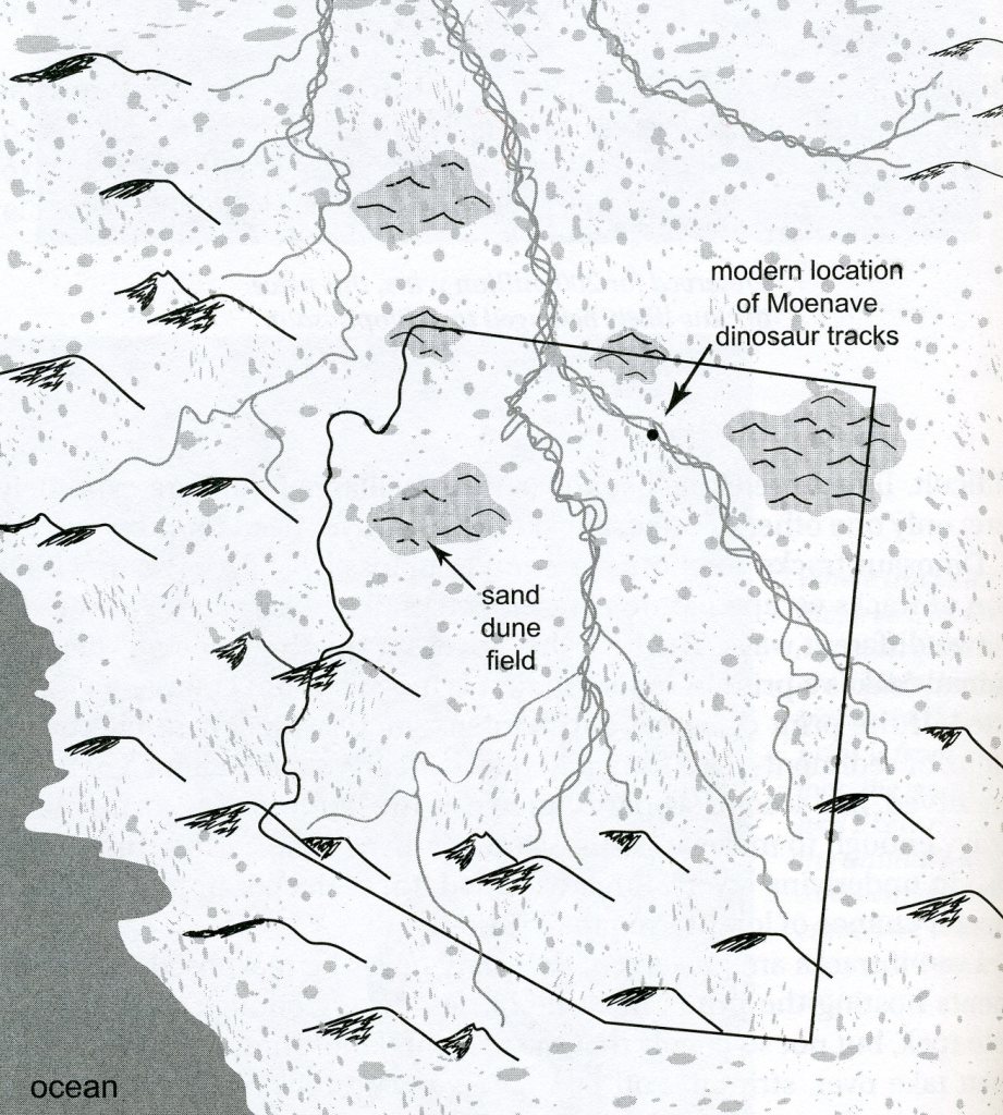
Just west of Tuba City and east of U.S. 89, I found dinosaur tracks on the Navajo Indian Reservation. They arc commonly called the Tuba City Dinosaur Tracks. The tracks are within the Moenave Formation, fine-grained sandstone deposited along streams just over 200 million years ago, either very late in Triassic time or early in Jurassic time.
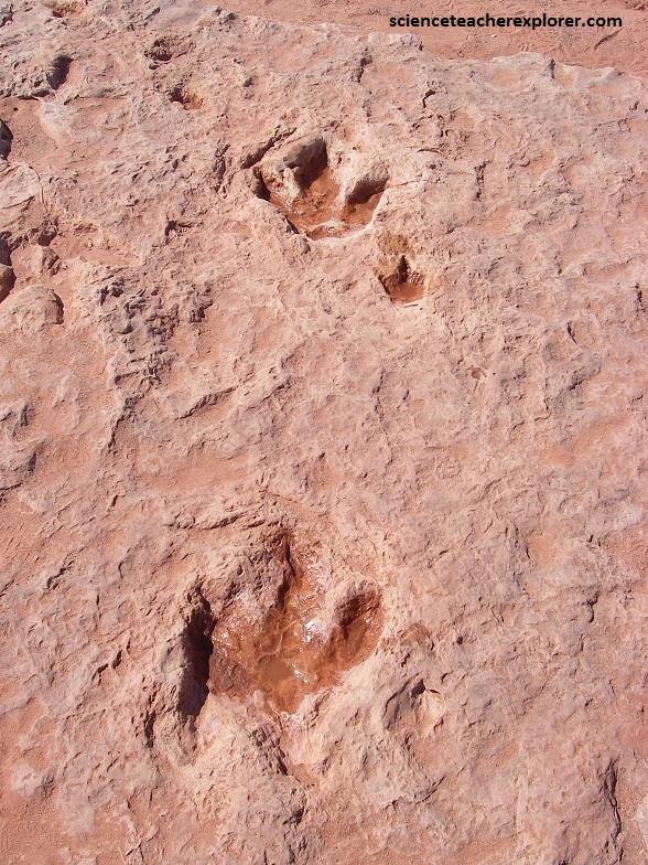
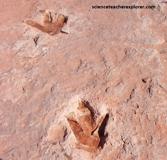
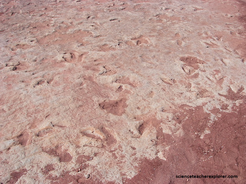
Picture above and below, the tracks are trace fossils, (evidence of an animal’s presence without actual fossilized remains). Based on their age, their large three-toed size, and that they were made by animals that walked on two legs, these were made by carnivorous dinosaurs called theropods or Diloposaurus.
When the dilophosaurs dance around this area, it looked very different form what we saw in 2010. During Jurassic time, a range of tall mountains in southern Arizona fed a family of braided rivers that spilled northward across a series of flatlands on their way toward the sea in Utah. Shallow lakes dotted this landscape, and fossilized bits of wood indicate the abundant vegetation lined the lakes and river floodplains. Sandstone and siltstone layers deposited by these rivers in flood likely mad the cover-up of these Moenave tracks and skeletons possible.
The Moenave skeletons reveal that Dilophosaurus was the biggest, fiercest carnivore of the time. A full-grown dilophosaur stood about 2.3m tall, stretched 6m long, and tipped the scales at 318kg. Pictured below, smaller footprints in the area might relate to early crocodilians or mammal-like reptiles.
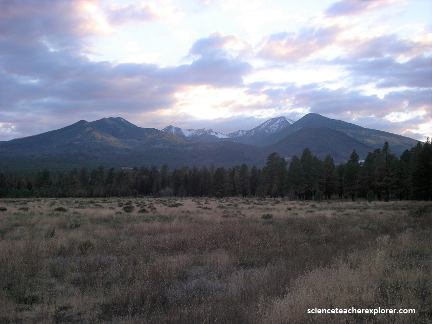
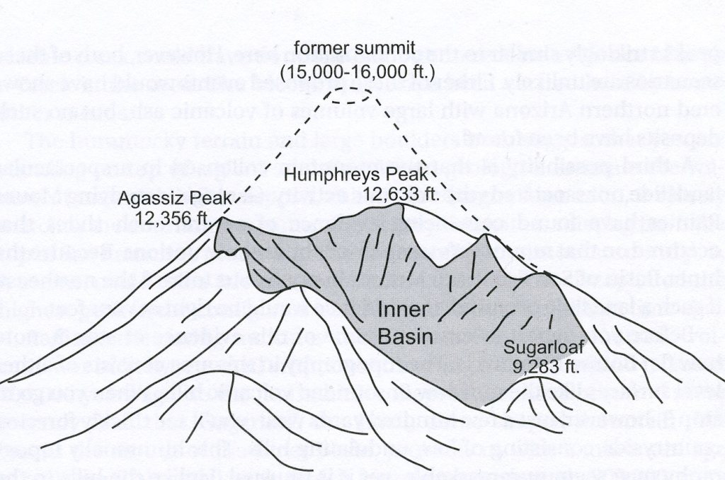
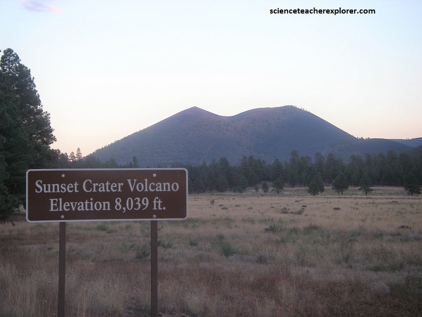
Further down U.S. 89 and closer to Flagstaff, I visited Sunset-Crater Volcano National-Monument. The San Francisco Volcanic Field is the largest in Arizon, covering an area of about 5200 square kilometers. The youngest addition to the field is Sunset Crater Volcano and some lava flows from smaller, nearby craters that formed less than 1,000 years ago.
Pictured below, the Sunset Crater erupted between 1040-1100 AD. Rising just over 330 m above the surrounding plateau, Sunset Crater Volcano is one of the largest cinder cones on Earth.
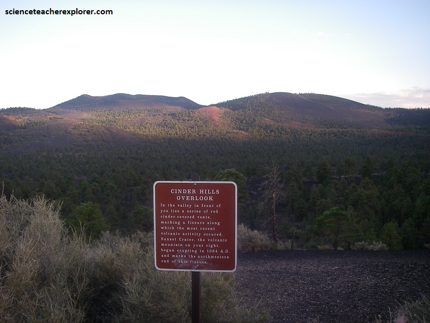
Pictured below, Sunset Crater Volcano formed start-to-finish during a single eruptive episode that probably lasted only a few months at most. Near the end of the eruption, the Bonito and Kana’s lava flows erupted from vents near the base of the cone. Vents near the top of the volcano released steam that oxidized iron in the cinders into the reddish orange color that gave the mountain it’s name.
Sinagua Natives, (ancestors of the Hopi and Zuni), had been living in the vicinity of Flagstaff, Arizona; for at least 400 years before their lives were disrupted by the eruption of Sunset Crater Volcano about 1,000 years ago. Although the Sinagua people moved away from the area for several decades, when they returned it was to Wupatki, just north of the volcanic activity.
Sunset Crater’s eruption blanketed the desert to its north with volcanic ash and cinders. The Sinagua, whose name means “without water” in Spanish, were proficient at farming without irrigation, but it seems likely that the Wupatki area was too dry to support any agriculture before the eruption. However, the ash retained enough rainwater to allow food crops in the previously uninhabitable area.
The Sinagua began to move back into the area by 1100 AD and at least 1000 people occupied the are of Wupatki National Monument by 1130 AD.
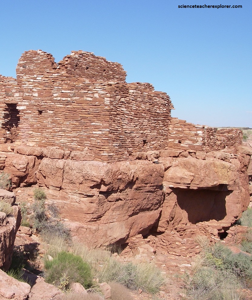
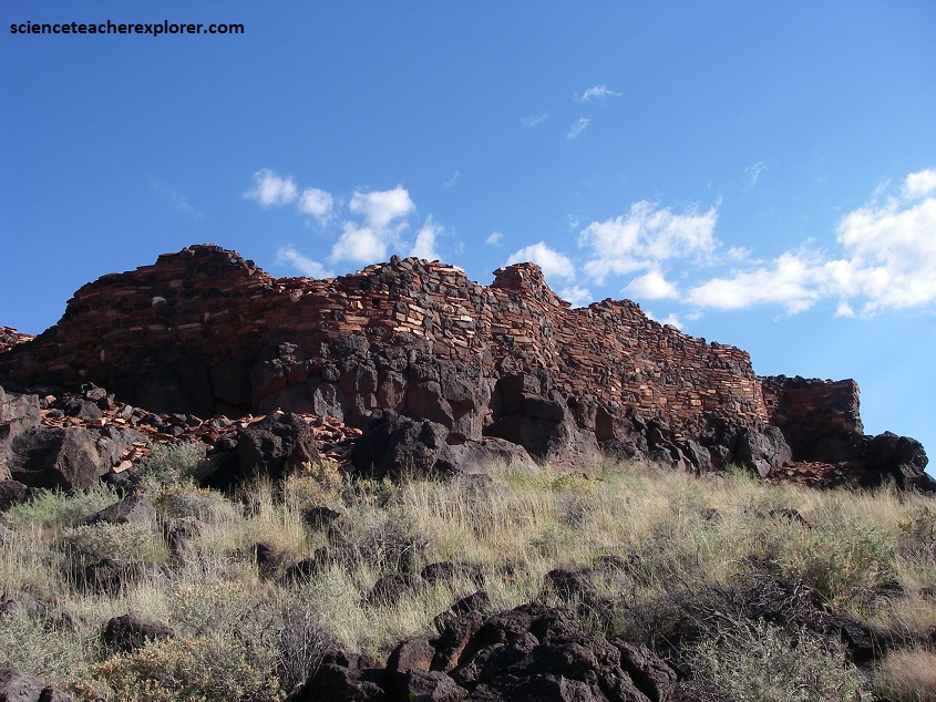
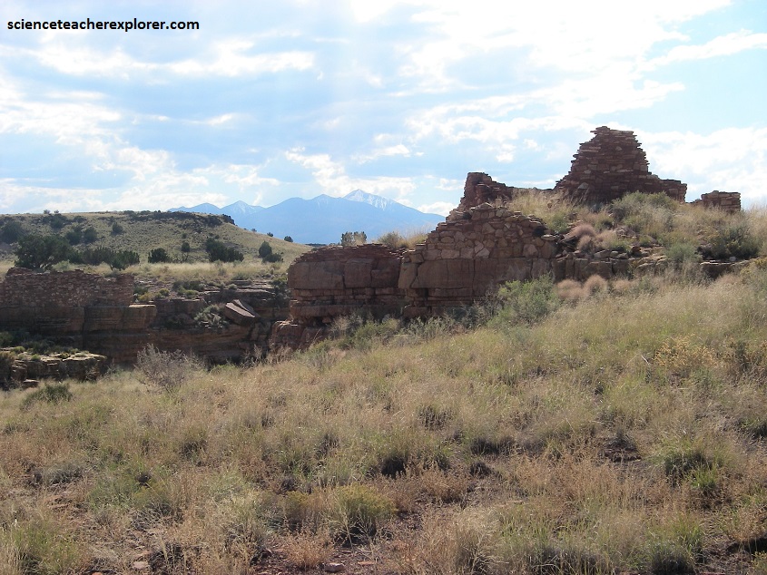
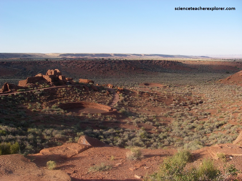
Pictured above, the red sandstone that makes up the bluffs is the Moenkopi formation of the early Triassic age.
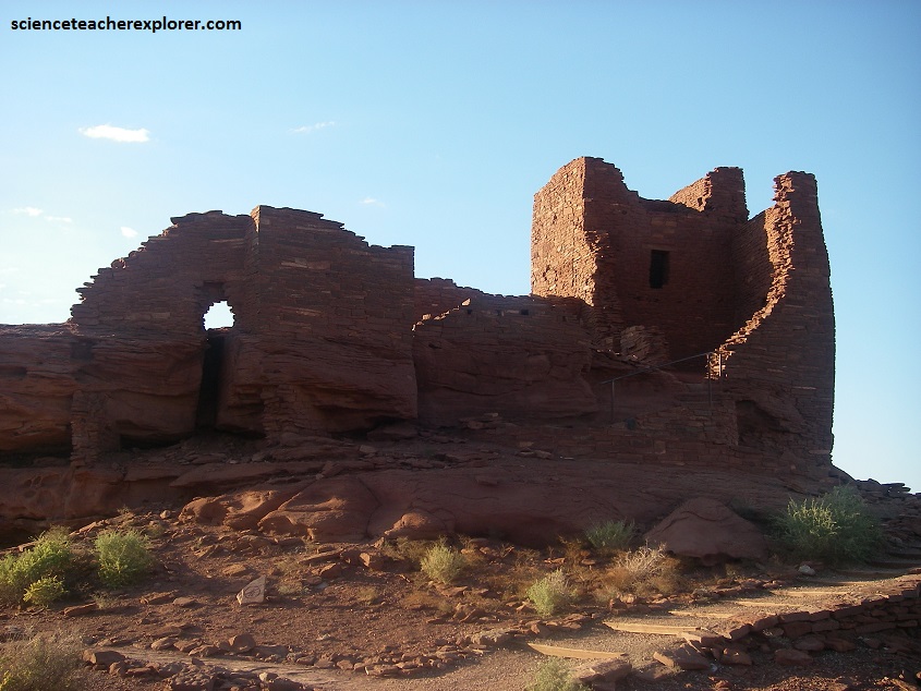
Above the Moenkopi Formation are some recent stream gravels, and the volcano’s ash and cinders. Because the pueblos were built using Moenkopi sandstone, they often blend into and seem part of the landscape.
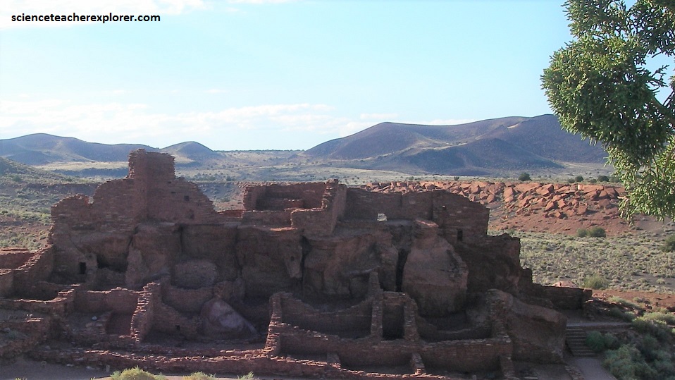
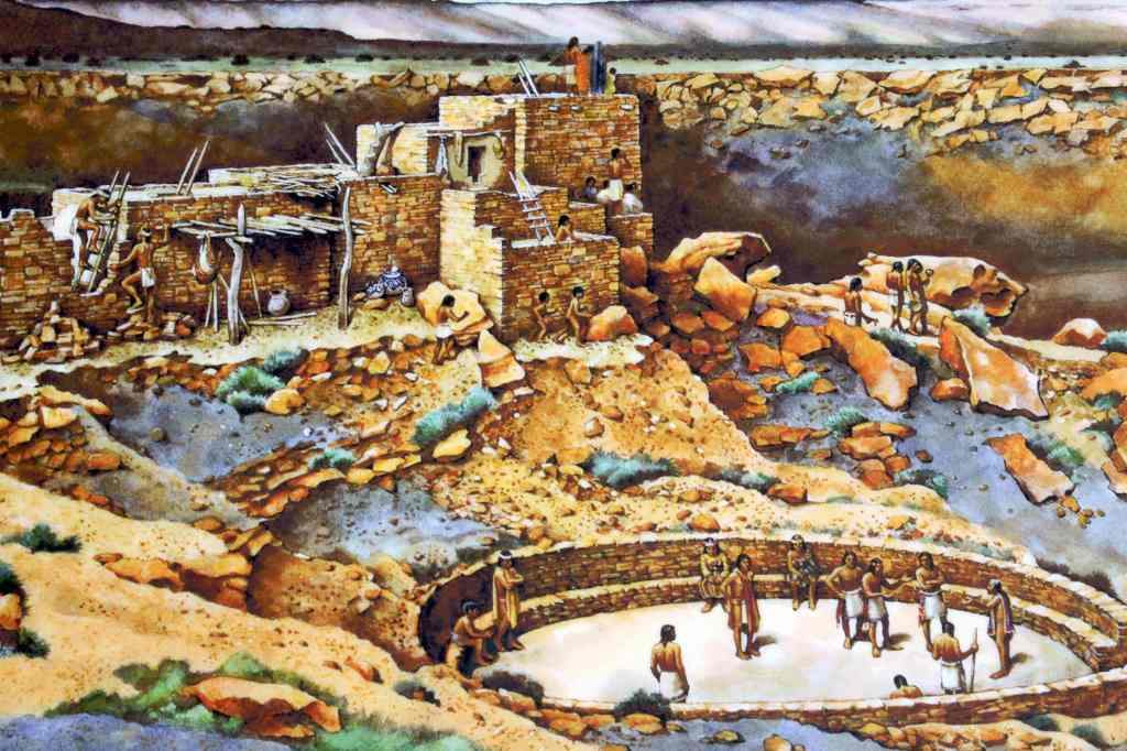
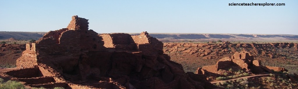
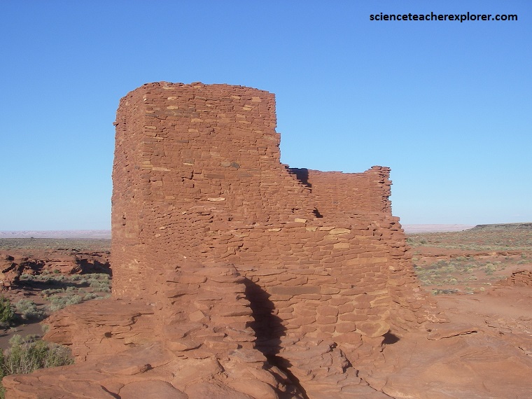
Pictured above, the Wupatki Pueblo has 100 rooms, (by far the largest of the pueblos in the monument). While it was home to many people, it was also a ceremonial center.
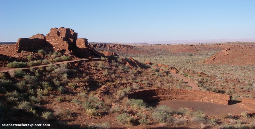
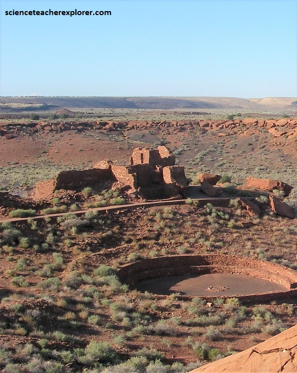
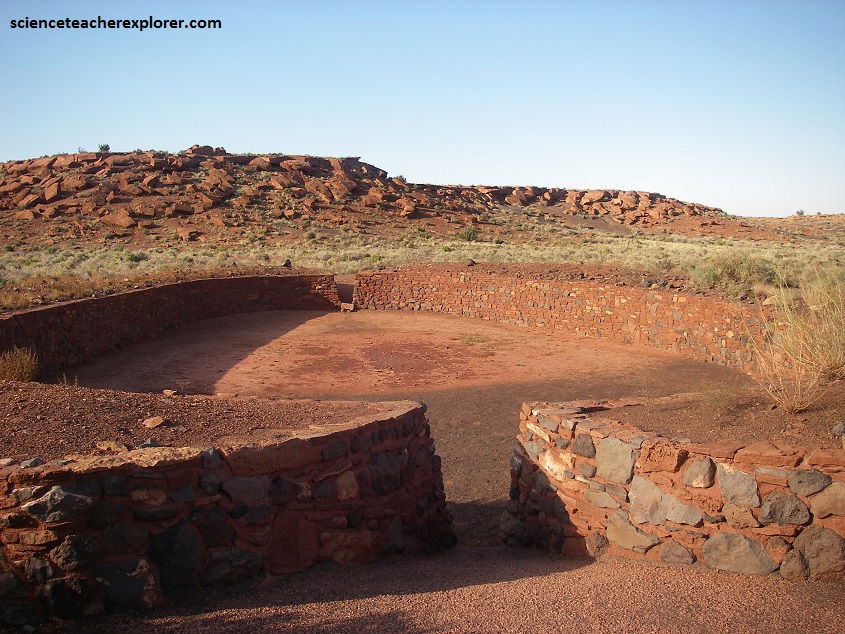
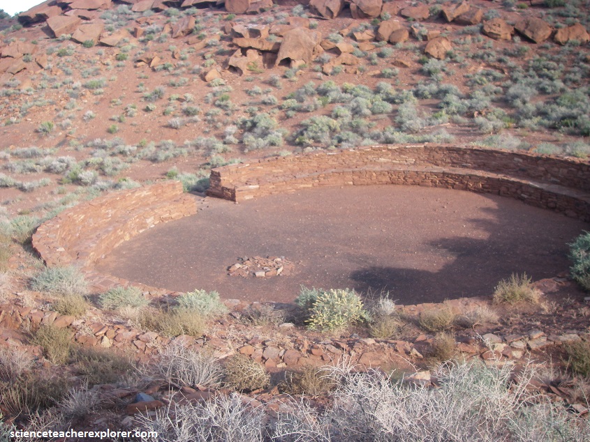
Pictured above, the Wupatki Pueblo site includes a large amphitheater, a ball court, and most notably a blowhole, (a hole in the ground through which the wind blows in or out depending on the outside atmospheric pressure.
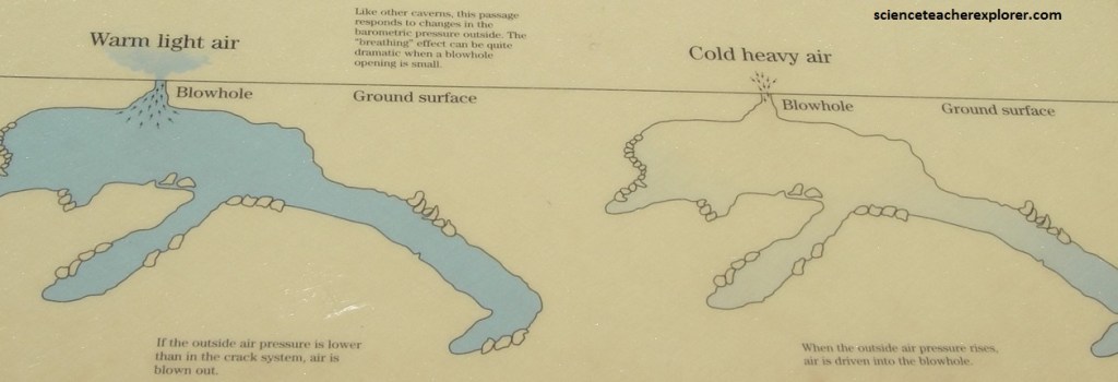
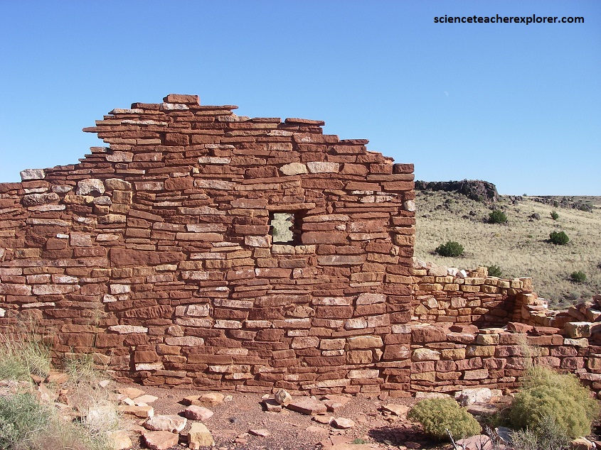
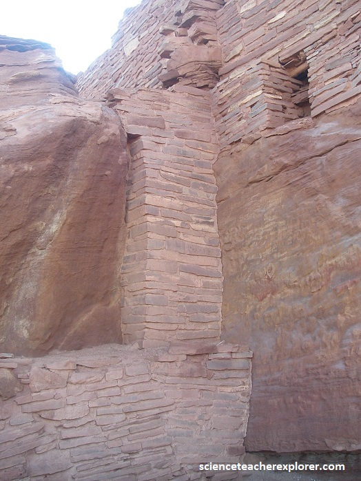
Pictured below, the air flows through a fissure in the Moenkop formation that no doubt connects to a cavern of some size within the Kiabab limestone below.
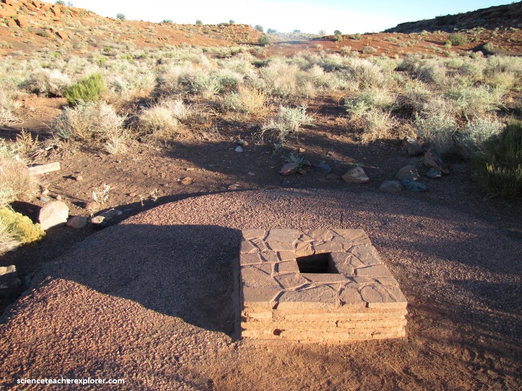
Pictured above, blowholes such as this were probably sacred to the Sinagua. It may be why the large development of Wuptki Pueblo was located here.
In the Wupatki area, between around 1150 and 1250, Sinagua culture reached a peak, society grew more complex and sophisticated, and trade expanded.
Pictured above, Wupatki Pueblo alone, there is a Hohokam style ball court and excavators found copper bells and 41 Scarlet Macaw remains from Mexico. Evidence of social hierarchy was demonstrated when, at a nearby pueblo site, archaeologists dug up the grave of the so-called Magician, (it contained more than 600 elaborate and unusual funerary objects).
By 1182, approximately 85 to 100 people lived at Wupatki Pueblo, but by 1225, the site was permanently abandoned. Possibly a major climate change caused the abandonment.
The Wupatki’s ruins remain of immense importance to the Hopi and Zuni peoples who continue to revere it as a sacred place and tell stories about its past through oral histories.
Sweeping mesas, basins, and grasslands, all in varying shades of rust red or faded green, overwhelm the topography. There’s little rain beyond the occasional summer thunderstorm, but that scarcely seems to bother the hardy saltbush, sand sage, and thread-leaf snakeweed, which grow in relative abundance.
Here the ancient buildings of Wupatki stand as living witnesses to the ingenuity of the Ancestral Pueblo peoples who built their homes and lives out of the copper-colored earth.
Evidence of over 2,500 manmade structures and features—multi-room pueblos, pit-houses, hearths, stone quarries, burial grounds, shrines, reservoirs, and field-houses—has been recovered at Wupatki National Monument.