Chiquitos, Bolivia 2019
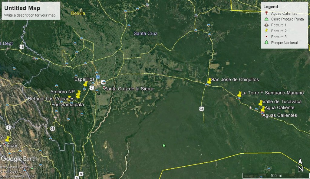
On August 4-6th, 2019; I had the opportunity to explore Eastern Bolivia Pampas called the “Dry Forests of Chiquitos”.
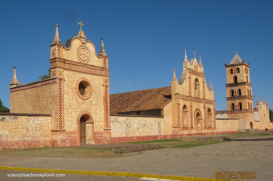
In the colonial era of South America, regions were controlled or divided between Spanish and Portugueses. A big portion was remained untapped until the end of the seventeenth century, when the Spanish Crown, sent the Jesuits to found several Jesuit missions in the regions that are now known as El Beni and Santa Cruz areas in Bolivia. The Spanish intention was economic among other interests and to sit presence of the crown in “conquered” regions since the Portugueses were approaching by what is now known as Brazil. The Jesuits, among other abilities, new a lot about architecture so they forced local people to construct the churches. In 1587, three Jesuits reached the remote far eastern outpost of Santa Cruz de la Sierra, at that time located near present-day San José de Chiquitos. (It moved to its present location in 1621.) The following year, the Jesuit Fr. Diego Martínez began sporadic evangelisation of the nearby Itatine tribe. Other tribes, almost all of them lingustically part of the Chiquitano (also known early on as Gorgotoqui) or Tupi Guaraní groups, soon were converted, with only the Chiriguano showing consistent hostility. After the expulsion of the Jesuits from the Spanish colonies, most of the missions were abandoned and deteriorated until the restoration project of 1972. Below is an image of my first stop in the Chiquitos area. My Hotel was located across the street of the Iglesia de San Jose de Chiquitos.
The Chiquitano dry forests are located primarily in northeastern Bolivia, forming a transition between the Amazon basin and the dry Andes and Chaco grasslands to the south. The Chiquitano forests receive approximately 1,000 mm of annual rainfall, but it is highly seasonal. Well drained forests have an uneven canopy of 20 meters, with common species such as Amburana cearensis (roble), and Cedrela fissilis (cedro).
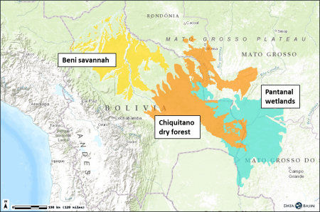
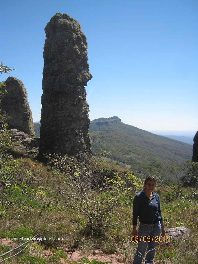
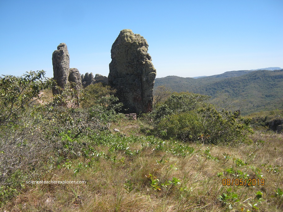
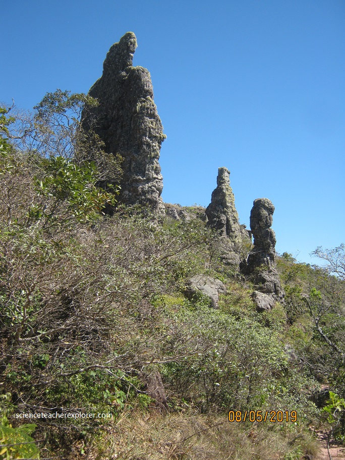
The Chiquitano is floristically similar not to nearby Cerrado but to the Caatinga region in northeastern Brazil, likely due to glacial history. In San José, I made friends with a local native-girl, who helped me to explore some of the local Chiquitano dry forests and Pampas. Pictured below, is in a small village called Chochis, Bolivia. The sandstone pillar is called the La Torre Y Santurario Mariano. This small village is located about 90 km east from San Jose de Chiquitos.
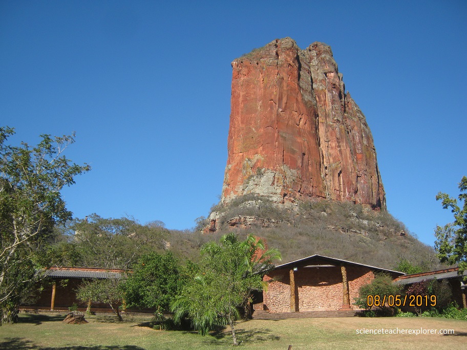
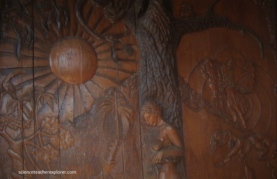
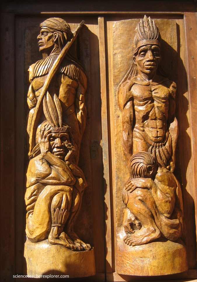
While in Chochis, Bolivia; we visited a giant red pillar called the Muela Del Diablo or La Torre de Chochis. Underneath the red pillar, is the Santurario Mariano. This place is special for people that like the tranquility and the beautiful landscapes. Sanctuary Mariano de la Torre is a Church that was built on a hill and designed by the artifice of the restorations of the Churches of the Jesuit missions of Chiquitos, Hans Roth in 1988. Pictured below, one can appreciate the ability and talent of Hans Roth, as well as the his recognition for the nature and for the local tribes. Pictured below, are examples wood carvings in the doors and pillars, showing native species of trees, men and woman in their original size.

Beside from wood carvings, you can see is the usage of large amounts of local construction material. As red stones which seem to be used in all the walls.
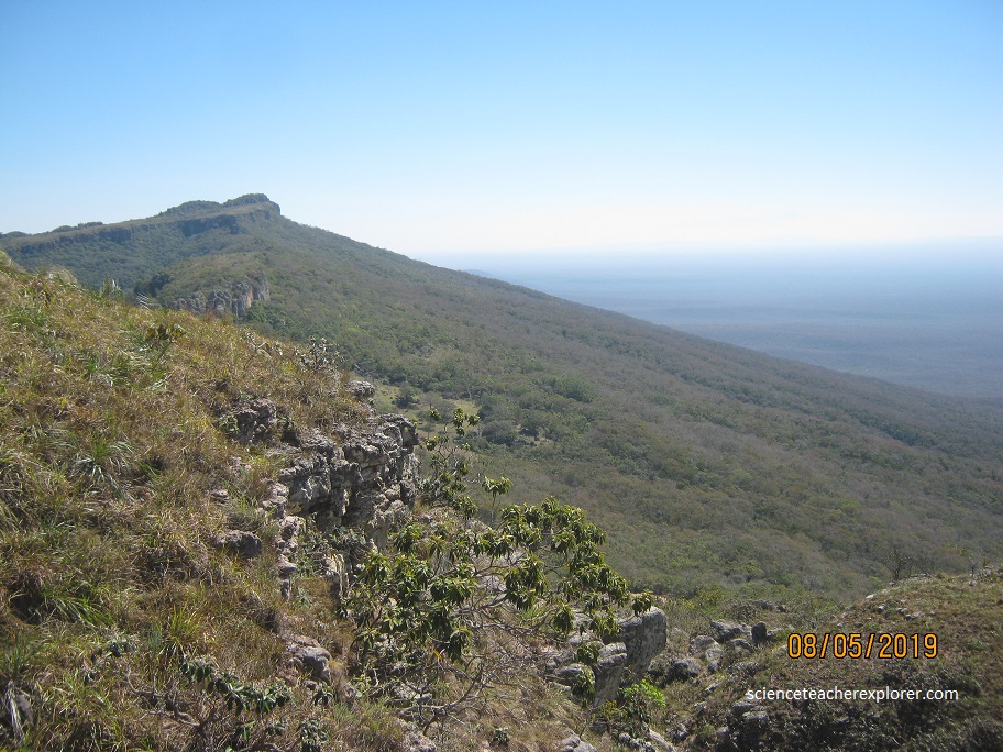
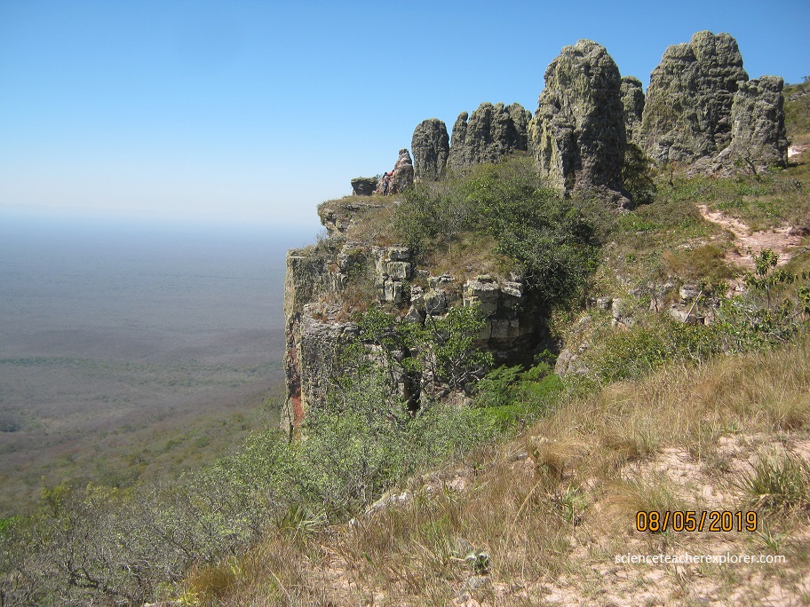
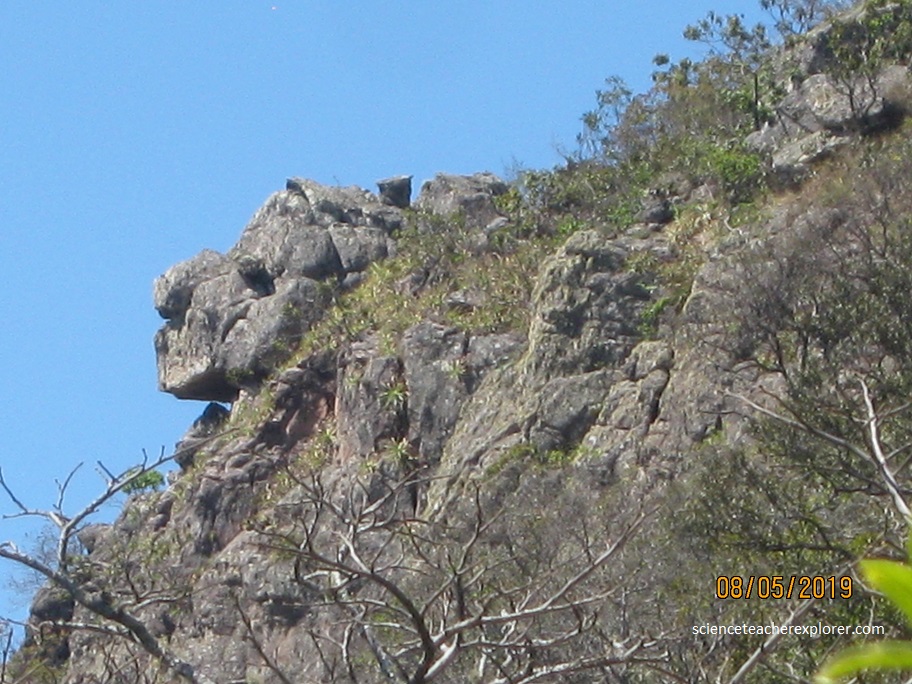
Our next stop was another 30 km down the road from Chochis. It was village called Santiago de Chiquitos. Just up from the village, we trekked to the Miradores del Valle de Tucavaca. The view was into Bolivia’s Pampa.
The Bolivian Pantanal is considered the primary source of the Paraguay River and also the most rich in biodiversity. Compared with the brasilian part It is much less visited by tourists and within this area there are two natural reserves one is San Matias in the North side of the bolivian Pantanal and Otuquis National park in the South part of it. All this helps it to be least altered than brazilian part.
The Pantanal in general is a huge, gently-sloped basin that receives runoff water from the upland areas (the Planalto highlands) and slowly releases the water through the Paraguay River and tributaries. The formation is a result of the large, concave pre-Andean depression of the earth’s crust. It constitutes an enormous internal river delta, in which several rivers flowing from the surrounding plateau merge, depositing their sediments and erosion residues, which have been filling, throughout the years, the large depression area of the Pantanal. This area is also one of the distinct physiographic provinces of the larger Parana-Paraguay Plain area.
Elevation of the Pantanal ranges from 80 to 150 m above sea level. Annual rainfall over the flood basin is between 1,000 and 1,500 mm, with most rainfall occurring between November and March. 2019 was a dryer year and fires across the Chiquitos Dry Forests were abundant. As a matter-of-fact my guide and I witnessed government workers setting fires to it.
Avast, waving sea of hip high grasses interrupted only by far-off horizons, lagoons, and the occasional tree-like ombu shrub, the Bolivian Pantanal wetland is an open, flat land of lama-like guanacos, endemic foxes, leopards, and ostrich-like rheas.
The introduction of gigantic herds of domestic cattle, unregulated hunting, and chemical-intensive agriculture have all but driven out large carnivores such as puma and the endemic Pampas cat. However, conservation efforts are beginning to take shape with introduction of National Parks.
Among the rarest animals to inhabit the wetland of the Pantanal are the marsh deer (Blastocerus dichotomus) and the giant river otter (Pteroneura brasiliensis). Parts of the Pantanal are also home to the following endangered or threatened species: the hyacinth macaw (Anodorhyncus hyacinthinus) (a bird endangered due to smuggling), the crowned solitary eagle, the maned wolf (Chrysocyon brachyurus), the bush dog (Speothos venaticus), the South American tapir (Tapirus terrestris), the giant anteater (Myrmecophaga tridactyla) and the yacare caiman (Caiman yacare).

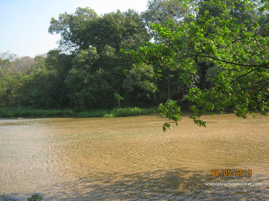
After Santiago de Chiquitos we traveled further east towards Aguas Calientes. Aguas Calientes is a small community almost on the side of the highway towards the Brazilian border in the Pantanal Wetlands. A few blocks driving in the community, we got to a river known also with the same name. In this river, the water had a temperature of approximately 40 ° C with a sandy riverbed.

On both sides of the river in the part where there are local bathers, the vegetation is exotic and lush. This part of the river is called “Los Hervores”. “Los Hervores” (The Boilers) is known, because there are some places of the river where the depth is below the knee, with small spots of water and sand that seems to boil and the sand bubbles rise to the top of the water current. At these Hervores the temperature seems to be higher than 40 º C. The surface of the sand is not dense enough to support the weight of a person, so some one who step in this parts of the river may suddenly collapse down into the quick-sand hole.
Many local and nearby people, as well as from the city of Santa Cruz and other parts of Bolivia come to Aguas Calientes, looking for relief from some physical problems. Rarely tourists get this far out into Eastern Bolivia.
