Chiricahua, AZ 2010
At the end of December of 2010, I found myself exploring Southern Arizona. There in the southeastern corner was the beautiful Chiricahua National Monument.
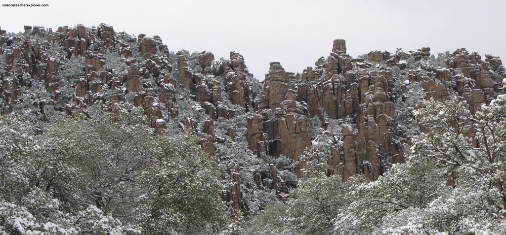
Chiricahua’s hallmark is the enormous collection of weirdly-shaped rock pinnacles that fill the higher regions of the park, the remnants of a huge volcanic eruption about 25 million years ago. This thick, white-hot ash spewed forth from the nearby Turkey Creek Caldera, cooled and hardened into rhyolitic tuff, laying down almost 610 m of highly siliceous, dark volcanic ash and pumice. The volcanic material eventually eroded into the natural rock formations of the present monument.
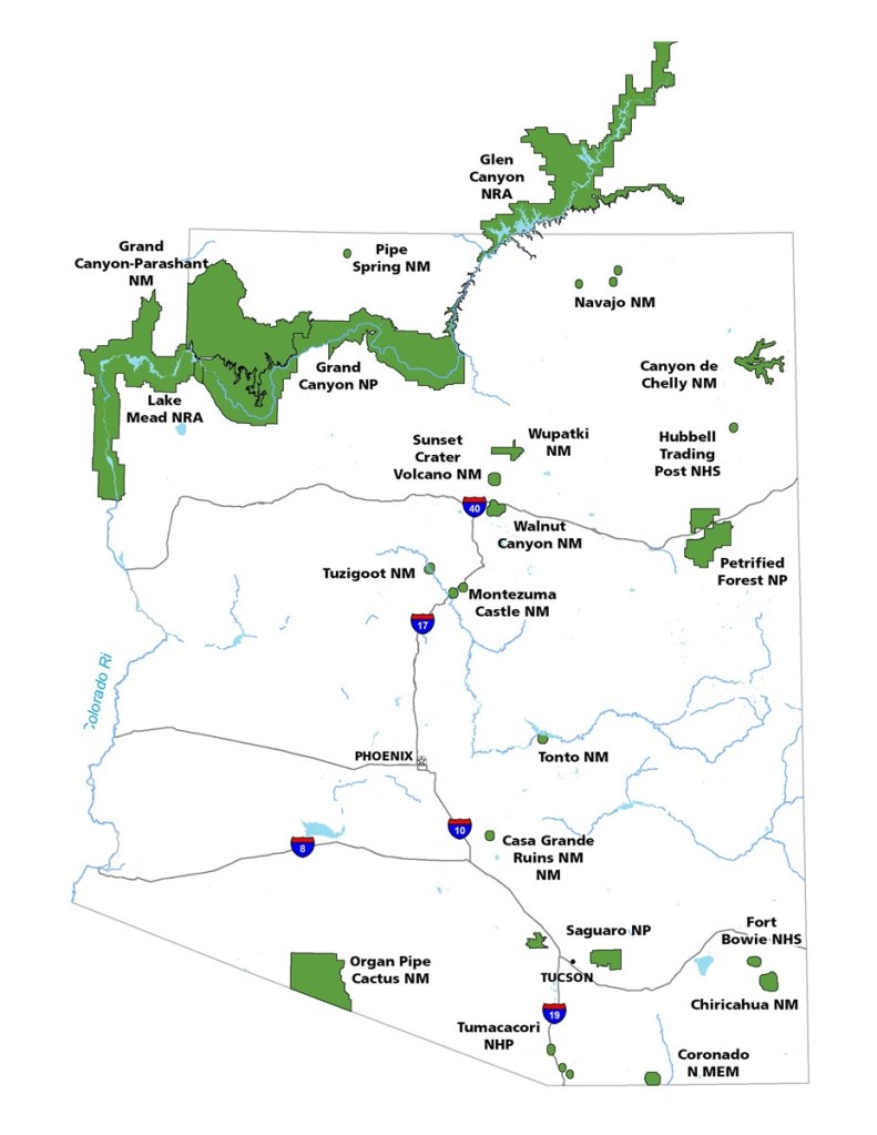
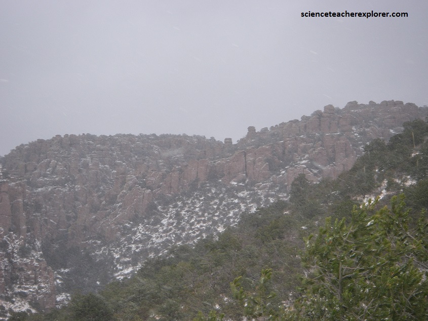
Winter here at Chiricahua was relatively temperate, with the low 60s and about 30 cm of snow on the ground, (pictured above and below).
Pictured above, the Chiricahua Mountains were part of a traditional homeland of the Chiricahua Band of the Apache Indian nation. The Chiricahuans had numerous clashes with settlers and travelers during the 19th century, many resulting from the “white man’s” violation of previously negotiated treaties governing land use. The Apache leaders Cochise and Geronimo were members of the Chiricahua Band who were famed, and feared, in their day. Territory of the monument was used as a safe-haven by the Chiricahuans until the cessation of hostilities.
Swedish immigrants Neil and Emma Erickson settled in Bonita Canyon, in the lower reaches of the monument, in the 1880s, and operated the “Faraway Ranch” on what is now monument property.
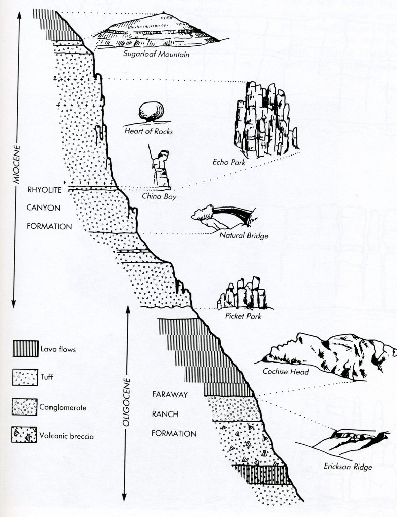
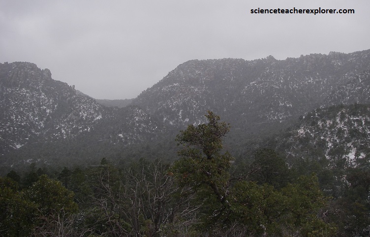
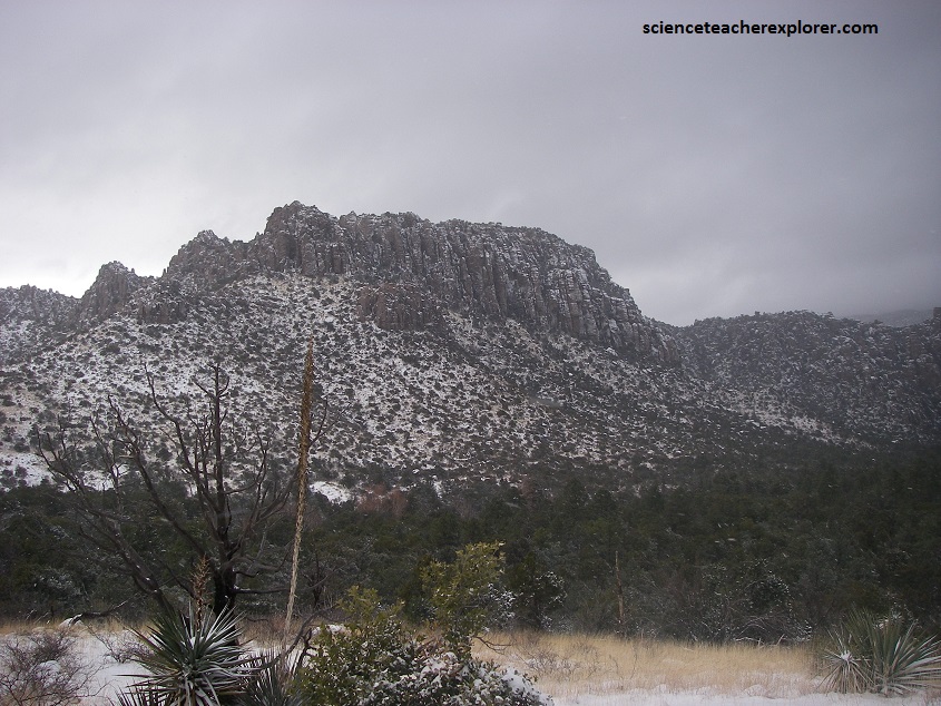
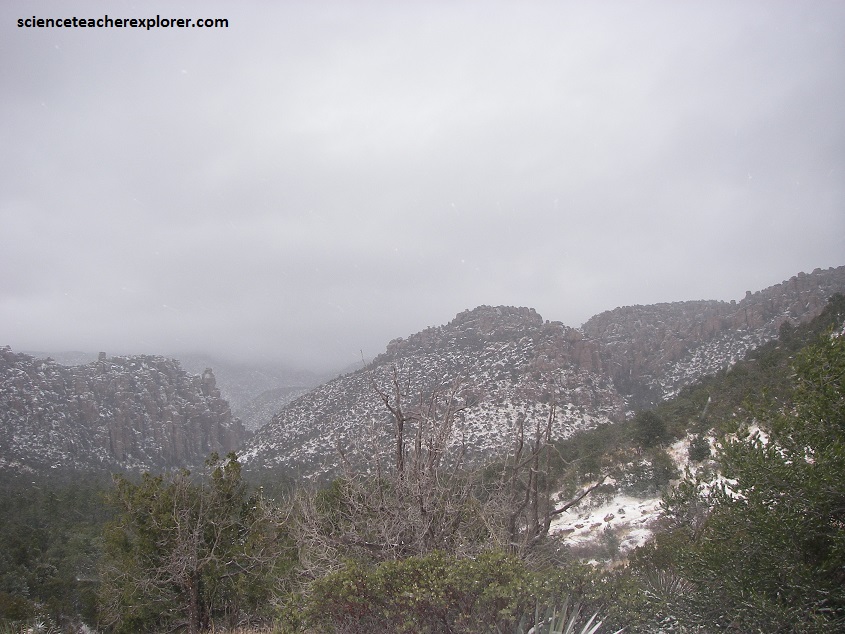
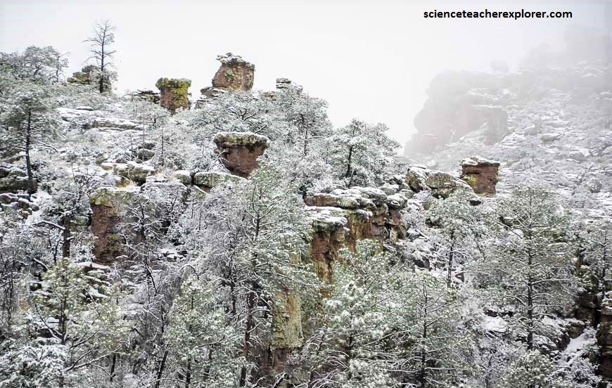
Pictured above and below, the rocks themselves are rhyolite tuff, fine-grained volcanic ash born in the maelstrom of huge eruptive explosions that burst from craters some distance southeast of the present national monument. Molten magma from an underground magma chamber, seething with steam and other rapidly expanding gases, increased vastly in volume as it emerged. Much of it was no doubt carried skyward in great rolling gray clouds, but other ash clouds swept furiously downslope as swift avalanching flows of fine, glowing particles. When these particles settled, still incandescent, they were so hot that they fused or welded together into rock known as as-flow tuff. Here, the varying degrees of welding give clues to some of the horizontal banding and corrugation seen in the eroded figures, for strongly welded ash alternates with much less strongly welded or even nonwelded material.
Hiking the big loop (an assemblage of several shorter trails) can be a day-long adventure, and it gave me access to the Heart of Rocks: a garden of naturally sculpted statues and shapes.
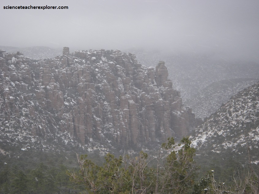
My journey through the monument’s wooded canyons, sheer-walled corridors, and mind-blowing formations thrilled the child within me. Pictured below and above, weathering by water and wind follows joints in the rock, particularly the prominent sets of vertical fractures that result from earth movement along parallel northwest-to-southeast faults. Imaged below, as water and wind eroded the fractured rock, the joints little by little were widened.
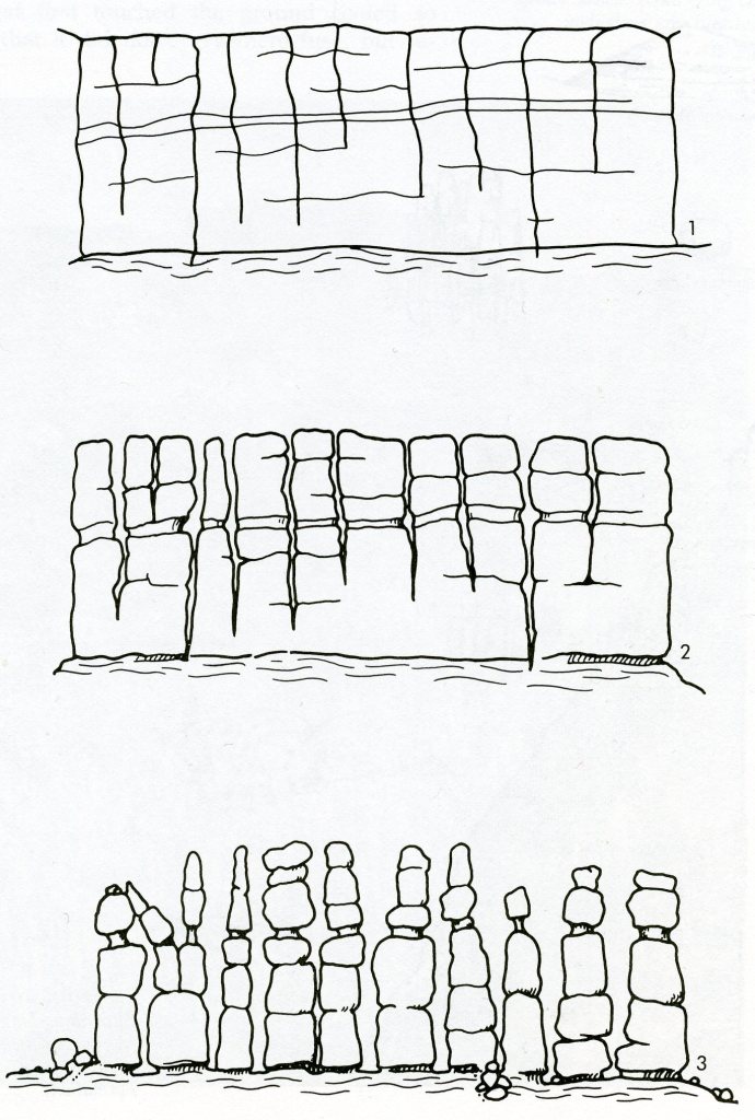
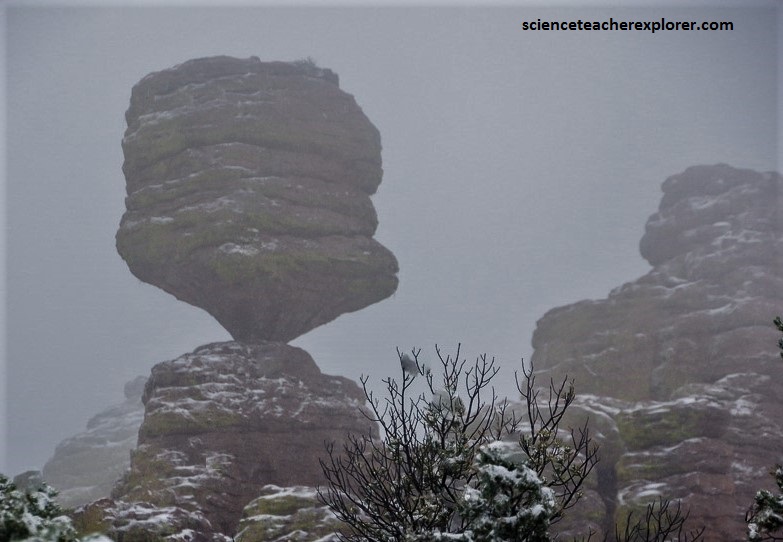
Pictured above and below, balanced rocks are unusually common here. Weathering of hard and soft rock layers initiates the process, undermining blocks of harder, more resistant rock by wearing away the softer, less resistant rock below.
Heart of Rocks Loop (strenuous) connected me with Big Balanced Rock (pictured below), Mushroom Rock, and a playground of fanciful formations.
The rock pinnacles were particularly beautiful when dressed in snow. Chiricahua National Monument hiking may not be ideal under snowy conditions but the snow kept people away so I almost had the trail to myself.
There was about three inches of snow by the time I got to Balanced Rock – with no sign of letting up – and a cold wind so I turned around there. It was a very beautiful hike with a moderate amount of elevation gain.
