Boiling Lake, Dominica
Becky (my wife) and I made our first trip of the year of 2016 in March, on a Caribbean Cruise. We had our friends, Mike and Lisa Stevens, join us. Our first memorable stop was on the Island of Dominica.
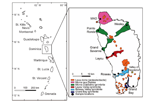
Pictured above on the left, the islands of the Lesser Antilles form an arc along the eastern margin of the Caribbean sea that stretches ~700 km from Grenada in the south to Dominica in the north. The arc represents the eastern boundary of the Caribbean plate which is underthrust by the North American plate. North of Dominica the arc is a double arc. The islands of the eastern arc consist of Oligocene volcanic and plutonic rocks overlain by limestone and are often referred to as the ‘Limestone Caribbees’. The islands of the western arc consist almost entirely of younger (Pleistocene) volcanic rocks and are called the ‘Volcanic Caribbees’. South of Dominica the two arcs converge and the islands are made up of Oligocene volcanic rocks overlain by limestone and capped by Pleistocene volcanic rocks.
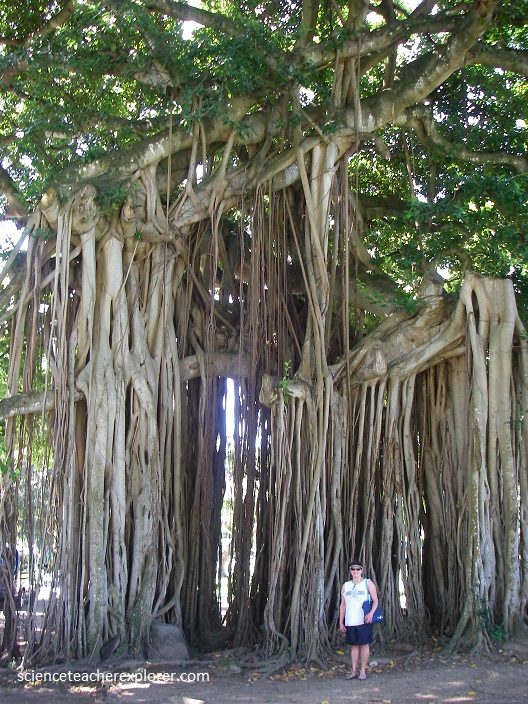
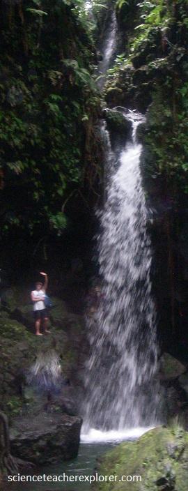
Pictured above, the girls had decided to split on the own for the day and visit “Emerald Waterfall” and then go to the beach. While Mike and I made a very long and strenuous hike to the “Boiling Lake” in the center of the Morne Trois Pitons National Park.
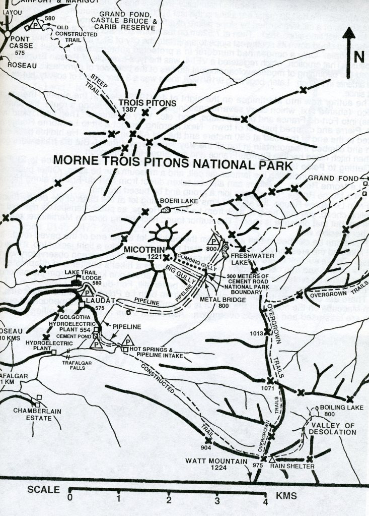
Boiling Lake is the second-largest volcanic lake in the world, located in an active geothermal area filled with acid hot springs and fumaroles. This was a steep, difficult, muddy hike, and took us at least three hours each way. It was a 26 km round-trip hike and a impossibly nerve-racking trek on a 7 hr. shore-leave from a cruise.
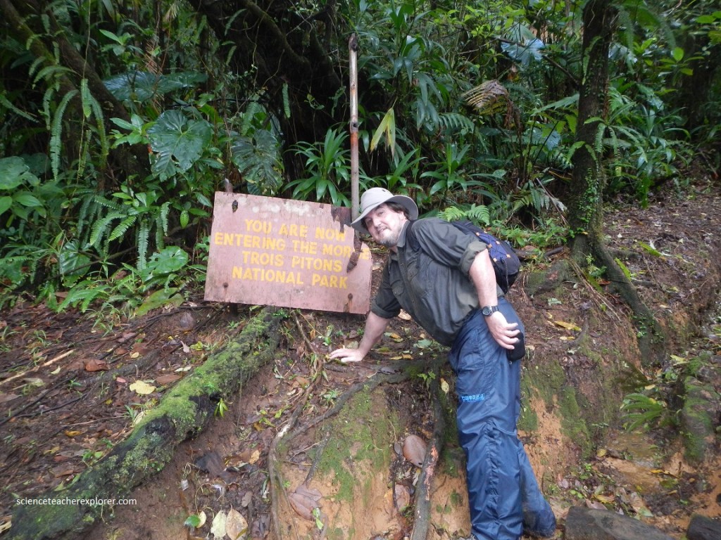
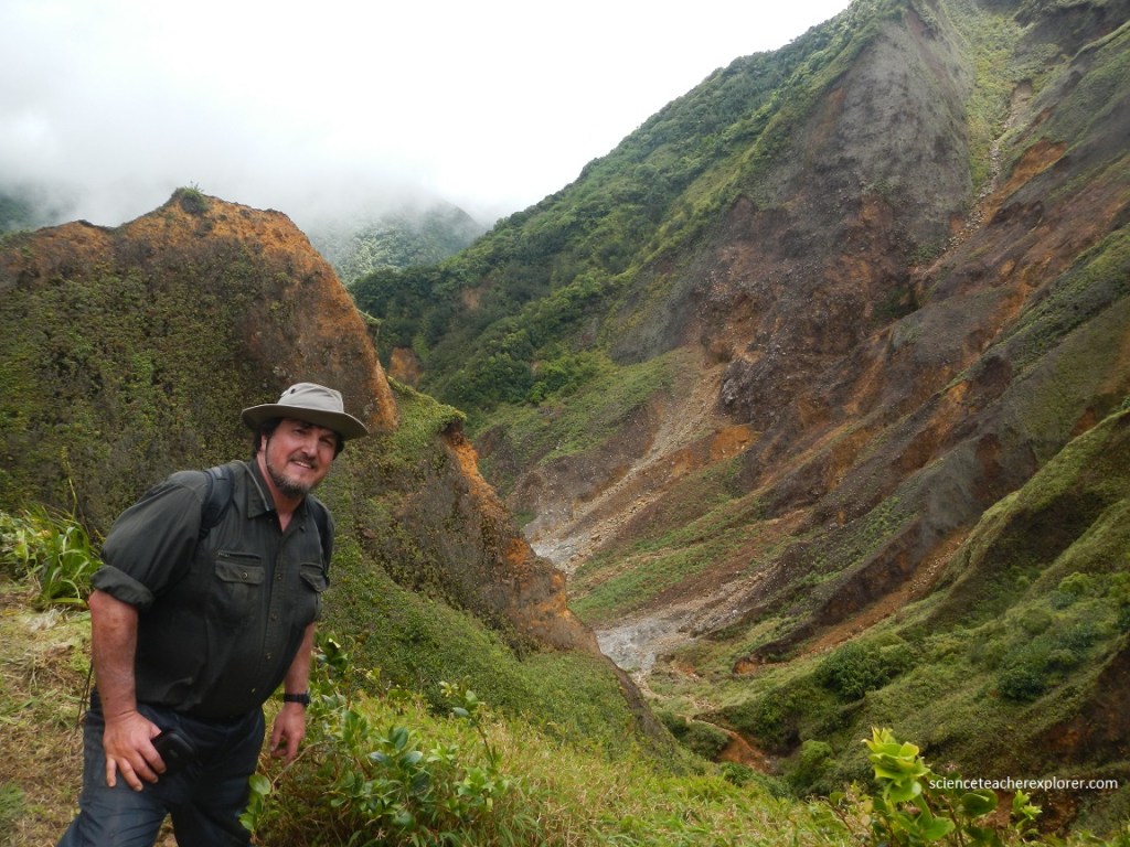
The hike began at Ti Tou Gorge and entered the Trois Pitons National Park. The first part of the hike climbed for almost an hour, crossing several high ridges as the trail wound through a rainforest. There were no switchbacks and much of the trail was slippery and steep. Mike and I climbed another 760 meters in elevation, only to leave the rainforest and begin the descent into the “Valley of Desolation”.
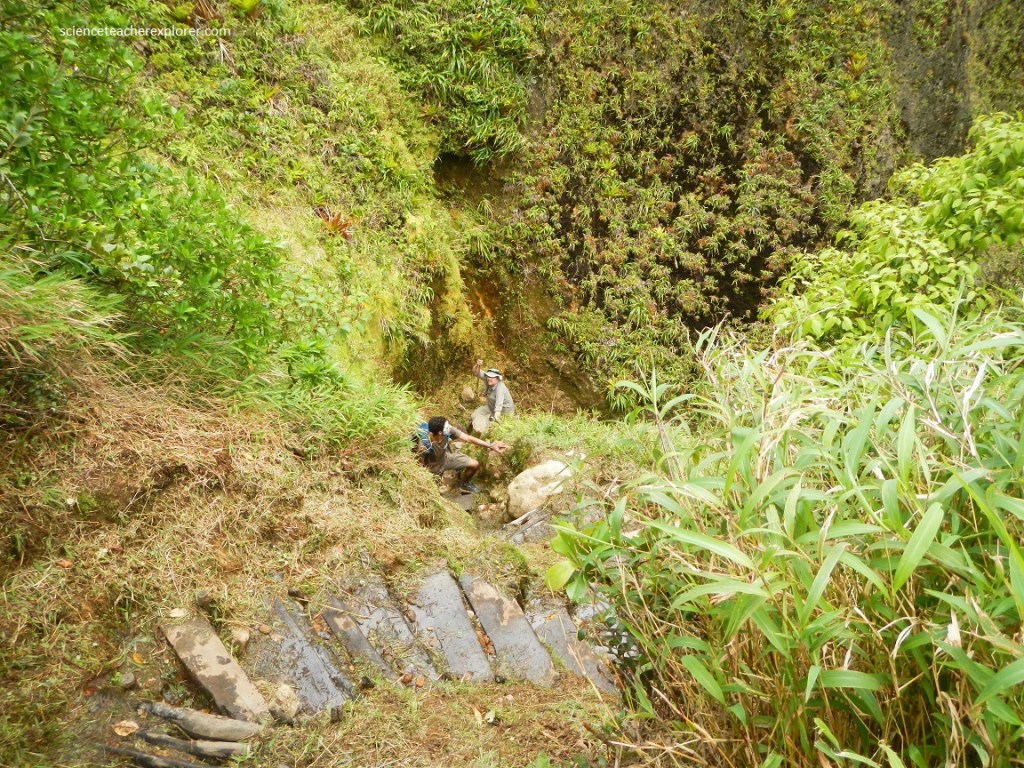
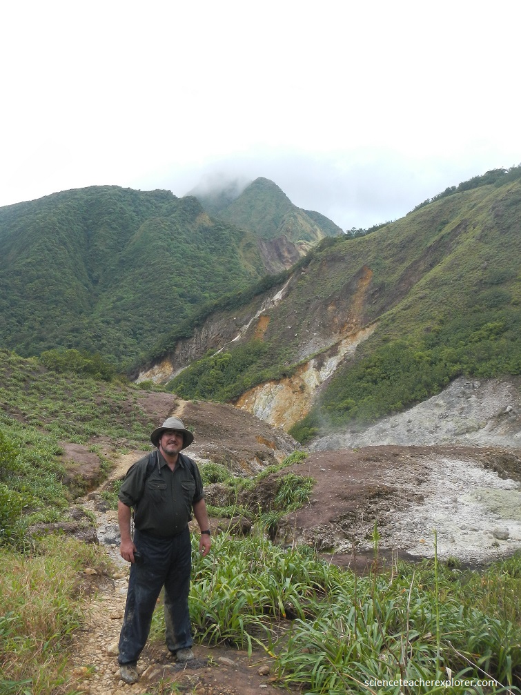
Dominica is a 750 km2 island of rugged topography and pristine rainforest which features nine volcanic centers that are <2.6 Ma. Dominica’s coastlines and interior valleys abound with thick (>20 m) ignimbrite deposits, composed of pumice clasts, rock fragments, and ash from solidified pyroclastic flows. There have been no documented explosive eruptions of large magnitude in Dominica in the last 20,000 yrs. The most recent activity involving magma was a lava dome collapse and of where Mike and I hiked up-to. Dominica’s most recent volcanic activity was several explosions of steam and ash violently ejected from hydrothermal vents.
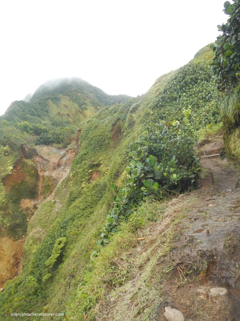
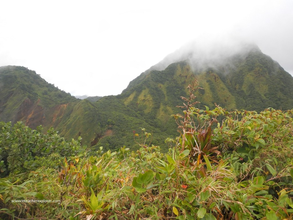
Phreatic eruptions occurred in the Valley of Desolation in 1880 and 1997, covering an area <1 km2 with a thin (~2 cm) layer of ash. This was Dominica’s most recent volcanic activity, which consisted of several explosions of steam and ash violently ejected from hydrothermal vents. The Valley of Desolation is an active hydrothermal area. Vegetation is sparse here due to the hot, acidic environment — lush, vivid green moss is the most common plant.
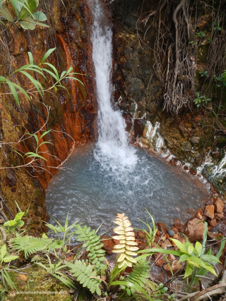
Steaming geothermally heated streams wind down the Valley of Desolation, past sulfur- and iron-oxide-encrusted rocks. The waters are often blue-gray from kaolinite and other dissolved minerals, and some of the pools are rimmed with green, probably a type of extremophilic red algae such as Galdiera or Cyanidium.
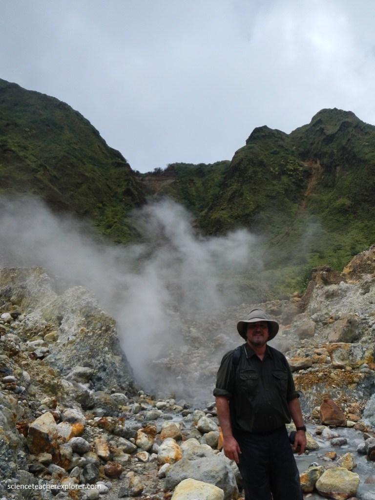
In some areas in “The Valley of Desolation”, there are deposits of black pyrite, and clouds of warm, sulfurous steam from the hissing fumaroles blow over the trail, alternating with cool breezes that leave you light headed.
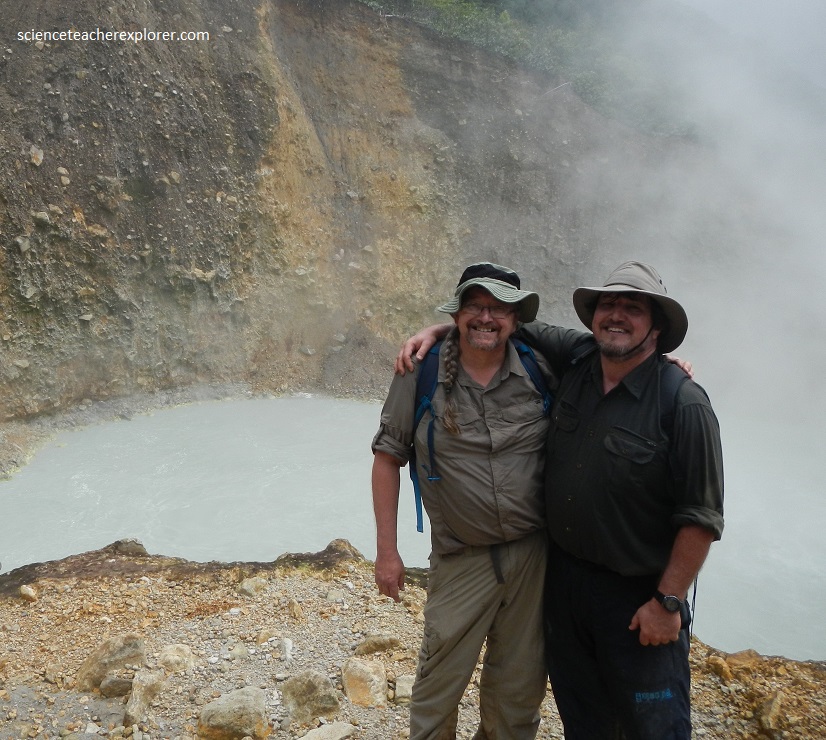
At the far end of the “Desolation Valley lies Boiling Lake, a 75 m volcanic lake that is typically very hot (80-90 ˚C) and acidic (pH of 3-5). Boiling Lake itself is nestled among small hills away from the fumarole field. The waters, which range from light grey to turquoise, are often partially obscured by steam, but the violent bubbling of the lake is easy to see and hear.
The Boiling Lake, Dominica March of 2016
