Tulum, MX 2002
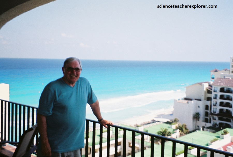
I went on vacation in Cancun, Mexico of 2002 and then again in 2021, with my wife, (Becky). While there, we visited an number of Mayan Ruins in the area. A couple of these locations were Tulum and Muyil on the eastern coast of the Yucatan.
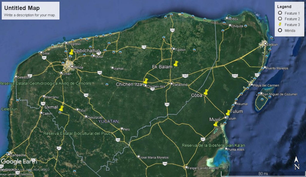
To drive to Tulum from Cancun was a straight shot (south) down the main highway 307 (Carretera Federal). The distance from Cancun to Tulum was about 118 kilometers. However, we stopped along-the-way at Xal-Ha with my Father-in-law to try our hand at snorkeling. Xal-Ha was only 8 km north Cancun on highway 307. Muyil was located another 25 km south of Tulum.
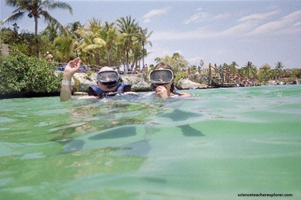
Pictured above, Xal-Ha Park is a commercial aquatic theme park and ecotourism development that is centered around the natural inlet and lagoon that forms with the flow of the river through rocks mixing salty waters with fresh underground water currents. This causes a very interesting Halocline zone to see while snorkeling. Less dense fresh water from the land forms a layer over salt water from the ocean. For snorkelers near caves, this can cause the optical illusion of air space. Passing through the halocline tends to stir up the layers, but it creates an amazing effect.
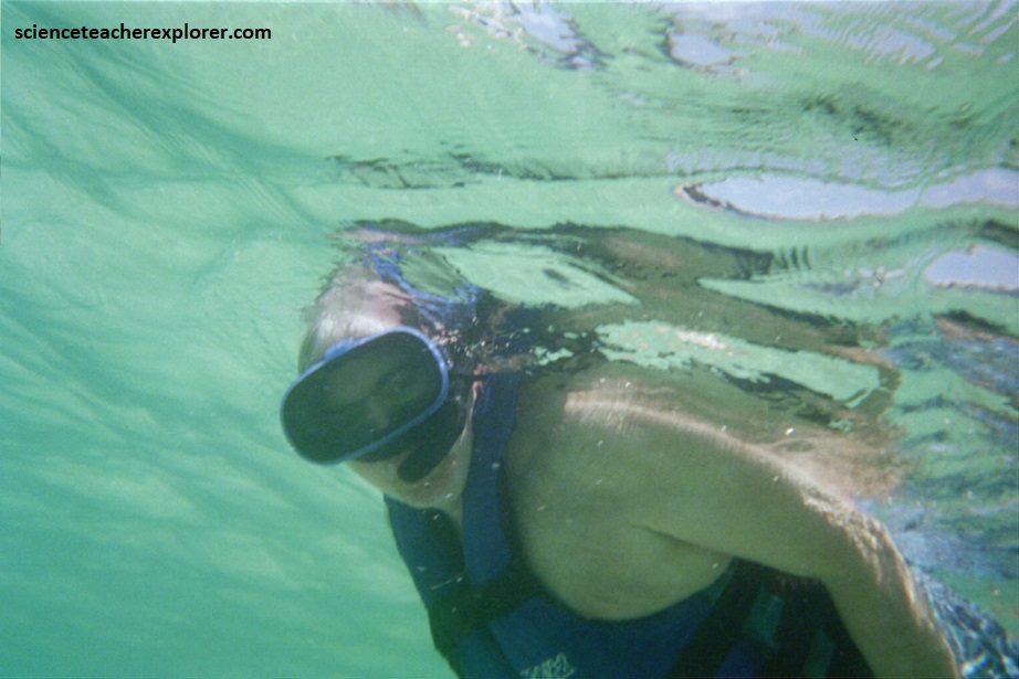
The inlet of Xel-Ha is a natural aquarium inhabited by hundreds of species: such as tropical fish and an abundant flora. The park also includes a turtle reserve, where research is constantly carried out to learn more about marine life and contribute to the ecological maintenance of the area. A shark fence extends across the lagoon’s entrance, and the public is permitted to swim and snorkel in the lagoon. Beneath the surface, the limestone has eroded into a myriad of small cave and grottos.
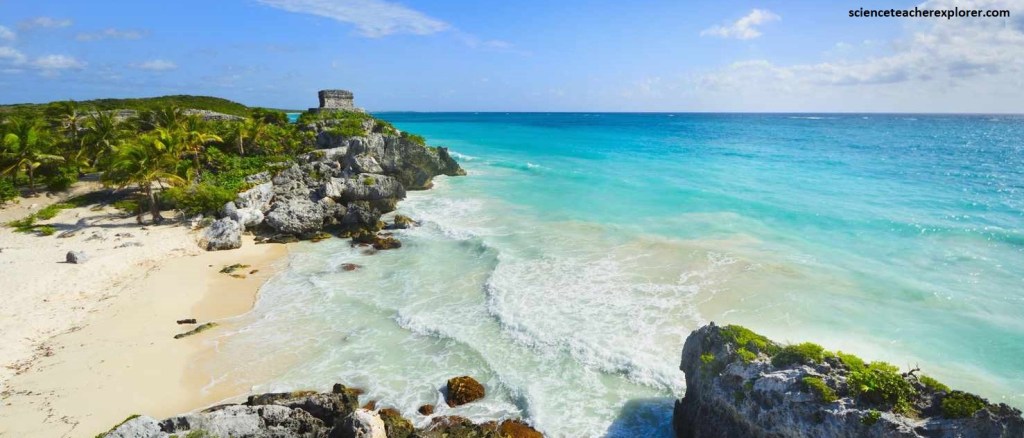
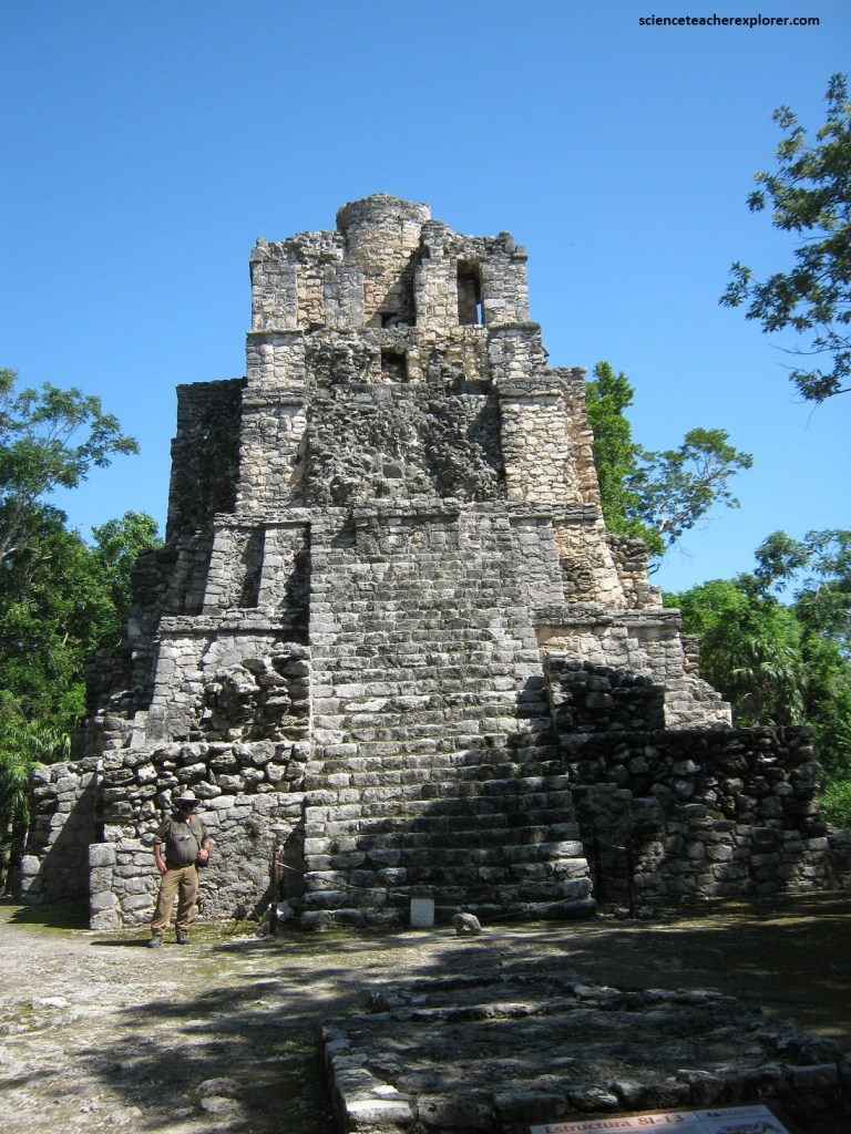
Pictured above, Tulum is an Mayan-Archaeological Site perched on a cliff above the turquoise waters of the Caribbean and is surrounded on three sides by a wall.
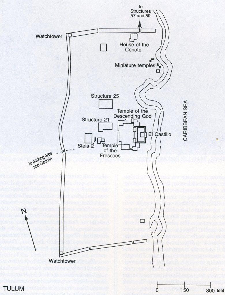
Imaged above, the wall has 5 entrances, one of which is used today as access to the site, and it encloses about 16 acres. It averages 6 meters thick and 3-5 meters high. The wall dates to 1200-1450 A.D. and the structures inside are Postclassic in date, (950-1539 A.D.). Tulum’s ancient name was ‘Zama’ or ‘City of Dawn’ and sure enough the ruins face the rising sun to incredible effect at daybreak without a wall on that side.
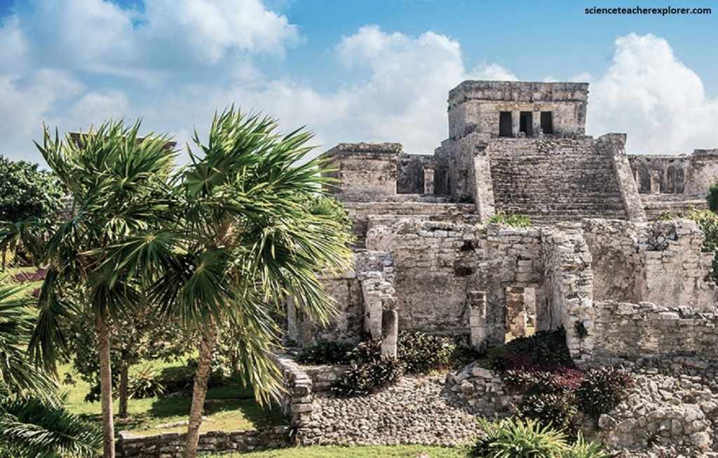
Pictured above, El Castillo was a temple with two rooms (one behind the other) and two serpent columns at the entrance, forming three doorways. There were three niches above the doorways, and the center one houses a depiction of the descending god. We approached the temple from the west by a stairway bordered by “alfardas”. There were rooms on two levels flanking the stairway. The lower -level rooms were small, one-room oratories; the second-level rooms were larger and have columns on the west side. The roofs of the second-level rooms were gone in 2002.
Tulum’s builders had remarkable knowledge of astronomy. One of the site’s most important buildings is the Temple of the Descending God, which was constructed in alignment with the planet Venus and the sun. During the spring equinox, the sun shines in through a narrow window and illuminates the interior in a spectacular show of reverence to the heavens above. The Temple of the Descending has an interesting outward batter to the walls, a niche above the single doorway with a depiction of the descending god, and remains of mural painting on the inside. The descending god, also called the diving god, may be in reality a bee god. This figure is part human but has wing-like attachments.
Pictured below, the Temple of the Frescoes was two stories and had four columns, forming five doorways, in the lower level of the front (west) facade. The doorways led to a corridor that surrounds an inner chamber on three sides, and the walls of the inner chamber had remains of a mural painting. The upper story was a single room with one doorway. Above the doorways (of both levels and the inner chamber) are niches with remains of sculptures; (seated figures and the diving god were represented).
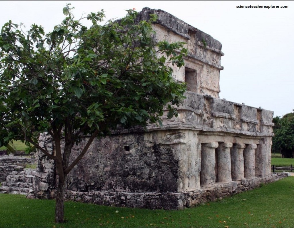
Pictured below, the doorways in the lower story of the Temple of the Frescos and the one in the one in the Temple of the Descending God were blocked by poles, but we could get photographs of the murals through the openings. The badly eroded Stela 2 had been re-erected on a small platform in the front of the Temple of the Frescos.
The Temple of Frescoes was also built with the celestial sphere in mind and it’s thought it served as an early observatory.
Video below, a cenote is a geological phenomenon of the Yucatán Peninsula. It consists of a large pool of groundwater exposed after the bedrock has collapsed. The Mayans used these natural wells for their fresh water. Therefore, it was common to build a home over these sinkholes. The video shows part of the House of the Cenote.
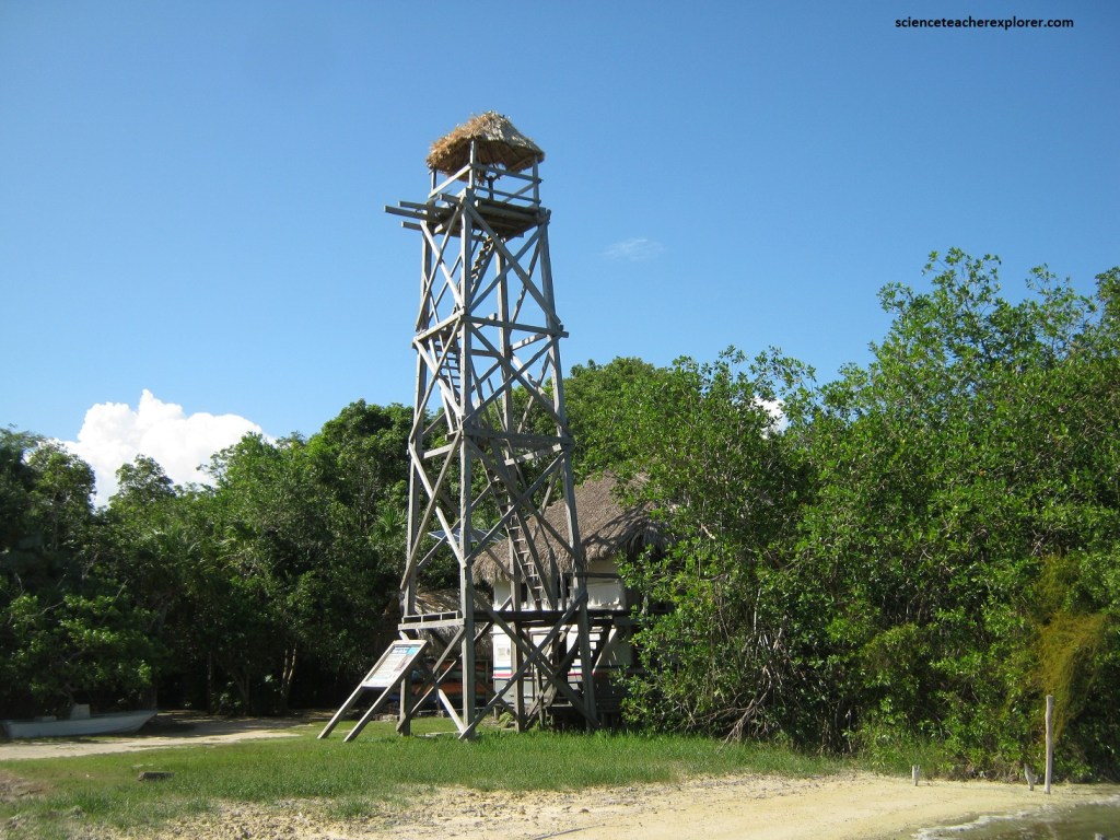
The many other structures inside the wall, including the watch-towers on the wall, were also worth visiting. Set on a 12-metre cliff overlooking an impossibly blue Caribbean Sea and a white sand beach fringed with swaying palms, the Mayans couldn’t have chosen a more picturesque location for their stone-walled citadel. Tulum reached peak importance between the 13th and 15th centuries AD but, by the end of the 16th century, it, like the other Mayan cities, had been abandoned.
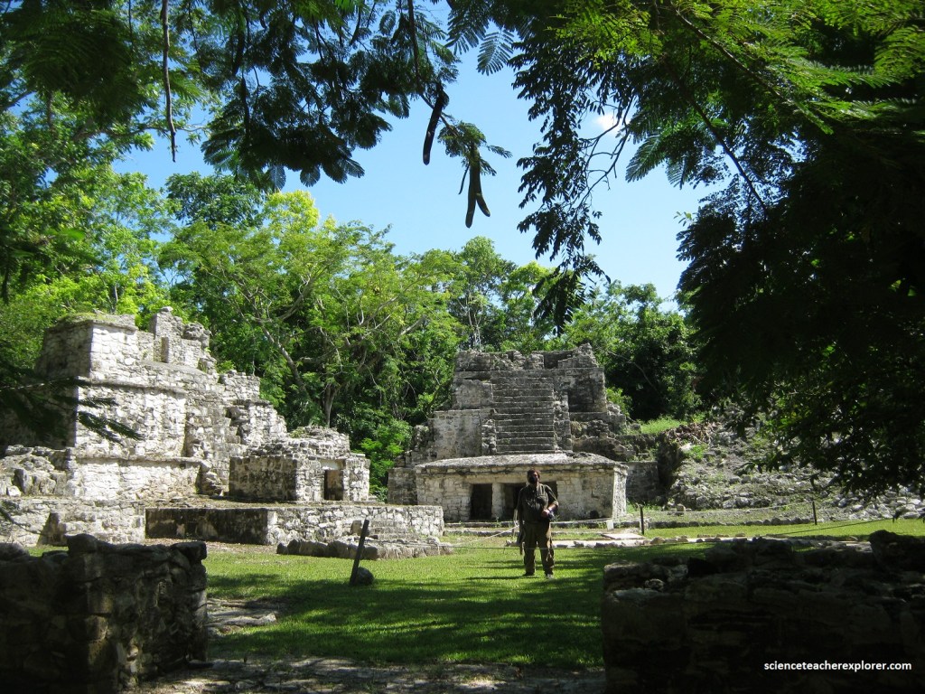
In 2021 I visited and explored the Muyil Archaeological Site. Muyil is one of the largest sites on the east coast of Quintana Roo and is located at the northern end of the Sian Ka’an Biosphere Reserve. The site has an internal sache system; and was occupied from around 1-1550 A.D..
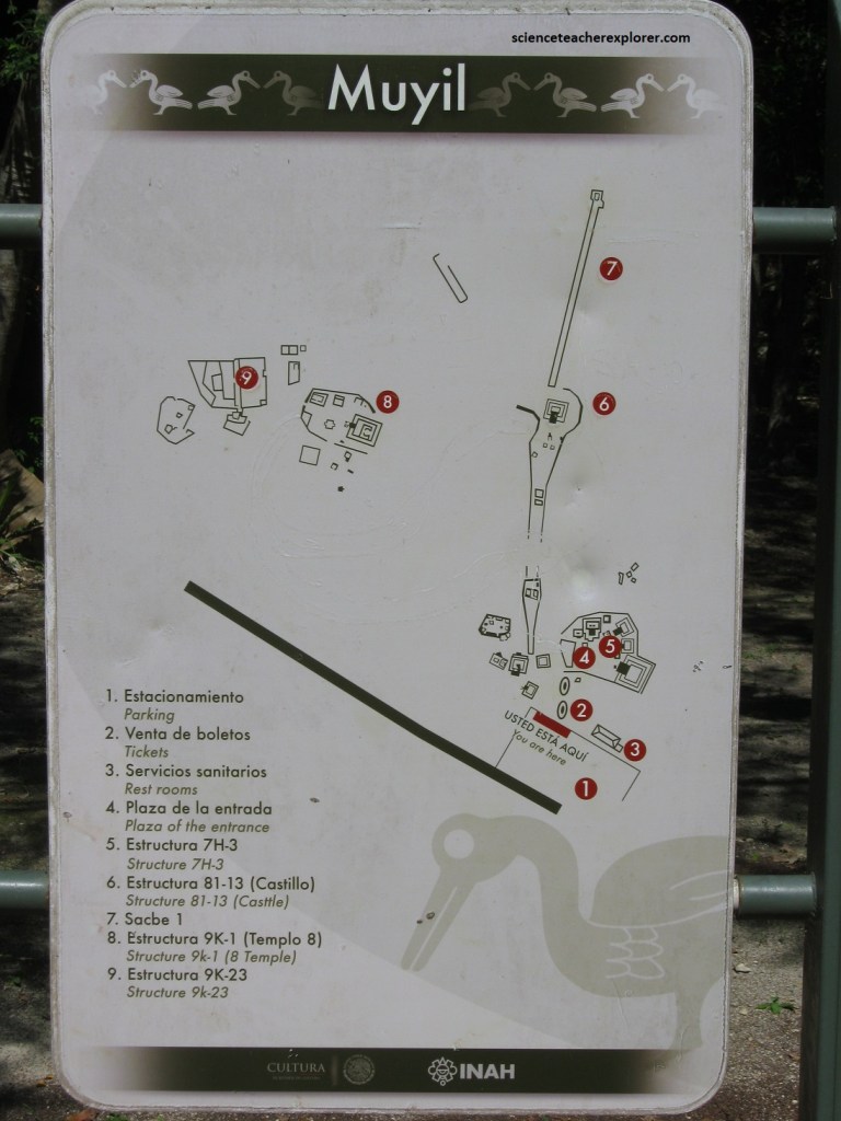
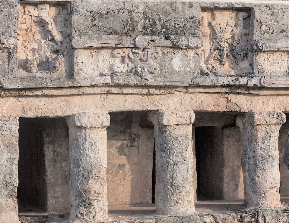
As we entered the Muyil Site, we came first to the Entrance Plaza Group. This was near the highway and the dirt trail to the site passed right by it. Pictured below, this area consisted of many structures. There were tall pyramidal mounds around a plaza, and though the mounds were mostly rubble, some facing stones and remains of a stairway could be seen. The mounds date to the Classic period, and inthis group three or four construction phases were evident. There was also a one-story building at ground level that has remains of standing architecture, including two doorway columns. This structure is Postclassic.
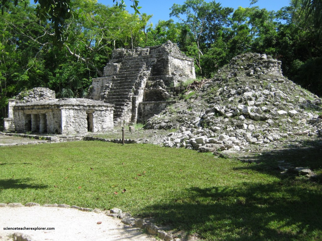
Pictured below, from the plaza, we walked along the path to the east to the Castillo. This was a pyramidal base with remains of a temple on top; it reached a height of 17 meters and was the tallest structure at Muyil or any of the east coast sites. The temple faced west and had remains of three narrow doorways and a unique round turretlike construction. On the lower west side of the pyramidal base, are remains of an inset stairway with “alfardas” on each side. There were remains of a narrow stairway near the top of the base that may have been a later addition. The temple itself may be Post-classic.
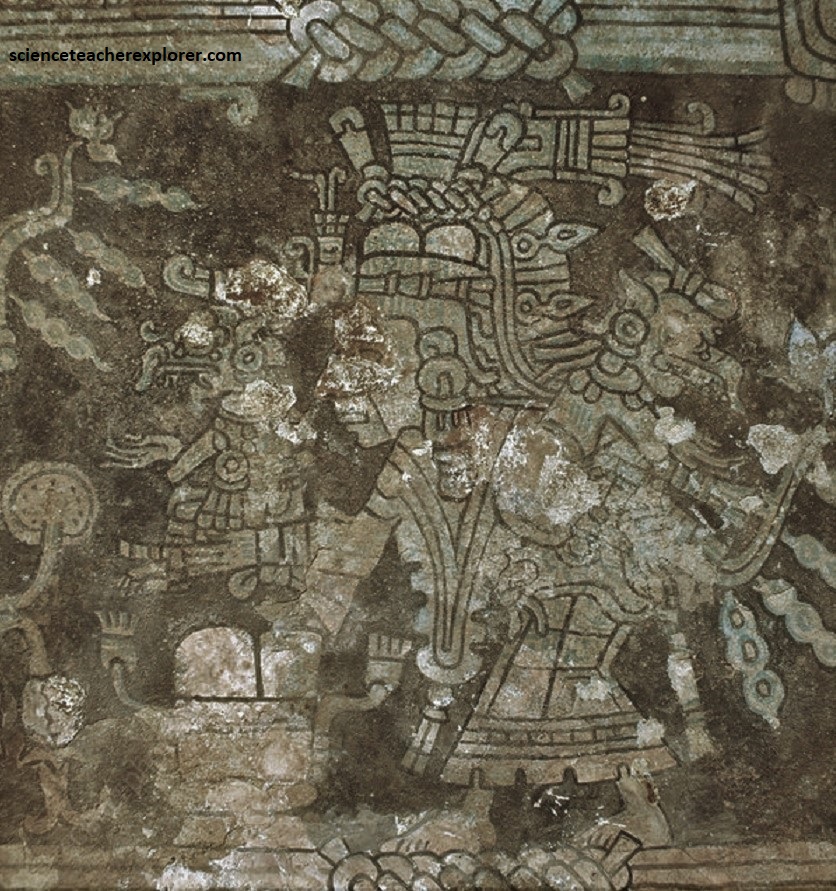
Pictured below, from the Castillo, the trail led us in a northerly direction for a couple of hundred meters to Temple 8, (one of the best-preserved structures at Muyil). It had been cleared and consolidated and consisted of a pyramidal base, or platform, rising in terraces, with a temple on top. The temple had two pillars in the main doorway and cobeled vaults inside. The front part of the roof of the temple had collapsed, but its back was mostly intact and had a simple medial molding. An inner shrine enclosed on three sides by the outer room was reached through a low doorway with an inset panel above it.
Pictured above, within the base of the structure was another temple, possibly of Late Classic date. Traces of geometric frescoes remained on both upper and lower structures. The area around Temple 8 is enclosed by a wall forming a ceremonial precinct, and large residential mounds are seen to the north, east, and west, (pictured below).
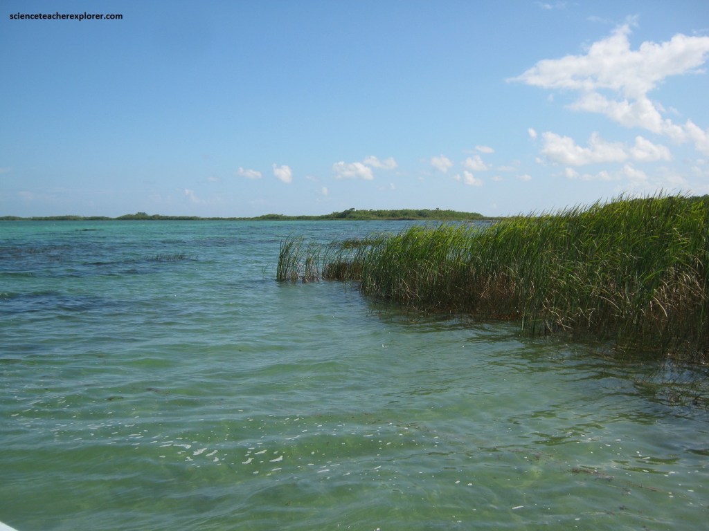
Muyil is connected to the Caribbean Ocean by a series of lagoons, a canal, and a natural waterway, but so far not port facilities have been located at the site.
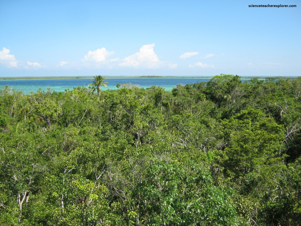
Pictured above, among the various types of protected zones in Quintana Roo, Sian Ka’an is the vastest, with 528,000 hectares containing a wealth of tropical salt marshes, mangrove swamps, centoes, petens and barrier reefs.
Pictured above, Sian Ka’an, (which translated from the Yucatec Mayan language to “Entrance to the Sky”), was decreed as a Biosphere Reserve in 1986.
The diversity of life in Sian Ka’an is exceptional. The tropical forests are home to charismatic mammals such as Jaguar, Puma, Ocelot and Central American Tapir. The property also provides habitat for a large number of resident and migratory bird species. There is a great diversity of marine life, including the West Indian Manatee, four species of nesting marine turtles and hundreds of fish species. About a third of the property is comprised of highly diverse and productive mangrove communities, of vital importance to fisheries in the broader region. Hundreds of forested islands, locally known as “Petenes”, emerge from the flooded marshes, some reaching over a kilometer in diameter. A geological, biological and cultural particularity are the “Cenotes”, deep natural sinkholes harboring fascinating life forms, many of them endemic. This karst phenomenon results from collapsing limestone exposing groundwater.