Jiaohe, China 2008
While trekking in Northwest China, my small group had taken a train from Hami to Turpan (Turfan) in July of 2008. Turpan is a unique city. It is located in the Turpan Basin at the depth of 154 m below sea level. From all sides the city is surrounded by deserts and mountains, destroyed medieval towns and ruins of ancient settlements.
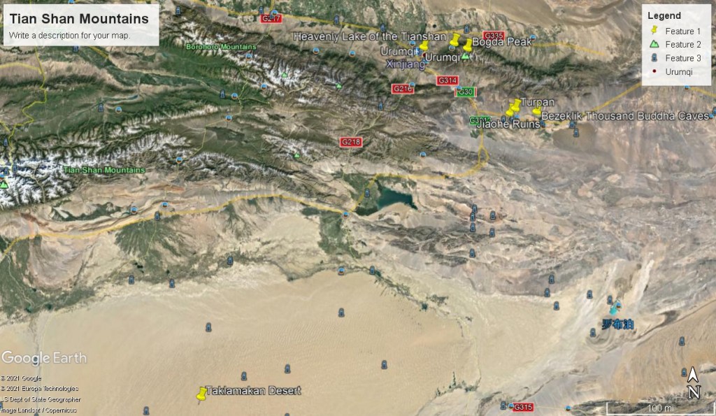
The Turfan Depression, is a fault-bounded trough located around and south of the city-oasis of Turfan, in the Xinjiang Autonomous Region in far Northwestern China, about 150 kilometers southeast of the regional capital Urumqi. It is accepted to be at an elevation, −154 meters, the second lowest depression on Earth. By some measures, it is also the hottest and driest area in China during July.
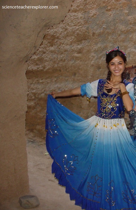
The people in Turfan were friendly and hospitable. Despite its climate, Turpan is one of the most densely populated cities in Xinjiang. It was home to about 250,000 people. The major part of the population (70%) is the Muslim Uyghurs. Many of the families are involved in wine production or activity associated with the grape business. The city’s daily life differs much from that of the other cities in Xinjiang. Because of the heat, the city has some kind of siesta in the afternoon, and towards the evening it has the active life started. The majority of Uyghurs looked very Caucasian. the women are colorfully dressed. their clothes have no similarities to those worn by chinese women in the same community. Usually they wear scarves on their heads, pantaloons, and a dress over the pantaloons.
Located 11 km to the northeast of Turfan, the Grape Valley stretches 8 km from north to south with a width of 2 km. This paradise of 220 hectares is covered with layer upon layer of grapes. About 13 varieties of grapes such as Manaizi (mare nipple grape), Wuhebai (white seedless grape) and so on are cultivated. Every year over 300 tons of raisins are made here.
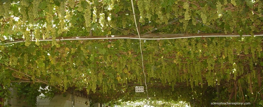
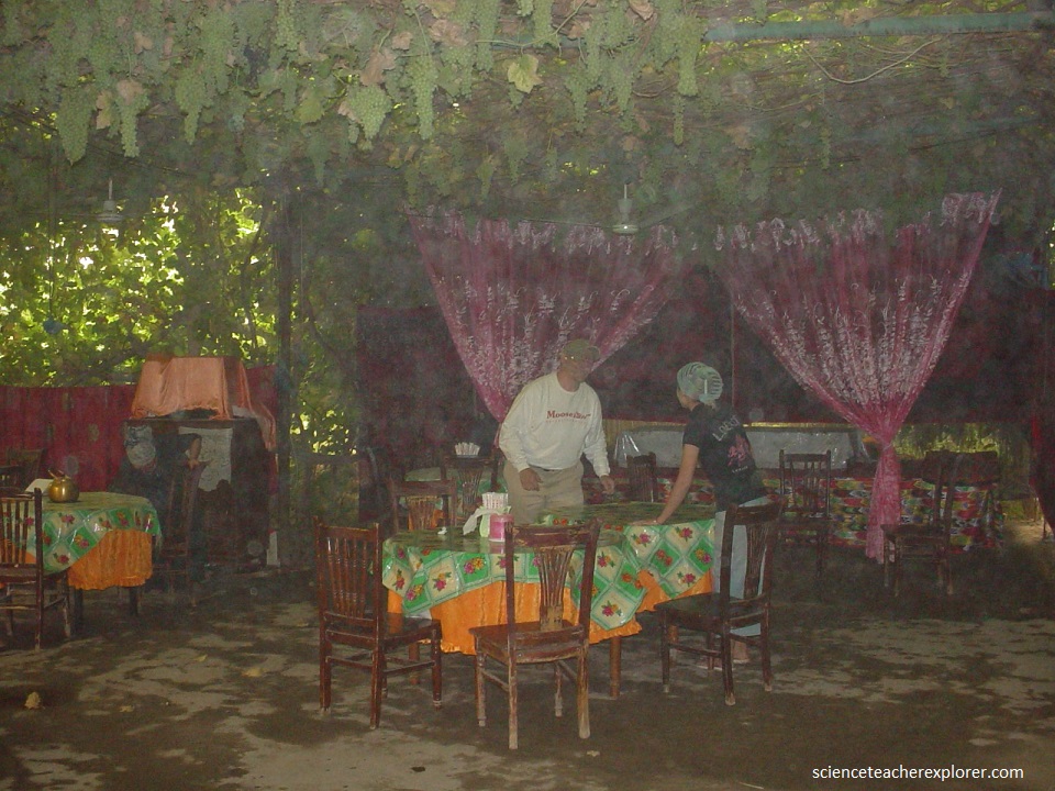
Besides the grapes, fruits such as peach, apricot, apple, and pomegranate are also planted. The water in the valley is melting snow water from Tianshan Mountains and it makes the valley lively. Wandering around, we could also find the drying rooms, where the sweet raisins are produced. Pictured below, we took a seat under the grape trellis, savored various grapes, appreciated the Uyghur people in their their living environment. The environment was refreshing from the heat of the desert, since the water in the grapes absorbed the rays of the sun.
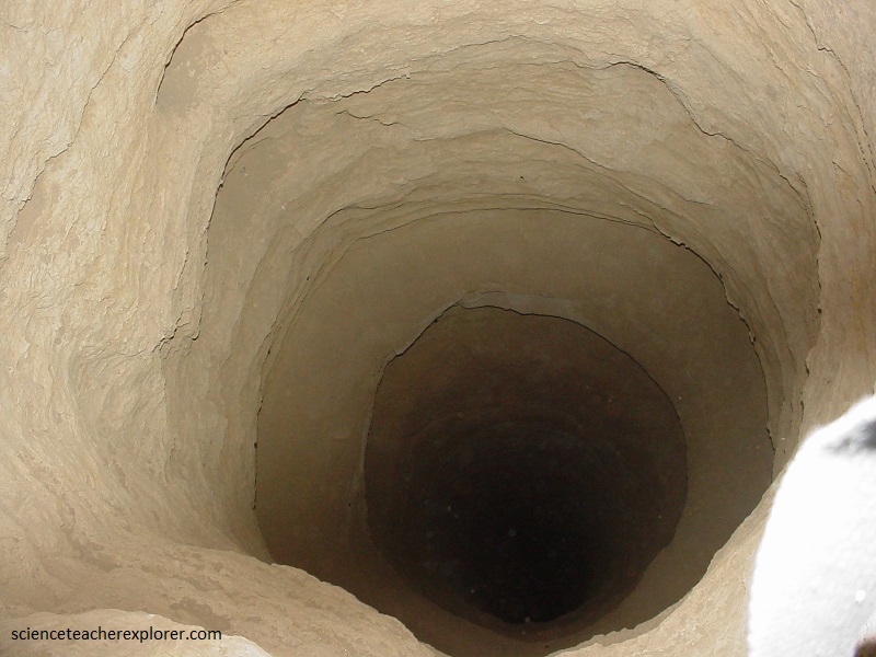
Turfan has a name the ‘Fire Prefecture’ and ‘Home of Winds’ for its very dry climate. Nevertheless, there are vast luxuriant and green oases around. The secret lies in the networks of wells and irrigation channels spreading underground like vascular nets, which provide the lifeblood of Turpan. This subterranean canals or underground water system was built by the local people inaccordance with local weather and hydrological conditions.
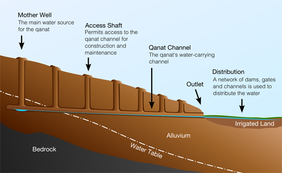
Imaged above, the Karez underground irrigation channel in Turpan is one of China’s three greatest feats of ancient engineering, along with the Great Wall and the Grand Canal. This irrigation system originated in Persia. Construction began on this ancient irrigation system during the Han Dynasty and as the Silk Road developed, methods of construction found their way to Central Asia and Persia. Is is called “qanats” or “kanats” in Iran today.
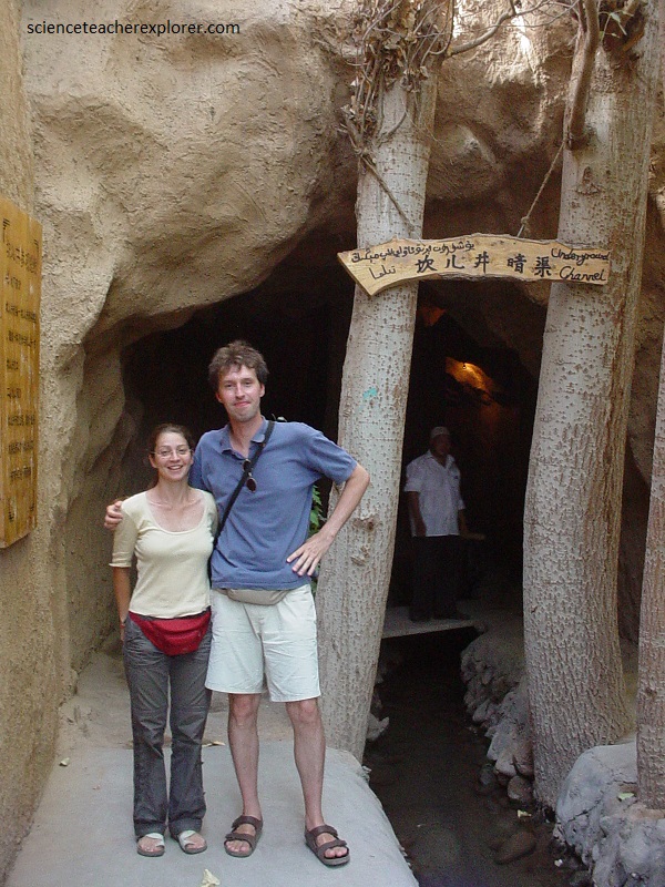
Pictured above, The Turpan Karez Water Irrigation System uses gravity and the slope of the land to direct water flow into underground channels, thereby lessening the effects of evaporation under direct sunlight. The system comprises of wells, underground drain channels (some up to 8 km long), and collection wells (where the water reaches a certain level and runs into above ground irrigation channels). In the entire system, there are over one thousand wells and the total length of the channels reaches 3,000km. The water is clear, cool and pure; it is used for agriculture and drinking. The karez is the lifeblood of Turfan. The most astonishing fact is that this feat of engineering was all completed by hand using simple tools.
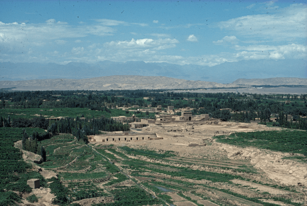
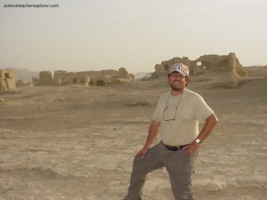
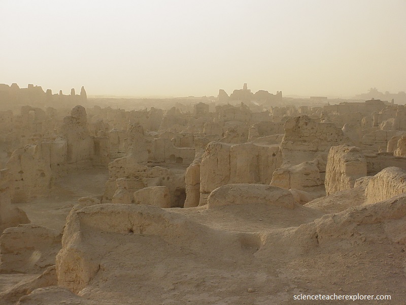
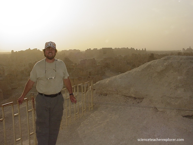
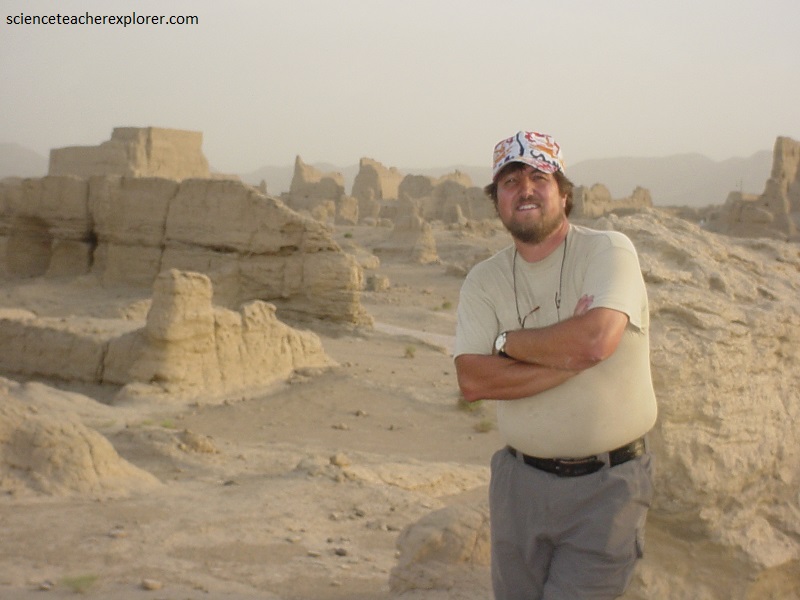
While in Turfan, my trekking group visited one of the world’s architectural wonders hidden in the Yarnaz Valley, 10 km west of Turfan. Like a willow leaf, the ancient city of Jiaohe (Yarkhoto) with a history of 2300 years lies between two rivers on a loess plateau atop a cliff of over 30 meters. The largest, oldest and best-preserved earthen city in the world, Jiaohe is 1,650 m by 300 m at its widest.
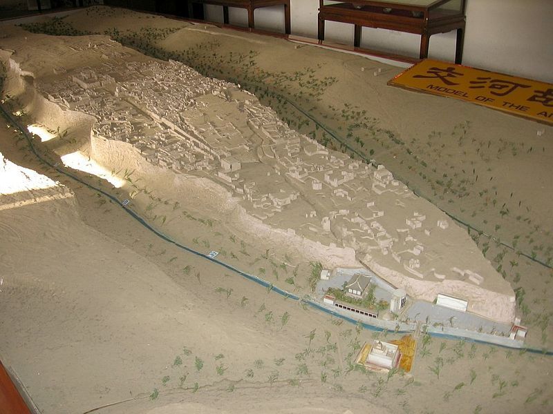
The ancient city of “Jiaohe,” meaning in Chinese is ” where two rivers meet“. According to historical records it was home to 700 households, 6500 residents plus 865 soldiers. It is the largest, oldest, and best preserved earthen city on earth. The city of Jiaohe was the capital of the Jushi Kingdom from 108-450 BC. The city was the highest level military post in the West of China. The city was built on a large islet in the middle of a river. The location made it easy to defend the city and so no city wall was made. The river had high cliffs on either side, creating a natural defensive structure.
Jiaohe distinguishes itself from other ancient cities owing to three features. First, it had only two city gates, the South and East Gates. The main South Gate vanished long ago, leaving a huge breach. The East Gate cut by the cliff was virtually non-existent. Second, the city faces cliffs on three sides, so there are no city walls commonly seen in other ancient cities. Third, all the buildings were dug from earth, and wood was rarely used.
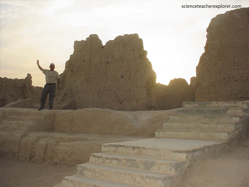
The central avenue, 350-meters long, runs north from South Gate, separating the city into three parts; namely, residences for common people, temples, and residences for aristocrats. To the west of the avenue, low buildings with sparse small temples were residences for commoners, while the high ones in the east were for aristocrats and troops. At the end of the avenue stands a large well-preserved Buddhist temple, Jiaohe Temple, with an area of 5,000 square meters
The Jiaohe Ruins featured the Tang Dynasty ( 618-907 AD) architectural style. Houses were dug downward from the earth, and as no house gates faced the streets, military defense was apparently priority.
At the end of the 8 th Century, the city was tossed into the reigns of the Turpan, Hui, and Mongols. Residents fled from the destroyed city continuously until in the beginning of the 14 th Century, the city was abandoned, as was its glory and prosperity of over 2000 years.
Miraculously, owing to the arid climate and remote location, the ancient city of Jiaohe remains intact, leaving us a rare exemplar of an earthen castle unburied from the sand.
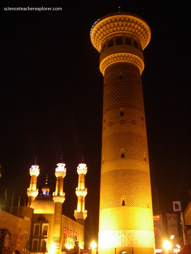
Upon returning to Turfan, my trekking group visited the Emin Minaret. The Emin Minaret is the largest extant old tower in Xinjiang and the only Islamic tower among the hundred famous towers in China. Standing 2 km east of Turpan, it was built in 1777 in honor of the heroic Turpan general, Emin Khoja.
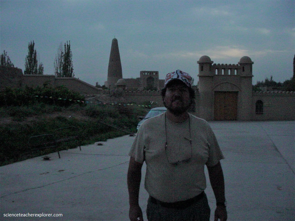
The Emin Minaret is underlined by the architectural significance. The 44-meter high minaret has no stories. From the base with a diameter of 10 meters, it tapers to an Islamic dome. In its center is a brick-piled pillar with 72 steps around it spiraling to the top. There are 14 openings for ventilation and lighting which are located in different directions and at various heights. On the top, there is an attic of 10 square meters with large windows on the four sides through which the marvelous landscape could be admired.

