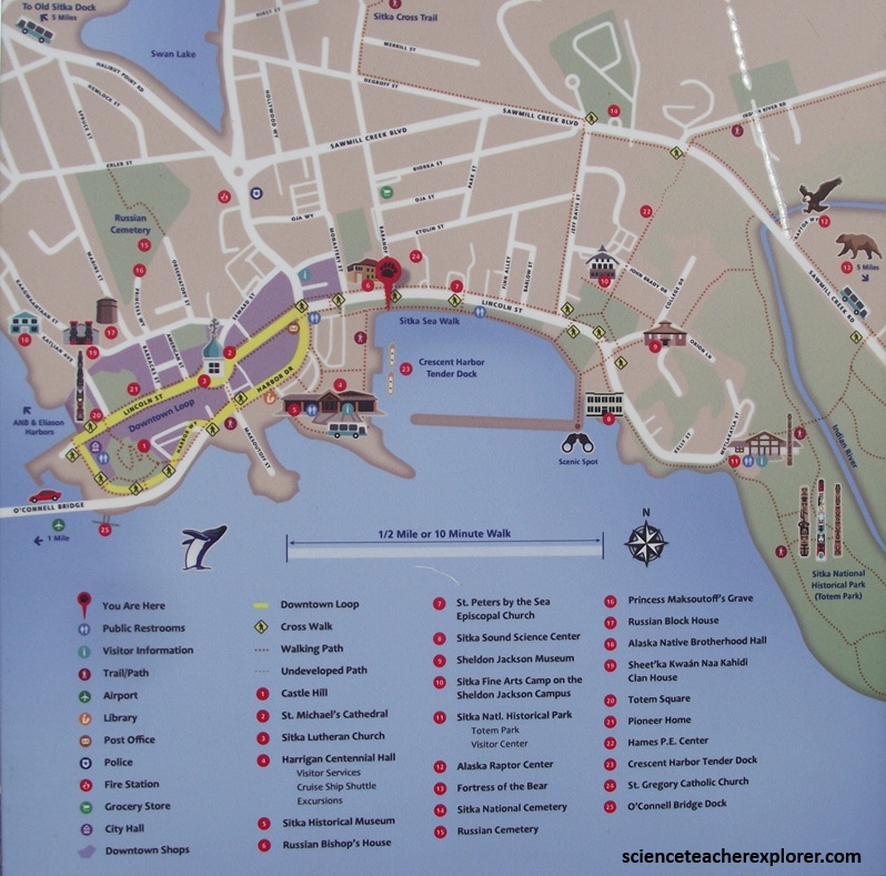
Inside Passage, Alaska
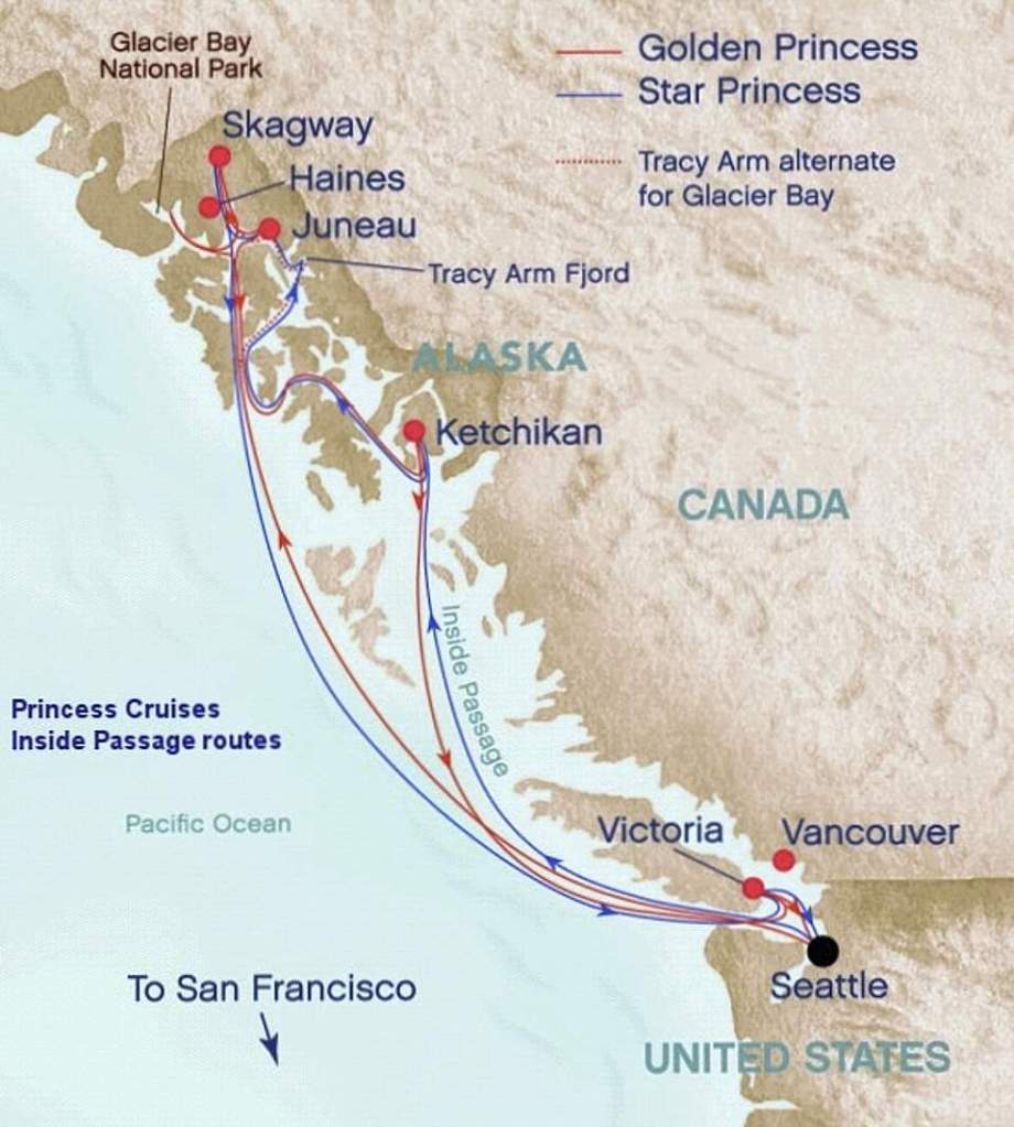
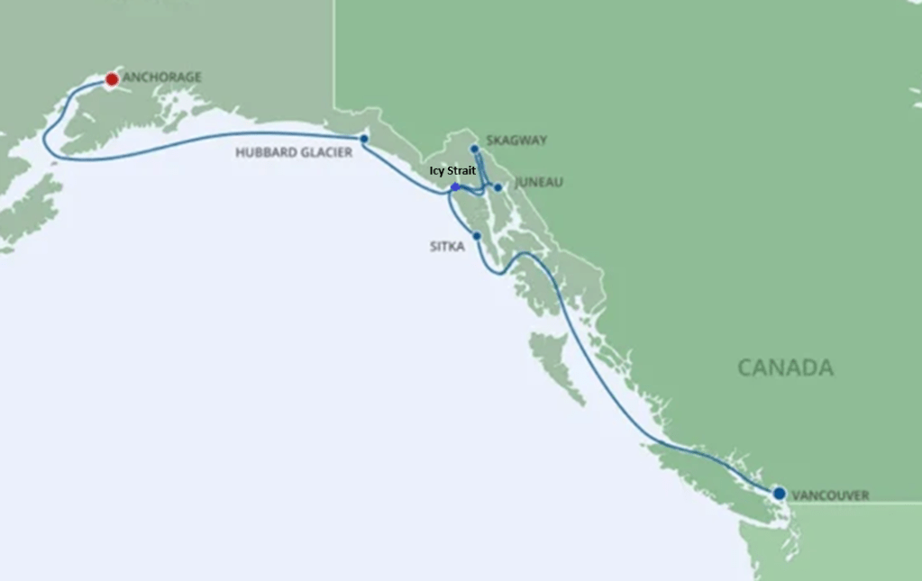
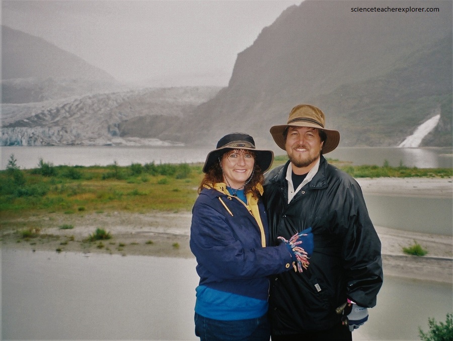
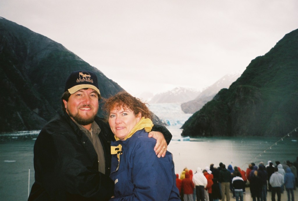
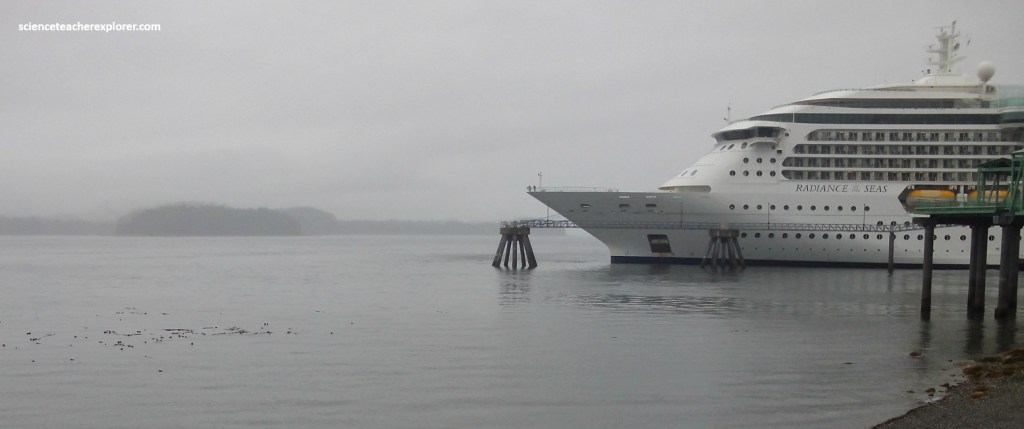
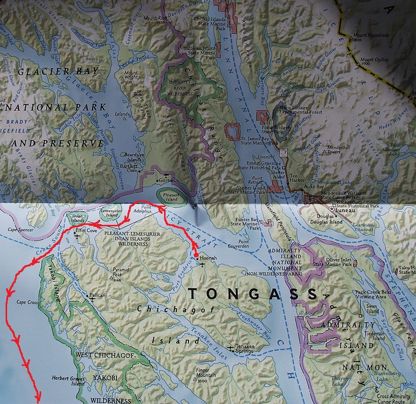
In the late-summer of 2006 and 2025, Becky (my wife) and I booked a cruise to explore and enjoy the “Inside Passage” to southeast Alaska. The “Inside Passage” is the cruise to see forest-covered islands, tidewater glaciers, and ice-scoured fjords. With the exceptions of Haines, Skagway, and Hyder, you cannot reach this Alexander Archipelago by road. We took the “Golden Princess” red route from Seattle, Washington in 2006, (pictured below) and the “Radiance of the Sea”, blue route from Vancouver in 2025, (pictured below that) .
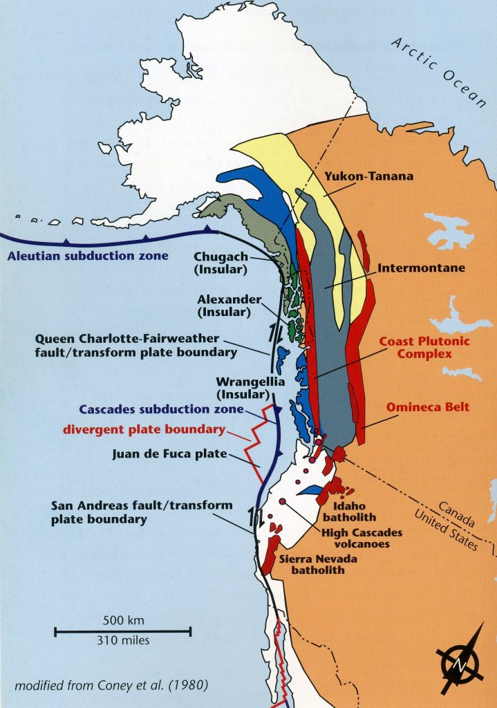
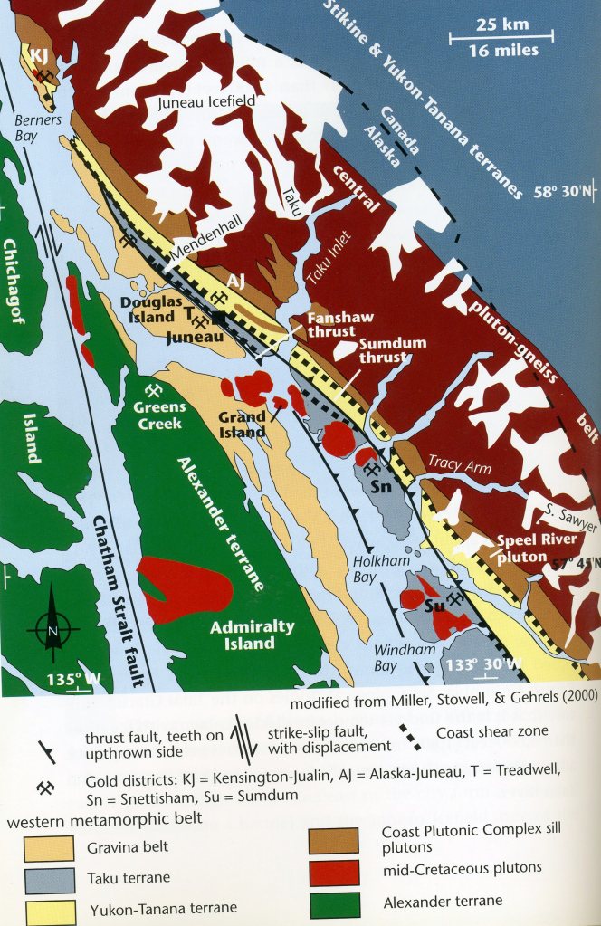
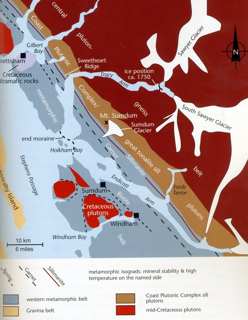
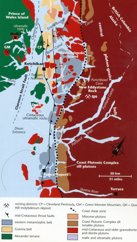
Southeast Alaska (the Inside Passage), and coastal British Columbia are primarily made up of accreted terranes, (the Alexander, Wrangellia, Chugach, and Yakutat). In the diagram below, an oceanic island or continental fragment (incoming terrane) approaches a subduction zone, where it will eventually attach (accrete) to the edge of the continent. An active volcanic arc develops on crust of an older accreted terrane. Extinct volcanic arcs on still-older accreted terranes reflect the positions of earlier subduction zones. Suture zones mark the boundaries between different terranes. Remnants of the Taku and Yukon-Tanana terranes, whose origins are closer to the continental edge of North America, were smashed up and joined to North America on the inland side of these later arriving rock packages. The mainland Coast Range is made of massive amounts of hard crystalline igneous rock of the Coast Plutonic Complex, (imaged below).
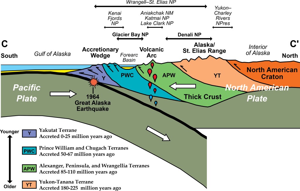
Imaged above, some of the magma entered the region when the Alexander and Wrangellia terranes were accreted, and additional magma was intruded during the active subduction zone of Late Cretaceous to Early Paleocene time. Extreme uplift throughout Cenozoic time led to the erosion of the overlying rocks. So much overburden rock was removed that intrusive igneous rock that cooled deep within the Earth’s crust is now exposed at the surface. These once deep rocks have recently experienced repeated glaciations, and much of the Coast Plutonic Complex is still covered by snow and icefields.
Imaged above; The Yukon–Tanana Terrane began to collide with North America about 225 million years ago, and was firmly attached to the continent by 180 million years ago. The Wrangellia, Alexander and Peninsular terranes slammed into North America from 110 to 85 million years ago, followed by the Chugach Terrane about 67 million years ago, and then the Prince William Terrane by 50 million years ago. The Yakutat Terrane started to collide with North America by 25 million years ago; it is still attached to the Pacific Plate, so it continues to smash into the continent.
Southeast Alaska is a geologically active. Current geological activity is manifest in earthquakes, glacial movement, and the less perceptible uplift and erosion of the earth’s crust. Towering mountains throughout the region continue to grow by tectonic uplift, (rates of 1.3 – 3.8 cm/yr). Large-scale erosion by the flow of glaciers and rivers, which occurs at a rate similar to uplift, has removed most of the original mountains that began to grow more than 90 million years ago. These active processes of mountain building and erosion in Southeast Alaska have created the vast network of waterways that provide an ideal route for viewing the diverse geology and biology of this region.
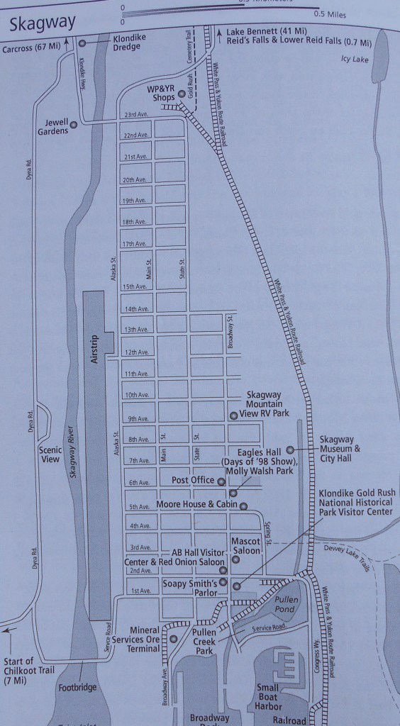
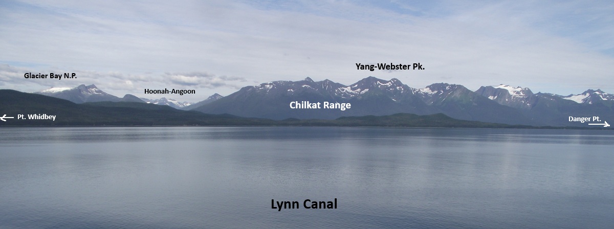
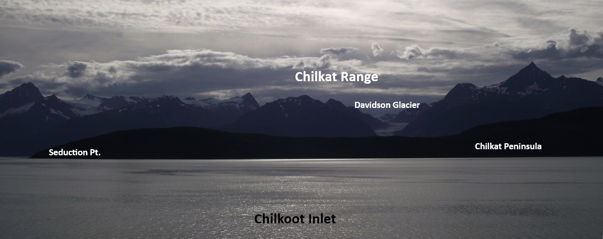
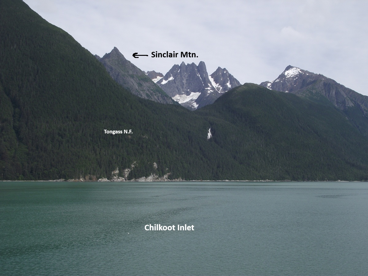
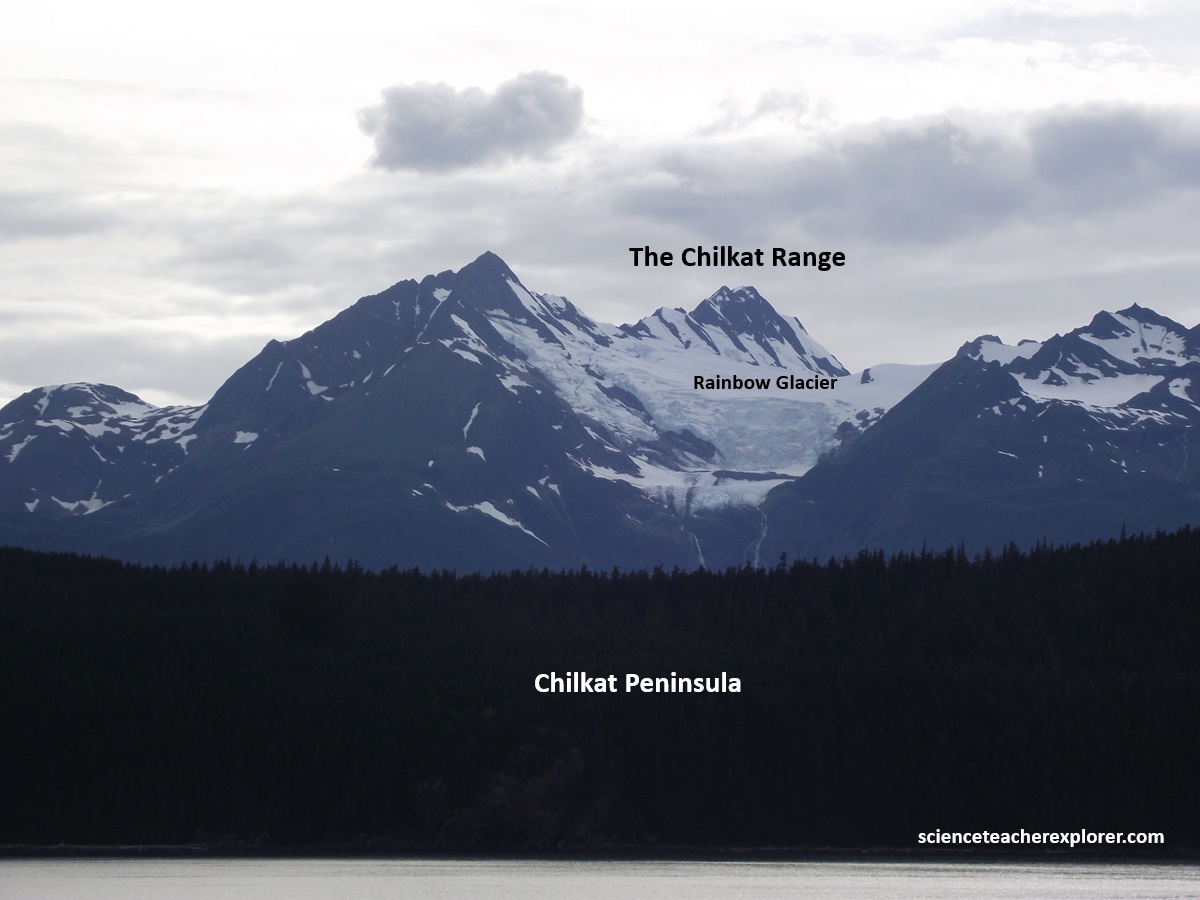
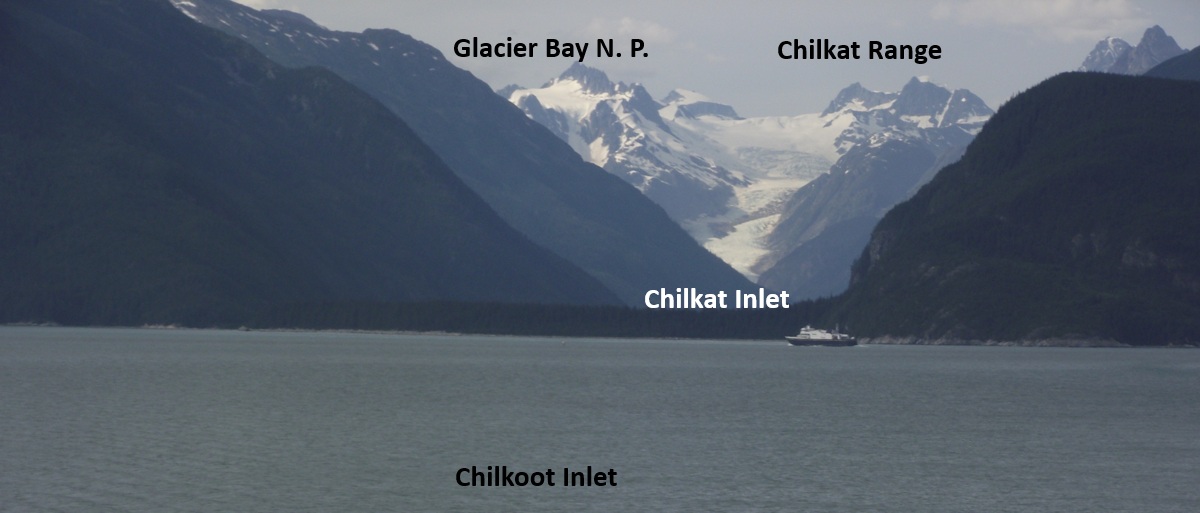
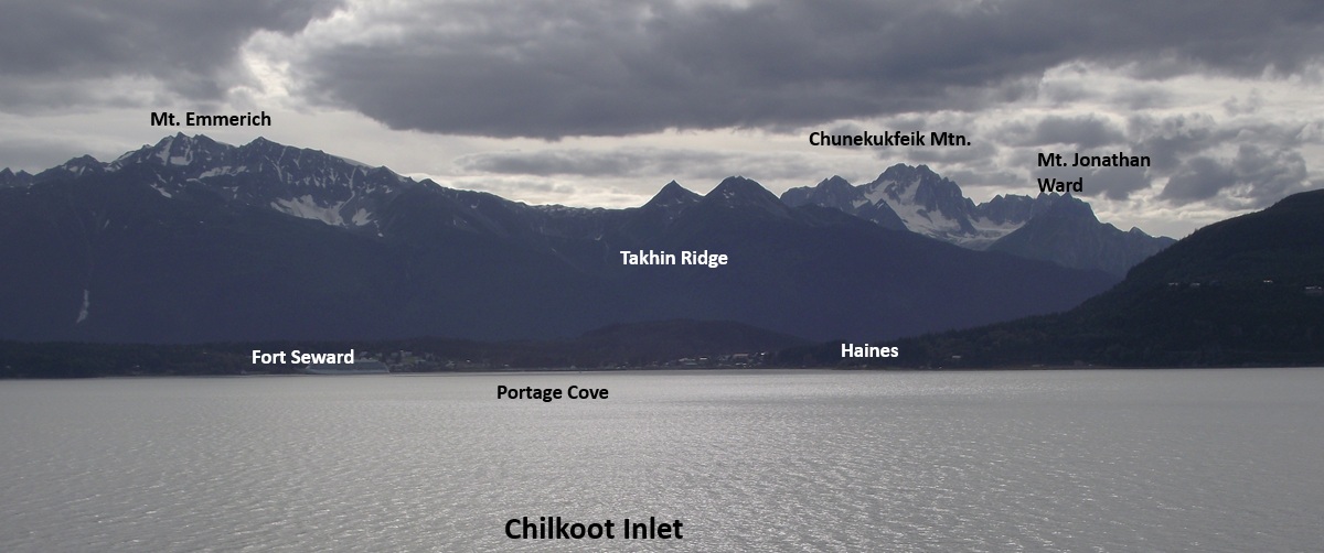
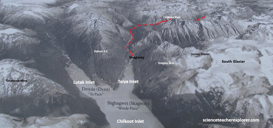
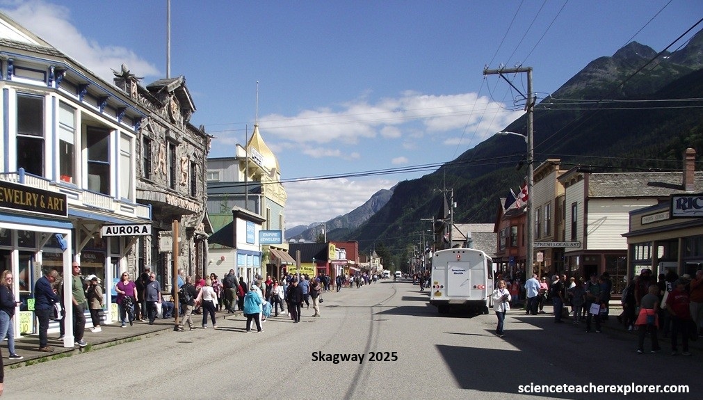
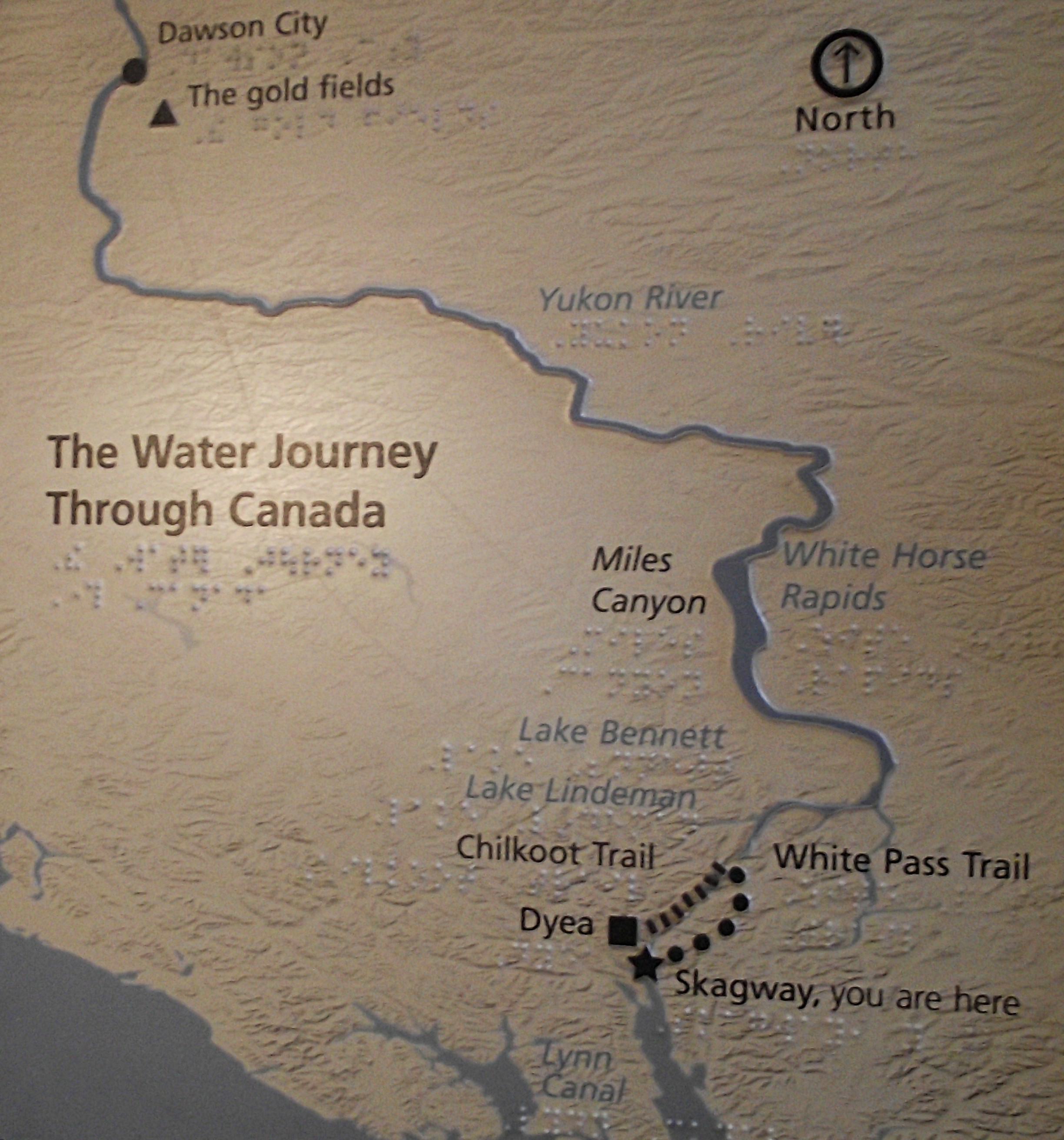
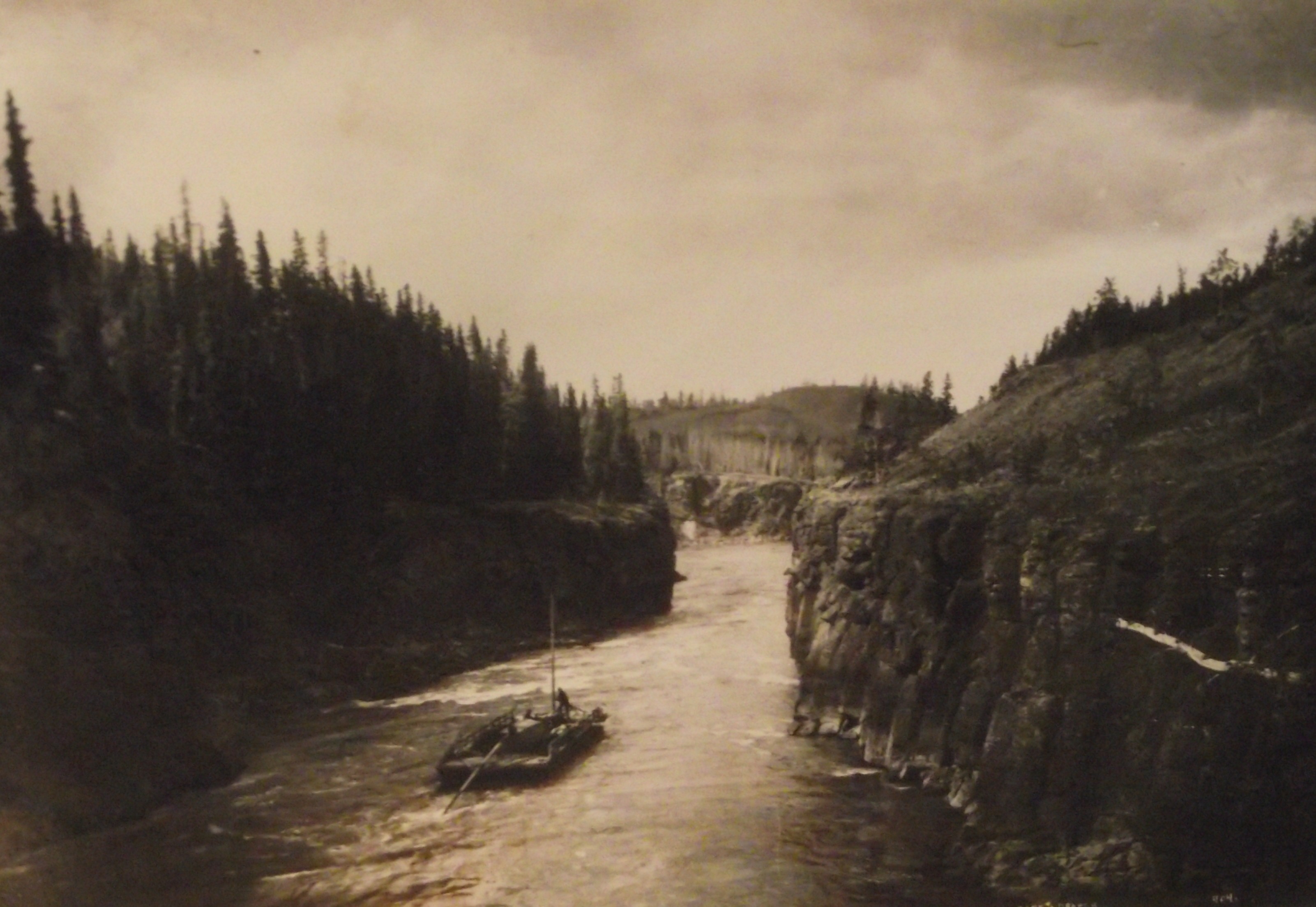
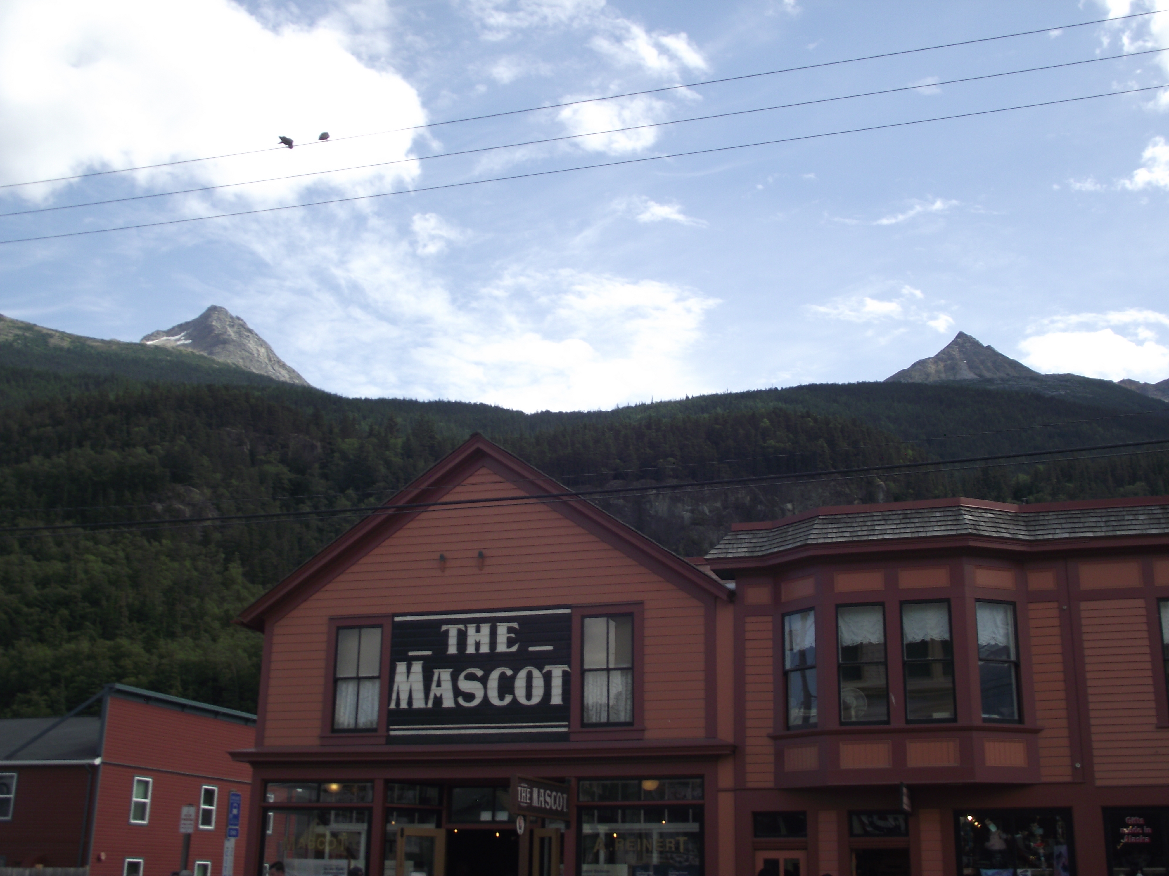
Imaged above, our first cruise-stop in 2006 and last cruise-stop in 2025, was Skagway. In both cases, we approached Skagway by-way of the Lynn Canal and the Chilkoot Inlet. The Lynn Canal follows the southeastern continuation of the Denali Fault: the Chatham Strait Fault, which extend from the Chilkat River in Haines to the southern end of Baranof Island, at the entrance to Chatham Strait. {The once glaciated and later flooded stream valley that followed the fault is North America’s longest fjord at 412km}. Throughout the Late Pliocene and Pleistocene time, repeated advances of Coast Range glaciers flowed into and deeply eroded this fault zone. Additionally, the Chilkat and Taiya Inlets follow splays of the Chatham Strait Fault. {The pictures below were taken in 2025, while traveling from south to north, up the Lynn Canal, the Chilkoot Inlet and the Taiya Inlets to Skagway}
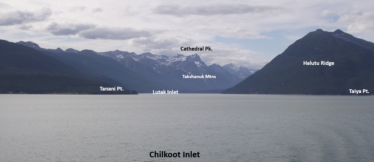
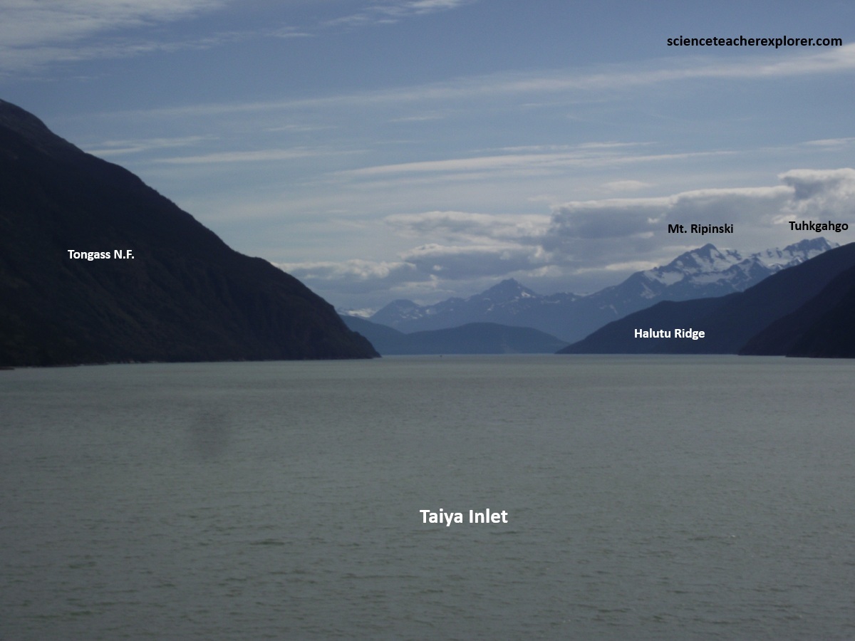
The Taiya Inlet, at the northern end of Lynn Canal, is the passageway for cruise ships bound for Skagway, which means “home of the north wind” in the Tlingit language. {The satellite photo below was taken from an Interpretive Sign on-site}.
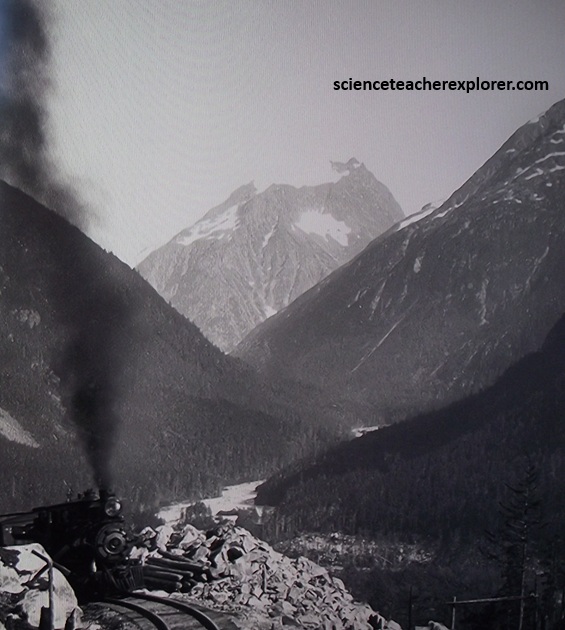
Klondike gold seekers discovered Skagway in 1898 when they descended on the area, swelling Skagway’s population to 20,000. From Skagway the way to the Klondike led over the Coast Mountains through the 1,000m White Pass to Lake Bennett in Canada, a trip of approximately 64km. Becky and I chose to book a tour in 2006, that took us along the Klondike Highway for a few hours to the White Pass, (pictured below).
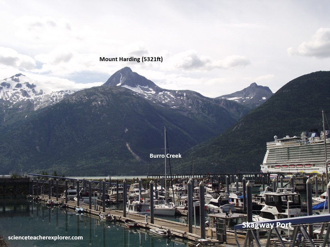
The modern Klondike Highway provided access into Canada through the deeply glaciated Burro Creek granodiorite and quartz monzonite that formed the bedrock of the Coast Mountains. No gold was ever found in this Skagway Valley. The gold fields were located approximately 900 km to the north, near the junction of the Klondike and Yukon Rivers at today’s Dawson City. Skagway became internationally known solely as a gateway to the Klondike gold fields.
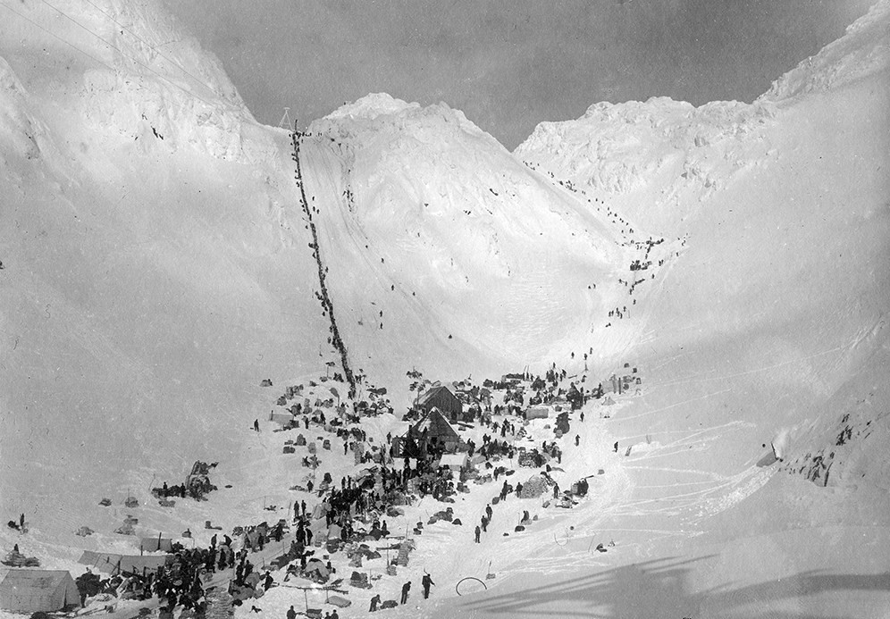
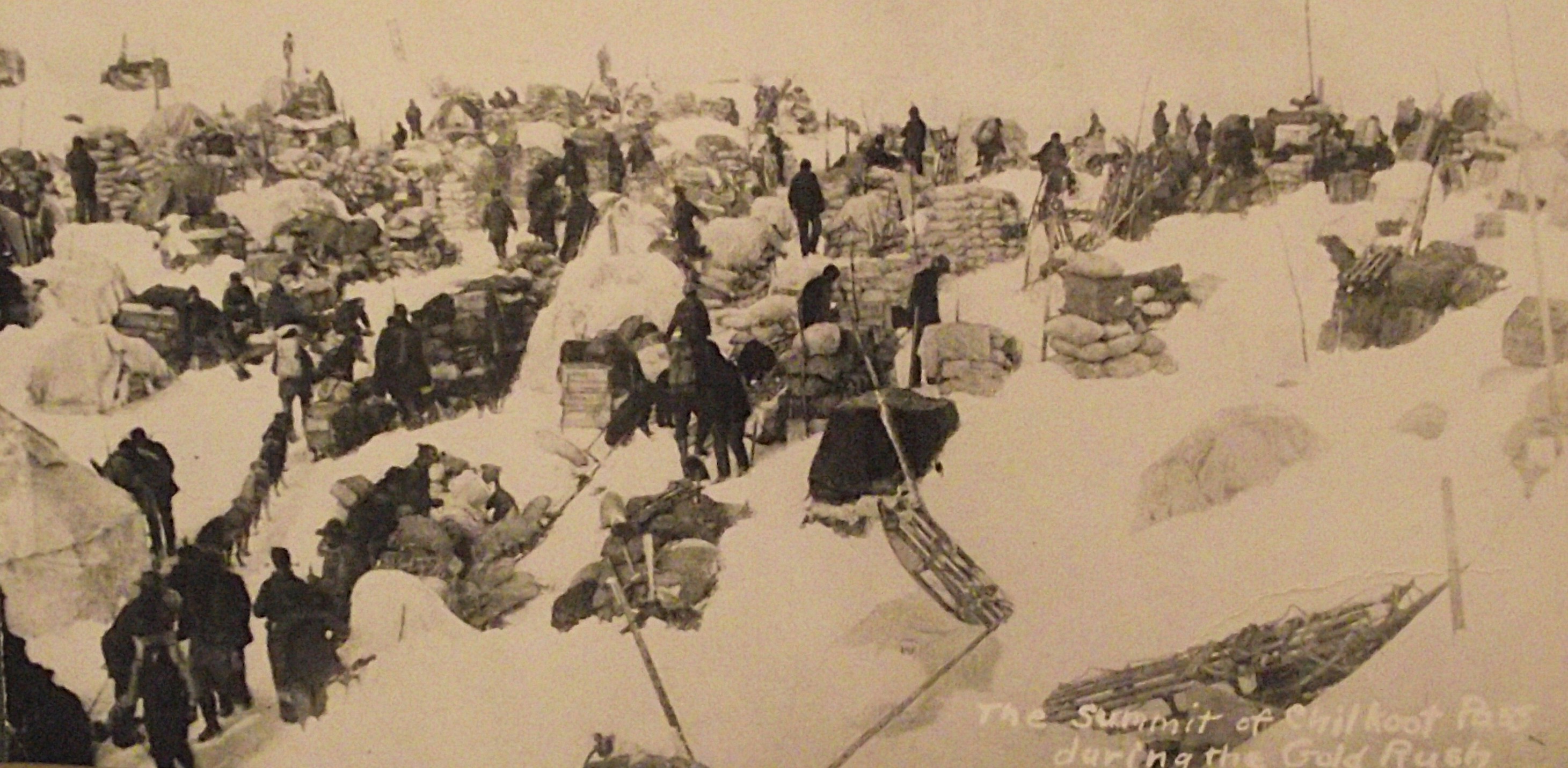
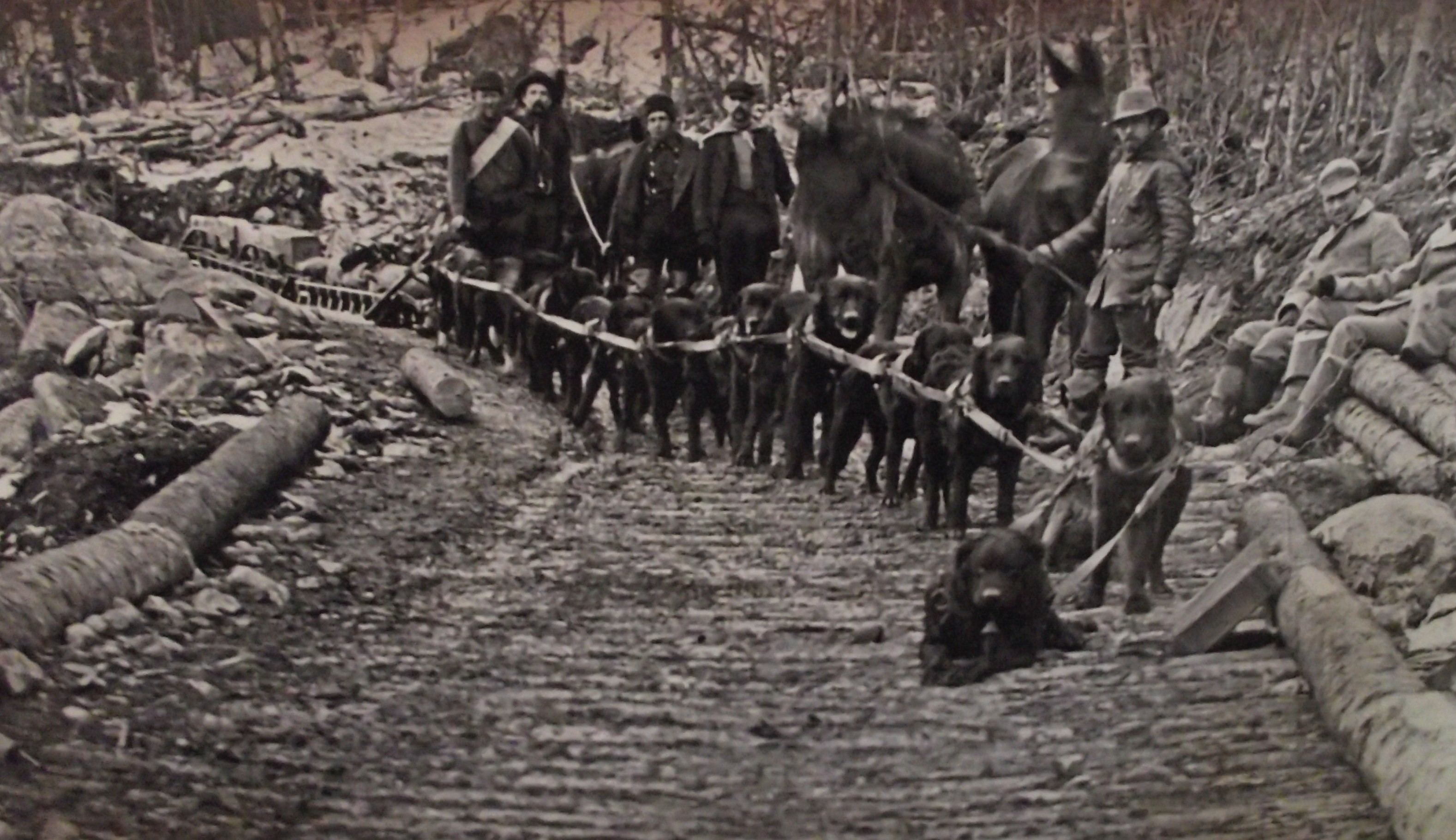
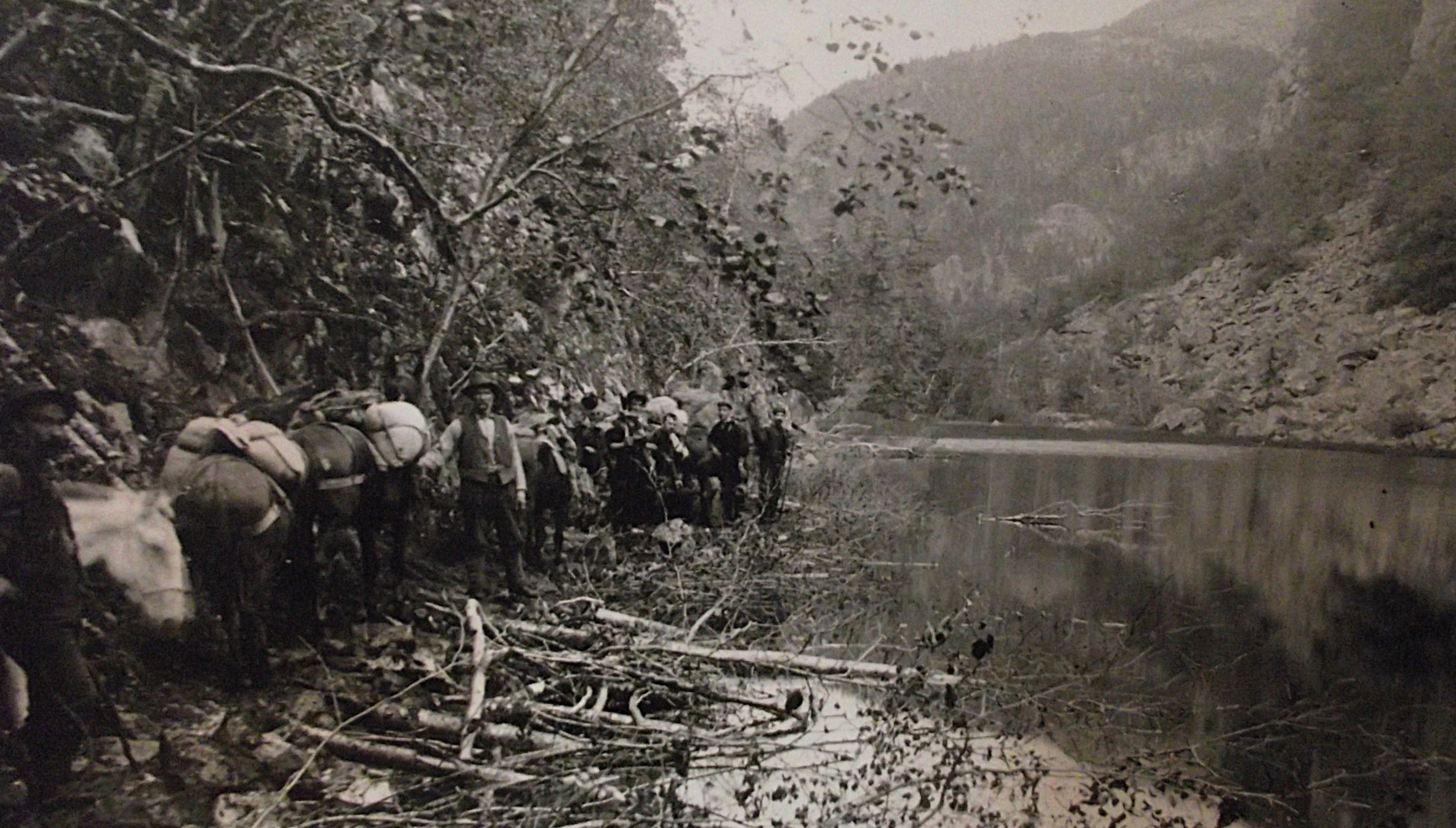
A more popular alternative to the White Pass Trail was the Chilkoot Trail, which followed a parallel course through the mountains from Dyea, an old Native village and trading post 15km from Skagway at the extreme northern tip of Taiya Inlet. This trail had long been used by the Chilkat Tlingit as a trading route to the Interior, and hundreds of prospectors had use it to traverse the mountains year before the big strike came. Both trails led to Lake Bennet, but the Chilkoot was shorter at only 53km, (imaged above). {The historical pictures below were taken from Interpretive Signs on-site}.
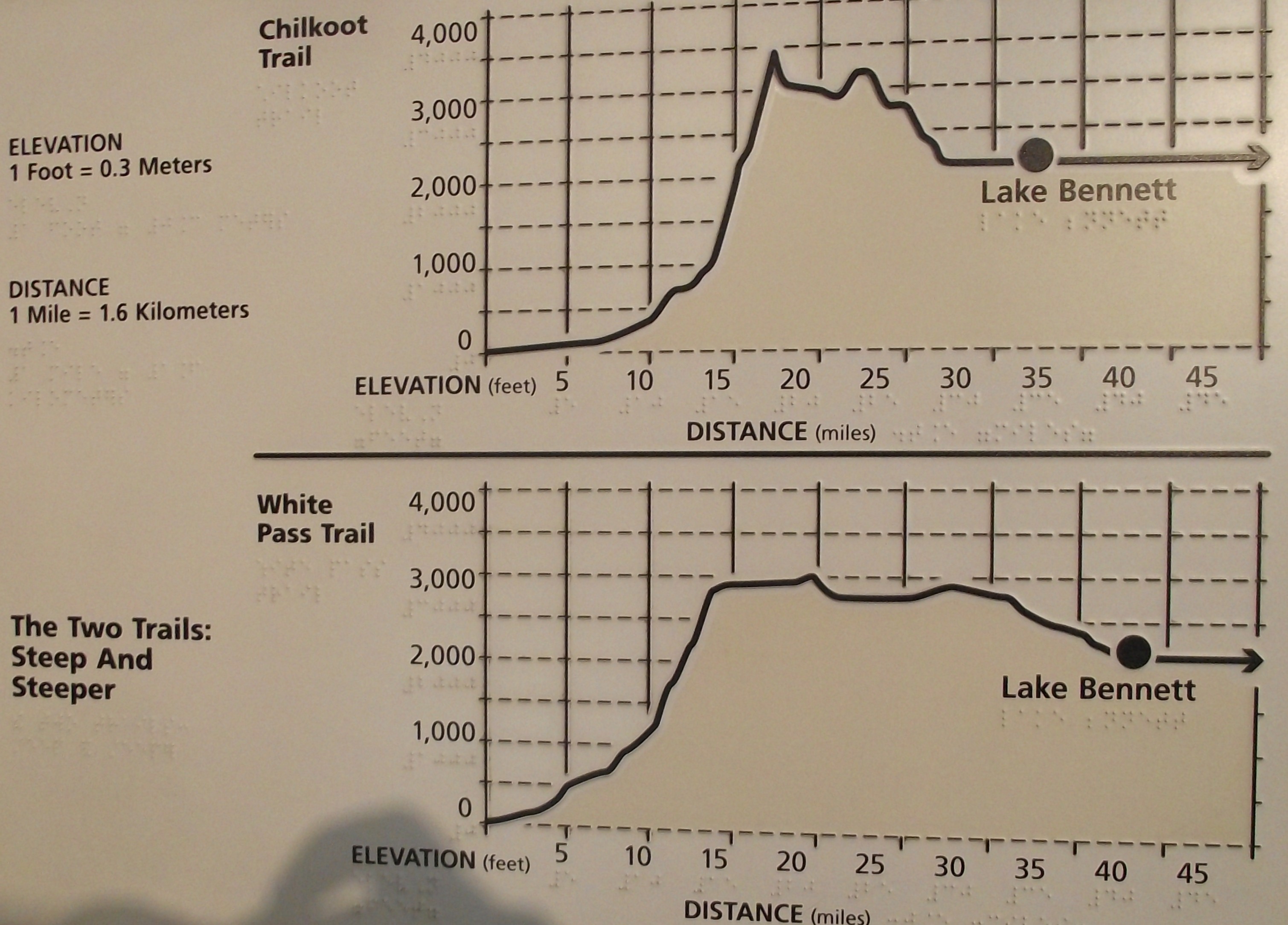
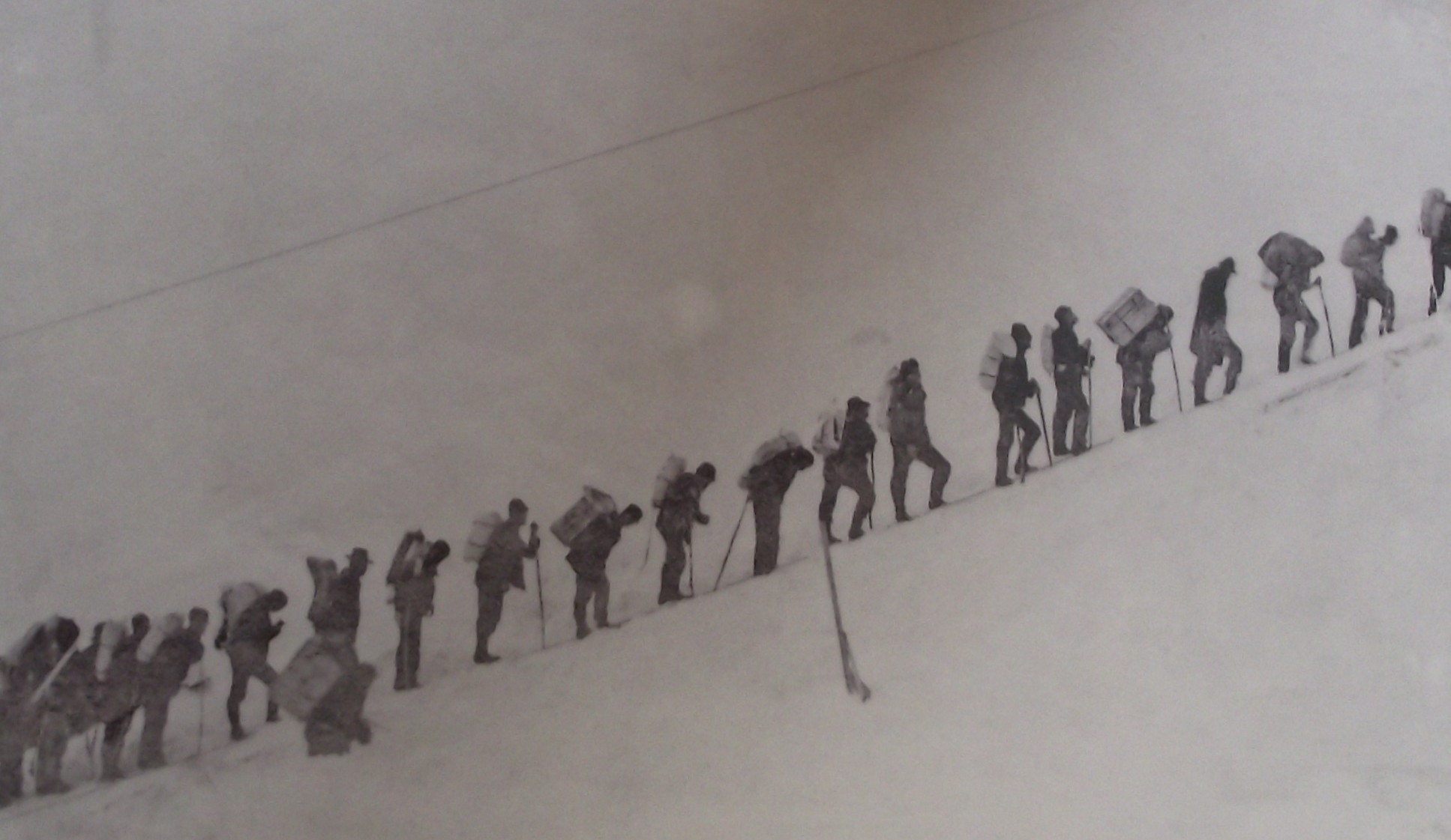
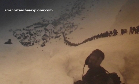
With shorter came steeper, however; the final kilometer climb to the 1,140m summit of Chilkoot Pass was tortuous 450 climb. In the winter steps were chopped into the snow, and the image of the long, black line of prospectors trudging single file up the “Golden Stairs” of Chilkoot Pass has come to symbolize the sacrifices made in the name of gold.
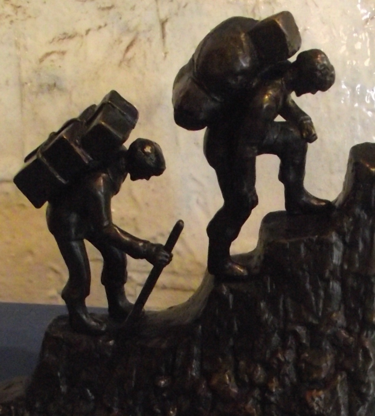
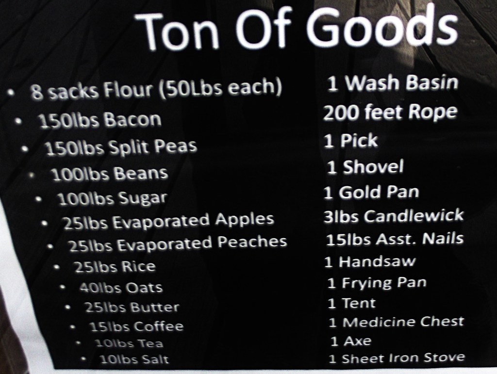
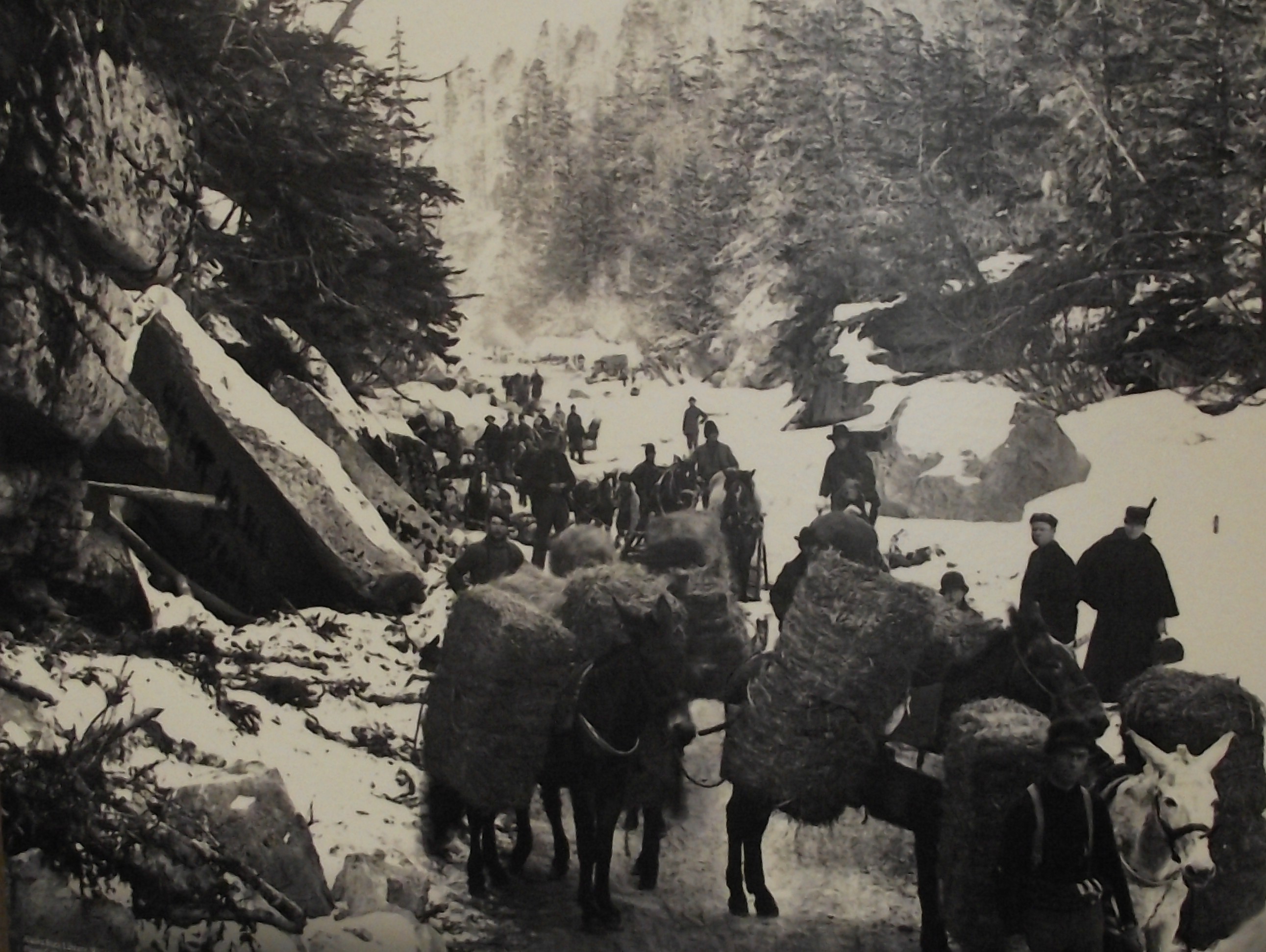
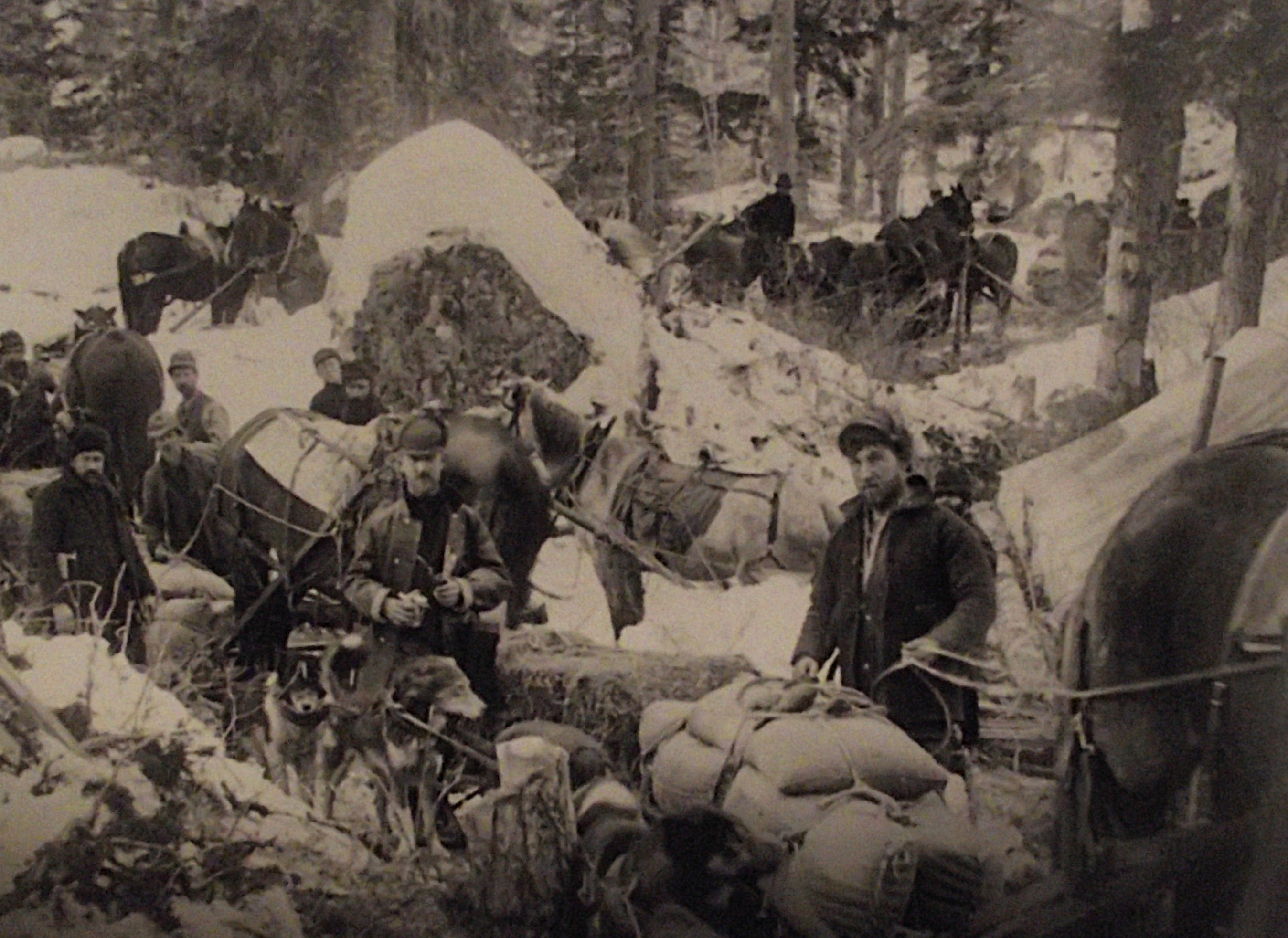
Pictured above, The Klondike gold seekers climbed 1,140 m in 27 km to cross the coastal mountains northward into the Yukon River valley drainage basin. This well-traveled trail follows the narrow Taiya River valley past the Irene Glacier. The valley is fringed by many 1,830 m peaks of Cretaceous to Early Tertiary granodiorite and culminates in the infamous scree slope known as the “Scales”. Here treacherous piles of loose granodiorite talus provide the only footing. Miners typically hauled 900 kg of equipment and a year’s supply of food up the “Scales” and over Chilkoot Pass into Canada. Crossing the pass one time would have been plenty for anyone, but the stampeders were forced to assault the summit repeatedly, some as many as 30X, to transport their gear (enough for a year’s prospecting) and the 900kg of food and clothing that the Canadian government required them to have before crossing the border.
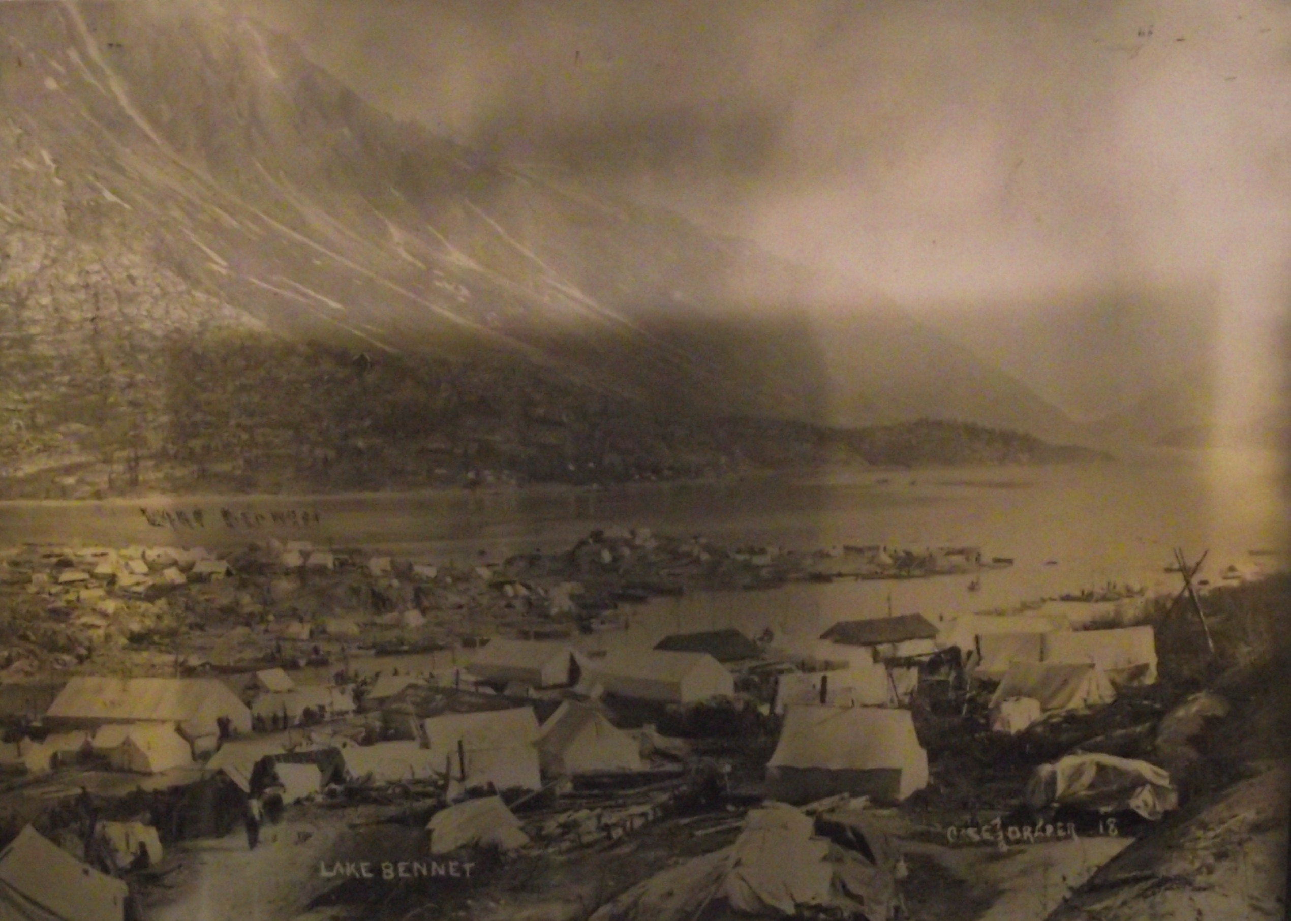
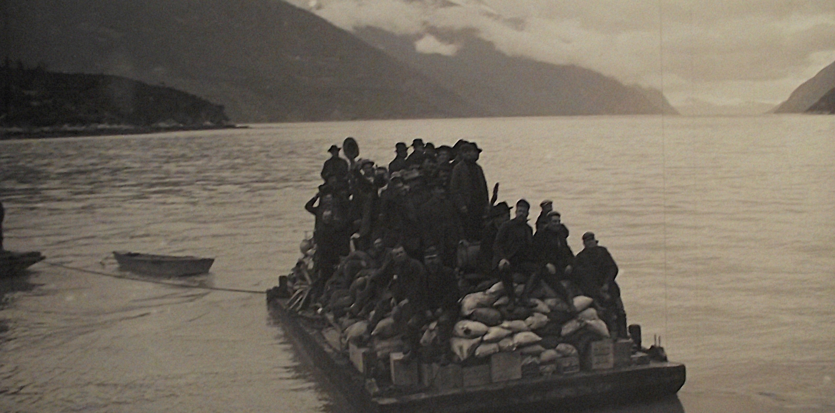
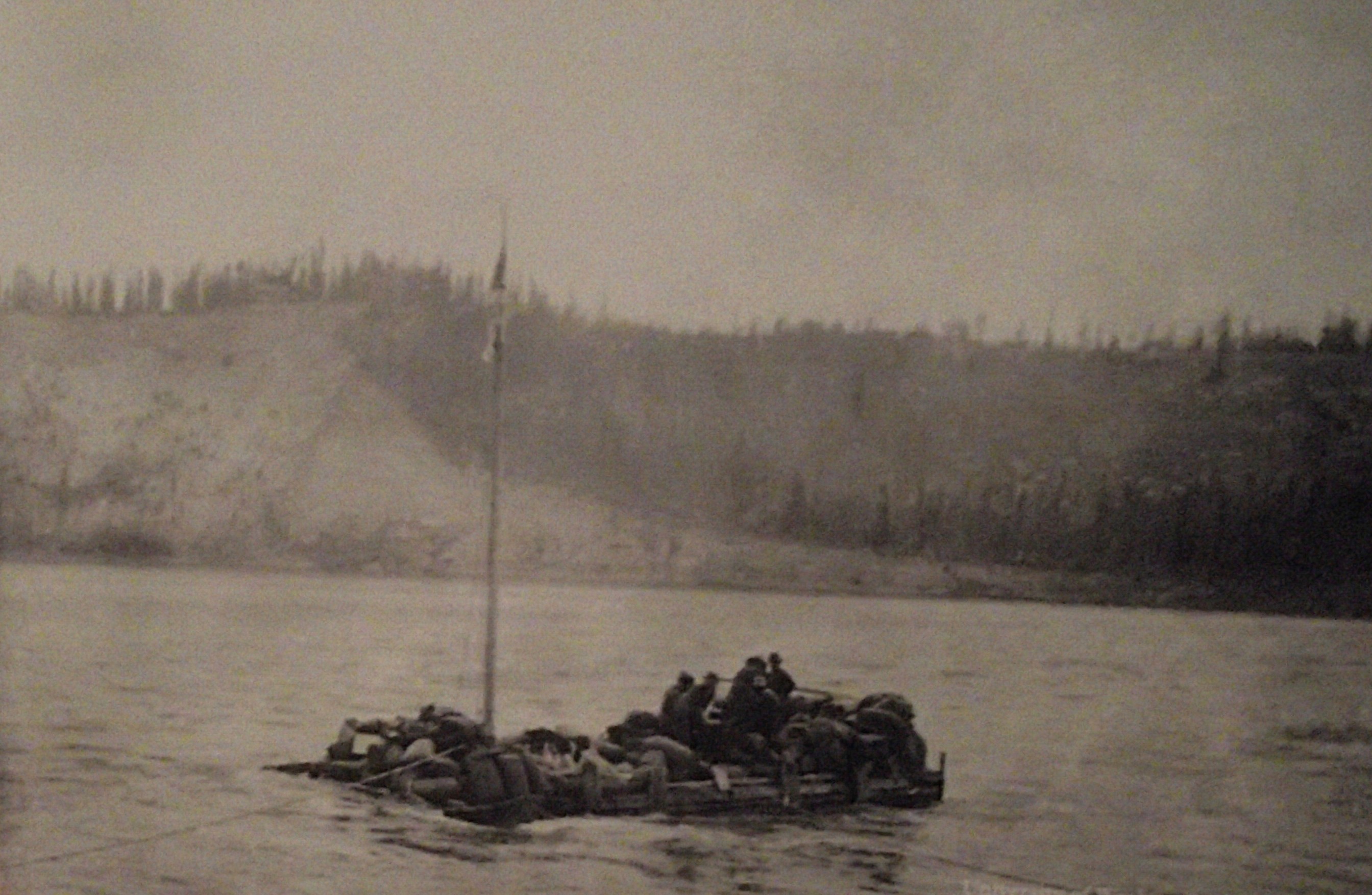
At the end of the trail, the stampeders camped beside Lake Bennett, where they manufactured crude boats out of the surrounding stands of timber and waited for the spring breakup. East of the divide, miners had a relatively easy descent to the south end of Bennett Lake, where they could next risk life and limb on a homemade raft to travel the rest of the way to Whitehorse and on down the Yukon River to Dawson. When the lake ice broke up in June, more than 7,000 boats charged downriver to Dawson. {The historical pictures below were taken from Interpretive Signs on-site}.
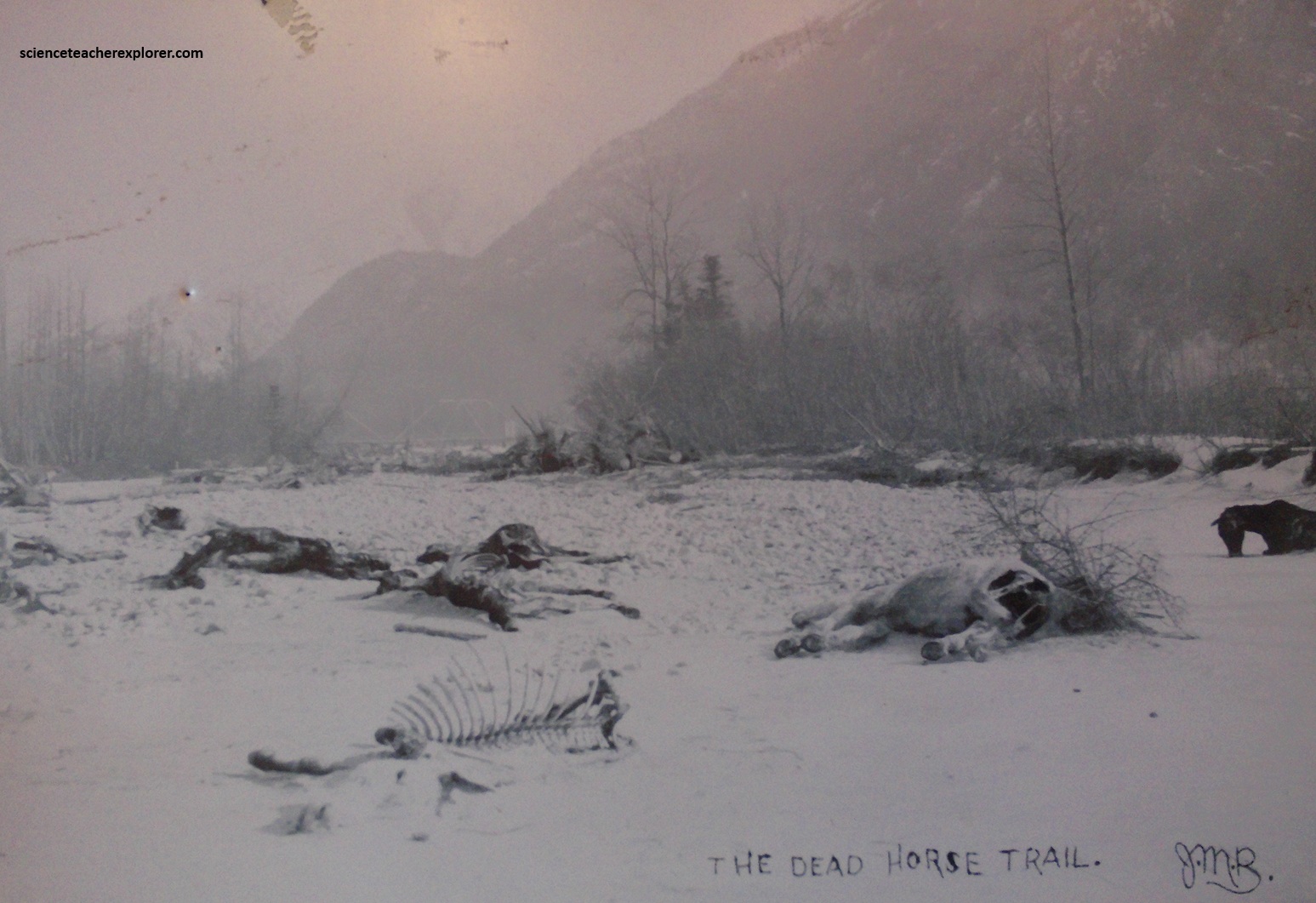
Of course, there was the other route, (the White Pass Trail). It was less steep, but longer. You could use a pack animal, so you didn’t have to hire Native-Packers. However, it was very crowded and the trail construction couldn’t keep up with the traffic. Then, heavy rains made it so muddy that it was virtually impassable. There were so many horses that died along the way, it picked up the nickname called the “Dead Horse Trail”, (pictured below). {The historical pictures below were taken from an Interpretive Signs on-site}.
Gold Rush stampeders used the Skagway area for the same reason rivers and glaciers did: it was a point of geologic weakness. The faults throughout the area allowed glaciers to carve more deeply here than elsewhere. As a result, the White and Chilkoot Passes had lower elevations and were passable year-round. They were the most used breaks in the Coast Mountains for hundreds of miles. Once over the passes it was a short journey down the Yukon River to Dawson City.
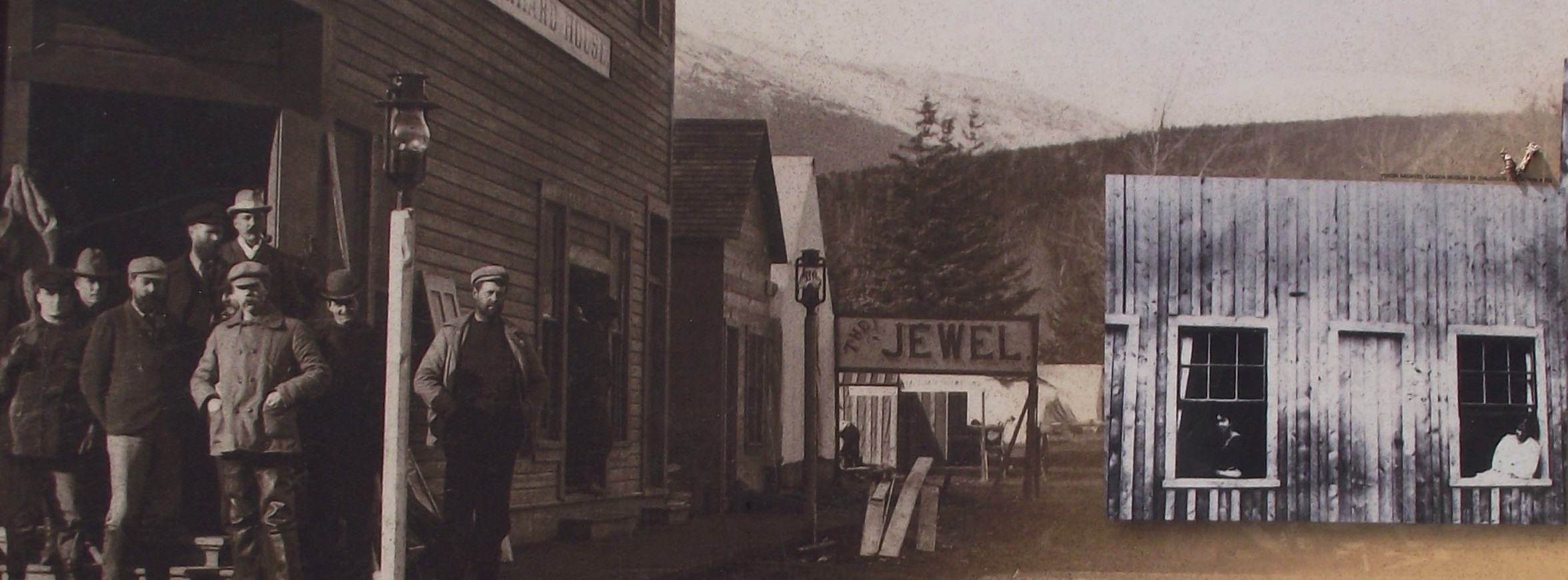
Skagway grew in reputation as a hard-bitten, lawless frontier town. Everyone was there for one reason only: to make money! If not in the goldfields, the by providing services, (some of them of the more reprehensible and unmentionable variety), to those who were on their way to the goldfields, or even by relieving the gold from those on their way back. {The historical pictures below were taken from an Interpretive Signs on-site}.
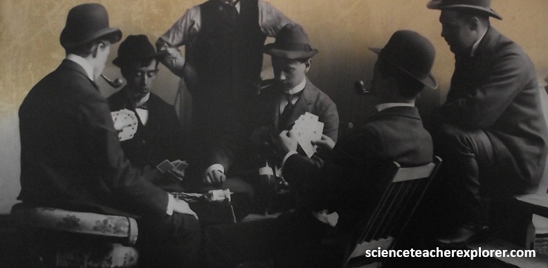
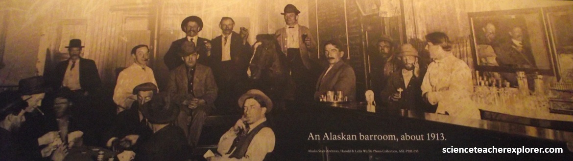
Pictured above, in 1897-98, beer and whiskey flowed in dozens of saloons. Gambling and prostitution thrived. Con artists fleeced the unsuspecting. Some called Skagway the “roughest place in the world.”
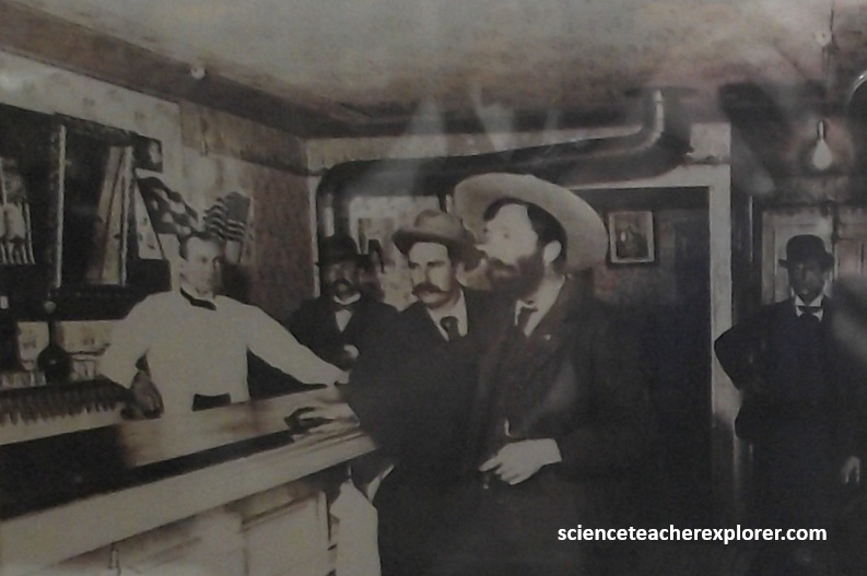
Pictured above, the most notorious outlaw of the era was Jefferson Randolph “Soapy” Smith, a fast-talking con artist and gang organizer whose nickname derived from one of his better-known cons, which was to “give away” ordinary bars of soap purportedly wrapped in large-denomination bills for the price of a mere $5. Smith was killed in a gun battle with a local surveyor/guard. Both were killed in the interaction. {The historical pictures below were taken from Interpretive Signs on-site}.
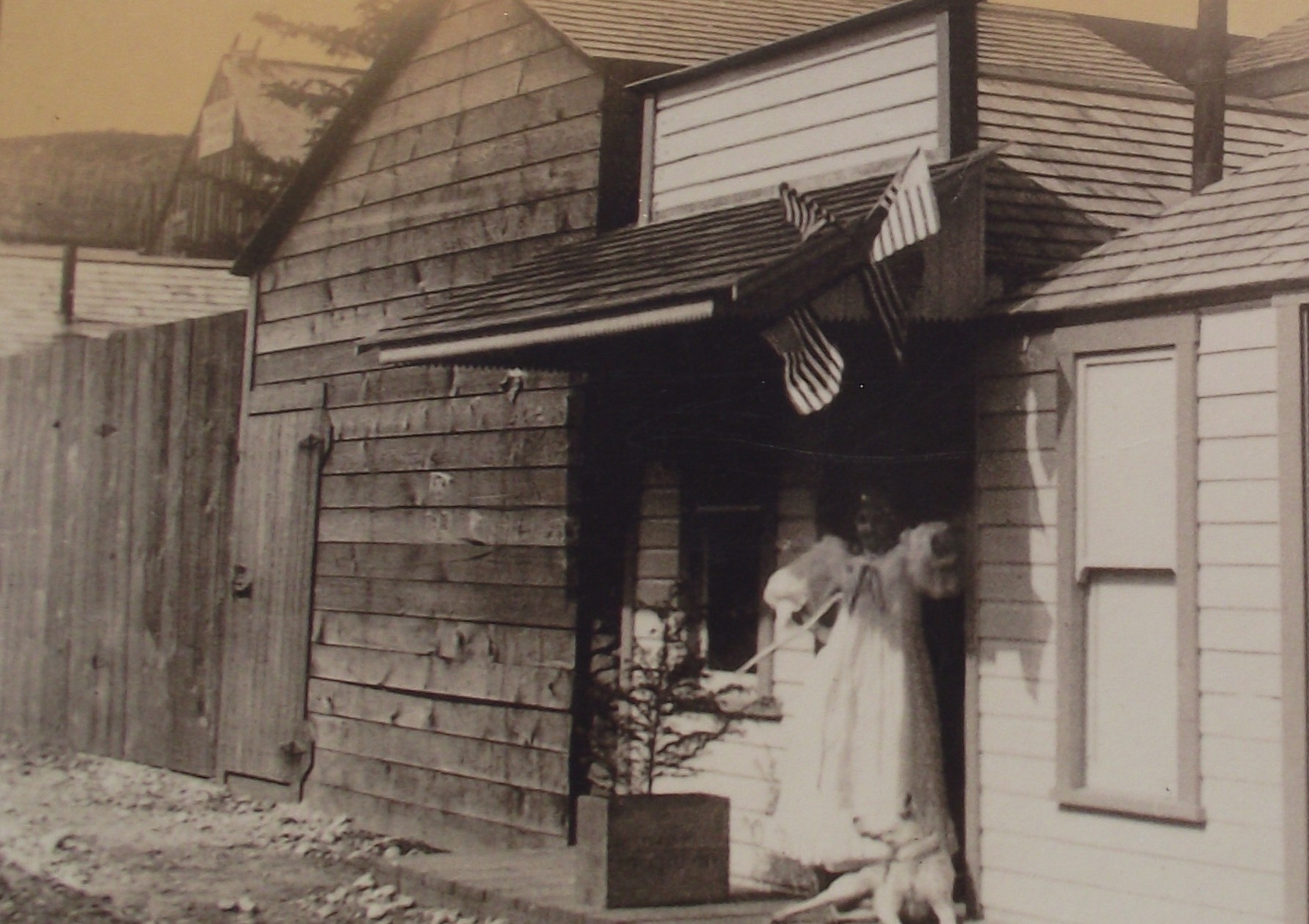
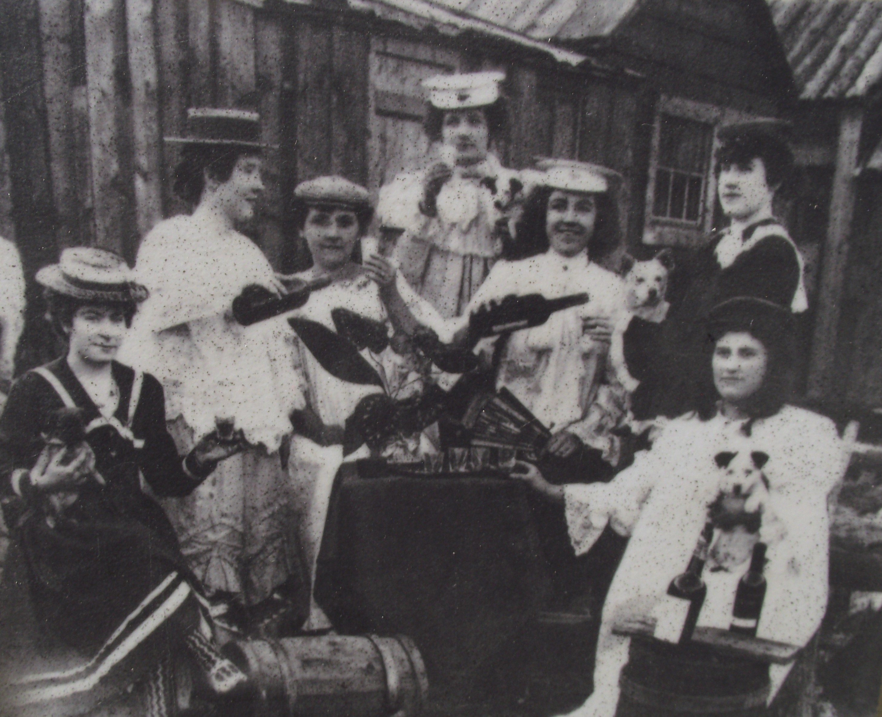
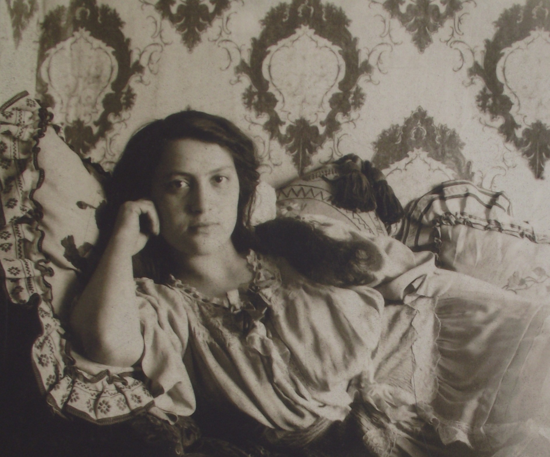
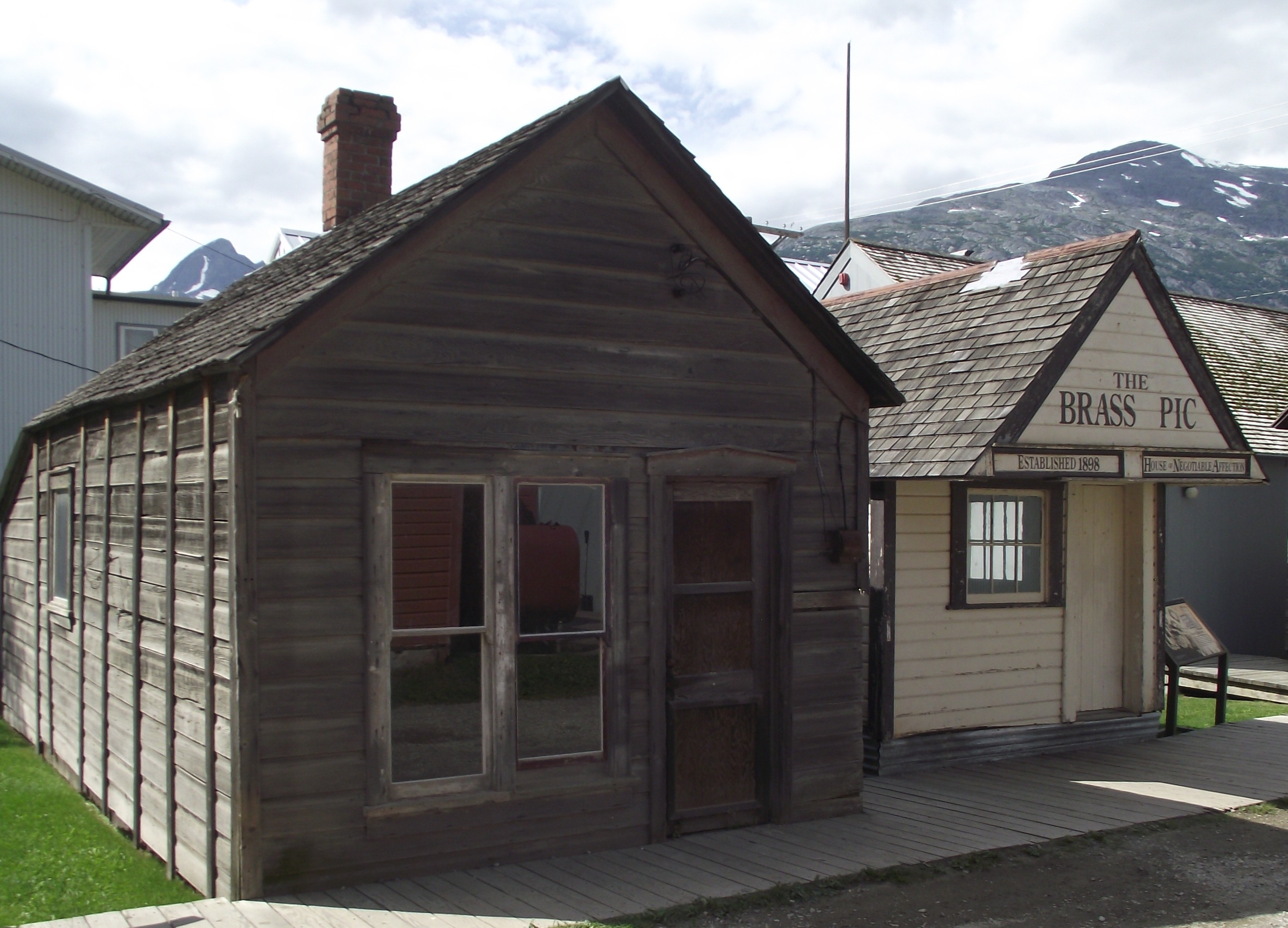
Pictured above, performers, dance hall girls, and prostitutes–all attempted to “mine the miners” in Skagway’s nightlife of the late 1800s and early 1900s, but in different ways. Professional actresses, singers, and other entertainers performed in vaudeville shows. Dance hall girls earned commissions in the saloons by waltzing with males and enticing them into buying many glasses, (or bottles), of liquor. Prostitutes worked in one- or two-room cribs in alleyways, upstairs in saloons, or in brothels. A few “ladies of the night” made fortunes and enjoyed lavish lives indulging in diamond necklaces and champagne baths. A couple of enterprising madams became rich and invested in real estate. To straitlaced Victorians, of course, all of these occupations were suspect.
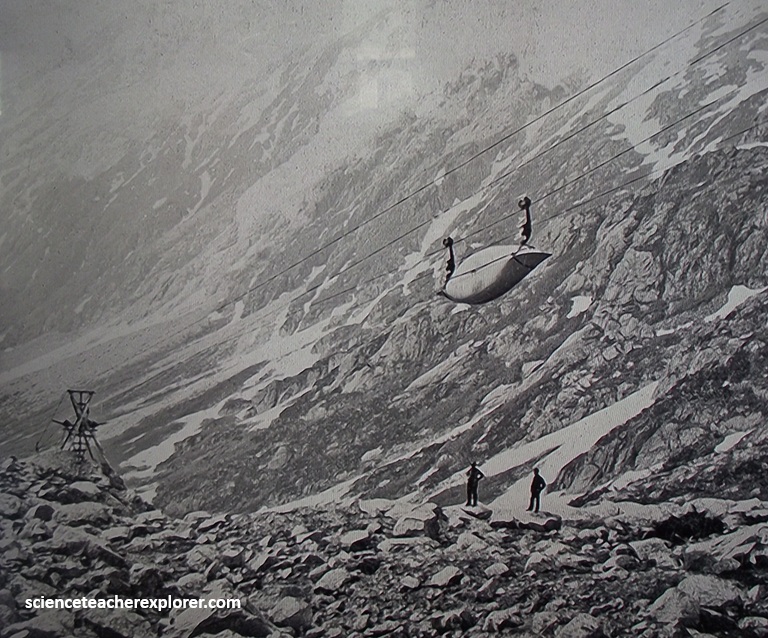
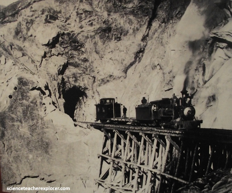
Pictured above, it was not long before several enterprising individuals had built crude tramways to help transport goods to the summit. The most sophisticated on the Chilkoot Trail was an aerial tramway complete by the Chilkoot Railroad and Transportation Company in May 1898. However, in times of such fervor as the gold rush of 1898, though, big dreams are the order of the day, and the man who now stepped onto the stage had the biggest vision of all: to build a railroad over White Pass. Michael J. Heney! The rest is history.
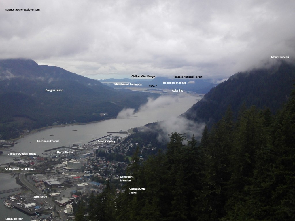
Our next cruise-stop was Juneau. The capital city of Alaska is situated on either side of the narrow and linear water-filled Gastineau Channel, between the mountains of Douglas Island on the west and the mainland on the east. Imaged below, high mountains east of the city form a rock wall between Gastineau Channel and the Juneau Icefield, one of the largest icefields in the Pacific Northwest with an area of over 3,070 square kilometers. The glaciers that flow from the Juneau Icefield have retreated dramatically since Juneau was established.
We took a tour to the northern part of Juneau. It occupies the flat-bottomed Mendenhall Valley, which was vacated as the Mendenhall Glacier retreated to the east. Pictured below, the valley is floored by post-ice age marine sediments overlain by glacial outwash and mud, and in the upper valley glacial moraines from the Little Ice Age retreat of Mendenhall Glacier. The glacier has retreated about 4.8 km since 1767, providing space for a small lake.
The Gastineau Channel is one of the most impressive of the linear glacially carved channels that parallel the Coast Mountains between Lynn Canal on the north and Prince Rupert on the south. These long depressions mark the location of numerous faults collectively called the Coast shear zone. Most of the displacements probably occurred between 90 – 50 million years ago however, some movement on the Gastineau Channel fault is more recent. Faulting along Gastineau Channel juxtaposed older Taku terrane and younger Gravina belt rocks. Pictured below, the steep-sided channel, which provided us with a dramatic setting for Juneau, formed when glaciers preferentially carved the less resistant faulted and sheared rocks of the Coast shear zone.

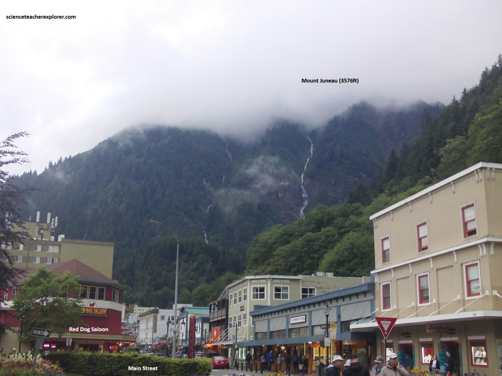
What is commonly referred to as Juneau is in reality a number of geographically and historically distinct communities interconnected by highway and bridge. Juneau proper is snuggled up against the flanks of the 1,190m Mount Juneau on the Southeast mainland, 1,450km north of Seattle. The residential communities of Thane, the Mendenhall Valley, Auke Bay, and others stretch north and south of Juneau along the coast. Across the Gastineau Channel, by bridge, lies the smaller, formerly independent community of Douglas and neighboring developments on Douglas Island. Together these communities and surrounding lands make up a single municipality of the Borough of Juneau, (pictured below).
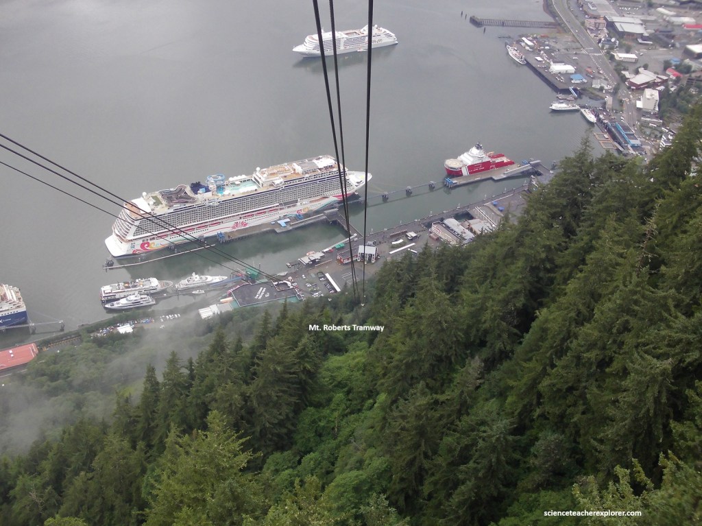
While stopping in Juneau in 2025, Becky and I took the ride on the Mount Roberts Tramway. The tram whisked us up in high-speed gondolas past the 670m level of Mount Roberts, where we were treated to the spectacular view seen above. The scene that unfolded from the ridge was a stunner, offering panoramic views and photo opportunities of downtown Juneau, Douglas Island, the the forest-rimmed waters of Gastineau Channel.
The Mount Roberts Tramway began running in 1996. Once at the upper terminal, there was a nature center, Tlingit Native interpretive exhibits, shops, a free movie on the Tlingit culture, and and hiker-friendly extensions to existing trails.
Approaching Alaska’s capital city, by-way of the cruise-port, the eye is captured first by the tall buildings which dominate the skyline, (state and federal government offices which generate the bulk of Juneau’s economic life.
But standing apart on the mountainside, to the south of the city, is the burned-out hulk of the AJ Mining Company mill, (a reminder of earlier days when Juneau pioneers were sluicing the gravel and blasting the tunnels which would make it one of the most productive gold mining areas in the world. {The historical images below were taken from an interpretive sign on-site}.
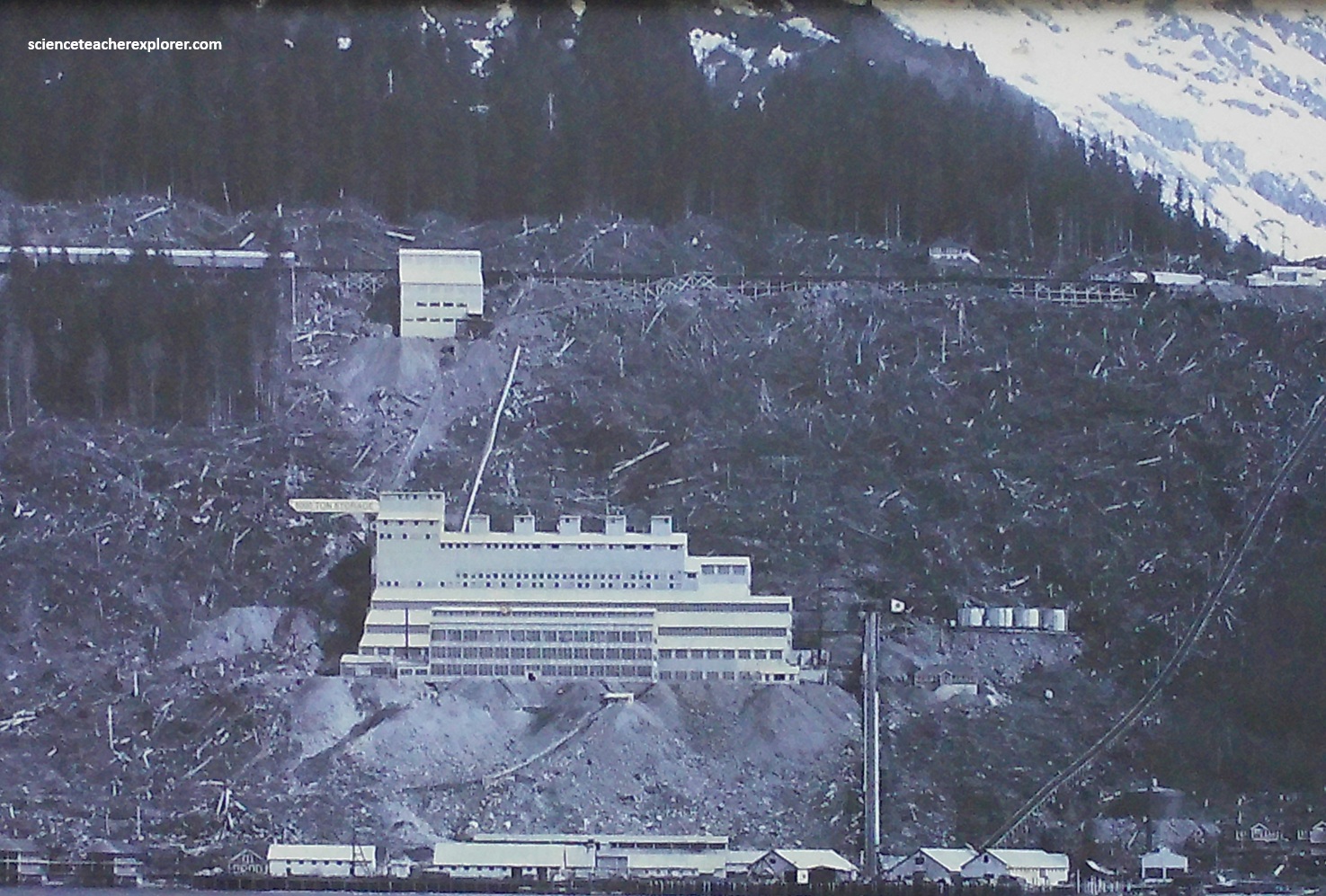
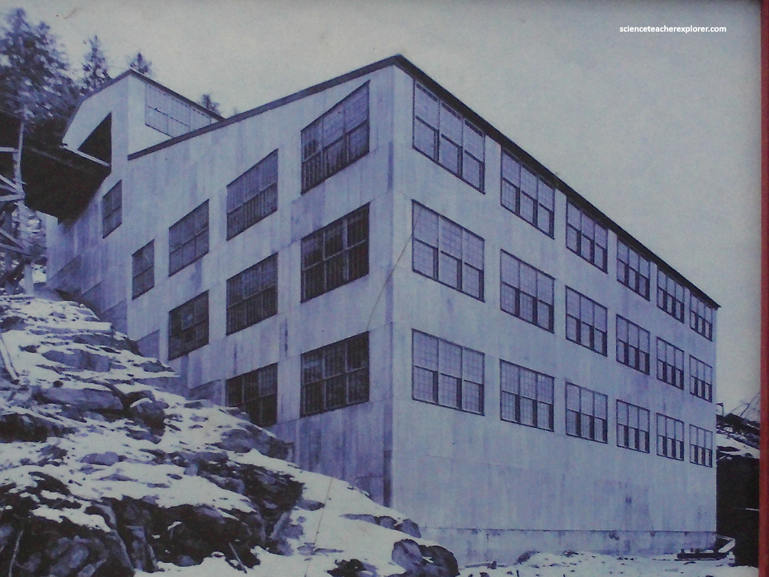
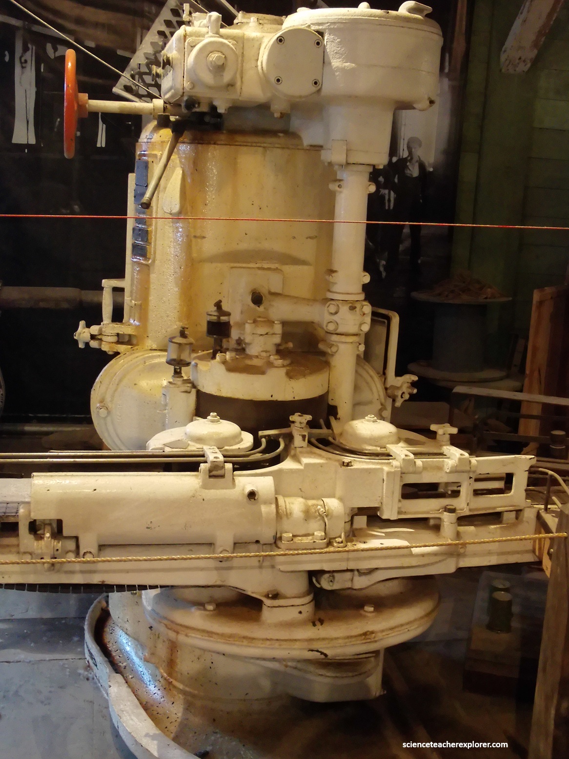
Pictured above, the Alaska Gastineau Mining Company operated a massive ambitious lode gold-mining operation in Juneau from 1912 to 1921. It famously processed huge volumes of low-grade ore using a two-mile railroad tunnel through Mount Roberts and a massive mill on the Gastineau Channel, eventually shutting down due to the challenges of World War I and wet ore.

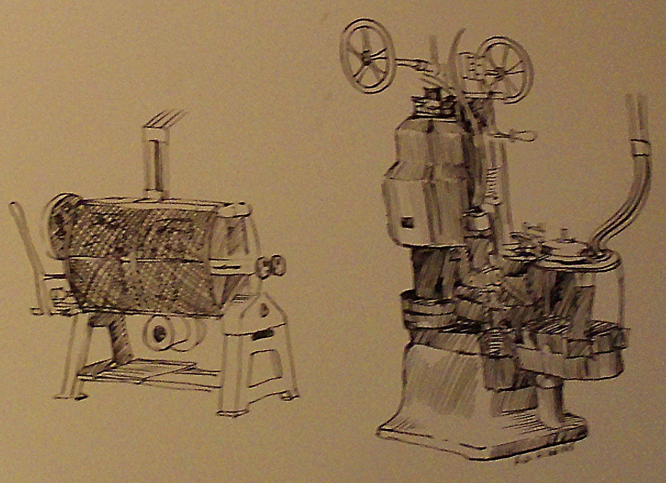
I booked a tour of the AJ Mining Company Mill site in 2025. It was a revolutionary plant that introduced new technologies to the mining industry. There, they displayed old mining equipment from the time period, (pictured below).

Pictured above, this Plymouth locomotive was used on the 4-level of the AJ Mine. It is a 1960 vintage piece used by Echo Bay Mines and retired to this spot on July 2000.
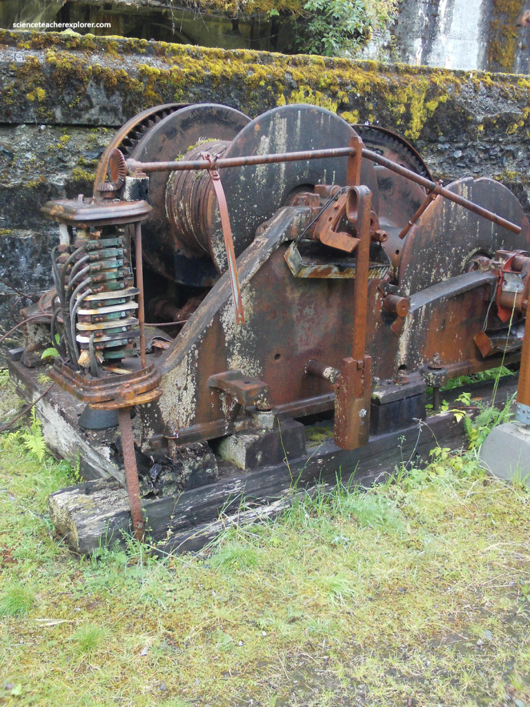
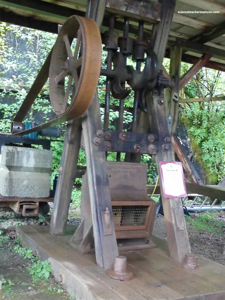
Pictured above, this “Power Hoist” was used to pull rail cars that loaded materials to and from ships at the machine shop and to pull railcars from the docks to the railroad station level.
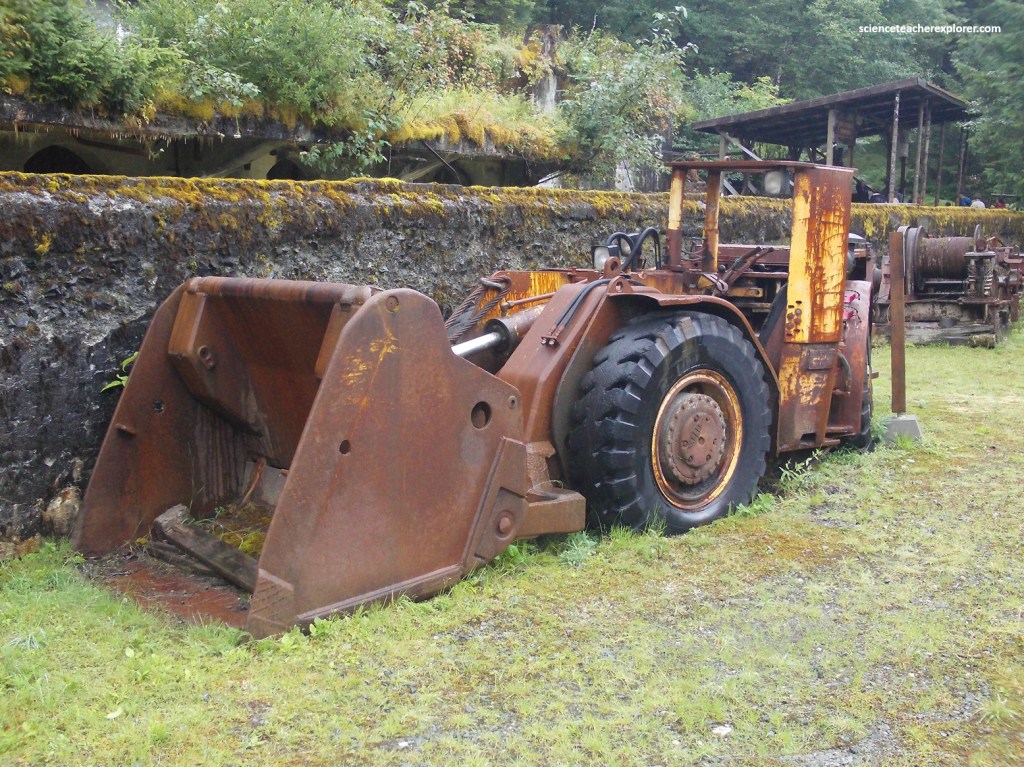
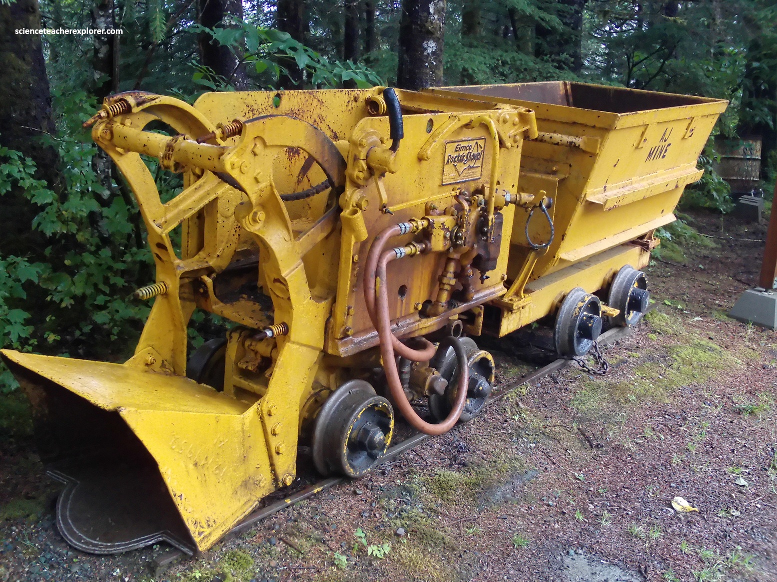
Pictured above, underground mining has changed from the use of track haulage to rubber-tired haulage. This LHD (Load-Haulage-Dump) machine could be used to excavated a mine opening as mall as 8’X8′, and a distance of 2000′. This machine was used in the AJ Mine by Echo Bay Mines during their attempt to re-open the mine.
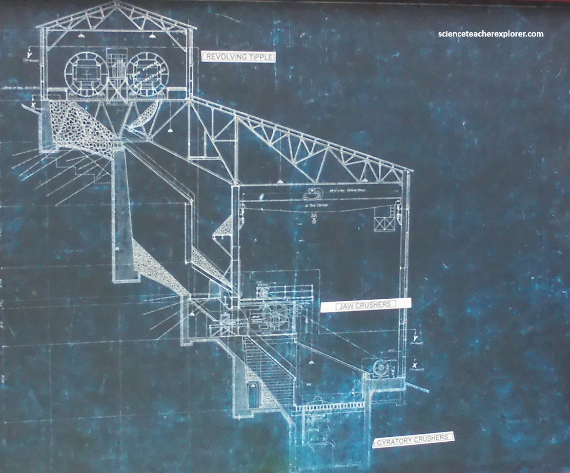
Pictured above, this stamp mill, (in working order), was used at John Peterson’s mine in Prairie Valley above Cheechako Creek, now known as Peterson’s Creek. After temporary closure, the 3 stamp mill was put into use in 1923 by John Peterson’s wife and daughters. It remained in use until 1928. It should be noted: instead of relying on traditional, noisy stamp batteries that crushed the ore, the massive Gastineau Mill utilized modern gyratory crushers, jaw crushers, and rotating tube mills to pulverize low-grade gold rock here.
Pictured above, is a crane used to load and unload mining materials and equipment from barges. It is a Bucyrus-Erie crane mounted on a McCormick Deering tractor.
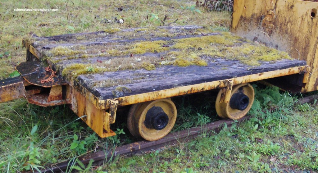
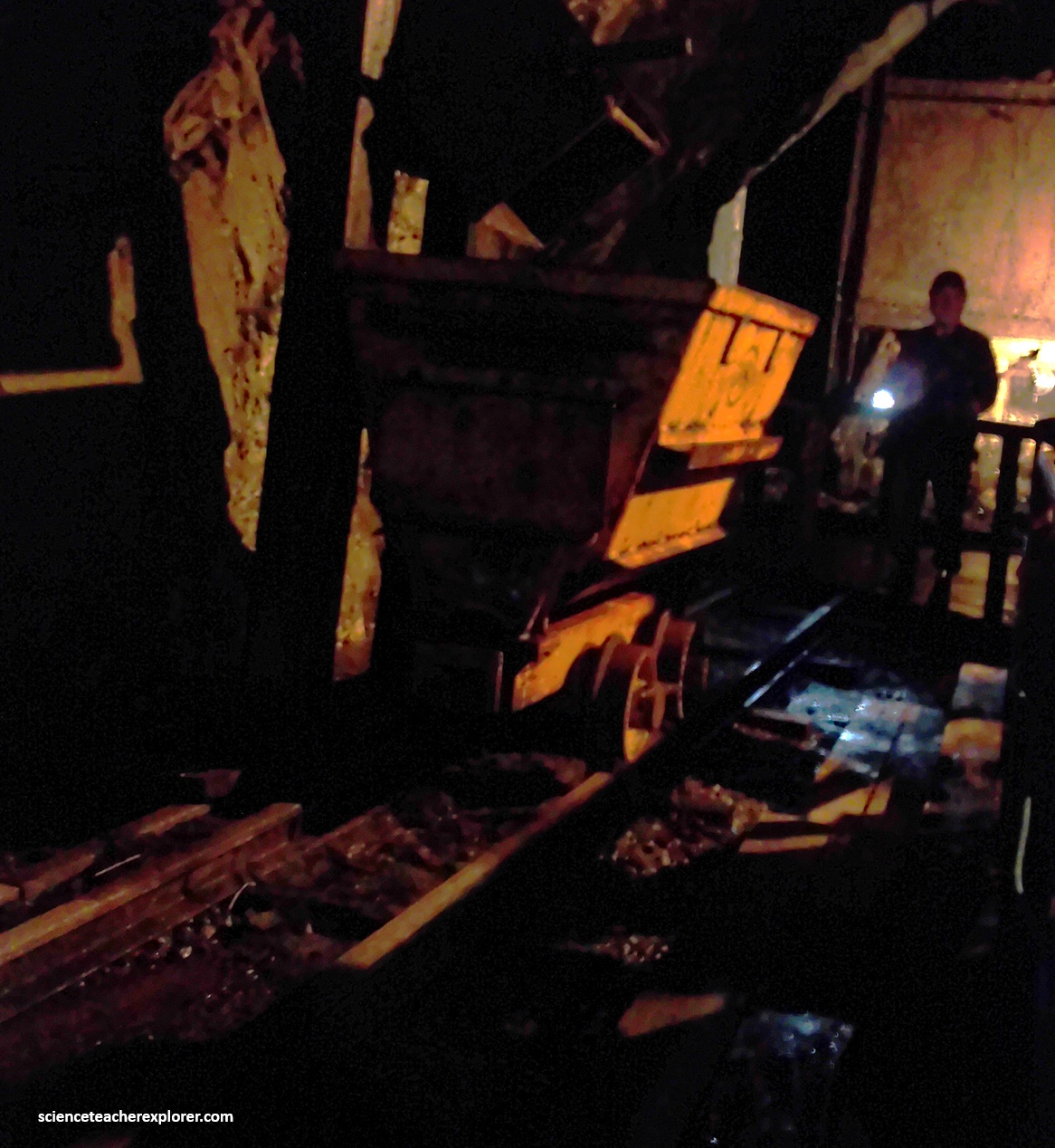
Pictured above, this “Flat Car” was used for hauling mine materials from the surface to underground.
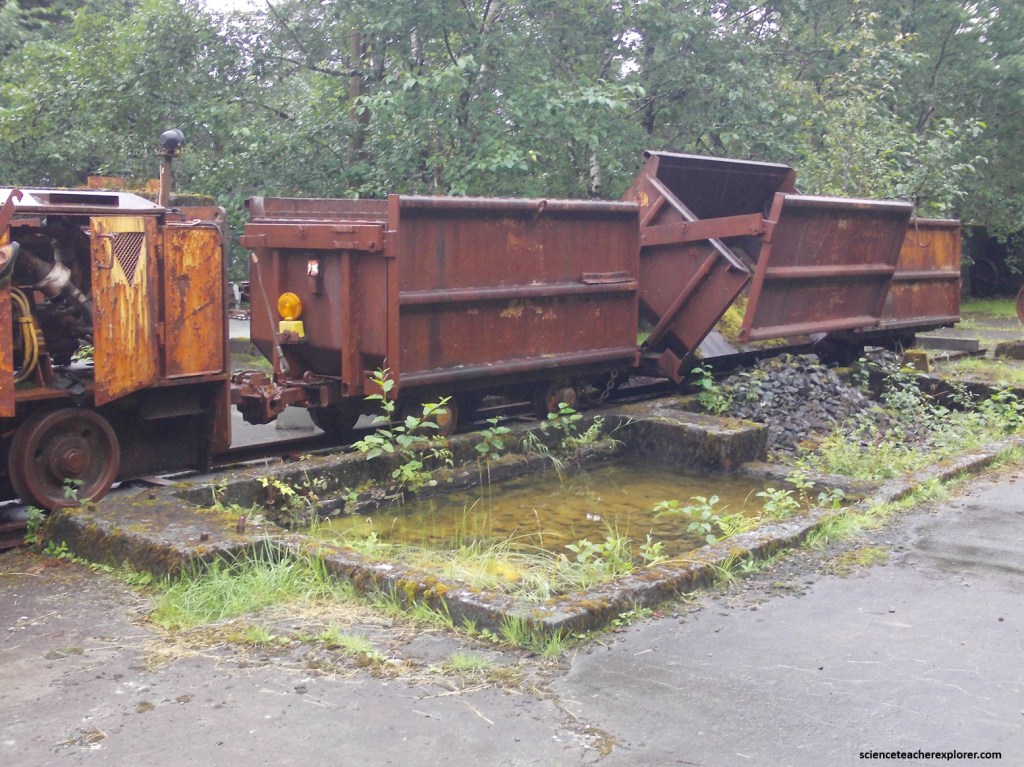
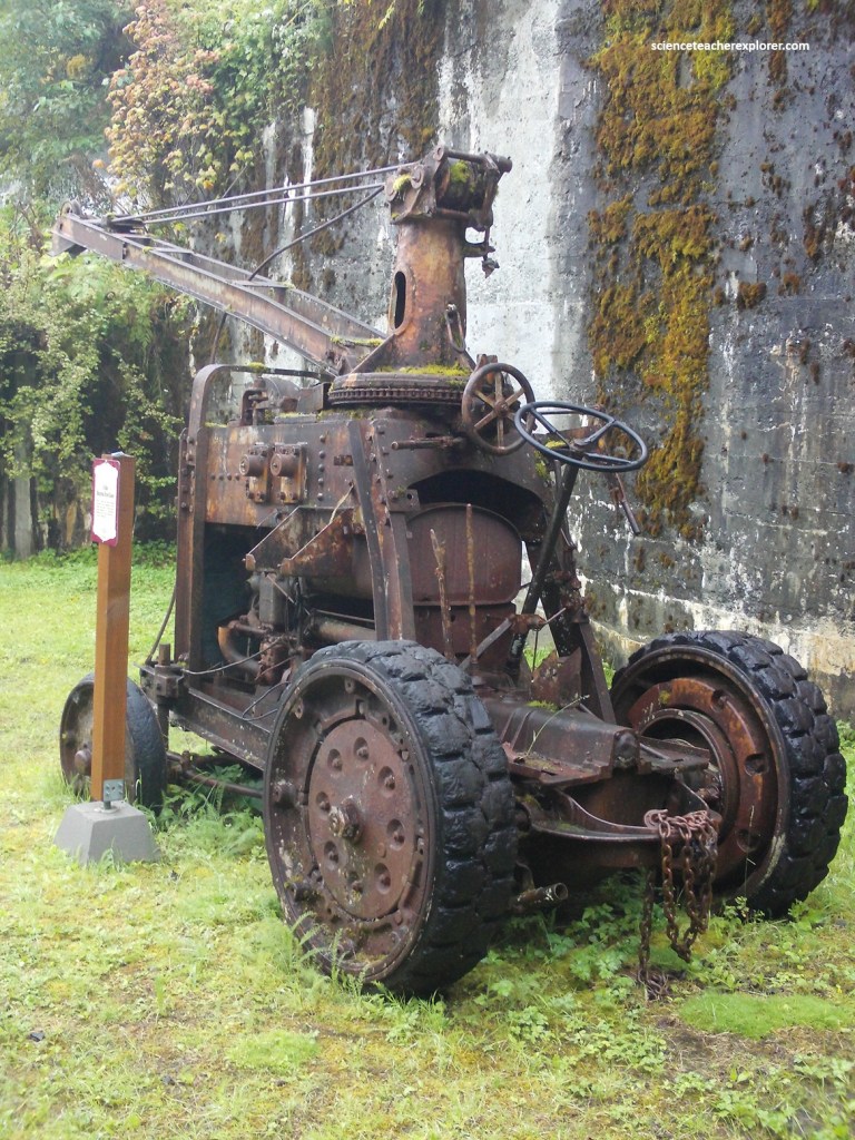
Pictured above, this Diesel Locomotive was used on Main haulage of the AJ-Mine by Echo Bay Alaska during their effort to re-establish the site as an operating gold mine.

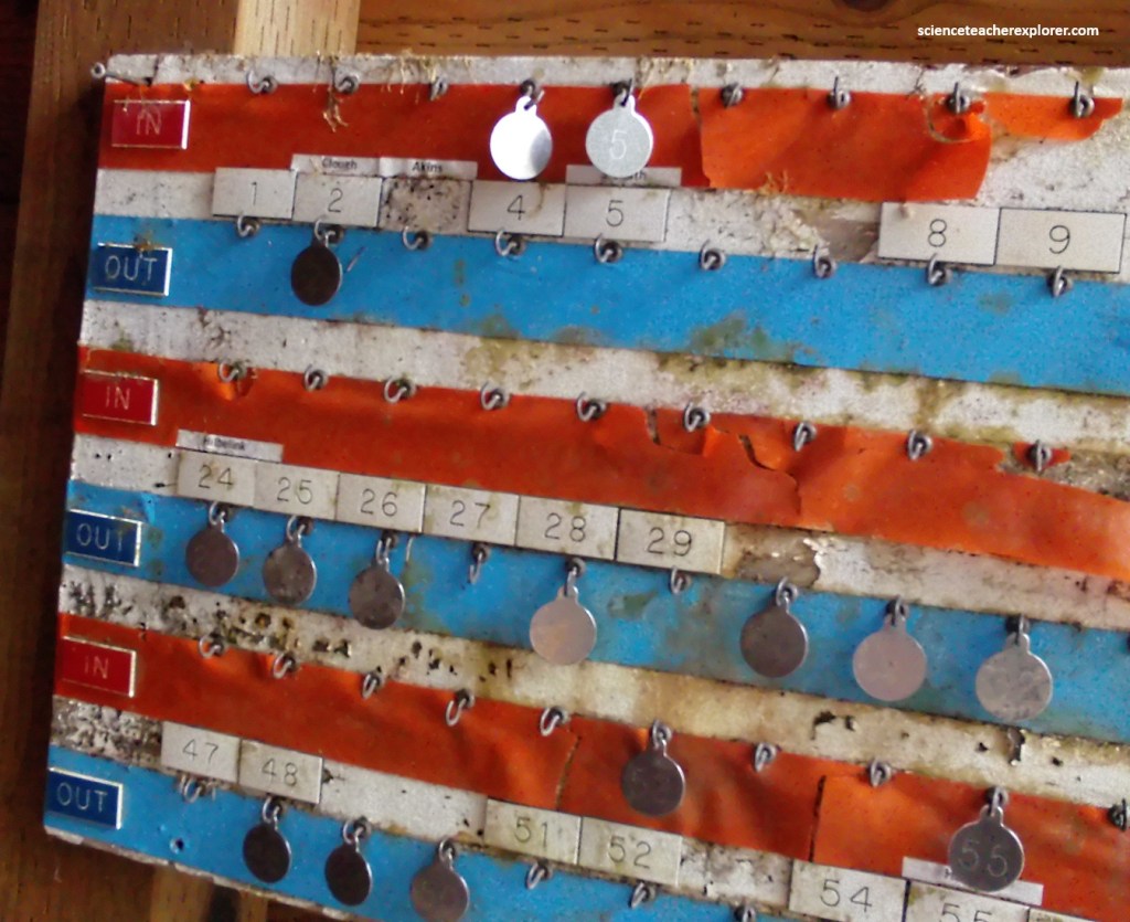
Pictured above, this “Man Car” was used on 4Level of the AJ Mine from approximately 1910 until 1944. The car hauled miners to and from the surface and underground. The tag-board seen below, was used as an indicator of who checked-in and who checked out. It was used at the mouth of the tunnel of the mine.
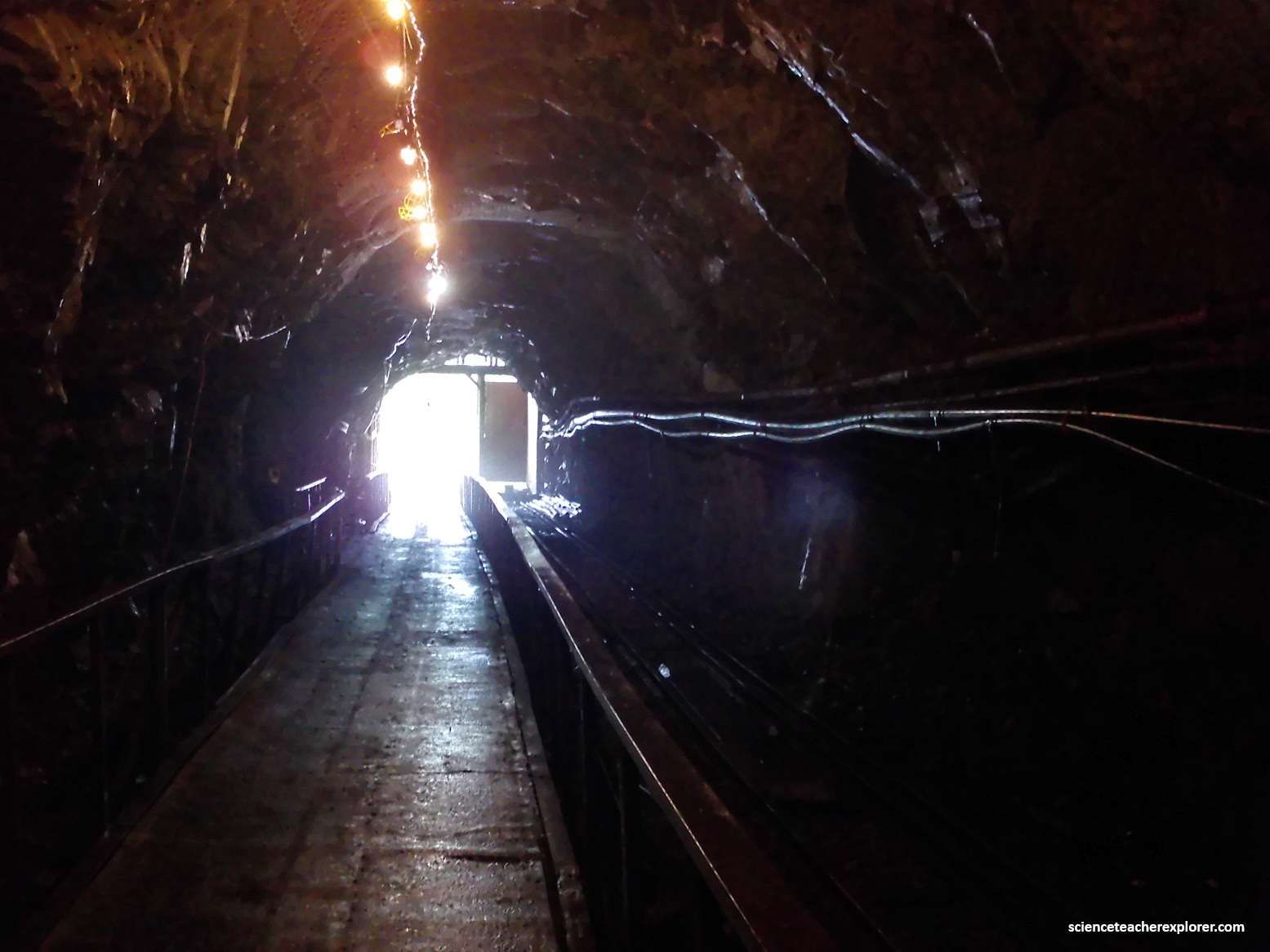
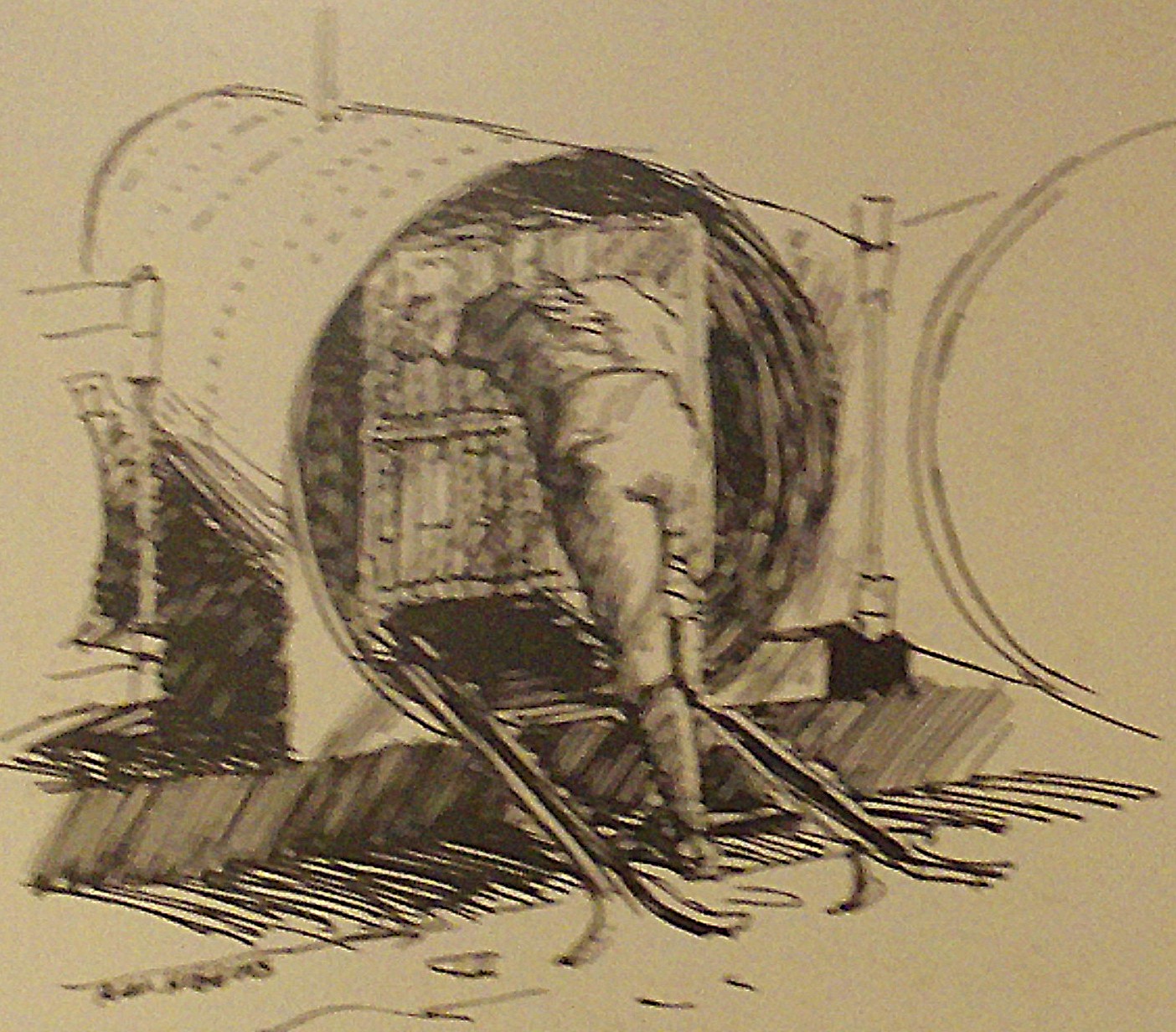
I ventured underground into the conveyor tunnel through which crushed ore was transported to the mill. Wearing a hard hat, I proceeded along a boardwalk into the 120m-long tunnel. Inside, I experienced a miner demonstrating hard-rock mining techniques and gave me a feel for the mining lifestyle, pictured below.
The Alaska-Juneau (AJ) and Alaska Gastineau mines are massive lode systems within the Juneau Gold Belt. Their gold deposits are hosted in a steeply dipping sequence of Mesozoic metavolcanic and metasedimentary rocks formed by intense tectonic thrusting and regional metamorphism. The gold deposits are part of a 6 km long, sulfide-bearing quartz vein system that forms intricate stringers, networks, and stockworks. Fluids profoundly altered the host rocks—specifically meta-gabbro and basalt—replacing hornblende with biotite and ankerite. The veins consist of 95% quartz alongside subordinate ankerite, pyrrhotite, galena, and sphalerite. Approximately 90% of the gold is free-milling, making it highly recoverable.
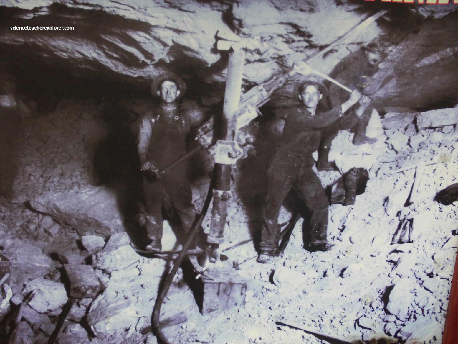
Because individual veins were too small to mine selectively, the AJ mine utilized a modified block-caving method. Miners targeted entire, large blocks of mountain and allowed the rock to collapse, later utilizing hand-sorting to extract the gold-bearing quartz from the barren waste rock before milling. A vein of ore in beds of rock or in fissures that can only be removed by drilling and blasting. Imagine an underground mine as a 10-15 story hotel with tunnels instead of floors extending away from the elevator. In the 1800s the tools were hand drills and black powder. Later dynamite, steam drills and compressed air drills were used. An experience miner demonstrated a compressed air-drill in the mine, (pictured below). {Note the historical photo below was taken from an interpretive sign on-site}.
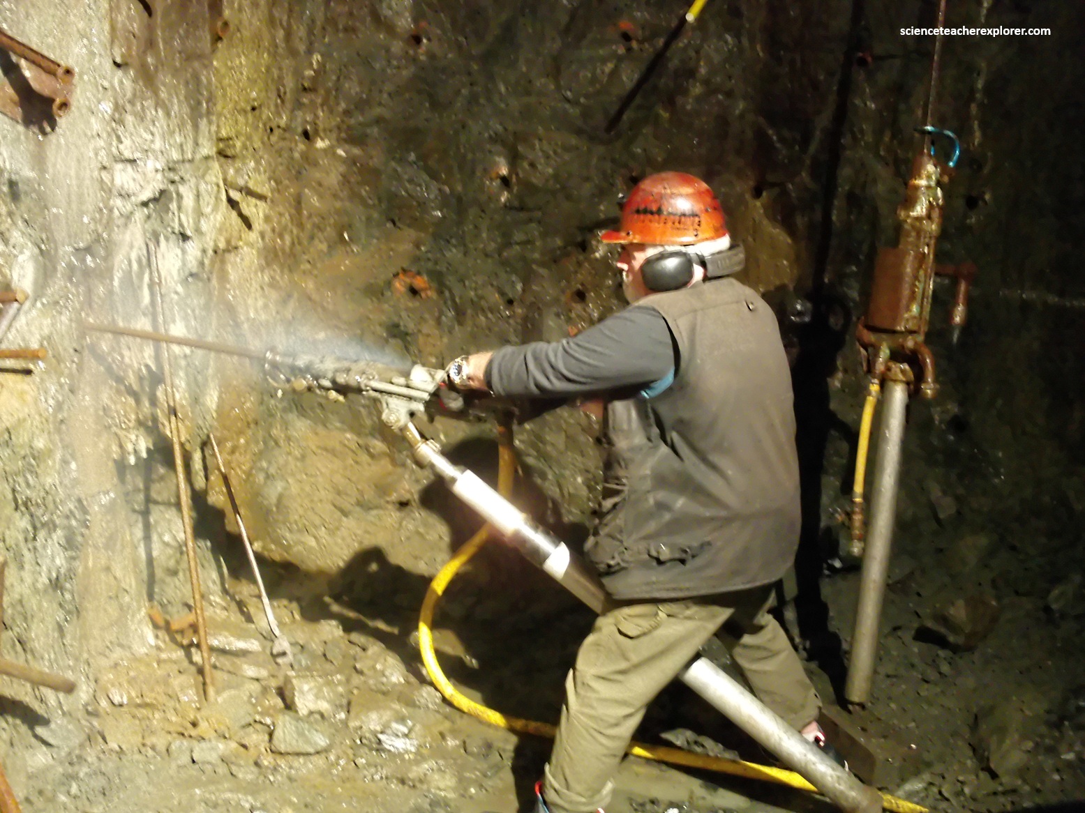
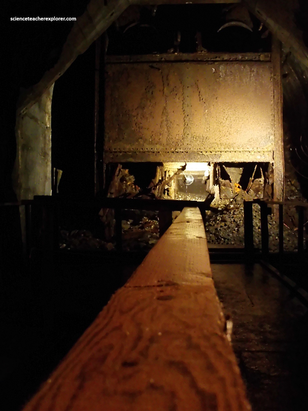
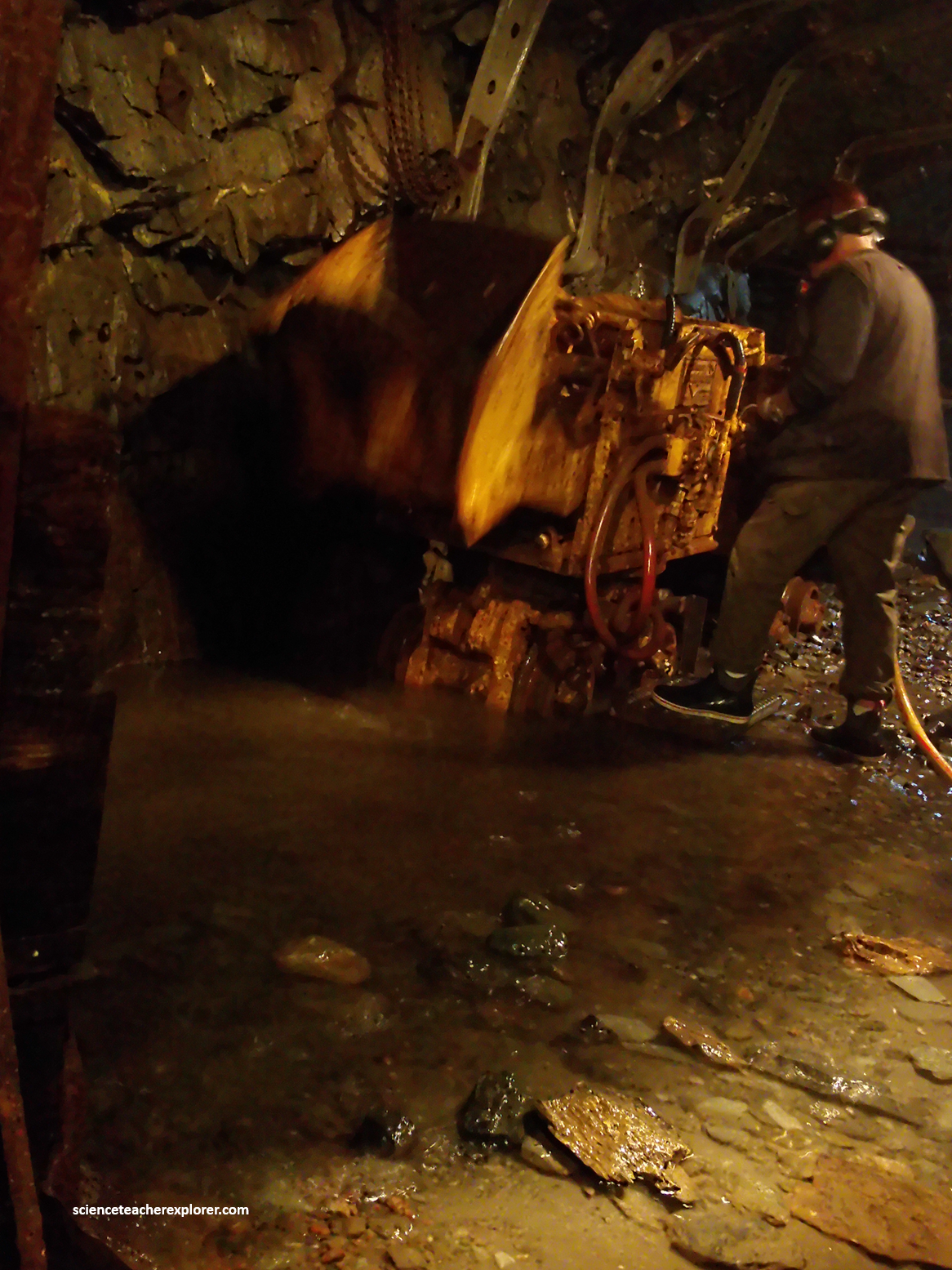
After blasting the rock or muck free from the tunnel face in the mine, a mucker would pick up the muck and dump over the top and into a ore car for removal to the surface. Pictured below, the Rocker Shovel Over-Shot Mucker was demonstrated from me in the mine.
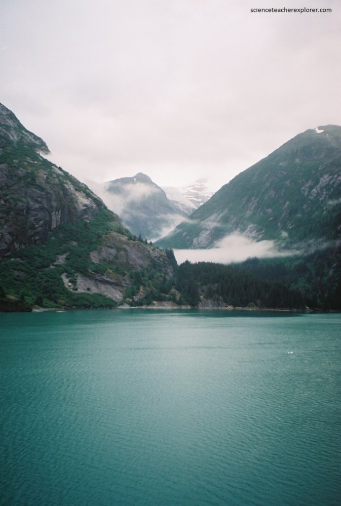
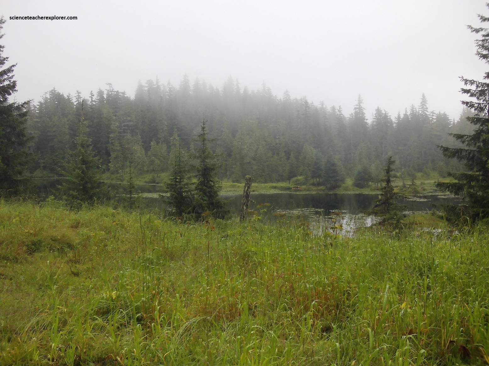
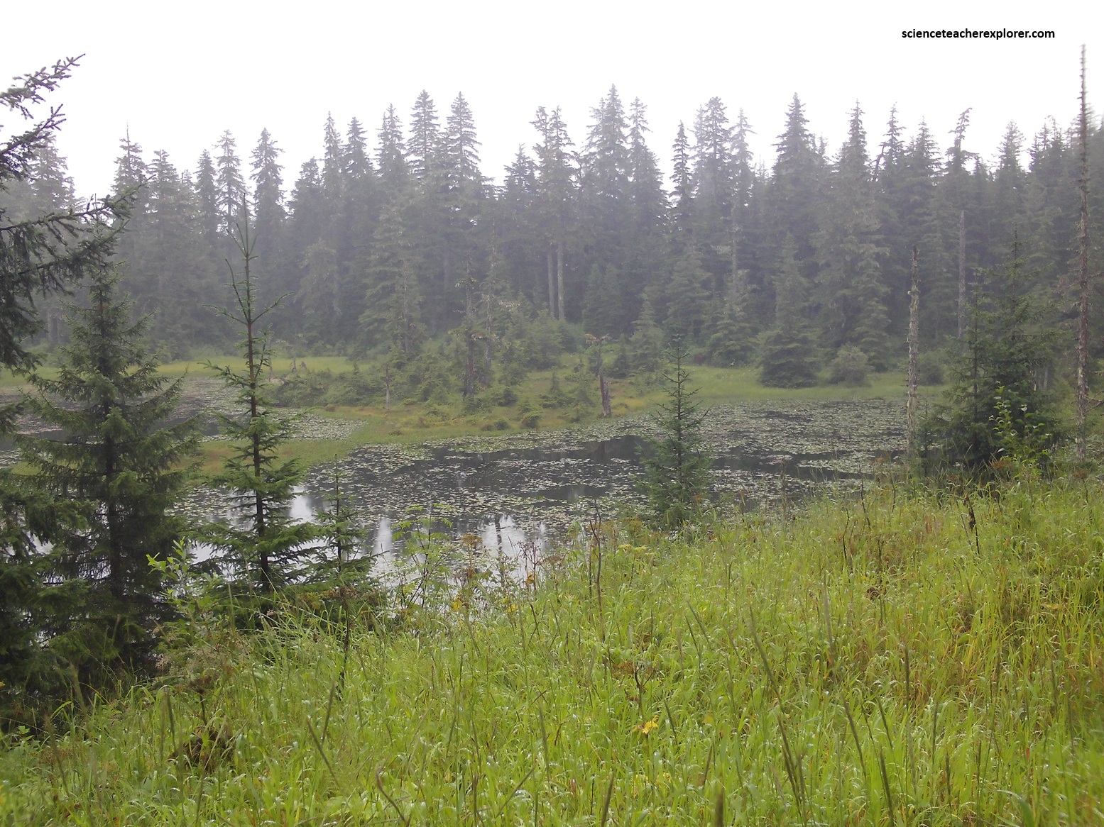
Our next visit on the cruise-ship in 2006, was the “Tracy Arm Fjord”. (Imaged below), the “Tracy Arm” is a narrow fjord leading into Holkahm Bay about 80 km southeast of Juneau. The fjord extends more than 32 km from the western edge of the Coast Mountains eastward to tidewater glaciers surrounded by imposing mountains that rise about 2,100 m above the sea. Numerous steep valley on either side of this fjord was once filled with ice feeding into the larger glaciers that carved the fjord. The steep mountainous region from the eastern shoreline of Holkham Bay to the Canadian border has been protected as the Tracy Arm-Fords Terror Wilderness.
Pictured below, spectacular evidence for the glacial processes that carved the fjords can be found throughout the Holkham Bay and Tracy Arm area. The shallow water that extends across the middle of Holkham Bay barely covers the end moraines of the glaciers that carved the fjord. On the north side of the bay, till has been breached by meltwater or tides to form a narrow channel into the entrance of Tracy Arm. Water rushing through this channel created large standing waves as the tide pours in and out.
Pictured above, a dense forest of spruce, hemlock, and cedar cling to the steep slopes underlain by the metamorphic rocks at the entrance to Tracy Arm. The nearly vertical bare rock faces east of the entrance are carved into igneous plutons and high-temperature metamorphic gneiss that is more resistant to the forces of erosion.
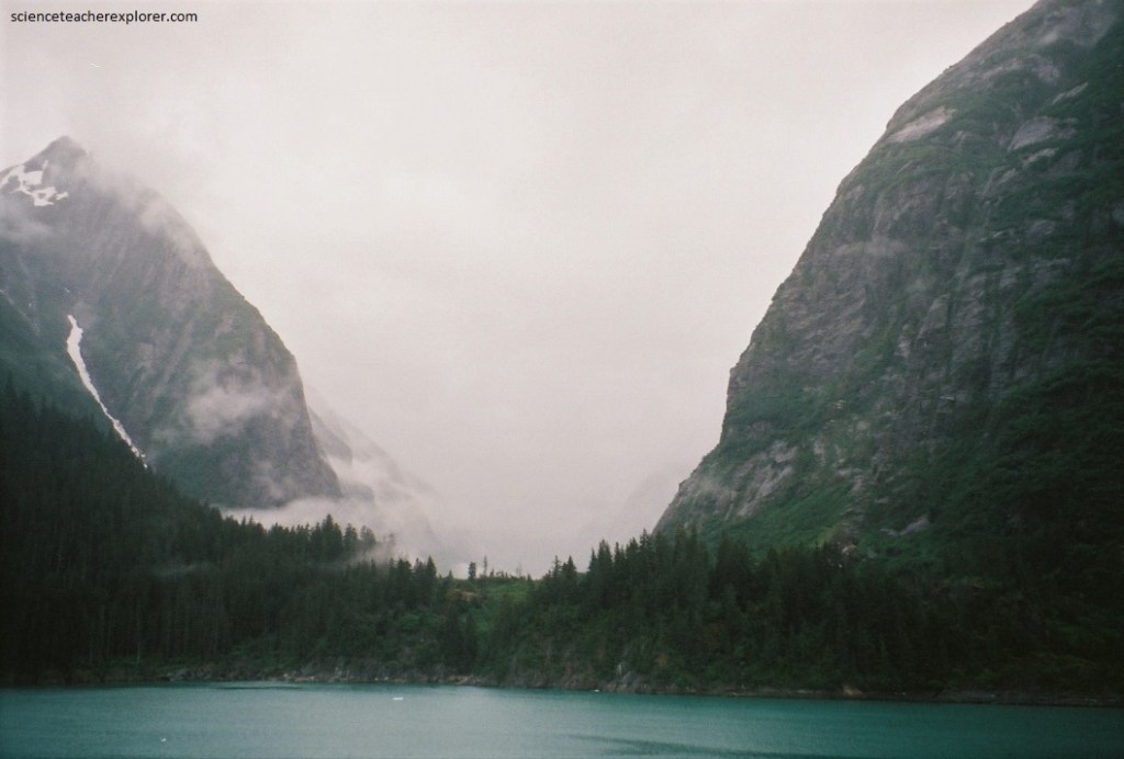
Pictured above, spectacular horizontal glacial grooves have been cut into the solid rock along the walls of the fjord. U-shaped valleys can be observed at waterline or up the steep slopes along both sides. These valleys are all hanging valleys with respect to the bottom of the fjord, which is more than 300 m below sea level. On a clear day, pointed mountain peaks or horns can also be seen; these mountains were formed at the head of valley glaciers that were flowing in divergent directions away from the peak.
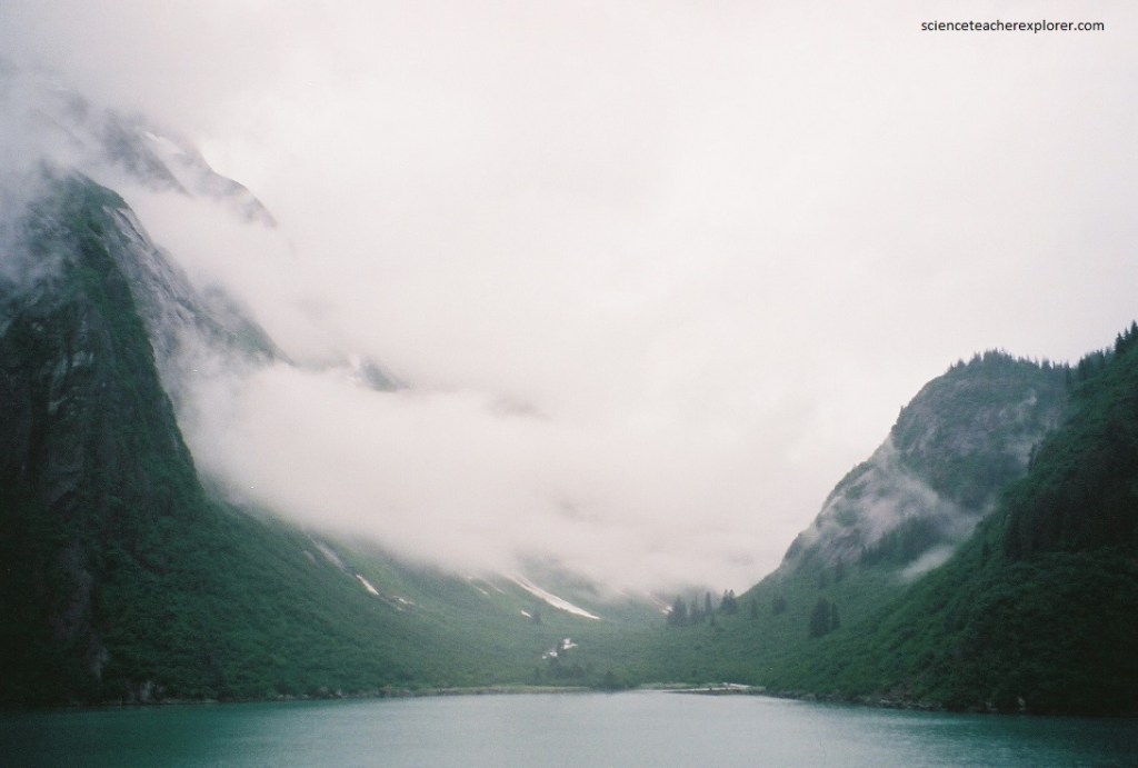
One of the most remarkable aspects of the steep glacially carved fjords in Southeast Alaska is the ability of plants to rapidly populate the cliffs that are initially devoid of soil. The succession of plants typically begins with moss, small flowers, and alders that can grow without much soil in small fractures in the rock or where small pockets of glacial till were left behind by the retreating ice. These plants rapidly break down some of the rock and add nutrients to remarkable “gardens” of additional plants clinging to the near-vertical walls of Tracy Arm.
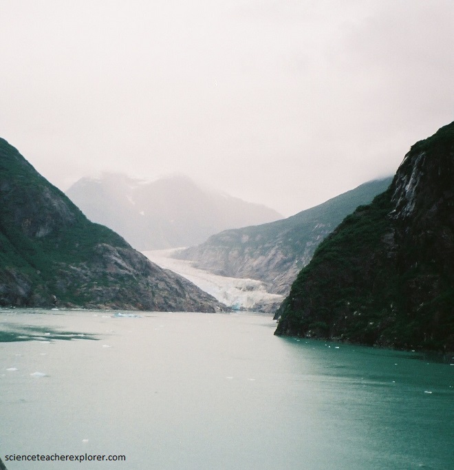
Pictured above and below, Tracy Arm terminates in two looming walls of ice that extend about 150 m from the bottom of the fjord to the top of the glaciers: Sawyer and South Sawyers. These glaciers are very active and calve frequently, often choking the fjord with everything from small bits to large icebergs. Although few records exist for the position of the ice in the pat, chars show that Sawyer Glacier may not have retreated more than about 8 km in the 160 years.
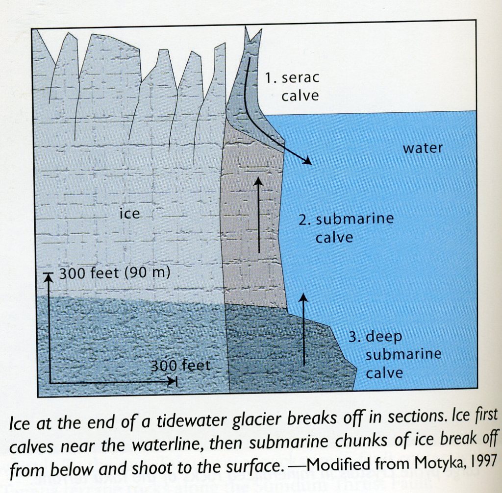
Tidewater glacier ice extends all the way to the bottom of the fjords. The glaciers initially calve ice from the upper portion of the terminus face. Imaged below, the remaining and formerly over-pressured buoyant submarine basal ice may sometime later shoot up to the surface from the fjord bottom, unannounced by sound effects.
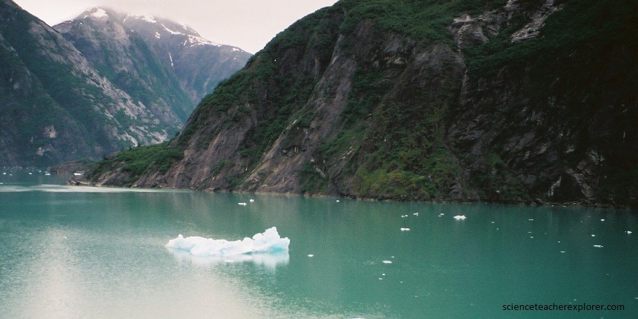
In 2006, all the glaciers we saw were actively thinning, retreating, and producing much berg ice. Pictured below, some icebergs were spotted floating about 130 km to the Stephens Passage.
Pictured above, in lower Tracy Arm, polished and extensive fjord walls expose the Great Tonalite Sill, a series of tabular, quartz-rich, dioritic plutons that follow the Coast Shear Zone between Prince Rupert and Skagway. In Eocene time, metal-bearing fluids deposited gold and quartz in veins in the Gravina Belt, Taku terrane, Yukon-Tanana terrane, and Great Tonalite Sill.
[Note: While Becky and I were on the 2025 Cruise in August 10th, near Juneau, a massive mega-tsunami occurred in the Tracy Arm Fjord. This giant landslide dropped 64 million cubic meters of rock into the water. The splash triggered the second-highest tsunami ever recorded in modern history. Water shot a staggering 481m up the opposite valley wall, (a height taller than the Empire State Building). The wave, (150mph), tore through the narrow fjord, ripping up entire forests, stripping trees down to bare rock, and tossing giant boulders high onto the ridges. Remarkably, no one was injured or killed. The event occurred at 5:26 a.m., hours before daily cruise ships packed with thousands of tourists usually entering the area. The largest recorded 576m mega-tsunami occurred in Lituya Bay on July 9th, 1958 with a 7.8 earthquake from the Fairweather Fault. Five people were killed, many people were injured, and many homes destroyed.].
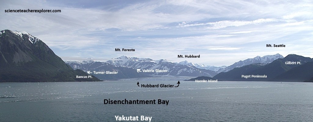
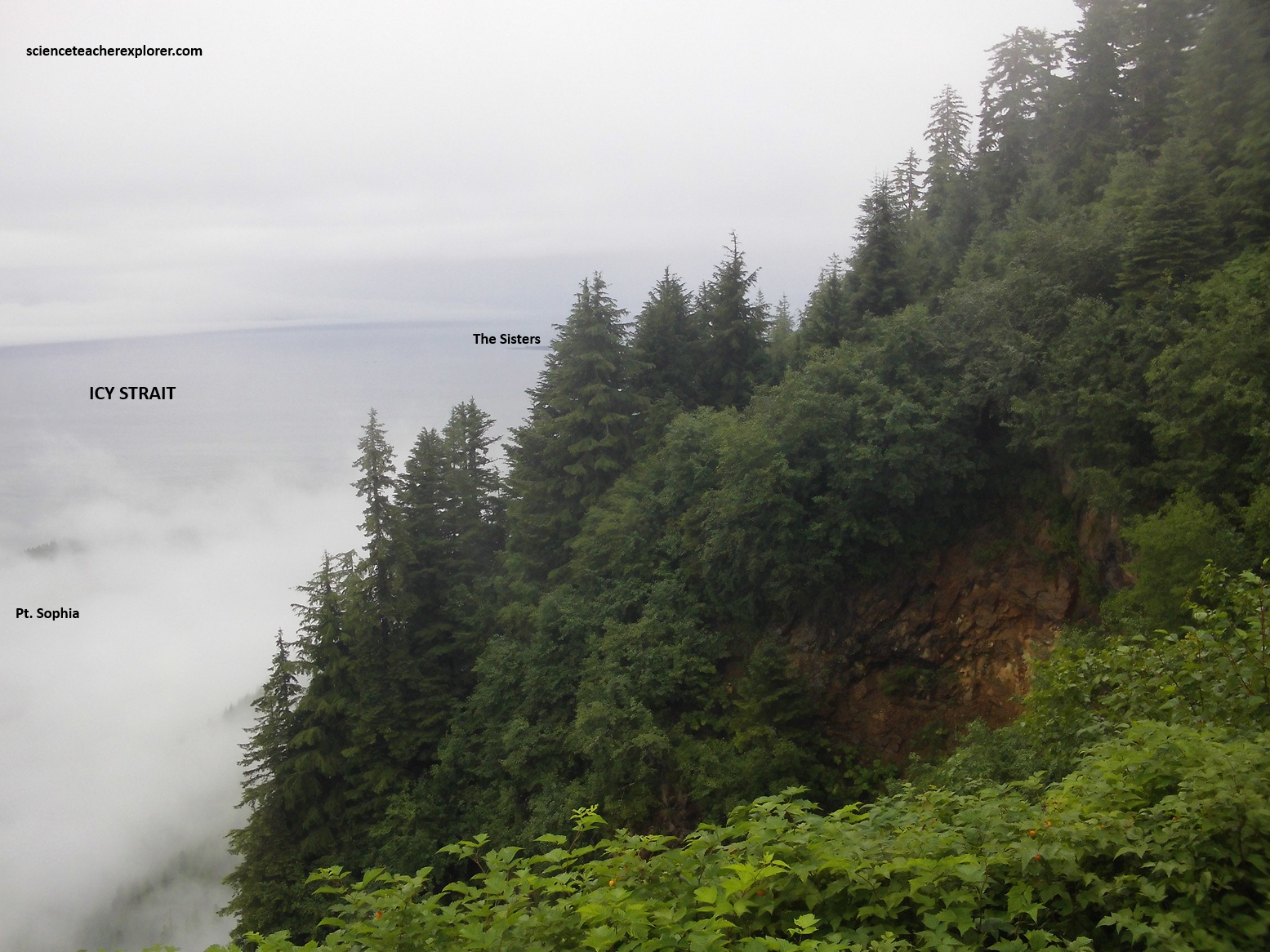
On our 2025 cruise, Becky and I headed through the Icy Straits, Cross Sound and northwest into the Gulf of Alaska, where we passed the infamous Lituya Bay and continued onto the Yakutat Bay to view the Hubbard Glacier, (pictured above).
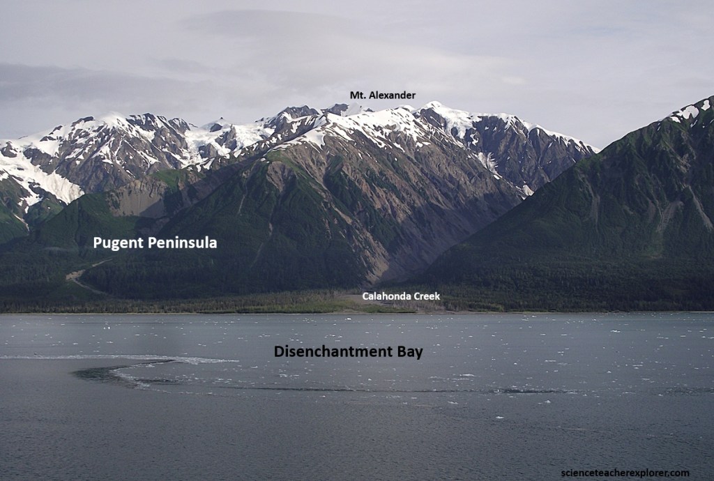
West, east and North of Hubbard Glacier is an area that has been nicknamed “The Roof of North America”—an immense rock, ice, and snow world with many of the continent’s highest peaks. 3300m or higher are common here, and there are at least four over 5,000m.
Much of this area is the Wrangell St. Elias National Park and Wilderness. This mountain wall catches the eastward flowing moisture-laden air, which falls as heavy snow. The immense weight of the snow pack creates the largest glaciers on the entire Pacific coast. Hubbard Glacier is part of a vast ice mass that extends along a few kilometers behind the coast in an unbroken line, (except for two places) almost to Anchorage, nearly 640km away. Today the glaciers have all receded substantially back from the shore, but a century ago, the ice reached the ocean in many places.
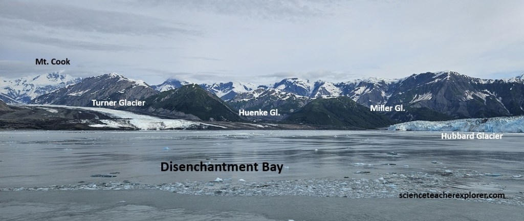
Rivers of ice, or glaciers, form as snow is transformed into ice under pressure. The glacier ice moves downslope by sliding over the meltwater at it’s base, as well as moving along shear zones within the ice layers. Ice scouring, rock plucking, and mass wasting of debris onto the glacier surface erodes the former stream valley deeply, forming a distinctive U-shaped valley. Down valley, sediment and meltwater exit the glacier terminus. Then there is an overabundance of sediment versus flowing meltwater, the down-glacier outwash river braided steams with many little islands that shift frequently with the changing flow of water. This is what we see with the Turner, Huenke, and Miller Glaciers, (picture above).
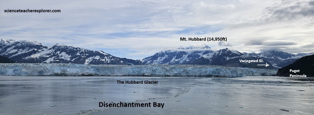
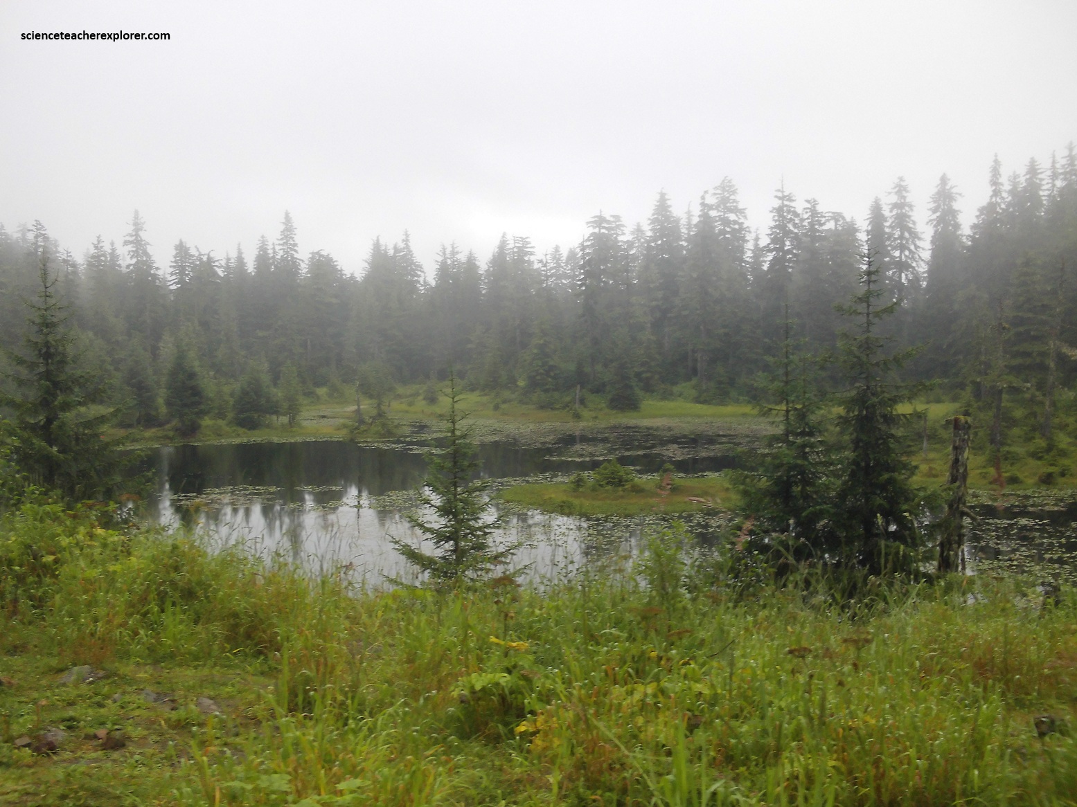
Usually glaciers move slowly, say 1-3m a day. On occasion, hoever, they can surge forward at much higher speeds: 50-67m a day or even faster! They can also retreat (breaking off icebergs or simply melting back). Pictured above, Variegated Glacier, (emptying into Russel Fjord), has been a ideal site for studying these sudden onrushes, as it surged regularly every 20 years.
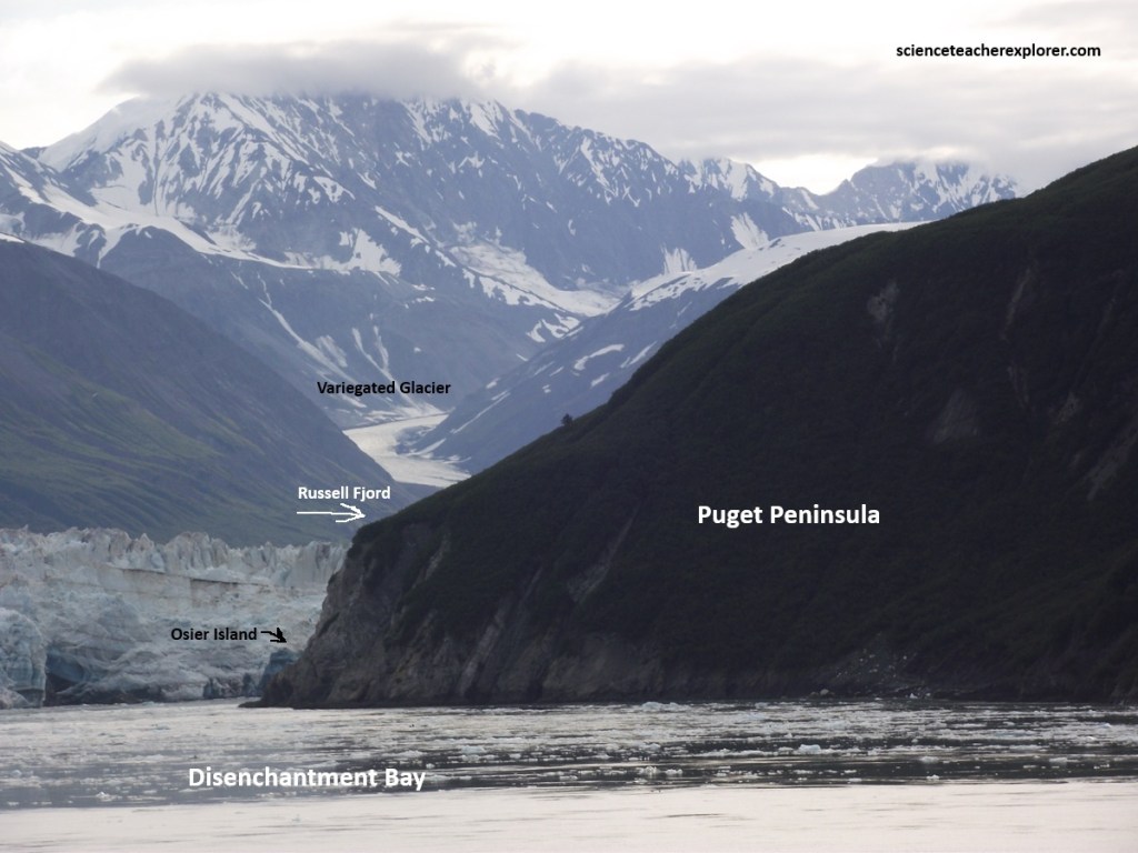
The conclusion is that water is flowing in channels under the ice. When pushed by the weight of the snow and icepack in the mountains above it, the glacier speeds up, it fractures more readily and these water channels become clogged. This raises the water level to the point where it partially floats the glacier! The result–a fast glacier. Variegated Glacier hit 54.7m a day in June 1983. Of course this speed wouldn’t crush you at over an inch a minute, but noticeable motion for something weighing millions of tons! The result is a continuous rumbling and cracking that is scary!
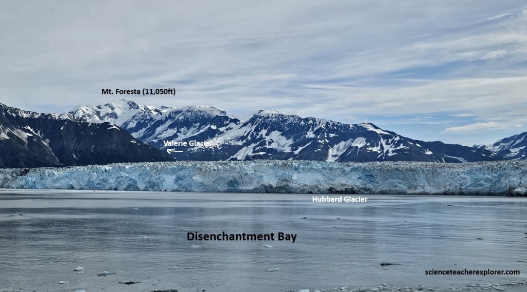
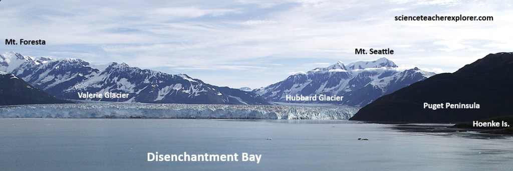
Pictured above, Hubbard Glacier, (which flows into Disenchantment Bay), is the largest tidewater glacier in North America, surged in 1986 and again in 2002. In June of 1986, this giant river of ice at the head of Yakutat Bay surged hundreds of meters in just a few weeks and dammed Russel Fjord. A huge lake had formed south of the glacier rose 10cm daily. The lake level was 1.8m higher than sea level on the east side of the glacier. Continued blockage of the fjord caused the lake to rise to 25m, nearing its 37m overflow level. On October, 1986, the Hubbard Glacier ruptured, dumping the lake at a rate of 105,000 cubic meters per second into Disenchantment Bay near Yakutat.
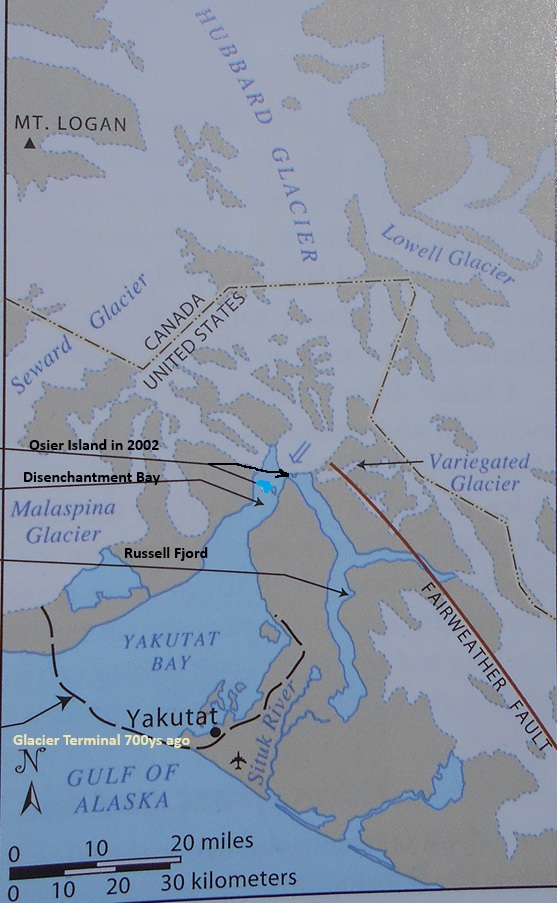
Imaged above, in the spring of 2002 the Hubbard Glacier again approached Osier Island pushing a moraine ahead of it’s terminus. By constricting the entrance to the fjord, it gave it an outflow river and raising the level of Russel Fjord. By the end of the summer, the trapped water broke through the glacier moraine barrier and discharged into Disenchantment By in 36 hours. These two Hubbard Glacier-Russell Lake outburst flood events were the greatest in recorded history.
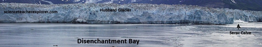
Tidewater glaciers, (which are glaciers such as the Hubbard that end in the sea), undergo cycles of advance and calving retreat related to ice supply and water depth at the terminus. As a tidewater glacier advances, it deposits sediment and shallows the sea at it’s terminus, often building a shoal of sediment over which it can move or against which it can be stabilized. If the glacier thins or sea level rises, the ice can become unstable, causing the terminus to break up and retreat through iceberg calving or shedding. Large areas of tidewater glaciers can be lost rapidly by this process.
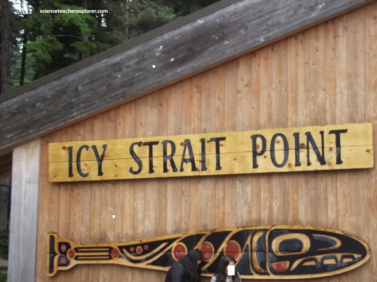
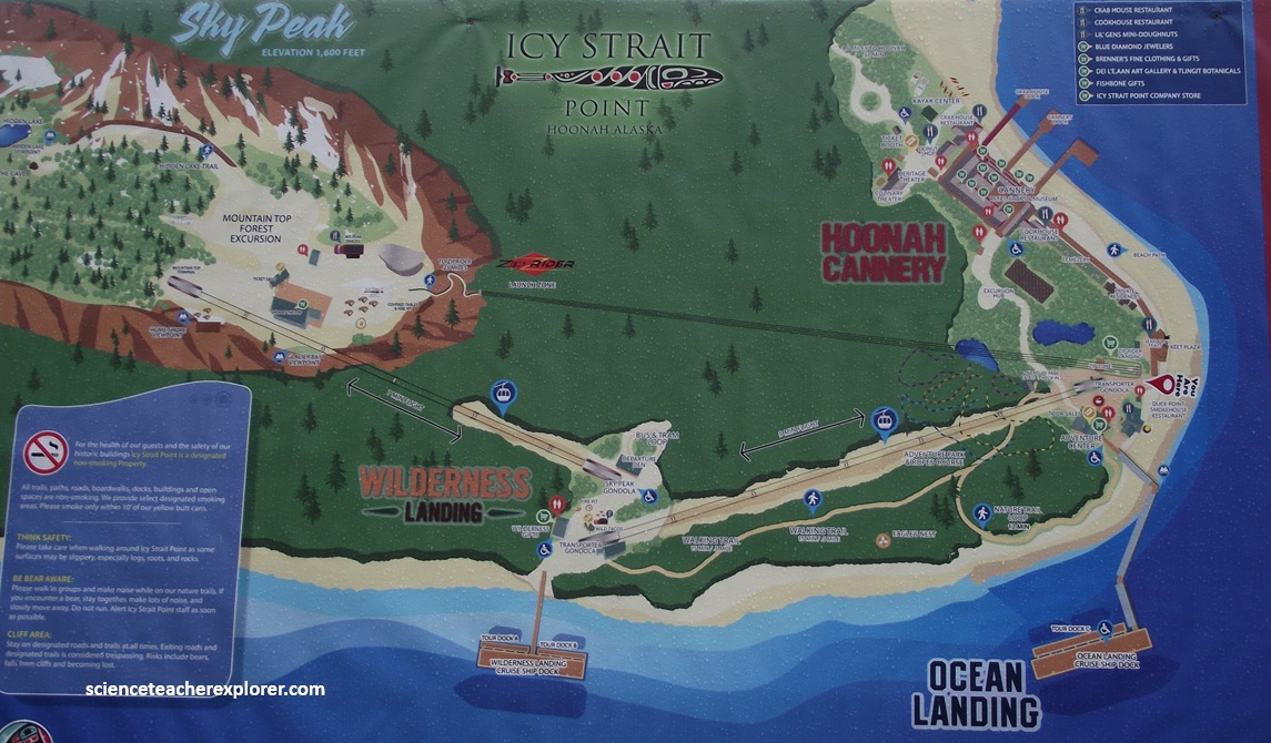
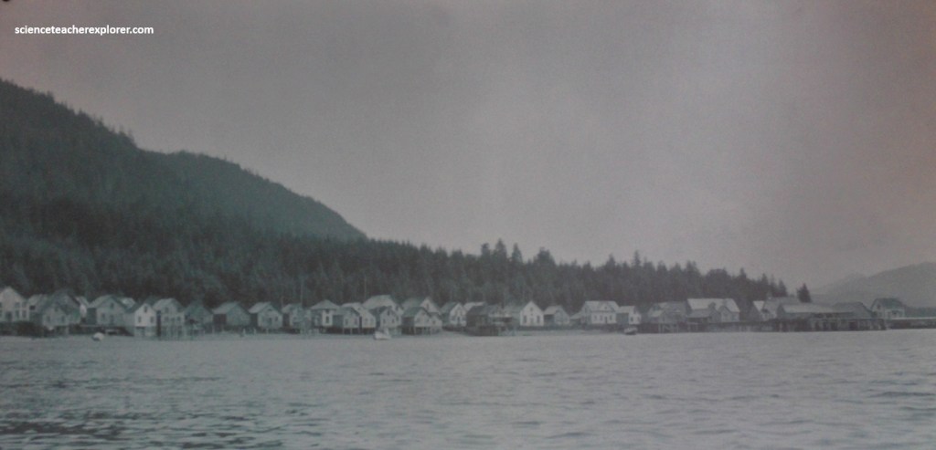
Pictured above, in August 2025, Becky and I landed in our cruise-ship, 2.4km down the road west from Hoonah, at Alaska’s newest and most novel cruise port. Icy Strait Point is a purpose-built cultural and soft adventure base created on the site of a historic cannery, (pictured below).

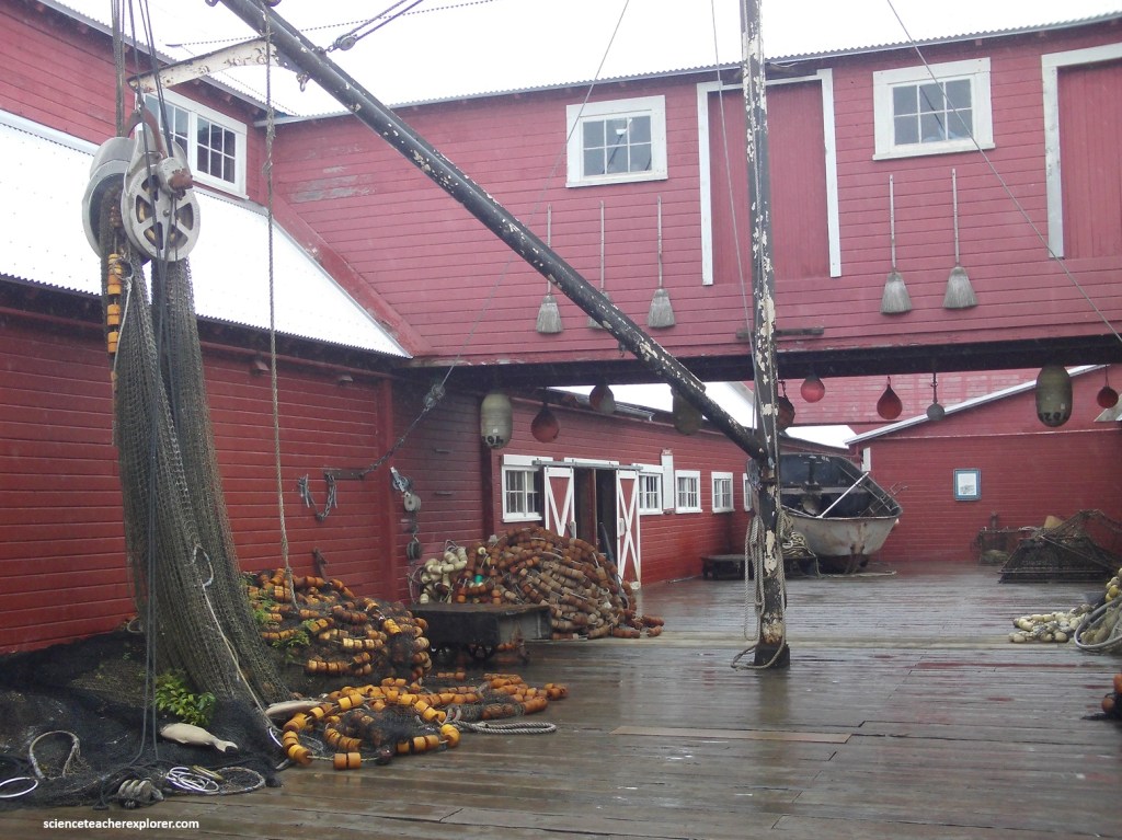
The Hoonah Packing Company (“HPC”), built in 1912, was one of eight canneries operating in the area during the early twentieth century, representing Hoonah’s major salmon-fishing industry at the time. However, the cannery ceased operating in 1954, but continued to see use by commercial fishermen for storing and repairing their boats and gear. Much of the canning machinery is still there, (picture below).
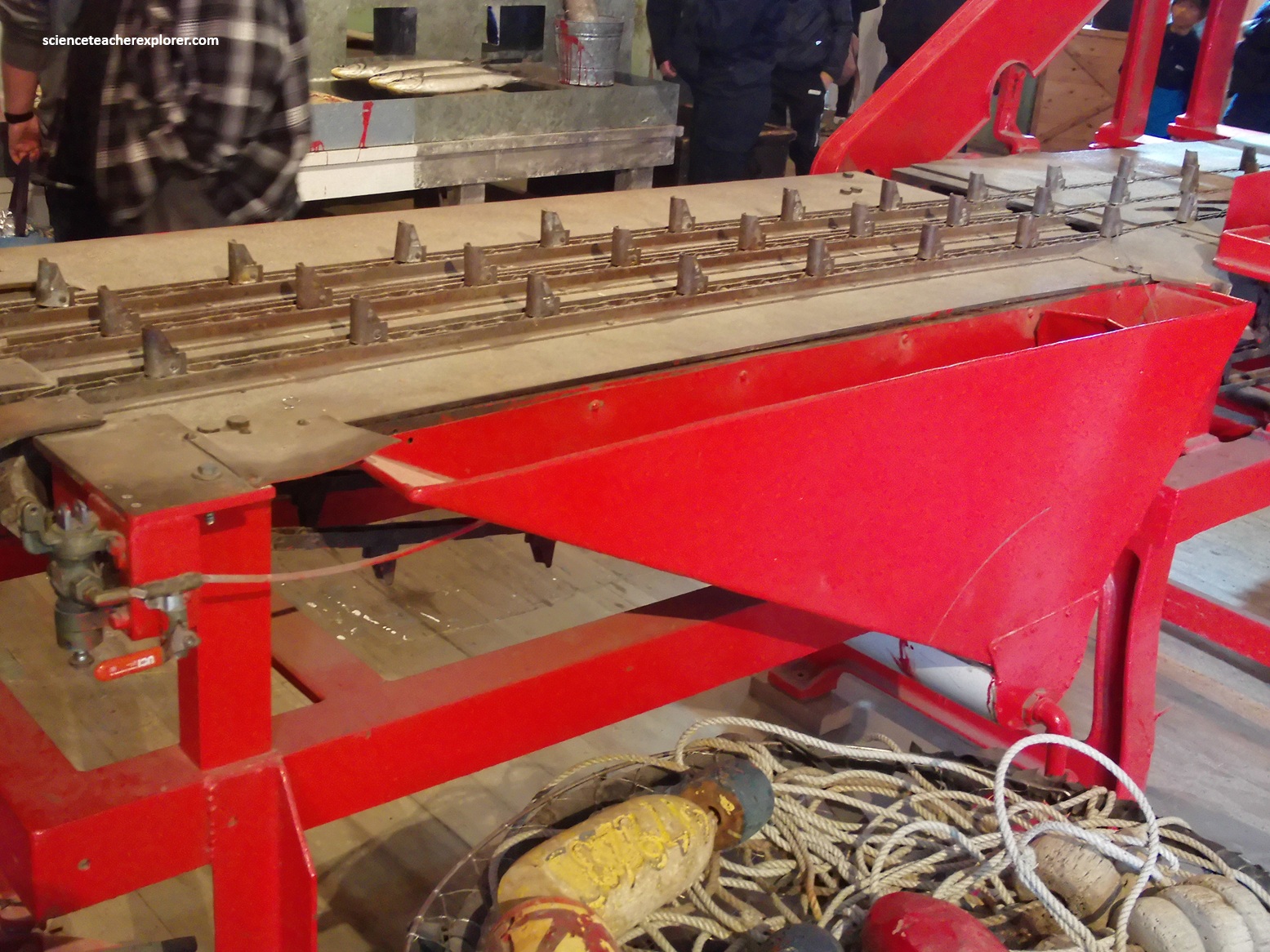
Pictured above, the “Guillotine” was the index machine that cut off the head of the fish. Since the salmon types and sizes varied, a cannery worker was required to push the fish into the path of the blade to ensure an accurate cut.
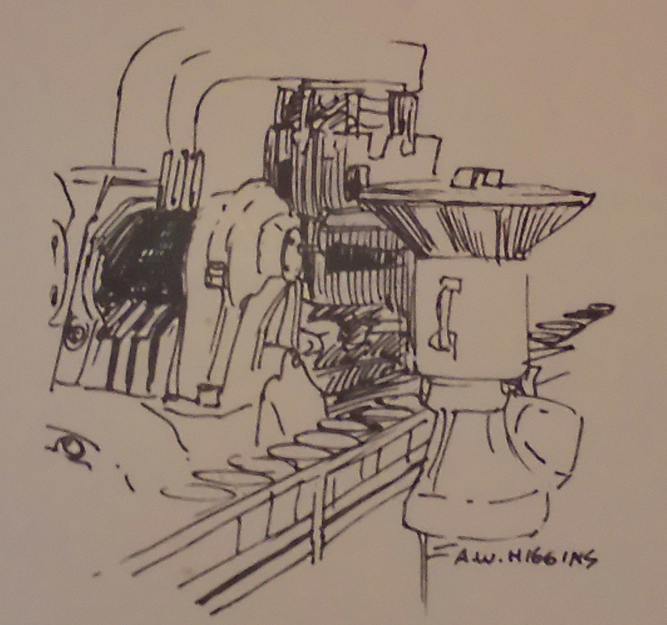
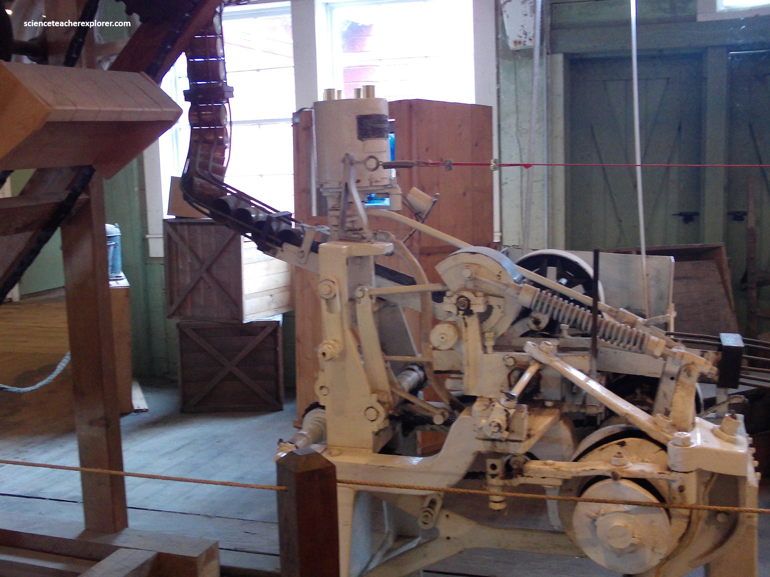
Pictured above, directly from the chopper the can-sized portions of salmon were fed into the “Filler” and loaded into the cans. Each can of salmon was given a calibrated amount of salt for taste and preservation.
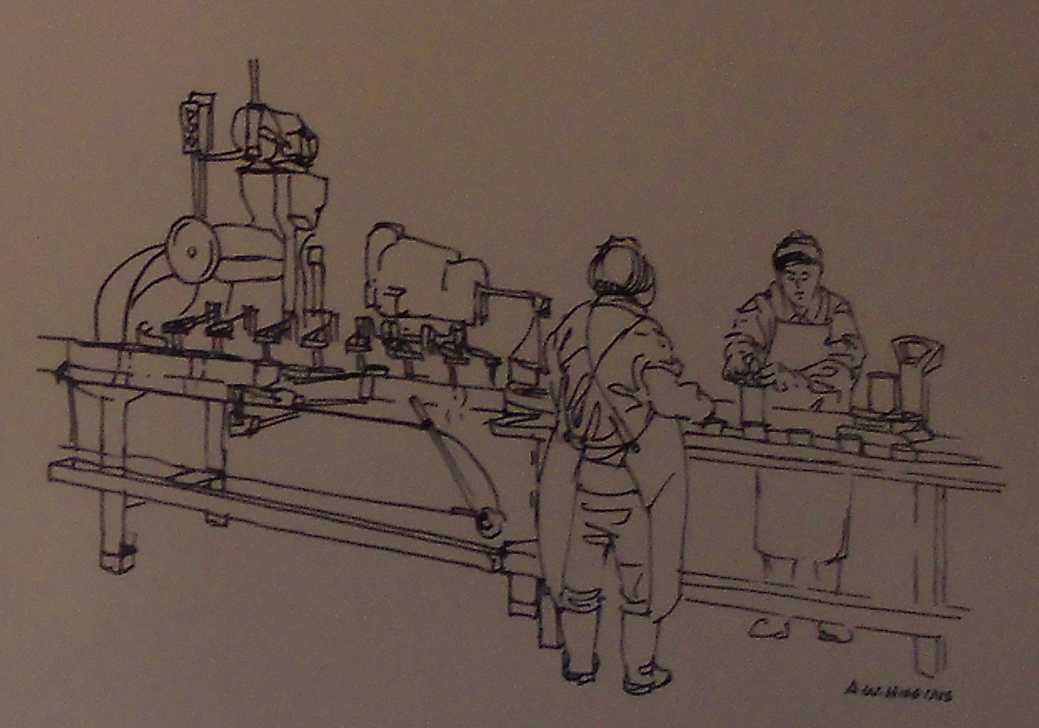
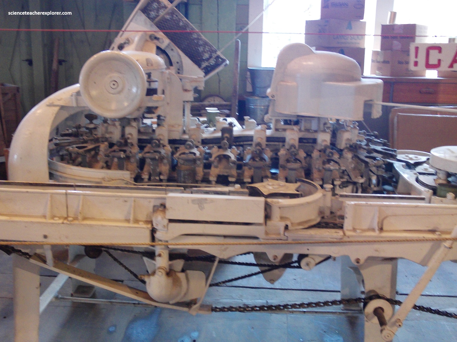
Pictured above, the next station was the automatic weighing machine which weighed each can to ensure the proper amount of salmon was present. Cans not meeting the proper wight were “kicked out” by the machine. Underweight cans were channeled to a slower conveyor belt and sent to the “Patching Table”.
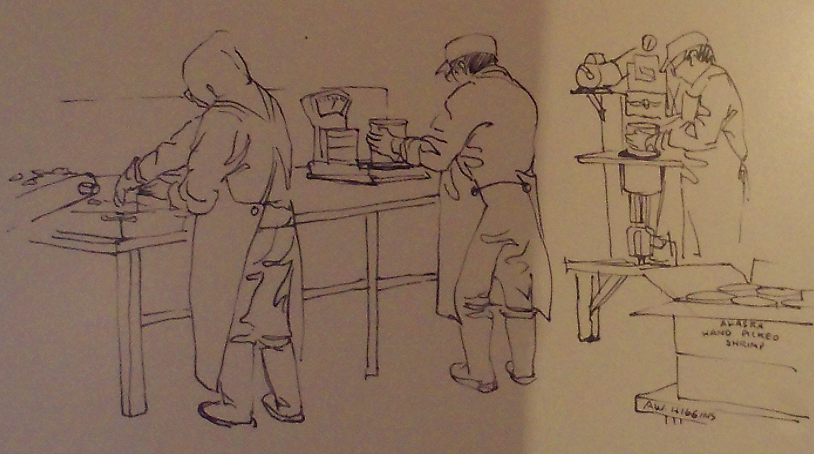
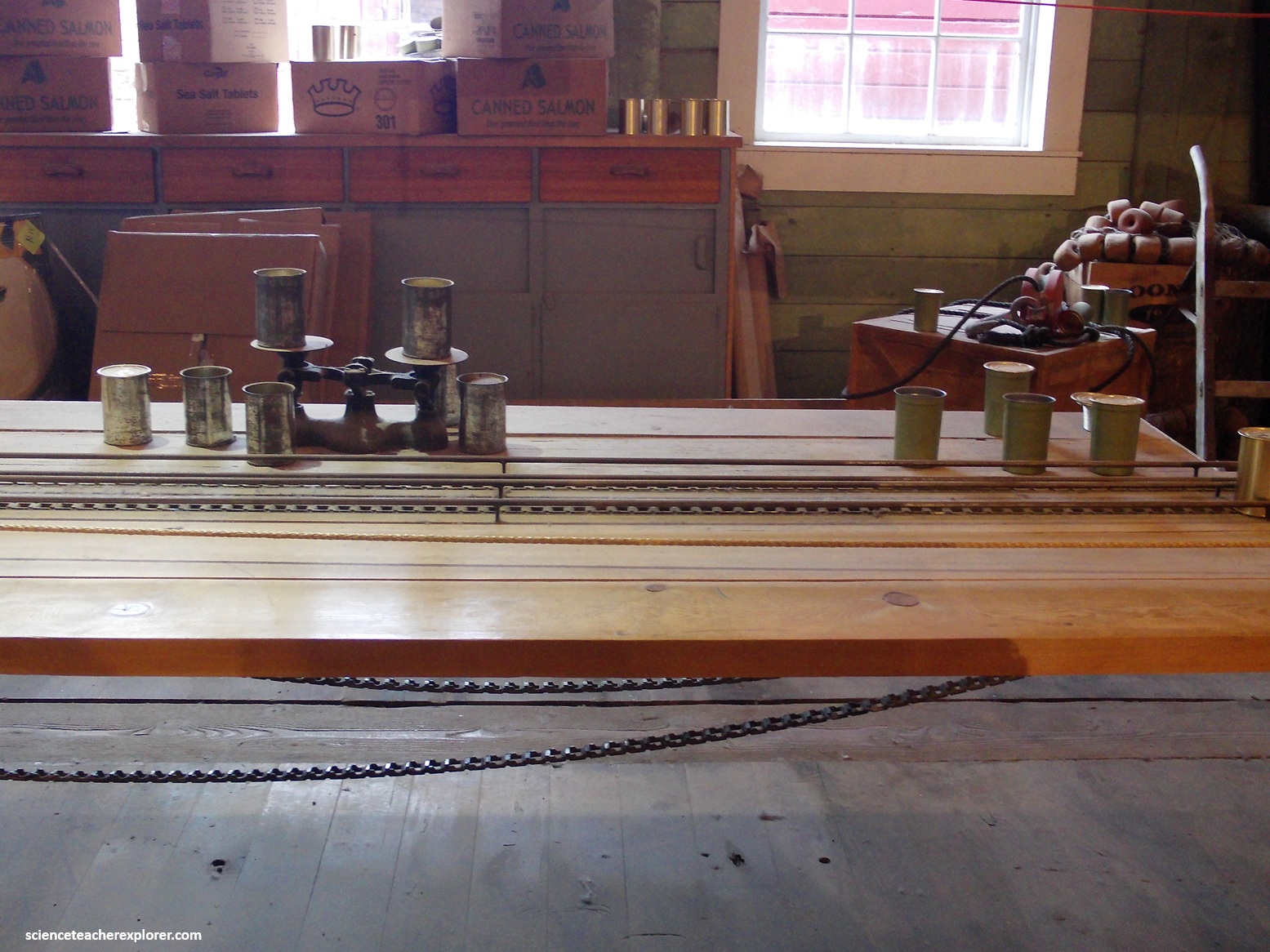
Pictured above, it was here at the “Patching Table” that workers added pieces of salmon had cut from fish too small or too large for the machines. After weighing against a master can on a balance scale, these corrected cans were put back onto the main conveyor belt to continue in the canning process.
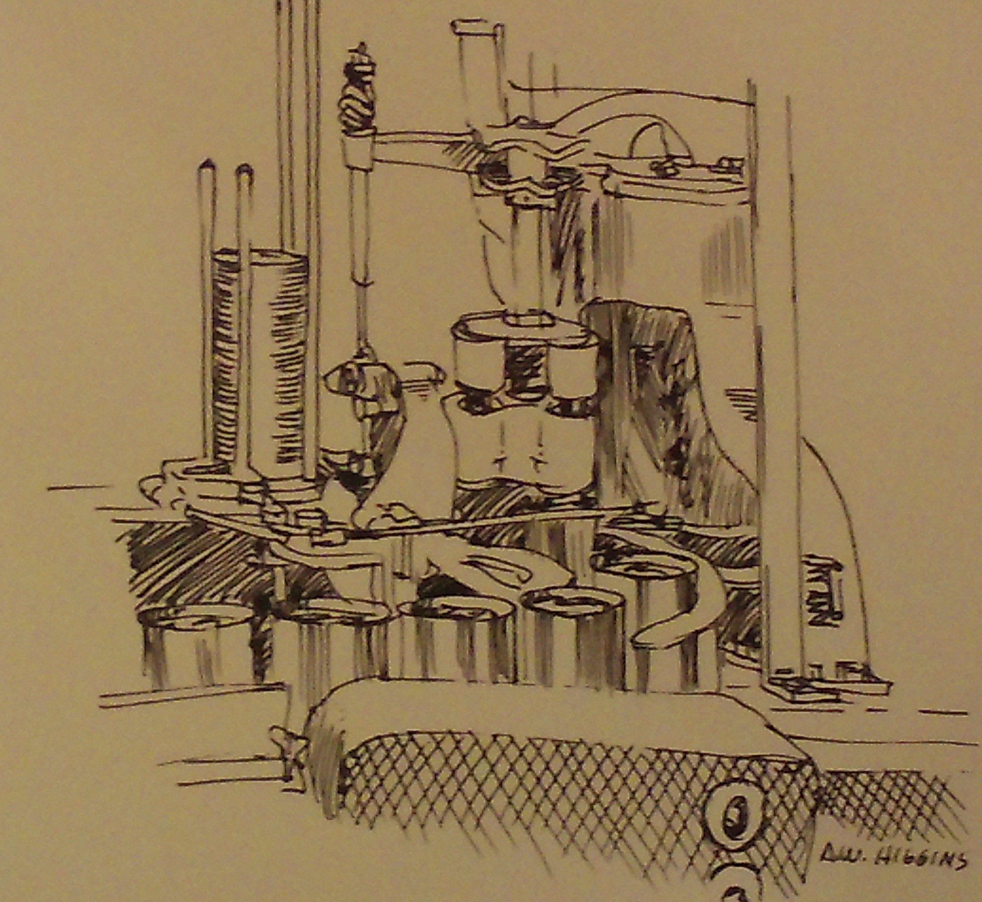
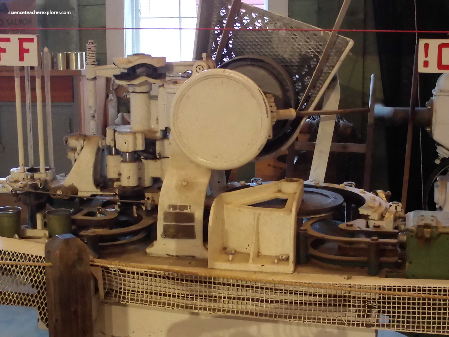
Pictured above, the “Curler Clincher” formed a loose seal between the lid and the edge of the can. A lid was put into place and the edges of the can and the lid were “curled” to loosely hold the lid so air can be removed from the can.
Pictured above, the “Vacuum Sealer” extracted all air to ensure longevity and product freshness. The vacuum sealing also provided the proper pressure for cooking the salmon in the can once sent to the retorts.
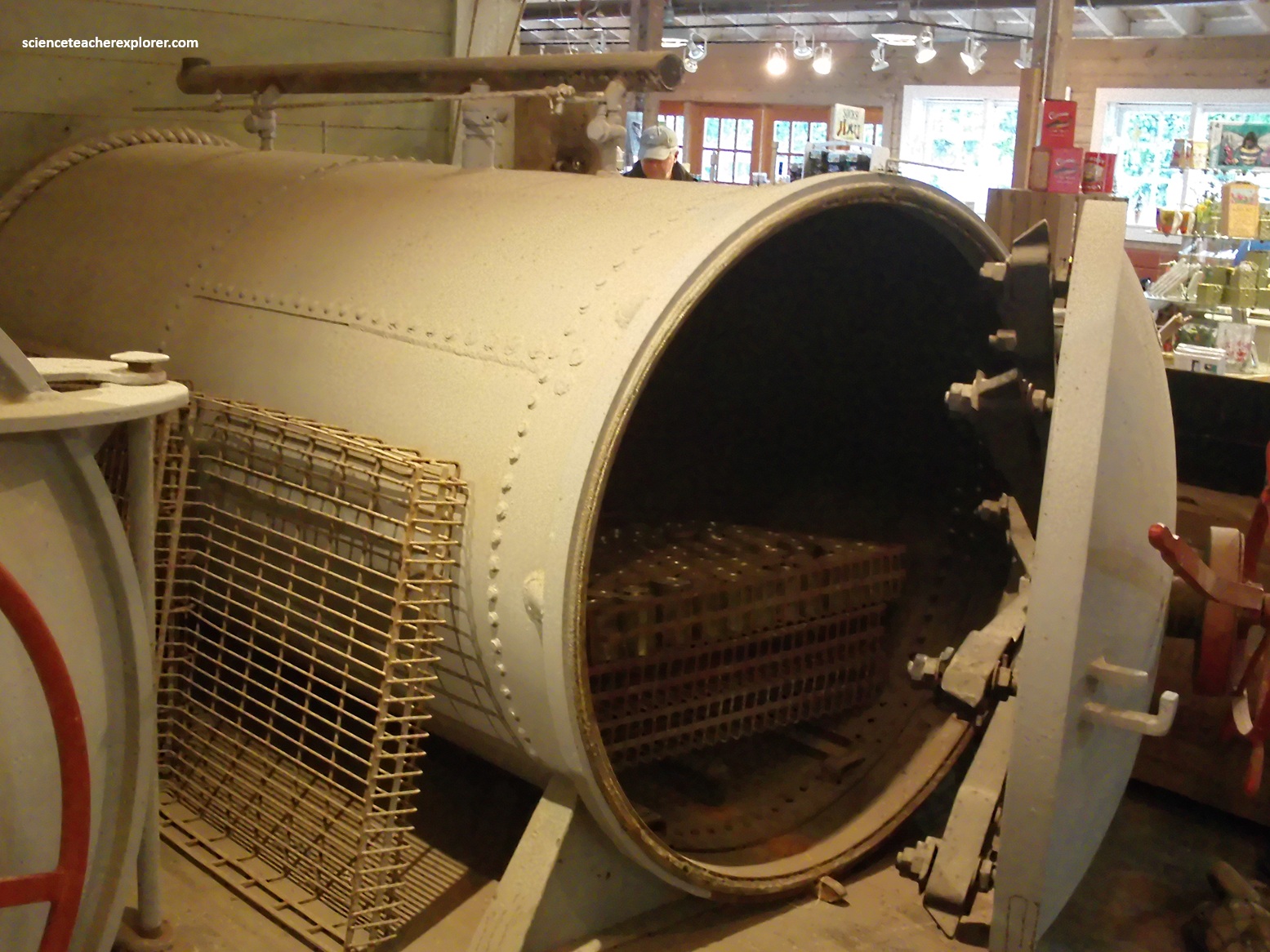
Pictured above, the cans were then placed on racks that were pushed into steam cookers called “Retorts”. One pound of tall cans was cooked for 90 minutes at 240 degrees Fahrenheit. The size of the can determined the temperature and the time of cooking. Each “Retort” was independently controlled for time and temperature by a cannery worker.
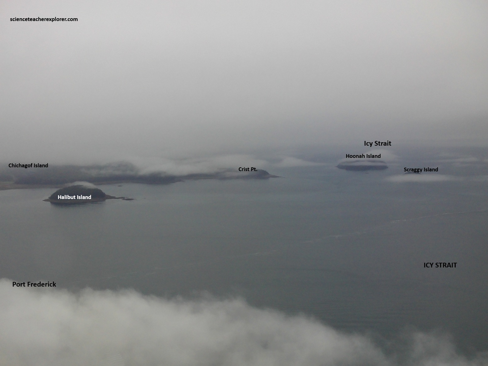
Hoonah, which translates to “village by the cliff” is one of the three communities near Chichogof Island that can be reached by the Alaska state ferry. Hoonah, the largest Tlingit settlement in the Southeast Alaska, lies on the northeast corner of the island in Icy Strait, just 32km from Glacier Bay.
Hoonah legends indicate that their people migrated from Glacier Bay to the present site long ago. Like so many traditional Native villages that were located near the resources of the sea, Hoonah became a cannery center in the early of the twentieth century.
Pictured above, Hoonah Cold Storage and the Hoonah fishing fleet continue to contribute in an important way to the economic well-being of the community. The Cold Storage has operated on this site for at least thirty years.
However, the current owner, Huna Totem Corporation has now branched into tourism with the creation of a high-quality, growing, cruise ship-based Native cultural center and soft adventure base called the Icy Strait Point. Becky and I booked two tramways tickets to get a spectacular view of the area and to trek the mountain’s lush green canopy of spruce trees, hemlocks, cottonwoods, and other native species, (pictured below).
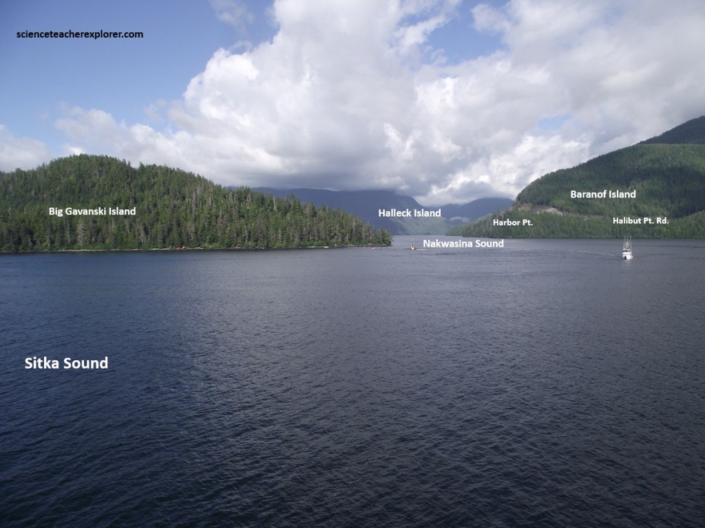
In 2025, our cruise went eastward across the “Cross Sound” to the Gulf of Alaska. There we turned south to explore the coast of Baranof Island, (imaged below).
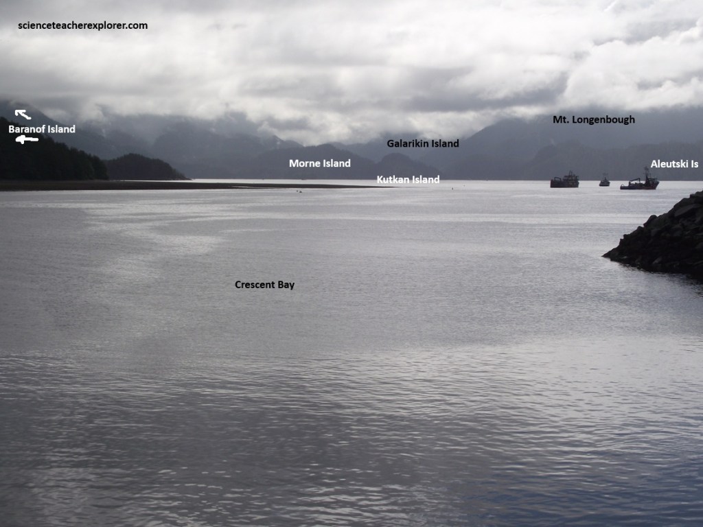
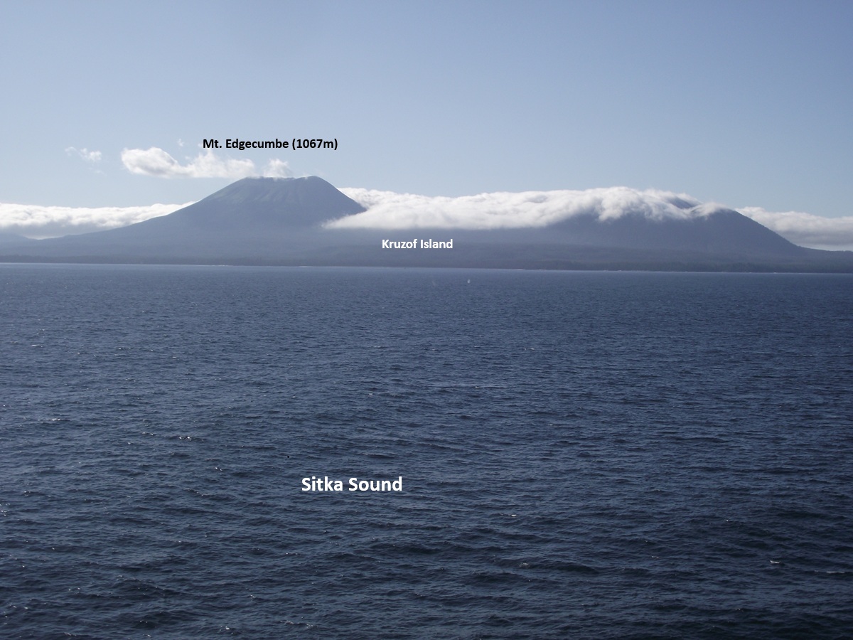
Our destination was Sitka, Alaska. Sitka’s setting was spectacular, from countless forested islands on Sitka Sound to the perfectly symmetrical cone of Mount Edgecumbe that rose to the west. Add to that, the exotic Russian heritage, the fabulous totem park and the attractive city center that corrals all the important sights within easy walking distance of the harbor.
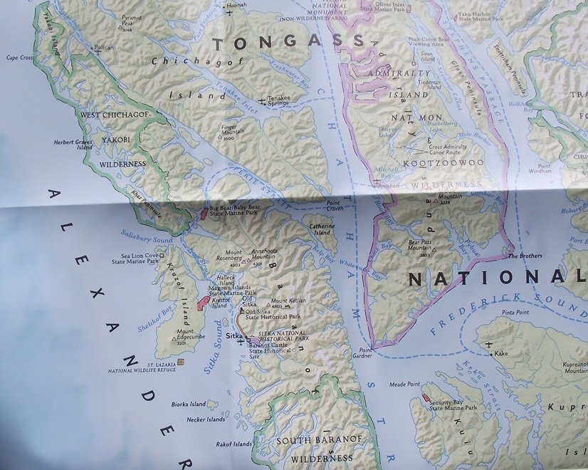
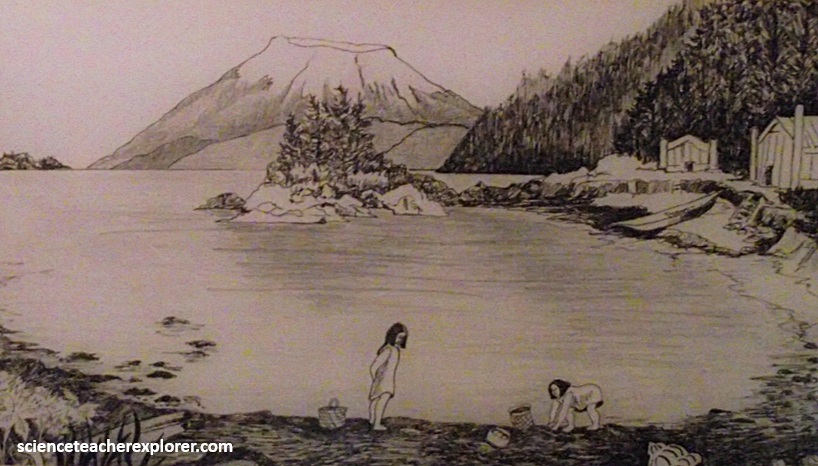
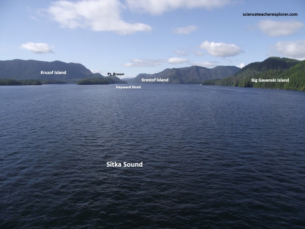
Sitka is situated on the west coast of Baranov Island on Sitka Sound, a body of water that faces the open Pacific. The site of the Russian capital after 1804, the town was the oldest non-Native settlement in the Southeastern Alaska Territory. Sitka was home to a community of Tlingit Natives prior to the Russian arrival.
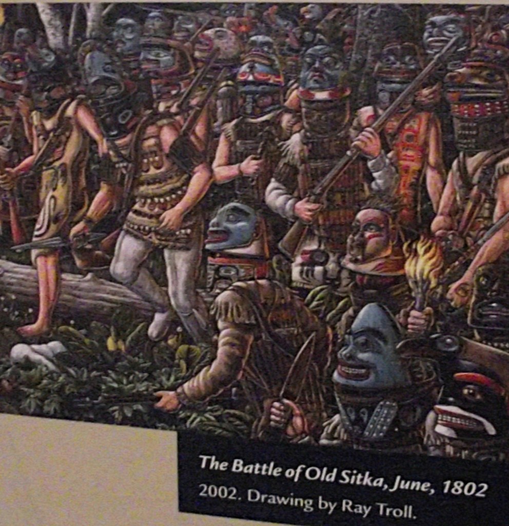
Since the Russian’s Plundered much of the valuable resources of the Tlingit Natives, the Tlingit grew increasingly hostile toward he Russians as well as the Koniag (Aluutiq) and Aleut hunters they brought with them from Kodiak and the Aleutian chain. Armed with guns and ammunition received from English and American traders in the area, they attacked the Russian Fort on June of 1802, burned the buildings, and killed all the occupants except the few who managed to escape into woods to take refuge aboard foreign trading vessels in Sitka Sound.
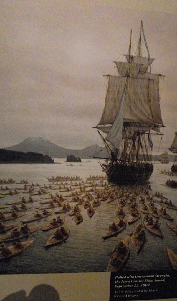
Two years later the Russians returned with three ships and many Aleut mercenaries in kayak-like bidarka boats. Finally routing the Tlingits, the Russians reestablished Sitka on the site of the Tlingit village, Shee Atika. For much of it’s Russian history, Sitka’s leader was Aleksandr Baranov, who established schools for the Tlingits and made Sitka the trading capital of the northwest coast.
Fortunately for the Americans, the Russians’ enlightenment didn’t extend to conserving the valuable fur resource, for once the sea otter had been slaughtered almost to extinction, financial reverses made the Russians willing to sell Alaska to the United States for $7.2 million, about 2 cents an acre, which they did in 1867.
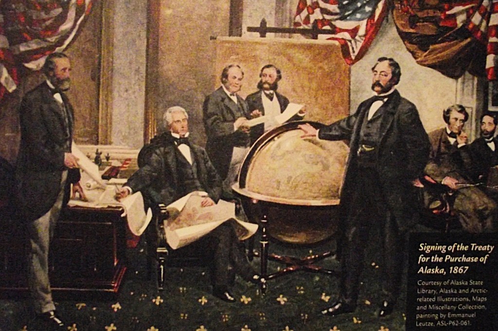
Sitka became the first official U.S. capital of Alaska immediately following the Alaska Purchase. And it subsequently was the U.S. capital for the Department and District of Alaska until the seat of government moved to Juneau in 1906. Eventually, Alaska became the 49th State of the United States in 1959.
The climate in Sitka is relatively mild when compared to other parts of the state. Only 5.1 days per year see highs at or above 70 °F (21 °C); conversely, there are only 10 days with the high not above freezing. Additionally, the winters are extremely mild compared to inland areas of similar and much more southerly parallels, due to the intense maritime moderation.
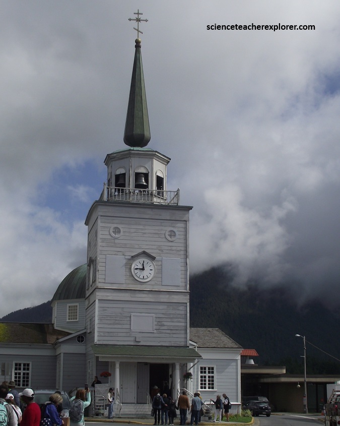
Pictured above, the Saint Michael’s Russian Orthodox Cathedral straddles the main thoroughfare downtown, and dominates the skyline. It is a replica of the original that was built on the site between 1844 and 1848.
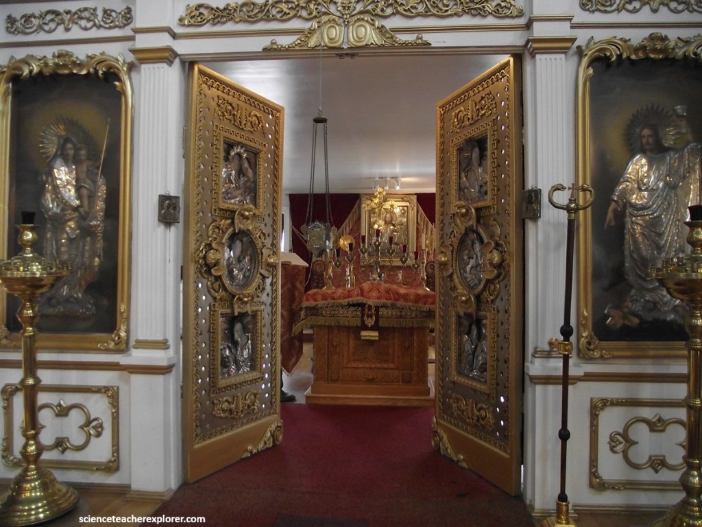
In 1966 the old church was destroyed by a fire that swept through the business district. The townspeople rushed in and managed to save almost all the precious icons and other furnishings that had been brought from Russia in the early days of the church.
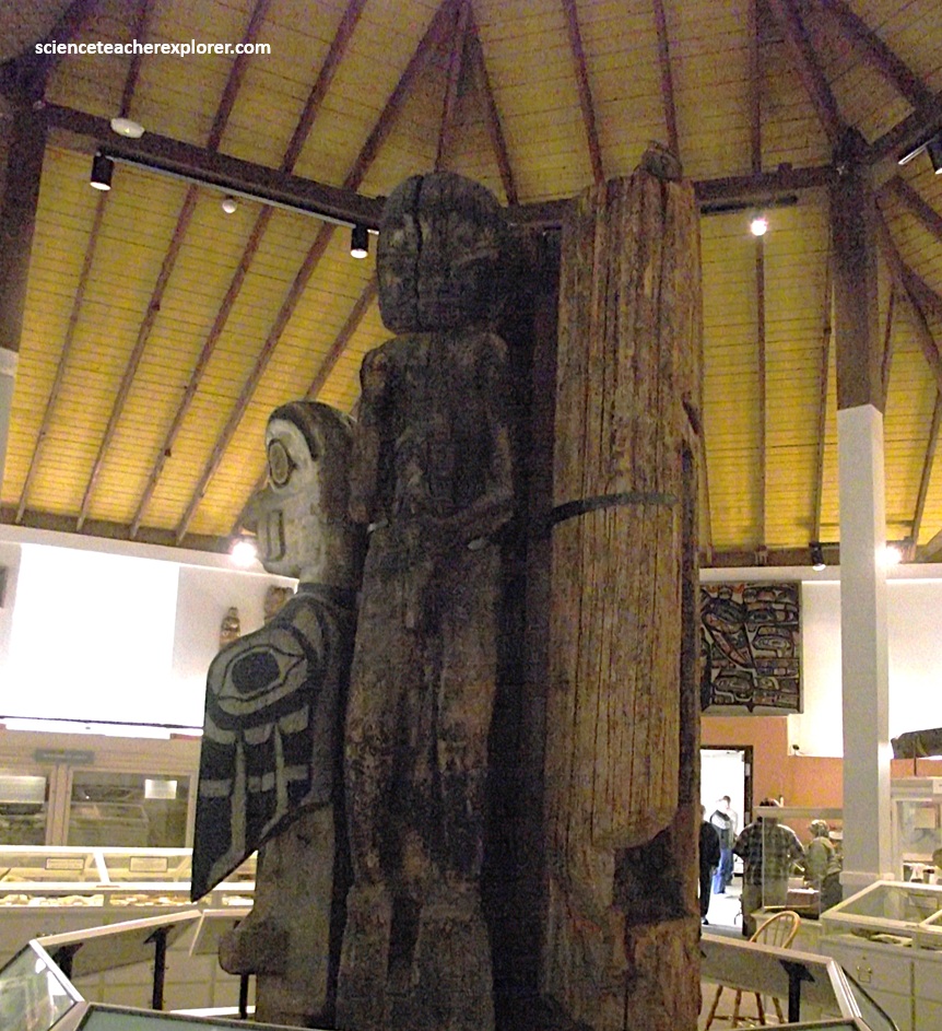
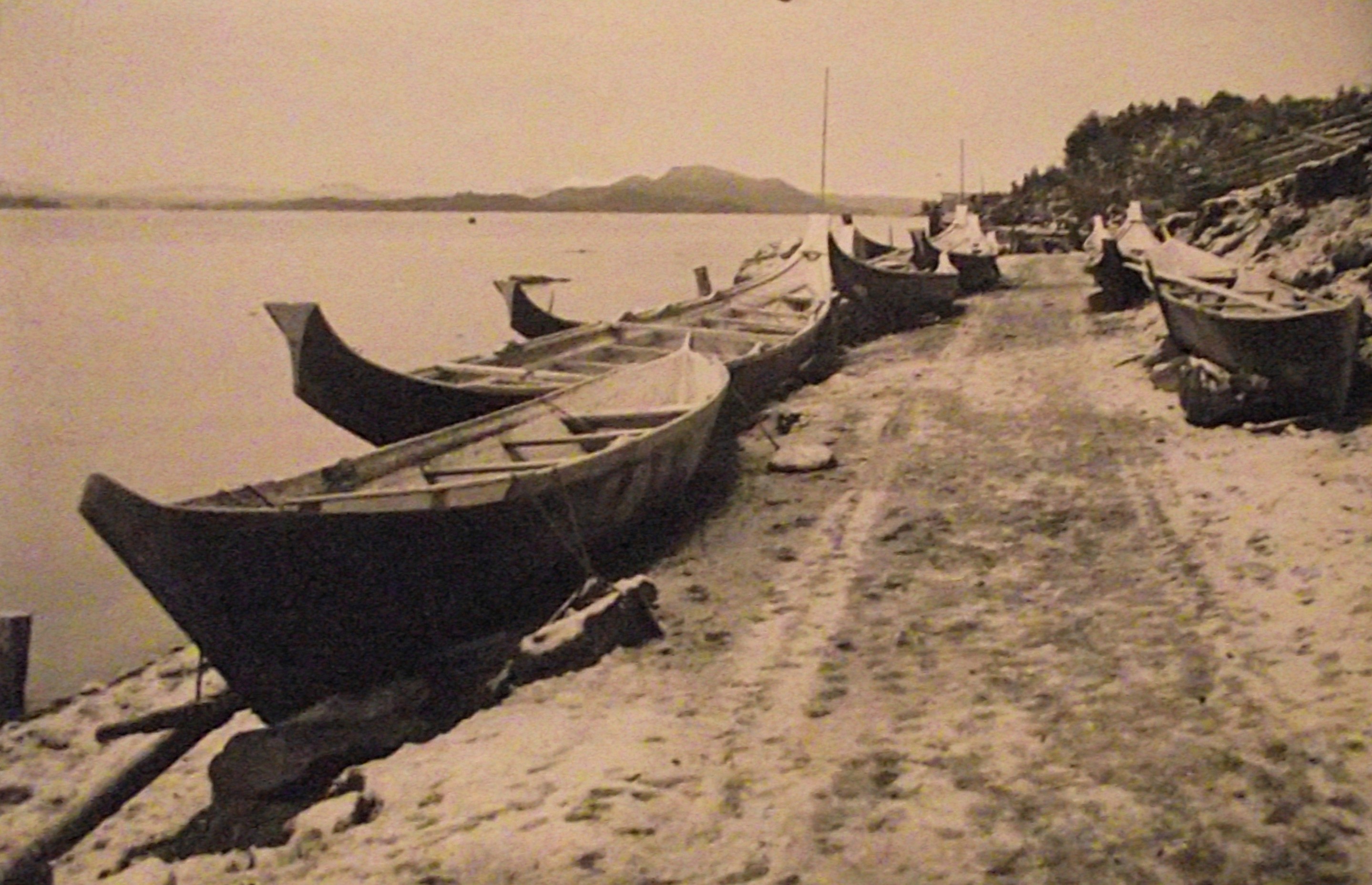
Becky and I, made our way to the octagonal structure on the eastside of Sitka. It was built in 1895 as a repository of Alaska Native artifacts collected by the Presbyterian missionary, educator, and administrator Dr. Sheldon Jackson, as he traveled throughout the Alaska territory in the late 1800s and early 1900s. This museum collection has been called one of the most important in the world, and within it’s compressed confines, we found exquisitely carved ivory tools, ivory sewing implements, jewelry, pipes, lip labrets, carved wooden ceremonial masks, dance regalia, a very old Chilkat blanket, water proof clothing made from walrus intestine, dog sleds, kayaks, umiaks and canoes. Note the Totem Poles pictured above. {The historical photo below was taken from an Interpretive Sign on-site}.
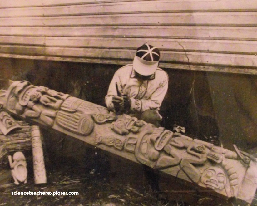
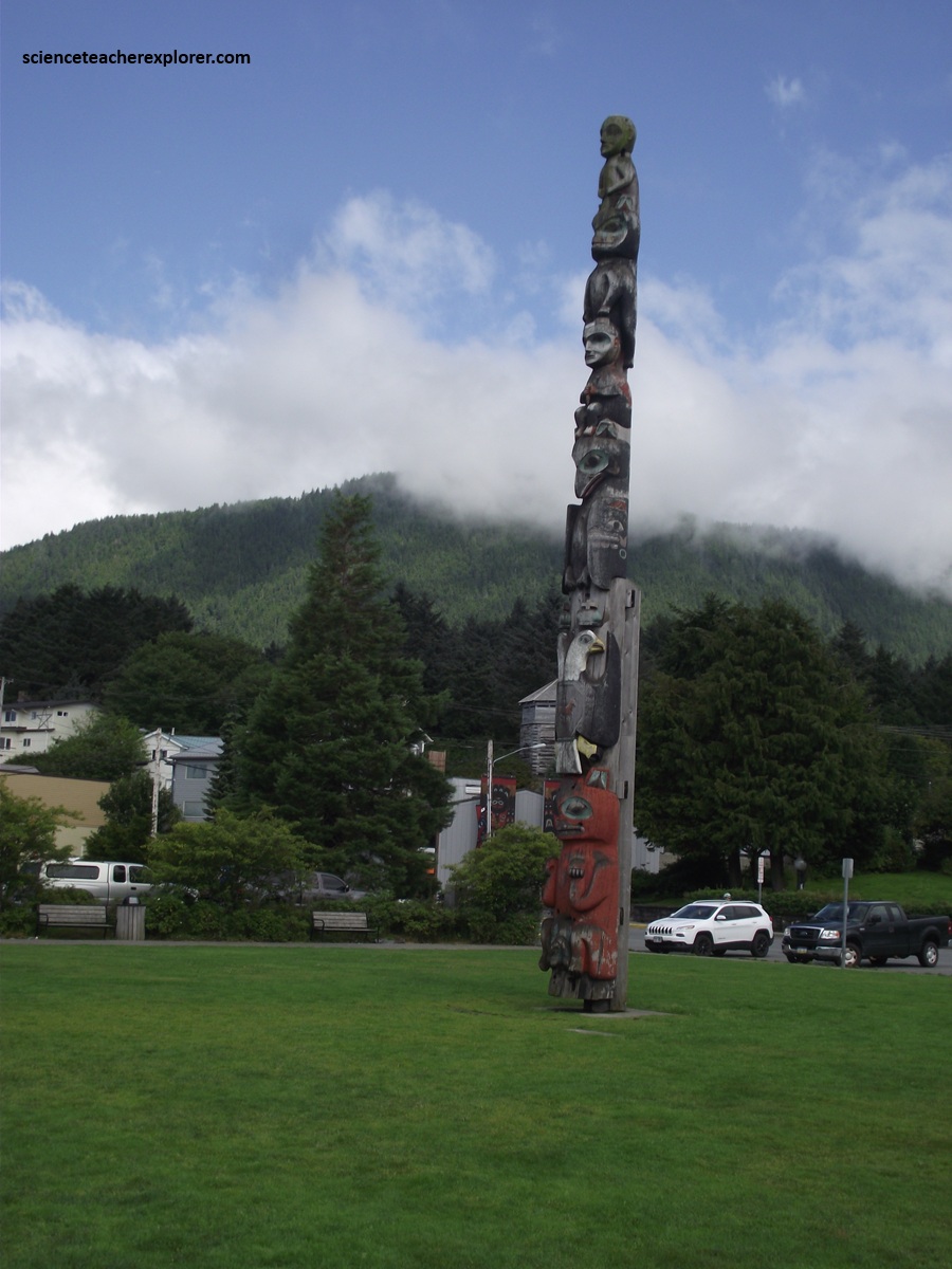
Totem poles are found from Southeast Alaska to Puget Sound in an area that coincides with the of Western red cedar. Though other suitable wood could be used, red cedar was the preferred material for carving totem poles because of its straight grain, resistance to rot and ease is carving. There are four principle types of totem poles: (1) Heraldic poles illustrated the crests of clans and house groups which commissioned the carving, (Bear, Eagle, Crow, Beaver, Wolf, Whale, etc.). (2) Mortuary poles served as an above-ground receptacle for the cremated remains of important people. (More than one person could be interred in a mortuary pole). (3) Memorial poles erected to memorialize individuals. (4) Ridicule poles carved and erected to shame people into paying debts of honor or money.
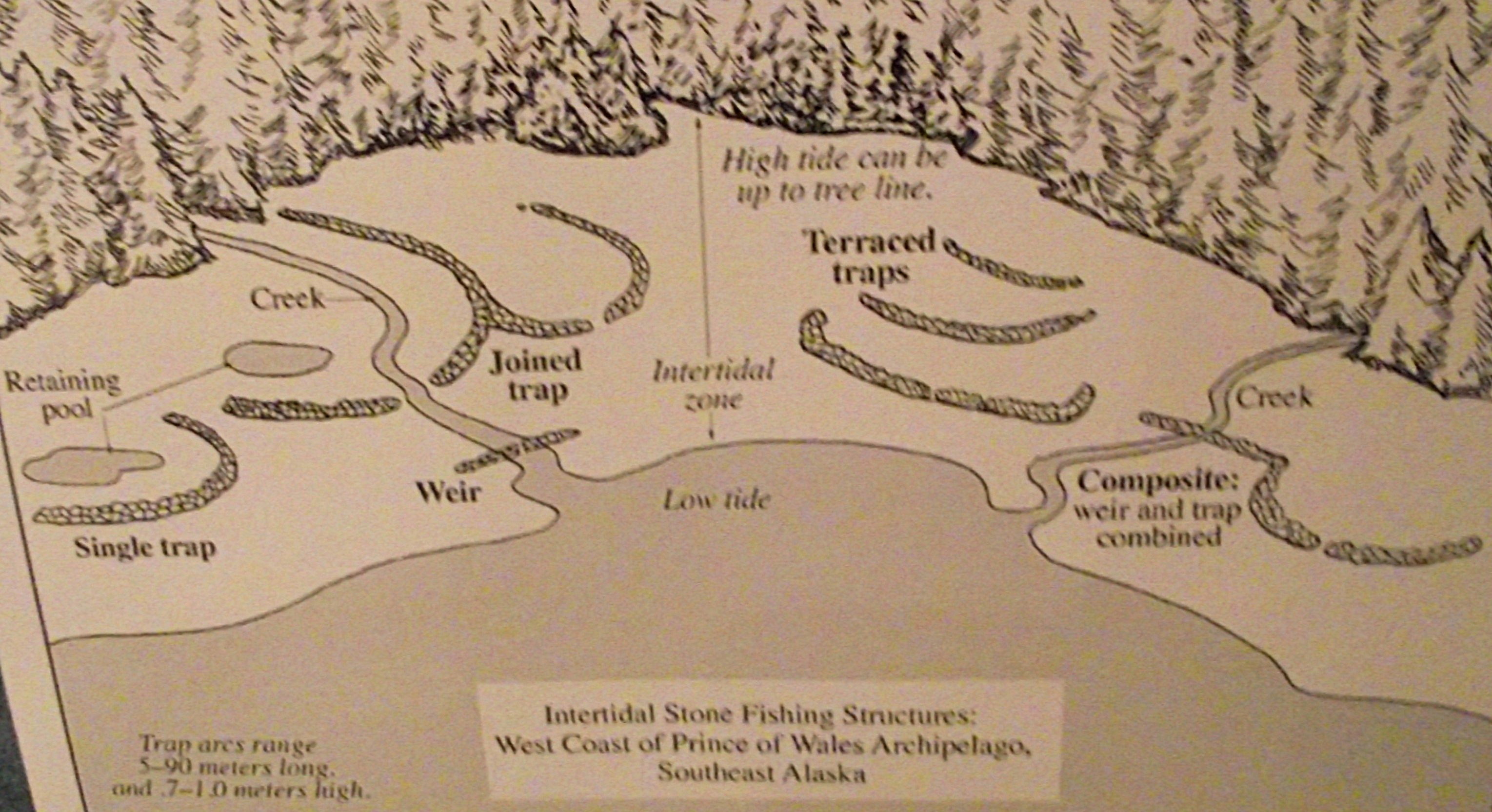
The Tlingit were masterful fishermen who designed conservation-minded fishing technologies through millennia of experimentation. The Tlingit invented trolling, for which they dragged lures behind their canoes to catch king and coho salmon. They also attached baited hooks to wooden buoys that were set along the known migration paths of coho salmon. They also used various fish traps and complex netting systems for salmon harvesting. However, their most intensive fishing efforts were directed at places where the most salmon congregated: rivers, streams, and intertidal zones over which salmon passed to access their home streams or migration routes. The Tlingit also built different kinds of fishing weirs using stones, carved stakes and woven cedar mats that were used during high tides. (Images above, were taken from Interpretive Signs on-site).
The bedrock of western Baranof Island is Late Cretaceous Sitka Graywacke, volcanic sediments of the Chugach terrane. These submarine avalanche deposits were shed onto the adjacent shelf from a volcanic arc and transported down the continental slope. They are feldspar-rich sandstones, conglomerates, and mudstones that have been metamorphosed to lower greenschist facies.
North of Sitka, many outcrops of the Sitka Graywacke are seen. However, there is a 2.5-5cm band of 9,000 year-old ash from the nearby Mt. Edgecumbe in the soils lying on top of the Sitka Graywacke in the roadcuts.
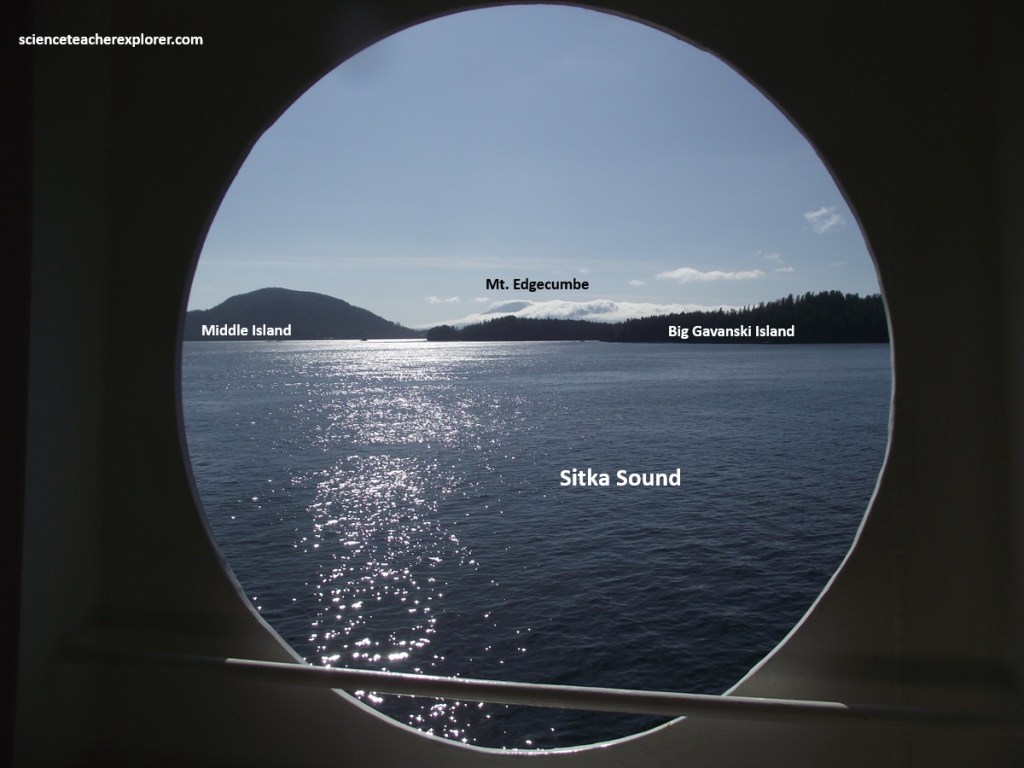
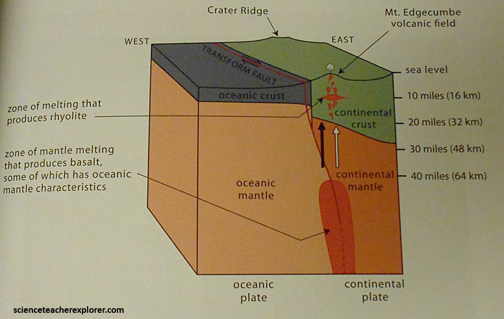
Pictured above, the iconic Mt. Edgecumbe stratiform volcano towers over Kruzof Island to the west. It was formed close to the Queen Charlotte-Fairweather Transform Fault, the position of which seems to determine if the erupting magma is basalt or rhyolite, (imaged below).
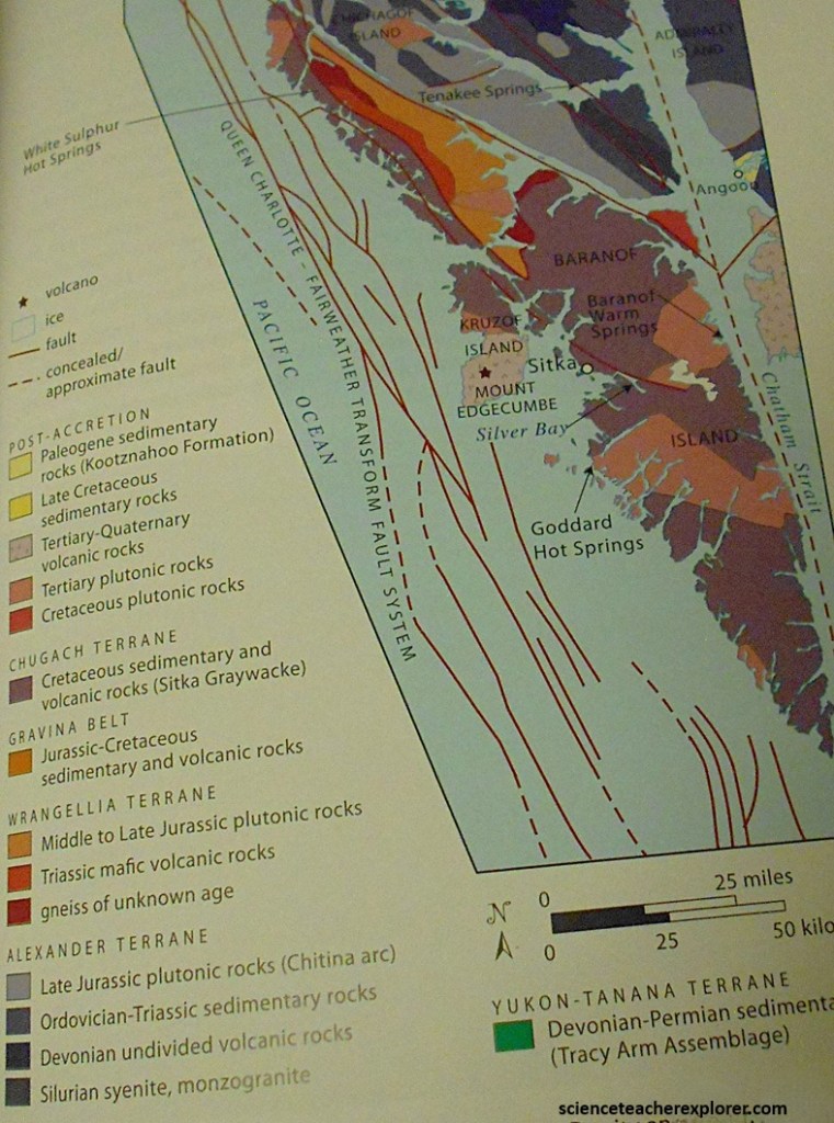
The Mt. Edgecumbe volcanic field formed initially as basaltic underwater tuffs that were erupted onto the continental shelf beginning about 600,000 years ago and are exposed on the eastern coast of Kruzof Island, (imaged below).
{Note: the first image above was taken from “Roadside Geology of Alaska, 2nd Edition”, Connor, 2014 & modified from Riehle in 1996} More silica-rich, explosive rhyolitic eruptions began about 14,000 years ago, following the withdrawal of glacial ice. An eruption that occurred 11,250 years ago is found widely in the ash layers around Southeast Alaska.
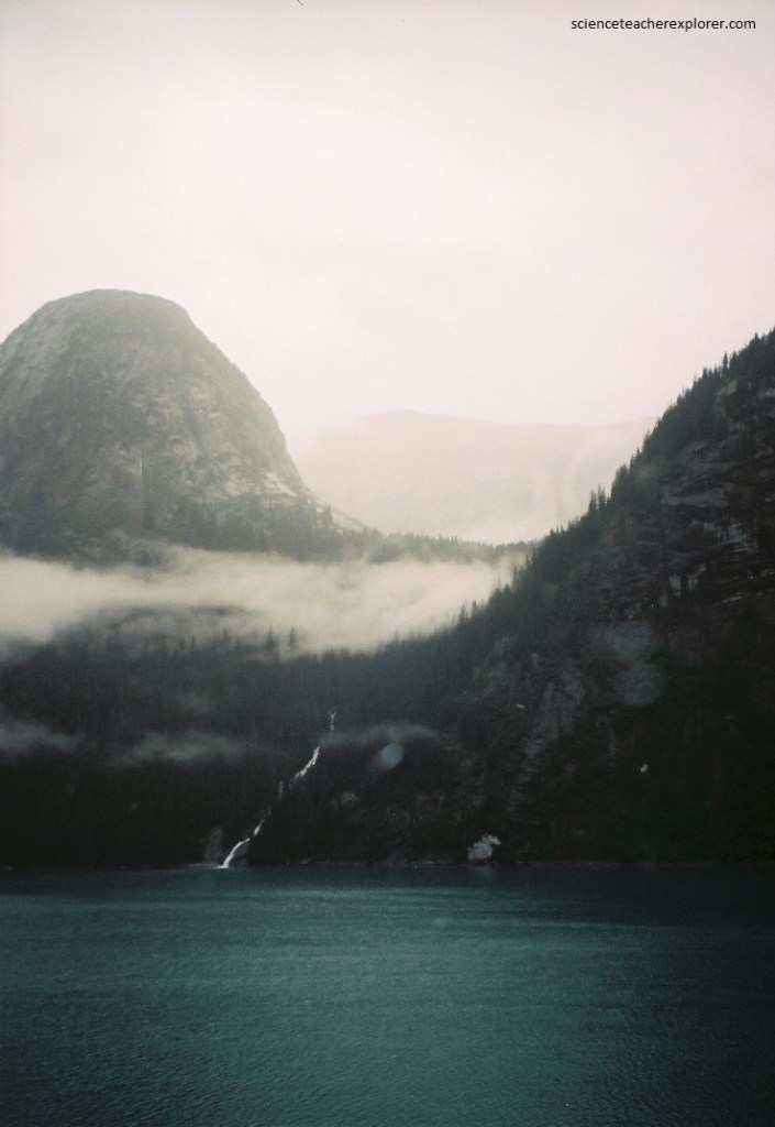
Pictured above, the Clarence Strait is a long body of water that separates Prince of Wales Island on the west from smaller islands and the mainland on the east. Although there are no significant towns along the shores, the strait serves as a major artery of the Inside Passage. Pictured above, the eastern shore of Clarence Strait is formed by Paleozoic Alexander terrane rocks south of Ernest Sound, and Mesozoic Bravina belt rocks to the north.
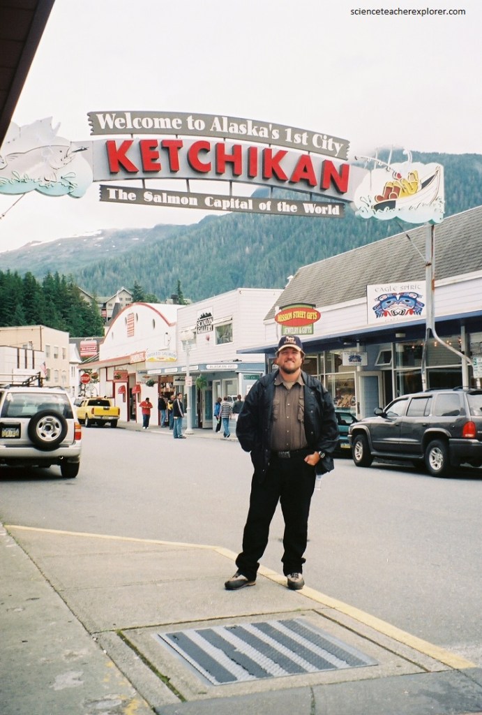
Imaged above, Ketchikan is situated in the southernmost part of Southeast Alaska and is often considered a gateway city for travelers traveling north from the lower forty-eight states on the Inside Passage. The city lies along the eastern shore of Tongass Narrows between Revillagigedo and Gravina islands and is about 32 km west of Misty Fjords National Monument.
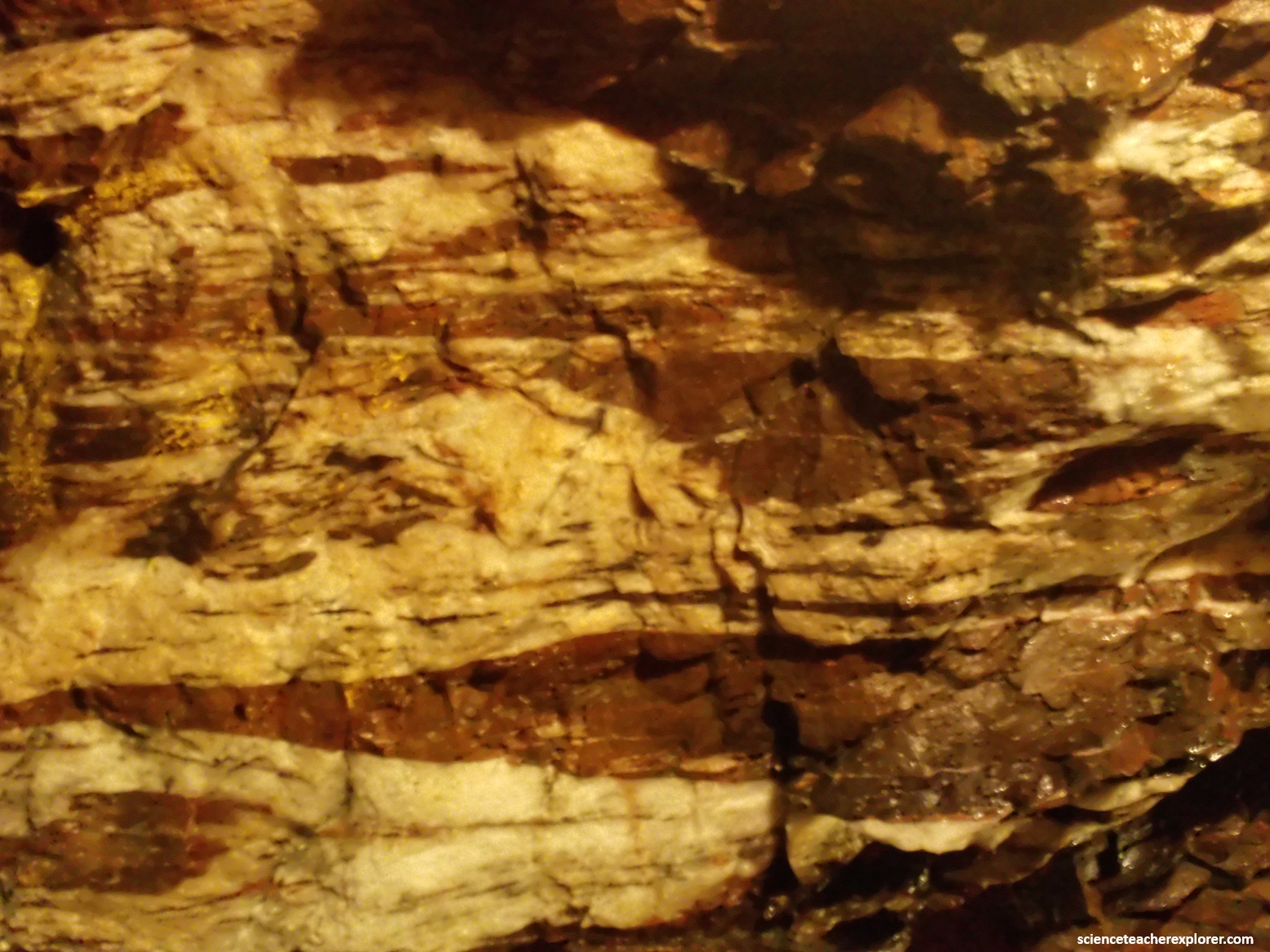
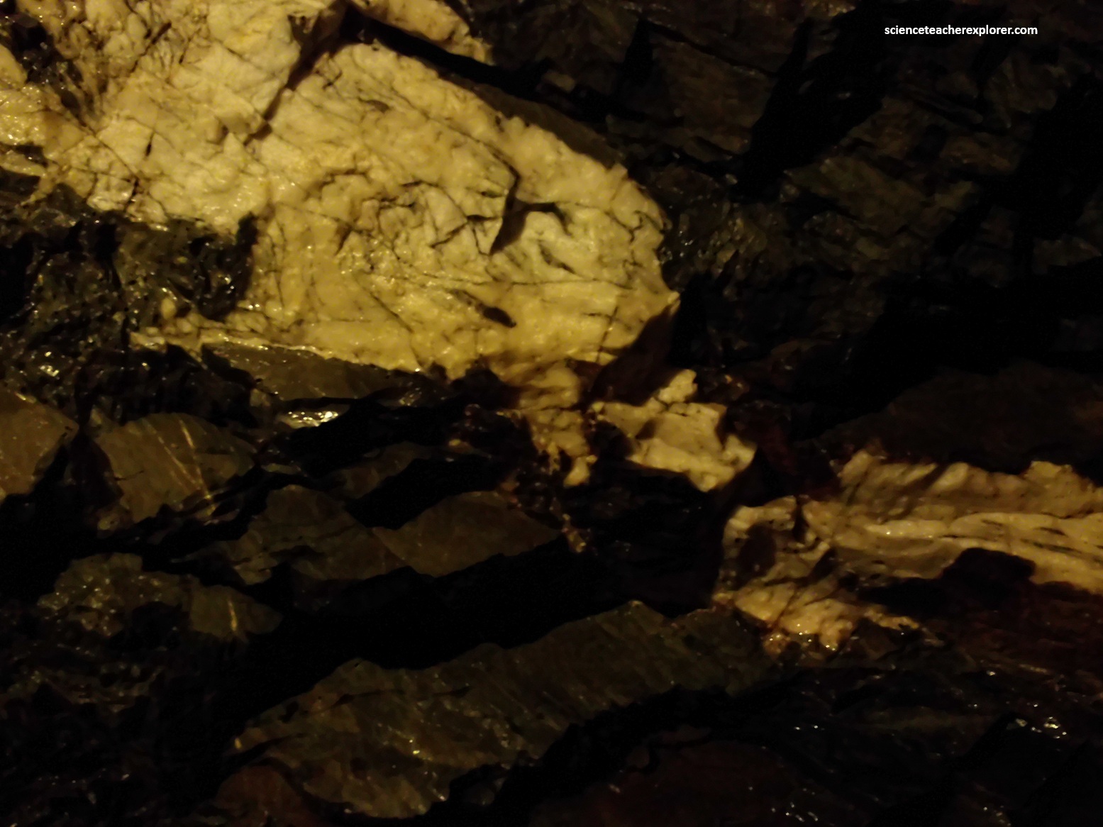
Ketchikan is underlain by rocks of the western metamorphic belt and is situated along the eastern boundary of the Gravina belt. However, unlike its northern counterparts, Ketchikan is now far south of the remaining tidewater glaciers in the Inside Passage. Perhaps the most striking thing I noticed on arrival in Ketchikan was the predominance of green rocks. The bright coloration is largely derived from chlorite and epidote that grew during low-to medium-temperature metamorphism.
The Ketchikan area has a long mining history with deposits of copper, molybdenum, uranium, and iron found nearby. Mines and known mineral deposits stretch from the Coast Mountains north and east of town to the Prince of Wales islands. The Cleveland Peninsula was extensively explored for gold during the nineteenth and early twentieth centuries.
