Grand Coulee, WA USA
On October 20th, 2017; my wife Becky and I visited the Grand Coulee.
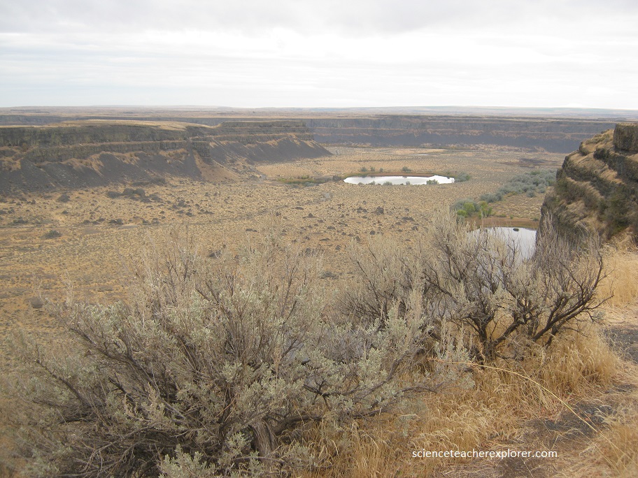
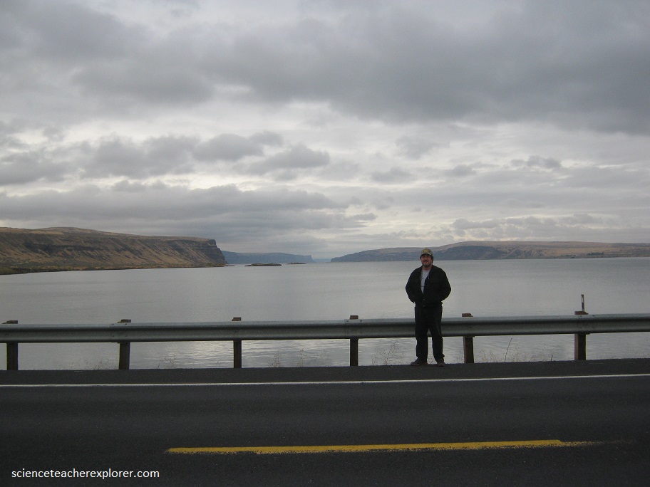
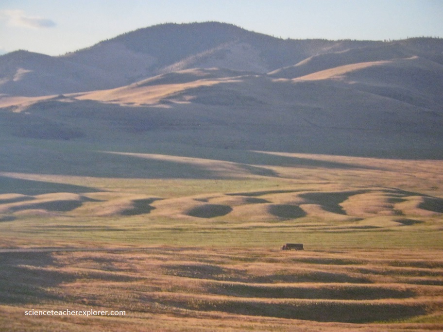
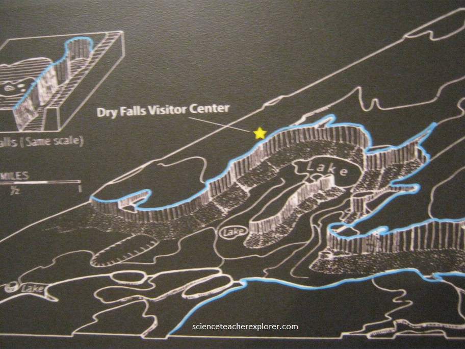
The Grand Coulee is one of the youngest and most unusual natural wonders in North America. (Picture below) I’m standing in front of this amazing canyon, that is the largest of several coulees that cut through the Columbia Plateau of eastern Washington State. Becky and I drove through and along several of these coulees.
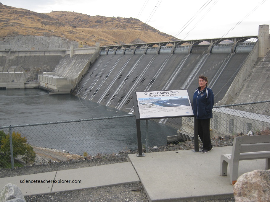
The Grand coulee was created during the last ice age by the largest recorded floods known to science. At intervals of about 50 yrs., a towering wall of water over 2,000 ft. high broke through an ice dam in the Rocky Mountains and cascaded through Washington State to the Pacific Ocean.
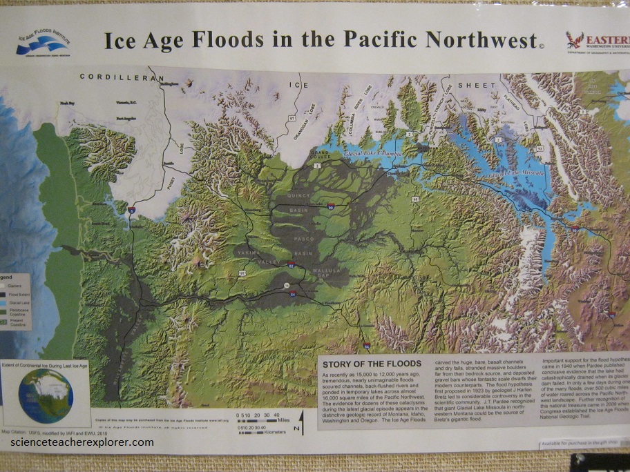
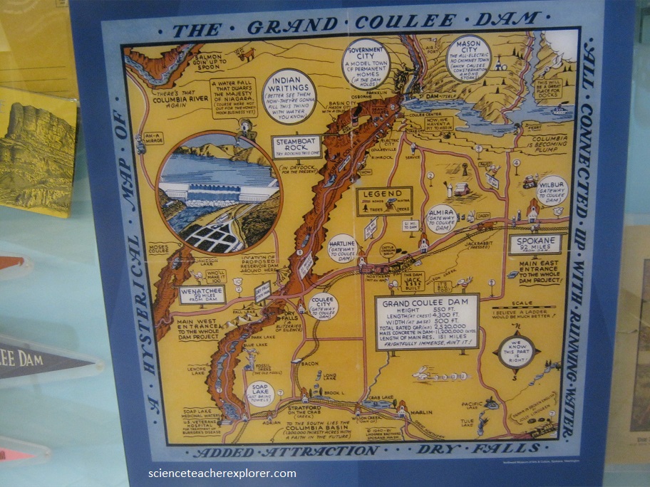
“As recently as 15,000 to 12,000 years age, tremendous, nearly unimaginable floods scoured channels, back-flushed rivers and ponded in temporary lakes across almost 16,000 square miles of the Pacific Northwest. The evidence for dozens of these cataclysms during the latest glacial episode appears in the distinctive geologic record of Montana, Idaho, Washington and Oregon” (Quoted from the posted map above).
“The Ice Age Floods carved the huge, bare basalt channels and dry falls. Stranded massive boulders far from their bedrock source, and deposited gravel bars whose fantastic scale dwarfs their modern counterparts.” (Quoted from the above Ice Age Map).
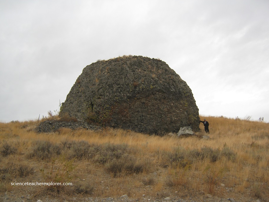
The water exerted so much force, it ripped up the bedrock, creating the coulees that we see today and picture below. Notice how big the boulder is that I’m standing next to, that was deposited by the flood.
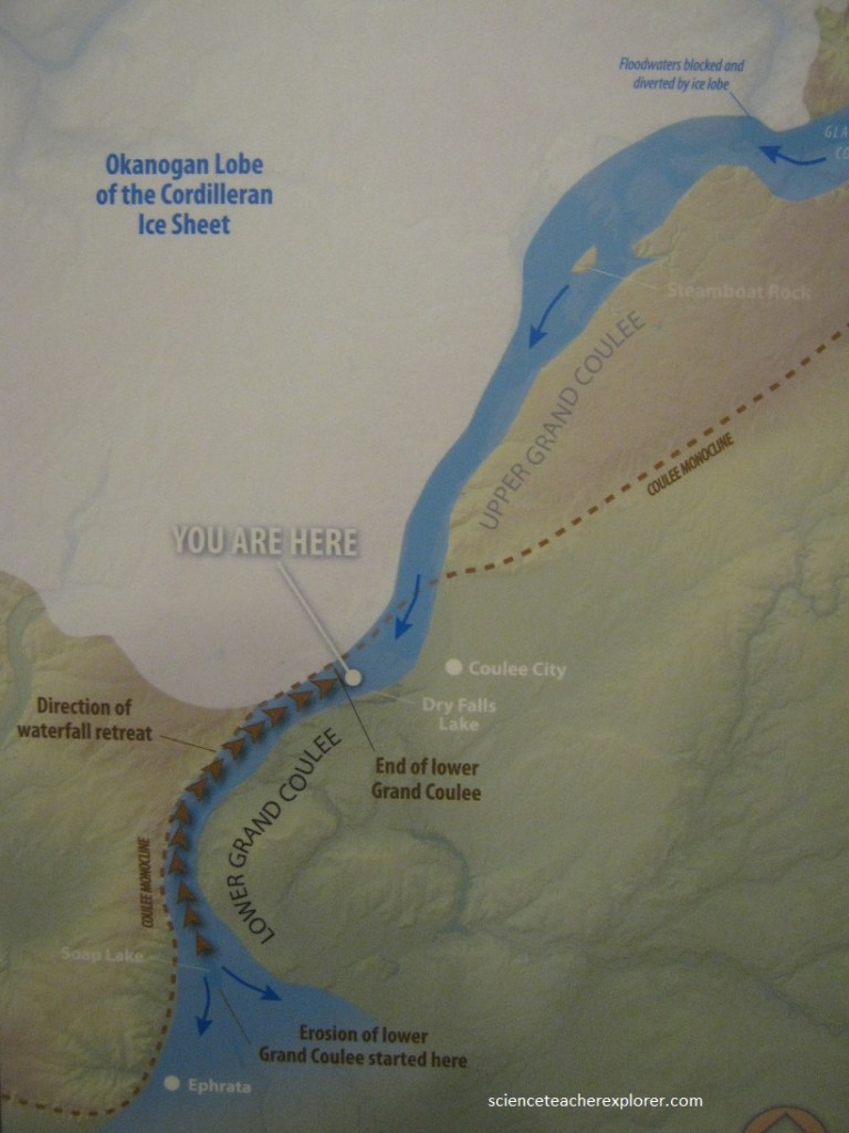
(Pictured below) I’m standing in front of the most unusual and extraordinary geological wonders in North America. Situated in the middle of the Grand coulee canyon, this four-mile wide, 400 ft. high cliff was once the world’s largest waterfall. Not a drop of water flows over Dry falls today, but 15,000 years ago enormous floods escaping from a gigantic ice dam to the northeast thundered across the landscape.
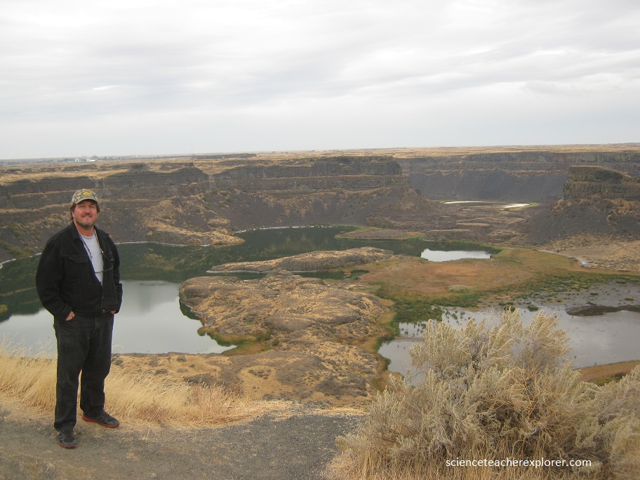
The floodwaters ripped up bedrock located approximately 11 miles farther south, eroding the cliff back to this point in the process.
At the peak, the floodwaters flowing over this cataract were 1,000 ft. high with a volume 10 X that of Niagara.