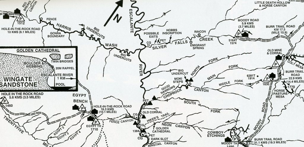
Hole-in-the-Rock Road
For many years, I’ve explored the “Canyons of the Escalante” from the early 1980s to present. Eventually, I started taking groups & taking photos. This web-site documents a few of those
The main access road was the “Hole-in-the-Rock” Road, 8 km southeast of the town of Escalante, Utah on Hwy-12. The locals call this road “Fifty Mile Bench Road”. The “Canyons of the Escalante” is a collective name for the erosional landforms created by the Escalante River and its tributaries, the Escalante River Basin. Located in southern Utah in the western United States, these sandstone features include high vertical canyon walls, water pockets, narrow slot canyons, domes, hoodoos, arches, and natural bridges.
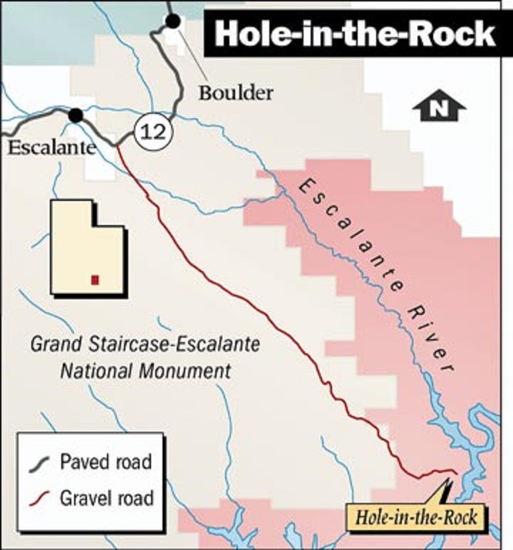
This area, extending over 3900 km² and rising in elevation from 1100 m to over 3350 m, is presently one of the three main sections of the Grand Staircase-Escalante National Monument and is part of the Glen Canyon National Recreation Area that borders the adjacent Capitol Reef National Park.
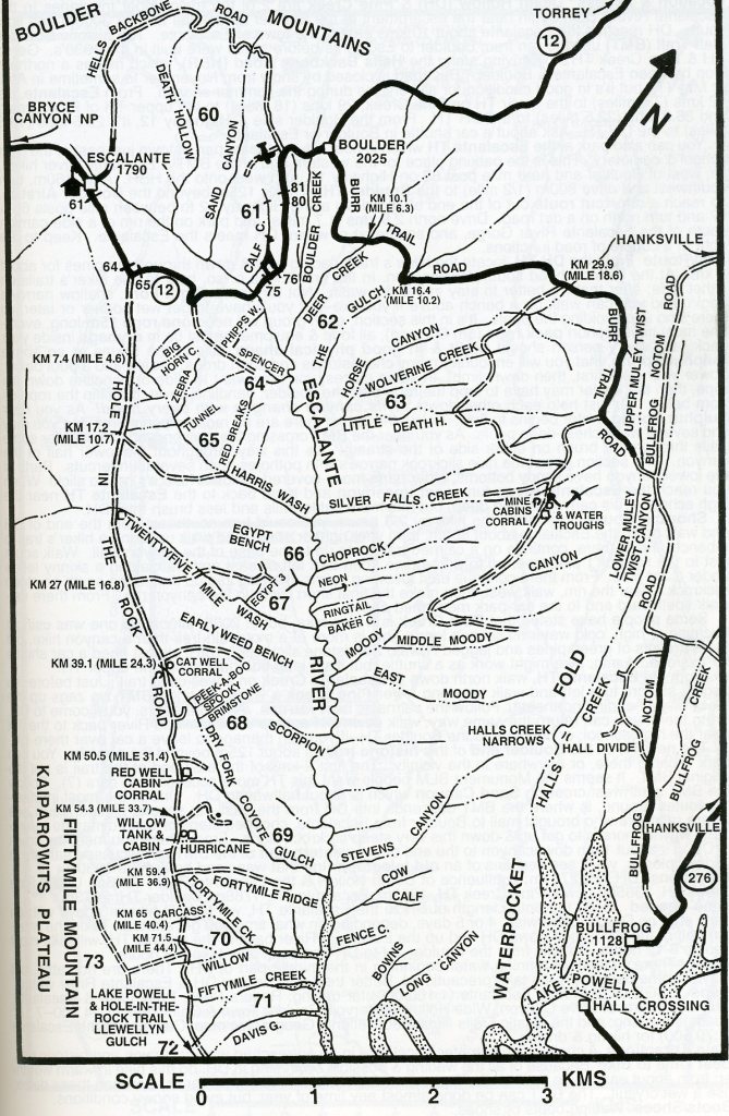
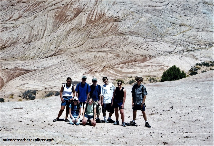
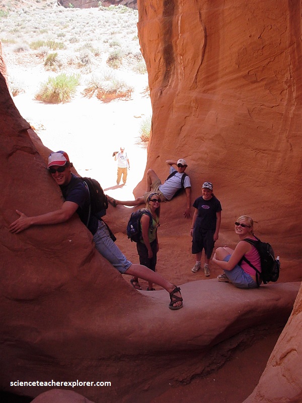
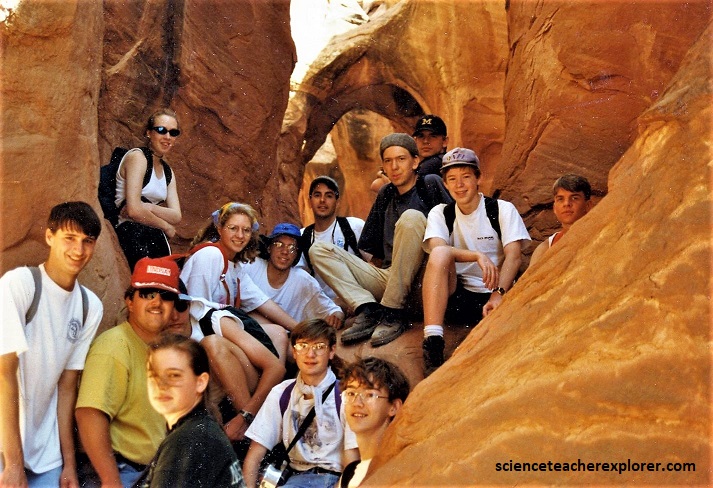
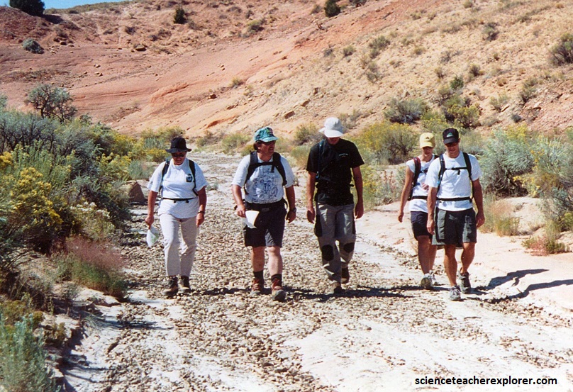
My first mention is the northern-most destination on the road, Zebra Canyon. I led an educational expedition of students and adult-advisors there in 2002.
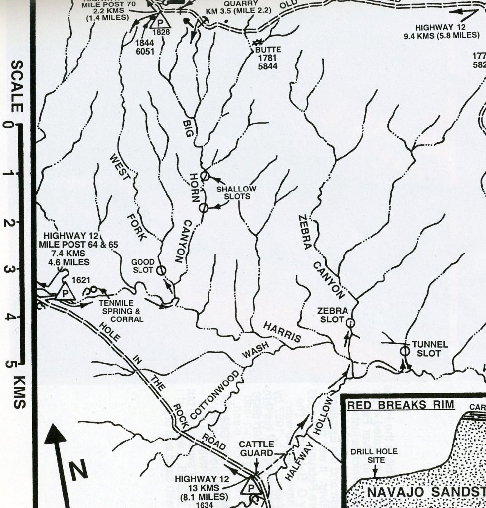
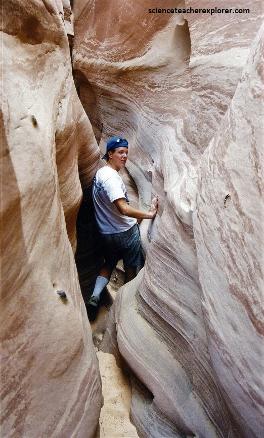
My group parked by the cattleguard, 13 km south of Hwy. 12, at the head of “Halfway Hollow”. There we hiked down (north-east) “Halfway Hollow” and a short walk in Harris Wash to gain access to the “Tunnel Slot”. I found on a reconnaissance mission that this was the best way to enter our destination, “The Zebra Slot”. Right at the mouth of “Tunnel Slot”, there was a large pothole surrounded by trees and brush.
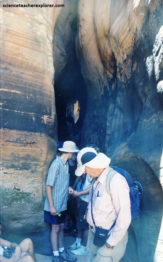
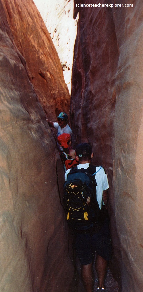
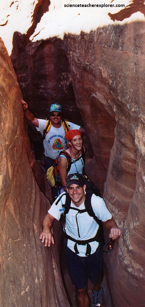
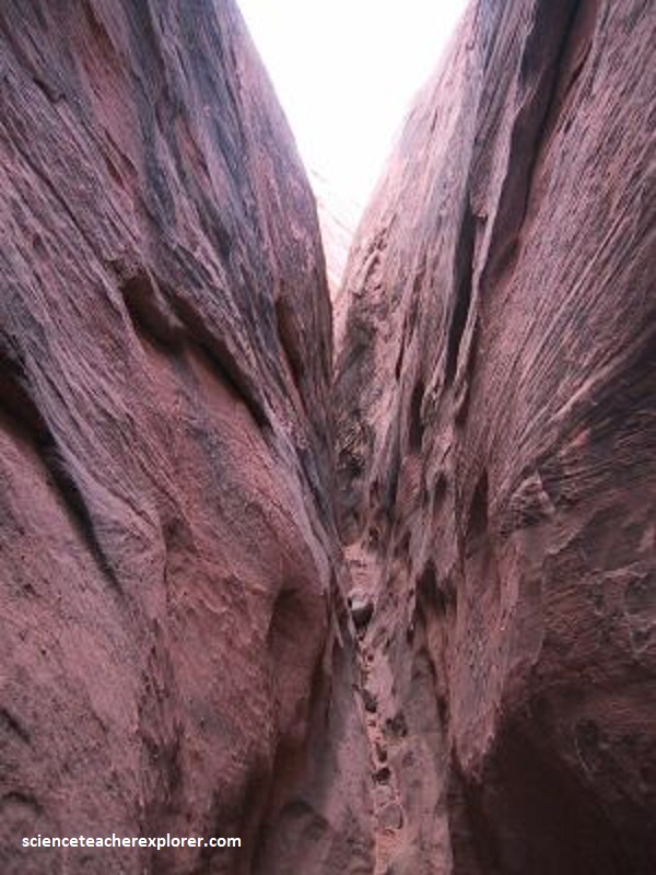
We walked up the “Tunnel Slot” Drainage for about 300 m and entered a virtual tunnel with a very tight slot above narrowing down to 10 cm. It opens up to 1-2 m blow and we was able to wade 35-40 m to the other end.
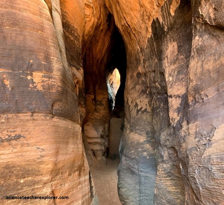
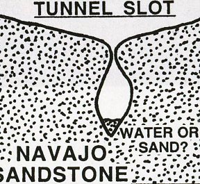
The sandstone layers now exposed in the Canyons of the Escalante were deposited during the Mesozoic era, 180 to 225 million years ago, when this area was part of a large area of sand-dunes. The sandstone that “Tunnel Canyon” cuts through is the Navajo Sandstone, (pictured below).
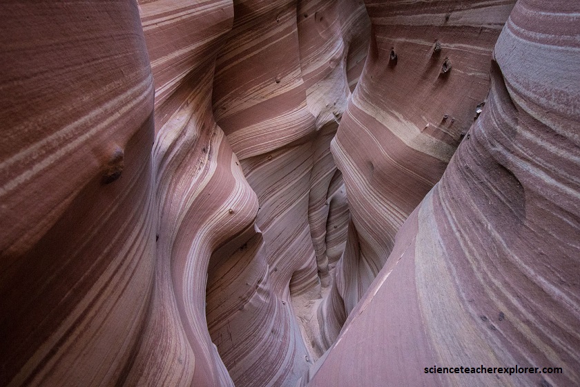
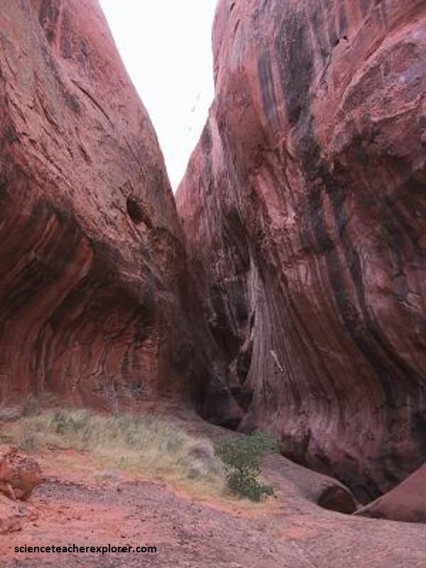
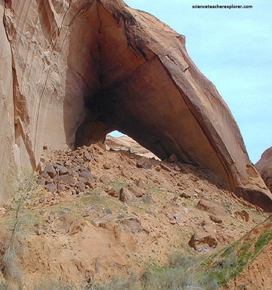
North of the Tunnel, in the shallow drainage, was a very interesting sandstone formation that made for some interesting pictures. We had to stop there to deal with an emergency-issue with one of the advisors and his heart medication. Pictured below, notice the appearance of large red wave-like structure flowing up the side of the white sandstone.
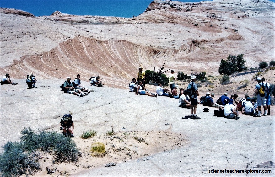
The range of colors of the Navajo Sandstone –red, brown, pink, salmon and white—results from varying amounts and forms of iron oxide (rust) within the rock, and in the case of the white upper portion of the Navajo, the overall lack of iron.
The discoloration or “whitening” of the rock occurs after lithification. The subsequent loss of color is caused by fluid interaction that either dissolves the cementing minerals out from between the sand grains, leaving the sandstone very friable, or reduces the cementing minerals (chiefly iron through chemical reactions that change the oxidation state). {Notice how the red sandstone seems to be slightly more erosionally resistant}.
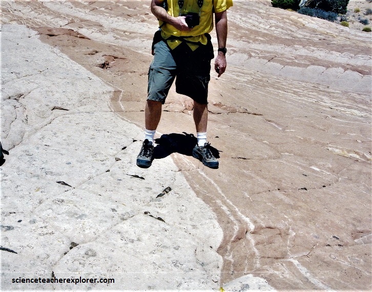
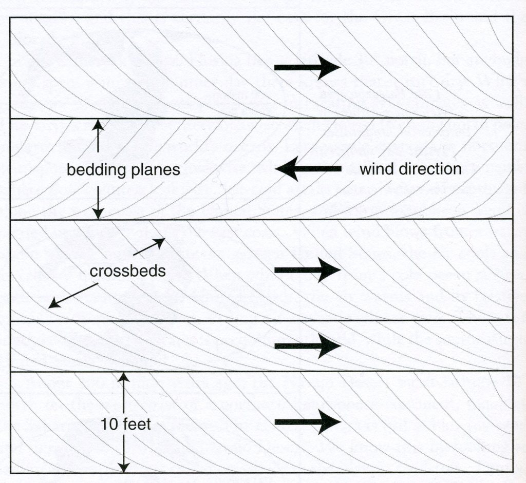
The Navajo Sandstone is formed from ancient sand dunes that lithified over time. Pictured above, cross-bedding is created through the migration of sand dunes. With cross-bedding, the inclined laminations are deposited at the same angle as the migrating face of the dune. This process was repeated several times in order to create the strata featured above.
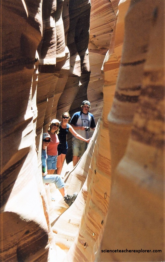
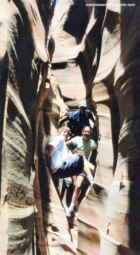
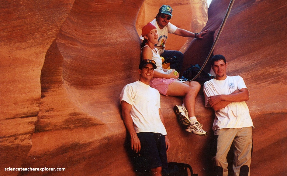
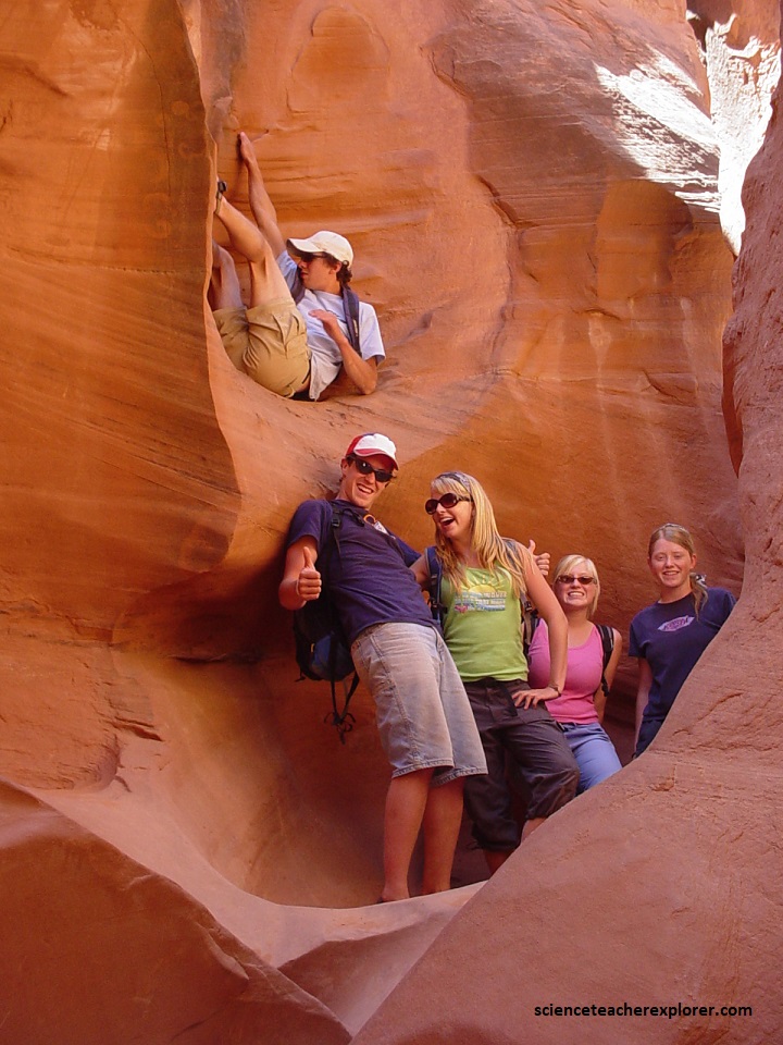
Just east of the top of, (1 km), “Tunnel Canyon”, we entered the lower part of Zebra Canyon. In the lower end of Zebra is one colorful slot. It cuts through pinkish striped Navajo Sandstone, for which it is named.
Zebra slot is only about 100 meters long, and we entered from the top, after crossing some deep potholes.
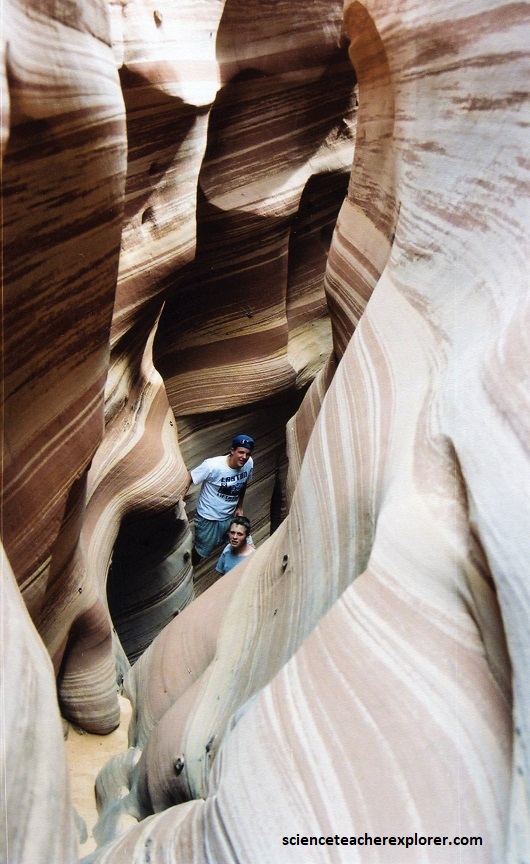
But how does Zebra Slot get its stunning coloring and bands? The answer is iron oxidization and slow sand depositing. Sandstone is made primarily from quartz surrounded by iron oxides. The more iron oxides are present, the more red or pink color in the sand – as it quite literally rusts.
Pictured above, the sandstones with a laminated structure are common building materials. Lamination is macroscopically expressed as color and grain size variations observed both in the deposit and within individual beds; therefore, the properties of such sandstones are diverse depending on the spatial distribution of the binding mass and framework components.
Pictured above, the sandstones with a laminated structure are common building materials. Lamination is macroscopically expressed as color and grain size variations observed both in the deposit and within individual beds; therefore, the properties of such sandstones are diverse depending on the spatial distribution of the binding mass and framework components.
For the terrestrial sandstones of different genesis, four types of laminae have been distinguished based on petrographic studies. They have a siliceous binder or a mixed ferruginous (iron)–siliceous–argillaceous binder with different proportions of these components.
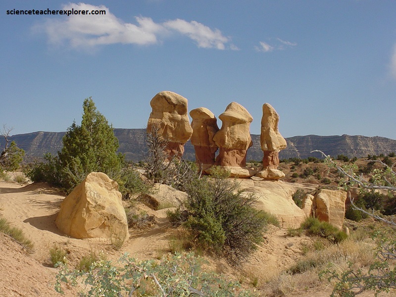
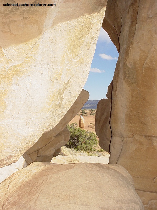
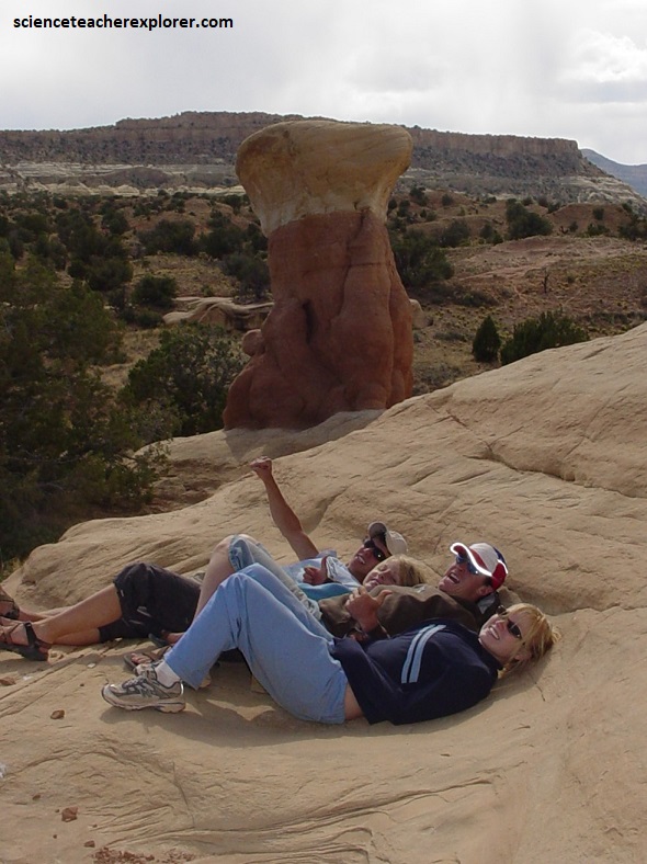
In 2006, I led another educational expedition to the Devil’s Garden, (19 km south of Hwy 12) just west of the Hole-in-the-Rock Road. At Devils Garden, Mother Nature has sculpted the Entrada Sandstone into goblins, stone babies, monuments, and delicate arches to delight the beholder
(pictured above and below). In the background, The Straight Cliffs Formation of the Kaiparowits Plateau to the west of the Devils Garden were formed during the more recent Cretaceous period.
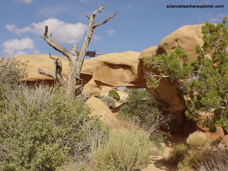
The features at Devil’s Garden are formed along the contact of the Gunsight Butte and Cannonville Members of the Entrada Sandstone. The natural arches and other formations were created, and continue to be shaped, by the natural processes of weathering and erosion.
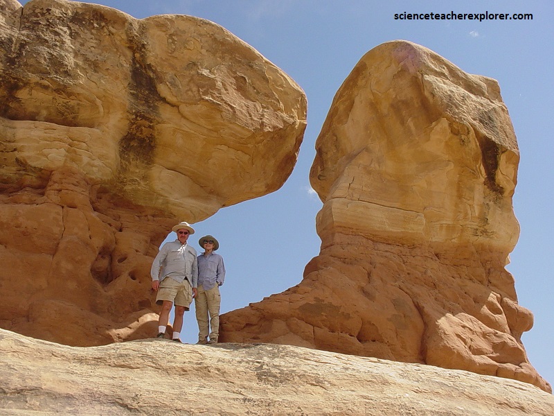
Pictured above, some of the rock layers are composed of a harder caprock material which resists the effects of weathering and erosion. Those caprock layers will remain intact much longer than other less resistant layers which weather and erode away below and around them leaving behind the current arches and hoodoos. Cycles of heat and cold, precipitation, ice, wind and gravity all play a part in the creation of the formations.
Daily extreme temperature variations create fractures by repeated expansion and contraction of the rock in a process called thermal stress weathering. The thermal stresses can cause deep cracks that split the rock into separate pieces in an erosional process called thermal exfoliation. Precipitation causes dissolution of the fine crystalline grains that bind the larger particles together, which is known as chemical weathering. Freezing water expands in fractures making them wider and deeper in a process called frost weathering. Gravity exerts a constant downward force that creates new fractures and separates the formations along existing fractures in a process called stress relief exfoliation. High speed winds remove any loose grains from the formations and wind-borne particulates sandblast the surfaces making them smoother.
My 2002 expedition, also explored the spectacular “Golden Cathedral” within Neon Canyon, off of the Escalante River. The “Golden Cathedral” is accessed off of Egypt Bench through Fence Canyon. The Egypt Bench access road is 26 km down Hole-in-the-Rock road from Hwy 12. This access road heads northwest for about 16 kms and stops at the Egypt Bench Trailhead.
In 2001, I explored the Egypt 3 Slot Canyon with a small group of trekking buddies, (an ex-student and a married couple). Egypt 3 Slot is located between Egypt Bench and Twenty-five Mile Wash. The Egypt Bench access road is 26 km down Hole-in-the-Rock road from Hwy 12. This access road heads northwest for about 16 kms and stops at the Egypt Bench Trailhead. From there we hiked down 1.5 km into the Egypt 3 Slot Canyon.
Egypt 3 was a bit technical within the Navajo Sandstone. It required some canyoneering skills to successfully get through it. There were two small potholes and one major potholes to overcome before we was able to return. More importantly, there was a 7 meter rappel after one of the potholes. An ascension climbing-devise was necessary to get over one of the small potholes and a rope-straddle was needed for the other.
The headwaters of the Escalante River are located on the slopes of the Aquarius Plateau, in Utah’s Garfield County, just west of the town of Escalante. The Escalante River begins at the confluence of Birch Creek and North Creek, with the flow of Pine Creek added just below the town. The river runs a total distance of 130 km from the Birch/North Creek confluence before emptying into the Colorado River in Kane County. The lower section of the river, just east of the Hole-in-the-Rock road, reaches the surface of Lake Powell.
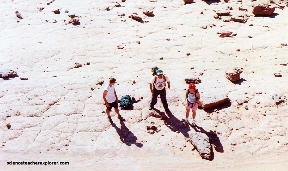
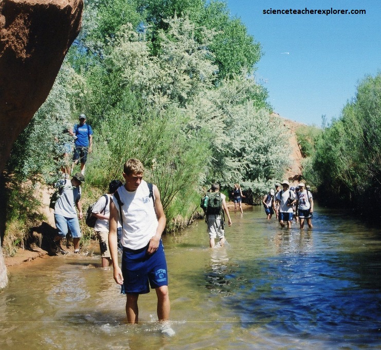
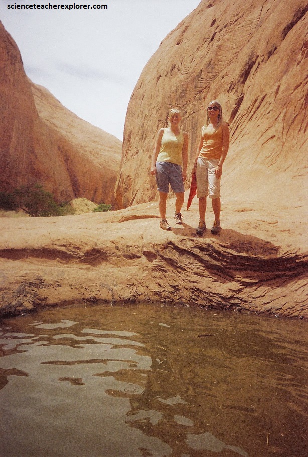
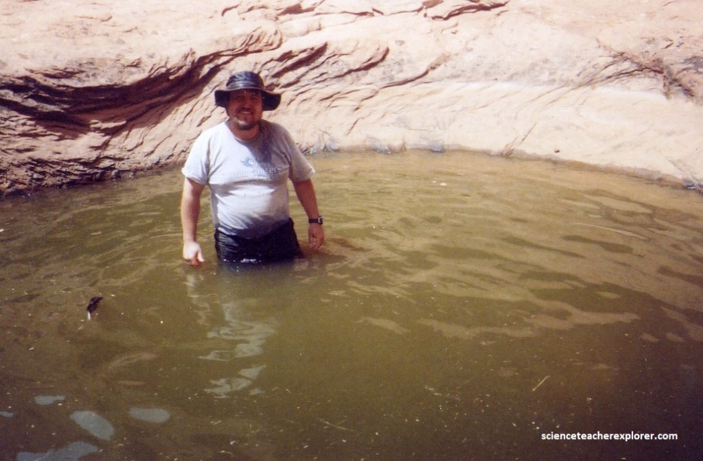
Pictured above, numerous side canyons also feed the main river, accounting for the large size of the basin. From the west, the major tributaries are Harris Wash, Twentyfive Mile Creek (the one I’m in above), Coyote Gulch, Forty-mile Gulch, and Fiftymile Creek, along with the smaller Phipps, Fence, and Scorpion, Davis, Clear, and Indian Creeks. Most of these larger creeks flow from the top of the Kaiparowits Plateau or from the base of its eastern edge, the Straight Cliffs.
An even greater number of tributaries flow in from the north and east, including Death Hollow and Calf Creeks, the combined Boulder and Deer Creeks, The Gulch, Wolverine and Silver Falls Creeks, and Choprock, Moody, Stevens, and Cow Canyons. Streams from the north flow from Boulder Mountain, while those from the northeast originate in the Circle Cliffs area, near the Waterpocket Fold in Capitol Reef National Park.
The “Canyons of the Excalante” is a collective name for the erosional landforms created by the Escalante River and its tributaries. These sandstone features include high vertical canyon walls, numerous slot canyons (like Egypt 3), water-pockets (sandstone depressions containing temporary rainwater deposits), domes, hoodoos, natural arches and bridges.
My 2002 educational-expedition, also explored the spectacular “Golden Cathedral” within Neon Canyon, off of the Escalante River. The “Golden Cathedral” was also accessed off of Egypt Bench through Fence Canyon. We returned to the same parking lot as we did in the 2001 Egypt 3 Trek.
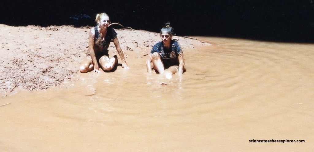
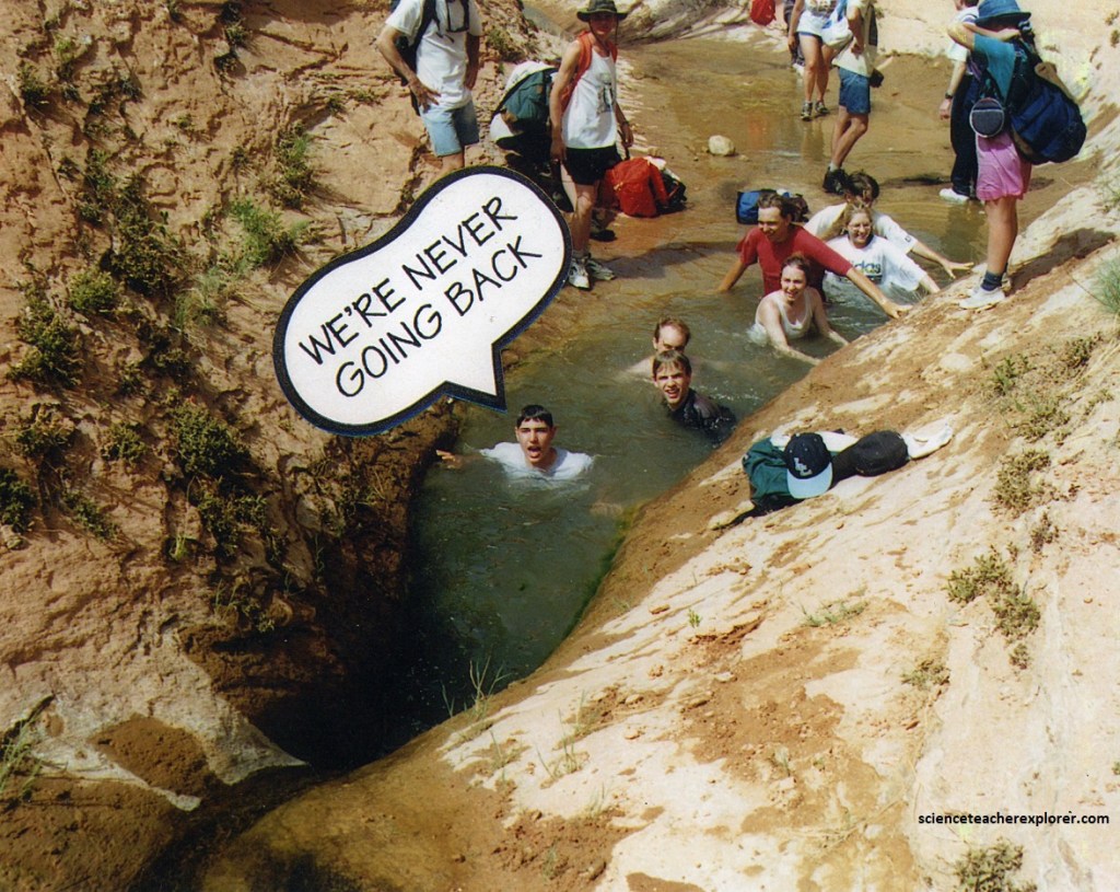
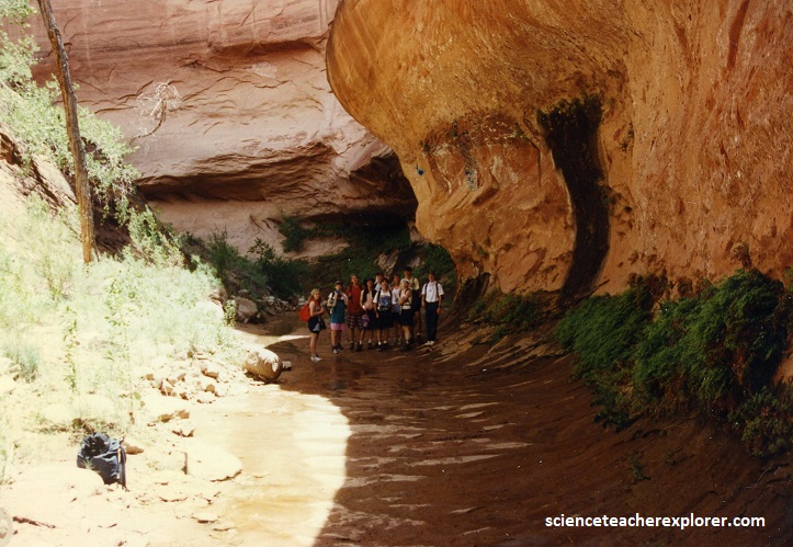
Pictured above, from the Egypt Bench Trailhead parking-lot, we descended into Fence Canyon and onto the Escalante River. Pictured below, the students decided to take a dip in the river.
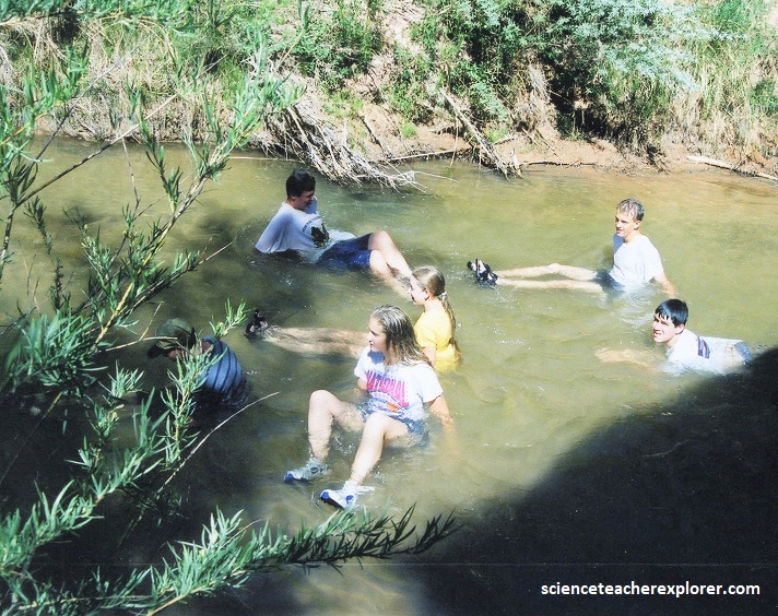
Wading south in the Escalante River for 1.3 km, we came across the mouth of Neon Canyon, heading east, (pictured below). For most of the year, the Escalante River is a small stream, easily stepped across or waded. During spring runoff and the summer monsoon, however, the river can become a raging, muddy torrent ten to one hundred times bigger. In some years, the river can be run using kayaks or canoes.
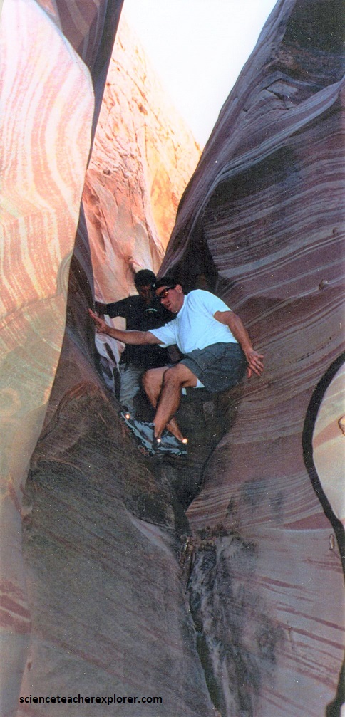
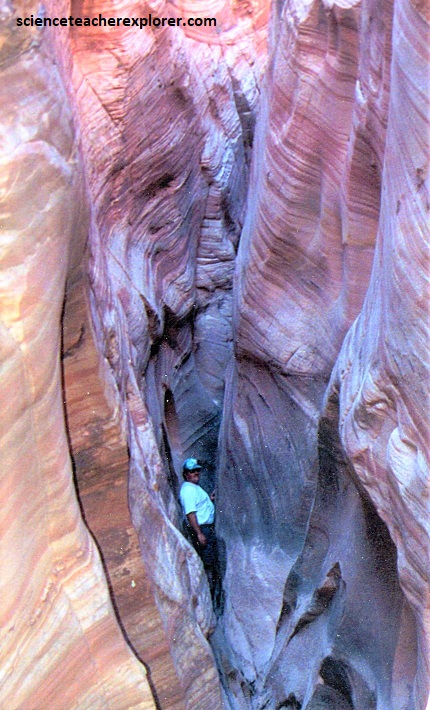
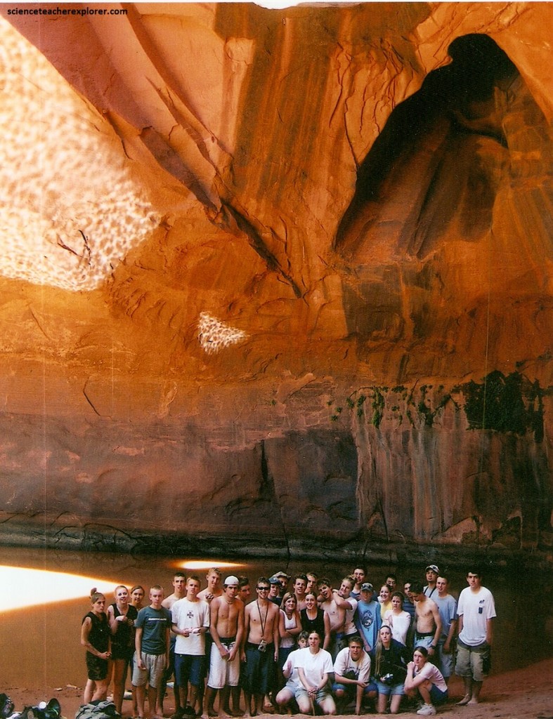
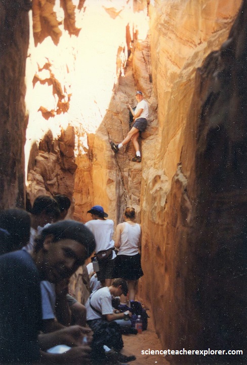
Much of the Escalante River’s course is through sinuous sandstone gorges. The river and the rugged canyons which drain into it form a key section of Grand Staircase-Escalante National Monument. Our group turned into Neon Canyon (east) to view the magnificent Golden Cathedral (pictured below). I climbed above, (with a few of my adult-advisors) Neon Canyon to make a grand entrance by rappelling off the Golden Cathedral into the pool.
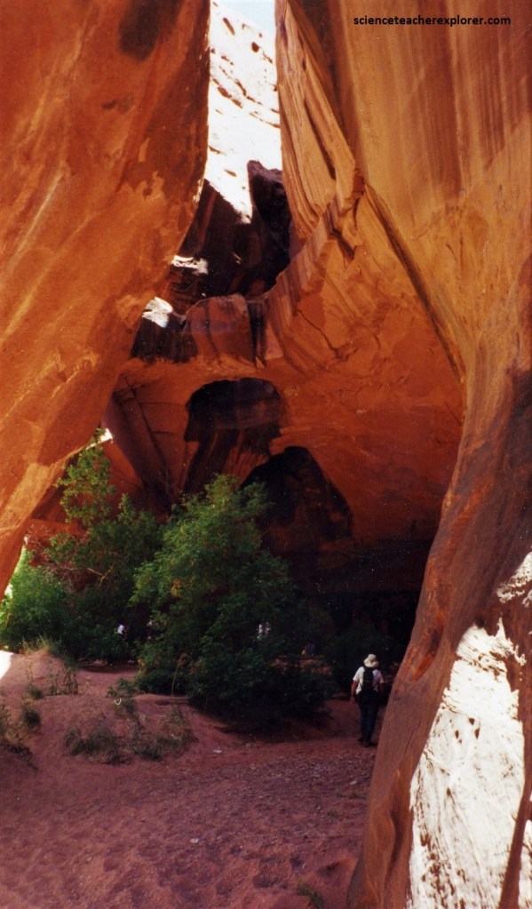
Pictured below, the “Golden Cathedral” is a dry fall with a couple of bridges. These collapsed potholes, since they were formed by water, are technically natural bridges and not arches. The pool can be very cold as well. Rappelling down through the collapsed potholes was something that I decided to do, which we reached from hiking down the upper part of Neon Canyon. It requires technical canyoneering skills.
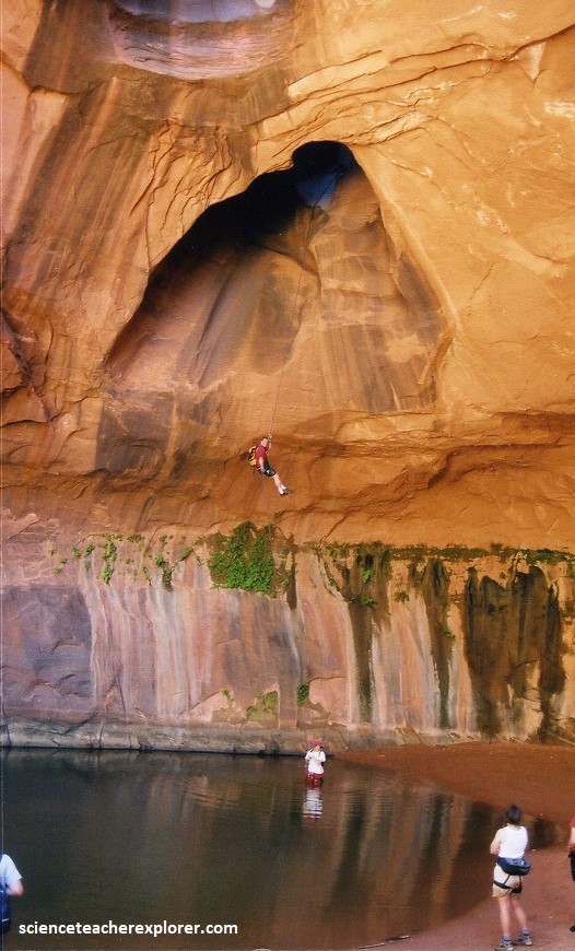
To rappel the Golden Cathedral, we needed one 50 meter rope and several short ropes of 15 meters to be use to get down into the tight slot above. Additionally, we took some webbing, a bolt kit and rappelling gear for each person, (three of us).
Pictured below, the sun rays reflected off the water to dance along the canyon walls as my student group played in the water for the day. We were there long enough to enjoy watching the reflection dance across the entire canyon wall.
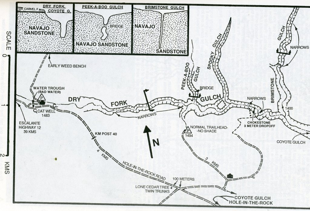
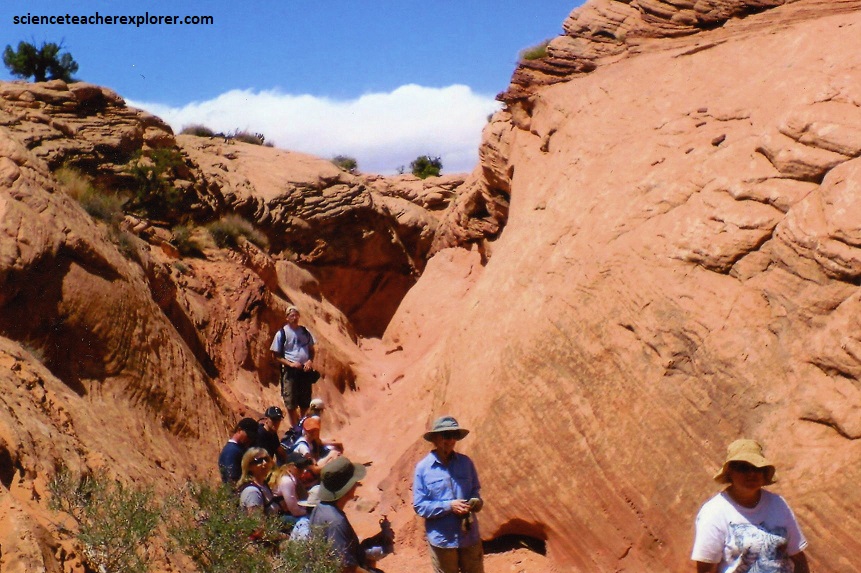
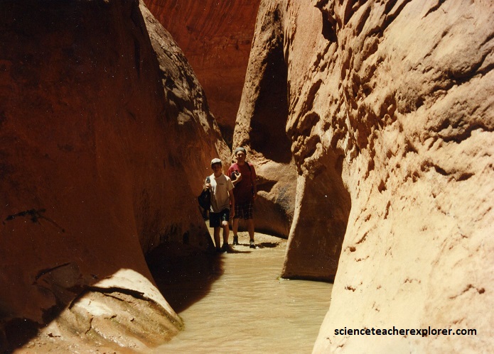
In 1996 & 2006, I led another expedition into Dry Fork Gulch to explore “Peek-a-boo and Spooky” side-gulches. These short slot canyons are part of Dry Fork of Coyote Gulch. To approach these canyons we had to drive down Hole-in-the-Rock road for 43 km, where we turned left onto the bench between Coyote Gulch and Hurricane Wash. We had to turn left again after a hundred meters and drive another 3 km to approach the trailhead, (imaged below).
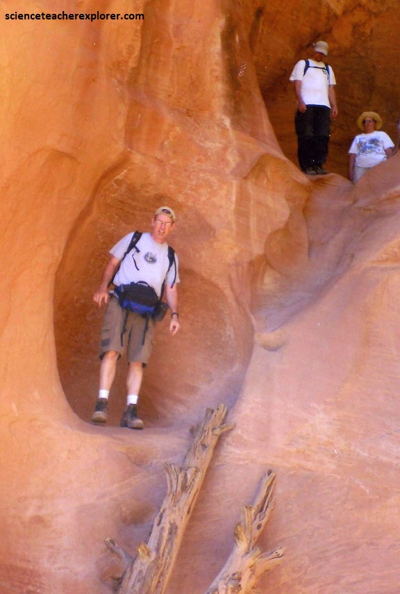
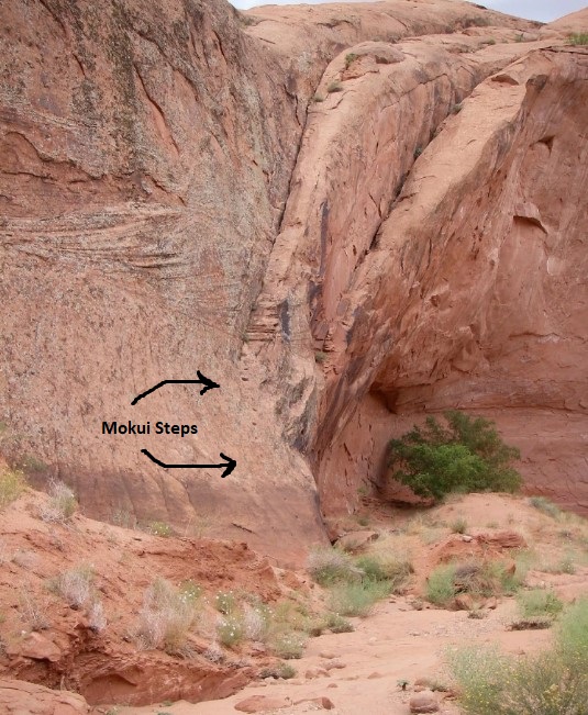
Pictured below, about 150 meters down-canyon from the parking lot, where ew reached the bottom is the beginning of “Peek-a-boo” Gulch. There were some “moki steps” cut in the rock and a log-placed, got us into the lower end.
Near the end of the Cretaceous period, about 80 million years ago, the entire western section of North America entered an era of uplift and mountain-building, an event known as the Laramide orogeny. More recently, additional uplift formed the Colorado Plateau province. These episodes of uplift raised the Aquarius Plateau to the extent that erosional solid forces were acting on the Escalante River Basin. Wetter climates during the recent ice ages of the Pleistocene period contributed to the deep cutting of the canyon walls.
Sandstone exposed in canyons nearer to the Colorado River is typically from the Glen Canyon Group. The dark red cliffs of Coyote & Dry Gulch, for example, are composed of Navajo Sandstone.
The Glen Canyon Group of rocks, which consist of the Wingate Sandstone, Kayenta Formation, and Navajo Sandstone, are relatively hard and so the tributaries of the Escalante River have cut deep canyons like the Dry and Coyote Gulch.
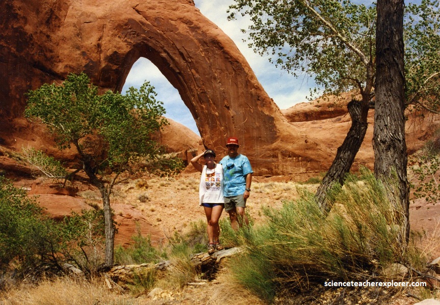
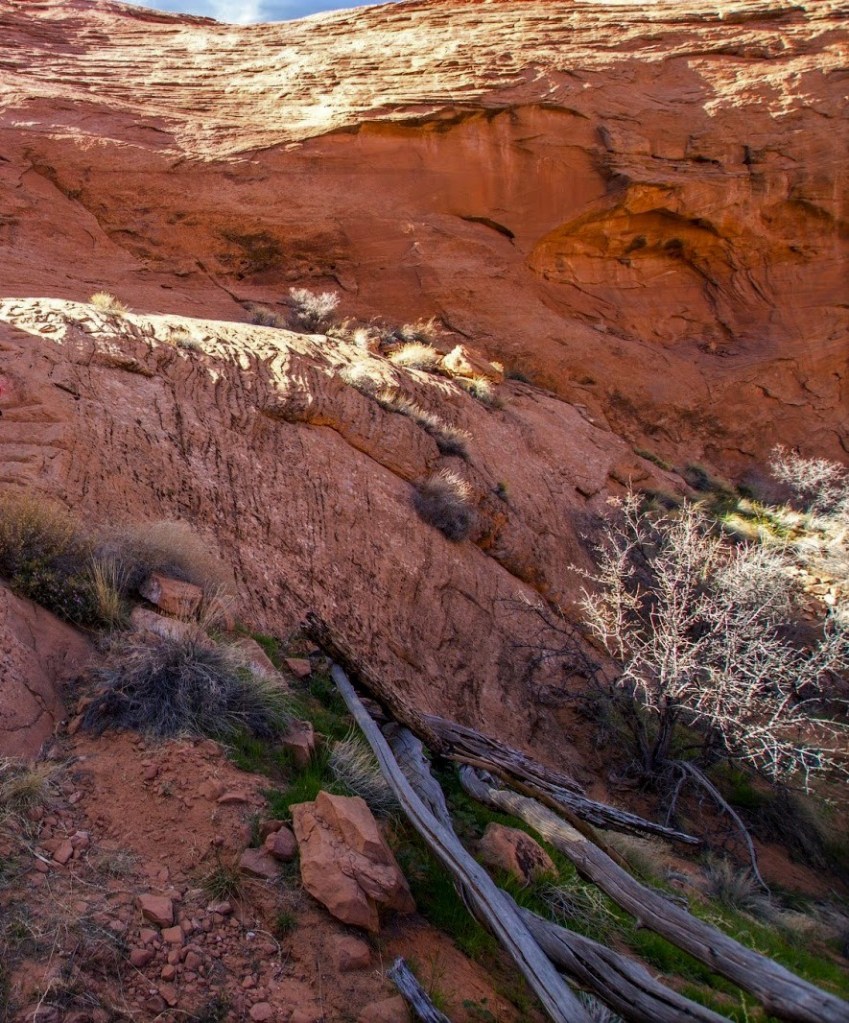
Locally meanders have been entrenched into the harder rock. The stream may locally be able to erode across loops in the meanders to form rincons after entrenching has taken place, adding interest to the canyons. Locally, natural arches and bridges are encountered in the canyons, (pictured below).
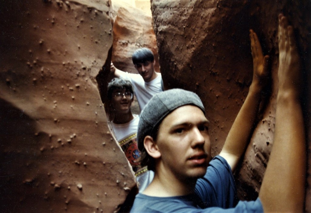
Pictured below, my groups were able to climb all the way up and exit Peek-a-boo Slot. From there we were able to climb over the bench to the east and enter into the upper end of Spooky Slot.
Pictured below, not far after we entered Spooky, we had to remove our day packs and walk side-ways for most of it’s length. This is a really, really narrow slot.
Pictured above, the Navajo sandstone in this canyon seemed to consist of tiny-little concretions embedded in it’s matrix. Concretions are masses of mineral matter embedded within the rock layers, including this sandstone. They often take shape when minerals precipitating (settling) out of water collect around a nucleus, such as a pebble. Additionally, there seem to be an infestation of spiders in this slot during our 1996 expedition (pictured below).
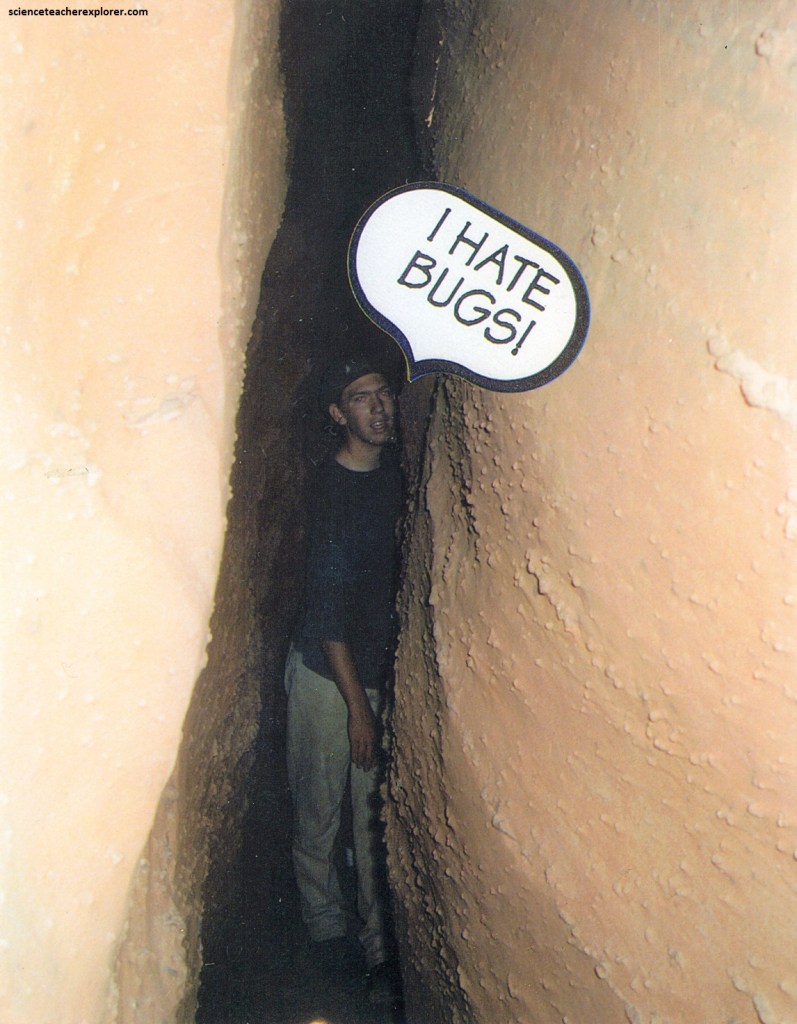
Pictured above, this slot was the narrowest, darkest and coolest slot that I encountered over the years. I was a little too big to fit through standing up, so I ended up crawling the distance. It was slightly wider at the foot level, by a few centimeters.
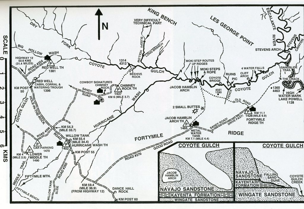
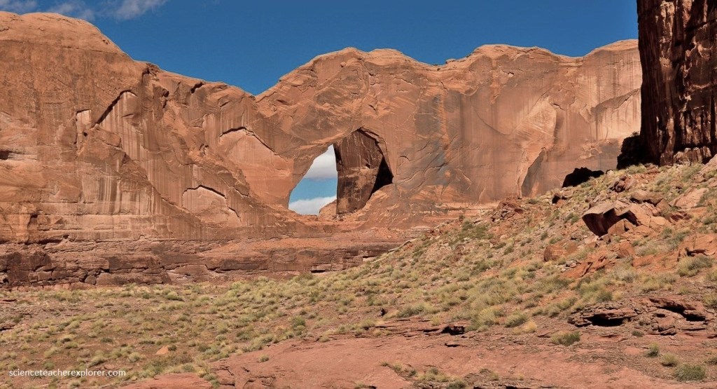
In 1992, I explored Coyote Gulch alone. I drove 57 km down Hole-in-the-Rock road and turned left on a signed dirt-road leading northeast along Forty-mile Ridge. This was the road to Jacob Hamblin Arch Trailhead and a metal tank at 1450 meters. From the metal tank, I walked due north until I reached the canyon overlooking the Jacob Hamblin Arch. I then headed down the slickrock ridge running down to the north just east of the arch. It was a little steep, but I had no problem making it to the bottom. From the bottom I headed east down the canyon. The sandy streambed of Coyote Gulch, typically just a few centimeters deep and provided a path for wading through the trees and vegetation lining the bottom of the canyon. The Jacob Hamblin Arch seemed large enough to reach under an overhang on the opposite side of the canyon.
Pictured below, further downstream within the canyon is Coyote Natural Bridge, a small hole carved in a large sandstone fin. The Navajo Sandstone is an easily recognized and prominent unit in Grand Staircase-Escalante National Monument and the Escalante Canyons Section. It generally forms bare-rock outcrops with high-angle cross-beds and is 367 to 433 meters thick in the Escalante Canyons section. It generally thickens from east to west towards the Circle Cliffs.
The Navajo is a light-colored, fine- to medium grained, massive sandstone. As mentioned above, it displays an elaborate array of high-angle cross-beds and forms cliffs, domes, monuments, and other bizarre erosional forms. The light coloration of the Navajo has been described with almost every color; white, tan, buff, salmon, pink, vermilion, brown, red, yellow, cream, orange, and gray. Hematitic (iron oxide) cement produces the red colors, limonite the yellows, and ferrous iron minerals the browns and local greens. Most of the grains are sub-rounded to well rounded, well sorted, frosted, and quartzose. Much of the Navajo is lightly cemented and friable, producing sand at the bottom of gulches like Coyote Gulch. Below the Navajo Sandstone and older is the Keyenta Formation. Here in Coyote Gulch, the Keyenta Formation intertongues with the
Navajo Sandstone and seen below Stevens Arch, (pictured below). The environment of deposition of the Kayenta Formation is dominantly fluvial, (unlike the eolian Navajo Fm.), but lacustrine and eolian beds are interbedded, notably in the upper part of the unit. In the photo below, I’m standing on the Wingate Sandstone.
At the lower end of Coyote Gulch, and about 0.5 km before the Escalante River, I took a picture of Stevens Arch and headed out of the canyon towards the south, up a big sand slide. The trail lead up to the top of the Navajo Sandstone and a crack in the wall. From the top, I walked southwest along a cairned slickrock & sandy track in the direction of Forty -mile Ridge Trailhead, (where my truck was parked). This made a great one day loop-hike.
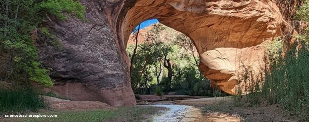
In 1996, I led another educational-expedition of students and leaders into Forty-Mile Gulch. Forty-Mile Gulch and Willow Creek are two canyons located in the lower end of the Escalante River drainage. Access to these canyons are found 62 km on Hole-in-the-Rock road from Hwy. 12. There, my group hiked down Carcass Wash, (east), and Forty-Mile Gulch to the confluence of Willow Creek. Then we hiked up Willow Creek to Sooner Gulch where we met with our vehicles on Hole-in-the-Rock road.
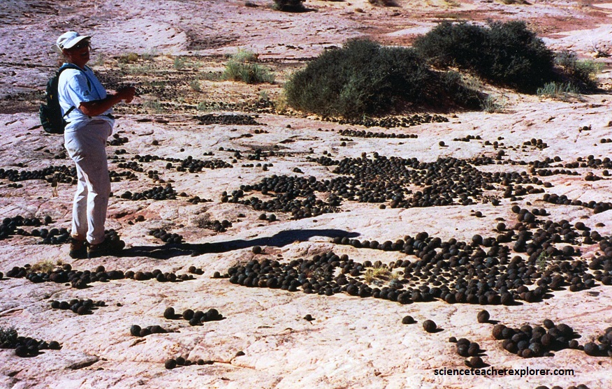
Pictured below, Moqui marbles are particularly common in the Navajo Sandstone. It is believed that these ironstone concretions formed near the water table during deposition as iron-froth-coated air bubbles in water-saturated sand. Moqui marbles are abundant in the Forty-Mile Gulch area in the Escalante Canyons section of the monument.
Forty-Mile Gulch slowly gets deeper and more entrenched in the Navajo Sandstone. About halfway down, water begins to flow year around. After another 2 km, we came to a waterfall, (pictured below).
A Sahara-like desert extended across what is now the Southwestern US, including the Escalante region, beginning during the Jurassic roughly 200 million years ago. It was a time of extremely hot, dry, and windy weather. The combination of arid conditions, strong winds, and an abundant supply of sand created an enormous desert of sand-dunes. Over the eons of being blown around this Jurassic desert, the sand grains became rounded, frosted, and of roughly the same fine-grained sizes. The Navajo Sandstone formed when the particles were slowly cemented together by silica (silicon dioxide or iron oxide) and other minerals that moved through the sediments in groundwater.
Pictured above, Forty-Mile Gulch gets very narrow within the Navajo Sandstone, below the falls. Until about 190 million years ago, the largest of these deserts was the environment where the Navajo Sandstone formation developed. A few tens of millions of years later, another enormous sand sea rolled across the Southwest, creating the Entrada Formation.
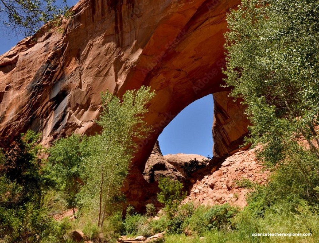
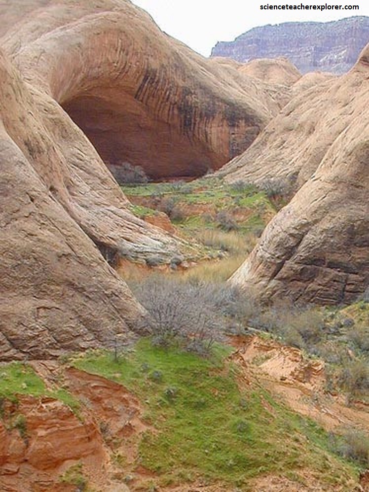
Sedimentary rocks from those long-ago deserts hold many clues about the environmental conditions of the time. The unstable dune fields were largely devoid of life, but around the margins of the dunes, dinosaurs once wandered. Today, occasional sandy hollows where cactus have gained a foothold interrupt the vast expanses of bare rock. At the junction of Willow Creek, our group turned upstream and after 1.5 km we came to Broken Bow Arch, (pictured below).
Pictured below, nearby Broken Bow Arch is a spring and a huge undercut for good camping. From there, up through Sooner Gulch to our vehicles waiting.
In 2006, I led a student/adult group for an educational adventure trip into Davis Gulch. This canyon is in the lower end of the Escalante drainage and very near the end of the Hole-in-the-Rock road. To access this canyon we had to drive south on this road 80 km from Hwy 12.
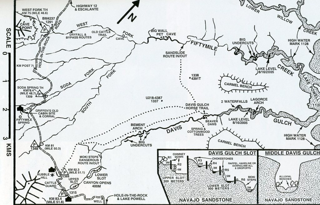
The best way into Davis Gulch is where it crosses the Hole-in-the-Rock road, beyond the northern toe of Fifty-Mile Point. From there, we walked down the main drainage. In about 200 meters, we entered the upper slot, which had 2 drop-offs created by choke-stones. After about another 200 meters of narrows, the canyon opened up for about 300 meters. Next came the lower slot.
Picture above, this one got very narrow in a place or two with 4 more drop-offs of 5 meters. After about 1 km, the canyon opened up and we hiked to the Davis Stock trail to return.
The boundary between the Escalante Canyons and Kaiparowits Basin sections of the monument is placed at the base of Fifty-Mile Mountain (Straight Cliffs).
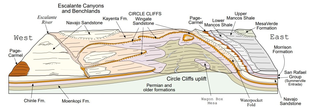
The dominant structural feature of the Escalante Canyons section is the Circle Cliffs uplift. It has a gentle southwest limb that extends from the Hole-in-the-Rock Road east-northeast to the axis of the uplift. The east limb of the uplift is the Waterpocket Fold, another steeply dipping monocline like the East Kaibab monocline. The Waterpocket Fold, however, is in Capitol Reef National Park. The core of the Circle Cliffs uplift is lined by the prominent vertical and magnificent red-brown or orange-brown cliffs of the Wingate Sandstone. These cliffs “circle” the uplift and are the basis for its name. The core of the uplift exposes Permian and Triassic rocks. The Escalante monocline is a north-northwest-trending feature north of the town of Escalante that dips to the west.
Davis Gulch is the last known place that Everett Ruess visited before he mysteriously disappeared in 1934. When the people started searching for Everett they came down the stock trails and found some of his gear and his donkeys right below the stock trail.
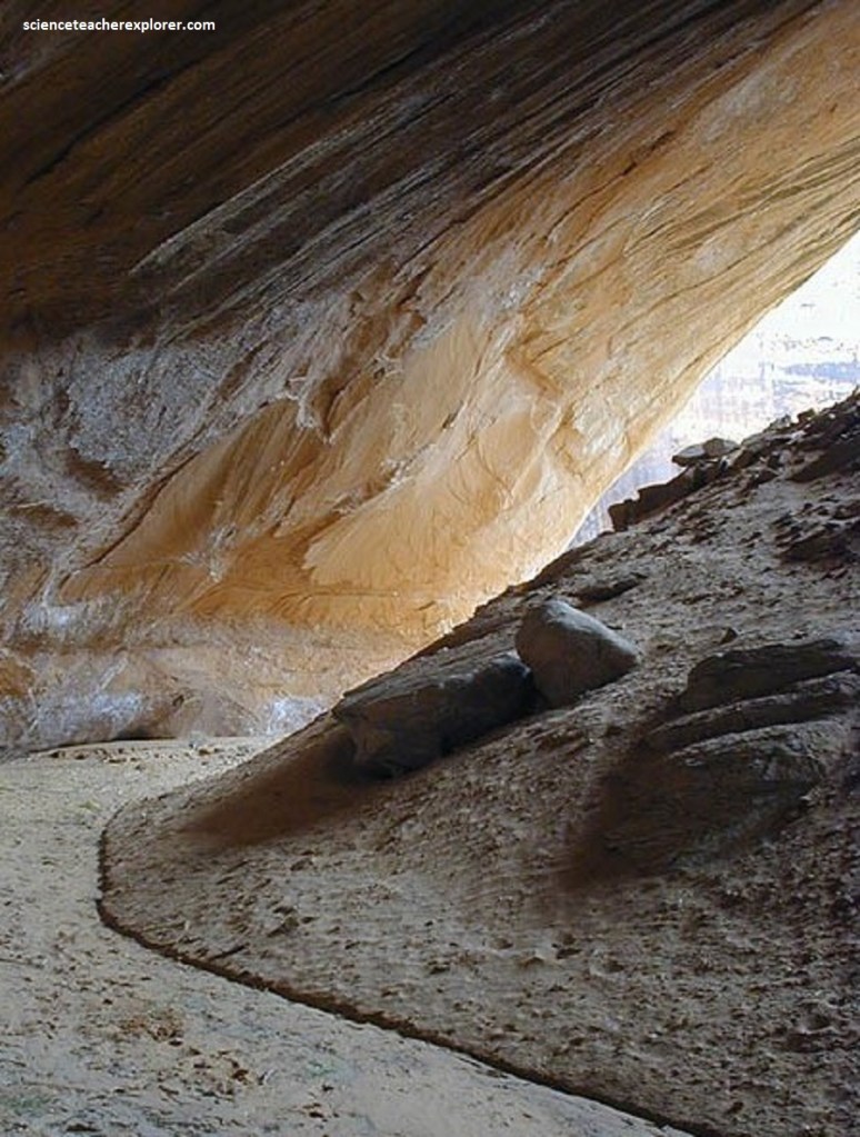
Pictured above, near the bottom of the Davis Gulch Slot, I found a technical way to get out of Davis Gulch. When I was on a reconnaissance trip to Davis Gulch in 2005, I took this route. It was very scary! I wouldn’t recommend it, unless your an expert climber. Further along, our group took a lunch at a 85 meter deep undercut and a year-round stream, (pictured below).
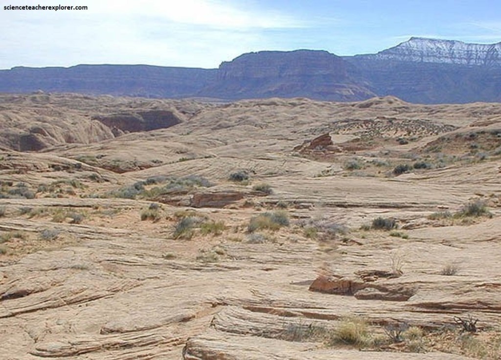
Hole in the Rock Road roughly parallels the edge of an impressive high plateau, a landform aptly named the Straight Cliffs, or Fiftymile Mountain. These steep cliffs are the eastern margin of the enormous Kaiparowits Plateau and formed by Jurassic and Cretaceous rocks. The youngest rocks are composed of sediments deposited along the western edge of the Interior Seaway, which extended through the middle of the North American continent until finally withdrawing about 68 million years ago. The sandbars and barrier islands built along a straight shoreline of this seaway happen to be quite resistant to erosion, and today they create the Straight Cliffs pictured above.
As our expedition group hiked down Davis Gulch, we periodically scared up a herd of Mule deer. How they got there was a curious question, since this canyon was surrounded by vast distances of tree-less slick-rock of the Navajo Sandstone. Of course the vegetation and water made a perfect oasis for these animals. Beaver dams were also common.
Pictured above, the Navajo Sandstone surrounds much of the region crossed by Hole in the Rock Road–an impressive 90 km of unpaved road that extends from just east of the town of Escalante southward to the Colorado River. This modern route closely follows a historic trail built in 1879 by the extraordinary efforts of a group of Mormon trailblazers. Instructed by their leaders to cross the Colorado River and establish new settlements in southeastern-most Utah, the rugged landscape posed serious challenges to the builders.
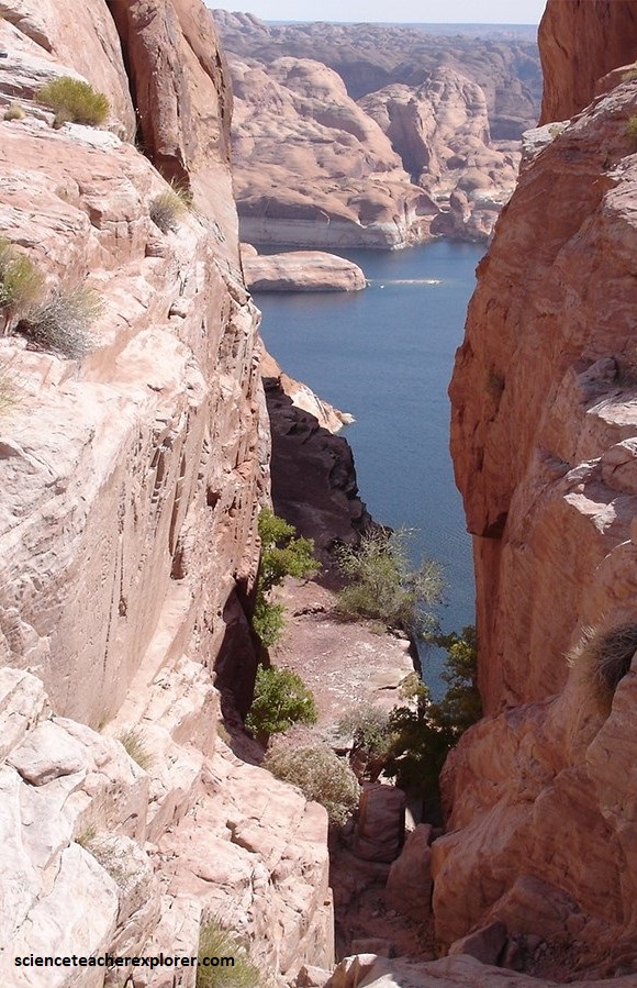
Pictured above, the pioneers, (originally from Parowan, Utah) successfully carved out a route, using a narrow crevice called Hole-in-the-Rock to drop down cliffs 365 m high to reach the Colorado River. By enlarging this natural crack with blasting powder and by chiseling anchor points for ropes into the rock, they managed to move 250 people, 83 wagons, and over 1000 head of livestock down the precipice to the river. A ferry carried the wagons across the water, where the rough route continued to a place now called Bluff, Utah. Today, Lake Powell has encroached on the river crossing that was used.
