Bisti Badlands, NM 2011
In October of 2011, Becky (my wife) and I explored and trekked the Bisti Badlands of northern New Mexico, near Chaco Canyon National Park.
Located in the arid desert of northwestern New Mexico, the Bisti Badlands (formally the Bisti/De-Na-Zin Wilderness) offer one of the closest approximations of an unknown alien world as can be found.
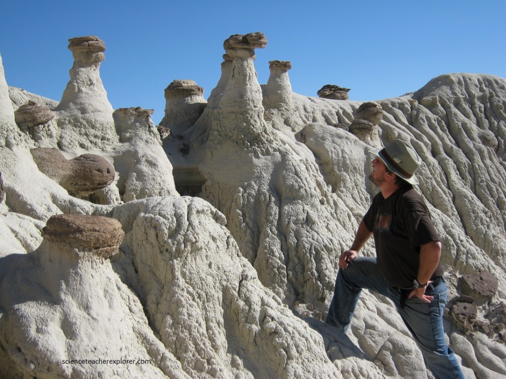
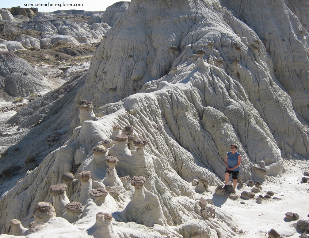
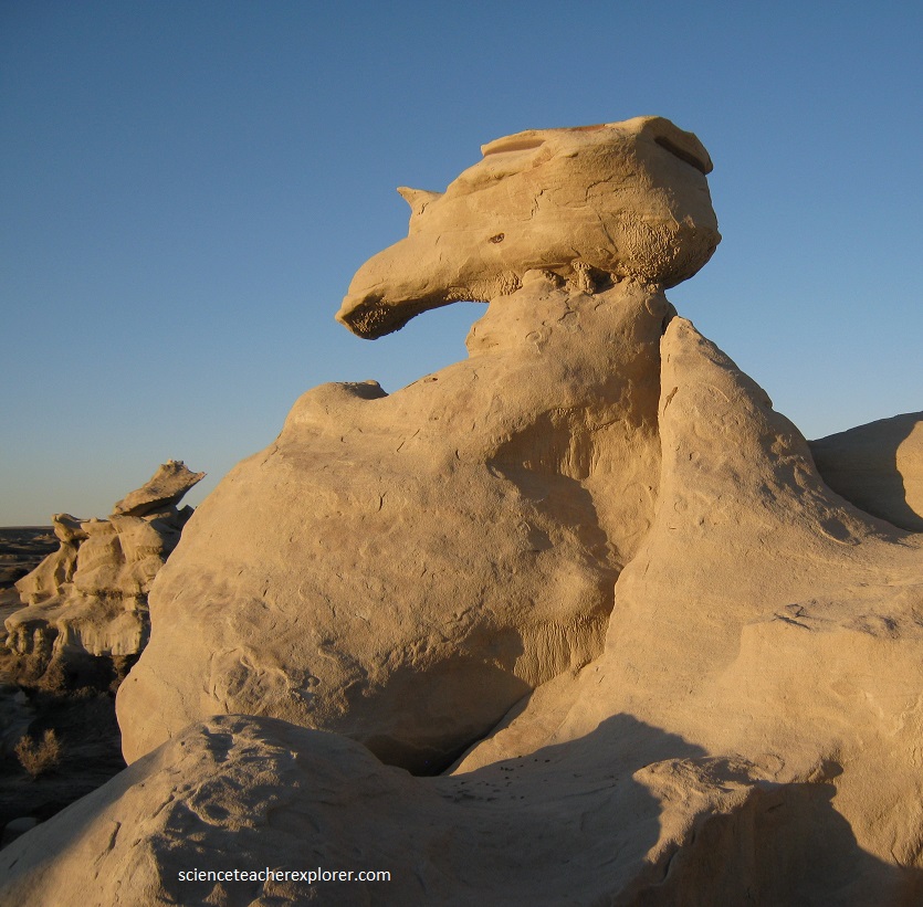
The strange rock formations and eroded landscape of the Bisti Badlands are hidden in the desert of northwestern New Mexico. The hills are made up of layers of sandstone, mud-stone, coal, and shale that have been eroded into a maze of mounds ravines, arches and hoodoos.
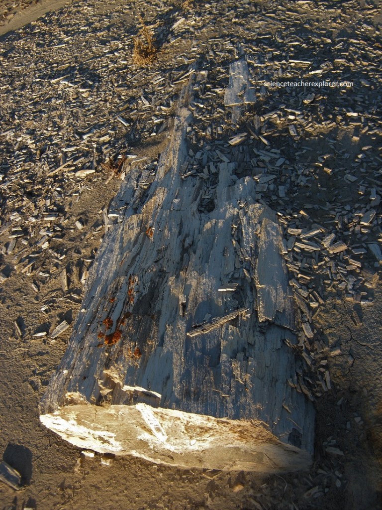
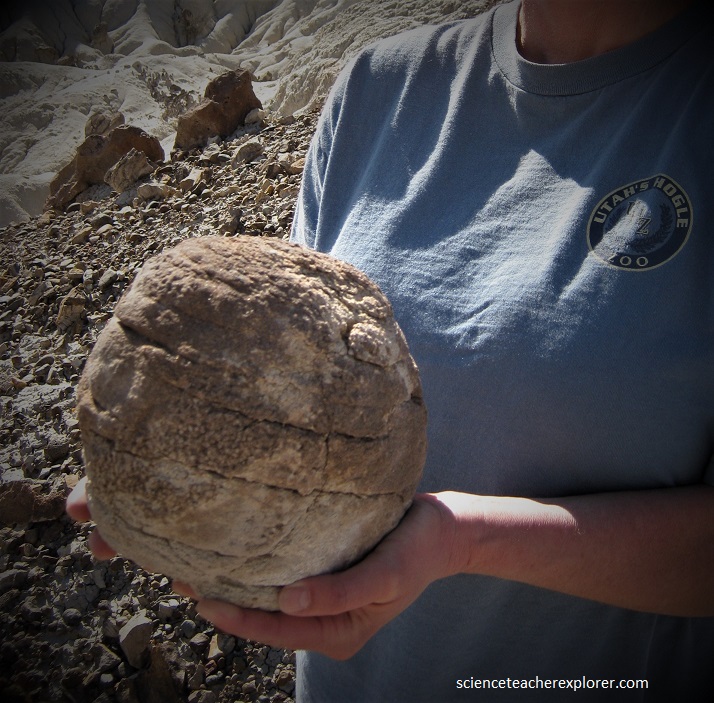
The area was once a riverine delta that lay just to the west of the shore of an ancient sea, the Western Interior Seaway, which covered much of New Mexico 70 million years ago, (of the late Cretaceous). The motion of water through and around the ancient river built up layers of sediment. Swamps and the occasional pond bordering the stream left behind large buildups of organic material, in the form of what became beds of lignite and tree stumps, (in the Fruitland Formation and the Kirtland Shale). The Bisti Beast (Bistahieversor sealeyi), a relative of Tyrannosaurus rex, was discovered in the Bisti Badlands and excavated in the 1990s. Other dinosaurs, excavated from these badland include Parasaurolophus, Pentaceratops, and Alamosaurus, a sauropod that was one of the largest animals to inhabit North America. Fossils of crocodiles, turtles, lizards, and fish, mammals, and plants are also present. Pictured below, large logs that were carried by powerful, fast-moving rivers and eventually buried in sediment are preserved.
At some point, a volcano deposited a large amount of ash, and the river moved the ash from its original locations. When the water disappeared it left behind a 430 m layer of jumbled sandstone, shale, mudstone, and coal that lay undisturbed for fifty million years.
Sandstone layers were deposited above the ash and remains part of the delta. The ancient sedimentary deposits were uplifted with the rest of the Colorado Plateau, starting about 25 million years ago. Six thousand years ago the last ice age receded, and the waters of the melting glaciers helped expose fossils and petrified wood, and eroded the rock into the hoodoos now visible.
Trekking into the Bisti Badlands, Becky and I descended from tawny sand and sage desert, into a world of gray, black, red and purple sands and rock.
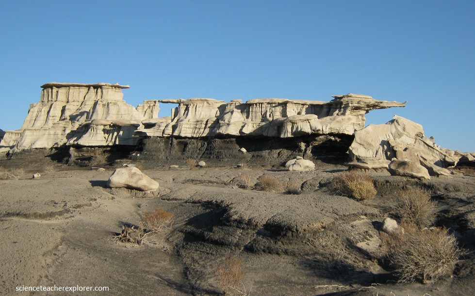
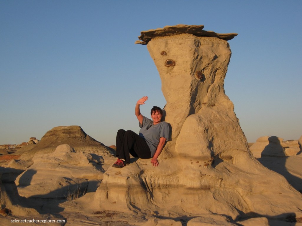
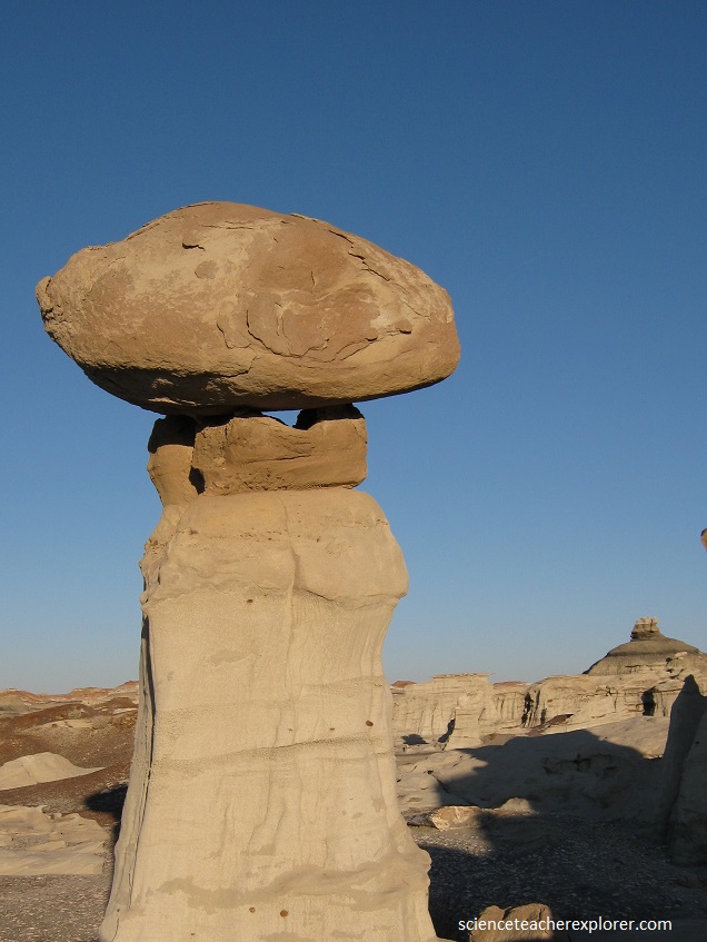
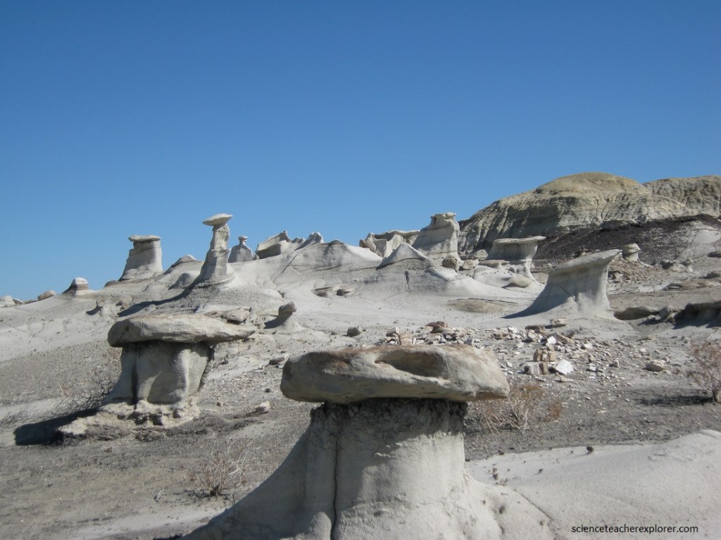
Ash erodes very quickly and does not hold water long. These two qualities make for poor growing conditions and explains the general lack of plant life. Anywhere that hard materials sit atop a layer of ash, hoodoos have eroded out of the matrix. While igneous protrusions might be a more common source of stone pillars and pedestals, in the Bisti Badlands, pillars and hoodoos exist solely because everything around and below them has been removed by wind and water, over time.

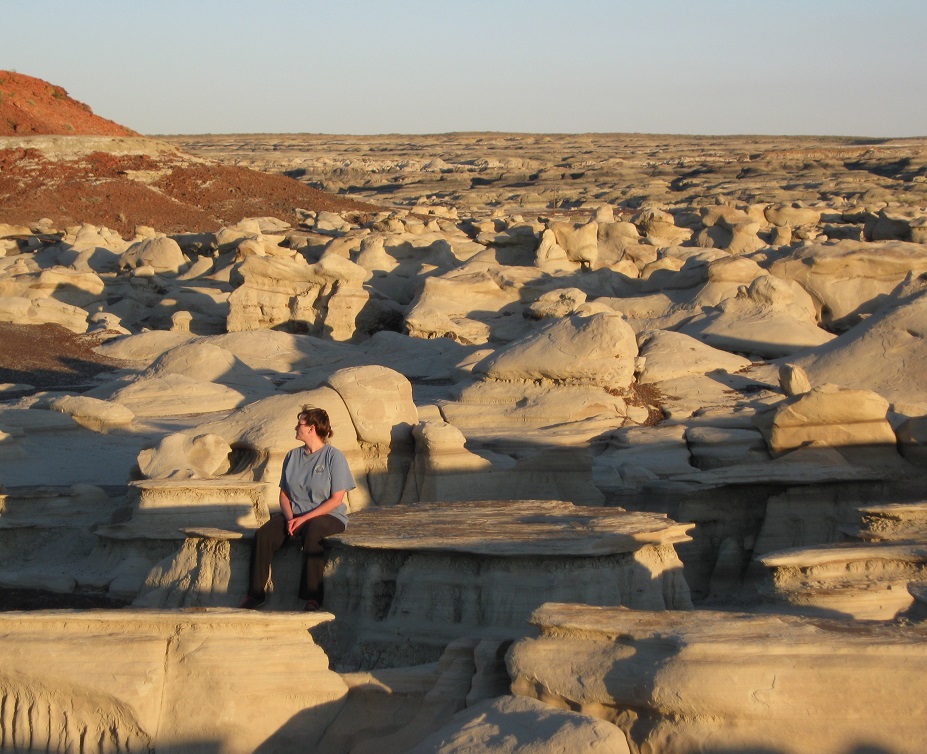
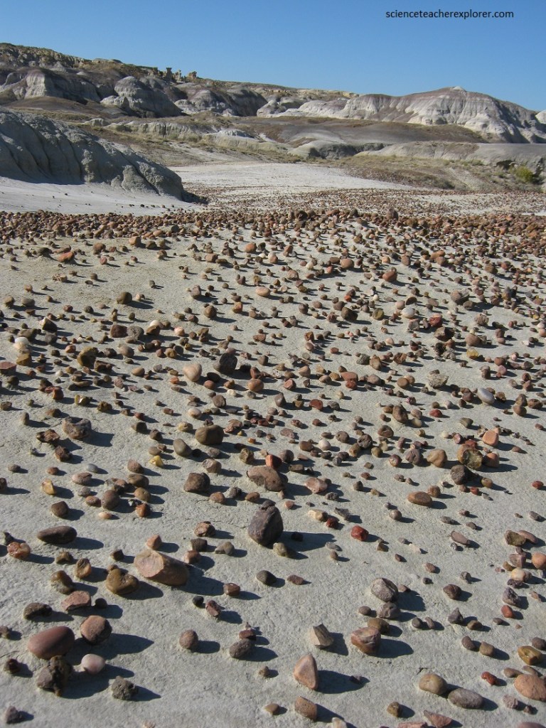
Sixteen kilometers farther east is the more remote De-Na-Zin Wilderness. There were no established trails, and we had to be careful when exploring the area because many of the rock features were easily damaged and unstable.
Petrified wood and the fossilized bones and teeth of a wide variety of animals can be found here also.
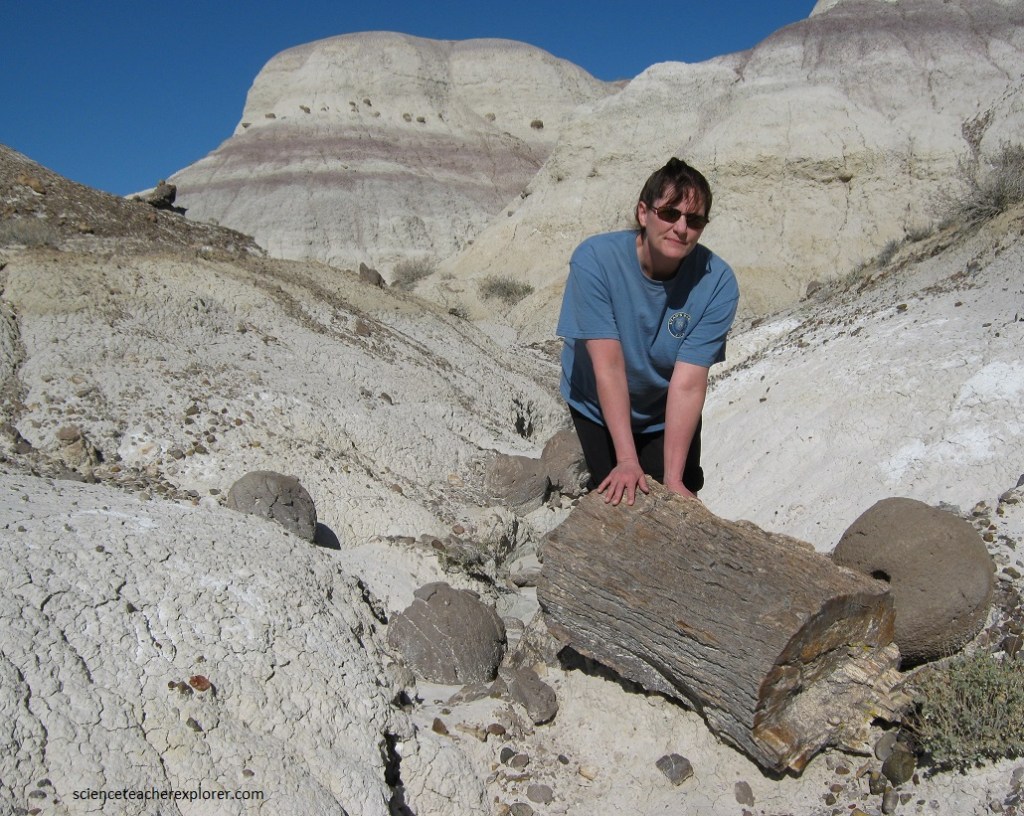
Lignite mounds coincide with most of the petrified wood and fossils found in the Wilderness. Generally, the organic remains are harder than lignite, so they weather out as the lignite erodes. The fossils in the wilderness preserve a record of freshwater life in and on the edge of the great delta at that time.
On the De-Na-Zin Wilderness, the exposed layers of shale coincide with the K/T boundary layer. It is one of the few pieces of public land in the world where the boundary layer is visibly exposed. De-Na-Zin is less ashy and more sandy than Bisti, making for fewer hoodoos and higher hills. The K/T boundary layer is the 65 million year old layer that the dinosaurs became extinct.

The high plains around the Wilderness are about 6,500 feet above sea level today. The badlands lie 200 to 400 feet below those surrounding plains. The highest points in the Bisti/De-Na-Zin Wilderness are always grassy.
Translated from the Navajo american native word Bisti meaning “among the adobe formations.” De-Na-Zin, from Navajo american native word that translates as “Standing Crane.” Petroglyphs of crane have been found south of the Wilderness.
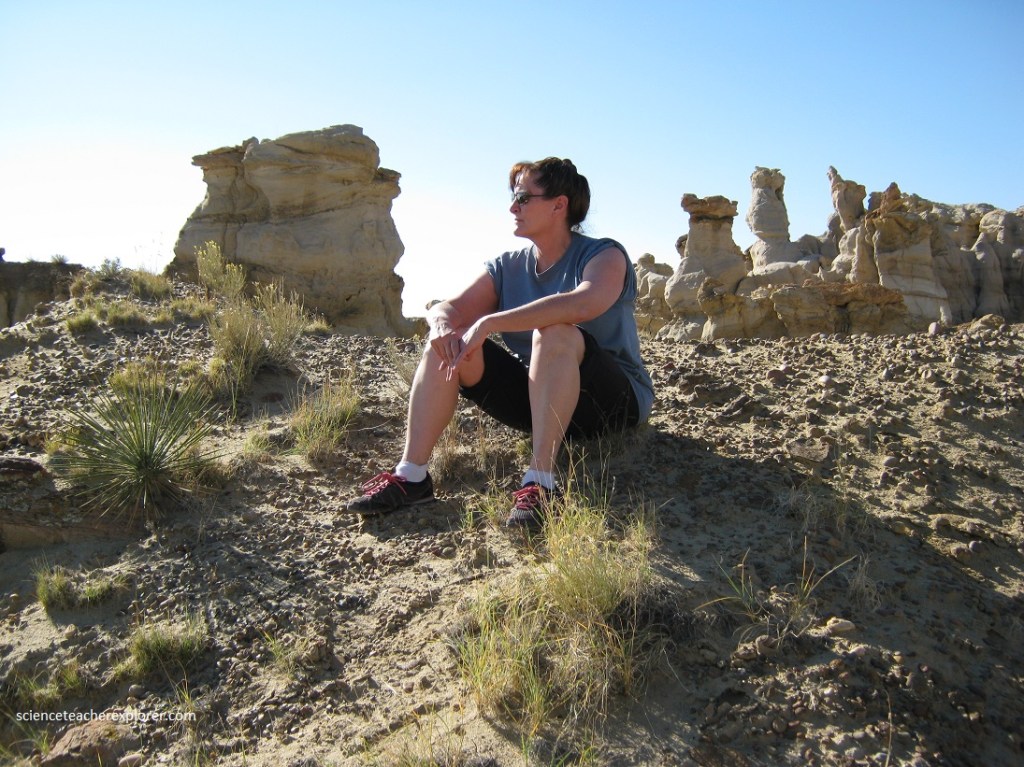
As Becky and I further explored the De-Na-Zin Wilderness, the blasted landscape was covered in strange, undulating fungal shapes made of the colorful sandstone and shale. Huge hoodoos (tall, thin rock spires) and small labyrinths of odd stone shapes had been created by eons of water and moisture wearing away at a softer layer of ash, creating improbable, top-heavy oddities.