House Range, Utah
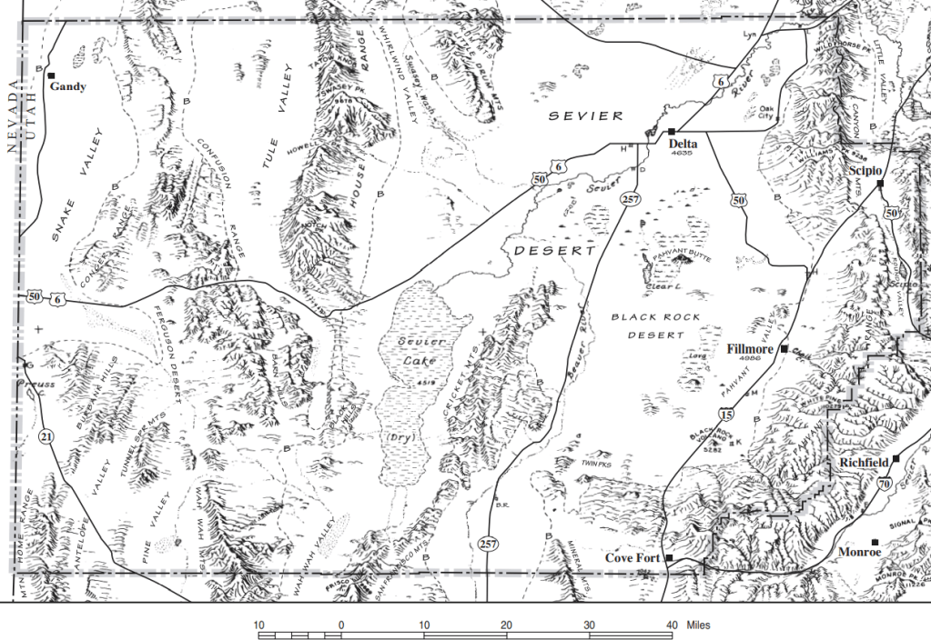
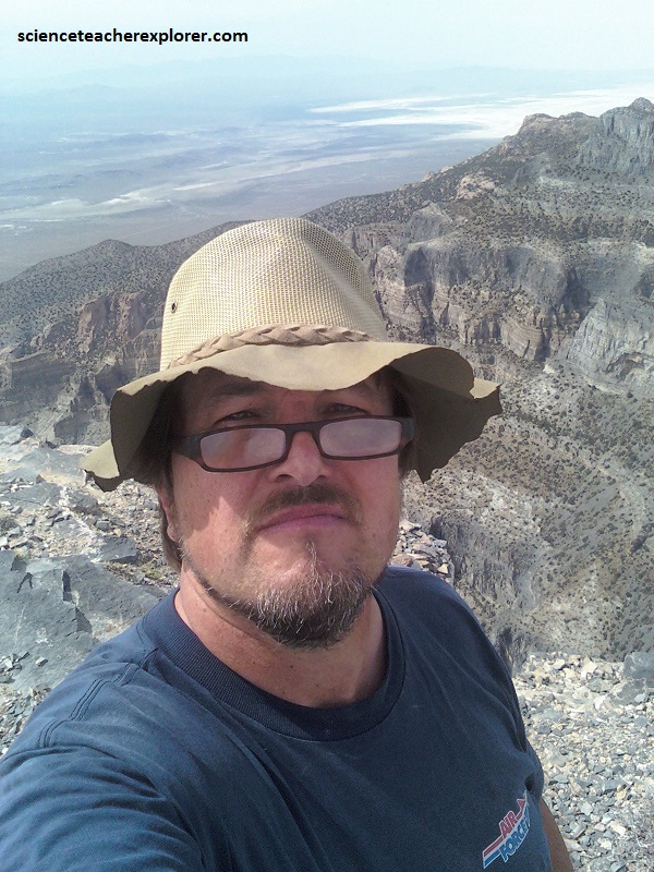
The House Mountain Range is one of the most imposing range in western Millard County, Utah. Its highest point, Swasey Peak, at 2,947m, is only 4.5 m higher than its more precipitous neighbor, Notch Peak, 27 km to the south. The northwest face of Notch Peak forms one of the tallest sheer cliffs in the western United States. In June of 2015, I decided to climb Notch Peak in West-Central Utah. Notch Peak is in Utah’s West Desert, west of the town of Delta, Utah.
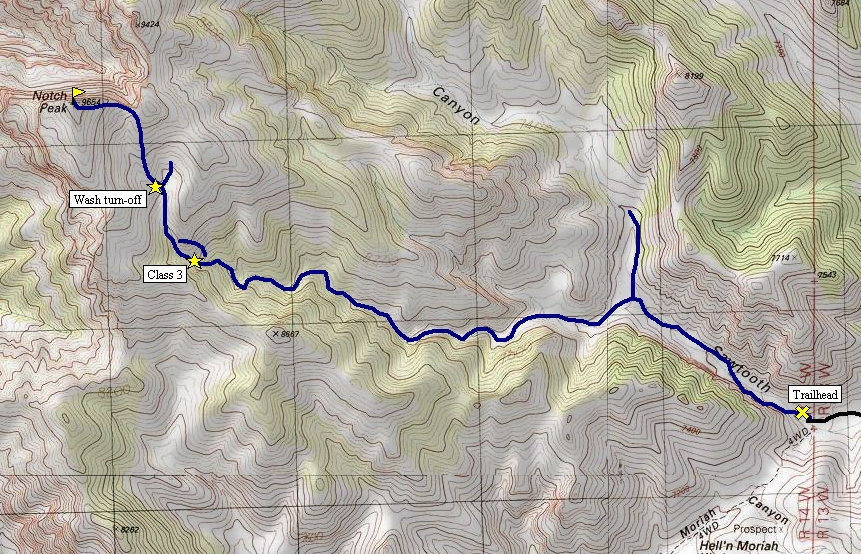
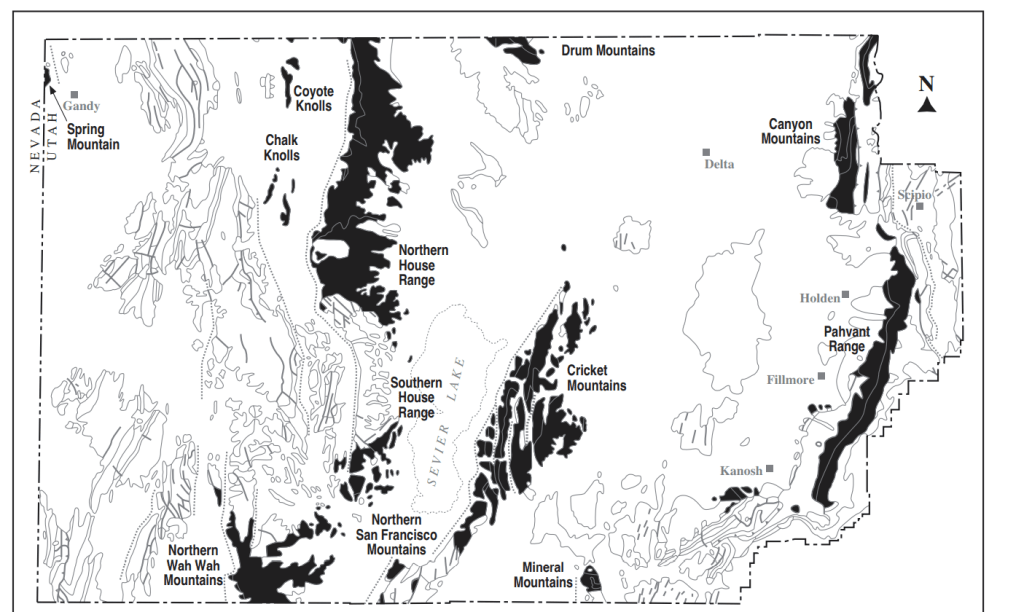
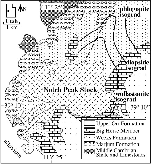
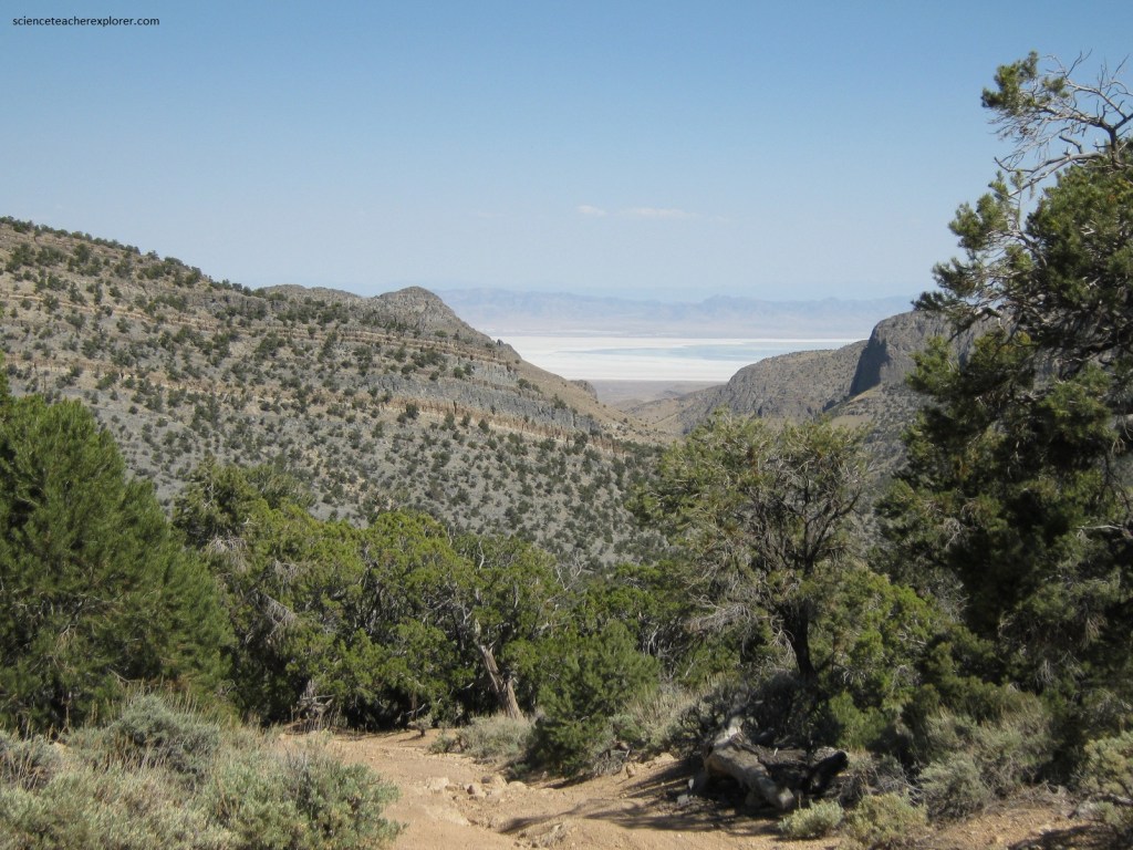
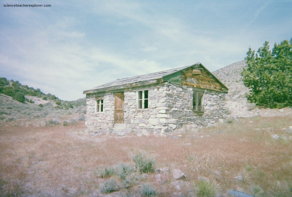
To get to the normal climbing route, drive west out of Delta on Hwy. 50-6. Very near mile post 46, turn north onto a good graded road. After about 10 km, turn left onto another graded and well-used road that runs to some active mines in Miller Canyon. Just before you reach the base of the mountain, turn left onto a less-used and rougher road heading southwest. Follow this about 5 km and you’ll come to the Buchanan Cabin. From this cabin drive another kilometer and park. Hike up and into Sawtooth Canyon. Follow the map provided below.
This relatively easy hike follows Sawtooth Canyon as it meanders though a gorge-like canyon, past sage brush and a mini natural arch. The views at the top can’t be beat.
The hike is located in the very wild and unpopulated west desert of Utah. Services, people, and help are a long ways away when visiting the area.
The hike is quite casual, but the summit offers jaw dropping exposure down the second highest vertical drop in the United States, (the first is El Capitan in Yosemite National Park). Some debate the second highest drop status depending on how you define pure vertical drop, but it is a stunning drop to stand on top of, and a hike I would strongly recommend.
This part of the House Range is chiefly made up of a passive margin sequence of Cambrian to Ordovician carbonate rocks. At first glance, the House Range appears to be a simple east-tilted, late Cenozoic extensional fault block with Cambrian strata boldly exposed on its west face, and the same strata forming dip slopes on its east side. On closer inspection, the range reveals several features formed during Mesozoic mountain-building tectonism.
The top of the range is aptly named Notch Peak Dolomite, (500 million year old Orr & Weeks Formations). At the base of the range is the pink/orange Notch Peak granite and monzonite, which is Jurassic in age (169 million years old). Around Notch Peak, especially from the west side (Tule Valley side), white Lake Bonneville fossiliferous marls occur.
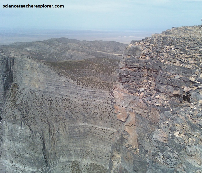
Because of the intrusion, “Painter Spring Canyon” below the notch can clearly show a well-developed metamorphic Skarn-aureole and even inter-fingering textures between the intrusion and the limestone. Also, small quantities of tungsten and placer-gold have been found there.
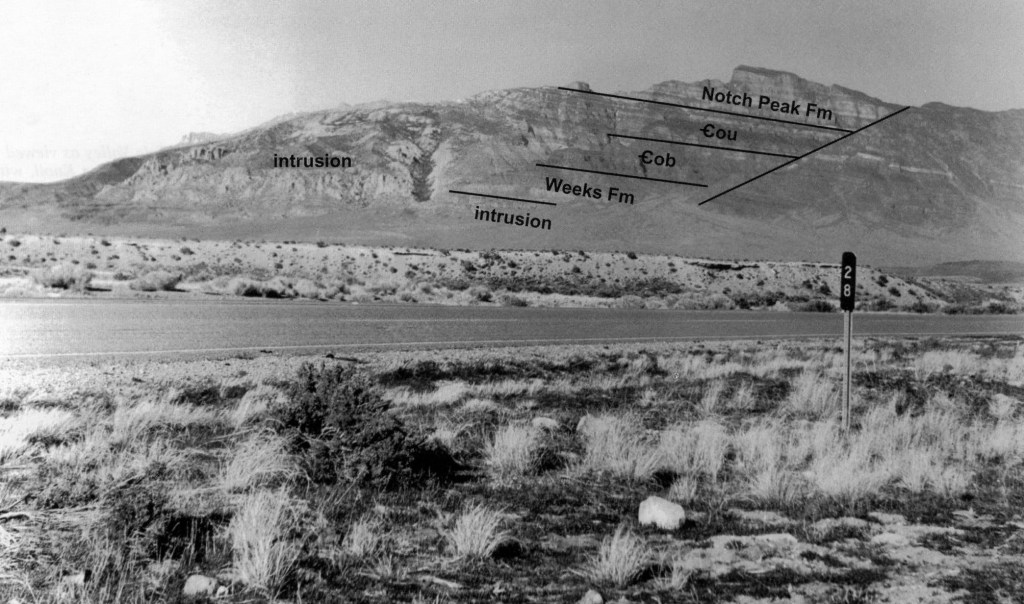
The Notch Peak intrusion of Jurassic age, is obviously the oldest of the rock formations found here. In late Cretaceous time this intrusion and the Cambrian strata had been intruded and were moved southeastward tens of miles as part of a large thrust plate. This plate was broken internally by tear faults that are oriented parallel to the direction of movement of the plate. This allowed small blocks of the plate to slide by each other.
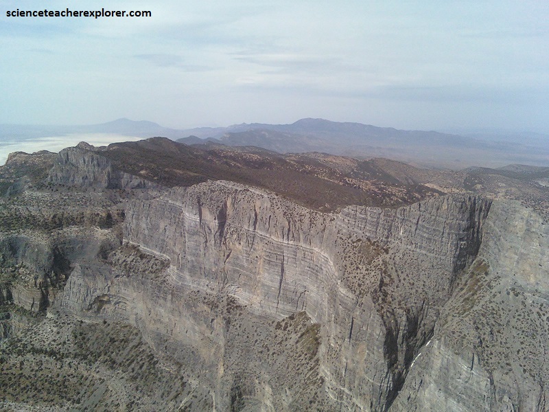
These, (mentioned above), tear faults separate coherent blocks of Cambrian strata from adjacent blocks made up of brecciated and brittly attenuated strata. This Cretaceous brecciation made the affected blocks less resistant to erosion. This can be easily observed by looking at this west face of the House Range from Tule Valley.
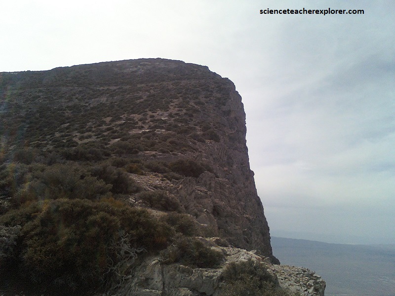
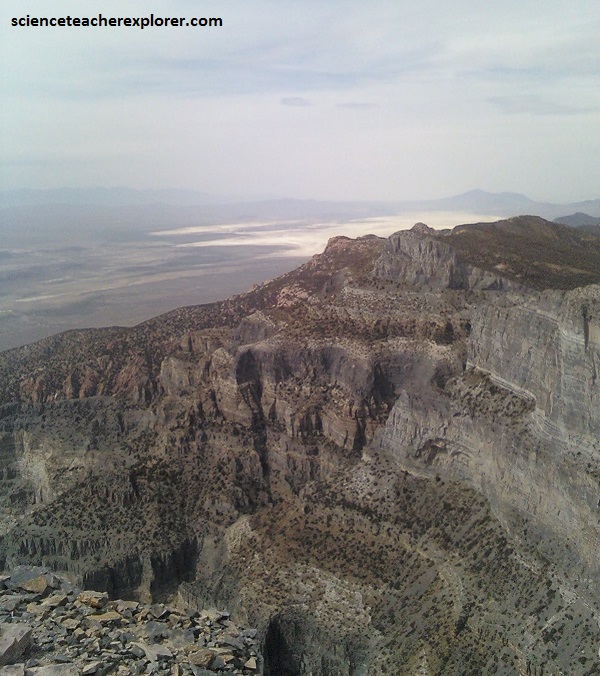
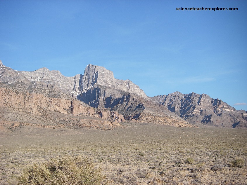
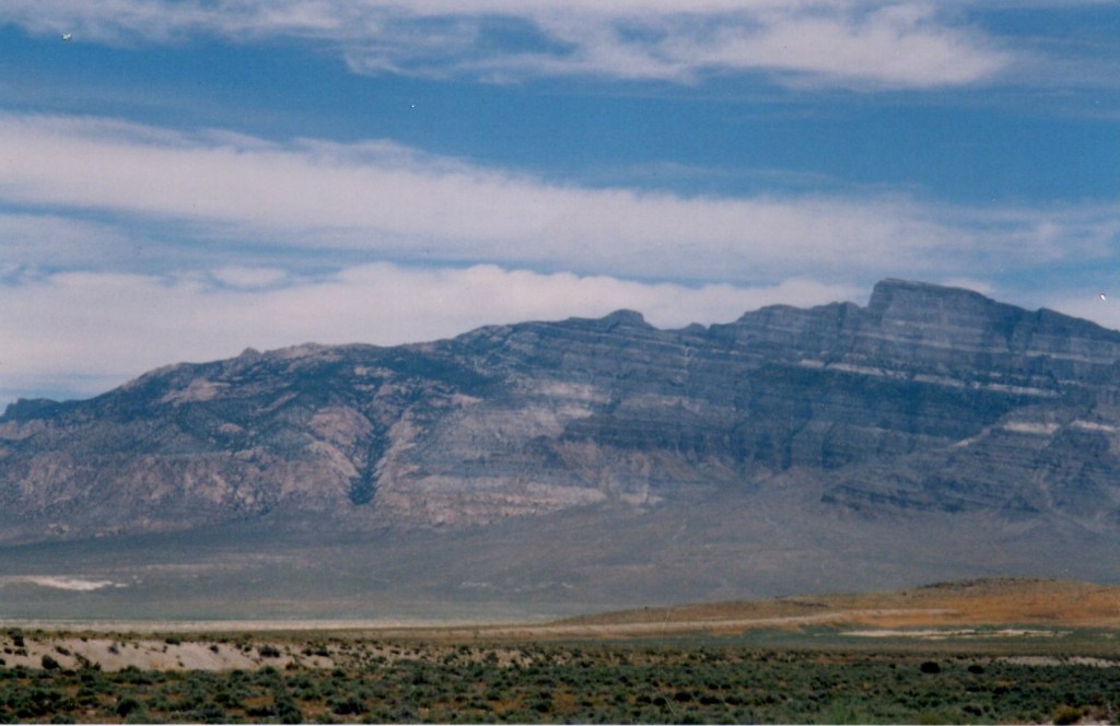
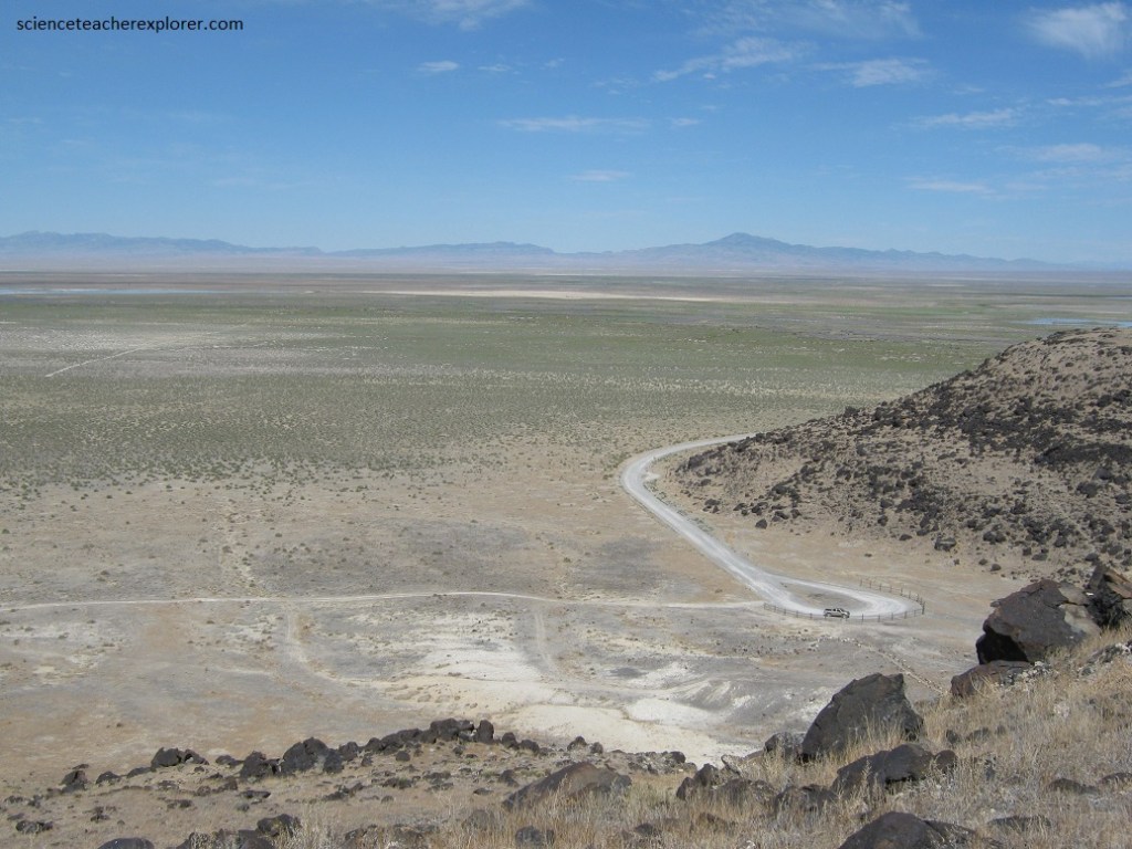
The northwest face of the mountain is a massive carbonate rock (limestone and dolomite) cliff with a 670 m of vertical rise, making it among the highest cliff faces in North America. Overall, the summit rises about 1,360 m) above Tule Valley, (pictured below).
Un-brecciated blocks form bold unbroken cliff lines (pictured above); brecciated and attenuated blocks form lower topography and more rounded and irregular cliff lines. Oligocene volcanic and sedimentary rocks in the House Range were generally deposited in those portions
of the range where the Cambrian strata had been previously attenuated.
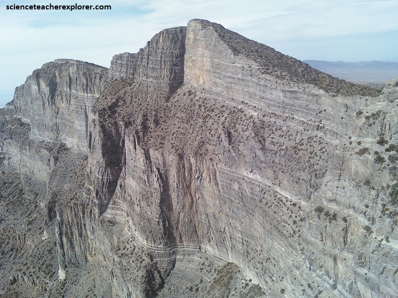
Pictured below, west side of the “House Range” as seen from milepost 28 on U.S. 50-6. Upper third of Notch Peak is the section for the cliff-forming Upper Cambrian Notch Peak Formation. The tree-covered slopes at the base of these cliffs expose fossiliferous cliffs of the upper Orr Formation. The Big Horse Limestone Member of the Orr and Weeks Limestone are also shown. White layers of limestone beds that were recrystallized and bleached (marblized) by heat and fluids from the Jurassic granitic intrusion exposed in the knobby ledges left of the straight canyon. This metamorphism took place at a depth of several thousand meters. Unlabeled exposures on the right side of the layering have been offset by faulting. Present exposure of the limestone beds is a result of uplift and erosion during the Cretaceous Sevier Orogeny.
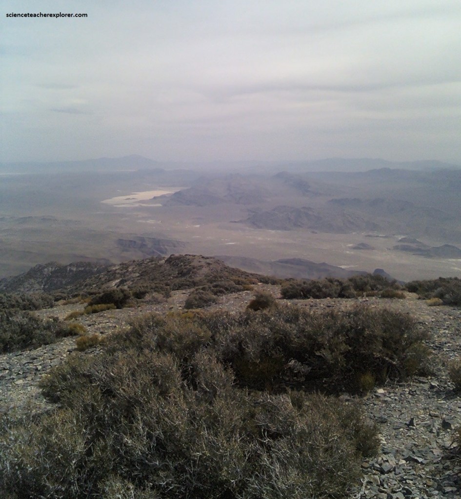
The view of the west desert of Utah, from its summit give some perspective on the lonely western side of the state and how isolated and expansive it is.
The massive limestone and dolomite bedding is nearly flat and horizontal (not folded). Tectonic folding could have resulted in fractures that weaken rock layers. Similarly, tectonic compressional forces have not thrusted these rock layers over one another. [Elsewhere in the Basin and Range past episodes of tectonic folding and thrusting have fractured and weakened otherwise similar formations and thereby reduced their integrity and ability to form towering cliffs]. Though there is no clear evidence for such forces, an east-west oriented fracture (perpendicular to the range-front fault) could have provided a zone of weakness contributing to the north-facing orientation of the peak’s greatest cliff.
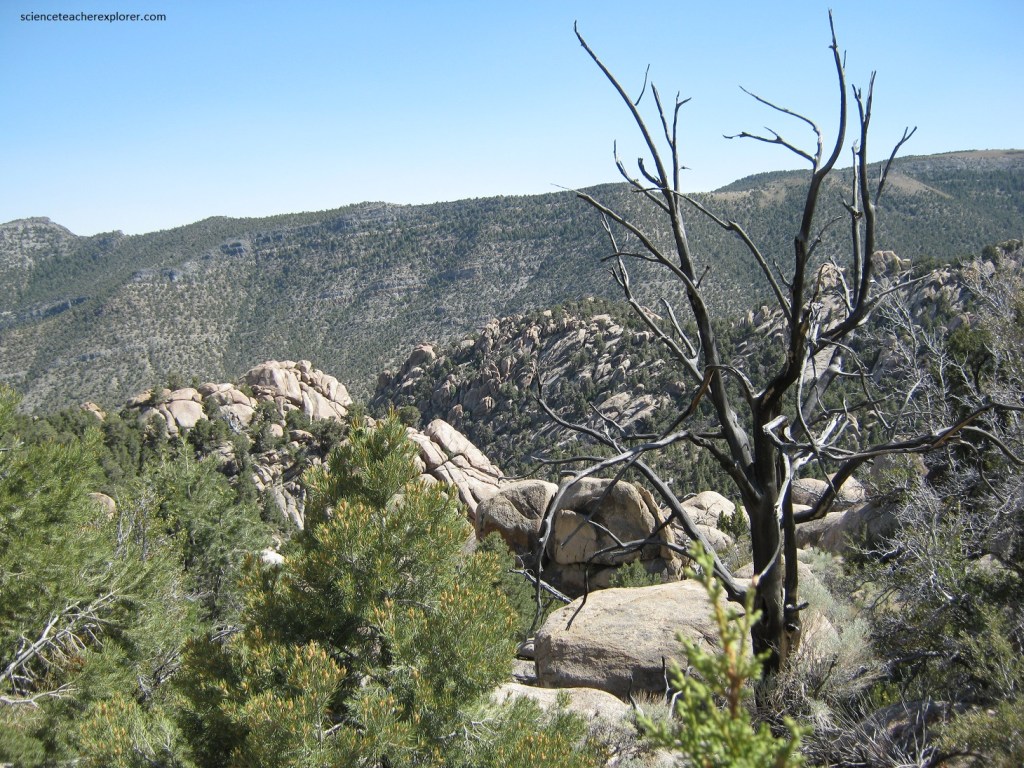
Utah’s West Desert is part of the Great Basin geophysical province. Throughout western Utah and all of Nevada, are a series of mountain ranges all lined up in a north-south direction. In between the ranges are valleys, also running north-south. Everywhere in between it’s a desert, with the exception being in the higher mountains, some of which are alpine in character. Because it’s so dry there’s a scarcity of vegetation leaving mostly barren rocks exposed in many locations. This gives us a chance to inspect the rocks for fossils, something that’s difficult in more humid climates.
Most of the House Range from Notch Peak north past Tatow Knob, is Cambrian (from 544-510 m.y.a.) limestone, dolomites and shales, (pictured below). These rocks originated when animal life and other deposits accumulated at the bottom of a shallow sea during this time. Later in time, the entire region was uplifted, along with being faulted, folded and sometimes twisted.
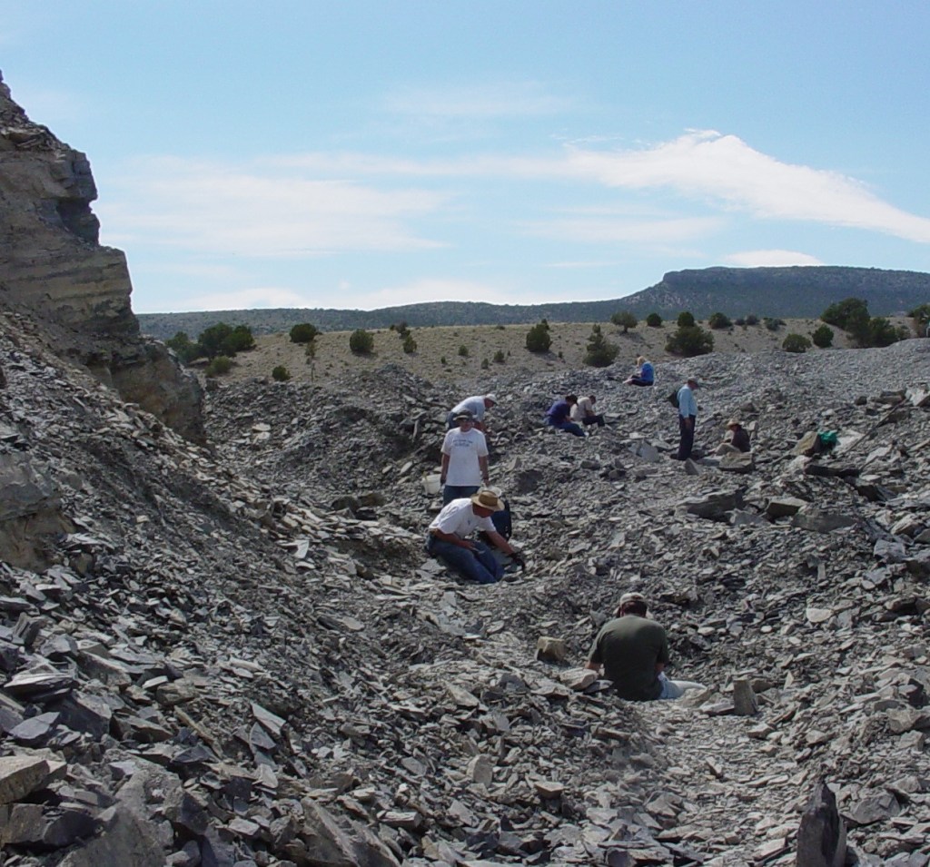
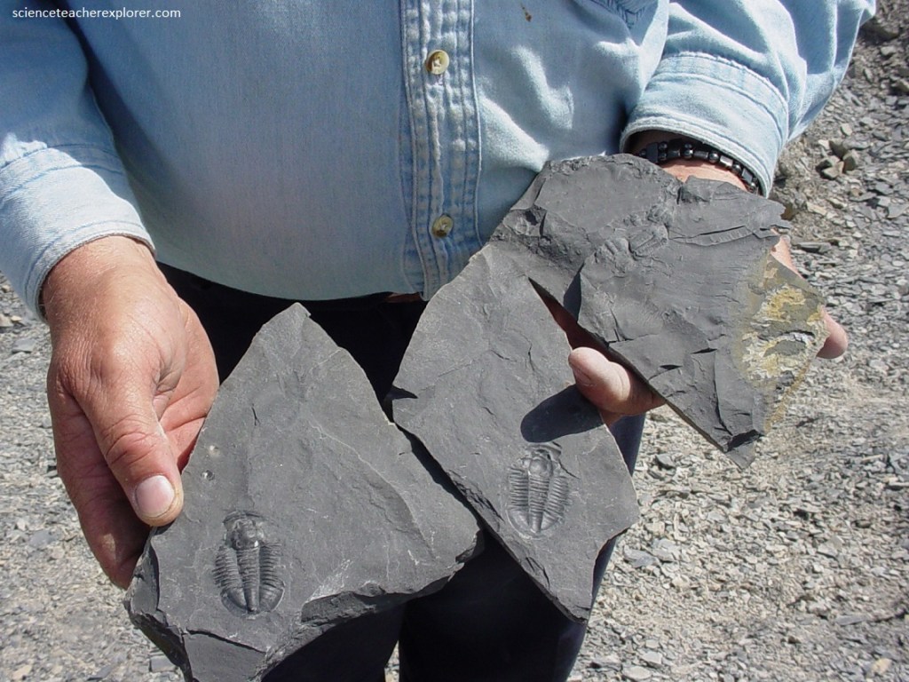
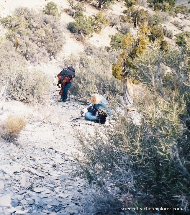
One of the best known places in the world for collecting Cambrian & Ordovician “Trilobites” is just south east of Antelope Spring within the House Range, (pictured below).
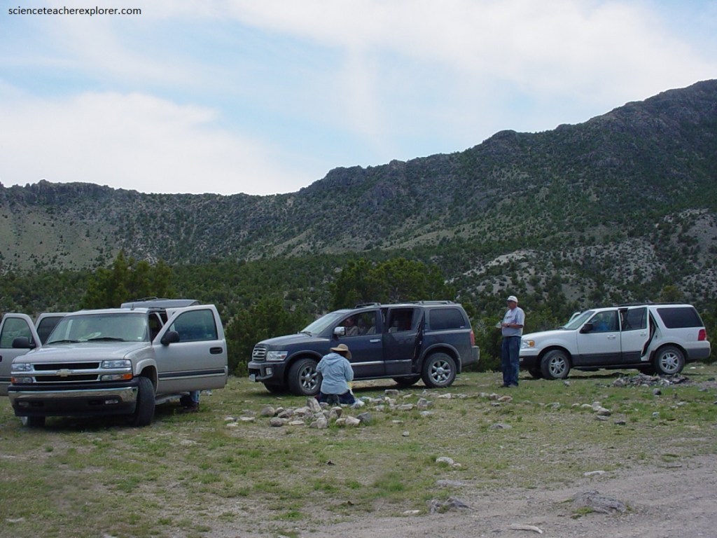
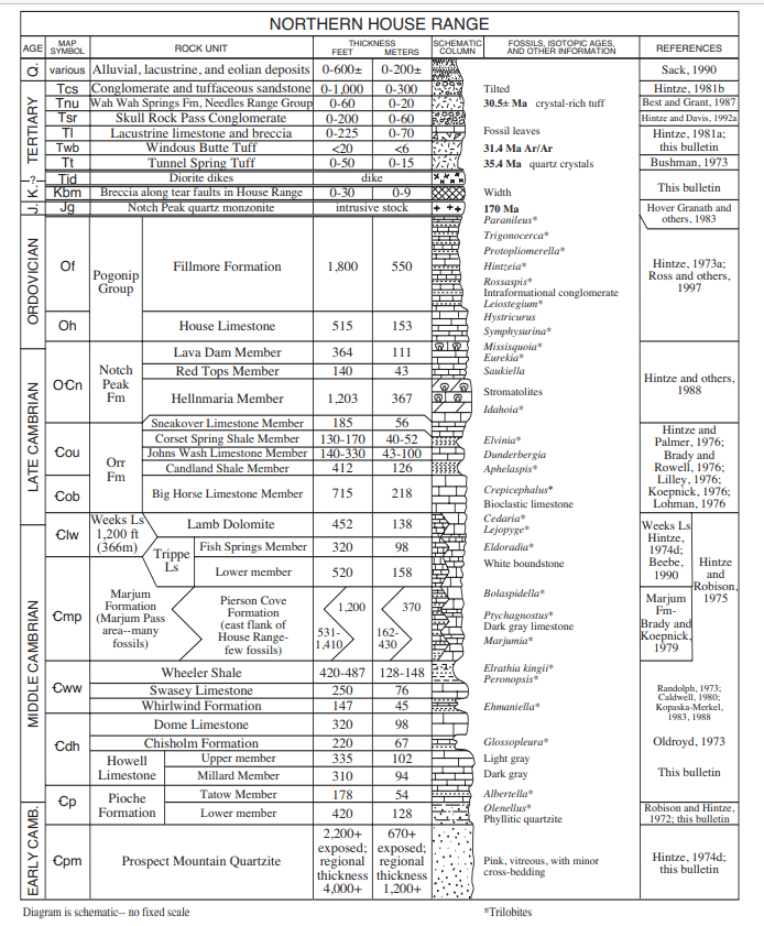
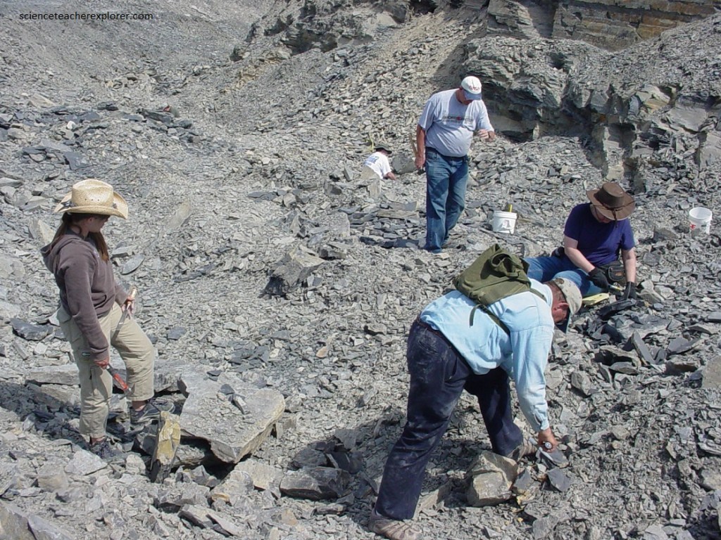
Pictured above, I led a trilobite-hunting group of adults from the University of Utah in 2006. On this tour, we hit several sites within the House Range, including the above “Antelope Springs” site, just southwest of Swasey Peak. The Antelope Springs site are now being mined and trilobites sold throughout the world. Most of the specimens come from one thin layer 15-20 cm thick in the Wheeler Shale Formation. Imaged below is a more detailed stratigraphy found in the southern House Range. The Wheeler Shale contains interbeds of shaley limestone, mudstone, and thin platy limestone (imaged below).
Another trilobite-bearing unit that directly overlies the Wheeler Shale in the central part of the House Range is the Marjum Formation. This formation consists of thin-bedded, fine-grained, silty limestone with interbeds of shale and mudstone (imaged below).
Also located in the central part of the House Range is a fossiliferous limestone called the Weeks Formation, that crops out in North Canyon near Notch Peak. The Weeks Formation overlies (is younger than) the Marjum Formation and also contains trilobites.
Pictured below, one kilometer south of Antelope Springs is a pay-to-dig operation. It is called “U-dig Fossils”. [Buy a ticket at the “Rocks and Gifts Shop” in Delta, Utah]. My group had wonderful success here.
Pictured above and below, for a reasonable fee, U-Dig-Fossils will help you every step of the way for finding the right trilobite fossil. They will even provide the tools.
The trilobites are an extinct form of marine life, more than 500 million years old, that lived on the sandy bottoms of shallow, warm ancient inland seas. They swam in the seas virtually unaffected by evolutionary changes for some 300 million years, until they finally disappeared forever about 200 million years ago.
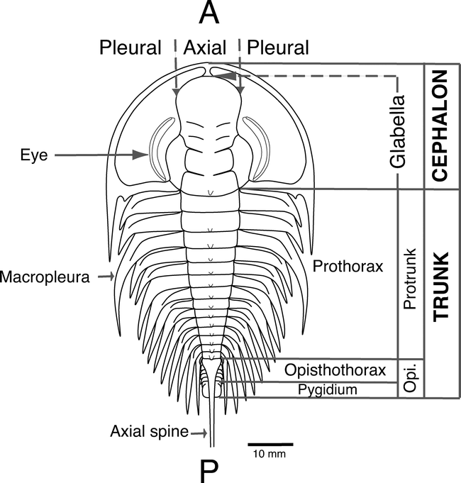
Pictured below, the trilobites, so called because of their three-part body, (cephalon, thorax, and pigidium), had a hard exoskeleton. This allows us to see what they really looked like without resorting to speculation, as we have had to do with such creatures as the dinosaurs.
After spending the morning at Antelope Spring, I lead my group to some alternative-secret sites within the House Range. Pictured below, is on the north-eastern side of Swasey Peak. This site was developed by the Brigham Young University paleontologists.
Pictured below, are other sites found south of Antelope Spring within the House Range. Many of these sites are found just east of Howell Peak of the House Range.
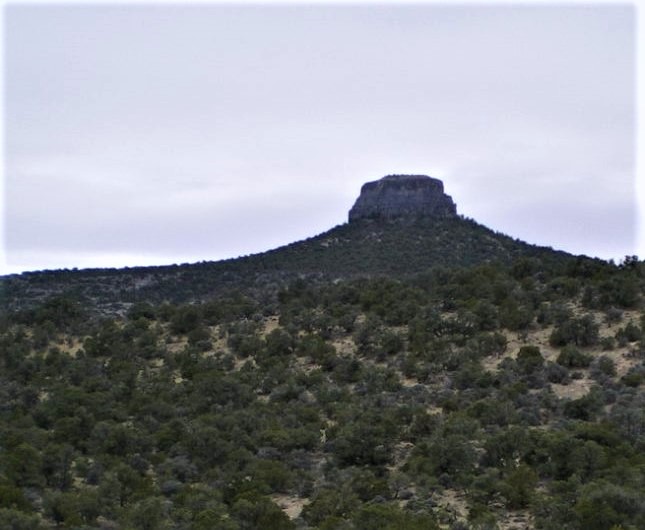
Pictured above, the east side of Howell Peak is gently sloping, but the west face is a massive cliff. The entire mountain is made of Cambrian limestones. Exposed below all the big limestone cliffs on the west side is the Prospect Mountain Quartzite Formation.
Another site within the House Range we visited for trilobites and other fossils is on the north side of North Canyon. This is the canyon you would drive up to get into Amasi Valley (just north of Notch Peak & its north neighbor Pine Peak). About 500 m into the canyon, we looked for the shale beds on the opposite (north) side of the canyon. These moderately fossiliferous outcroppings ran for about one kilometer, (picture above).
Picture above, one of the more interesting parts of Sawtooth Mountain is the area north of Notch Peak. This moderately high region is generally known as Amasi Valley. What makes this place so interesting is, it’s part of a large intrusive body of granite known to geologists as the “Notch Peak Intrusive Stock”. It extends from Painter Spring and its two canyons above, south to the lower end of West Sawtooth Canyon. Pictured below, the granite and quartz monzonite is also exposed in the upper ends of Miller and North Canyon, (Amasi Valley).
Pictured below, there has been small exploratory mining operations at or near the contact point of the granite and limestone since the early 1900’s, but not enough rich ore was found to create a mining district. Placer mining for gold on a large scale first began in about the 1930s in the middle part of Amasi Valley.
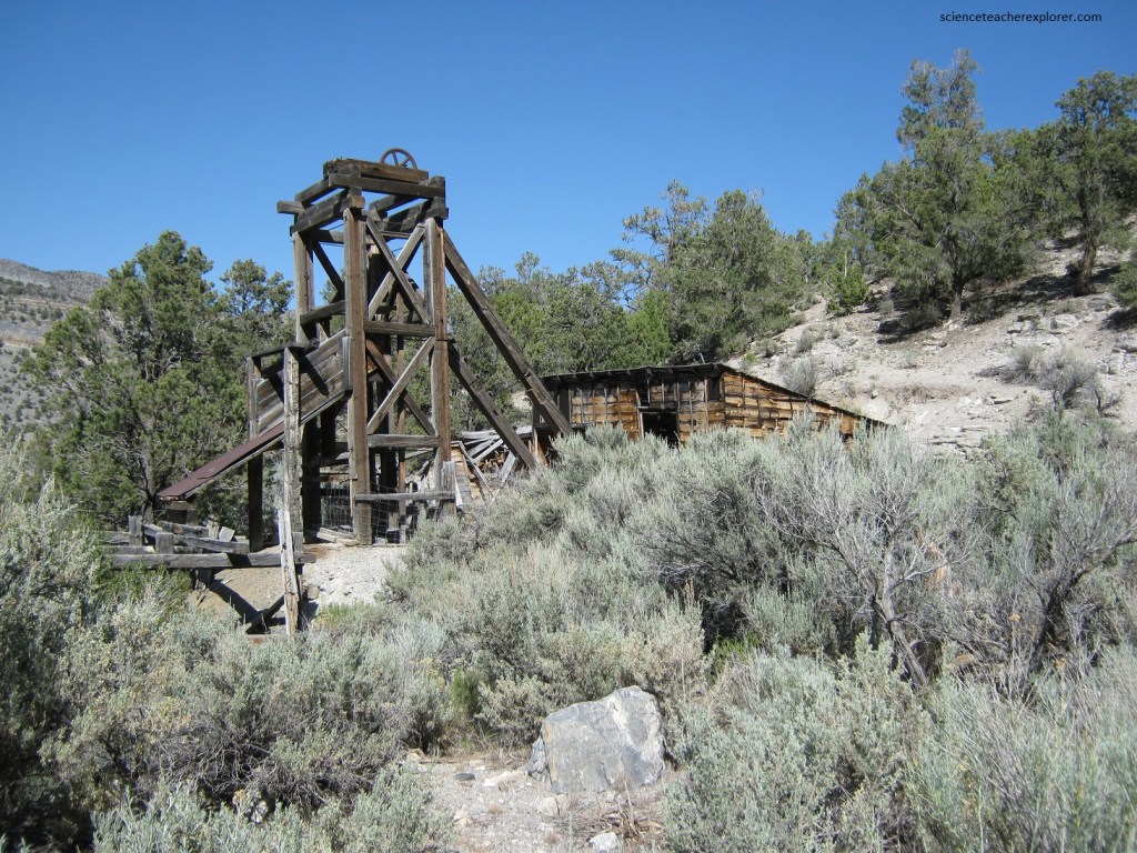
Tungsten, found in scheelite ore, was discovered around the time of World War I, but it wasn’t until wasn’t until after World War II, (in the late 1940s), that serious mining began. Some of the tungsten was milled at the bottom end of Amasi Valley. However, the government stopped buying the tungsten in the 1950s.
Pictured above, I was there prospecting for gold in the lower end of Amasi Valley, just above the old Horseshoe Mine & Mill, but I never found much gold out of the Skarn-type deposits there. However, I had a friend from my childhood, (Buchanan), who claimed to have taken a large gold-find within this valley. This is what led me here.
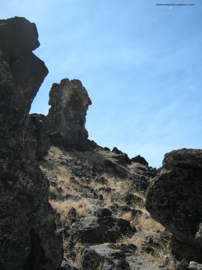
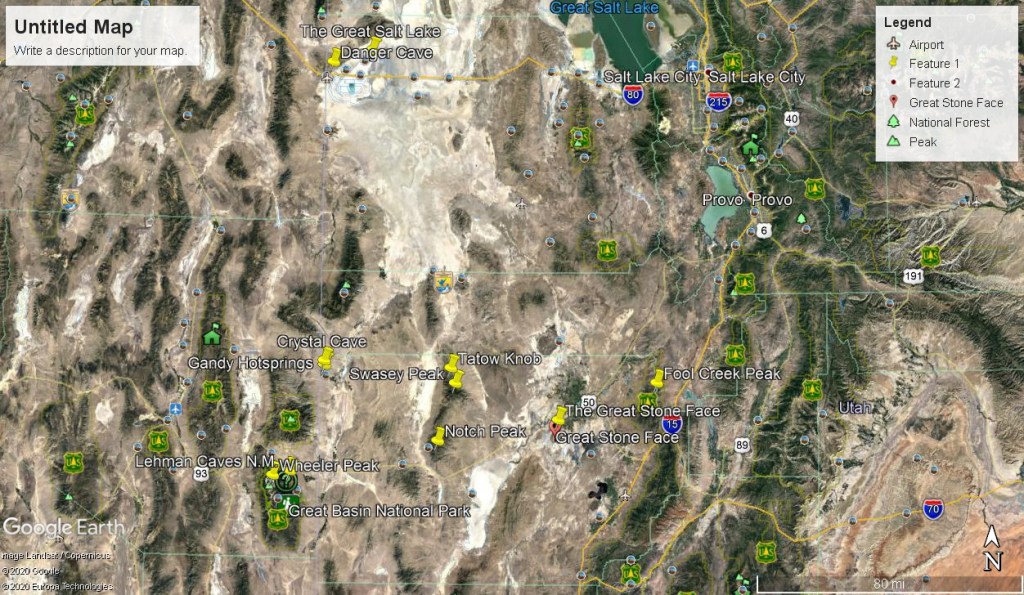
Later, I explored an area south of Delta, Utah at a geological location called the “Great Stone Face”. Pictured below, looking down at the parking lot, (west), of the “Great Stone Face”, you can see the “House Range” in the far distance, across Sevier Lake-Playa, with Swasey Peak standing proudly on the right. Nearby, on the volcanic rock, are Fremont Petroglyphs. Apparently, the local native-American Ancients recognized the “Great Stone Face” was special place.
Pictured below, located just west of Delta is this natural rock formation known as the “Guardian of Deseret”. When the Mormon Pioneers traveled hundreds of miles by wagon train and handcarts to settle this western wilderness, they discovered this familiar looking rock face that they thought looked like “Joseph Smith”. You make the distinction!