Trou-aux-Cerfs, MU
While trekking in South Africa during the Spring of 2023, I flew over to Mauritius Island to explore some of the volcanic terrain there. Mauritius is a subtropical island country in the Indian Ocean, just over 1,130km east of Madagascar, off the south-eastern coast of Africa.
Samuel Clemens (Mark Twain) once wrote that “Mauritius was made first and then heaven, heaven being copied after Mauritius”. For the most part, it’s true: Mauritius is rightly famed for its sapphire waters and powder-white beaches. But there’s so much more attraction to Mauritius the the beach, and it’s the kind of place that rewards even the smallest attempts at exploration.
Mauritius enjoys a typically tropical climate with year-round heat. The summer months are December to April, when it can be extremely humid. I was there in April. The coastal temperature ranged between 25-30oC. On the plateau was some 5oC cooler.
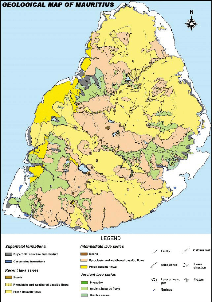
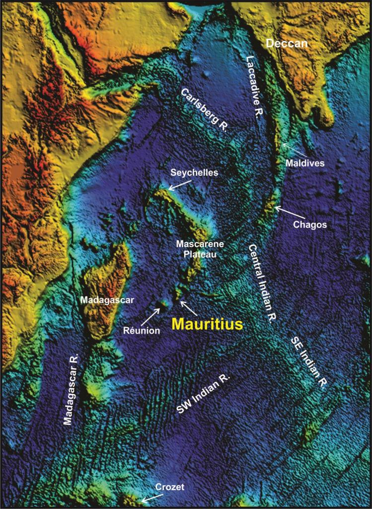
Mauritius is a volcanic island and is relatively young in geological terms compared to other islands. It was formed approximately 10 million years ago by volcanic eruption. In fact, the island itself is a volcano. The highest point, 550 m – 600 m above sea level, is the central plateau; from there on, the land gently slopes towards the sea. There is some debate as to the actual formation of Mauritius. While some scientists are in favor of the hotspot theory that created the Mascarene island groups, others support the independent formation of the Mascarene islands by fracture zones on the sea floor, (imaged below). While in general both theories seem plausible. Whatever the case, the initial genesis of the island remains the same. Everything started 65 million years ago, during the breakup of Gondwana when India detached from Africa and moved upwards towards Asia.
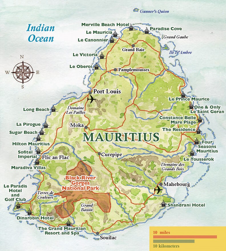
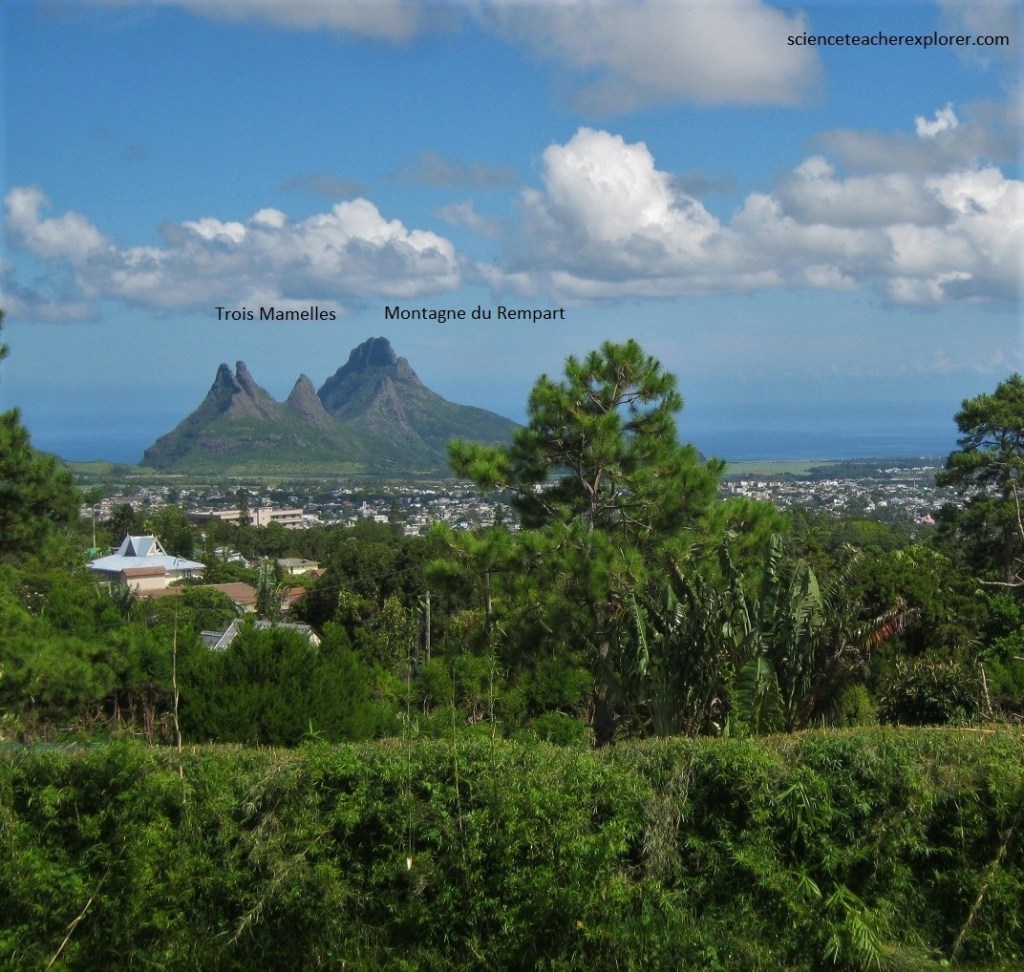
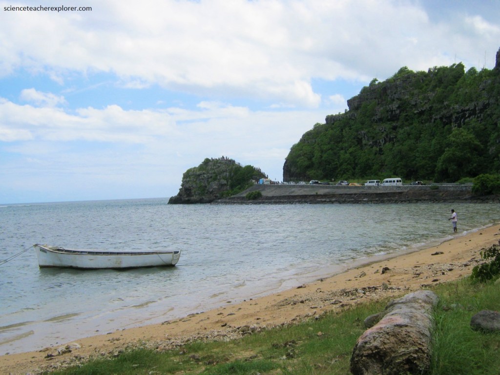
Of course, what brought me to Mauritius was to explore the Trou-Aux-Cerfs. About 1km west of central Curpipe, the Trou-aux-Cerfs is a dormant volcanic crater some 100m deep and 1km in circumference.
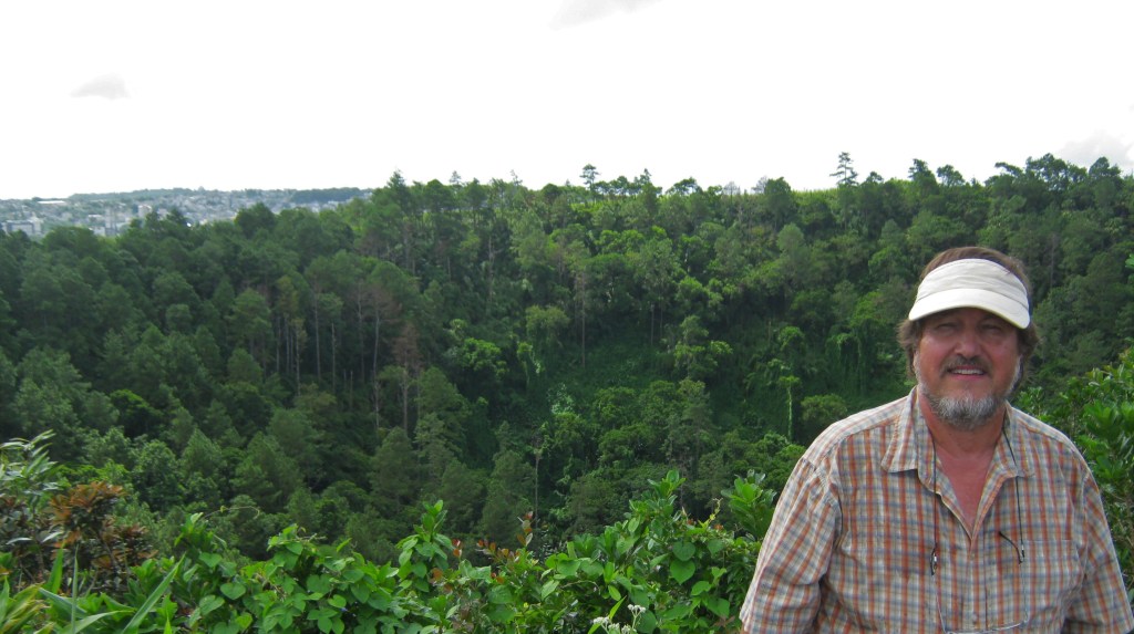
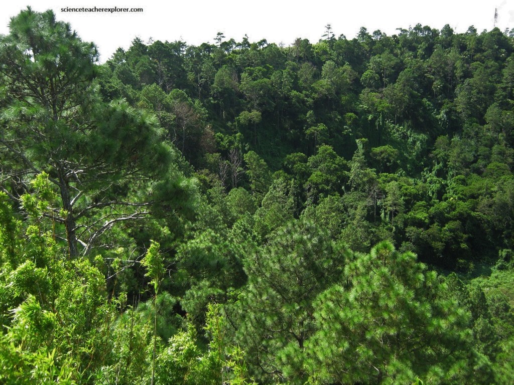
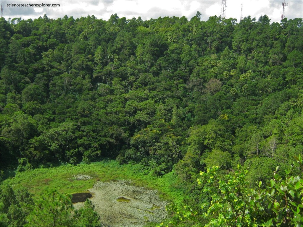
Pictured below, the bowl is heavily wooded and from the road around the rim, (a favorite spot for joggers and walkers), I got breathtaking panoramic views of the island of Mauritius.
A road runs up the slope of the volcano to the crater, 650m above sea level. It was possible to climb down the inside of the deep, densely vegetated crater to the lake, (but I didn’t).
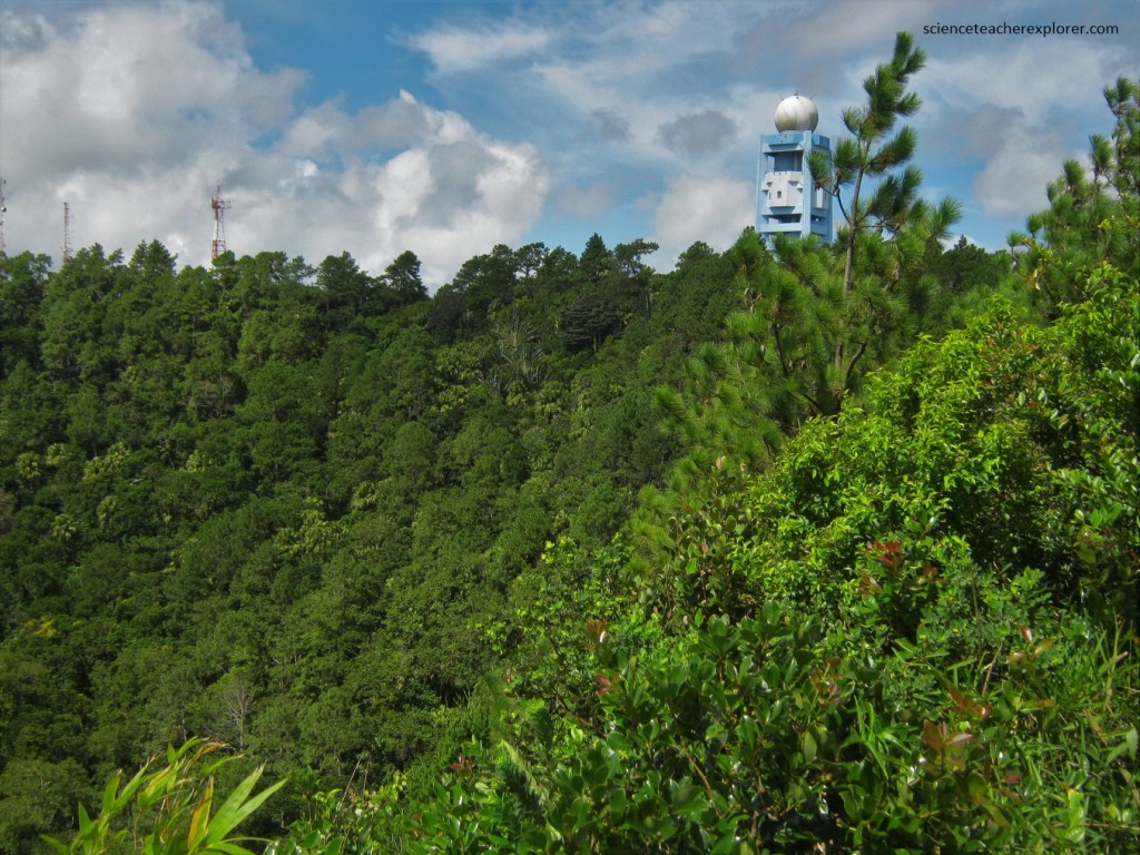
Near the rim of the volcano, there is a meteorological station that monitors cyclonic activity in the region, (pictured below).
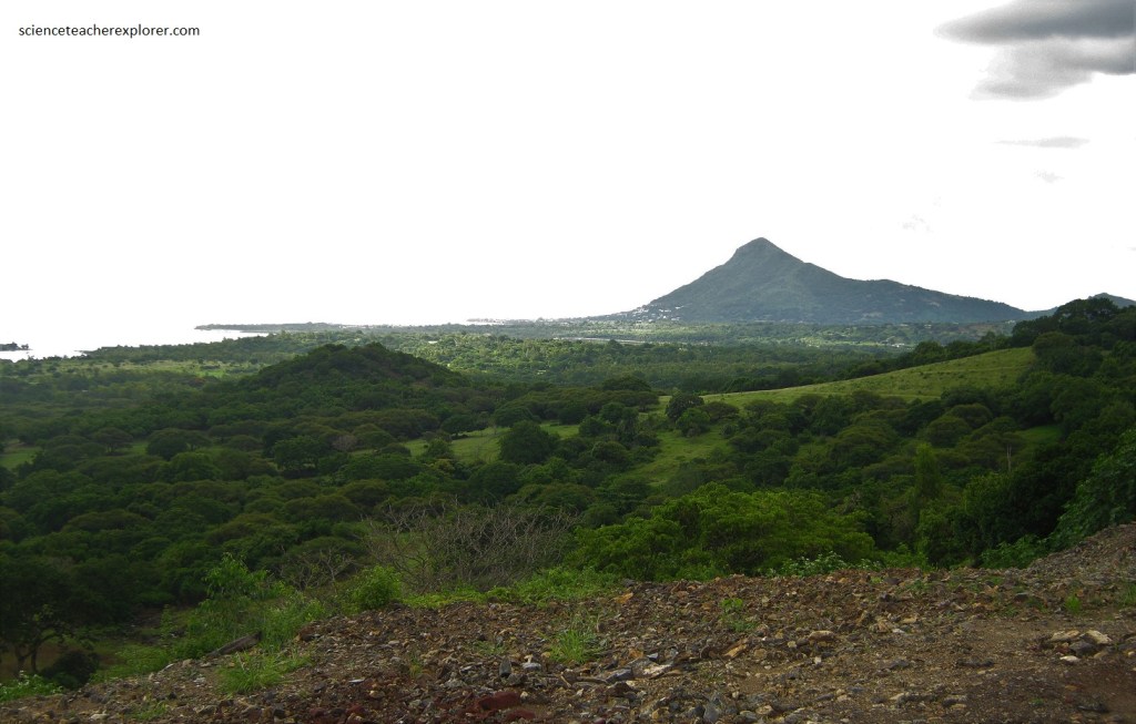
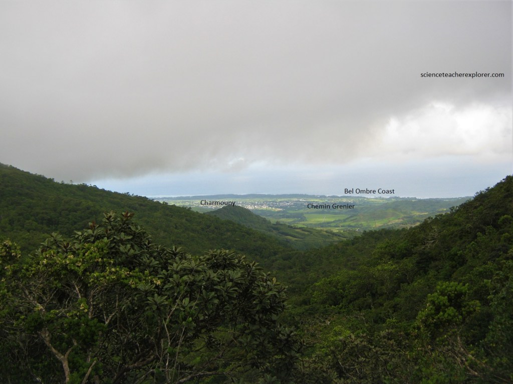
Pictured below, the panoramic view looks out over the plateau towns and the mountains to the north and northwest. To the west are the three conical peaks of Trois Mamelles, and Montagne du Rempart, described by Samuel Clemens as a “dainty little vest-pocket Matterhorn”.
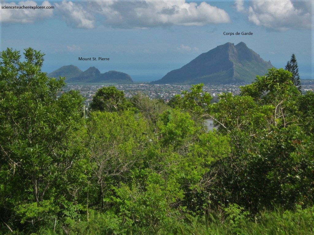
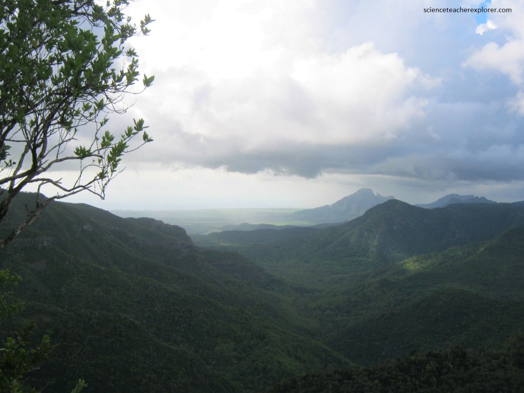
Pictured below, the view to the north-west is Mont St. Pierre and the Corps de Garde.
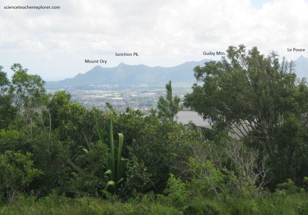
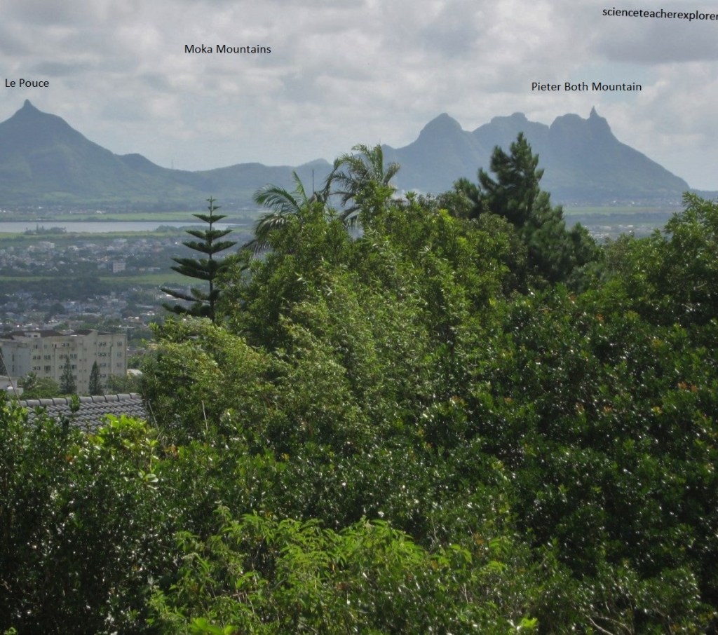
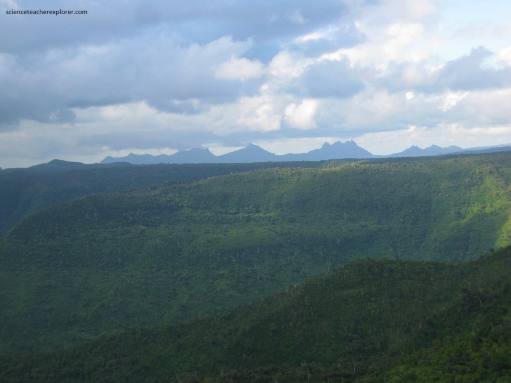
Pictured below, the view to the north is Mount Ory, Junction Pk., Guiby Mtn., Le Pouce and Pieter Both Mountain within the Moka Mountains. Pieter Both Mountain has a massive boulder balanced on its summit.
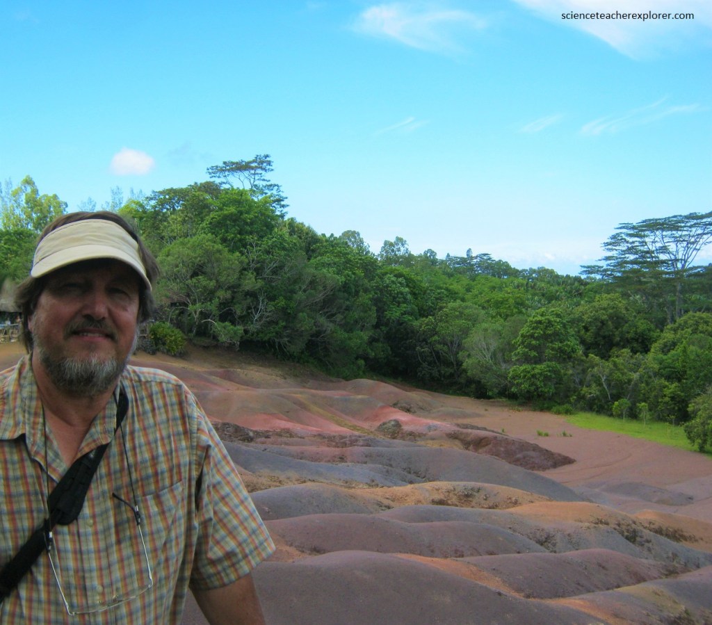
Our next destination to explore on Mauritius was the Chamarel Colored Earth.
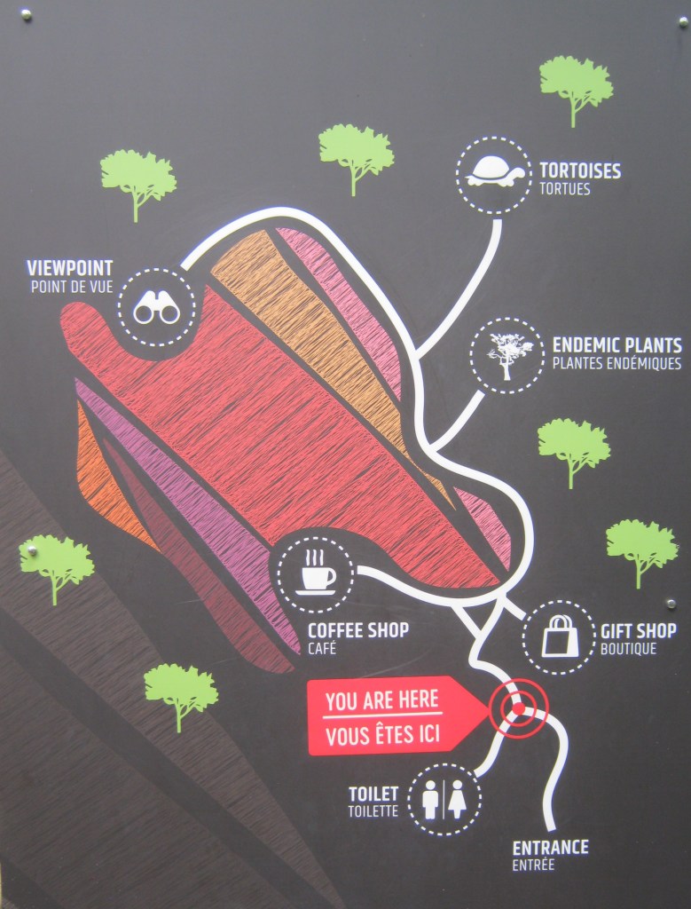
The Chamarel Colored Earth or “Terres de Couleurs de Chamarel” is a striking geological feature in the south-western part of Mauritius.
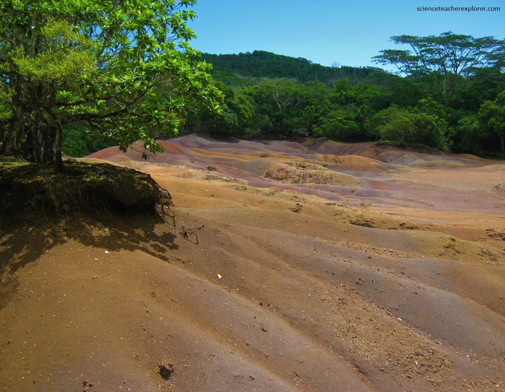
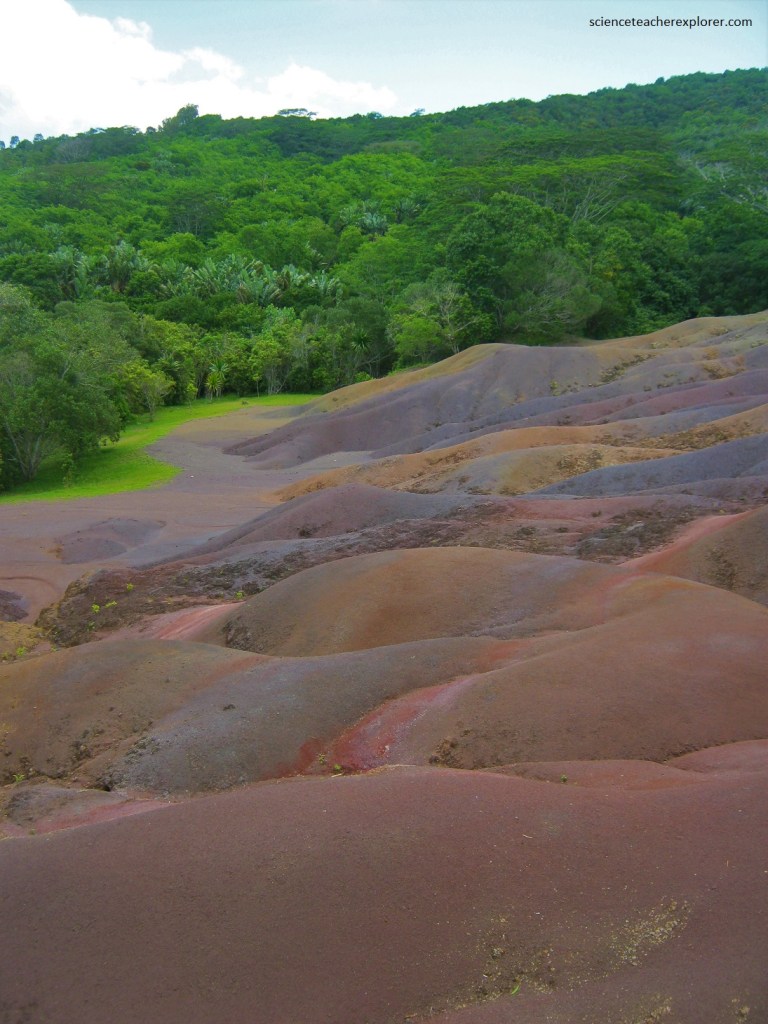
Pictured above, the Chamarel Colored Earth is an area of undulating land with contrasting layers of colored earth. Known locally as “Seven Colored Earth”, the seven hues are at their most striking at sunrise.
Pictured above, the Chamarel 7 Colored Earth (7,500m2) bears witness to the island’s volcanic activity between 3.5 million and 1.9 million years ago.
Over time, Mauritius’ hot and humid climate eroded the area’s basaltic rock, leaving behind a chemically-weathered, porous rock known as saprolite at the surface. This erosion created the spectacular landform we see today, with its many colors and sharply defined ridges.
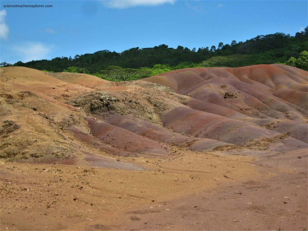
Pictured above, erosion stripped the land of the nutrients that plants need in order to grow, resulting in the area’s bare, unvegetated landscape. It left behind deposits of iron and aluminium oxide, which are responsible for the red, brown, violet, green, blue, purple and yellow colors that we see in the earth today.
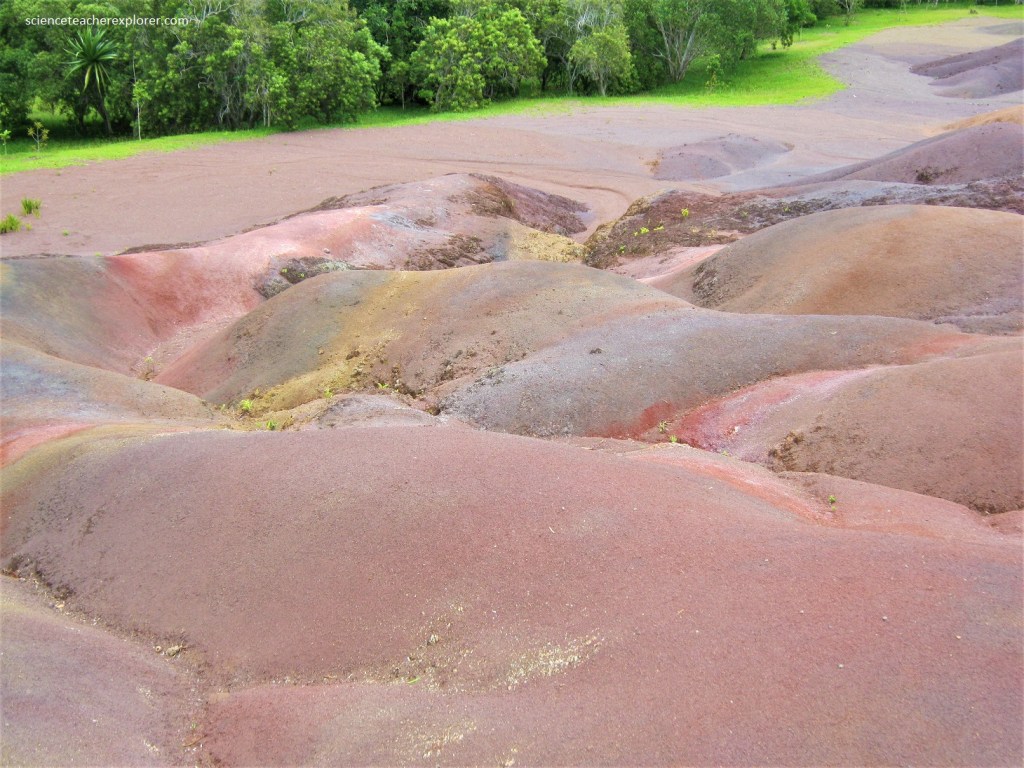
Pictured above, Iron and aluminium repel one another, a phenomenon that causes each metal to spontaneously gather in colorful stripes. Ferric oxide creates hues ranging from red to brown, while aluminium produces shades of blue to violet-blue.
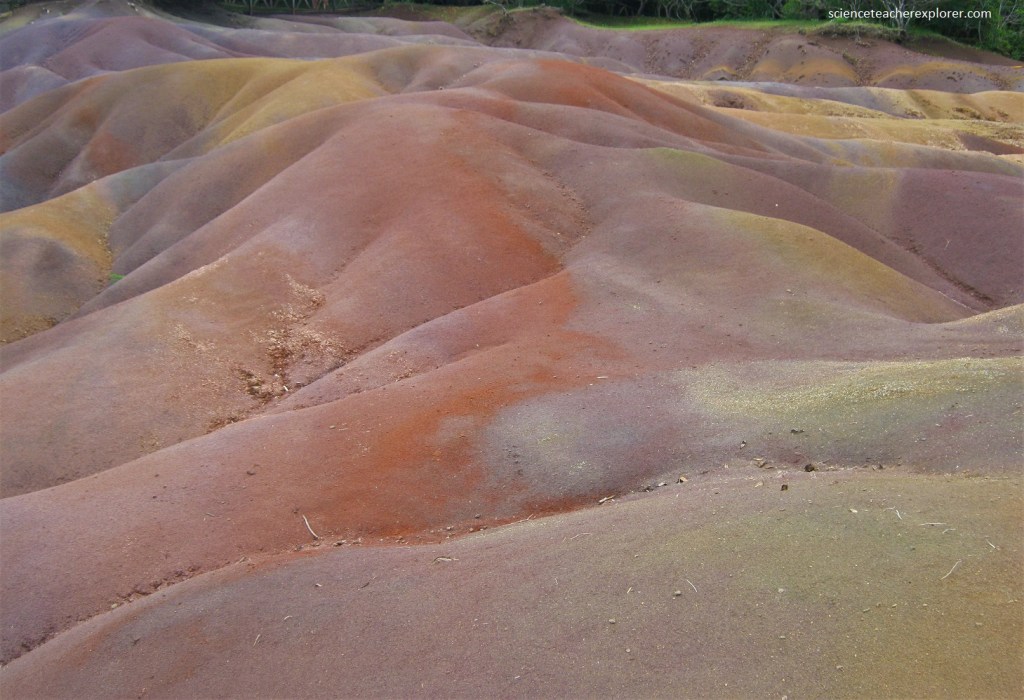
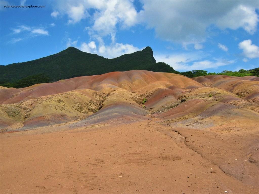
The natural phenomenon is thought to be the result of weathering on unevenly cooled molten rocks, resulting in a lunar-type landscape.
Pictured above, the ash is unusual because it is make up of elements that do not mix. Specimens of the colored earths in glass tubes are on sale at the site. Curiously, when the colored earths are mixed together in a tube, they separate out into distinct color bends again after a few days.

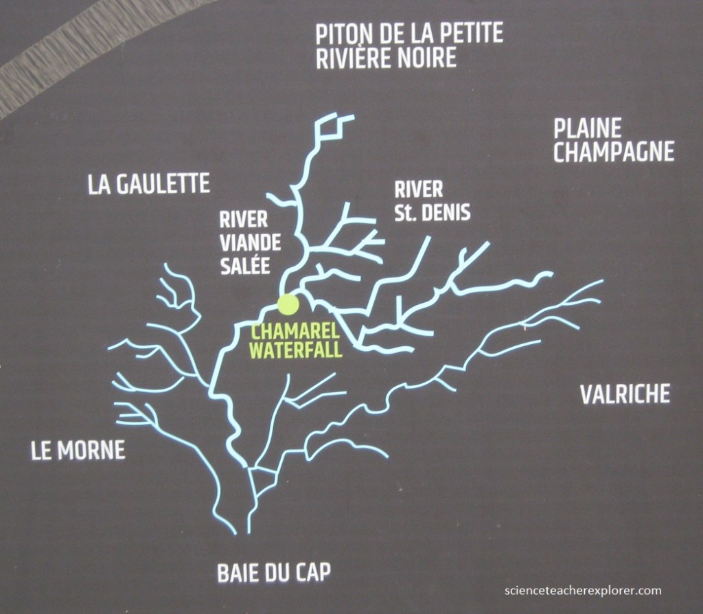
Pictured below, there are several good vantage points to see the nearby Cascade Chamarel, (Chamarel Waterfall) plunging down a high cliff face into the Riviere du Cap. With it’s 100m drop, Chamarel Waterfall is the highest in Mauritius. It is fed by two rivers, the St. Denis and Viande Salee. It’s water then descends into one of the Baie du Cap River’s catchment areas. The flow ranges from 22,500m3-41,000m3.
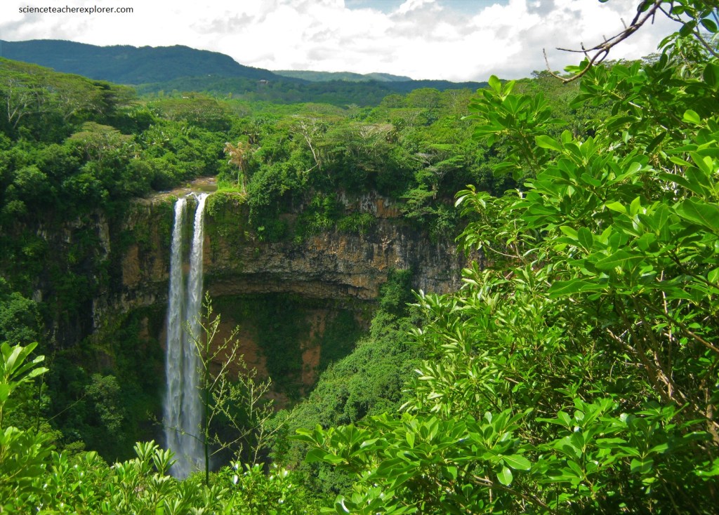
Pictured above, the Chamarel Waterfall is testimony to Mauritius’ volcanic past, which lasted several million years. Its bedrock consists of two lava flows from two different volcanic periods. the first flow is dated to 10-8 million years ago. It is heavily weathered, proving that it remained exposed for millions of years before being covered by a second lava flow 3.5-1.9 million years ago. Over several million years, basalt leaching and the erosion caused by fast-flowing streams carved the deep valley that the waterfall flows through today.
The 7 Colored Earth is working with the Mauritian Wildlife Foundation (MWF) on programs to restore, conserve and mange the forests of Chamarel. The project, which began in 2009, aims to preserve endangered Mauritian fauna and flora and to restore the area’s unique biodiversity of weeding out exotic plants and planting native species, (pictured below). The following plants are examples of this project.
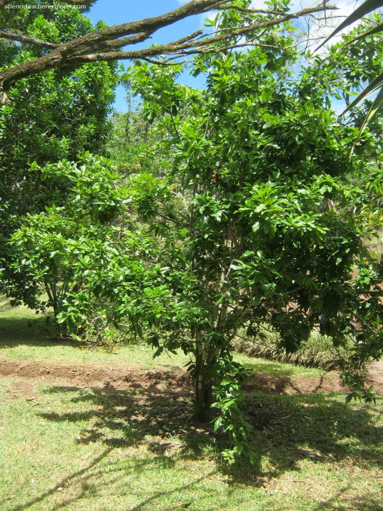
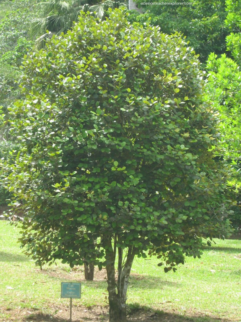
Pictured above, the Ochna mauritiana, locally known as ‘bois bouquet banané’ or ‘banana wood’, is a small tree measuring between 1.5 and 4 meters. It is the only plant of the genus found in Mauritius. The bark on its branches is yellow-brown and bears white lenticels – raised pores in the stem of a woody plant that allows gas exchange. The species has thin, shiny, green leaves with finely toothed margins. The species is distinguished by its clusters of white flowers blooming usually on bare branches.
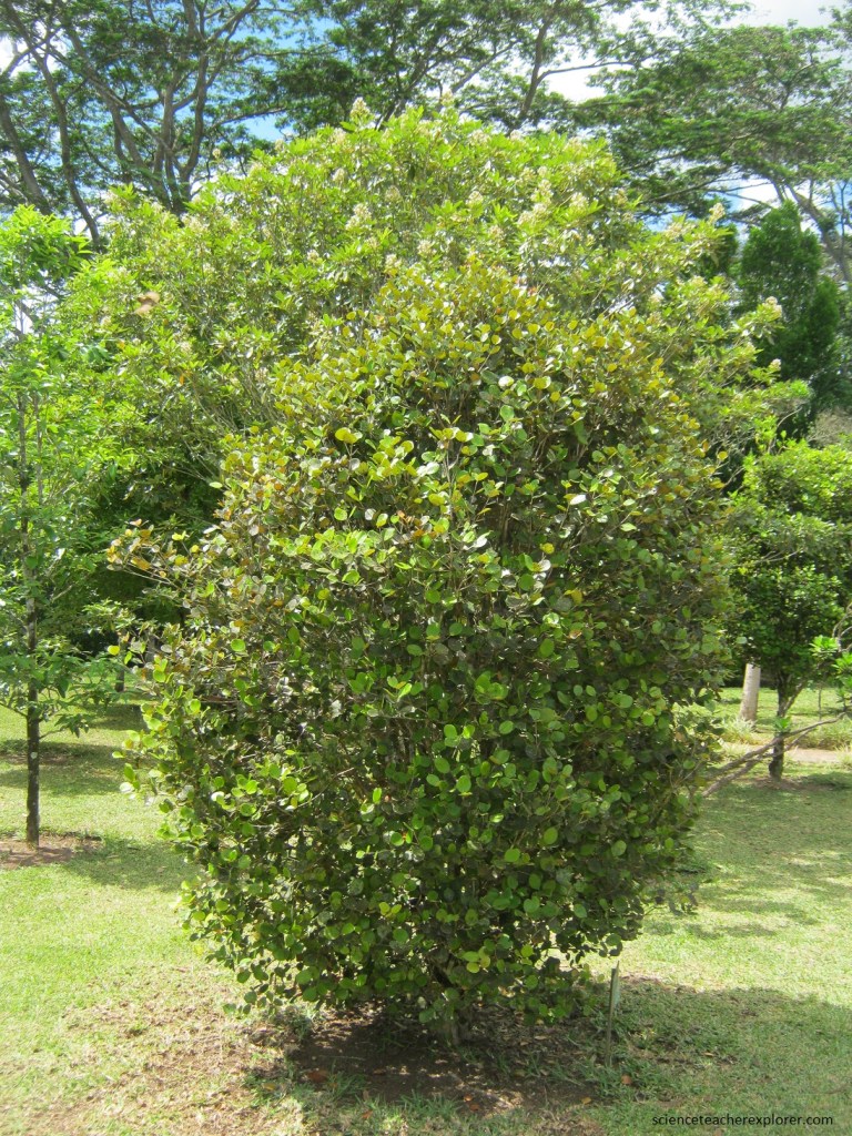
Pictured above, the Blois Clou Monimiastrum globosum is small tree that can reach up to 5m. The leaves are very dark shiny green with a reddish midrib. It bears small white flowers and the fruits resemble small guavas. It is endemic to Mauritius and thrives in uplands and mossy forests.
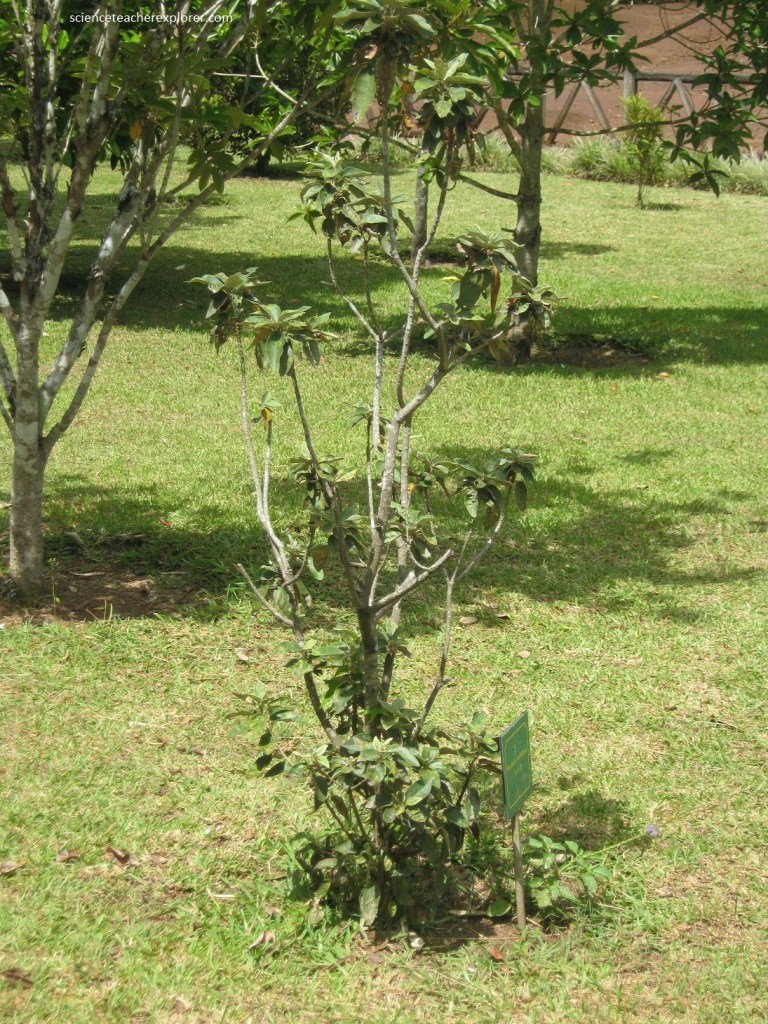
Ramosmania rodriguesi, commonly known as Cafe Marron, is a tree native to the Mauritius. The plant has an average size of about 1.5 to 1.8 m and features white five-petal star-shaped flowers. Its French common name Cafe Marron translates to “brown coffee”. It was thought to be extinct until a single surviving tree was spotted by a schoolboy in 1979. In 2003, the café marron bore its first fruit with viable seeds. Slow but steady efforts have been made to grow more café marron trees and speed up the pollination process. Young R. rodriguesi leaves have obtuse, rounded apexes while mature leaves have rounded, almost truncated apexes. The petals’ tube is funnel-shaped and leathery with a length of 1 centimeter. The plant’s fruit is thin and elongated.
Pictured above, The Trochetia Trochetia boutoniana can reach a height up to 3 m. The leaves are oval shaped and due to its xerophyte adaptations it is leathery on the underparts. The petals are between 5 and 6 cm and they grow asymmetrically and are bell-shaped that has a coloring of dark red with a white background. The capsule is globular and contains up to 10 black seeds. The Trochetia is relatively rare because of its weak regeneration and due to introduced monkeys which feed on the flower buds. The only occurrences are on the slopes of Le Morne Brabant, Mauritius. The Trochetia is the national flower of Mauritius since 1992 and it is often illustrated on stamps of Mauritius.
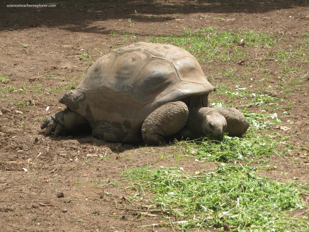
Pictured above, the tortoises at Chamarel 7 Colored Earth come from Aldabra, an uninhabited atoll in the Seychelles archipelago. Aldabra tortoises were introduced in Mauritius in the 1880s on the recommendation of famed naturalist Charles Darwin. They are the cousins of endemic Mauritian tortoises. Before the arrival of humans in Mauritius, the island was home to some species of endemic tortoises. As a result of overhunting, Mauritius’ endemic tortoises are now extinct.
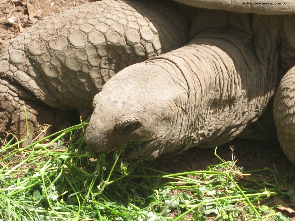
This Aldabra Giant Tortoise is a meter in length and can live up to 150 years. The tortoises are herbivorous and cold-blooded. Males and females can be told apart by the shape of their bellies. Females have a flat belly, while males have a hollow belly, making it easier for them to mate. Females lay a single clutch of between 9-25 eggs every year. They lay them in nest up to 30cm deep, which they excavate using their hind feet.
The natural environment of Mauritius has paid a heavy price for the country’s rapid development, and the government seems keener than ever to encourage more tourists to plug the gap left by declining sugar and textile industries. The expansion of tourist facilities, however, is straining the island’s infrastructure and causing environmental degradation and excessive demand on services such as electricity, water and transport.
Mauritius is often cited as an example of racial and religious harmony, and compared with most countries it is, as on the surface, there are few signs of conflict in 2023. However, racial divisions are still apparent between the Hindu majority and the Muslim and Creole minorities, and these tensions constitute one of the few potential political flashpoints. Such issues usually only surface during elections, when parties aren’t averse to playing the race card.
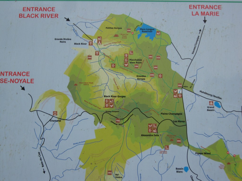
Pictured above, the Black River Gorges is a forest-clad area in the southwest of Mauritius. It was declared a national park in 1994 to protect much of the island’s woodland, (less than one percent of the island’s original forest cover remains intact).
Pictured above, the Black River Gorges National Park is the largest nature reserve on the island. There are 9 species of birds and more than 150 species of plants which are found only on Mauritius.
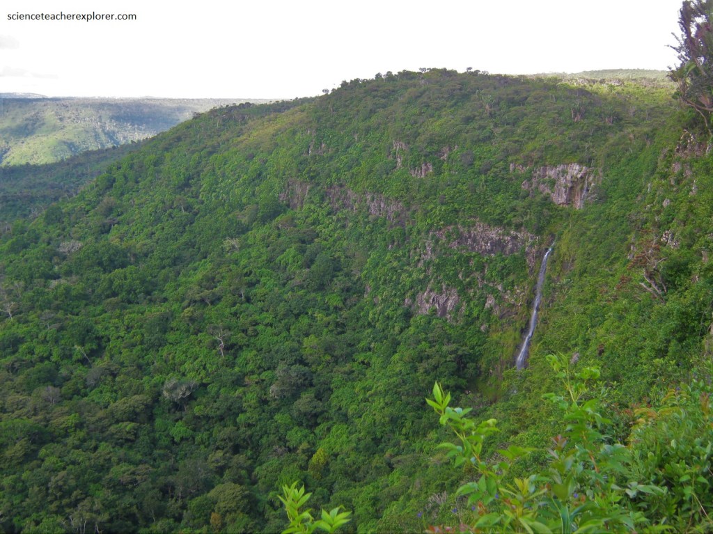
The Black River Gorges National Park on Mauritius 2023.
The Black River Gorges National Park has helped to ensure the survival of the threatened native species such as the Mauritius kestrel and the pink pigeon.
There are over 50km of trails in the Black River Gorges, that are easily accessible from Curepipe or Vacoas. I chose not to hike them.
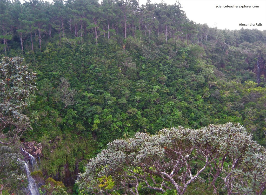
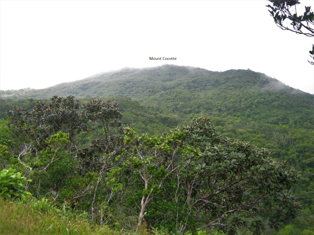
Pictured above, found a few kilometers from the Gorges Viewpoint is Alexandra Falls. It is found approx. 700m above sea level and has views from different areas from a raised platform where you can see quite far. There are good views of the gorge from the main view point and the cloud forest of Mt Cocotte, (pictured below).
Alexandra falls is the scenic view and the natural forest, with the papyrus trees, that makes a visit to the falls worthwhile, (pictured below). Tall guava trees completely surround the area of Mt. Cocotte.
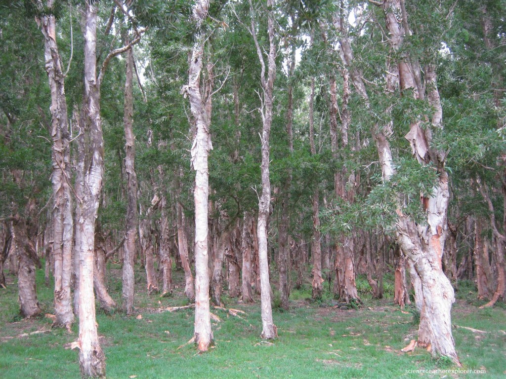
Pictured above is a forest of papyrus trees. It is actually a “White Birch” and the bark peels easily! It is mainly used to produce a cheap quality of paper!
Illustrations from the logbooks of the first ships to reach Mauritius show hundreds of plump flightless birds running down to the beach to investigate the newcomers. Lacking natural predators, these giant relatives of the pigeon were easy prey for hungry sailors, who named the birds “dodo”, which in one interpretation at least, means ‘stupid’. It took just 30 years for passing sailors and their pets and pests, (dogs, monkeys, pigs and rats), to drive the “dodo” to extinction; the last confirmed sighting was in the 1660s.
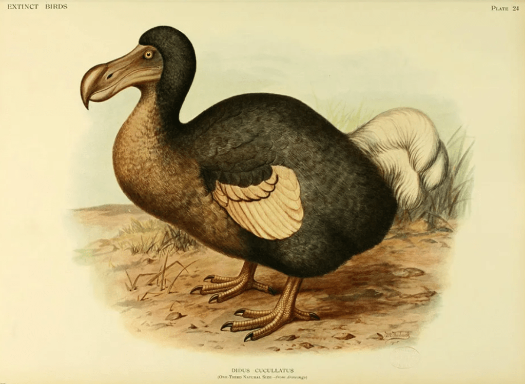
Just as surprising as the speed of the dodo’s demise is how little evidence remains that the bird ever existed. A few relics made it back to Europe during the 18th century, (a beak, skull and foot), but until recently our knowledge of the “dodo” was mainly based on sketches by 17th century seamen. [A skeleton was found in 1865 & assembled in Durban, South Africa].
